
Ascent Passport
-
Winter ascent class.
-
Region 2.10 mountains of Dagestan, Chekhychay gorge, Shalbuzdag ridge.
-
Shalbuzdag North-Eastern, 3500 m, via the gap in the right bastion of the South wall.
-
5A category of difficulty, first ascent.
-
Route characteristics:
Height difference: route — 230 m, wall — 210 m (from 3270 m to 3480 m), average steepness of the wall — 70°, route length 506 m, wall section 246 m, section lengths:
- 1 — 250 m
- 2 — 20 m
- 3 — 38 m
- 5 — 198 m.
-
Equipment used on the route: rock pitons — 27, chocks — 27, bolt hangers — 0. Left behind rock pitons — 3.
- UIAA symbol route diagram: g. Shalbuzdag N-E from the south via the gap in the right bastion 5A category of difficulty.

- UIAA symbol route diagram: g. Shalbuzdag N-E from the south via the gap in the right bastion 5A category of difficulty.
-
Climbing days — 2; climbing hours — 8.
-
Overnight stay at 3350 m in the assault camp in the Shalbuzdag cirque.
-
Leader: Goryaev Anatoly Erdnigorayevich, 1st sports category
Participants:
- Voronin Sergey Valeryevich, 1st sports category
- Slobodenyuk Yuri Yuryevich, Candidate Master of Sports
-
Coach: Murtazaliev Ziyabutin Murtazalievich
-
Departure from Base Camp — March 1, 1998. Preliminary processing — March 2, 1998. Departure on the route, summit, descent to the assault camp — March 3, 1998. Return to Base Camp — March 4, 1998.
-
Organization — Dagestan Republican Search and Rescue Service of the Ministry of Emergency Situations of Russia.
Tactical Actions of the Team
On March 1, 1998, at 10:00, the team departed from the "Erydag" base. At 16:00, they arrived at the overnight stay location and set up camp. On the morning of March 2, 1998, at 9:00, they departed for reconnaissance of the route. They bypassed the "Table" from the east and returned via the same path. The most logical route seemed to be the one visible from the ABC, and at 14:00 on March 2, 1998, they began processing.
While on the scree:
- Voronin put on rock shoes and began processing the inner corner on two ropes (ropes — 11 mm " Edelweiss" 50 m dynamic and 11 mm "Beal" 50 m static).
- Goryaev provided belay.
- Belay was done through a " harness".
- The first belay station was 35 m from the start of the route.
Actions of the rope team:
- Goryaev approached Voronin using "Petzl" ascenders, handed him the removed chocks along the way.
- Then Voronin worked another 35 m on a double rope, reached a convenient ledge, set up a rappel, and began descent.
- At 17:00, both were back down.
During the rope team's work:
- Slobodenyuk coordinated the work from below and relayed commands, and also contacted the base on the Standard HX 390V radio station.
- They returned to the tent at 18:00.
On March 3, 1998, at 9:00, the team started working:
- Goryaev went first on the pre-fixed ropes, leaving a control cairn at station R1.
- Then Slobodenyuk followed.
- Last, Voronin followed, dismantling station R1 along the way.
On the ledge:
- Goryaev changed into rock shoes.
- He proceeded on a doubled rope via the "ram's forehead".
- Then he traversed a 5-meter wall and a straightforward inner corner.
- He set up a belay station on the ledge, received the rest of the team, and continued working on a steep inner corner with a grotto in the center.
- In the grotto — second control cairn KT2.
Features of the passage to the grotto:
- Very cautious work is required.
- The passage is complicated by unreliable holds.
After the grotto:
- Goryaev exited the grotto, traversed the inner corner, set up a belay station, and received Slobodenyuk, then Voronin followed.
- From the ledge, Goryaev entered a chimney, reaching the grotto under a plug.
- Slobodenyuk insisted that Goryaev set up a belay station there, as the continuation of the route is not visible from under the plug, and team interaction is hindered.
- In the grotto — third control cairn KT3.
Completion of the ascent:
- Goryaev bypassed the plug on the left wall of the chimney using rigid 30KhGSA pitons (which performed very well throughout the route), and reached the top.
- He set up a belay station, received the rest of the team at 14:00.
- They left a control cairn there.
- On the way to the summit, they overcame a small inner corner.
- Reached the summit at 14:30.
The weather was clear and partly cloudy in the morning. By 12:30, the weather began to deteriorate, with light snow falling and a cold wind blowing.
Descent from the summit down to the NW to the wall of the central bastion, then left and down via straightforward rock and scree. Corresponds to route 1B category of difficulty. Then they reached the tent via a large-block scree at 15:10. At 16:30, they contacted the base and stayed overnight. In the morning, they packed up and returned to the base via the ascent route.
The route features varied terrain. Well-trained athletes can complete the entire route free-climbing without using artificial aids. Be cautious on section 11! The terrain is damaged. On section 12 — when exiting the grotto — a large unstable block is present. Work on a doubled rope, belay with a dynamic " Edelweiss" 11 mm rope through a "harness". On the route, large knots were used as chocks. Equipment: Gore-Tex and Polartec from "Salewa" and "VTN".
Rescue team:
- Sogokon A.E. — team leader, Candidate Master of Sports
- Krasnopolsky Yu.V., Candidate Master of Sports
- Skornyakov A.N., Candidate Master of Sports
- Smotrov S.I., Candidate Master of Sports
- Nurbagandov G.M., Candidate Master of Sports
- Bublik O.N., 1st sports category
- Makovkin M.V., 1st sports category
Route Description by Sections
Section R0–R2. The route begins with a 60-meter inner corner, the right side of which has a steepness ranging from 90° to 120°, and the left side — 80–85°. In the center — a gap 5 to 20 cm wide. The terrain on the sides of the corner (especially in the middle part) is not well-defined; one has to use the gap and friction. For belay, it is recommended to use large chocks. In the middle of the corner — an inclined monolithic ledge. The belay station is inconvenient, and setting it up is challenging. Features:
- The most difficult sections: the last 10 m before station R1 and the cornice above it. The entire corner was climbed free.
Section R2–R5. At the top of the inner corner, there is a small "ram's forehead" that levels out into a convenient ledge, on which station R2 is set up.
Section R6–R10 to station R3 is of moderate difficulty with a challenging wall. For station R3, there is a convenient ledge.
Section R10–R12. The section is an indistinct angle, with a grotto in the middle part. The greatest difficulty:
- Passing the section up to the grotto; the terrain is unreliable; holds should be loaded very cautiously.
- When exiting the grotto, there is a large unstable block. Then — an inner corner up to station R4.
Section R12–R13. From station R4, there is an entry into a chimney with a plug. It is recommended to set up station R5. There is also a control cairn KT3.
Section R13–R15. From station R5, there is an exit from under the plug, then left through a "ram's forehead" into a large chimney that widens to 5 m at the top with a plug. Station R6 is under the plug. Setting up a station is challenging due to damaged terrain. The exit from under the plug is difficult.
Section R15–R16. From the station, there is an exit from under the plug to the left onto the roof up to station R7; on the left side of the chimney, there is a control cairn KT4. From station R7, descend westward on scree to a wall with an inner corner. Through the inner corner, movement is simultaneous, then ascent via scree to the summit.
Descent from the summit to the west on scree to the wall of the next bastion, then left and down via straightforward rock and scree leads to a large-block scree. A two-headed rock to the south of the route serves as a landmark for the descent.
The descent corresponds to route 1B category of difficulty.
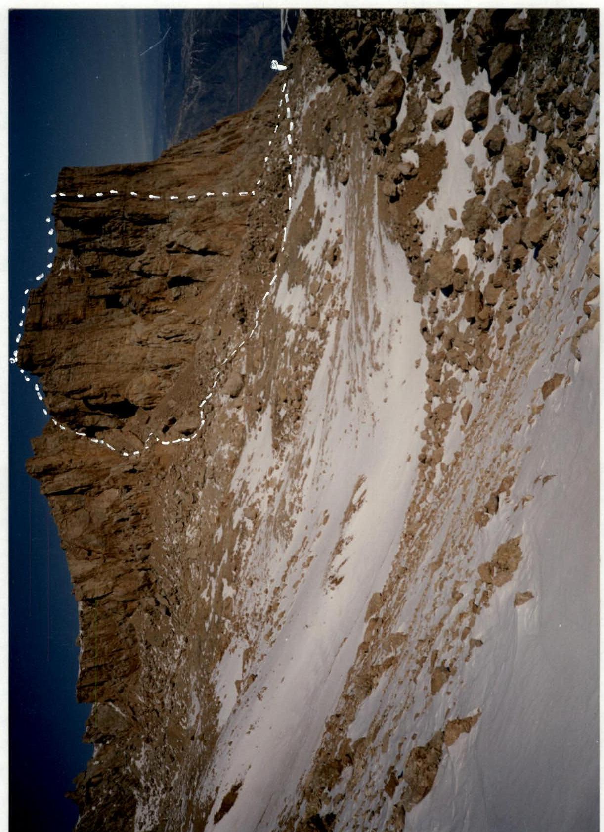
Photo 1. General view of Shalbuzdag NE summit. 3500 m. March 2, 1998, 10:00, Lomo Compact
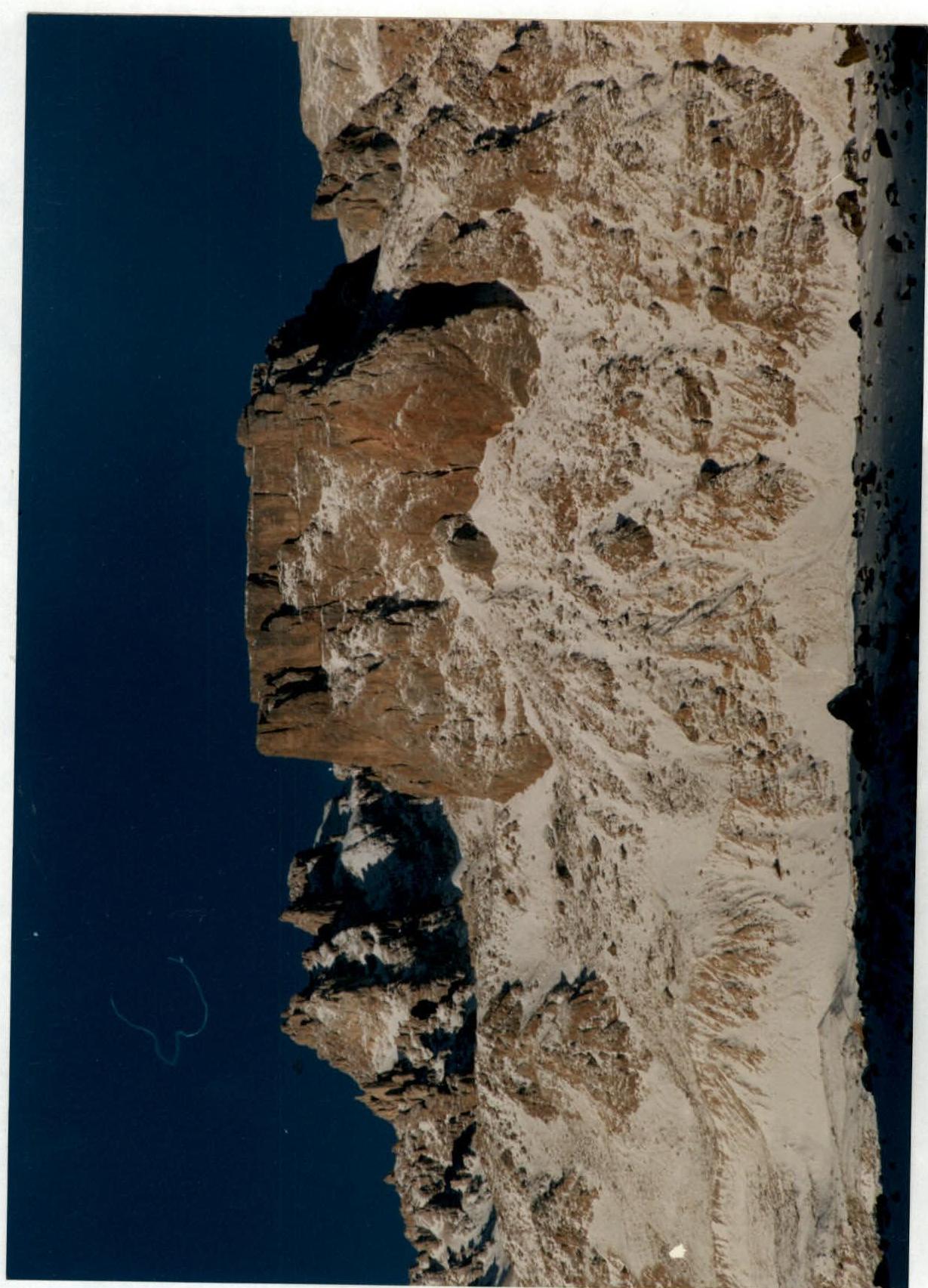
Photo 2. Route profile from the right. Taken from Tekipirkent village 1700 m. February 18, 1998, 9:00, Nikon (F–120 mm)
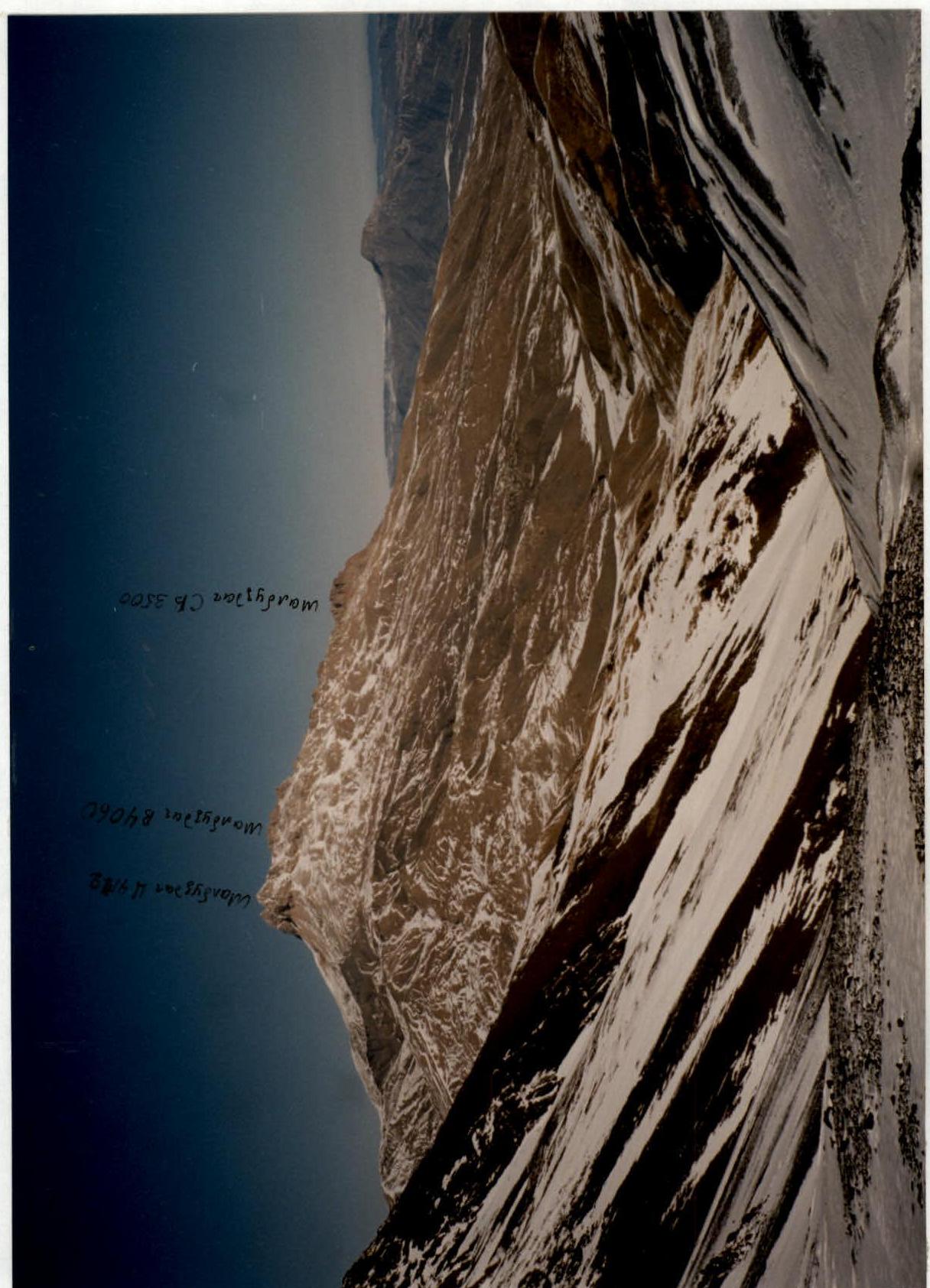
Photo 3. Photopanorama of the ascent area. Taken from under Vakhchag pass (3000 m). February 28, 1998, 10:00. Nikon
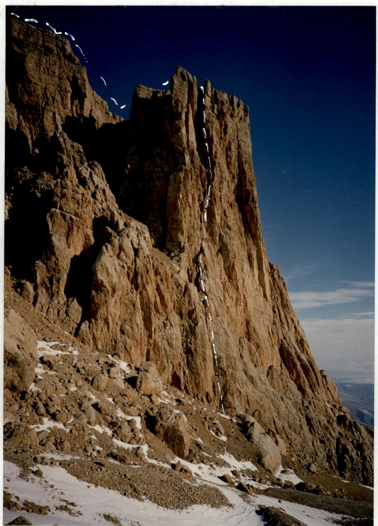
Photo 4. Technical shot of the route. March 2, 1998, 11:00. Lomo Compact.
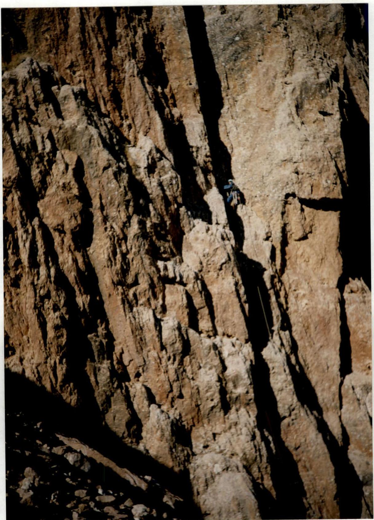
Photo 5. Voronin climbing the inner corner — section R0–R1, preliminary processing. March 2, 1998, 14:30. Lomo Compact.
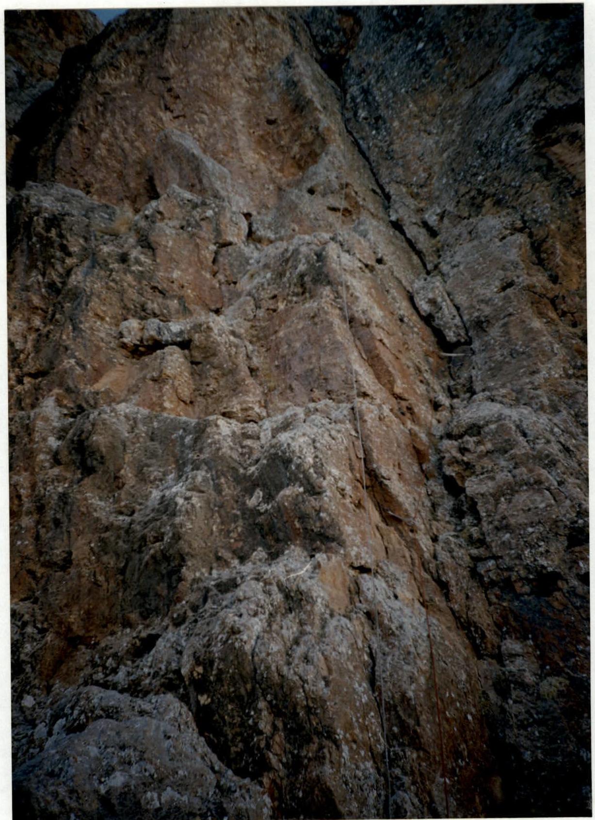
Photo 6. Voronin climbing the upper part of section R0–R1. Preliminary processing. March 2, 1998, 14:50. Lomo Compact.
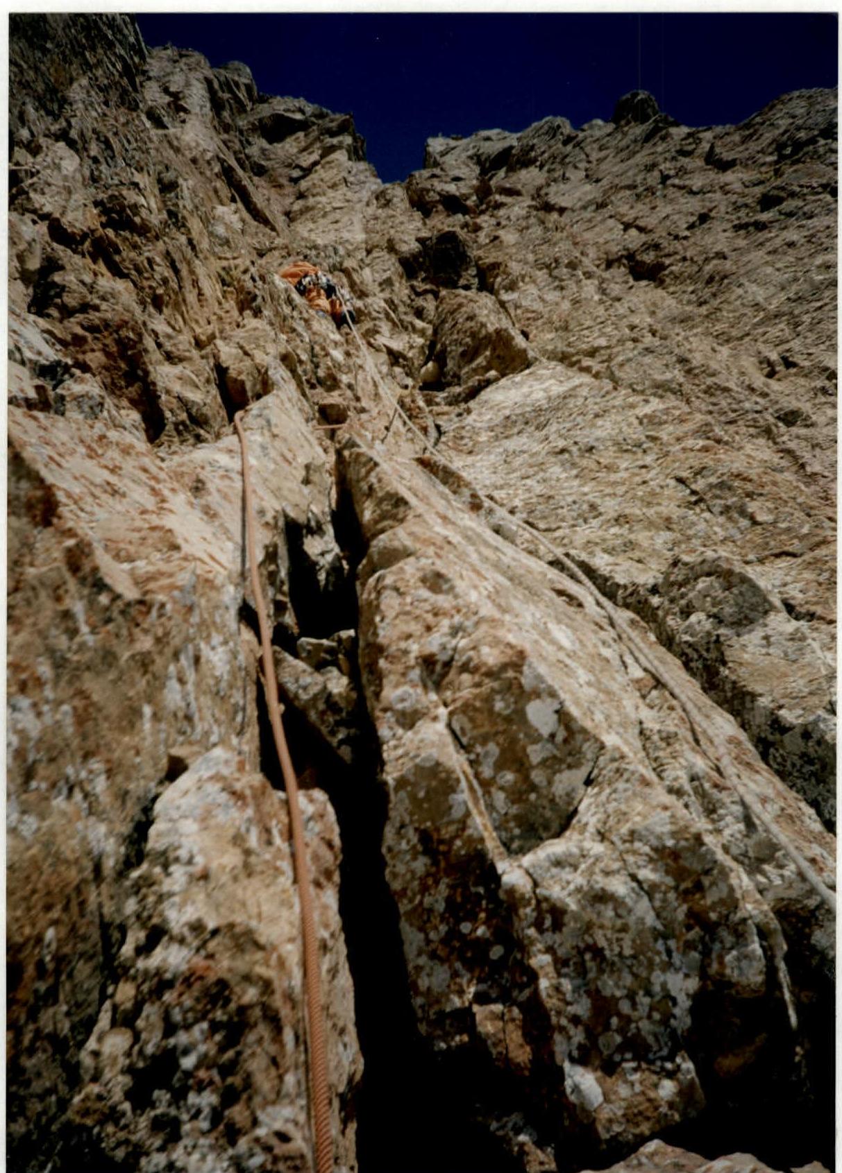
Photo 9. Goryaev climbing section R11–R12. Taken from belay point R3. March 3, 1998, 11:00. Lomo Compact.
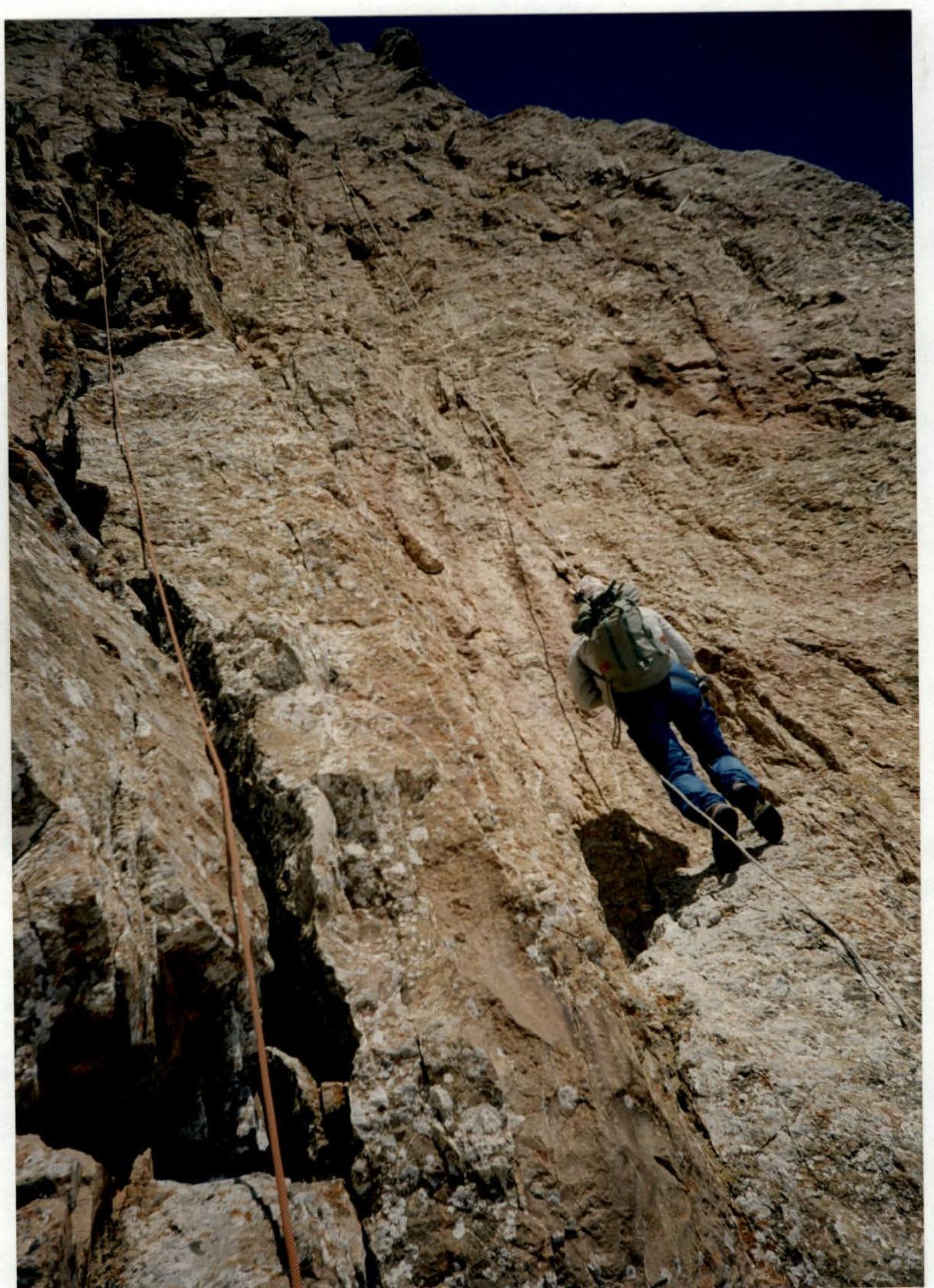
Photo 10. Slobodenyuk climbing via fixed ropes on section R11–R12. March 3, 1998, 11:50. Lomo Compact.

Photo 12. Climbing via fixed ropes in the chimney on section R15–R16. March 3, 1998, 13:00. Lomo Compact.
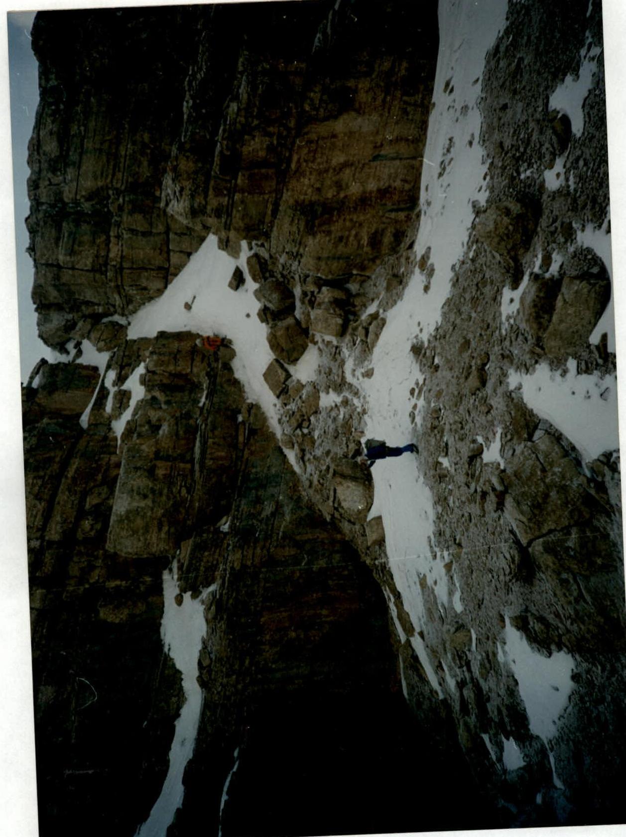
Photo 14. Exiting onto the pre-summit slope through the inner corner on section R18–R19. March 3, 1998, 14:15. Lomo Compact.
Comments
Sign in to leave a comment