- Climbing category — rock climbing
- Climbing area — 2.10., Dagestan mountains, Chekhychay gorge.
- Peak, its height, climbing route, its character — Shalbuzdag East, 4th tower, 4020 m, via the SE buttress.
- Estimated category complexity — 3A
- Route description — Height difference 400 m, section length 10 m, average steepness — 45°.
- Pitons used — rock, ice, bolted 6/0, 0/0, 0/0; placed nuts 6/0
- Number of climbing hours — 4
- Number of nights — No overnight stay
- Leader's full name, participants and their qualification — Dorro Konstantin Eduardovich, 1st sports category; Mammaev Sulayban Nurmagomedovich, 2nd sports category; Krasnopolsky Yuri Vasilyevich, Candidate for Master of Sports
- Team coach —
- Date of departure on the route — July 6, 1989
- Organization — Mountain Club of Dagestan State University "EOS"
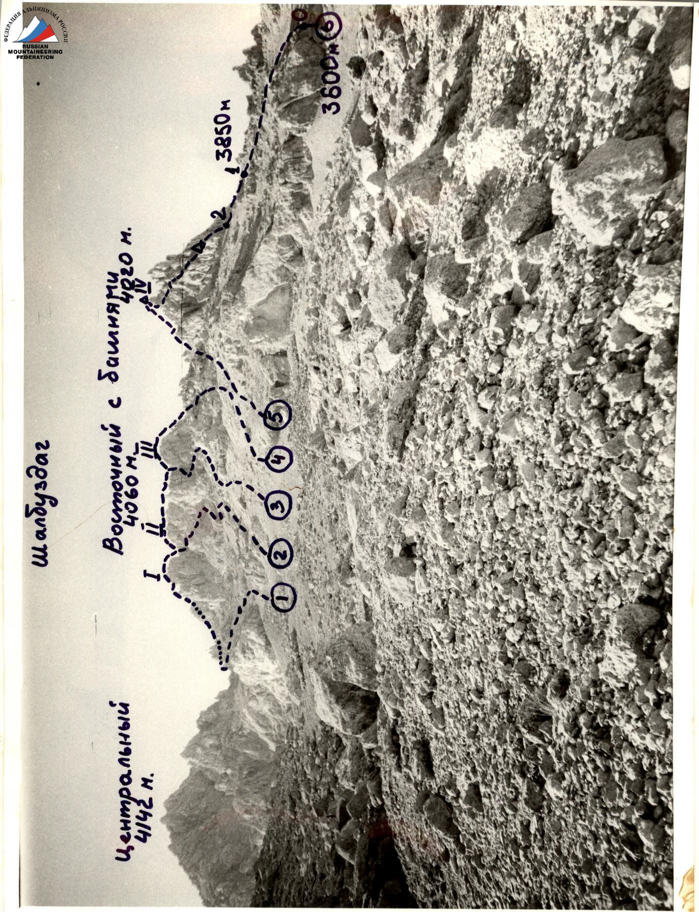
1, 4 — Shalbuzdag East. 1–3 towers traverse in both directions — 3A category complexity. 2 — Shalbuzdag East. 2nd tower S/N — 2A rock. 3 — Shalbuzdag East. 3rd tower S/N — 2B rock. 5 — Shalbuzdag East. 4th tower S/N — 2A 6 — First ascent route: Shalbuzdag East.
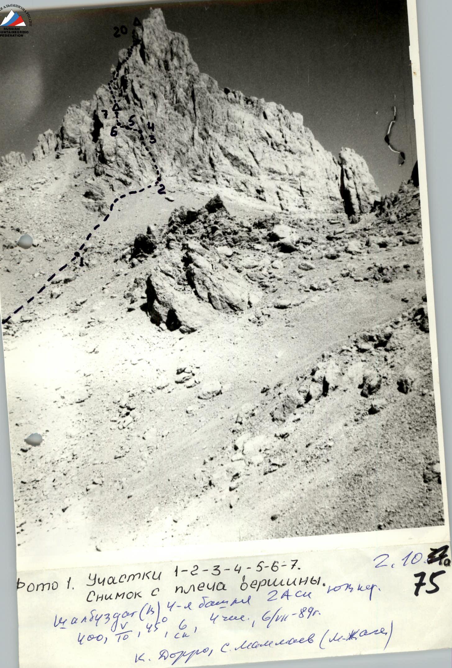
Photo 1. Sections 1–2–3–4–5–6–7. Taken from the shoulder of the peak. Shalbuzdag (b) 4th tower 2A S/N. 400, 10, 45°, 6, 4 hours, 6/II-89. K. Dorro, S. Mammaev (lying down.)
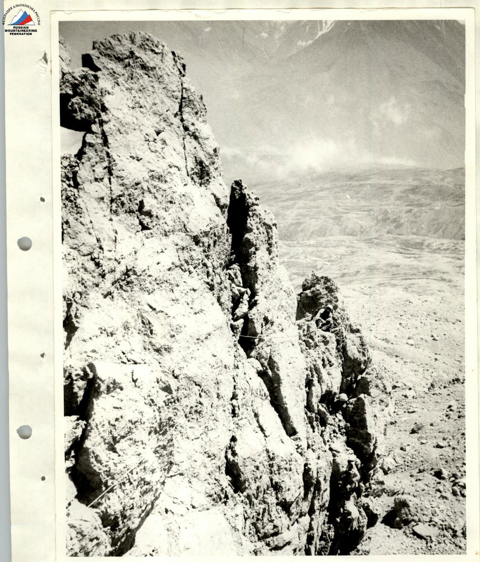
Photo 2. Sections 14–15. Key location of the route. Bypassing the 2nd gendarme on the left.
Brief explanation of the diagram
The route starts from the right edge of the lower rock belt (3600 m) of Shalbuzdag mountain. Via the scree slope with rock outcrops (sections 0–1) reach the shoulder of the eastern ridge (3850 m) of Shalbuzdag.
Then:
- bypass the rocks of the SE buttress on the right (sections 1–2);
- reach the base of the rock couloir (sections 2–3);
- in the upper part, ascend the wall (sections 3–4) to a ledge (R1);
- then move left and upwards under a steep internal angle (sections 6–7);
- via it reach the ridge of the buttress (control cairn). Further via the scree couloir and a short wall (sections 8–9–10) reach R2. Via the couloir and steep wall (sections 10–11–12), bypassing the 1st gendarme, reach its saddle, then left and upwards via large-block rocks (sections 12–13–14) ascend to a convenient platform (R3), before the 2nd gendarme. From the platform, via the left wall of the gendarme (key location) (sections 14–15) reach a hollow (sections 15–16). Then left and upwards via an internal angle (sections 16–17) reach R4. From the belay point via large-block rocks (sections 17–18) to the saddle of the forked peak tower. Via the left wall of the left tower of the peak (sections 18–19) reach a ridge (R5) and via a slab (sections 19–20) ascend to the peak (cairn).
Another ascent option is possible from the saddle: bypassing the tower on the right, join route 2A category complexity and ascend to the peak via it (simpler, but longer). Descent from the peak via route 2A category complexity.
Route diagram in symbols
Shalbuzdag East 4th tower via the SE buttress 4020 m

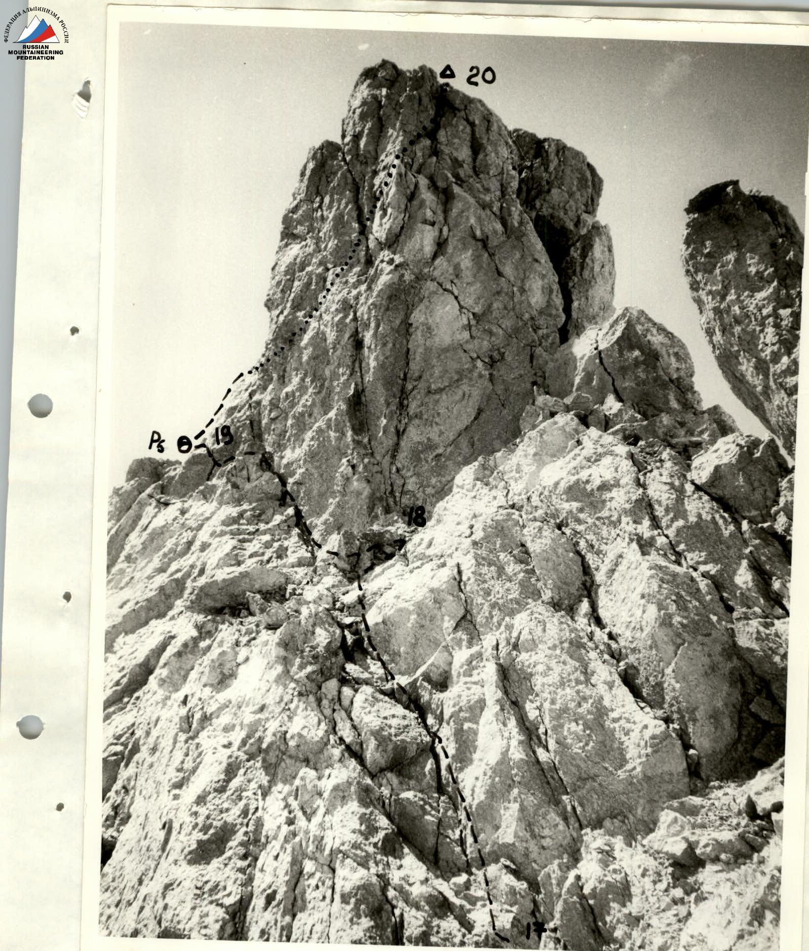
Photo 3. Sections 17–20. Peak tower. Taken from R4.
Description of the approach to the route
From Kurush village, Akhtynsky district, DASSR (2500 m, southeastern slope of Shalbuzdag) descend along the road, about 400 m, towards Usukh-Chay village. At the first stream, near a clay remnant, turn left and follow a livestock trail to the right – upwards to a characteristic saddle on a ridge (from Kurush village – 1 hour). Then via a marshy lowland approach the base camp location near "Big Rocks" (from Kurush village – 1.5 hours).
From the base camp, follow characteristic shale ridges towards Shalbuzdag. Then via scree and snow slopes of moderate steepness approach the right edge of the lower rock belt of Shalbuzdag (from base camp 3 hours).