Ascent Passport
- Ascent class — rock climbing
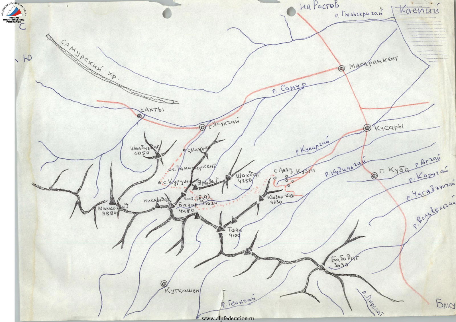
- Ascent area — 2.9 Eastern Caucasus
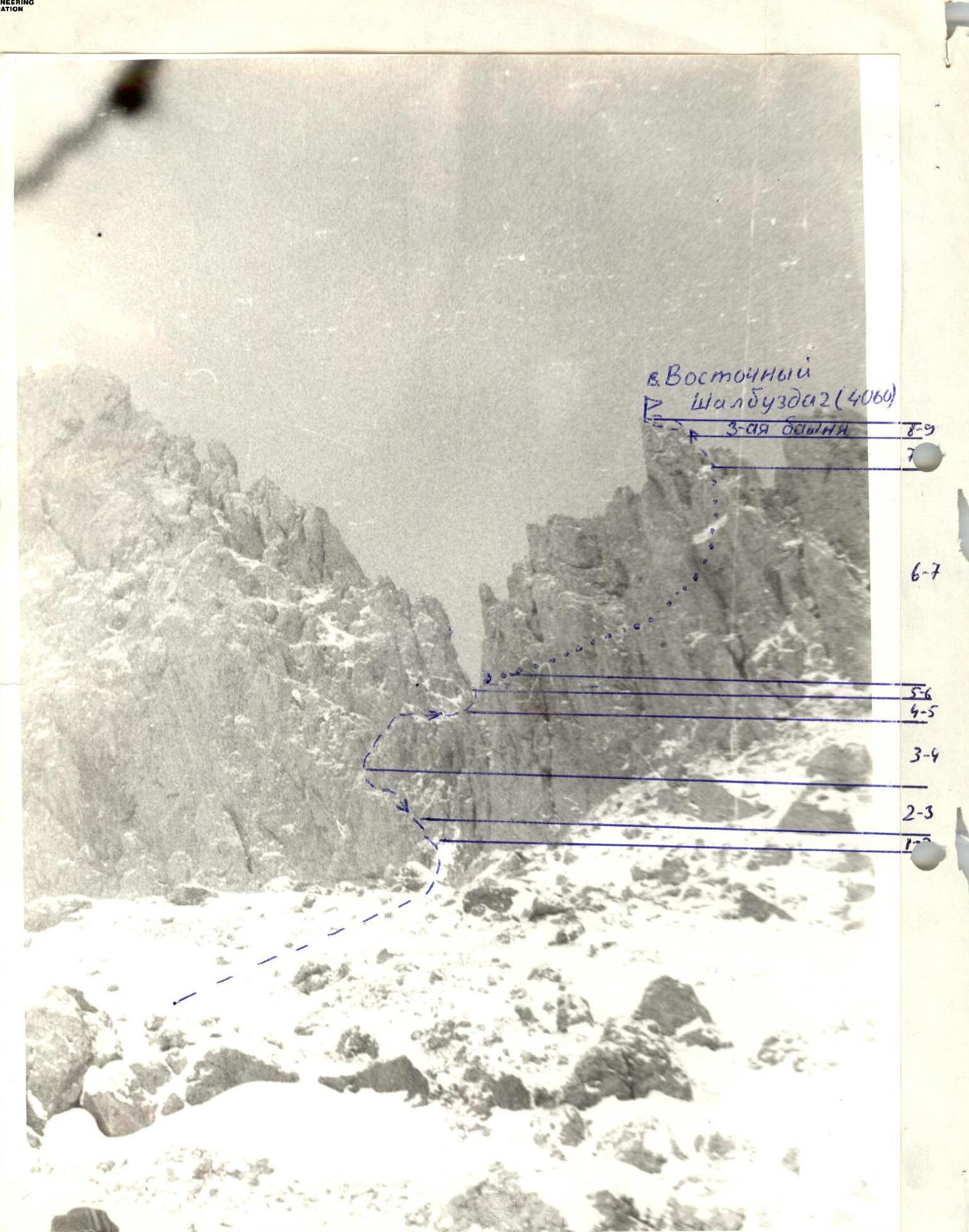
- Peak, its height, and ascent route — Eastern Shambuzdag, 3rd tower (4060 m) from the south
- Proposed difficulty category — 2B No. 48105, May 22, 1979
- Route characteristics:
- elevation gain — 560 m
- average steepness — 55°–60°
- length of sections: R1 — 600 m, R2 — 15 m, R3 — 20 m, R4 — 15 m, R5 — 30 m, R6 — 7 m, R7 — 40 m, R8 — 7 m, R9 — 5 m
- Pitons driven:
- for belaying: rock — 7, ice — 0, bolt — 0
- for creating I.T.O.: rock — 0, ice — 0, bolt — 0
- Number of climbing hours — 8 hours
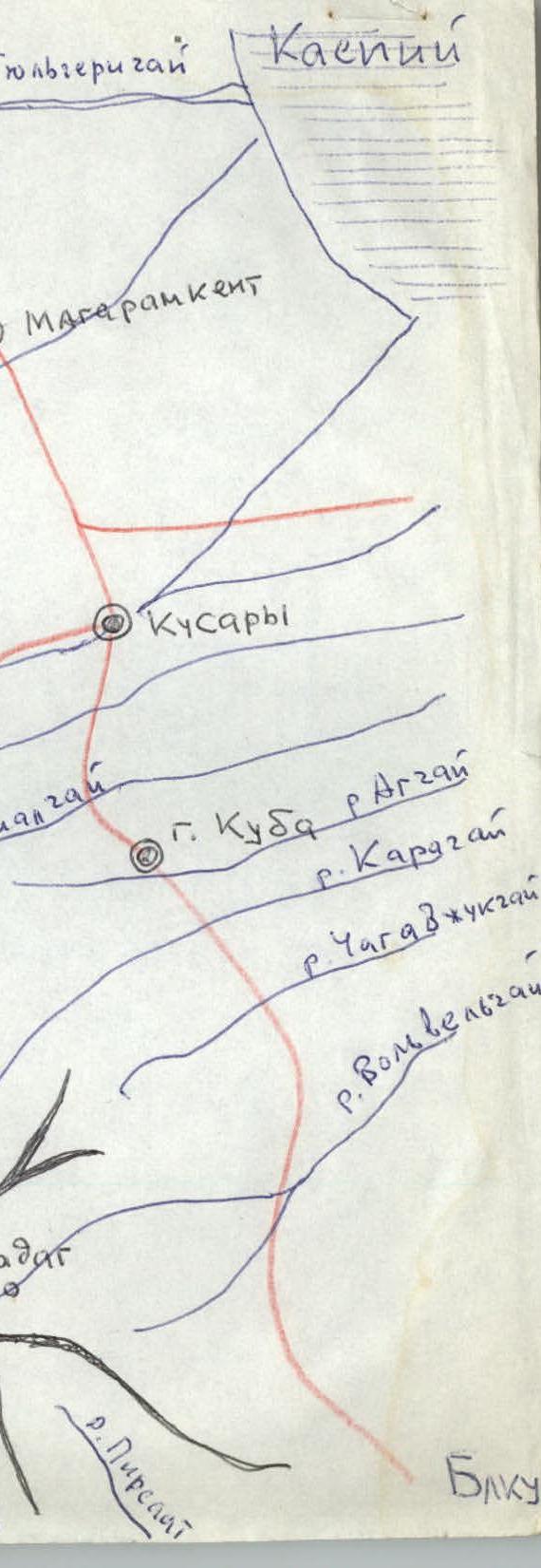
- Number of overnight stays and their characteristics — overnight stay in the village of Kurush
- Surname, name, patronymic of the leader and participants, their sports qualification:
- Nezametdinov A.B. — Master of Sports
- Donnikov B.I. — III sports category
- Ivanov A.S. — III sports category
- Pakhomov O.S. — III sports category
- Team coach — Nezametdinov A.B.
- Date of departure for the route and return — February 2, 1979
Ascent Route Description
Description of the ascent route to the 3rd tower of Eastern Shalbuzdag, 2B difficulty category, from the south.
From the village of Kurush, follow the path to the upper pastures for 2-3 hours until you reach a standalone cairn on a grassy ridge. From this cairn, head towards the 3rd tower for 2 hours. The col between the 2nd and 3rd towers is visible. The 2B category route goes to the col, and then from the col to the tower's summit.
The ascent to the col initially goes straight up for 15 m along moderately difficult rocks to a rock niche that provides protection from falling rocks. There are cracks for driving pitons.
Up and left for 20 m along inclined ledges to the start of a ledge that goes up and right — piton belay.
Along this narrow ledge for 15 m to the base of a wide internal angle, 30 m, consisting of two steep sections with an inclined ledge in between. Belay is via pitons and rock features.
Then 7 m along easy rocks to the col.
From the col, traverse the tower along a ledge on the left. The rocks are moderate, belay is via rock features and pitons, 40 m.
Then along a slab for 7 m and a sharp ridge for 5 m to the tower's summit. Cairn.
Descent is via the ascent route.
From the village of Kurush:
- 5 hours to the base of the tower
- 2 hours to the col
- 1 hour from the col to the summit
The ascent from Kurush and back takes 12 hours.
It is recommended that the ascent be made by a sports group of ranked climbers or a single team of badge holders.
Table
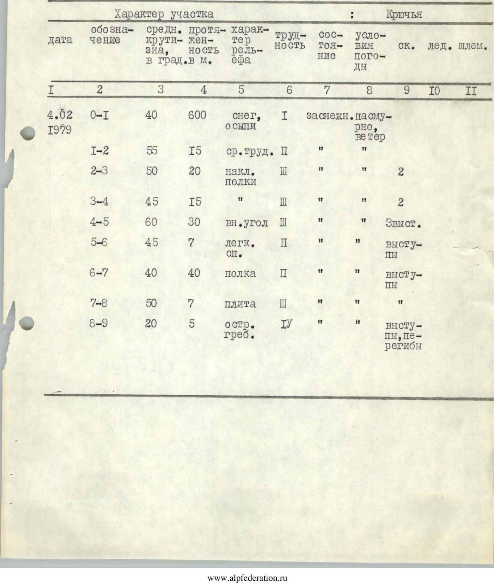
| Date | Designation | Average steepness, in degrees | Length, in meters | Terrain character | Difficulty | Condition | Weather conditions | Pitons: rock | Pitons: ice | Pitons: bolt |
|---|---|---|---|---|---|---|---|---|---|---|
| February 4, 1979 | R0–R1 | 40 | 600 | snow, scree | I | snow-covered | overcast, wind | |||
| R1–R2 | 55 | 15 | moderate difficulty | II | " | " | ||||
| R2–R3 | 50 | 20 | inclined ledges | III | " | " | 2 | |||
| R3–R4 | 45 | 15 | " | III | " | " | 2 | |||
| R4–R5 | 60 | 30 | internal angle | III | " | " | 3 features | |||
| R5–R6 | 45 | 7 | easy rocks | II | " | " | features | |||
| R6–R7 | 40 | 40 | ledge | II | " | " | features | |||
| R7–R8 | 50 | 7 | slab | III | " | " | ||||
| R8–R9 | 20 | 5 | sharp ridge | IV | " | " | features, bends |