Ascent Passport
- Ascent class: rock climbing
- Ascent area: 2.96 mountains of Dagestan
- Peak: its height, ascent route, and character:
- Shalbuzdag East (4060 m), 2nd tower from the south
- Proposed complexity category: 2B
- Route characteristics:
- elevation gain — 400 m, average steepness — 45°, section lengths:
- category I — 340 m, category II — 95 m, category III — 70 m, category IV — 10 m.
- Pitons hammered:
- rock — 4/0, ice — 0/0, bolt — 0/0, protection elements — 6/0
- Number of travel hours: 5 hours
- Number of overnight stays: no overnight stay
- Surname, name, patronymic of the leader and participants, their qualification:
- Dorro K.Z., Shanavazov Sh.Z. — 1st sports category
- Team coach:
- Kozorezov E.F. — 1st sports category
- Date of ascent: December 28, 1985
- Organization: Mountain Club of Dagestan State University

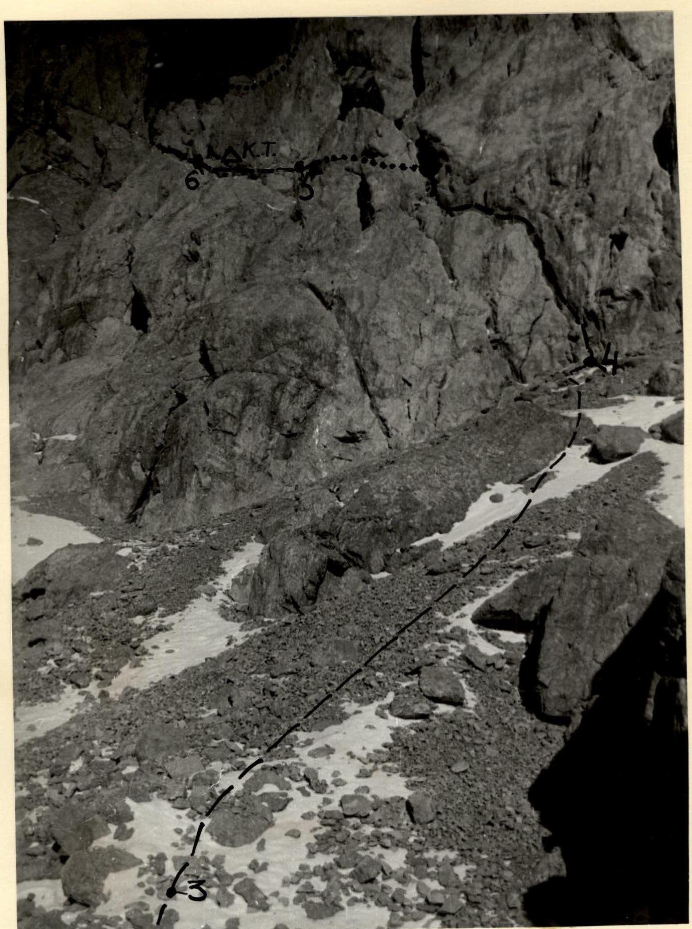
General view of the peak with previously ascended routes marked. —> First ascent route and sections R0–R3. Also, elevation marks.
Brief explanation of the diagram
The lower part of the route passes through the rightmost, wide couloir in the lower rocky belt of Shalbuzdag massif. At the end of the couloir, on rocks resembling "ram's foreheads," lies scree — beware of falling rocks! Therefore, we recommend moving up to the right towards the right side of the couloir (200 m). Then:
- up the broken rocky slope (50 m),
- reach a relatively gentle snowy slope (terrace) under the upper rocky belt of the peak.
Along the terrace, with minimal elevation gain, proceed left through deep loose snow (snow at any time of year).
Bypass large rocky blocks up to 20 m high to reach the base of a 40-meter couloir. Through the couloir, initially snowy at the bottom and scree at the top, approach the base of an oblique characteristic chimney formed by a detached rock block.
Through the chimney (30 m) left and up. The chimney is filled with snow at the bottom; passage is complicated by two 3-meter walls and rocks resembling "ram's foreheads."
Then along a ledge left (10 m) to a cave (control cairn at the entrance).
Up a 3-meter wall to a large scree ledge ("ram's foreheads," beware of falling rocks!).
Then along the ledge left and up (30 m) to approach a wall with two chimneys. Through either chimney, transitioning into an internal corner, reach the col between the first and second towers of East Shalbuzdag (25 m).
Then right along a sharp ridge of large blocky rocks (15 m) and simple rocks (5 m) under a smooth 10-meter slab (crux).
Over the slab to the summit of the 2nd tower of East Shalbuzdag (cairn).
From the start of the route, 4–5 hours. Descent to the col via the ascent route, then down slabs in simultaneous rope teams (200 m) bypassing the first tower of East Shalbuzdag, and one rappelling descent to the col between Shalbuzdag Main and East (1.5–2 hours). In case of heavy snow or bad weather, we recommend:
- descent via the ascent route (2 hours).
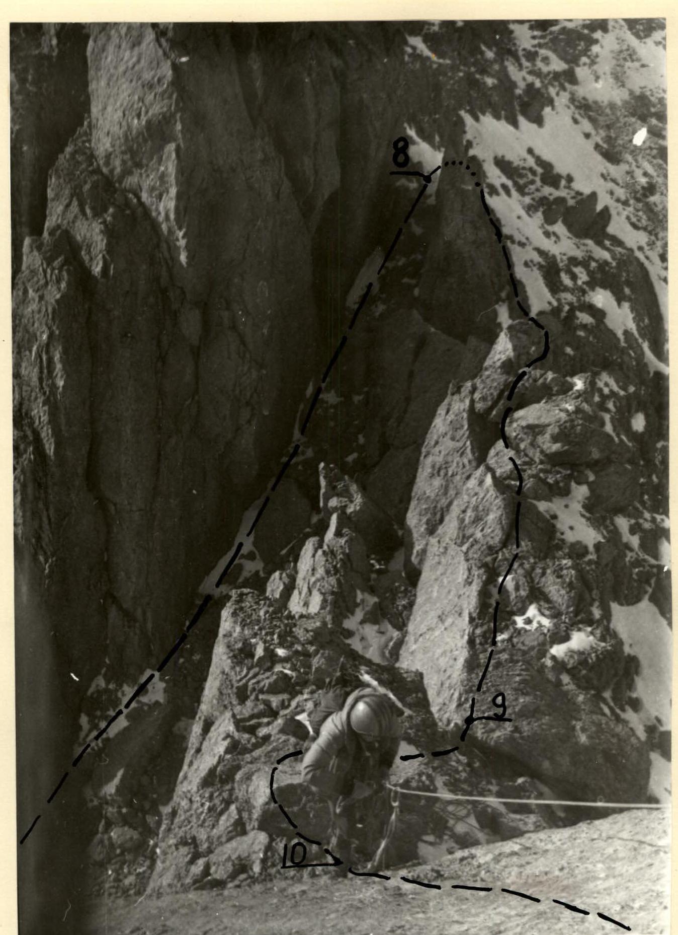
Photo 1: Sections 3–4–5–6.

Photo 2: Exit to the col. Upper part of section R7–R8 and sections R8–R9–R10. The photo is taken from the summit, from top to bottom. The slab — the crux section — is visible.
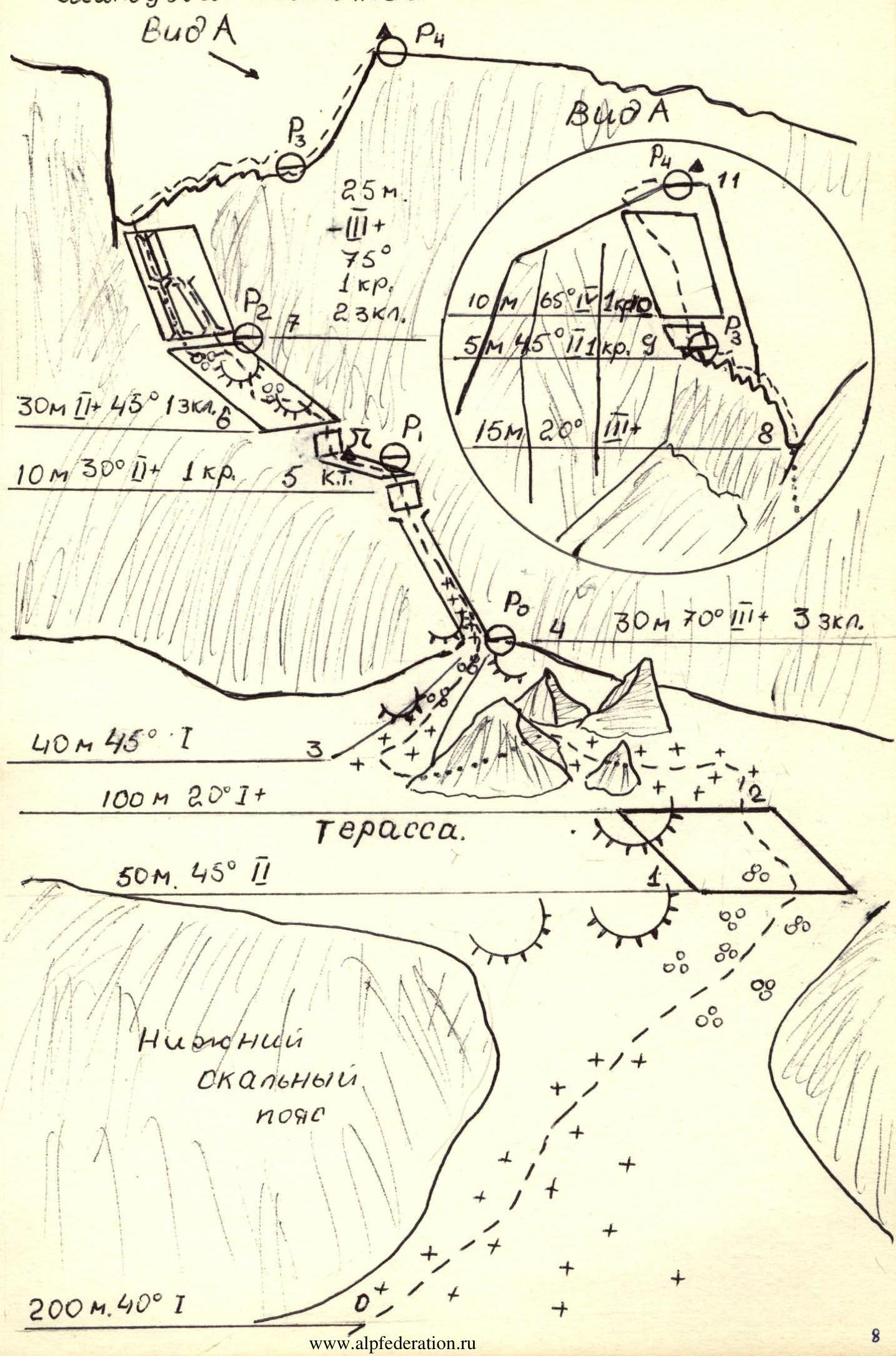
Photo 3: Sections R8–R9–R10–R11. The dotted line marks the descent path to the col between Shalbuzdag East and Central.
Note: Photos from December 28, 1985, "Smena-simvol" camera, T-43 lens. Route diagram: Shalbuzdag East 2B from the south.
Description of the approach to the route
From the village of Kurush, Akhtynsky district, DASSR (2500 m, southeastern slope of Shalbuzdag), walk down the road about 500 m towards the village of Usukhchai. At the first stream, near a clay remnant, turn left and follow the cattle trail (SPТ) up to the right, about 1 hour, to a characteristic col on a ridge. Then through a marshy lowland overgrown with grass, approach the base camp area near "Big Rocks." From Kurush — 1.5 hours.
From the base camp:
- Follow characteristic clay ridges towards Shalbuzdag.
- Then through scree and snowy slopes of moderate steepness, approach the start of the route: the right wide couloir in the lower rocky belt of Shalbuzdag.
From the base camp — 3–3.5 hours.
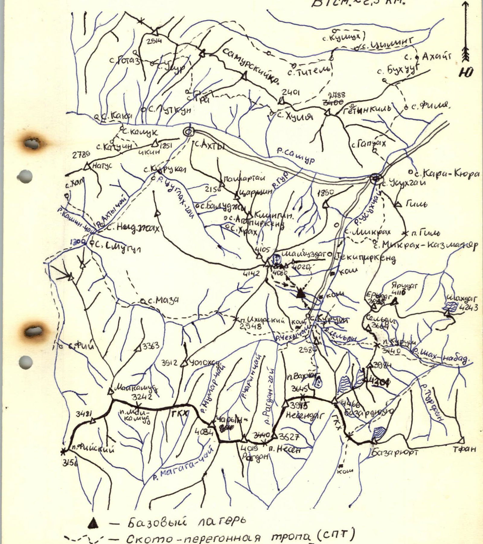
Map of the ascent area
- Base camp
- Cattle trail (SPТ)
- MCR — Main Caucasus Ridge