
Ascent Passport
- Climbing area
- Ascent class
- Peak, its height
- Ascent route
- Estimated difficulty category
- Route characteristics
- Pitons driven:
- Number of overnight stays and their characteristics
- Surname of the leader and participants, their qualifications
- Team coach
- Date of ascent
- Organization
Rocky 2.10 mountains of Dagestan Tлили-Меэр Mt., 2457 m via NW ridge and 3 wall 2B cat. diff. height difference — 685 m, average steepness — 35°, length of sections:
- 1st cat. diff. — IIIS m
- 3rd cat. diff. — 50 m
- 4th cat. diff. — 25 m rock — 8, chocks — 2
overnight stay behind Gogoтль village
- Shanavazov Sh.E. — 1st sports rank
- Mammaev S.M. — 2nd sports rank
- Stokozov D.A. — 2nd sports rank
- Smotrov S.I.
March 5, 1989
Mountain Club of Dagestan State University
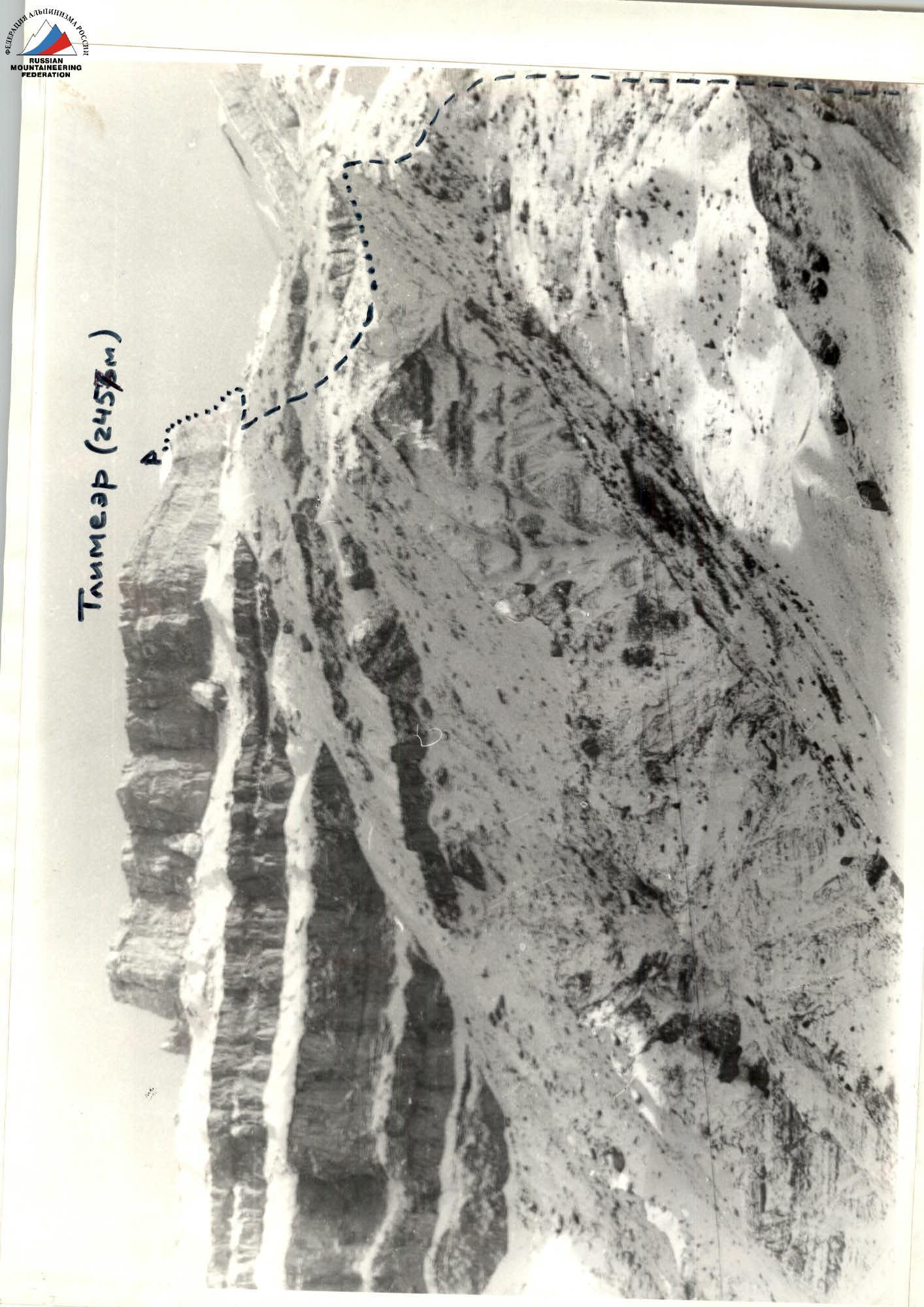 Photo of Tлимеэр peak (2457 m) indicating the ascent route
1. General characteristics of the mountain
The Tлили-Меэр massif (“Saddle-mountain”, Avar language) is located in Inner Dagestan on the border of Gunibsky and Sovetsky districts. Tлили-Меэр stands out sharply against the background of the surrounding plateau-like mountains due to its relative height and original shape. The climate in the area is generally stable. In its structure, Tлили-Меэр is a narrow plateau stretching from southwest to northeast. It is a typical mesa of synclinal form, formed by four horizons of hard limestones and dolomites. The height difference from the valleys of Avar and Andi Koyсу is about one kilometer. Four steep rocky belts of the mountain massif are of great interest to climbers of the Republic. A characteristic feature of Tлили-Меэр Mt. is easy orientation and the possibility of returning from any point on the route. Rockfalls on the route are rare, but possible, especially in summer.
The first known ascent to the mountain was made in 1937 by Khunzakh conscripts. Then it was repeatedly climbed by tourists following the Erpeli-Gunib route. There are no easy paths to the mountain. This route was passed by a group of climbers led by Aliev G.A., but no report was compiled. In March 1991, a group led by Dorro K.E. made an attempt to ascend by the same route, but descended from the middle of the route due to difficult weather conditions. The advantages of the route are:
- the beauty of the surrounding landscape and the route itself;
- the logic of the route.
2. Description of the approach to the route
Behind Gogoтль village, cross the river near the mill and ascend straight up a grassy slope of moderate steepness. On the way to the route, there are platforms for setting up bivouacs in winter. In summer, it is not recommended to spend the night on the slopes of the mountain due to the lack of water.
Having reached a characteristic steep ridge leading to the right shoulder of Tлили-Меэр Mt., you should ascend along a faintly marked trail. In winter, the ridge is snowy, and there are cornices on the right side. With a good condition of the trail (no snow or thick grass), you can reach the wide areas in 1.5 hours, from which you can approach the wall of the fourth rocky belt along a large scree. (From Gogoтль village — 4 hours).
Further:
- Reach the slate ridge,
- Go around the fourth rocky belt from the right,
- Approach the rocky part of the route.
Descent from the summit — via the ascent route or via Kozorezov E.F. route 2A cat. diff.
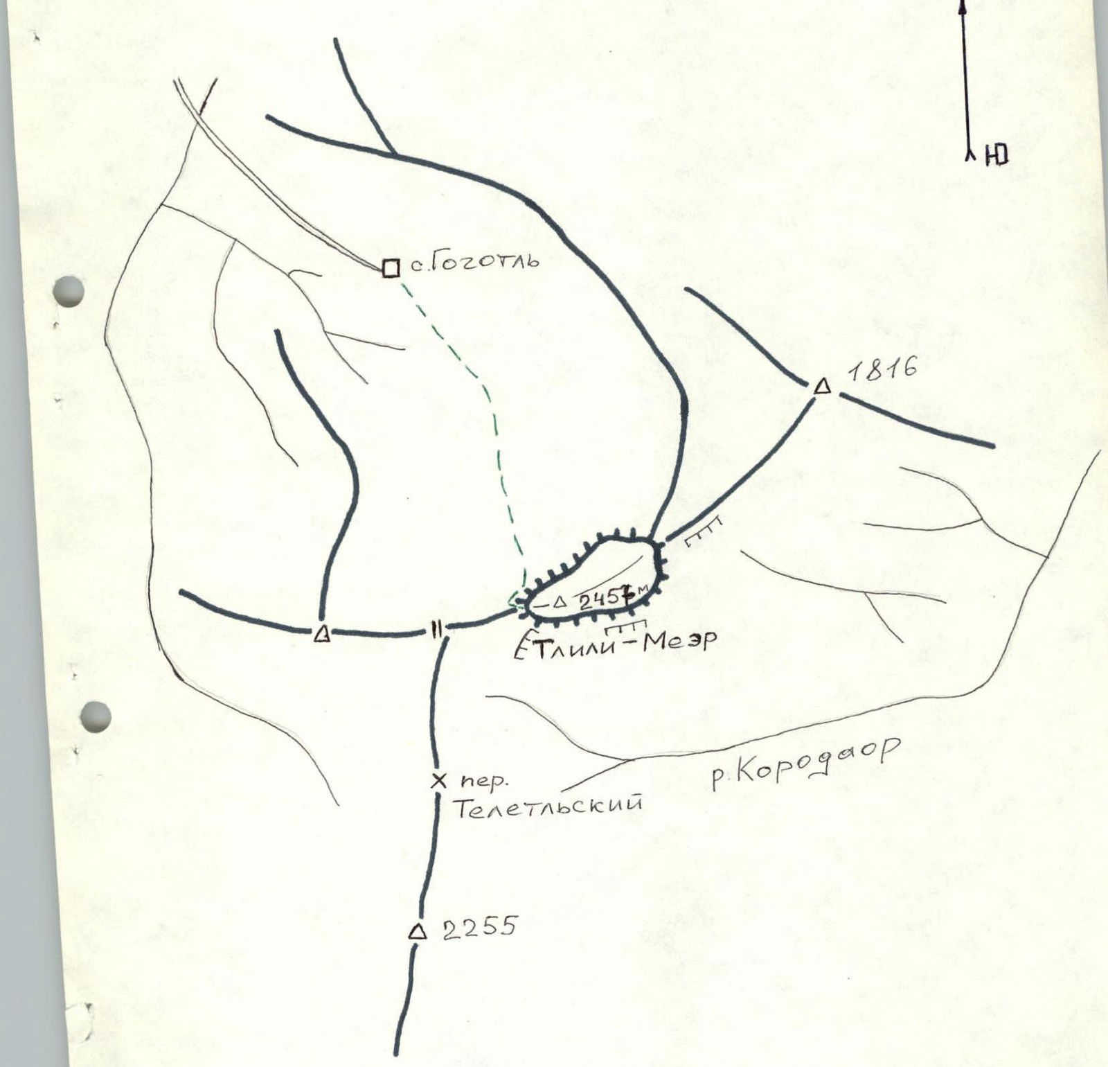 Map of the ascent area
 Route diagram.
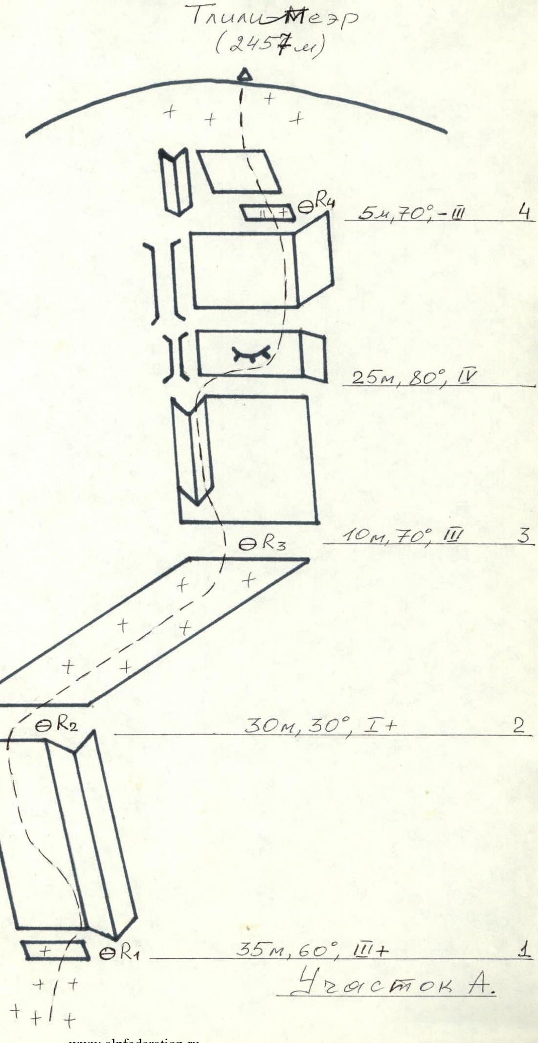 Route diagram in ChIAA symbols
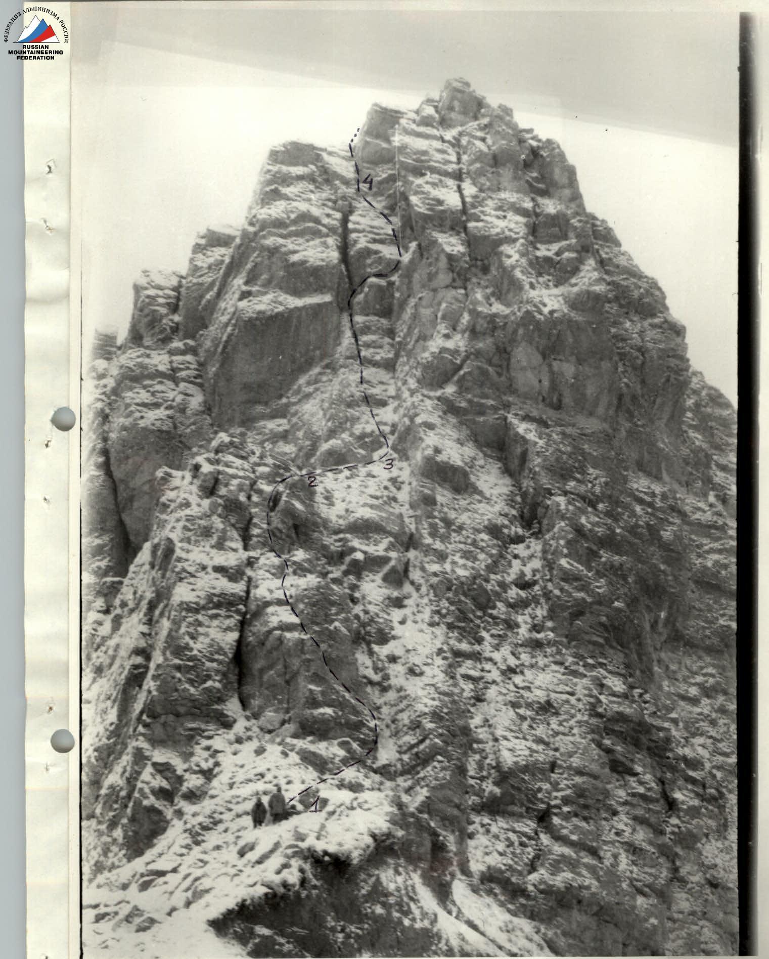 Photo of the route (section A)
Comments
Sign in to leave a comment