
Ascent Passport.
- Winter category.
- Region 2.10, Caucasus, Dagestan mountains, Temir-otrog ridge, Nukatl ridge.
- Temirgokh, 3926, via the right part of the Southeast slope, combined route.
- 2A category difficulty, first ascent.
- Route characteristics: height difference 700 m, average steepness 30°, 1st category difficulty - 650 m, 2nd category difficulty - 550 m, 3rd category difficulty - 650 m, 4th category difficulty - 40 m.
- Pitons were not used.
- Climbing time - 4 hours.
- No overnight stays on the route. Overnight stay in a hut (2350 m) in the Temiror valley.
- Dorro Konstantin Eduardovich - CMS Maximov Vladimir Vladimirovich - 2nd sports category
- Ascent - January 1, 1997.
- Organization: Mountain Club "EOS"
Makhachkala 1997
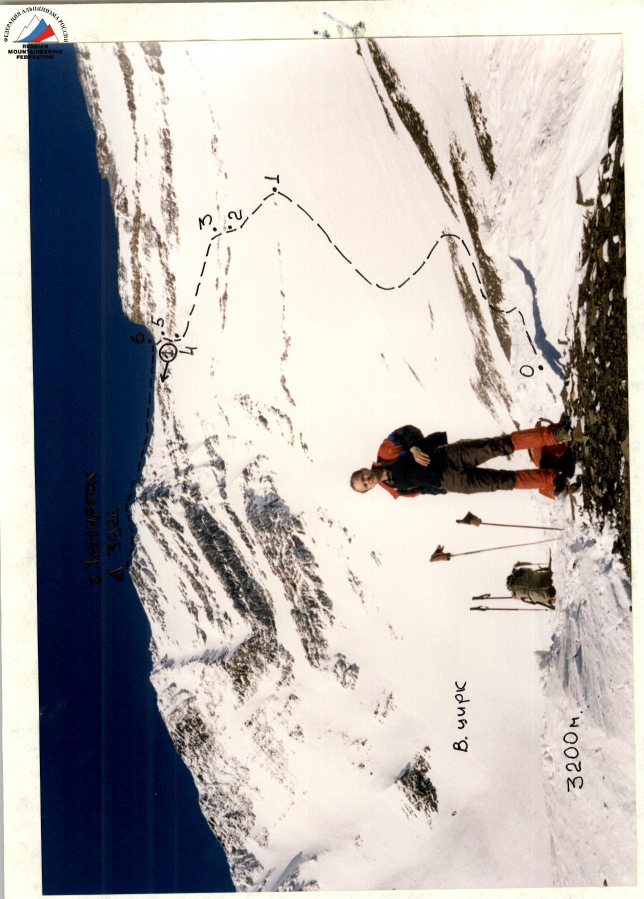
Photo of the general view of Temirgokh peak, taken from the moraine of the Western cirque, 3200 m, January 1, 1997, 11:00, symbol-shift.
Approach Description.
From the village of Khibda (formerly Sovetskoye), the district center of the Shamilsky district of the Republic of Dagestan, go up the Avar Koisu river along the improved dirt road on the left bank to the third bridge across Koisu (20 km). You can get to this place by bus (villages Bezhta, Tlyarata). A little higher upstream, the Temiror river flows into the Avar Koisu (1094 m) from the right. Cross Koisu by the bridge and enter the Temiror valley along the dirt road, then follow the right bank to the village of Rugelda (1650 m) (7 km, 2 hours). After passing through the village, go higher and exit to a horizontal section of the road that leads to the village of Somoda (1700 m, 2.5 km, 1 hour). After passing through the village, descend to the river and cross Temiror via a suspension bridge - a convenient clearing for rest.
Then follow the left bank of Temiror along a good trail, which gradually rises up the slope (the trail is reinforced with walls and widened with overpasses), passing through a pine forest. The scenery is very picturesque. The trail leads to the MTF Mudrukh (2000 m) - a good building with several rooms. Then continue up the slope, gaining altitude, and enter the trough part of the valley. The forest ends. The trail, crossing several gullies, leads to a hut (2350 m, 3 hours). A bivouac is possible. In winter, the hut is empty, and a tent can be set up right inside, in one of the rooms. Directly to the southwest, a 3500 m pass is visible (conditionally Temir), to the right of it is the dome-shaped peak Bezhyuda (3790 m), and to the left is the 3580 m peak with a powerful rocky bastion. The peaks are not visible from the hut, only the powerful rocky triangle of the NE ridge of the NE peak of Temirgokh. From the hut, go up the valley, in the area of 2700-2800 m, turn right and, bypassing the farthest (left) counterfort of the SE slope of Temirgokh NE, enter the couloir between the counterfort and an old moraine ridge. The couloir is avalanche-prone. Depending on the conditions, you can turn left onto a ridge. There are places with rockfall hazard, and moraine deposits and conglomerate at the top. The steepness increases to 40° in the upper part. The ascent ends abruptly at the final moraine ridge of the cirque under the Eastern slopes of Temirgokh (3200 m, 3-4 hours from the hut). This is the starting point of the route.
Route Description.
Start of the route: on the moraine ridge (3200 m) of the almost horizontal cirque under the Eastern slopes of Temirgokh. There is a glacier in the cirque, with no crevasses. Move along the right (in the direction of travel) side of the cirque towards the visible saddle between the main peak and the shoulder of the NE peak of Temirgokh.
- Bypass the first narrow rock band on the right (point 1).
- Then go left and up to the second rock band (crampons may be needed).
- Pass through the rock band via a couloir, where the steepness increases.
- Traverse the last rock band (sections 4-5) via a couloir or to the right through an inner corner; belaying may be necessary.
The slope beyond the rock band becomes gentler and leads to a saddle (3825 m). Then continue left along the ridge with rocky outcrops and steps, and in winter - cornices. Rappel! A cairn was found on the summit, likely built by geodesists during triangulation measurements. Peak 3926 m. The ascent from the cirque takes 4 hours. This was the first mountaineering ascent. Descent via the ascent route - 1 hour 30 minutes.
Note. A triangulation marker is installed on Temirgokh NE (3884 m).
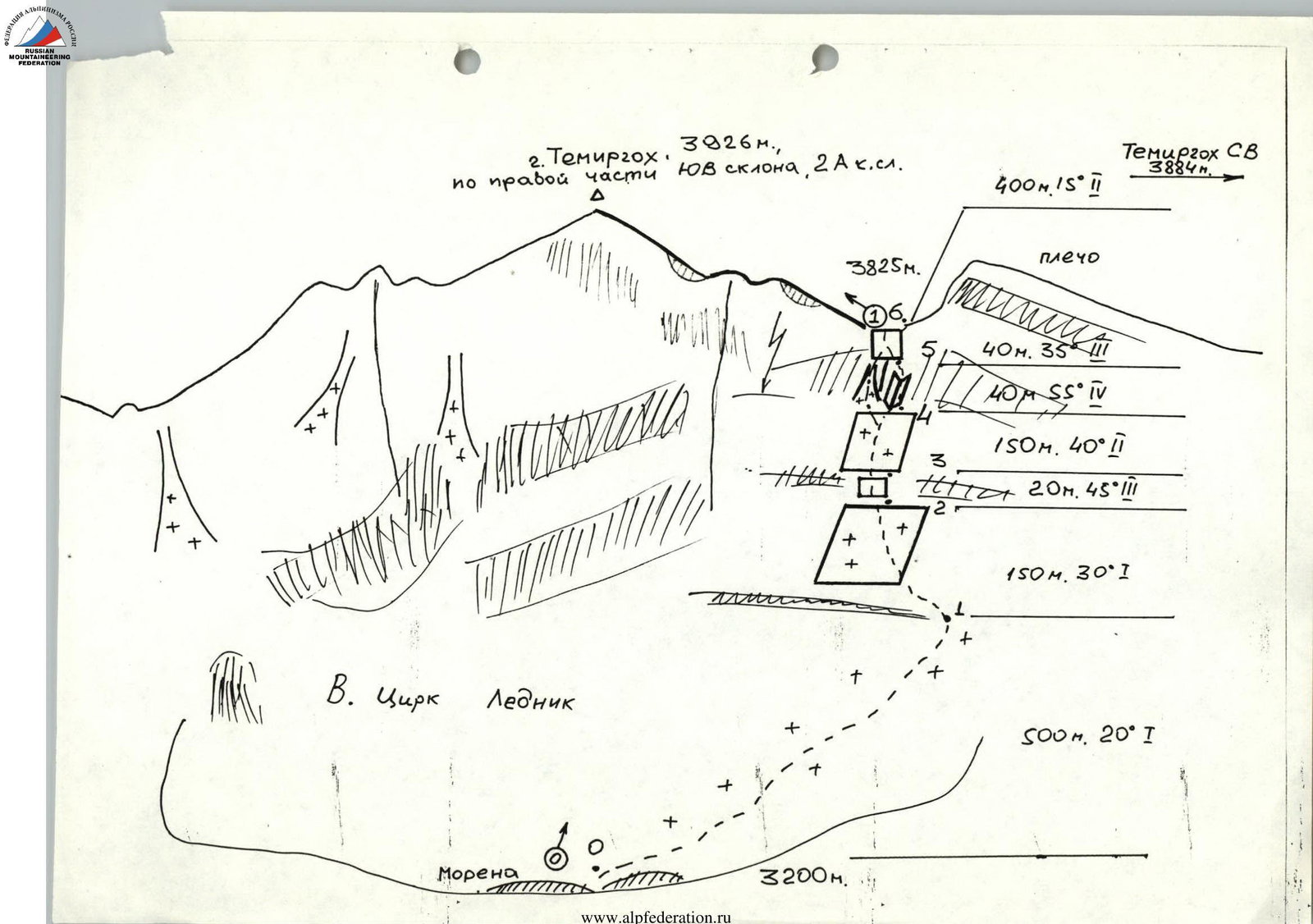
Diagram of the ascent route to Temirgokh peak (3926 m) via the right part of the Southeast slope (2A category difficulty).
- Shoulder 40 m, 35° (category difficulty 2)
- 40 m, 55° (category difficulty 4)
- 150 m, 40° (category difficulty 2)
- 20 m, 45° (category difficulty 3)
- 150 m, 30° (category difficulty 1)
- Cirque, Glacier, +500 m, 20° (category difficulty 1)
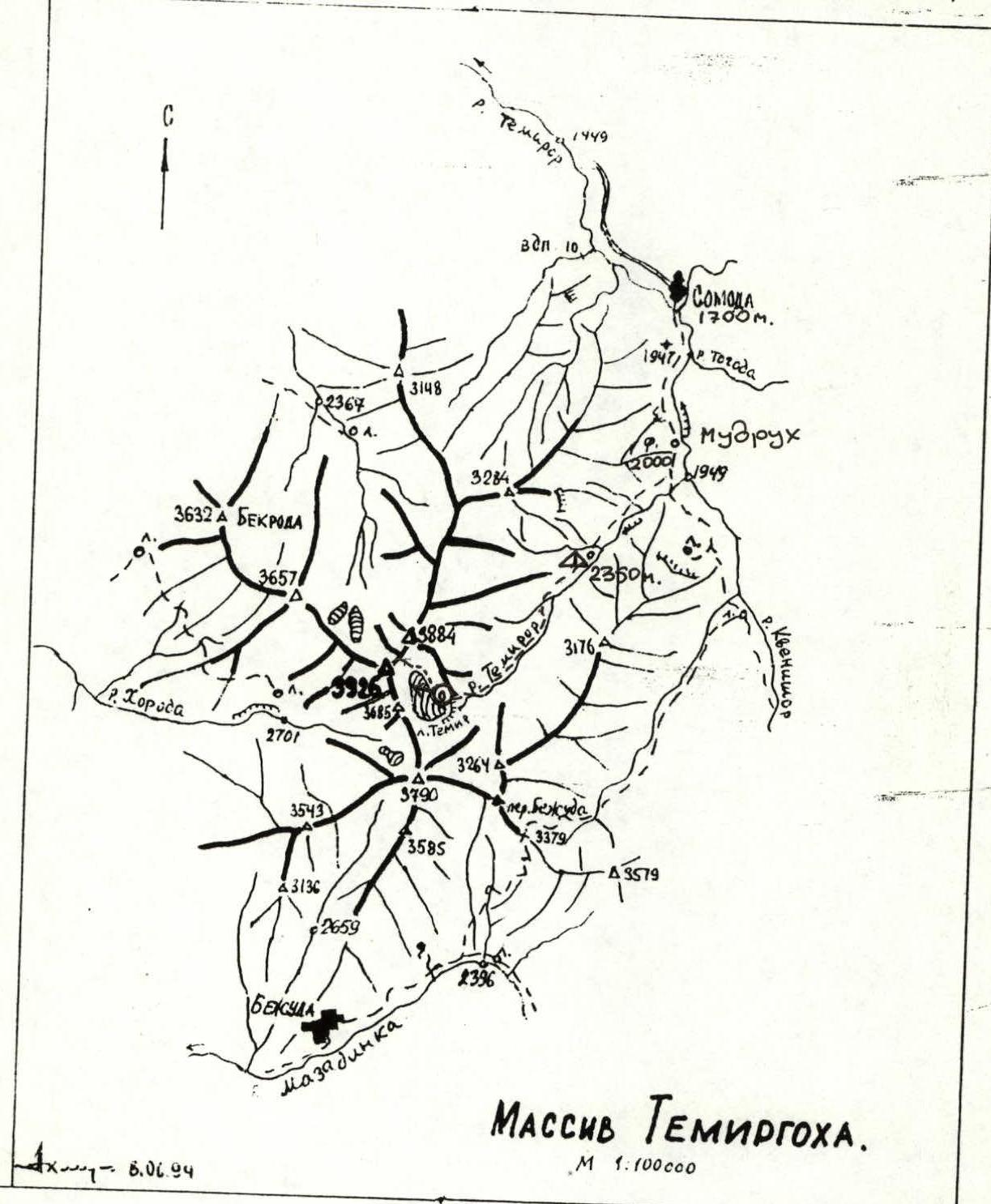
Map of the ascent area.
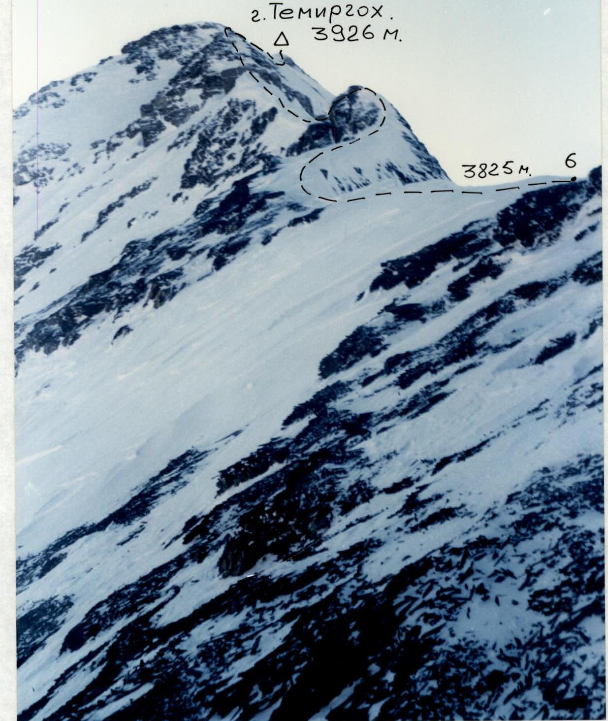
Photo 1. Pre-summit ridge from 3810 m, January 1, 1997, 15:00, symbol-shift.
Comments
Sign in to leave a comment