
Ascent Passport
- Combined route 295
- Climbing area — 2.9a East Caucasus
- Summit Sel'dyk (3666 m) from the South
- Difficulty category — 1B
- Route characteristics: height difference — 400 m. Route length — 790 m (Ic.tr. — 690 m, Pc.tr. — 100 m). Average steepness — 30°.
- Rock pitons — 2, ice — 0, bolted — 0
- Number of travel hours — 9
- Overnights — in the base camp at the confluence of the Chekhychay and Sel'dy rivers
- Name of the leader and participants:
- Krasnopol'skiy Yu.V. — CMS
- Pashuk E.G. — 1st sports category
- Kozorezov E.F. — 1st sports category
- Leonov P.G. — 1st sports category
- Team coach: Master of Sports of the USSR Timoshin M.E.
- Date of departure and return: 4/V-1984
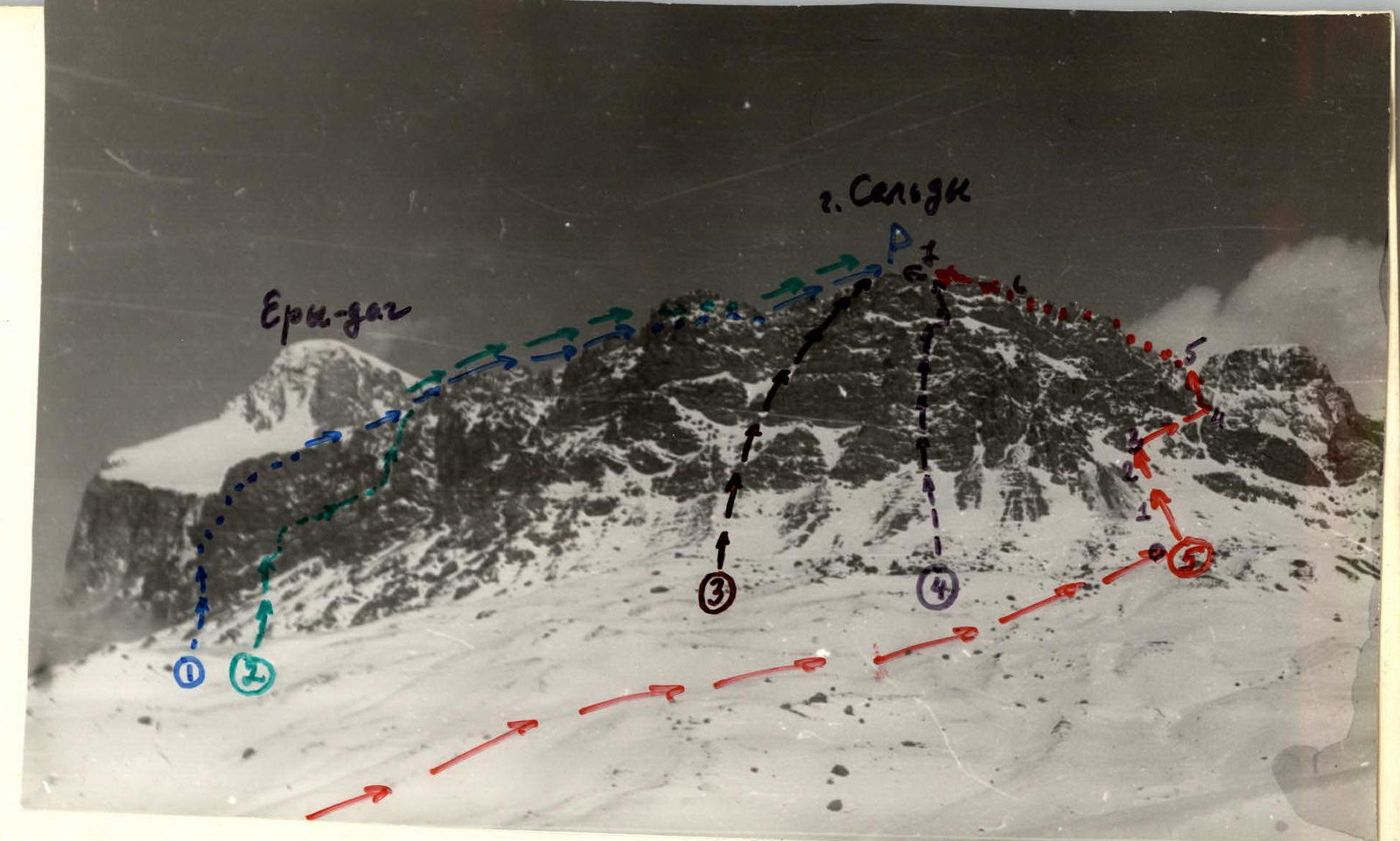
View of Sel'dy from the south (T.N2)
- Sel'dy via "black well" 45 k.kr.
- —co to 3 ern. 35 k.br.
- —i— via 103 kf 35 k.J
- —i— wo 10 om. 45 k.tr.
- —i— South 1B zm br. (0r.)
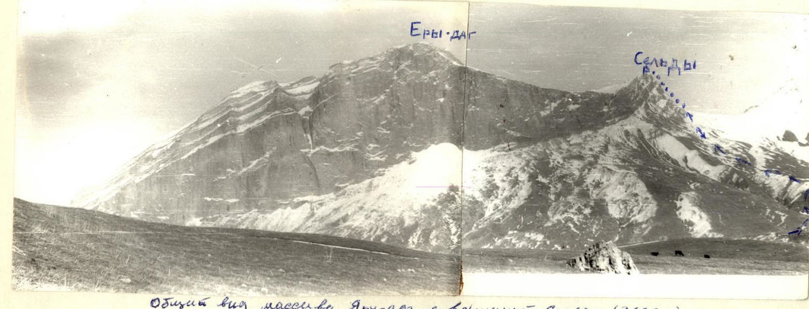
 General view of the Yaru-dag massif with Sel'dy peak (3666 m)
Photo from the slopes of Shalbuzdag (8.1 km slope)
General view of the Yaru-dag massif with Sel'dy peak (3666 m)
Photo from the slopes of Shalbuzdag (8.1 km slope)
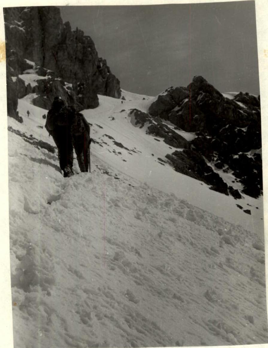
Section R3–R4
Brief explanation for the table
From the overnight stay in the meadow at the confluence of the Chekhychay and Sel'dy rivers, move along the trail towards the Kurushsky pass. Turn left off the trail and move in the direction of the South wall of Sel'dy mountain. Up to the left along grassy slopes and scree to a wide depression filled with huge boulders. From the overnight stay — 2–3 hours. Further movement:
- Along the large scree and snow slope in the direction of the visible saddle.
- Steep snow, not clearly defined couloir with rock outcrops, pass alternately or using ropes.
- A wide snow-covered ledge passing under the wall leads to the plateau.
- Along a steep narrow couloir on the snow slope up to the left to the rocky ridge leading to the summit, from the depression — 4–5 hours. Descent via the ascent route — 3 hours.

Table of main sections
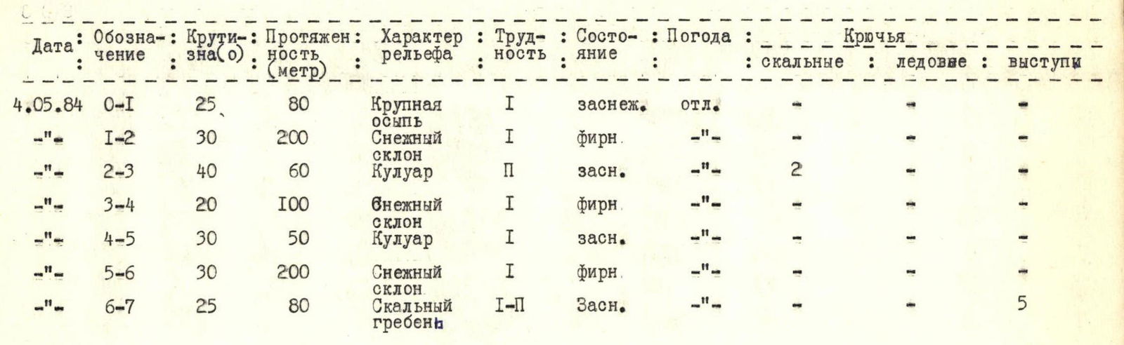
| Date | Designation | Steepness(°) | Length (m) | Terrain characteristics | Difficulty | Condition | Weather | Rock pitons | Ice | Outcrops |
|---|---|---|---|---|---|---|---|---|---|---|
| 4.05.84 | R0–R1 | 25 | 80 | Large scree | 1 | Snowy | excellent | — | — | — |
| «—» | R1–R2 | 30 | 200 | Snow slope | 1 | Firn | «—» | — | — | — |
| «—» | R2–R3 | 40 | 60 | Couloir | 2 | Snowy | «—» | 2 | — | — |
| «—» | R3–R4 | 20 | 100 | Snow slope | 1 | Firn | «—» | — | — | — |
| «—» | R4–R5 | 30 | 50 | Couloir | 1 | Snowy | «—» | — | — | — |
| «—» | R5–R6 | 30 | 200 | Snow slope | 1 | Firn | «—» | — | — | — |
| «—» | R6–R7 | 25 | 80 | Rocky ridge | 1–2 | Snowy | «—» | — | — | 5 |
Comments
Sign in to leave a comment