
Russian Alpinism Championship 2004 First Ascent Category
Report
On the ascent by the Dagestan State University team on Mt. Sel'dy (3664 m) via the center of the western wall. First ascent
Team leader: Evgeny Grigoryevich Pashuk
Makhachkala, 2004
Ascent Details
-
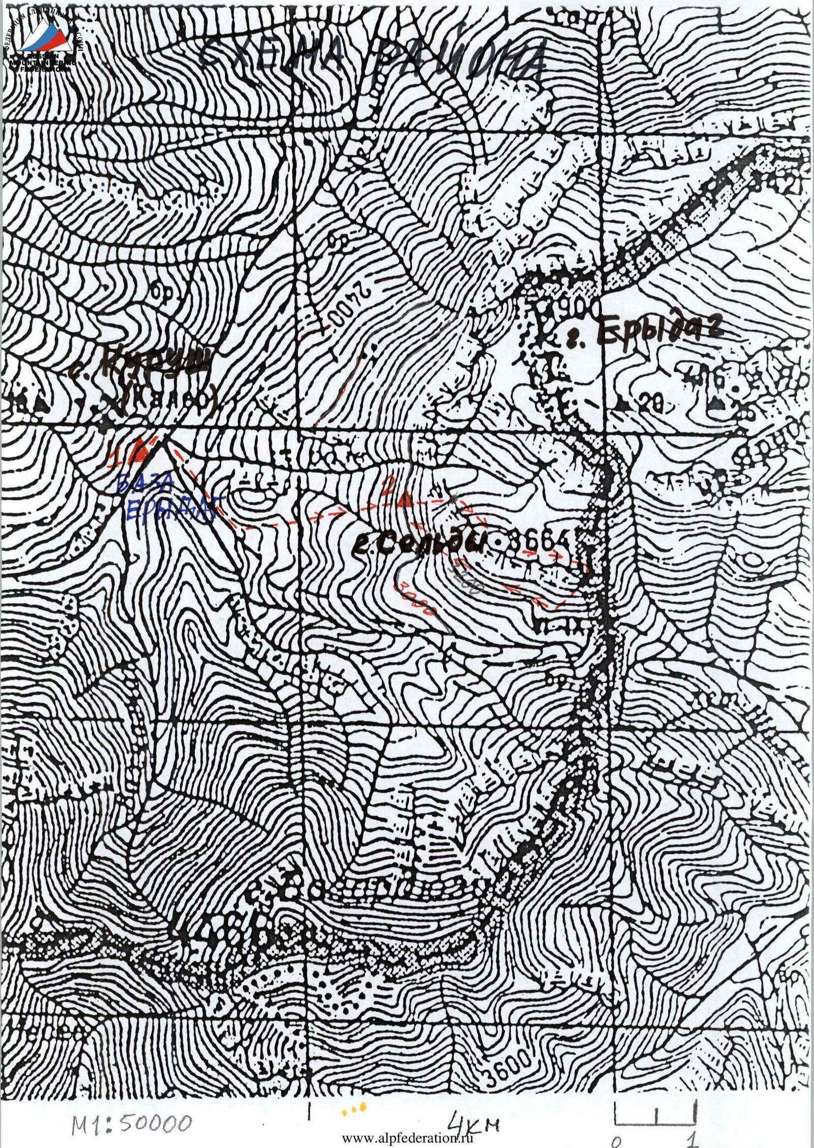
Region 2.10, Caucasus, Dagestan Mountains, Chekhychay River valley.
-
Sel'dy, 3664 m, 5B category of difficulty, via the center of the western wall.
-
Proposed category of difficulty: 5B, first ascent.
-
Route type: rock.
-
Route height difference: 350 m, route length: 970 m, wall height difference: 250 m, wall section length: 265 m, average wall slope: 75°, average central wall section slope: 83° (from R2 to R8), section length with V category of difficulty – 65 m, VI category of difficulty – 80 m, traversed using ATO – 80 m, with complexity A1 – 0 m, A2 – 80 m, A3 – 0 m, including 30 m traversed using skyhooks.
-
Pitons left on the route — 9:
Left:
- rock pitons — 4
- removable bolt pitons — 1
- stationary bolt pitons — 4
- holes from removable bolt pitons (8 mm) – 26
-
Number of belay points used:
total (including for ATO) — 84/45; rock pitons — 33/12; chocks — 25/12; bolt pitons — 26/21, of which stationary — 4/0. Skyhooks used (times) — 28. Total artificial points of support (ATO) used — 73.
-
Team's total climbing time — 32 hours, days — 4.
Time spent by the "lead" climber on the route — 28 hours. Including 2 days, 11 hours for preliminary route processing.
-
Overnight stays: 1st, 2nd in ABC under the wall in tents (3050 m); 3rd in a "grotto" in a seated position (3395 m).
-
Team leader: Pashuk Evgeny Grigoryevich — CMS
Team members:
- Nurbagandov Gadzhi Gadzhimuradovich — MS
- Mazanov Tagir — 1st sports category
-
Coach: The team prepared independently.
-
Preliminary route processing: 01.07.2004–02.07.2004.
-
Departure for the route 03.07.2004.
Summit reached on 04.07.2004. Return to base camp (village Kurush) on 04.07.2004.
-
Organizer: Dagestan State University.
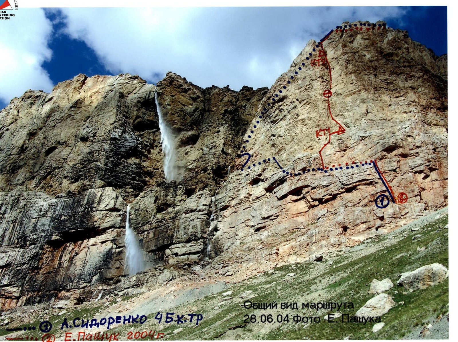
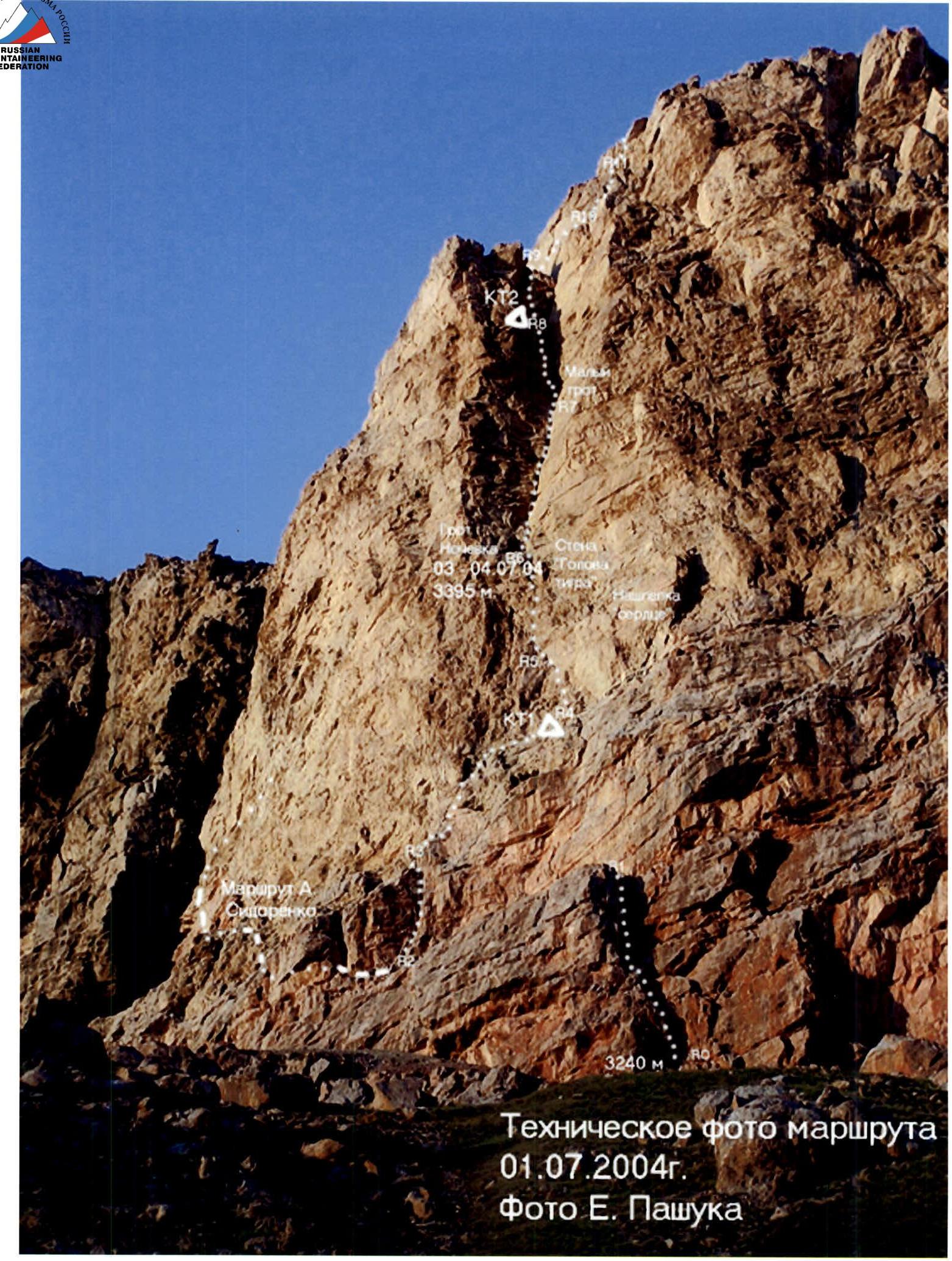
General view of the route. 28.06.2004. Photo by E. Pashuk.
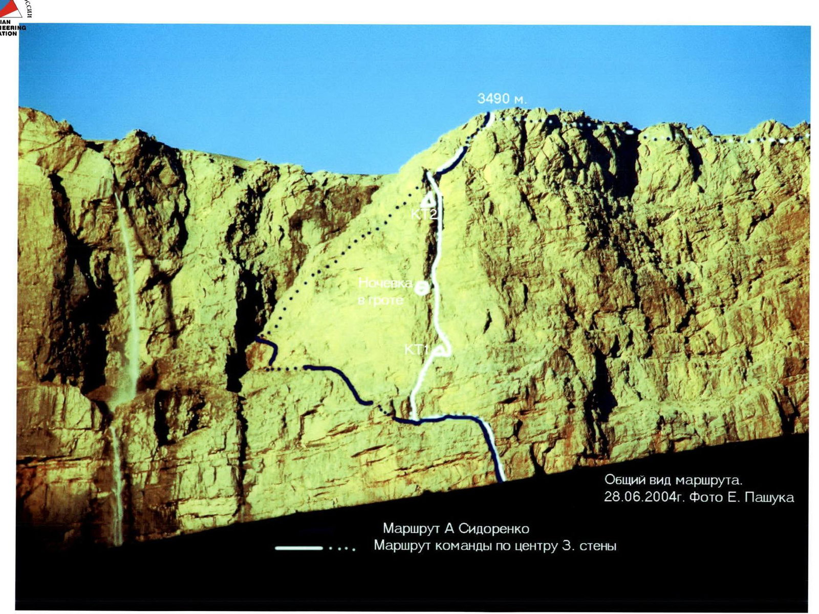
General view of the route. 28.06.2004. Photo by E. Pashuk. A. Sidorenko's route. Team's route via the center of the Western wall.
Overview of the Climbing Area
Sel'dy 3664 m via the center of the western wall
Mt. Sel'dy is the highest point on the western plateau of the Erydag-Yarudag massif, located in the North-Eastern spur of the Main Caucasian Ridge, on the border between Russia and Azerbaijan. The spur forms a virtually single plateau with Mt. Yarudag (4116 m) and Mt. Shakhdag, located in Azerbaijan. The western plateau of the massif drops into the Chekhychay River valley with a wall that is the western part of the Erydag wall (3925 m), stretching in an unbroken 15-kilometer arc from the Gil' pass in the NE to the Kurushsky pass in the South. In Dagestan, the walls drop by 300–1100 m. The wall is composed of metamorphosed limestones. The climate in the area is dry, with the most precipitation occurring in May–July. In winter, the weather is frosty and dry with periods of strong winds and precipitation. A major issue on the wall is the lack of water, which can be a problem even in winter. To reach the climbing area from Makhachkala, take the federal highway "Kavkaz" south to the village of Novo-Goptsy (180 km), then turn right and head up along the Samur River to the village of Usukhchai (district center of Dokuzparinsky district) (225 km, 700 m above sea level). Then turn left onto a dirt road and head up along the Usukhchai River to the village of Kurush (250 km, 2500 m). The journey takes 6–8 hours. From the village of Kurush:
- descend along the trail to the confluence of the Sel'dy River into the Chekhychay River on the right (2250 m);
- to the right, on the left-bank terrace, are the kungas of the "Erydag" base of the Dagestan Republican PSS EMERCOM (30 min.). It is possible to drive there by car.
Approach to the route. From the "Erydag" base, cross two bridges and exit onto the right-bank terrace of the Sel'dy River. Follow the road up along the river, bypassing a green dome-shaped mountain, to a deep slate gully with a stream. Cross the stream and move along the trail in the direction of the Charaur waterfall, leaving the ridge coming from under the waterfall on the left. The trail leads to a farm. Cross the stream flowing to the right of the farm and move up directly opposite the center of the Western wall of Mt. Sel'dy with a characteristic vertical inner corner. There are many convenient sites here, but water is only available:
- in the springs at the farm level;
- near the waterfall.
It's better to ascend to the last rise, ending in the wall's scree. Here, 50–60 m below the scree, there is a spring. Under a characteristic red angular boulder with a black vertical stripe, there are convenient sites — the "Red Stone" overnight stay. The height is approximately 3100 m. From the "Erydag" base — 2–3 hours. From the overnight stays, ascend vertically up the scree to the inner corner of the wall. Here, there is a convenient protected ledge — the start of the route. The route passes through the center of the western wall of Mt. Sel'dy with the maximum steepness and length. Despite the relatively short length of the wall section (265 m), due to the high steepness and complexity of the terrain, it requires a team to have a full set of technical and tactical skills, as well as determination and faith in victory.
Ascent Details
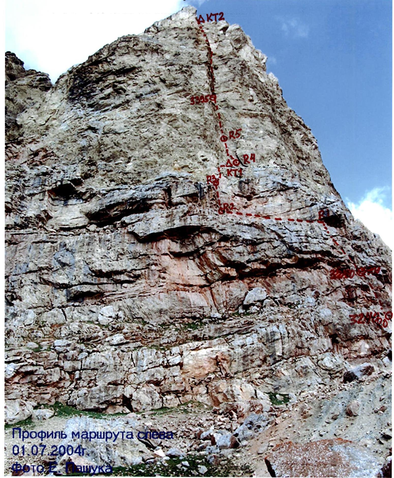
Route profile from the left. 01.07.2004. Photo by E. Pashuk.
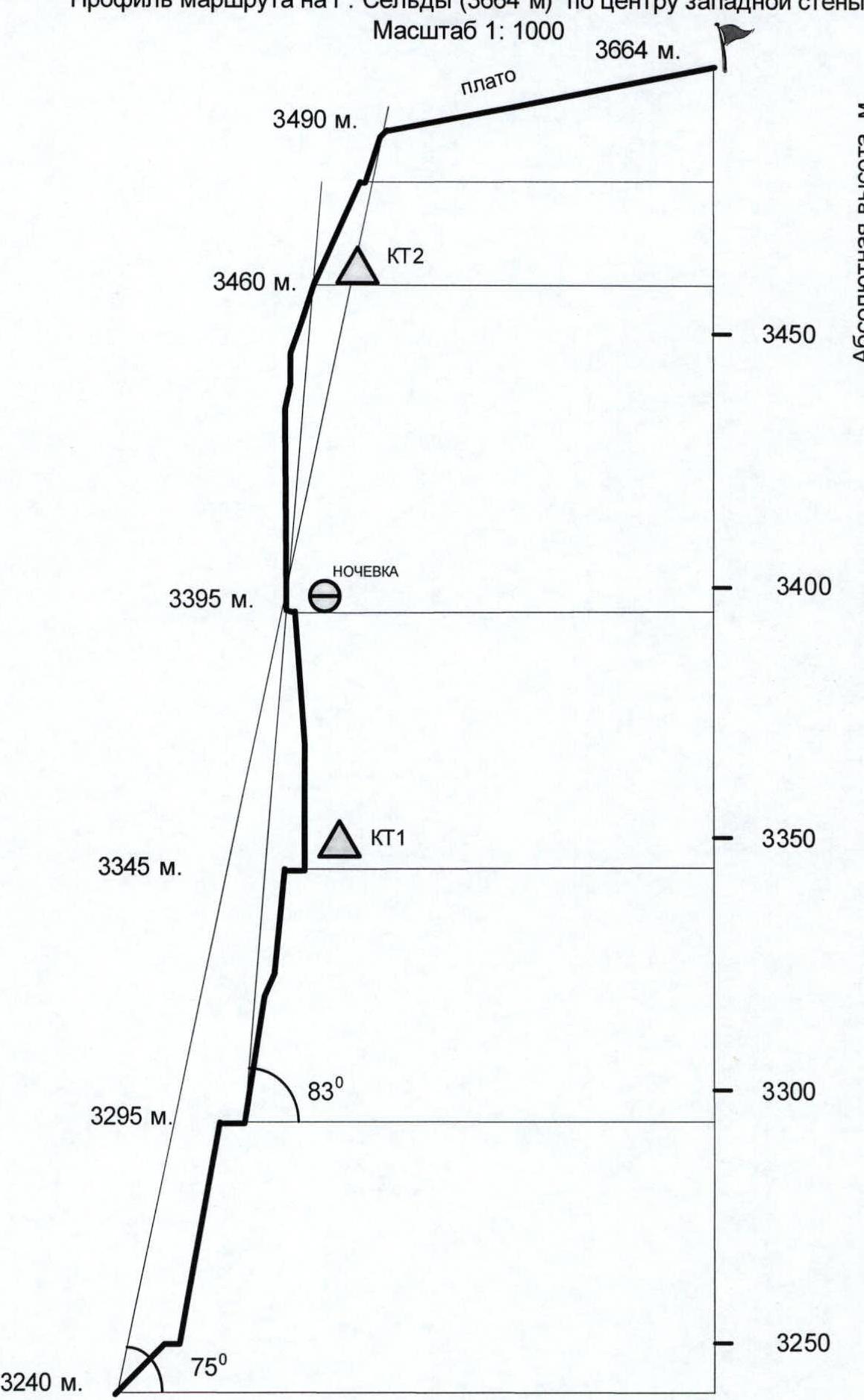
Hand-Drawn Route Profile
Route profile on Mt. Sel'dy (3664 m) via the center of the western wall Scale 1:1000
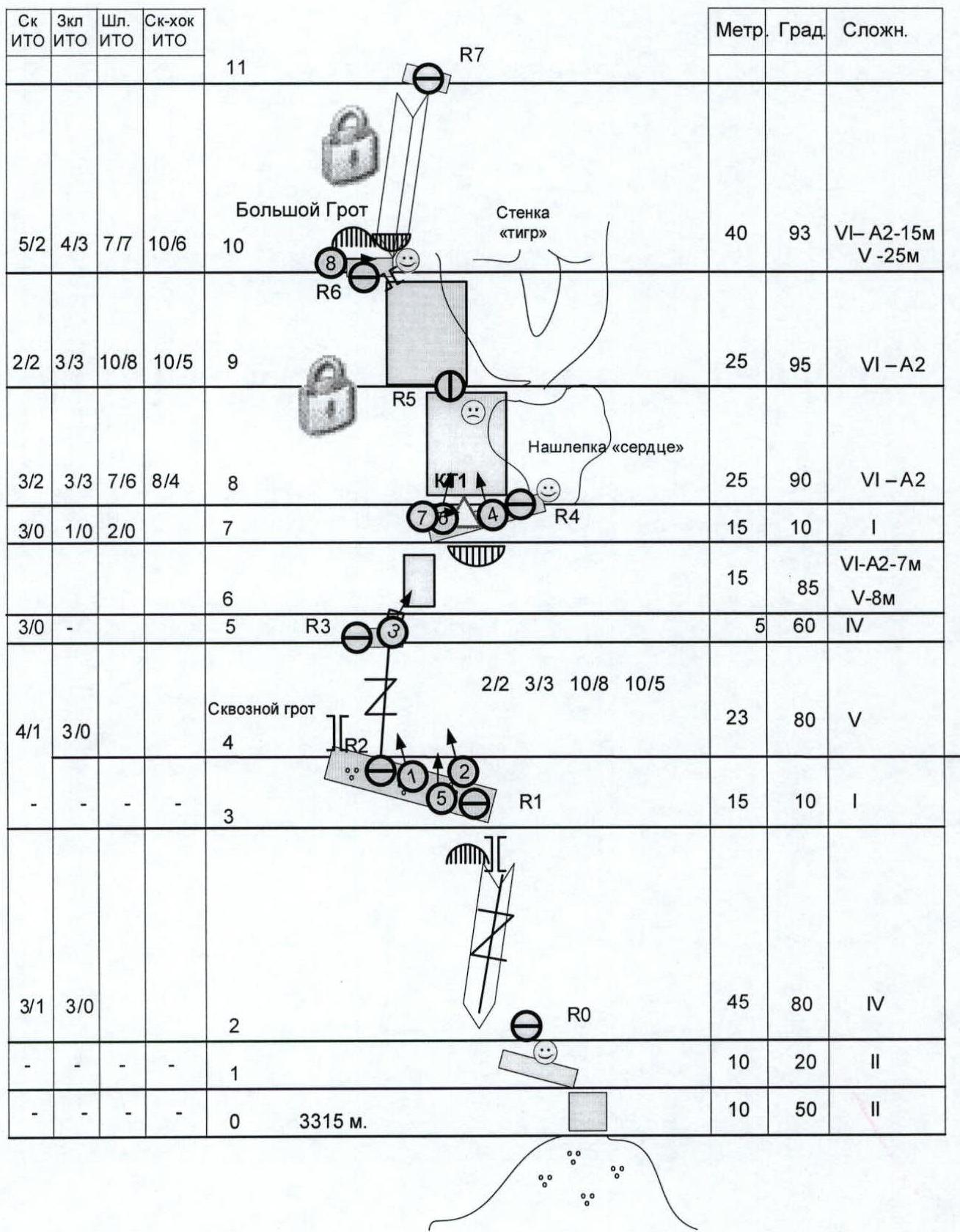
Route diagram in UIAA symbols on Mt. Sel'dy (3664 m) via the center of the western wall Scale 1:1000 Sheet 1 of 2
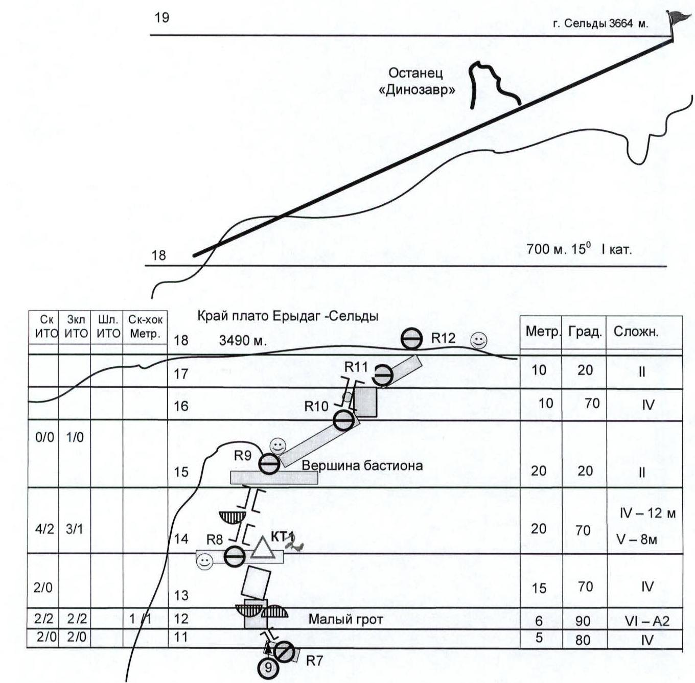
Route diagram in UIAA symbols on Mt. Sel'dy (3664 m) via the center of the western wall Scale 1:1000 Sheet 2 of 2
Ascent graph to the summit of Sel'dy (3664 m) via the center of the western wall 01–04 July 2004. E. Pashuk +2

Ascent Tactics. Mt. Sel'dy 3664 m, via the center of the western wall
"Based on years of observations of the route, reconnaissance, and experience of attempts to climb it, the following ascent tactics were developed:"
Departure for route processing and the ascent from the "Red Stone" overnight stay. Equipment and water are cached on a wide ledge (R1–R2).
Route processing up to R5 or R6 (3 ropes) with caching of equipment and water. When traversing stonefall-prone sections — ledges R0, R1–R2, R4, the chimney, and the overhang R6, the team must be concentrated on the corresponding station:
- ledge R0
- ledges R1–R2
- ledge R4
- couloir R6
- overhang R6
Processing Tactics
Traversing the R2–R3–R4 section: The rope team climbs the R2–R3 section with a minimum amount of equipment. The main equipment and water are cached in a niche to the left of R2.
After setting up R3:
- The second climber removes R2;
- reaches R3;
- retrieves the rope.
After the first climber traverses the R3–R4 section and sets up R4:
- The second climber removes R3;
- reaches R4;
- retrieves the rope.
The rope is dropped from R4 to R1. Thus, traversing diagonal ropes with a backpack is avoided, and stonefall risk is reduced since the climbers are under the protection of a large overhang. The third climber ascends from R1 to R4, fetching the remaining equipment and water cached on the ledge, then descends to R1.
Traversing the R4–R5–R6 section:
The first critical section was divided into two parts. Since free climbing on the negative wall is extremely difficult and hazardous, traversing the entire wall up to the grotto would require an unreasonable number of bolt pitons. Movement is planned to the right and then left, bypassing the overhang. To reduce stonefall risk, a second station is planned at the base of the "Serdtse" patch. After setting up the hanging station R5, the second climber traverses the R4–R5 section lightly, straightening the ropes, then rappels to the R4 ledge. After the first climber traverses the R6 section, they set up the R6 station under the overhang of the large grotto and rappel to R5, removing intermediate pitons. The R5 anchor point remains to reduce the risk from stonefall.
This concludes the route processing. The team descends from R6 to R0 via three vertical ropes and then to ABC. As a result of processing, three vertical ropes remain on the wall, and almost all equipment is cached on the second ledge.
Ascent Tactics
The entire team departs from ABC early in the morning. When traversing the ropes, the first climber goes lightly with lower protection. The other team members with gear must use upper protection. The team assembles in the stonefall-protected grotto R6. Work on the second critical section R6–R7 (overhanging inner corner) begins no later than 10:00. In case of unforeseen difficulties, an overnight stay in the grotto is planned. The ascent to the plateau is planned for no later than 20:00. The summit ascent and descent can occur in twilight.
The team fulfilled the main tactical objectives.
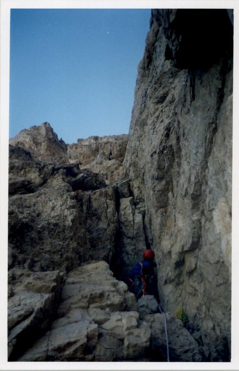
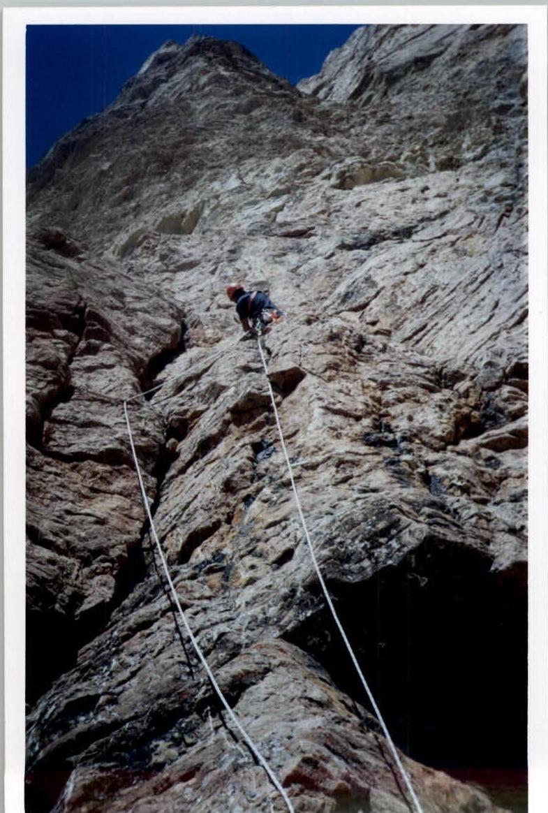
Photo 9. Nurbagandov in the small grotto R7–R8. 04.07.2004. Photo by E. Pashuk.
Photo 4. Nurbagandov at the start of "КМО79"3 R4–R5. 02.07.2004. Photo by E. Pashuk.

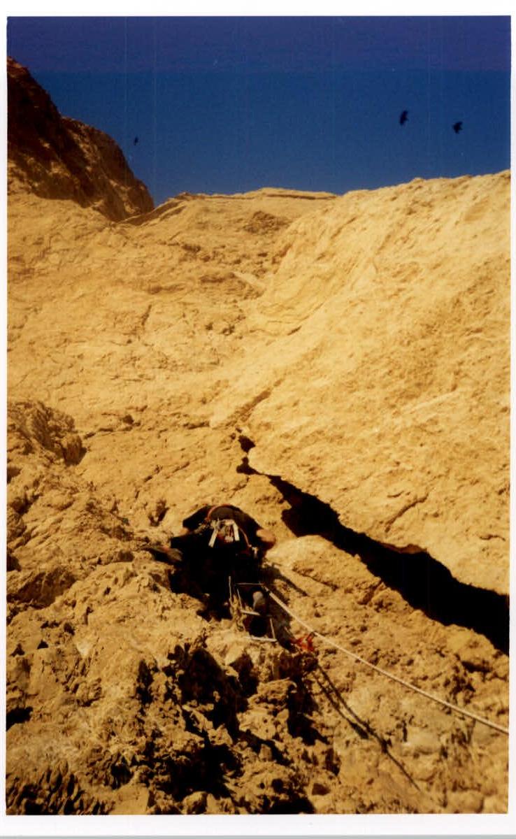
Photo 6. Nurbagandov on the R5–R6 section. 03.07.2004. Photo by E. Pashuk.
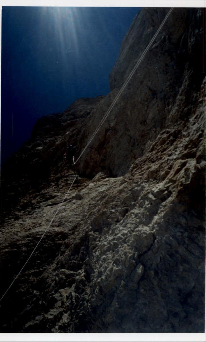
Photo 3. Nurbagandov on the R3–R4 wall. 02.07.2004. Photo by E. Pashuk.

Photo 3. Nurbagandov on the R3–R4 wall. 2 July 2004. Photo by E. Pashuk.
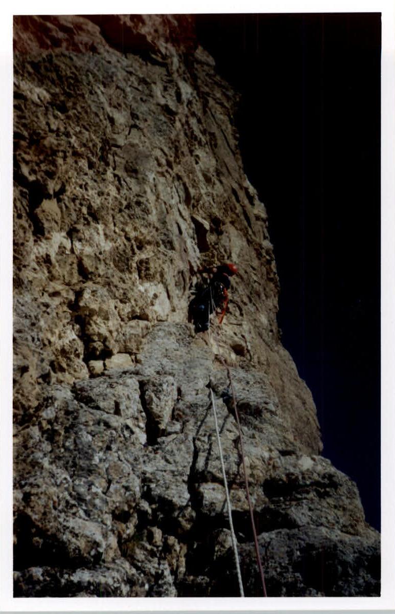
Photo 2. Nurbagandov and Mazanov on the R3–R4 section. 02.07.2004. Photo by E. Pashuk.

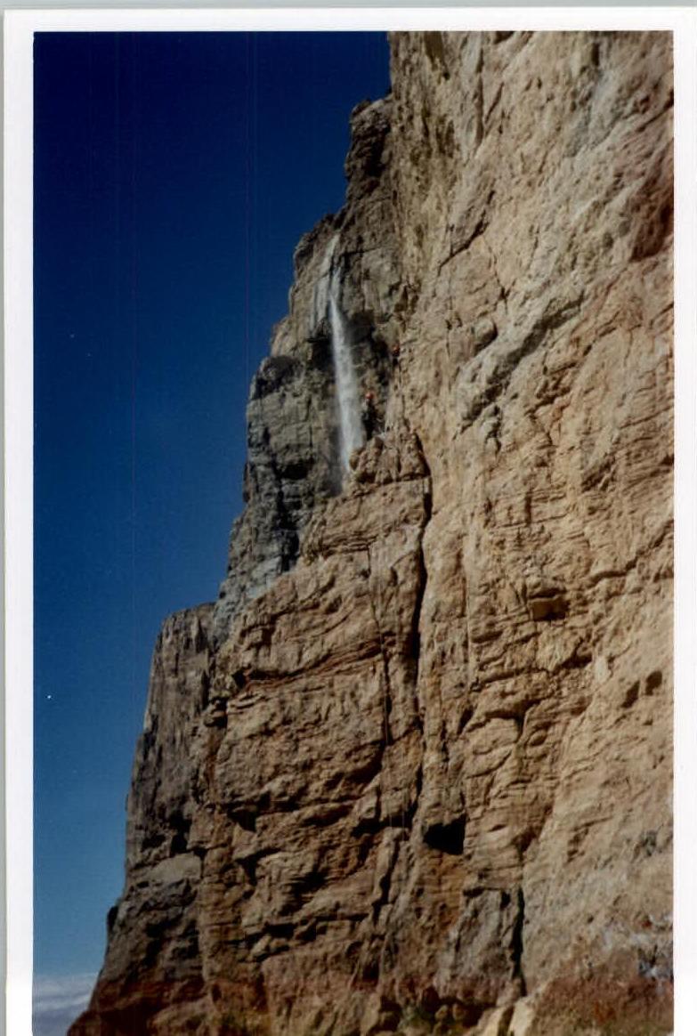
Photo 1. Nurbagandov on the R2–R3 section. 02.07.2004. Photo by E. Pashuk.

Comments
Sign in to leave a comment