
To the report on the ascent to v. No. Zap. Yarydag via the S wall.
The photographs show the view of the peak Zap. Yarydag from the South.
(photo 1 — Distant view, photo 2 — Close-up view).
The route passes between the gendarmes "Zub" and the buttress, beyond which the SE wall of the peak begins. Thus, the route has natural limitations, and deviating from them is more challenging than the route itself. It is impossible to approach the first belay station from the side. The second belay station can be reached via the SE wall (see photo 3).
Photo 3 shows the view of the peak Zap. Yarydag from the SE, from the Kurush pass. The profile of the buttress separating the S and SE walls is visible, with "Zub" peeking out from behind it.
Although the route is not visible, the photograph gives an idea of the average steepness of the route — it should not be less than the average steepness of the buttress.
On the right part of the SE wall, there is a couloir and a snowy slope, which some groups have used to descend from the peak.
The first ascenders believe that the route is very logical, original (i.e., it does not repeat previously climbed routes and is not a variation of them), and deserves an assessment as a 4B category of difficulty route.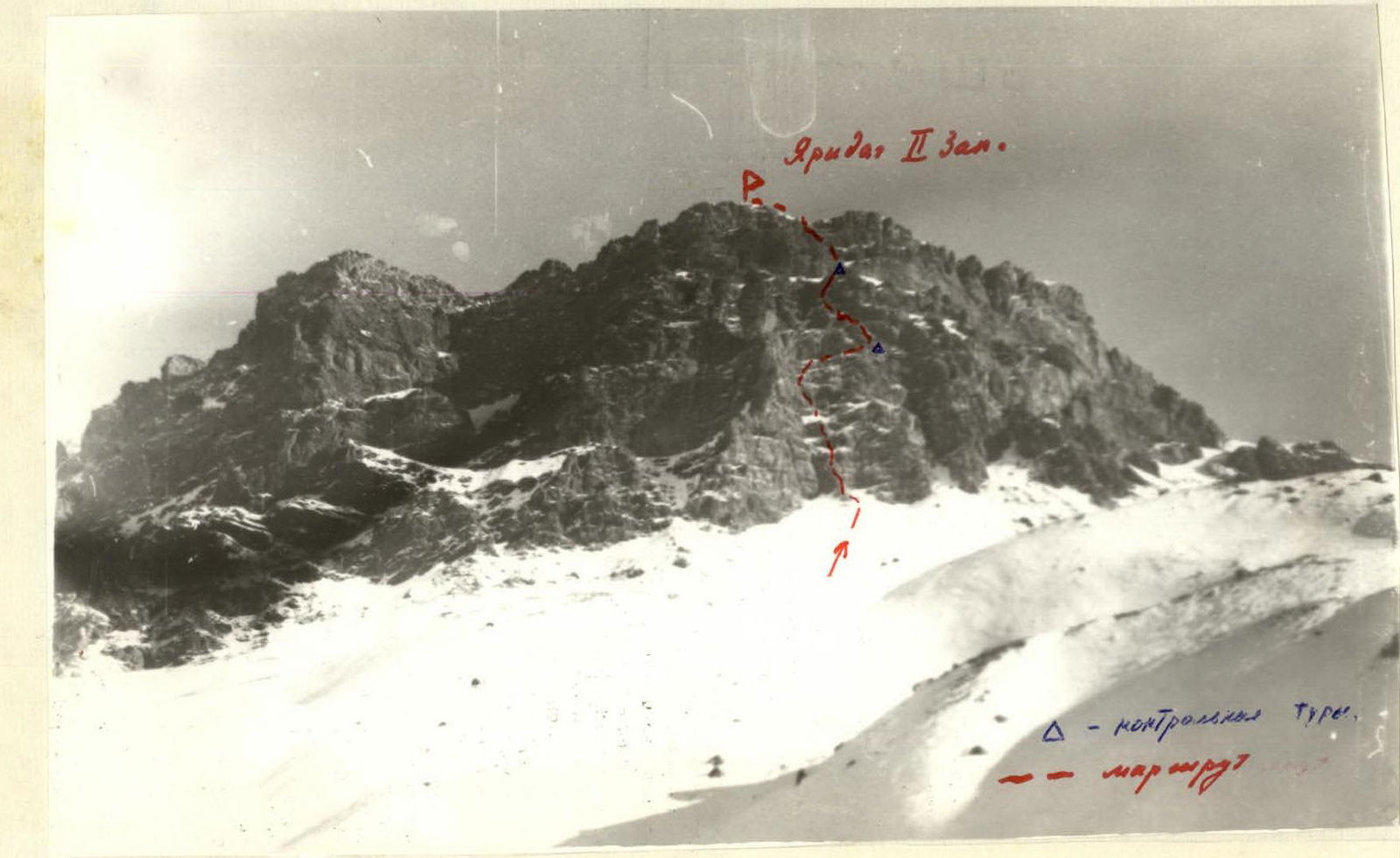 Photo 1. 2nd Zap. peak of the Yarydag massif. View from the south (from the trail to Kurush pass). The SW buttress is on the left.
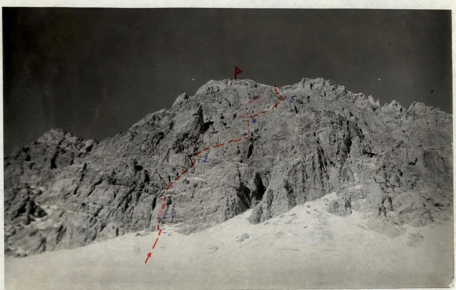 Photo 2. 2nd Zap. peak of the Yarydag massif. View from the south, from under the route. Sections 5–6, 6–8, and 7–8 are practically not visible.
Route Description
Related to
EurasiaWestern AsiaCaucasus MountainsGreater CaucasusEast CaucasusSouth Eastern CaucasusMount Bazardüzü
Route:Ю стенеWarnings
- This text was translated automatically
- This text was processed automatically
Comments
Sign in to leave a comment