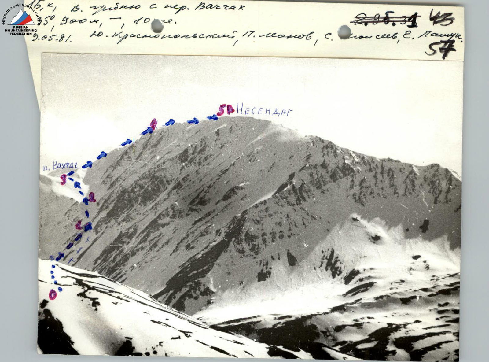
Ascent Record
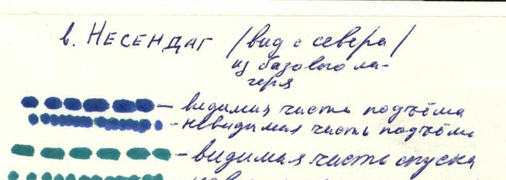
(Nesendag from Vakhchag Pass, Category 1B difficulty)
-
Type of Ascent Combined
-
Ascent Area 2.9. Eastern Caucasus
-
Peak, its Height, and Route Nesendag (3925 m), from Vakhchag Pass
-
Anticipated Difficulty Category 1B
-
Route Characteristics: Elevation gain — 900 m, average slope — 35°, section lengths:
- R0–R1 — 300 m.
- R1–R2 — 350 m.
- R2–R3 — 200 m.
- R3–R4 — 400 m.
- R4–R5 — 250 m.
-
Pitons Used: for belaying: rock 0, ice 0, bolted 0 for creating intermediate belay anchors: rock 0, ice 0, bolted 0
-
Number of Climbing Hours 10
-
Number of Nights and their Characteristics No overnight stays
-
Leader and Participants' Names, their Sports Qualification Krasnopolsky Yu.V. CMS (Candidate for Master of Sports) Pashuk E.G. 2nd sports category Leonov P.G. 2nd sports category Moiseev S.I. 2nd sports category
-
Date of Departure and Ascent: May 9, 1981
-
Team Coach: CMS Krasnopolsky Yu.V.

 www.alp-federation.ru↗
 www.alp-federation.ru↗
Approach to the Route Description
From the base camp located 200 meters southwest of the bridge over the Usukh-chay river (below the Kurush village), go upstream for 200–300 meters. Cross the river and head south upstream along the Vakhchag river, which flows from the cirque formed by the peaks of Bazardyuzyu and Nesendag.
A good trail leads into the cirque, initially following the river, then climbing the slope of Nesendag. After two hours of walking from the base camp, it brings you to a wide meadow with signs of summer grazing. From the meadow, descend left to the river and walk 100–150 m to the confluence of two streams that form the Vakhchag river. This is the starting point of the route.
Route Description
From the confluence of the streams, ascend the steep right snow slope. After 100 m, the slope features easy rocks, then continue on snow towards the right cirque. Here, rope up and ascend the steep couloir on the eastern slope of Nesendag (1 hour).
After 300–350 meters, at the narrowing of the couloir, turn left and ascend a snow slope of moderate steepness to Vakhchag Pass. On the pass, near the lake: control cairn (2.5–3 hours from the cirque).
From the lake:
- head right and up to the summit ridge along a scree (in spring — snow) slope (1.5 hours from the pass);
- after reaching the ridge, walk 200–250 m north to the indistinct summit. Here is the cairn.
Descent — via the ascent route.
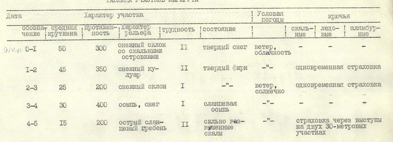
Route Sections Table
| Date | Section | Average Slope | Length | Terrain Characteristics | Difficulty | Condition | Weather Conditions | Pitons |
|---|---|---|---|---|---|---|---|---|
| May 9, 1981 | R0–R1 | 50° | 300 m | snow slope with rock outcrops | 2 | hard snow | wind, cloudy | - - - |
| R1–R2 | 45° | 350 m | snow couloir | 2 | hard firn | —"— | simultaneous belay | |
| R2–R3 | 25° | 200 m | snow slope | 1 | —"— | wind, sunny | simultaneous belay | |
| R3–R4 | 30° | 400 m | scree, snow | 1 | slate scree | —"— | - - - | |
| R4–R5 | 15° | 200 m | sharp slate ridge | 2 | heavily broken rocks | —"— | belay through ledges on two 30-meter sections |