
ASCENT FORM
- Area of ascent
- Class of ascent
- Peak, its height
- Ascent route
- Estimated difficulty category
- Route characteristics
- Pitons were not used
- Number of nights and their characteristics
- Surname, name, patronymic of the leader, participants, their sports qualification
- Date of ascent
- Team coach
2.9a Dagestan Mountains combined Izhena (3981) (4025) via N ridge from Izhena pass
2A height difference 440 m average steepness 30° section length: 1st difficulty category — 500 m 2–3 difficulty category — 140 m
Overnight stay at the "Sulak-high-mountain" weather station
| Akhmedkhanov K.E. | 2nd sports category |
|---|---|
| Kozorezov E.F. | 2nd sports category |
| Gairbekov A.P. | 3rd sports category |
| Elmurzaev M. | 3rd sports category |
| Svinarev G. | 3rd sports category |
July 26, 1979 MS Timoshin M.E.
Note: a note from Mikirov E.S. group's was found on the summit, dated April 27, 1979.
 Mt. IZHENA (4025 m)
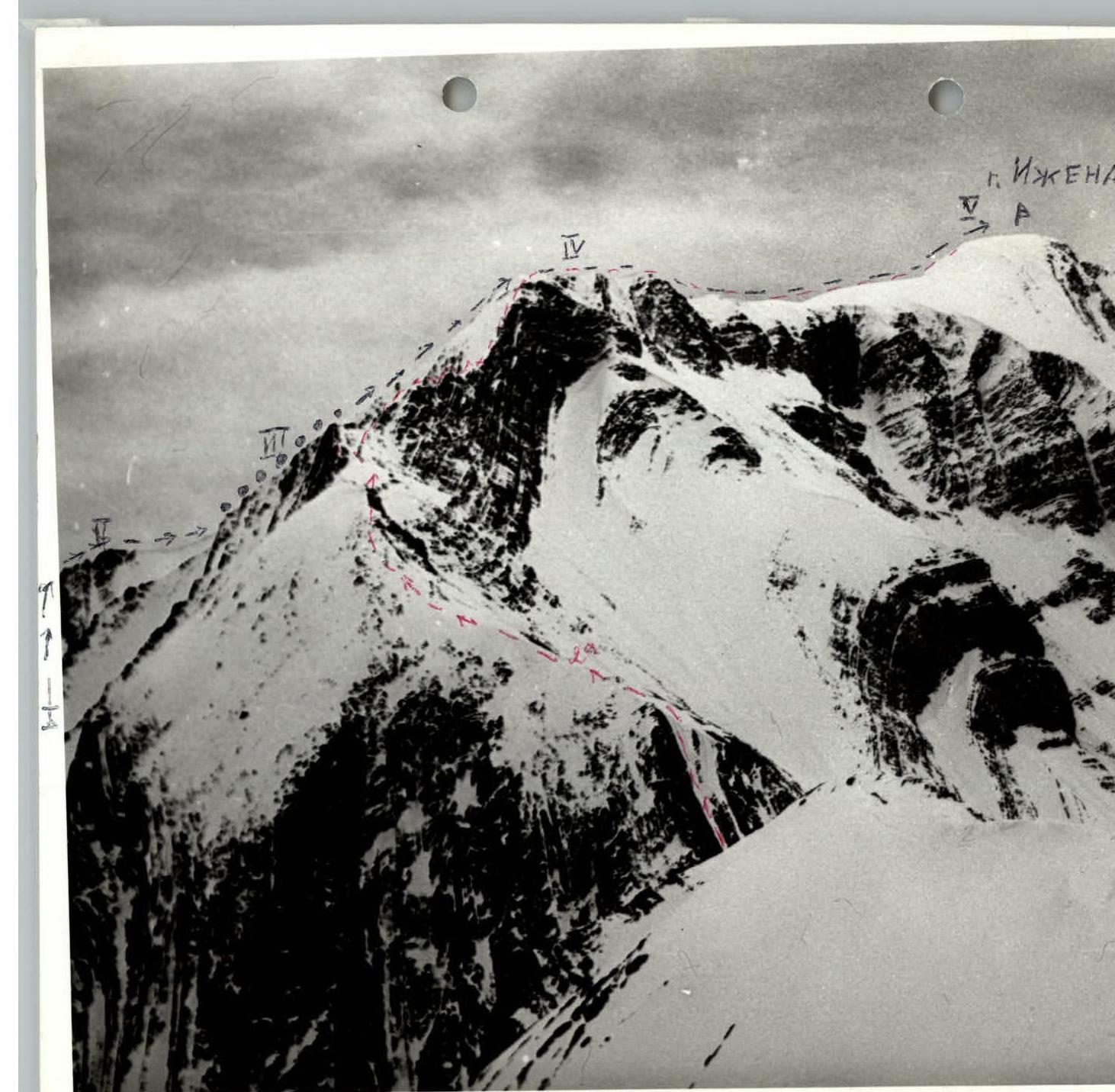
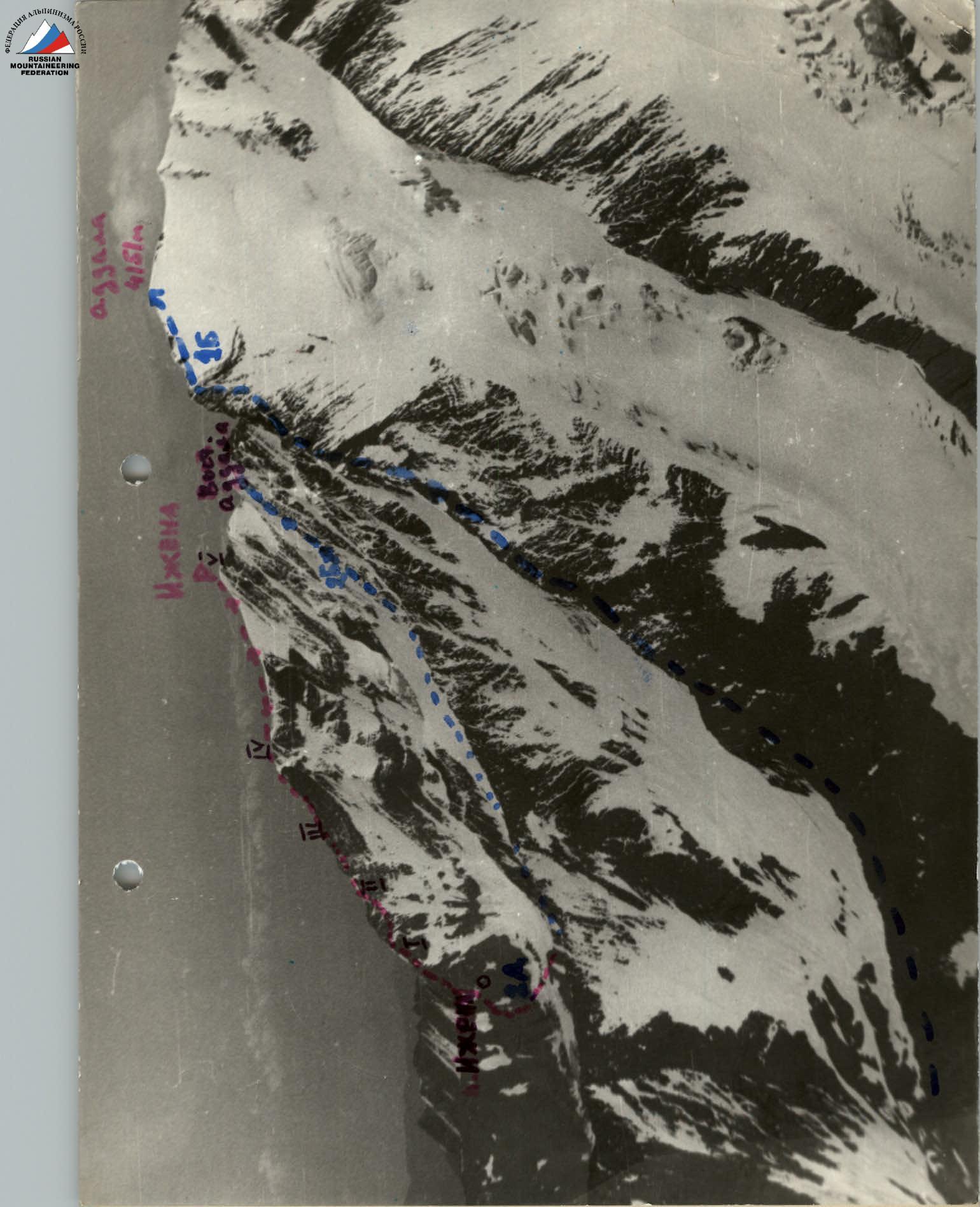
IZHENA-meer. View from Chkalov pass. Izhema 3981, 2A3 cat. diff., N ridge; 440 m, 30°. Akhmedkhanov K.E., Gairbekov A.P., Kozorezov E.F., Svinarev G., Elmurzaev M. January 26, 1979. (Dop. ASSR).

BRIEF CHARACTERISTICS OF THE PEAK
Izhena (Ahm.k.) Izhena-meer closes the highest part of the Bogossky ridge to the east. Its massif is located between the Izhena pass (1B) to the east and the Tunsada pass (3A–3B) to the west. Izhena-meer is a sharp ridge, steeply dropping to the northwest and southeast. The massif is composed of shale, with predominantly horizontal sandstone outcrops. The summit was visited by climbers and meteorologists from the Izhena pass. However, no route descriptions were made.
The summit was visited:
- by climbers from the Izhena pass;
- by meteorologists from the Izhena pass.
However, no route descriptions were made.
DESCRIPTION OF THE APPROACH TO THE ROUTE
It is preferable to set up a base camp at the clearing near the "Sulak-high-mountain" weather station, which is accessed by a good trail from the Cobe-Godari cottage, connected by a dirt road to the village of Tindi (8 km of motor road to the district center Agvali). From Tindi to the weather station is 8–12 hours.
From the weather station, go east along the crest of the lateral moraine of the Adдала glacier to the talus slope above the Izhena pass, a well-noticeable saddle in the Bogossky ridge (1 hour from the moraine). The exit to the pass from the moraine is up to the right along a steep talus (live stones!). There is a cairn on the pass (1.5–2 hours from the weather station).
ROUTE DESCRIPTION
From the pass saddle with simultaneous belay, move up to the right along heavily destroyed rocks to a characteristic shoulder. From it, along a narrow shelf to the right, bypass the sharp ridge and exit to the second shoulder. Then, with alternate belay through ledges, pass 3 sharp rock spires (possible via fixed ropes). Further, along simple rocks, climb to the nodal sub-summit and along the snow-ice, not steep ridge, ascend to the dome of the summit (2–2.5 hours from the pass). Descent is via the ascent route.
TABLE OF ROUTE SECTIONS
Date: July 6, 1979
| Designation | Length | Steepness | Difficulty | Terrain characteristics | Condition | Weather conditions | Pitons |
|---|---|---|---|---|---|---|---|
| R0–R1 | 100 m | 45–50° | 1–2 | ridge | heavily destroyed rocks | fog, wind | simultaneous belay |
| R1–R2 | 80 m | 15–20° | 2 | shelf | - | - | - |
| R2–R3 | 100 m | 30° | 2–3 | rock spires | smoothed sandstone slabs | - | belay via ledges |
| R3–R4 | 100 m | 40° | 1–2 | ridge | destroyed rocks | - | simultaneous belay |
| R4–R5 | 250 m | 20° | 2 | ridge | snow, ice | - | - |

UIAA ROUTE SCHEME
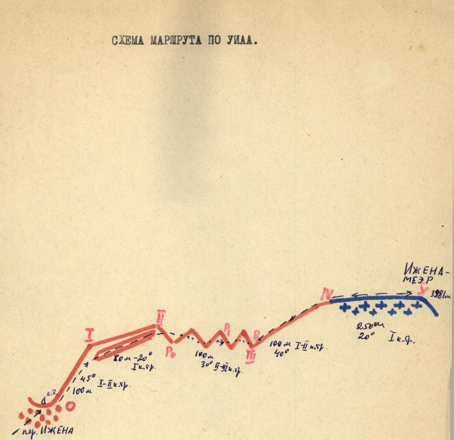
IZHENA-MEER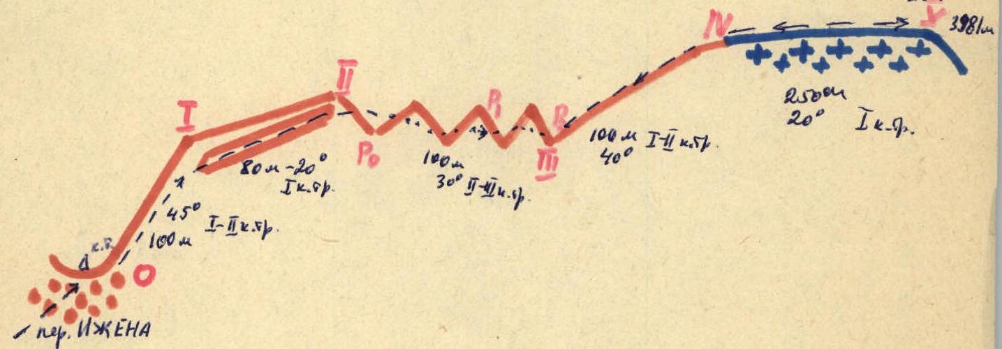
Comments
Sign in to leave a comment