2.10.38
ASCENT AREA — CHARODINSKY, EAST CAUCASUS, DASSR
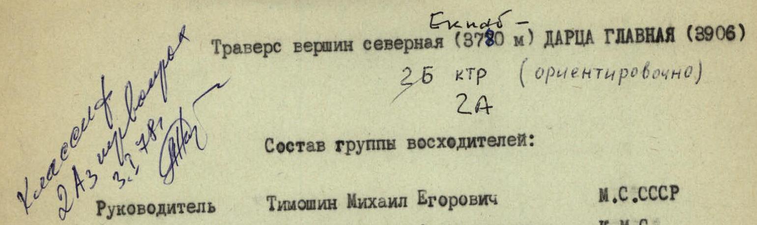
Traverse of peaks Severnaia (3780 m) — Glavnaia Dartsa (3906 m). Complexity category: 2B (approximately), 2A.
Climbing group members:
- Leader: Timoshin Mikhail Egorovich (Master of Sports of the USSR)
- Basriev Zakir Aligadzhievich (Candidate for Master of Sports)
- Pashuk Evgeny Grigoryevich (II rank)
- Kozarezov Evgeny Fedorovich
- Leonov Petr Georgievich
- Yakhyaev Ruslan Krimsulttanovich
- From the overnight stay, 5 hours 30 minutes to here. On the summit, a control cairn. Further, descent from the summit tower via snowy shelves 20 m (belay!) to a gentle corniced ridge (alternate belay!) and along it to the I gendarme. 5 m up and 20 m down through medium-difficulty rocks. Belay via outcrops. Behind the gendarme, a simple snowy ridge leads to the pass saddle (3640 m), and then to the II gendarme. 40 m of monolithic rocks of medium difficulty (belay via outcrops). Slightly above the middle of the gendarme, a convenient shelf for organizing belay (pitons!). Descent 10 m down easy rocks and along a corniced sharp ridge (alternate belay!) to the III gendarme. From the Severnaia Dartsa summit, 1 hour to here.
The heavily destroyed gendarme is climbed "straight up" via a rocky blade (belay via ledges!) — 20 m up, here, organization of descent (belayer sits astride the edge, belay via a rocky "finger") — 40 m down to the right, traversing the 80-85° wall of the gendarme (rockfall!) to a heavily corniced ridge (alternate belay!). After 40 m — IV gendarme, 15 m high, bypassed on the right via a snowy shelf (belay via outcrops!). Behind the gendarme, a convenient niche for a meal. From the III gendarme, 1 hour to here. 3700 m.
Further, along deep snow, 35-40° ridge, bypassing cornices (on the right) and the hanging glacier icefall (on the left) to a steep — 60-65° — snowy slope, and up it (alternate belay!) 50-60 m to the first rocky belt of the summit tower of the "Dartsa Glavnaia" peak. Here, 3820 m.
Rocky sections are climbed as follows:
- First belt (40-50 m) — heavily destroyed rocks, climbed via easy climbing with belay via outcrops.
- Second belt (50 m) — monolithic, bypassed on the left via a snowy shelf (belay via outcrops!).
- Exit to the ridge — via a 10-meter couloir with built-up ice (steps, pitons!), then from the edge, via large scree, exit to the "Dartsa Glavnaia" summit 3902 m.
Control cairn. From the overnight stay, 9:00 to here. Descent to the south via route 1B category complexity along the ridge to the Uzlovaya summit, then along its spur to the Ba plateau.
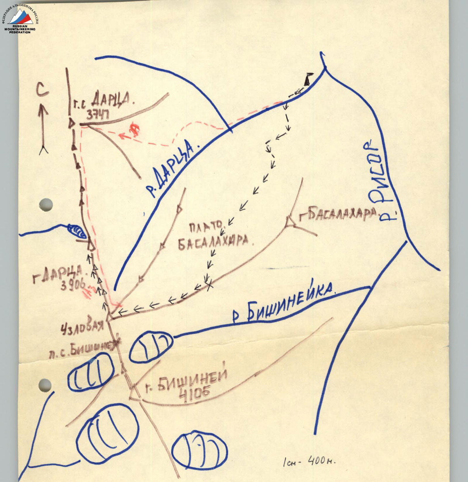
The Severnaia and Glavnaia Dartsa peaks are located in the Bishiney ridge, branching off from the Taklik peak, and is one of the highest ridges in the Charodinsky mountain region.
The base camp for the traverse, as well as for ascents to the Bishiney peak via the South ridge (2A category complexity) and to the Dartsa Glavnaia peak via the West ridge (1B category complexity, approximately), is set up at the mouth of the Dartsa river on a wide grassy clearing, 100-150 m above the confluence of the Dartsa river and the Рисor river.
Ascent: From the Archib village, along the road to the Alchonib village, and further along a trodden path to the Kubatl (Kubak) khutor. From here, along the left bank of the river, via a frequently disappearing path, traversing scree slopes, to a wide gentle outwash of the Dartsa river and up it to the clearing. From the Archib village — 3-3.5 hours.
From the overnight stay on the clearing at the mouth of the Dartsa river gorge (2420 m) up along the path on the left bank of the river to the confluence of two streams forming the river. Here, a nomad's camp. From here, straight up along destroyed shale slopes, then along a steep grassy slope to a weakly expressed ridge.
Here, a well-trodden path. Along the path, left and up to a wider site (2920 m, 2 hours from the overnight stay).
From the site, up along large scree to the southeast slope of the Bishiney ridge and traverse along small scree to a rocky rib. Along simple rocks of the rib — to a not-very-expressed scree couloir (rockfall!) and up along its right slope, overcoming two rocky belts, 5-6 m each, via easy climbing.
At a height of 3320 m (from the site, 1 hour), the scree ends.
Further, along steep (60°) shale outcrops to the narrowing of the couloir between two characteristic rocky remnants ("gates"). Along heavily destroyed rocks of the "gates" (belay! rockfall! built-up ice!), up 100-120 m, exiting to a snowy depression (3550 m).
From here, to the right, to a rocky ridge (belay!) and along it, 200 m of easy climbing — exit to the Severnaia Dartsa summit (3770 m).
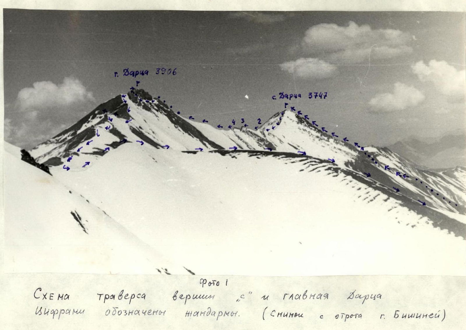 Photo 1. Scheme of traverse of "Severnaia" and Glavnaia Dartsa peaks. Gendarmes are marked with numbers. (Photo taken from the spur of Bishiney mountain)
 Dartsa peaks from the Sarisa river gorge.
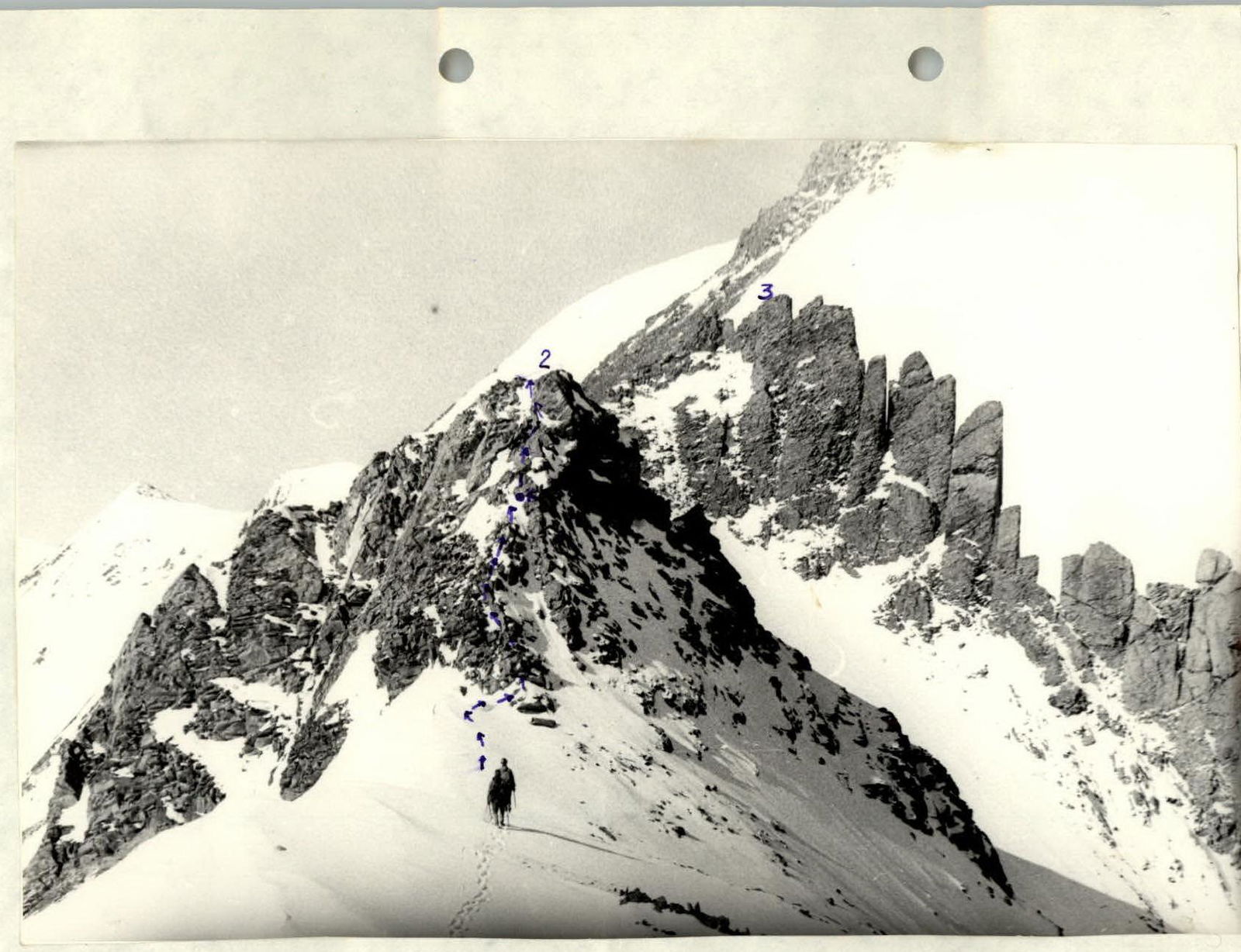 Photo 4. Second and third gendarmes (key section). (The piton location is marked with a dot).
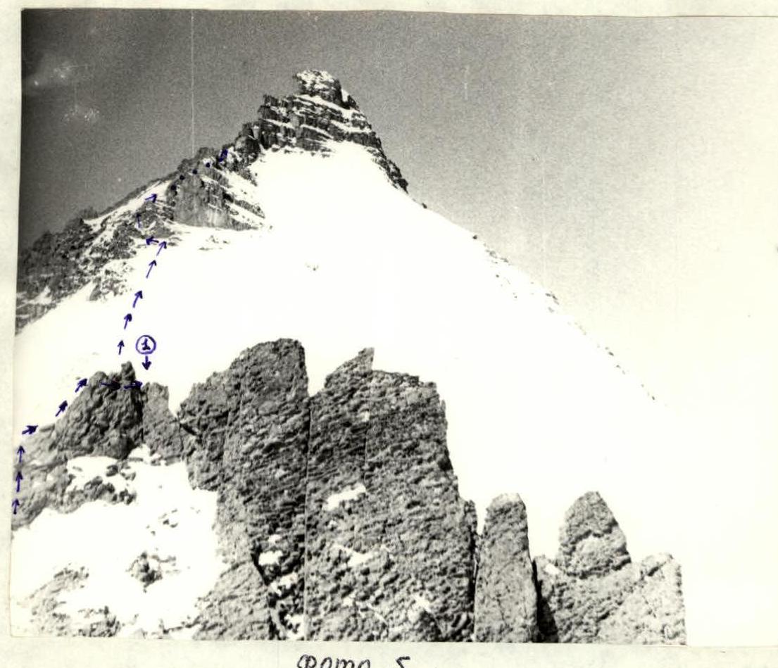
Photo 5. Third gendarme and summit tower (1) — belay location when descending from the gendarme.
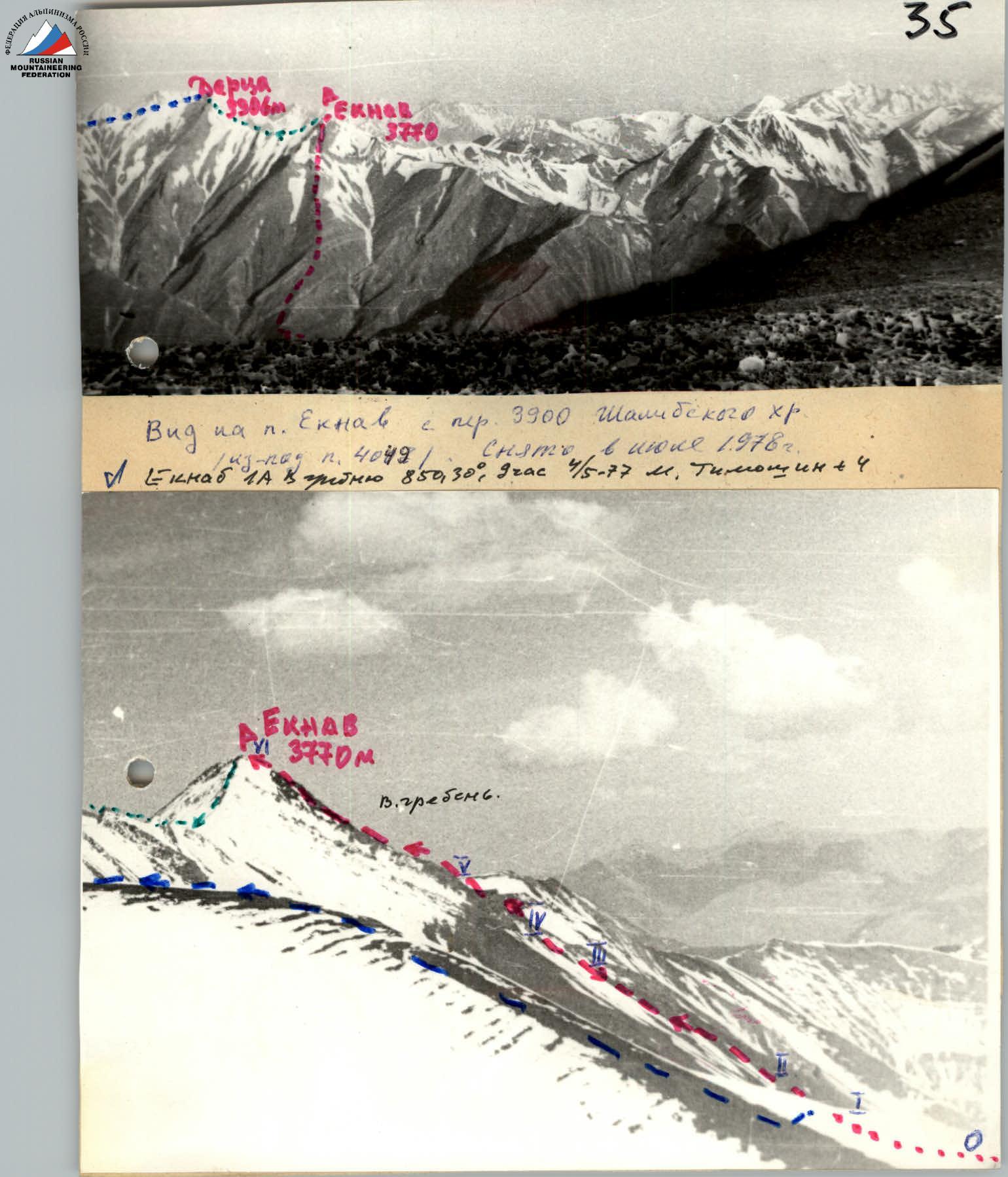
 Ascent scheme to the Glavnaia Dartsa peak 3906 m. 1B category complexity.