- Ascent class: Comb. 27
- Ascent region: №2–9 (East Caucasus)
- Summit, height, ascent route: peak 4040 (S. Gadzhieva, 3912 m) via the western ridge through peak 3800 (Bichuga)
- Estimated difficulty category: 2B
- Route characteristics: Height difference 1100 m, length of section I difficulty category – 1360 m, IV difficulty category – 40 m
- Rock hooks hammered: 4 Protrusions used: 3
- Number of walking hours: 2
- Number of overnight stays: No overnight stays
- Leader and participants:
- TIMOSHIN Mikhail Egorovich – Master of Sports
- SKORNYAKOV Anatoliy Ivanovich – II sports category
- Semenova Marina Mikhailovna – II sports category
- KRASNOPOLSKIY Yuriy Vasil'evich – Candidate Master of Sports
- SMOTROV Aleksandr Ivanovich – II sports category
- SMOTROV Sergey Ivanovich – II sports category
- Date of departure on the route and return: October 8, 1981
DESCRIPTION OF THE ROUTE TO PEAK 4040 (S. Gadzhieva), 3912 m VIA THE WESTERN RIDGE THROUGH PEAK 3800 2B DIFFICULTY CATEGORY (Bichuga Mala)
From the base camp, follow along the Bichuga River towards the glacier. Before reaching the glacier tongue, turn left and ascend the western slope (650–750 m) via soft scree to peak 3800 (cairn; from the camp — 4 hours).
From the summit, descend along the ridge down to a saddle and follow an easy slate ridge to approach a rocky ascent. Overcome the 40 m ascent directly with hook belay and exit onto the western summit of peak 4040 along the ridge. (It is also possible to overcome the ascent via a 55° ice slope on the left, 60 m).
Then, follow a sharp ridge (belay) for 5–10 minutes to reach peak 4040 (S. Gadzhieva). On the summit, there is a memorial plaque and a cairn; from peak 3800 — 4 hours.
Descent is via the ascent route, only through peak 3800, as there is no safe path to the left on the Bichuga glacier during descent.
Description compiled by P. Leonov.
October 8, 1981
TABLE
Main characteristics of the route to peak 4040 via the 3rd ridge through peak 3800
| Date | Designation | Average steepness, in ° | Length, m | Terrain character | Difficulty | Condition | Weather conditions | Rock hooks | Ice hooks | Protrusions |
|---|---|---|---|---|---|---|---|---|---|---|
| October 8, 1981 | R0–R1 | 35 | 700 | Scree | 1 | Fine scree | Good | – | – | – |
| – | R1–R2 | 20 | 480 | Ridge | 1 | Slate destroyed | – | – | – | – |
| – | R2–R3 | 70 | 40 | Wall | 4 | Destroyed | – | 4 | – | 3 |
| – | R3–R4 | 5 | 180 | Ridge | 1 | Sharp, destroyed | – | – | – | 2 |

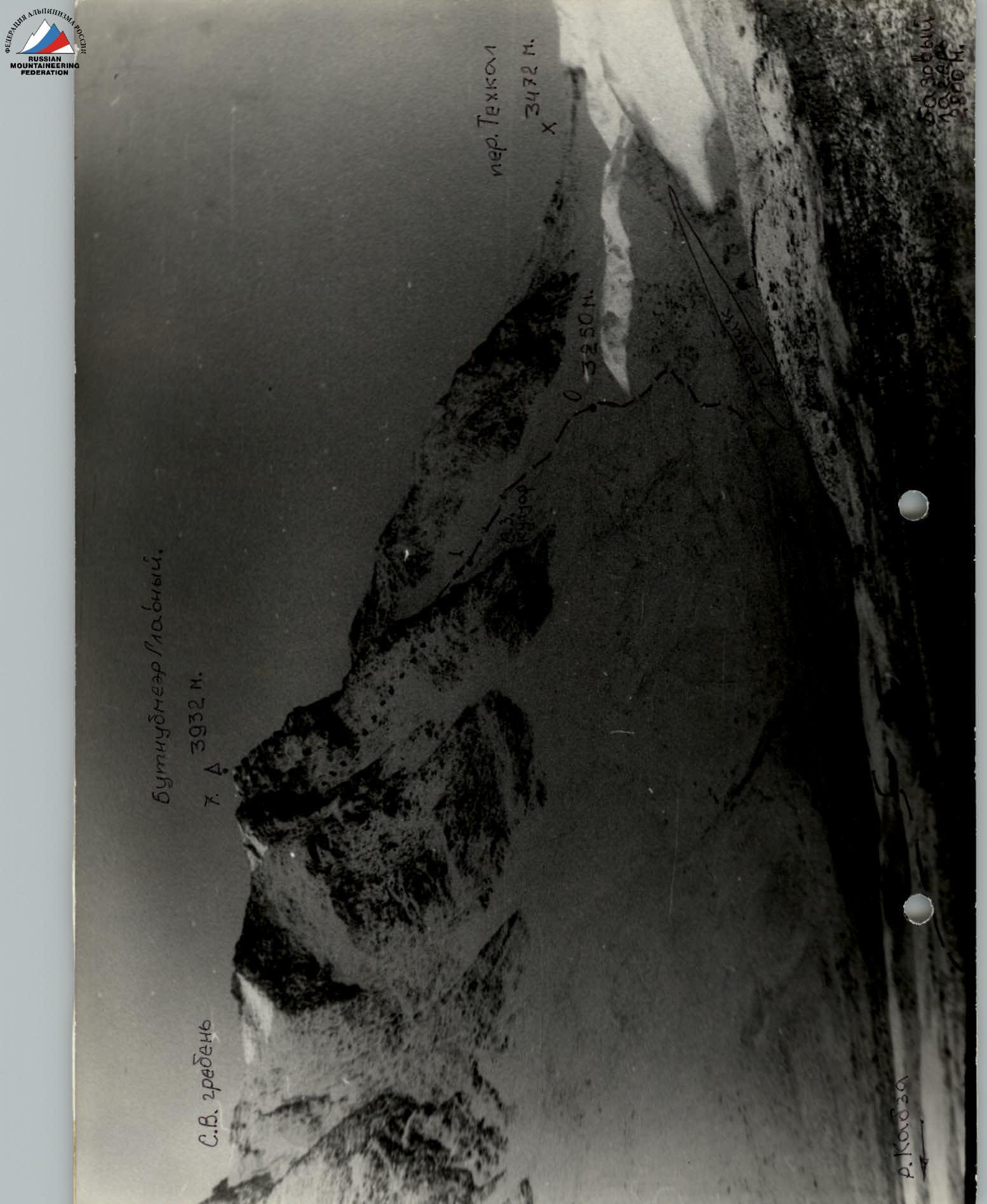
General photo of the summit Butnubmeer Main. September 22, 1991, №708, shot from the base camp from peak 2800 m, distance ≈ 2.5 km, №0″ shooting point according to the area map. Smena-8M, 4/40, T43. First ascent route: via the NW couloir and S ridge, approximately 2A difficulty category.