
Bichuga Malaz
2.10.27 2.9А.46. 21
Brief Characteristics of the Summit
Peak 3900 m in the western spur of the Bogossky ridge. This spur branches off from the watershed in the area of peak S. Gadzhiev, peak 3900, peak Serazhutdin Gadzhiev, Bochek, and peak Magomed Gadzhiev, forming a horseshoe that borders the Bichuga glacier. Peak 3902 is an almost perfect pyramid composed of sandstone and shale.
A route to peak S. Gadzhiev via peak 3902 was established in October 1981. When describing this route, as well as the Bochek — S. Gadzhiev — 3800 traverse, an inaccuracy was made in determining the height of this peak. Determining the height using topographic map contours made it possible to clarify the peak's height — 3900 m.
Description of the Approach to the Base Camp
From the village of Khonokh in the TsUMADINSKY district of the Dagestan ASSR, located 50 km from the regional center Agvali, go left towards the farm in the direction of the characteristic rock "gates". Before reaching them, cross the river and ascend along the trail to a small pine grove. Continue along the trail, which makes a steep ascent in a serpentine manner up the grassy slope, to reach a koshar (2 hours from Khonokh).
The trail traverses the slope with a slight gain in height in the direction of the confluence of the Bichuga and Tinav-chegelatly rivers. From the stream that has cut a deep and narrow canyon into the rocky bed, turn left, cross a clearing, and, moving along the rocky slabs, reach the trail leading to the second — "upper" koshar (1–1.5 hours from the lower koshar).
Here, you can set up a camp — there are convenient clearings and water.
Description of the Approach to the Route and the Route
From the base camp near the "upper" koshar, go along the left lateral moraine in the direction of the Bichuga glacier. Above the glacier tongue, turn left and ascend along a fine shale scree to peak 3900. After 750–800 m, the scree turns into a moderately expressed ridge. Ascend along its heavily destroyed shale and sandstone rocks for 200 m to reach the summit. There is a cairn here. The ascent from the camp takes 4–5 hours.
NOTE: the route can be recommended as a qualifying route for the "4th sports category" badge, "Alpinist of the USSR".
- Standard equipment; descent is via the ascent route.
Route Sections Table
| Ascent Date | Section | Length | Steepness | Difficulty | Relief Character | Relief State | Weather | Rock Hooks | Ice Hooks | Bolts | Notes |
|---|---|---|---|---|---|---|---|---|---|---|---|
| October 4, 1981 | R0–R1 | 800 | 30° | 1 | slope | scree | good | – | – | – | |
| October 4, 1981 | R1–R2 | 200 | 140° | 1 | ridge | destroyed rocks | fog | simultaneous belay |
Scheme of the Bogossky Ridge
"Khvarshinsky and Kilsky Nodes"
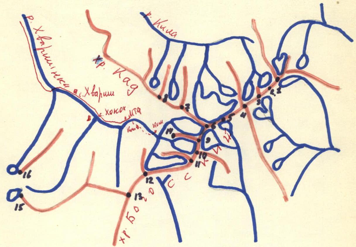
- Addala — Izhena-meer
- Tunsada
- V. Addala
- Addala — shukhtel-meer
- peak Belyakov
- peak Baidukov (Kasaraku-meer)
- peak Chkalov (Anchobola)
- Psuka-meer
- peak S. Gadzhiev
- Bochek-meer
- peak S. Gadzhiev
- peak 3819
- Zhizhia — Kintli
- peak 3900
- Tari
- Kogotl
Comments
Sign in to leave a comment