
Ascent Log
- Category of first ascents.
- Region 2.10. Caucasus, Dagestan mountains, Babaku ridge.
- Babaku, 3997 m, via the North Edge, rock route.
- Category 4B complexity, first ascent.
- Route characteristics: elevation gain 500 m, average steepness of the edge 45°, length 1300 m, section lengths: 1—800 m, 2—85 m, 4—45 m, 5—85 m, including climbing with artificial aids (ITOs): A1–7 m, A2–16 m.
- Used: placement elements: 37/13 rock pitons: 16/2 outcrops: 6
- Time taken: 7 hours.
- Overnight stay in the Western Cirque, in the upper reaches of the Artsalinekh River (3000 m).
- Leader: Konstantin Eduardovich Dorro — Candidate Master of Sports
Participants:
- Sergey Valeryevich Voronin — 1st sports category
- Evgeny Vladimirovich Maksimov — 1st sports category
- Departure, summit, return — July 1, 1995.
- Organization: Mountain Club "300".
MAKHACHKALA
1995

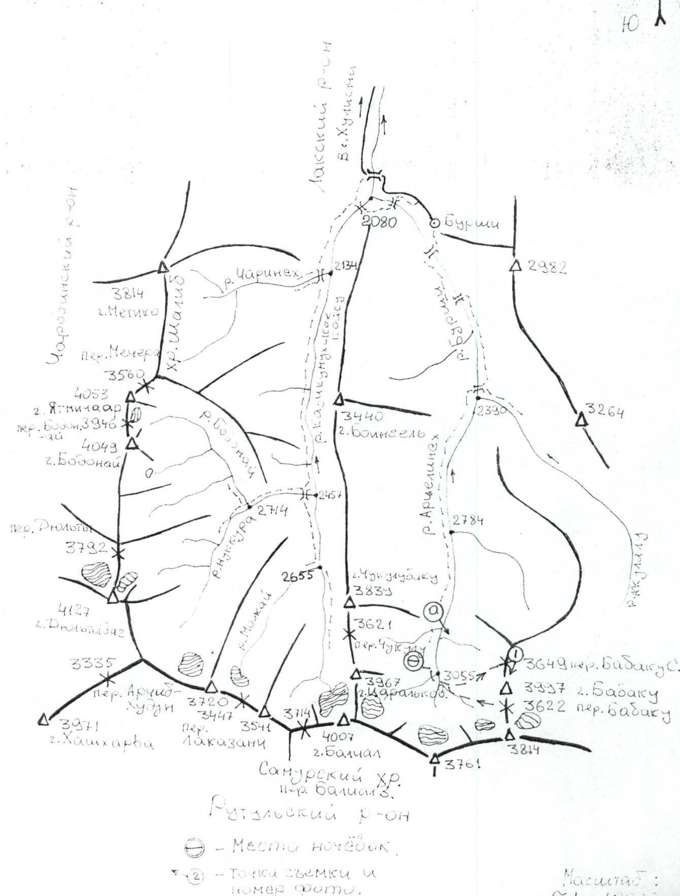
Map of the Ascent Area
Approach Description
From the village of Burschi (2200 m) in the Laksky District of the Republic of Dagestan, move southwards upstream along the Burschi River. Cross to the left bank via a bridge near the settlement and continue on a dirt road to the next bridge — to the right bank. The trail then ascends the slope, bypassing the constrictions, but it is also possible to follow the river. Then, cross a bridge 1 km below the confluence of the Akulalu and Artselinekh rivers (2390 m, 4 hours). Proceed along the left bank of the Artselinekh River; there are constrictions, but it is possible to pass along the river — this is faster than making detours or gaining height.
After the constrictions, the valley widens, and there is a gradual gain in height until the confluence with a large right tributary (2784 m). However, before the valley narrows, one should ascend higher and exit onto the left-bank moraine of the ancient glacier.
A wide and gentle cirque opens up, covered with moraine hills. It is convenient to set up a camp on a terrace (3000 m) under the slope of Tsaralkov mountain (3967 m). Opposite, across the cirque, stands the pyramid of Babaku mountain, and to the left, the saddle of the Babaku North pass is clearly visible.
From the overnight stay, cross the cirque and ascend via slopes of moderate steepness towards the pass, reaching the start of the couloir at 3500 m. The beginning of the route is 2 hours from the overnight stay.
Route Description
From the start of the route (3500 m), ascend the couloir (section R0–R1) with hard firn (crampons required), keeping to the right of the rocky and talus ridge, and beware of avalanches. Then move left onto the ridge, where there are rocky steps (section R1–R2), and proceed along it to the Babaku North pass (3649 m).
From the pass, follow the talus ridge (section R2–R3):
- Towards the first wall — here is R0;
- Through two walls to a ledge — R1 near rocky blocks;
- Along the ledge left towards indistinct angles — here is R2.
The rocks are made of solid sandstone (sections R8–R10): the structure is large-blocky, all fractures are diagonal and sharp. Move left into the adjacent angle via a crack — using artificial aids (ITOs) — and exit onto a talus slope, then right onto the edge. Establishing a belay station at R4 is problematic.
To the next wall:
- Start on ladders, with a small cornice (photo 3);
- Continue climbing normally (sections R12–R13) towards a small ledge;
- From it, ascend via an internal angle (sections R14–R15, photo 4) left of the edge, where there are placements for cams and nuts;
- The exit from the angle slightly overhangs;
- Sections with ITOs alternate with more pronounced relief features where climbing is done without aids.
The talus terrace is unpleasant, making it difficult to establish a belay station; having "carrots" (long, thin cams) is desirable. From R6, move directly along the edge (the left face of the "triangle"); the rocks are heavily destroyed (shale), and at the end of the second rope, the steepness increases (sections R15–R18). Exit via an internal angle towards R8.
Continue along the ridge, through two steep walls, and approach a vertical tower; below it is R11. Ascend via an angle 15 m to the right of the edge onto a narrow ledge, then move right, around an external angle, to R12 — a good ledge.
Then:
- Ascend via an angle and a chimney formed by a detached block (sections R25–R27, photo 5);
- Through a ledge to the next belt (sections R27–R28) — exit to R13;
- Continue through the final rocky belt onto the ridge and along it, rightwards, to the summit (3997 m).
The summit is visited by locals for ritual purposes; there are many cairns and monuments. Slightly below to the south stands a hut constructed from slabs, and sometimes a spring emerges from beneath it.
Descent is via the south ridge (category 1B complexity): there are rocky belts, almost all of which are passed left of the ridge, then exit onto the Babaku South pass (3622 m). From the spot with a cairn, move right into a couloir (avalanche-prone), then down the couloir, first right and then left, and descend a firn slope into the Artsalinekh River cirque, following a glacier covered with moraine, and then descend moraine hills towards the overnight stay (3000 m) (2.5 hours from the summit).
The ascent route:
- is beautiful;
- is logical.
Passing it is quite tense due to:
- the significant steepness of the rocky steps;
- in some places, the somewhat problematic establishment of belay points on the terraces.
This route was attempted by a group consisting of: Dorro K.E., Valiev A.R., Maksimov V.V., Shanavazov Sh.E. on January 2, 1991, but they were forced to return from the route (at point 3 according to the UIAA scale) due to harsh weather conditions.
 General view of the summit: Babaku (3997 m). The route via the North Edge — category 4B complexity, Dorro–95. Photo taken on June 30, 1995, from the Artsalinekh River cirque. Film roll — 8 m.

Photo: The North Edge of Babaku from the Babaku North pass, 3649 m. Photo taken on July 7, 1995. Film roll — 8 m.
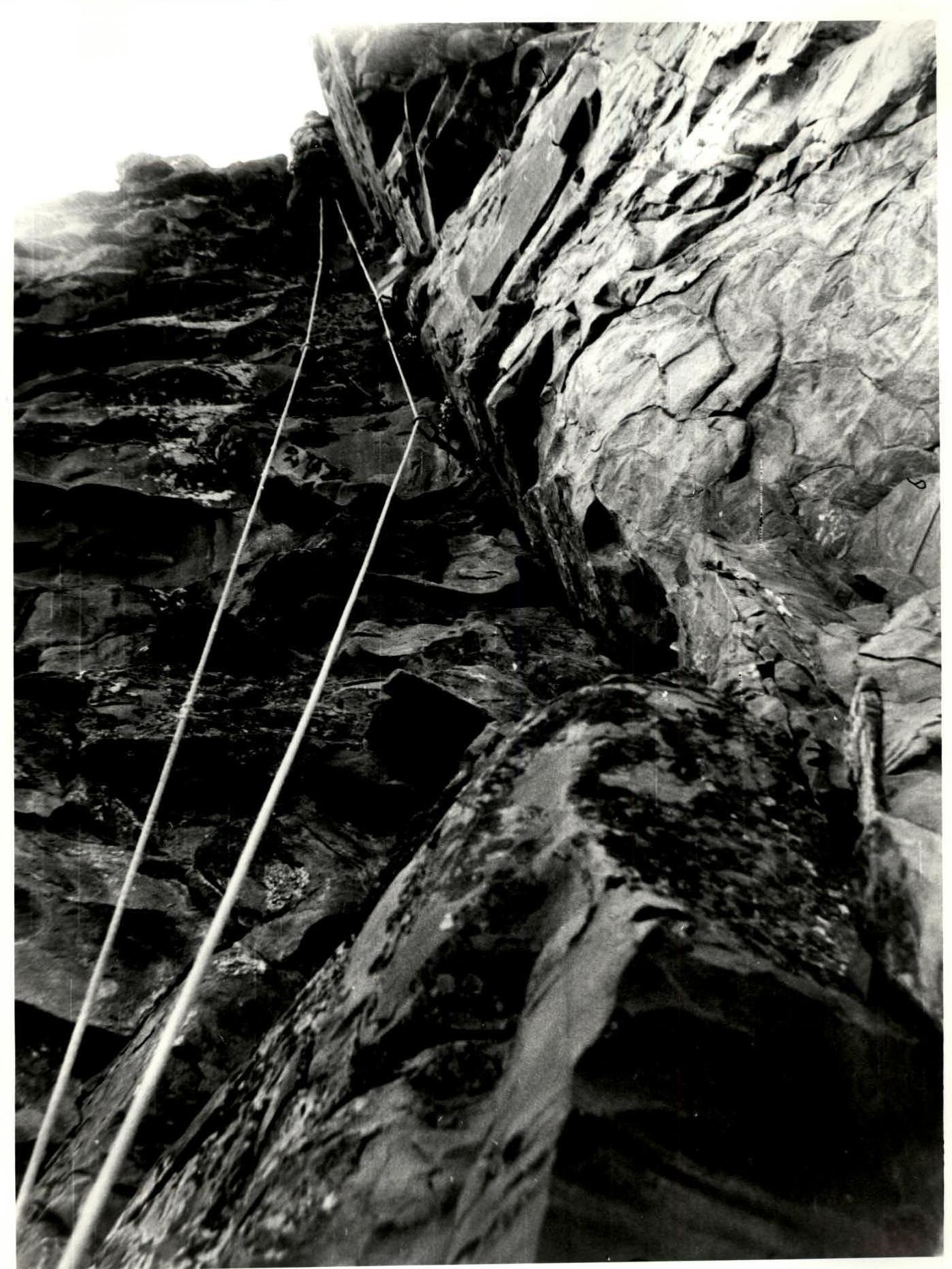
Photo 3. Dorro K.E. climbing section R14–R15. Photo taken from R5. July 1, 1995. Film roll — 8 m.
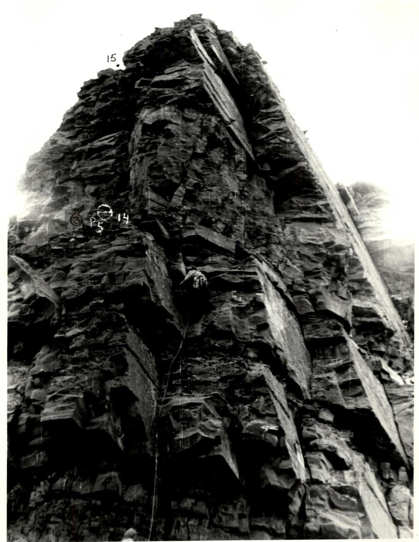
Photo 2. Sections R12–R15. The second rocky belt. On section R12–R13, Dorro leads. Photo taken from point R11. Film roll — 8 m. July 1, 1995.
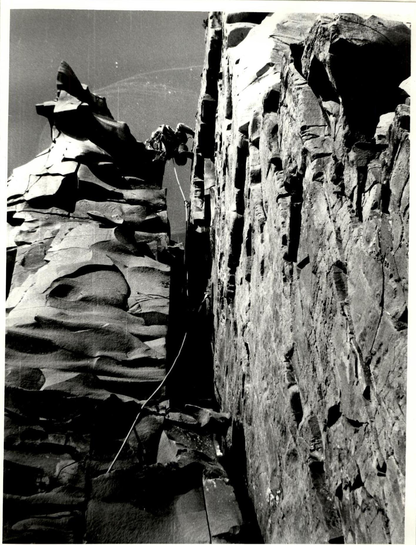
Photo 4. Dorro K.E. climbing a chimney. Section R26–R27. Photo taken from R12. July 1, 1995. Film roll — 8 m.
Comments
Sign in to leave a comment