Ascent Passport
I. Rock Route
- 2.96 — Dagestan Mountains (Eastern Caucasus)
- Ascent to peak 3903 from the SOUTH (first ascent)
- Proposed category — 2B cat. diff. 548, part 9. 16/4–85
- Characteristics of the summit:
- route length — 1230 m
- total height difference — 780 m
- average steepness — 40°
- length of sections: I cat. diff. 625 m
- II cat. diff. 605 m
- Pitons driven:
- for belay: rock 2
- for creating belay stations: ice —
- Overnight stay in the Southern cirque of peak 3903. Platform.
- Number of travel hours — 7 hours
- Participants:
- Akhmedkhanov K.E. — 2nd sports category
- Pashchuk E.G. — 2nd sports category
- Osmanov M.G. — 3rd sports category
- Abdullaev T.G. — 3rd sports category
- Team coach — Master of Sports of the USSR Timoshin M.E.
- Date of departure and return — June 22, 1971
Photo 1
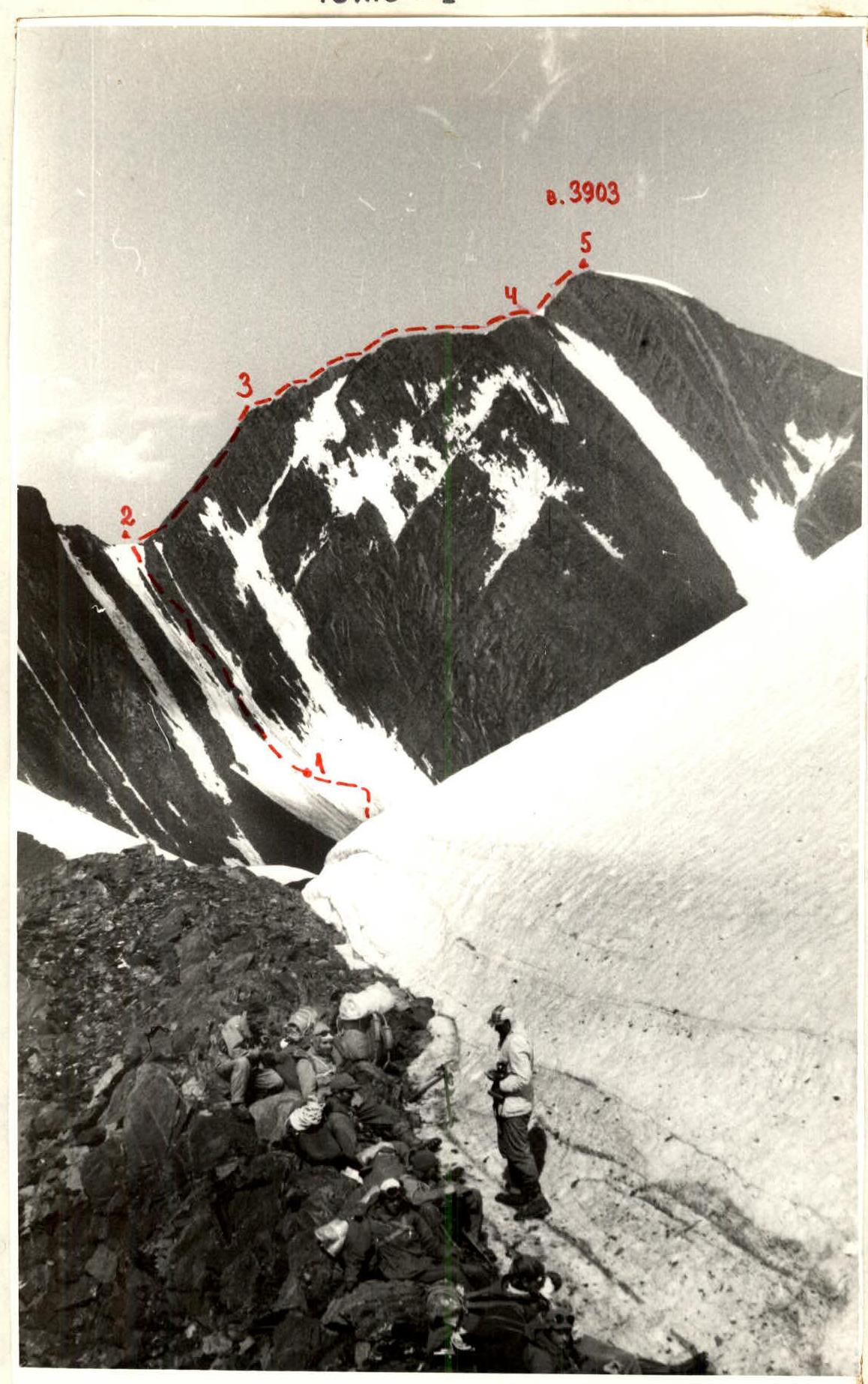
General view of peak "3903" and the first ascent route. View from SW, from the Snowy Ridge.
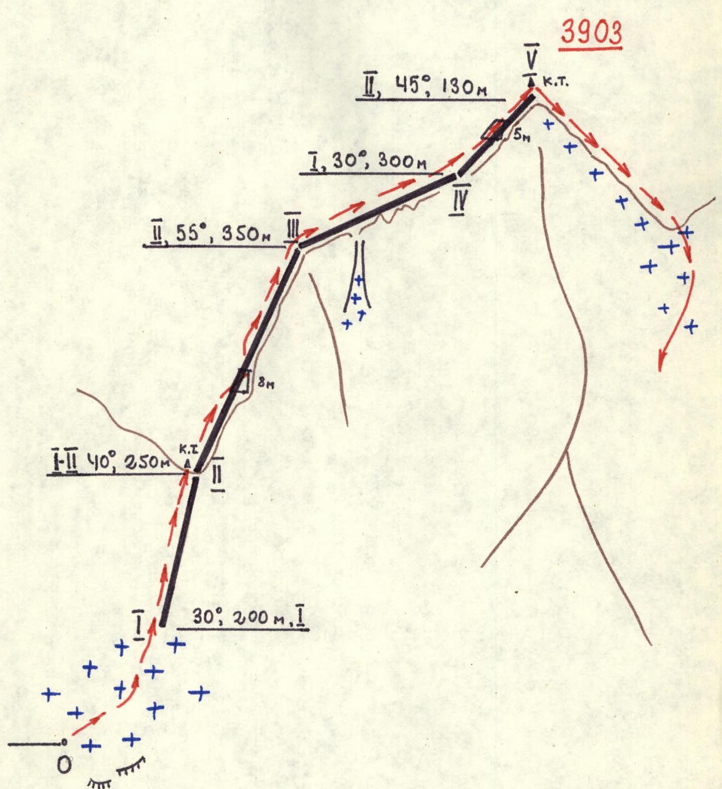
Route diagram in UIAA symbols.
Route Sections Table

| Date | Designation | Average steepness | Length (m) | Terrain character | Difficulty | Terrain condition | Weather | Pitons: rock | Pitons: ice | Protrusions |
|---|---|---|---|---|---|---|---|---|---|---|
| R0–R1 | 30° | 200 | firn | 1 | firn field, snow | fog | — | — | — | |
| June 22, 1971 | R1–R2 | 40° | 250 | counterfort | 1–2 | destroyed rock counterfort | occasional fog | — | — | 1 |
| R2–R3 | 55° | 350 | ridge | 2 | sharp break in rock ridge | clear | 1 | — | 2 | |
| R3–R4 | 30° | 300 | ridge | 1 | ridge with gendarmes | sunny | — | — | — | |
| R4–R5 | 45° | 130 | ridge | 2 | sharp rock ridge | weather on ridge, wind | 1 | — | 1 |
Brief Characteristics of the Summit
The unnamed massif "3903" consists of two peaks — Main (3903) and North (3882 m) and is located in the Snowy Ridge to the east of the Diklosmta massif. The nearest western neighbor — Mt. Ortlobek (3937 m), eastern — Mt. Gakko-Shanibeter (3673 m). Peak "3903" is composed of:
- black shales,
- partially sandstones. The slopes of the mountain feature:
- on the western slope — Diklos Maly (Eastern) glacier,
- on the southern slope — firn field and extensive snowfields. The border between Dagestan and Checheno-Ingushetia runs along the Snowy Ridge.
The nearest peak with established routes is the Diklosmta massif. This includes:
- 1B cat. diff. along the W ridge to Diklos V.,
- 2B cat. diff. along the SE ridge to Diklos Ts.
- 2B cat. diff. traverse from E to S of all Diklos peaks (submitted for consideration).
Note: — The group petitions for the unnamed peak "3903" to be named "Ametkhan Sultan" — honored test pilot of the USSR, twice Hero of the Soviet Union, who died during testing in 1971.
Approach to the Route
The beginning of the path to the village Gakko can be found in the reports — Diklosmta (1B cat. diff.) and traverse of Diklosmta (2B cat. diff.).
From a. Gakko along the trail along the r. Gakko to r. Shani, flowing from the southeastern slopes of the Snowy Ridge (5 km, 40 min). Without crossing the river, upstream along the Shani gorge along the riverbed to the confluence of its right tributary. Slightly above the confluence is a campsite. From the mouth of r. Shani about 3 hours. Elevation — 2750 m. Up the stream to the tongue of the firn field.
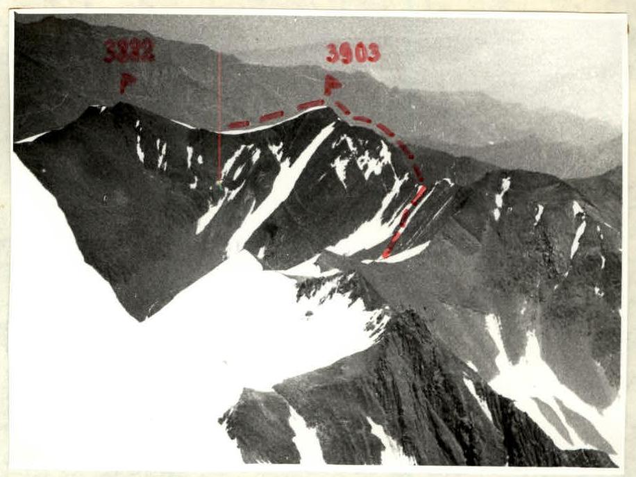 Photo 2. Massif of peak "3903" from the shoulder of Diklos.
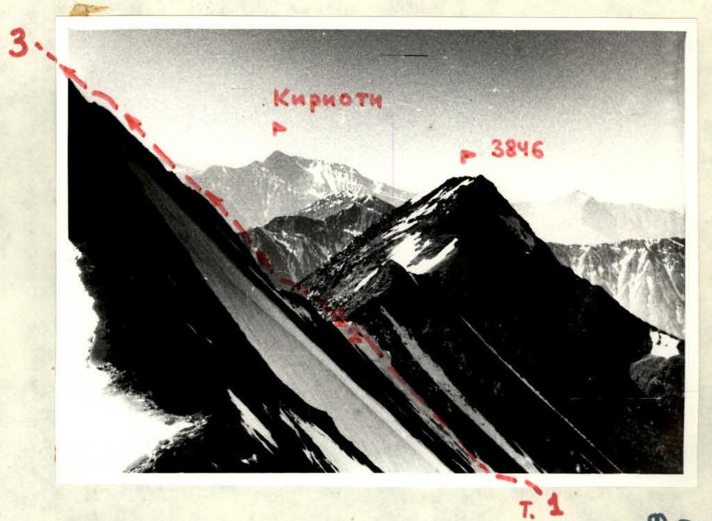 Photo 3. Southern ridge of peak "3903" between points R2–R3.
Route Description
Across the firn field (closed crevasses) to the foot of the southern saddle of peak "3903". Along the destroyed counterfort to the saddle (rockfall from the saddle!). Elevation about 3380 m, control cairn. From the camp 3 hours 30 minutes. From the saddle along the southern ridge of the peak to the wall (8 m, pitons), which is climbed to the right-upwards. Steep slate ridge (belay via protrusions) to the characteristic bend of the ridge. Further, the ridge features gendarmes, which are either bypassed on the right or climbed directly (protrusions). Before the summit, a steep ascent of the ridge with a 5-meter wall (pitons). On the summit (3903 m) control cairn. From the saddle 2 hours 30 minutes. Descent along the northern ridge to the saddle between the Main and North peaks. Further down the snowfields of the Eastern cirque to the camp (1 hour). Time taken for the ascent — 7 hours.