- Ascent class
- Climbing area
- Peak, its height, ascent route
- Estimated difficulty category
- Route characteristics
- Number of pitons driven
- Number of travel hours
- Number of overnight stays
- Names of team leader and participants, their sports qualification
- Team coach
- Date of ascent
- Organization
combined 2.9.6
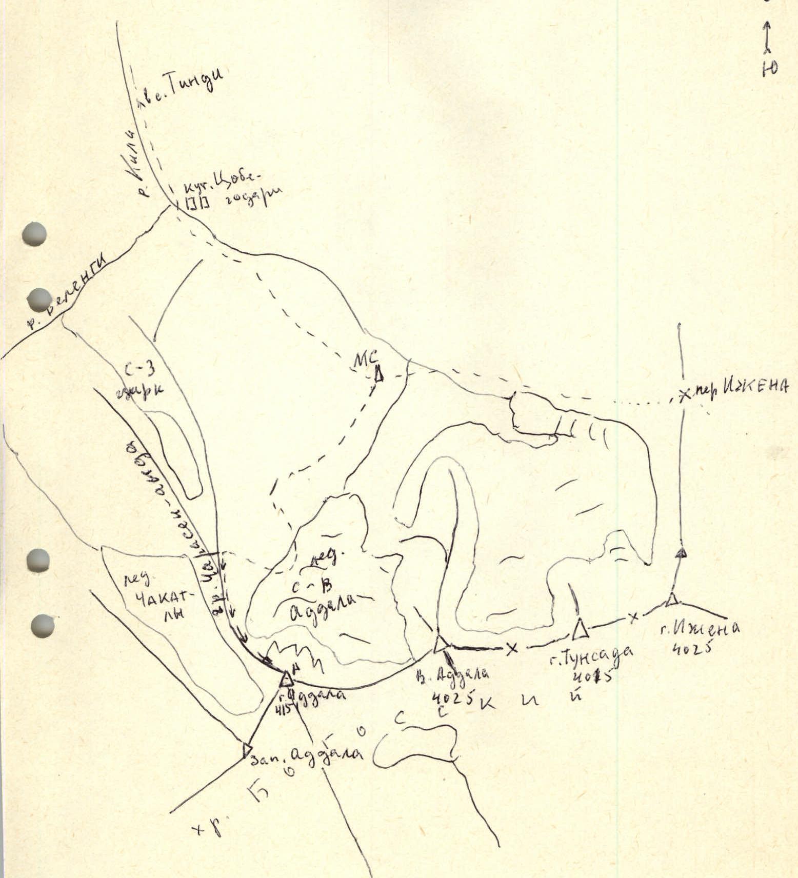
Dagestan mountains
Mt. Addala-shukhgel, 4151 m, via N ridge
2B
height difference — 850 m, average steepness — 45°, length of sections:
1st cat. diff. – 590 m,
2nd – 200 m,
3rd – 75 m
rocky – 5/0, icy – 2/0
7
no overnight stays
Shanavazov Sh. — 1st sports category
Il'ina E. — 2nd sports category
Aliskandiev A. A. — 3rd sports category
Dzhavatkhanova P. — 2nd sports category
Kozorezov E. F.
July 9, 1986
Mountain Club of Dagestan State University "Eos"

- Addala via W-NW ridge. 4B
- Addala via N ridge. 2B, optional. M-t group's route
Section R1–R2
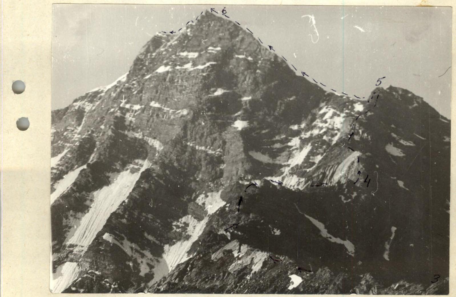
Sections R3–R6
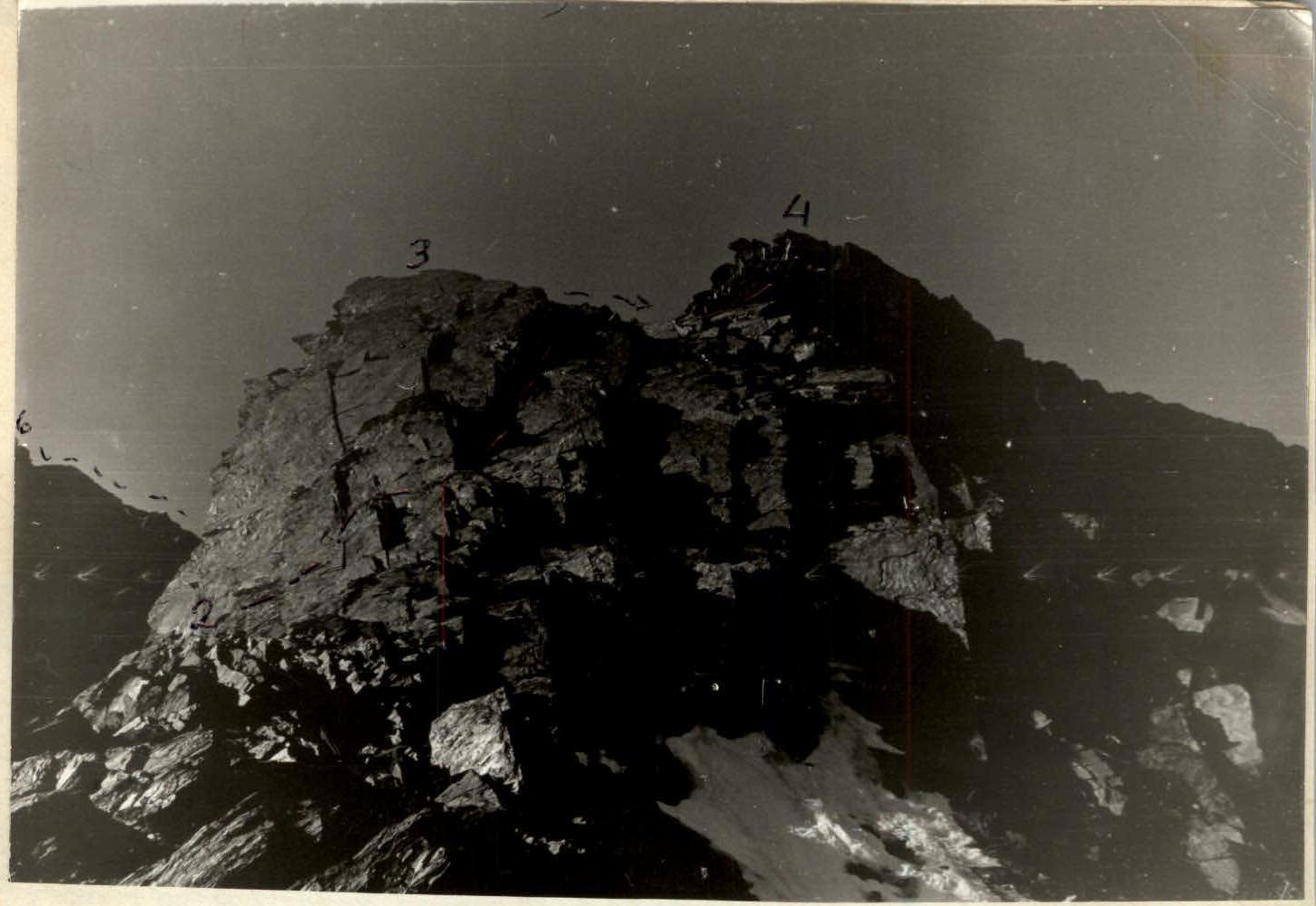 Sections R2–R4
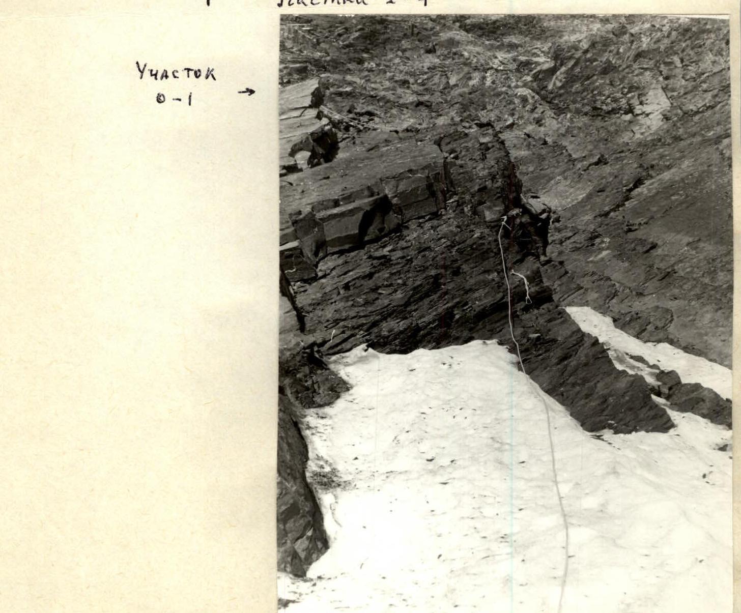 Section R0–R1
 The first known attempt to ascend Mt. Addala-shukhgel via N ridge was made in May 1974 by a group led by K. E. Akhmedkhanov, but it was unsuccessful due to heavy snow cover on the route and approaches. The group turned back from the R3–R4 section.
In June 1974, a group led by A. Aligaziev ascended Addala via N ridge, having started the ascent from the Northwest cirque. No route description was made.
Judging by the contents of a note found in the summit cairn, on October 5, 1985, a duo of climbers from Baku, T. Tagiev and A. Zharkov, completed the described route. The group did not register with the KSP and did not provide a route description. The difficulty assessment of the route is not given in the note.
Description of the approach to the route: From the "Sulak-high-mountain" weather station, follow the left-bank (orographically) moraine of the NE Addala glacier and descend to the glacier about 40 meters from its end.
Proceed along the glacier, initially in the direction of the N-E wall, and then, after passing the 2nd stage of the glacier's icefall, turn right and approach the rocks and scree of the N ridge. From the weather station, it takes 1–1.5 hours. Movement on the glacier is only in teams.
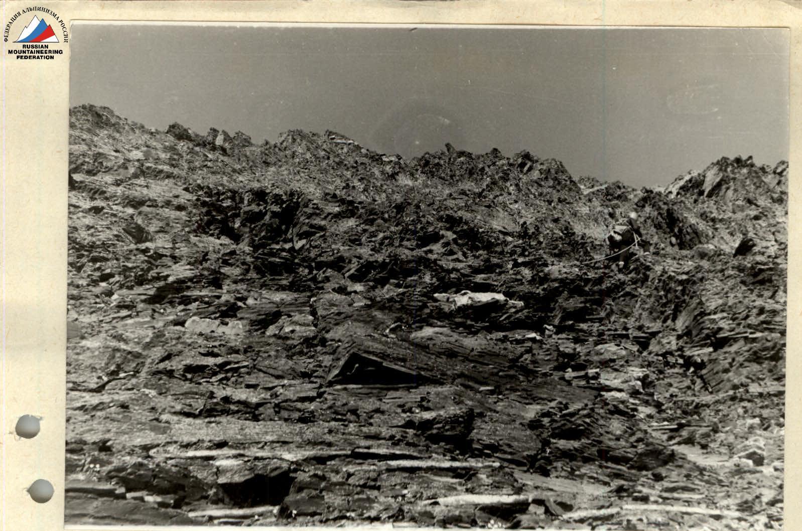
Explanation for the diagram: — The ridge is composed of heavily destroyed shales. — Gendarmes — outcrops of sandstone, slabs. — Belaying is required along the entire ridge.
During the ascent, the route was in ideal condition. Snow cover may complicate its passage within 1/2 – 1st cat. diff.
Descent is recommended via the Charasen-anda ridge to the Tsobegodari kutaan.

C-3 sphere of r. Aggan-Mayrent
Route diagram
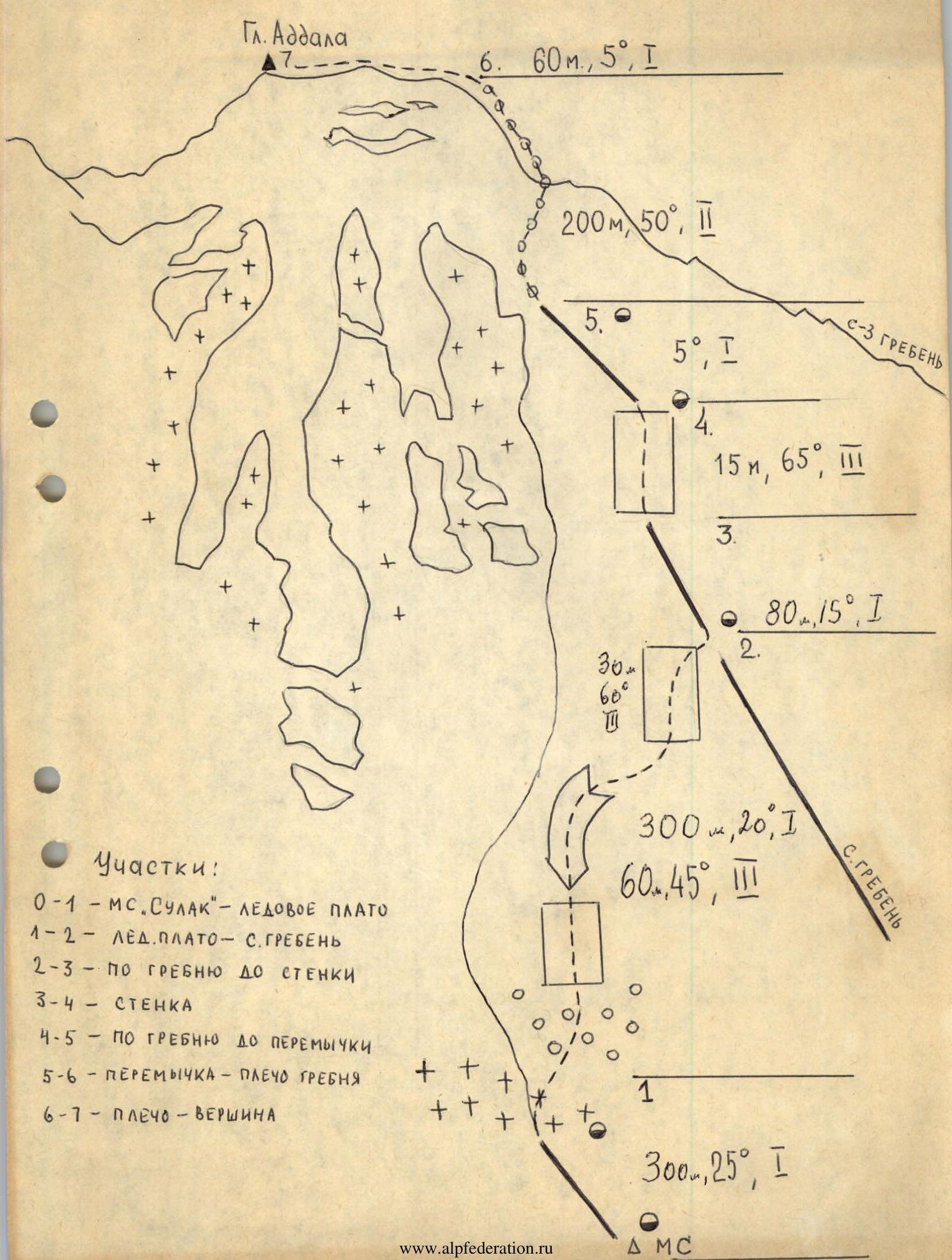
Peak Addala 6. 60 m, 5°, 1 200 m 50°, 2 5. 5°, 1 15 m, 65°, 3 80 m, 15°, 1 300 m, 20°, 1 60 m, 45°, 3 Sections: R0–R1 – MS. SULAK — ice plateau R1–R2 – ice plateau – N ridge R2–R3 – along the ridge to the wall R3–R4 – wall R4–R5 – along the ridge to the saddle R5–R6 – saddle – ridge shoulder R6–R7 – shoulder – summit 300 m, 25°, 1