
ASCENT REPORT ON JARLAM PEAK (2867 m) VIA THE SOUTHERN COULOIR AND EASTERN RIDGE, CATEGORY 1B ROUTE, BY THE UAL MOUNTAINEERING CLUB TEAM ON APRIL 4, 2023
Ascent Details
- General Information
1.1 Team Leader Chikin A.B., 1st sports category 1.2 Team Members: - Taysaeva L.A., 3rd sports category - Chelekhsaty V.L., novice 1.3 Coach Yakovenko A.N. 1.4 Organization UAL Mountaineering Club
- Object Description
2.1 Dzheyrakhsky district, Republic of Ingushetia 2.2 Rocky Ridge 2.3 Caucasus; 2.9. From the Pereval Krepostovy to the peak Shaviklde 2.7. Jarlam 2867 m
- Route Description:
3.1 Via the southern couloir and eastern ridge 3.2 Category 1B difficulty 3.3 First ascent 3.4 Rock climbing 3.5 Route elevation gain 330 m 3.6 Route length 900 m 3.7. Category I — 30 m Category II — 30 m Category III — 15 m 3.8 Descent from the summit via the Category 1B route, southern couloir, and eastern ridge
- Team Actions:
4.1 Total time 3 hours 30 minutes 4.2 No overnight stays 4.3 Departure for the route 06:30 on April 4, 2023 4.4 Summit arrival 10:00 on April 4, 2023 4.5 Return to base camp 14:00 on April 4, 2023
- Report Author:
5.1 Chikin Artem Borisovich artem.chikin@mail.ru 8-918-828-48-28
Route Description
The Jarlam peak is located north of the Jarlam pass, further along the ridge from the Novichok and Bashnya peaks. From the village of Guli, it takes 2–3 hours to reach the pass. Then, start descending directly north, down towards the visible "spade" of the Jarlam peak. Follow the river valley and before the peak, turn right and begin ascending through a grassy ridge towards the scree couloir descending from the eastern ridge of Jarlam.
- R0–R1 Begin along the scree couloir, on its grassy slopes and occasionally on small rocks and boulders, Category 1. 400 m.
- R1–R2 Reach the eastern ridge and turn left, initially following the ridge, then mainly on its southern side, until reaching a depression in the ridge. 200 m.
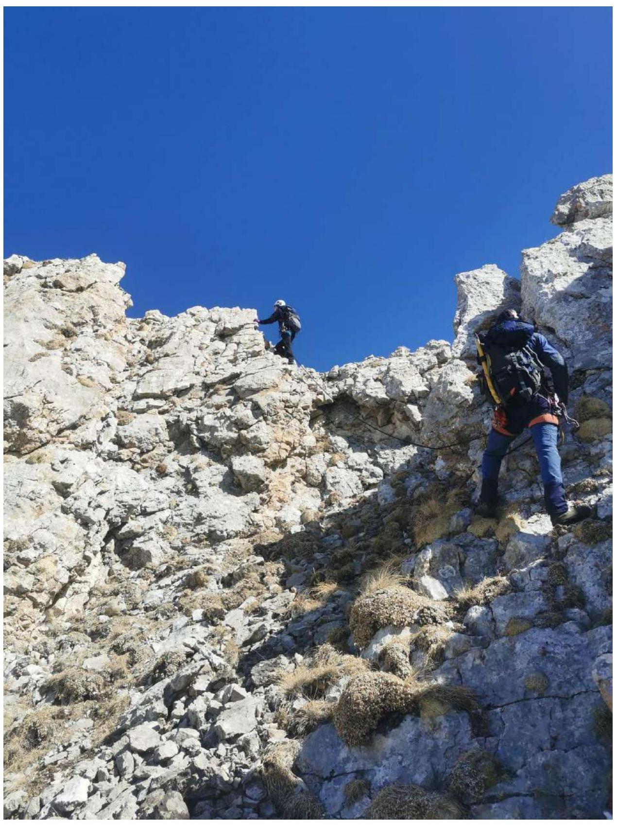
- R2–R3 Start ascending via rocky blocks and boulders, Category 2. 30 m, then continue along the ridge and its southern side towards the visible summit tower.
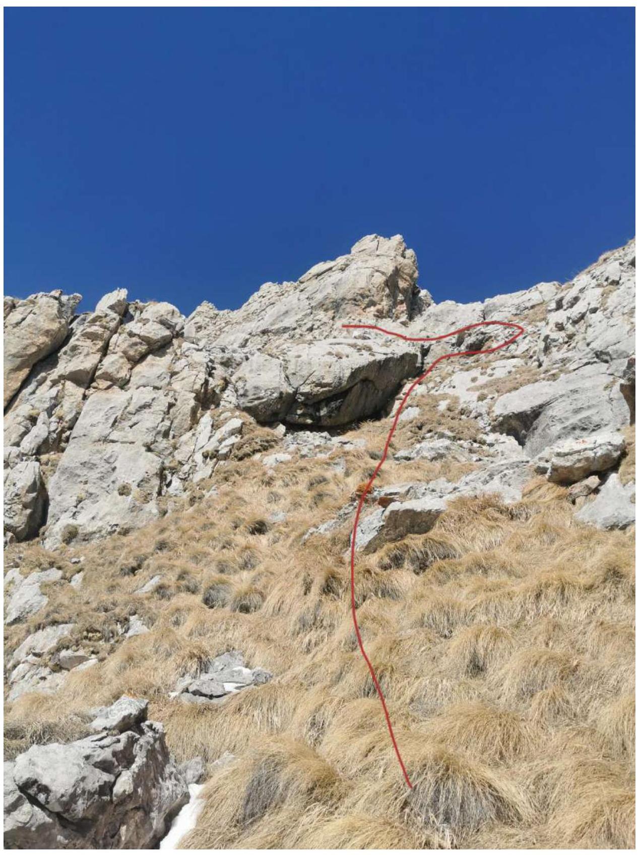
- R3–R4 Before the summit tower, bypass the overhanging reddish rocks on the left (southern side) via grassy terraces and in one place, Category 1 rocks.
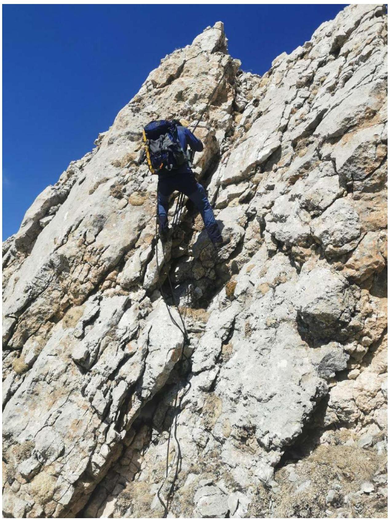
- R4–R5 Turn right, approach the inner corner of the ridge, climb through it onto the ridge, and then left along the ridge, Category 3 rocks. 15 m. The summit is 50 m further.
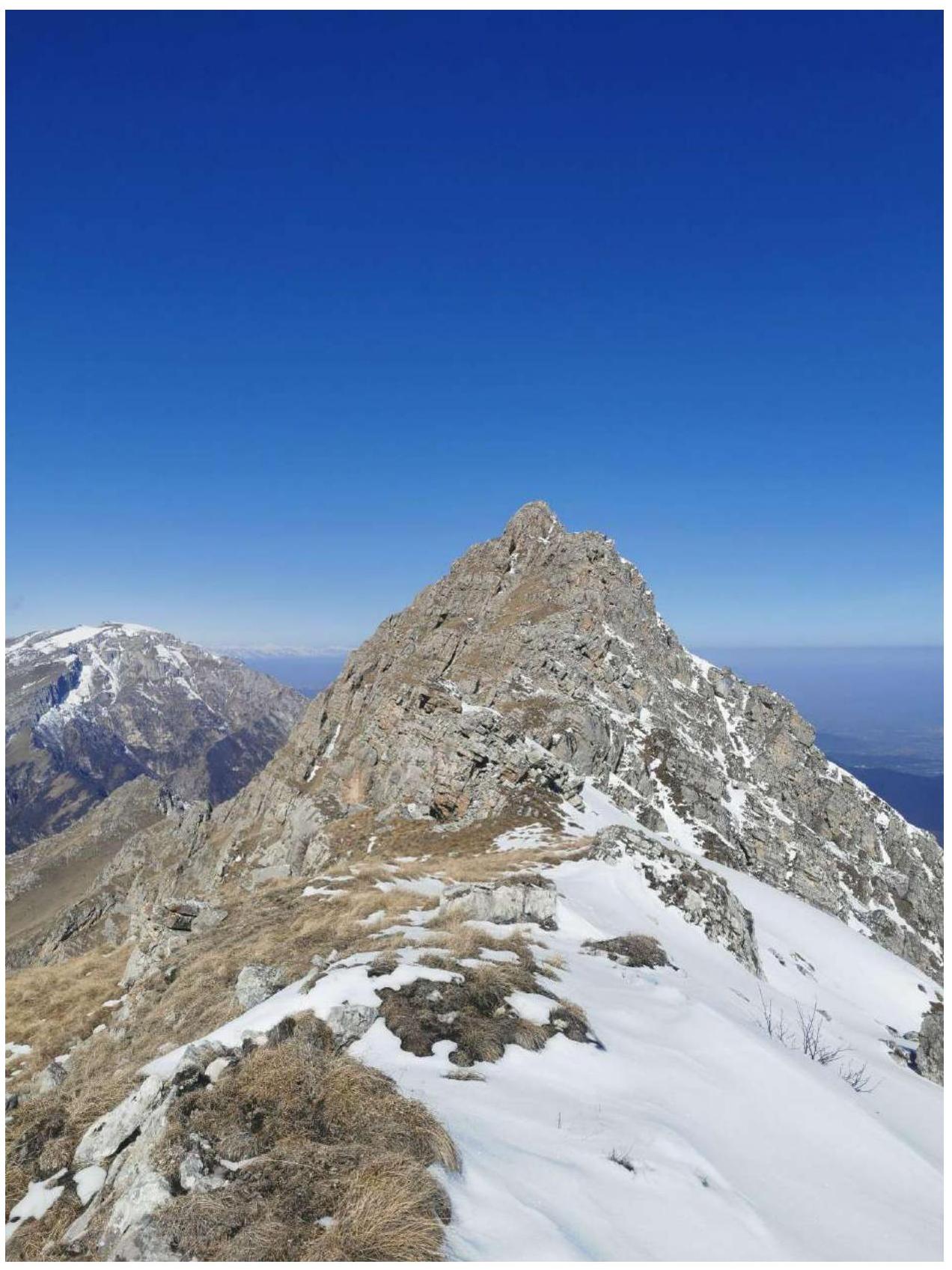
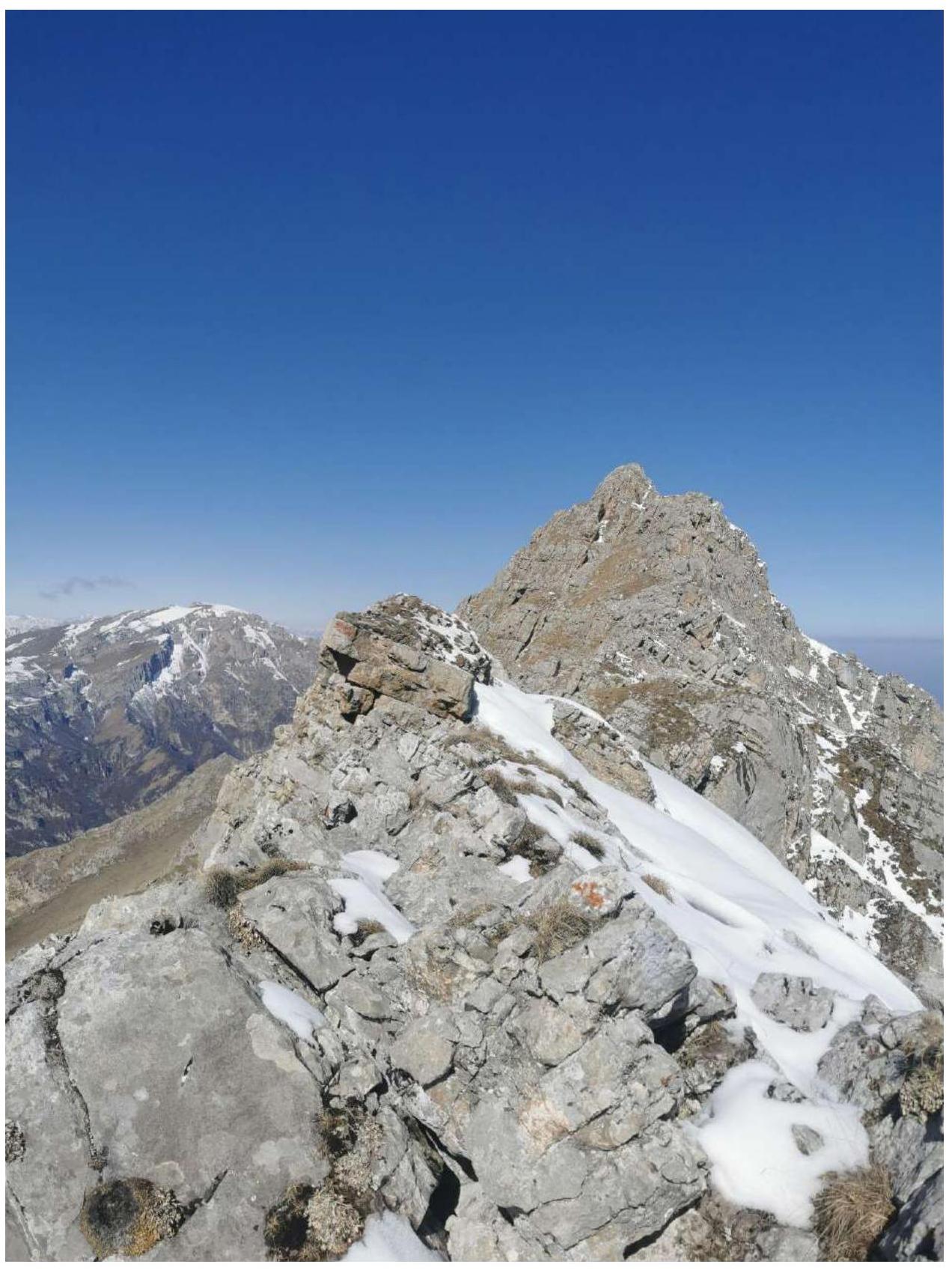
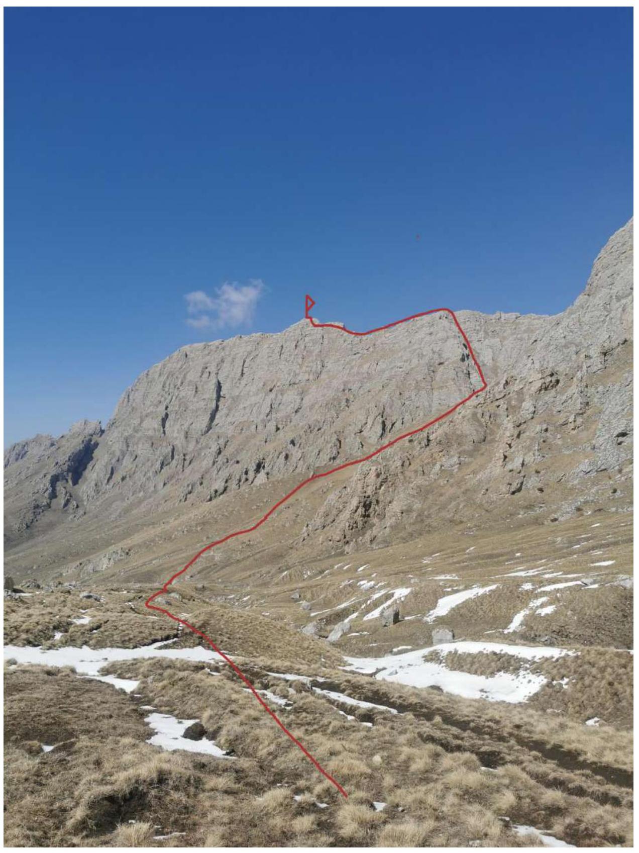 General photo of Jarlam 2867 m
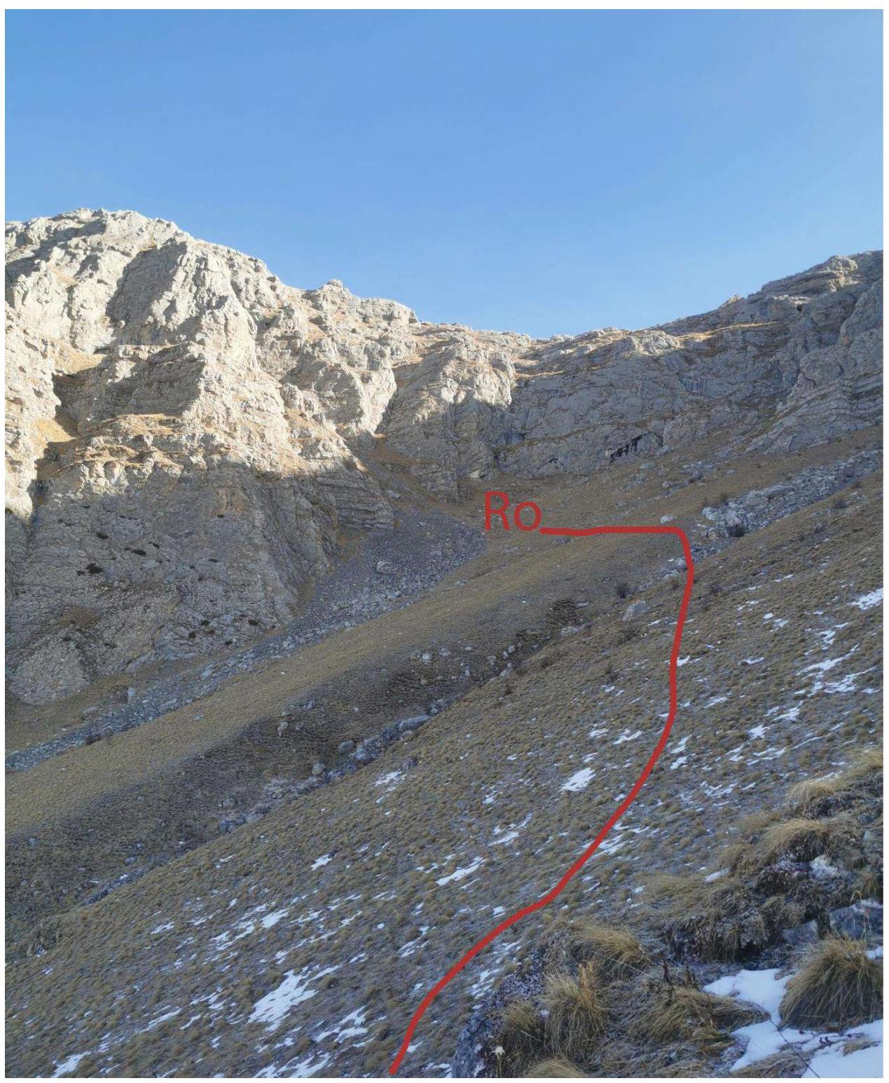 Start of the route R0
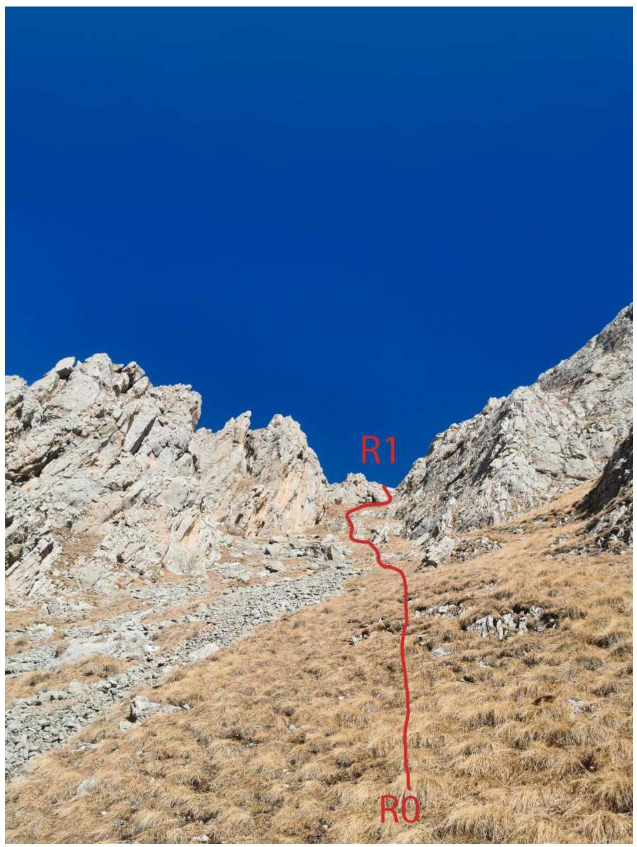 Couloir R0–R1
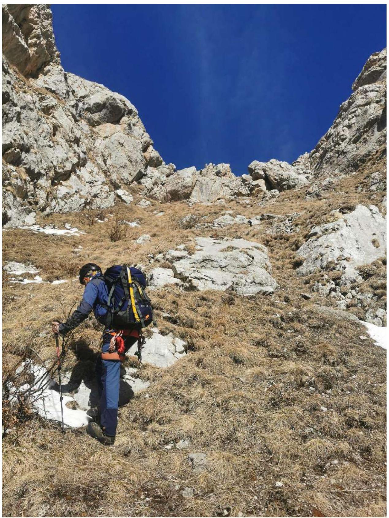 Couloir R0–R1
 Reaching the ridge R1–R2
 Further along the ridge R1–R2
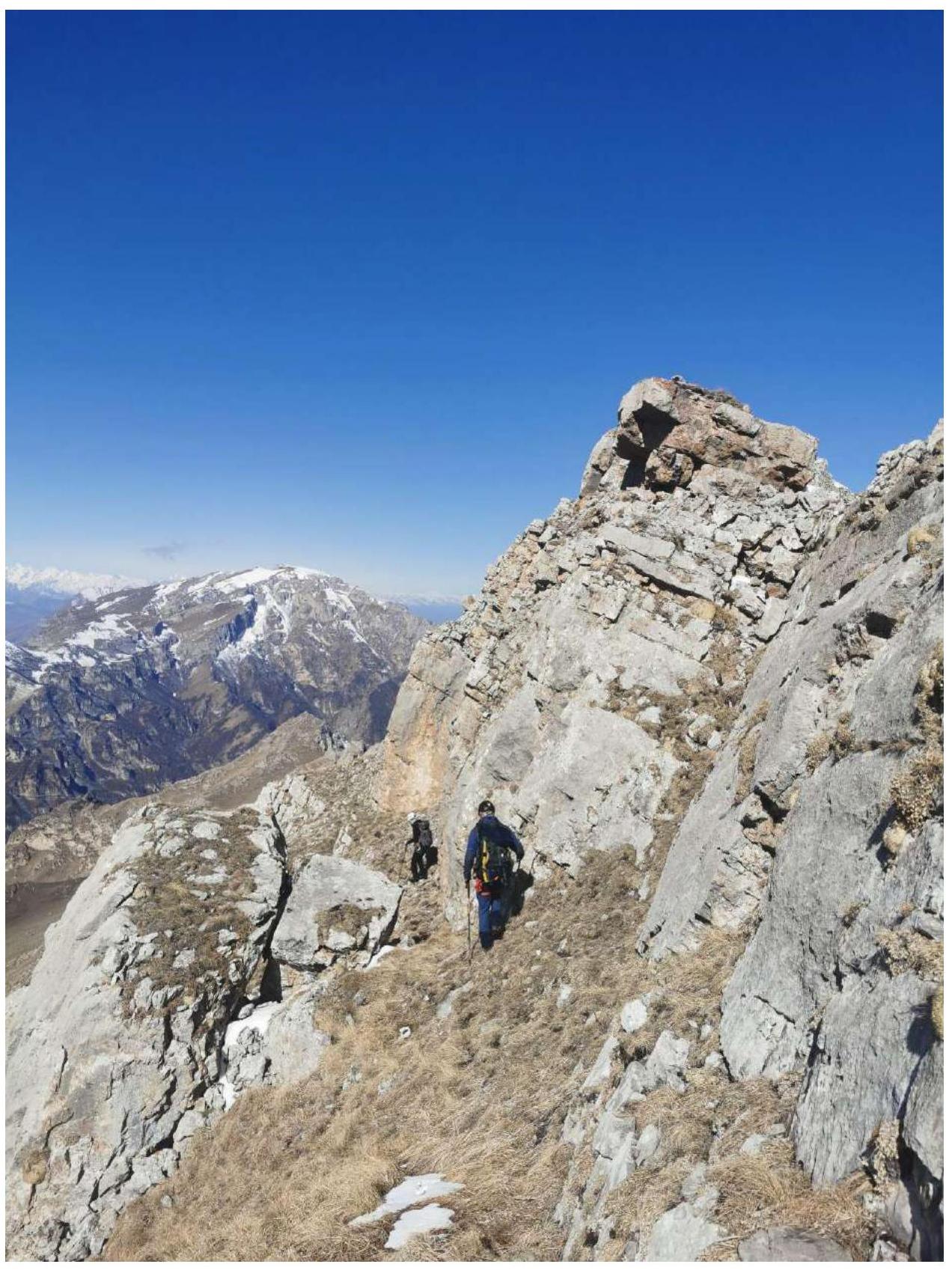 Bypassing the ridge from the southern side R1–R2
 Continuing along the southern side towards the depression R1–R2
 Depression in the ridge R1–R2
 Depression in the ridge up to R2
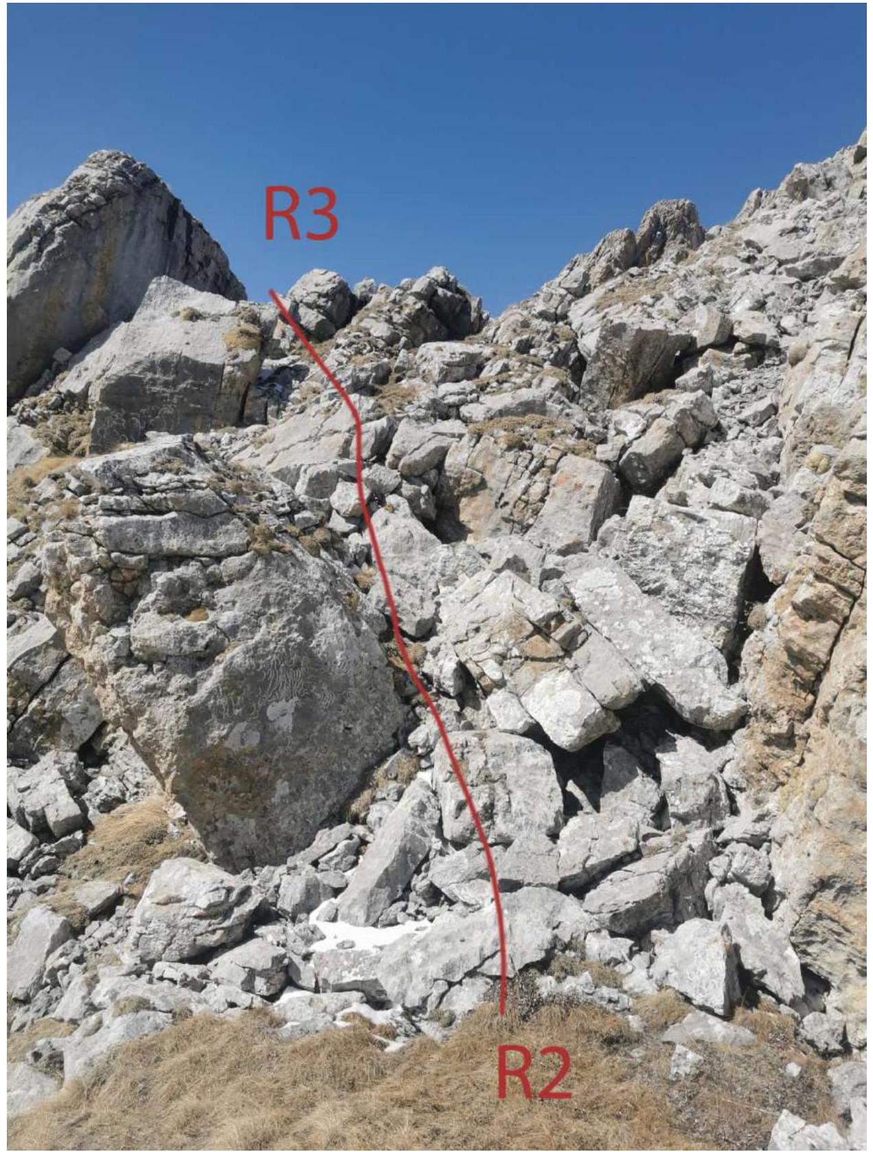 Section R2–R3, rocky blocks Category 2.
 Moving along the southern side of the ridge, section R2–R3
 Towards the summit tower R2–R3
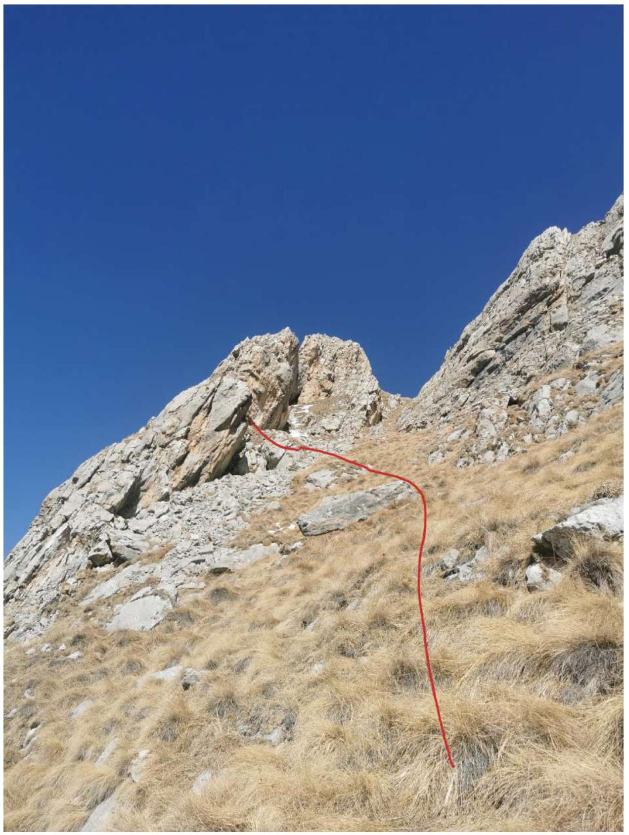 Bypassing the overhang before the tower R3–R4
 Further on grassy ledges R3–R4
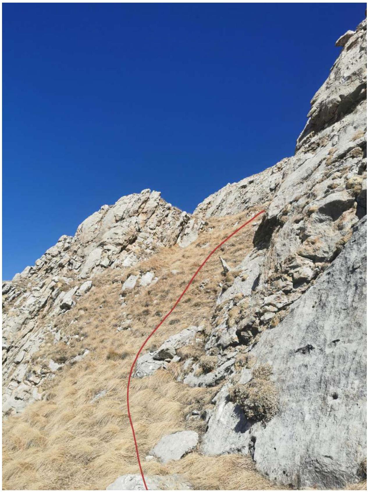 Approaching the key section R4–R5
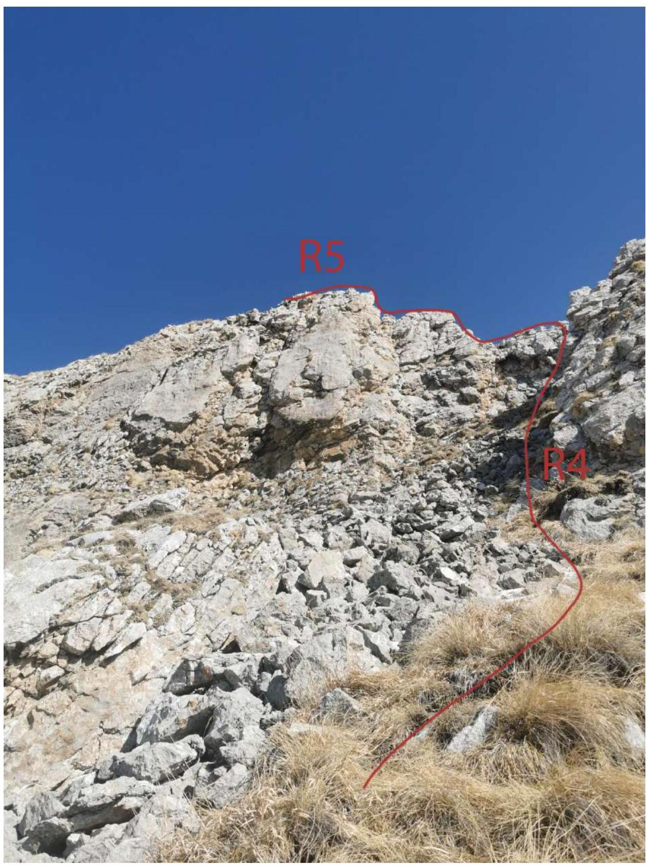 Passing R4–R5, Category 3 rocks.
 Section R4–R5, Category 3 rocks.
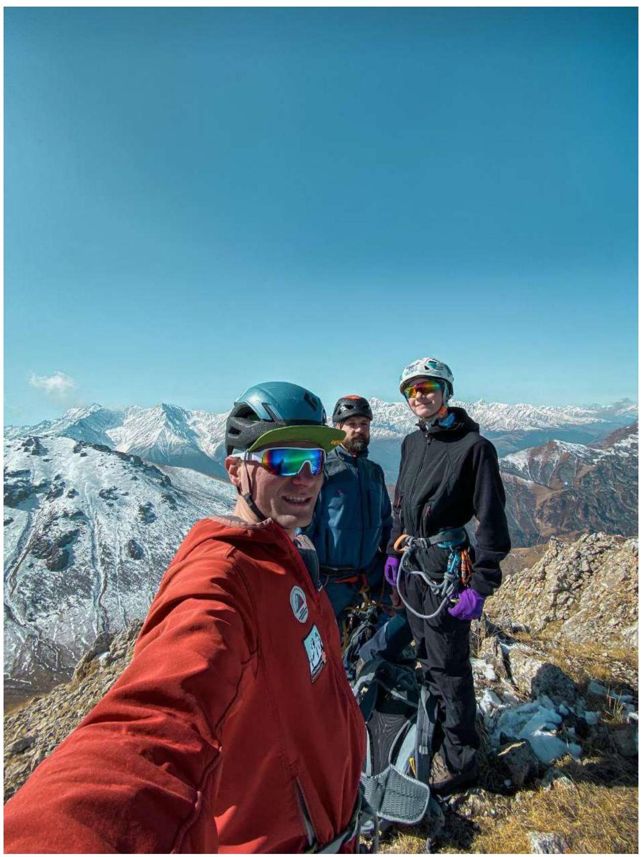
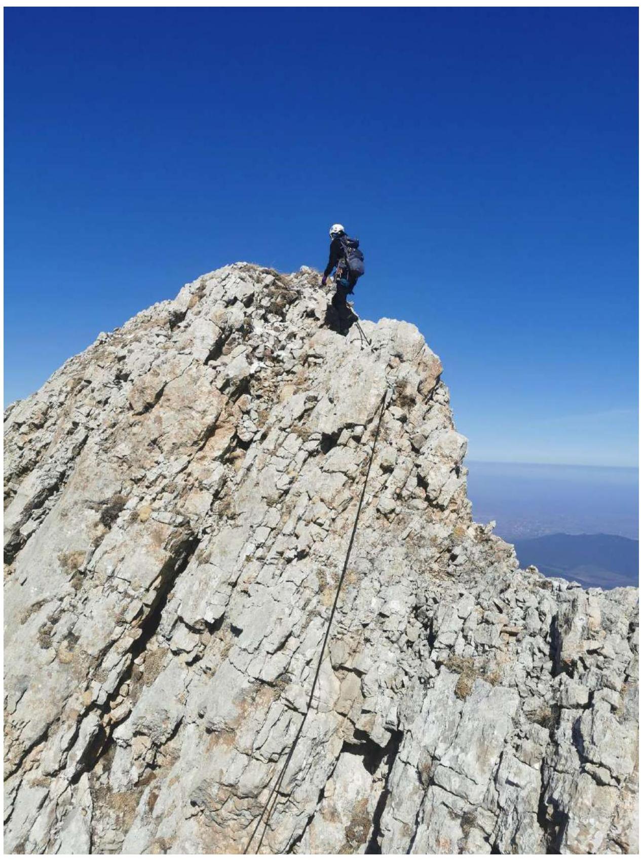 Photo on the summit of Jarlam
 Descent from section R4–R5
 Descent from section R4–R5
Conclusions and Recommendations for the Route
The route is recommended for training groups. The approach to and departure from the route is quite exhausting, so an overnight stay at the Jarlam pass is recommended. The route is interesting, logical, and the simplest line to the summit. During the off-season, there may be snow in the couloir and on the ridge, and crampons might be necessary. On the descent from the summit, section R4–R5, there is a rappel loop on the rocks. The descent via the couloir is rockfall-prone; it is recommended to proceed in a tight group along the couloir's sides. Before this ascent, routes on Jarlam had not been classified; a cairn and a hook were found on the summit, but no notes were discovered.