ASCENT REPORT
Djarlam
Via South-Eastern Ridge (“Ta-Ton'ka”)
Estimated complexity: 2A
2022
Ascent Details
| 1. General Information | ||
|---|---|---|
| 1.1 | Full name, sports rank of the team leader | Patutinskiy Alexander Nikolaevich, 1st sports rank |
| 1.2 | Full names, sports ranks of the participants | Torchikov Sergey Ilich, Candidate Master of Sports; Strelychuk Antonina Robertovna, Candidate Master of Sports; Plokhov Mikhail Sergeevich, Candidate Master of Sports; Yurchik Stanislav Tarasovich, 2nd sports rank |
| 1.3 | Organization | Regional Public Organization "Alpinism Federation of Nizhny Novgorod Region" |
| 1.4 | Coach | Bogdanov Alexey Vladimirovich |
| 2. Characteristics of the Ascent Object | ||
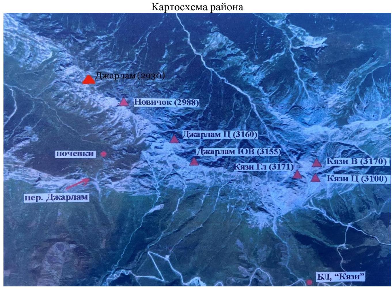
| 2.1 | Region | Caucasus |
| 2.2 | Valley | Dzheyrakh district |
| 2.4 | Name and height of the summit | Djarlam, 2930 m |
| 2.5 | Geographic coordinates of the summit (latitude/longitude), GPS coordinates | N 42°51′32″ E 44°48′0″ |
| 3. Route Characteristics | ||
| 3.1 | Terrain type | Rocky |
| 3.2 | Category of complexity | 2A |
| 3.3 | Name, year of the first ascent | Via South-Eastern Ridge, 2022 |
| 3.2 | Height difference of the route (altimeter or GPS data, m) | 500 m |
| 3.3 | Route length (in meters) | 1200 m |
| 3.4 | Descent from the summit | Via the ascent route |
| 3.5 | Additional route characteristics | Descent from the key section is recommended using two rappels. After each rappel, regroup behind the rock outcropping on the right side. Rockfall hazard: small and medium talus. |
| 4. Team Actions | ||
| 4.1 | Time taken for the route (team's moving hours) — time to the summit, total time including descent, time from bivouac to bivouac | 4 h 00 min; 5 h 30 min; 7 h 00 min |
| 4.3 | Time at control points | Departure from bivouac on Djarlam Pass — 4:30 (April 27, 2022); Approach to the key section — 6:10; Reaching the summit — 8:30; Return to bivouac — 11:30 (April 27, 2022) |
| 5. Weather Conditions | ||
| 5 | April 27, 2022: clear, windless. | |
| 6. Person responsible for the report | ||
| 6.1 | Full name, e-mail | Patutinskiy Alexander Nikolaevich, Aleks_patutinskii@mail.ru, +79772509085 |
Section lengths:
- easy terrain — 550 m
- 1st difficulty category — 390 m
- 2nd difficulty category — 240 m
- 3rd difficulty category — 10 m
- 4th difficulty category — 30 m
Maximum steepness of the key section — 60°; average steepness of the entire route (excluding easy terrain) — 20°. Number of protection points used: anchor bolts — 7, placed protection — 10. Protection points left on the route: total — 0.
Route Description
Approach to Bivouac
From the village of Guli, move upstream along the stream towards Djarlam Pass for 1.5–2 hours. From the pass, move up to the right part of the cirque for 250 m, gaining 50–70 m in height. There is no water at the bivouac site during summer and autumn.
Approach to the Route
From the bivouac, start moving along a well-defined trail that transitions into the grassy slope of Novichok peak. Continue up the grassy slope with a steepness of 25° until reaching the second talus gully (15–20 min) of easy terrain. On the left side, there is a talus gully leading to the saddle between Novichok and Djarlam peaks.
The Route
R0–R1
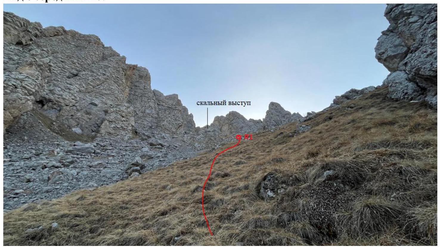
Movement begins from the rocky ridge (leave it on the right) up the talus gully with grassy and rocky ledges towards a prominent rocky outcropping in the center of the gully. Up 250 m, steepness 15–20°, 1st difficulty category.
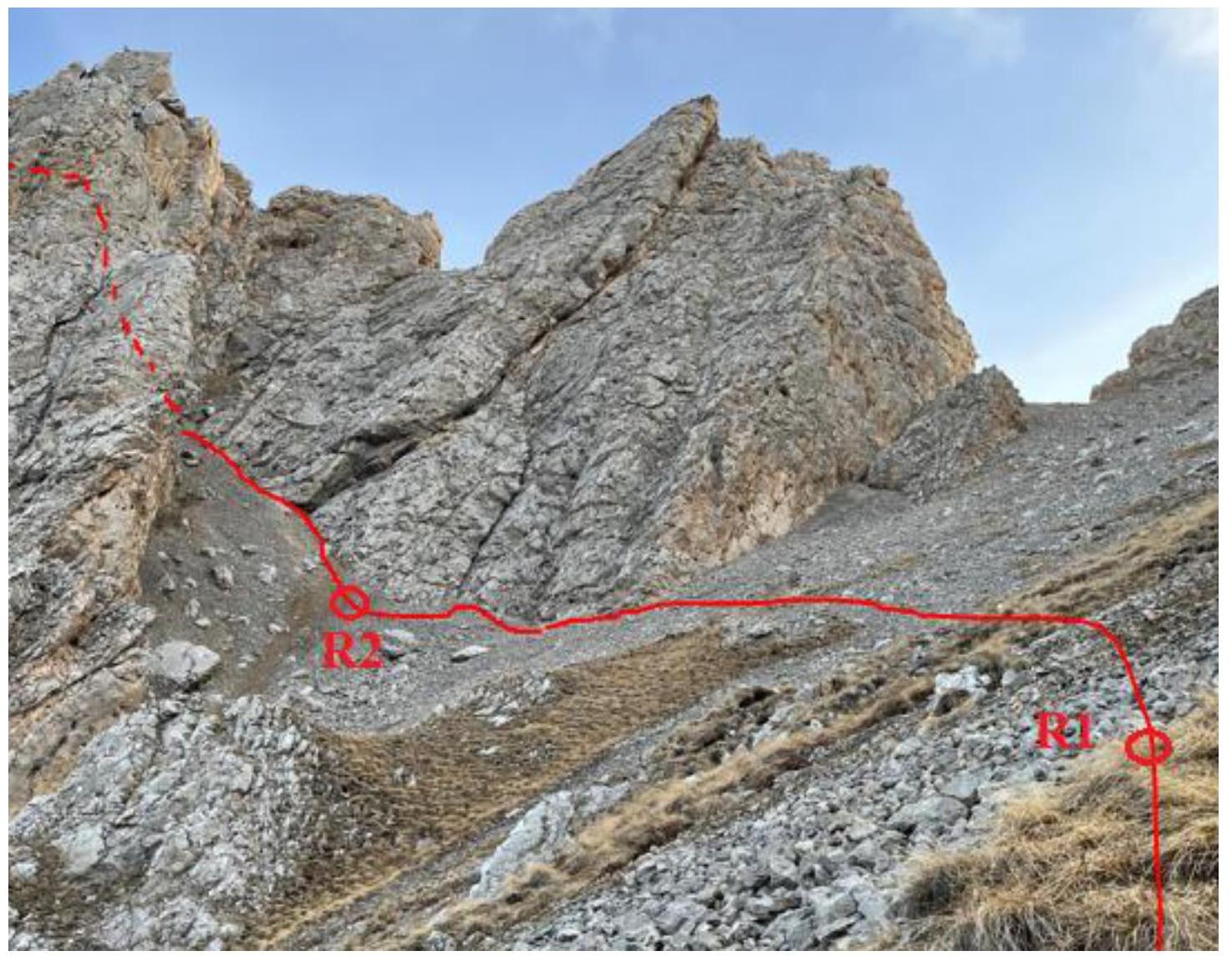
R1–R2
Traverse the talus gully. Above the rocky outcropping. Left 100 m, steepness 15–20°, 1+ – 2nd difficulty category.
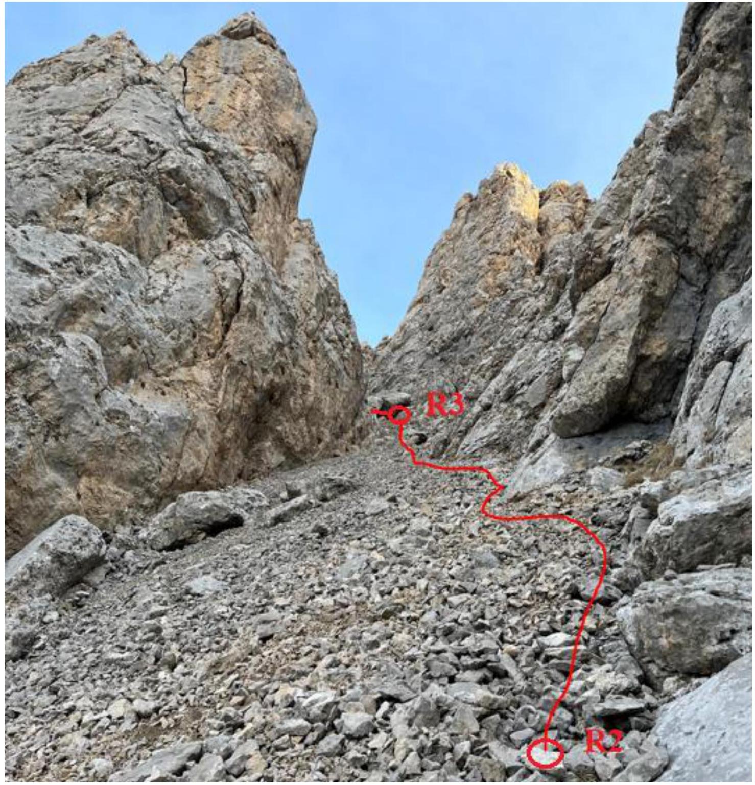
R2–R3
Climb up the talus gully, staying on the right side. Move in a tight group. Up 80 m, steepness 25–30°, 2 – 2+ difficulty category.
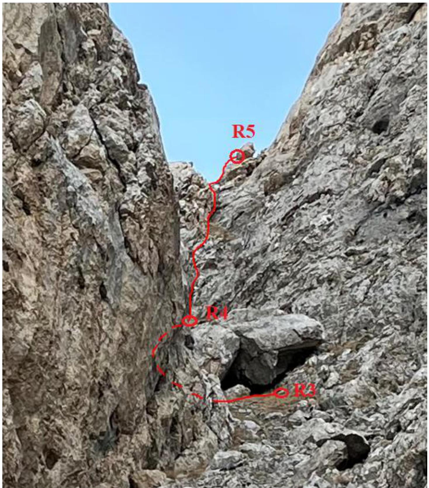
R3–R4
Cross the gully in its upper part to the left wall. Climb up a system of ledges (3 pieces).
- Left 7–10 m
- Up 10 m, steepness 30°, 2nd difficulty category.
R4–R5 (Key Section)
Climb up the wall to a large boulder on the right with a rappel anchor. 30 m, steepness 40°, 3+ difficulty category.
There is an alternative route: traverse along a ledge higher up, staying on the left, and then climb up a chimney.
- 5 m, steepness 20°, 1st difficulty category.
- 25 m, steepness 60°, 4- difficulty category.
R5–R6
Move along grassy areas down, then up towards a rocky bastion. 550 m, 5°, easy terrain.
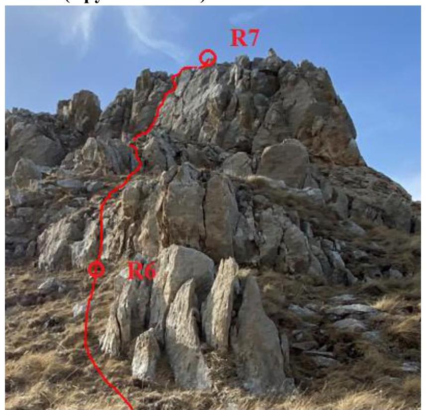
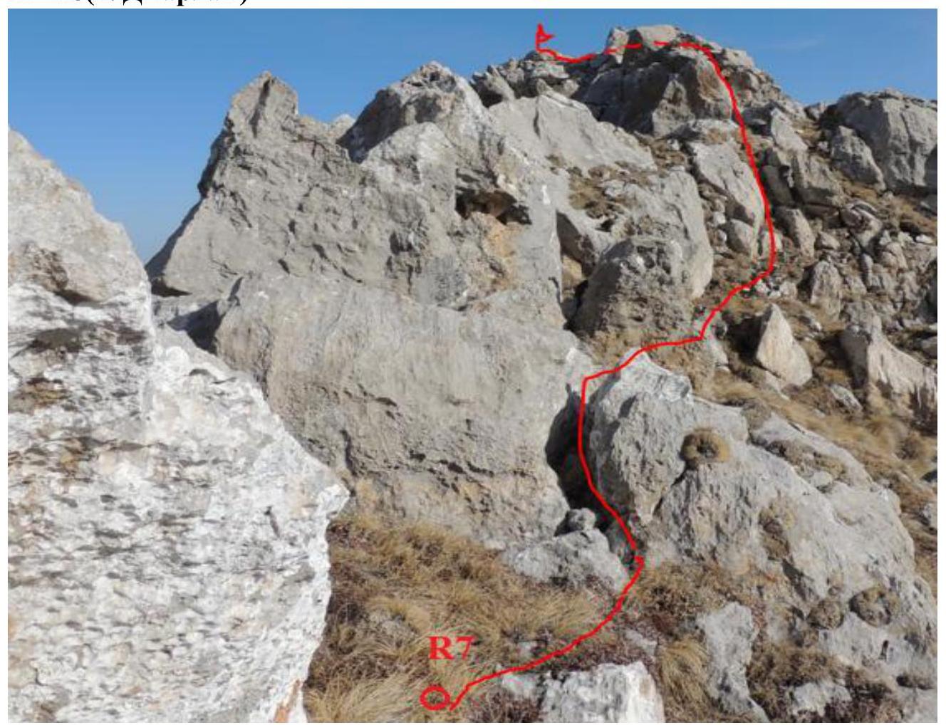
R6–R7
Reach the ridge via rocky outcroppings 20 m up the ridge. Climb the rocky outcroppings directly. Then, climb a 20 m wall with a steepness of 45°, 3rd difficulty category.
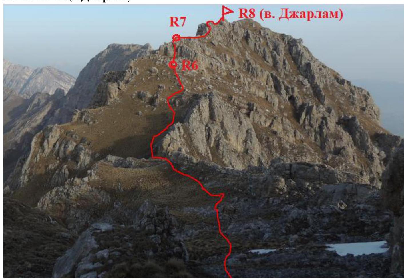
R7–R8 (Djarlam summit)
Move along the ridge towards the summit. Rocky terrain of 2nd difficulty category, interspersed with easy ledges.
- 150 m
- 10–20°
- 1 – 2nd difficulty category.
| Section | Length | Steepness | Difficulty Category |
|---|---|---|---|
| R8 | Djarlam summit | ||
| R7 | 150 m | 10–20° | 1 / 2 difficulty category |
| R6 | 40 m | 45° | 3 difficulty category |
| R5 | 550 m | 5° | easy terrain |
| R4 | 30 m | 60° | 3+ / 4 difficulty category |
| R3 | 20 m | 30° | 2 difficulty category |
| R2 | 80 m | 25–30° | 2 / 2+ difficulty category |
| R1 | 100 m | 15–20° | 1+ / 2 difficulty category |
| R0 | 250 m | 15–20° | 1 difficulty category |
General view of the route (including the approach to bivouac)
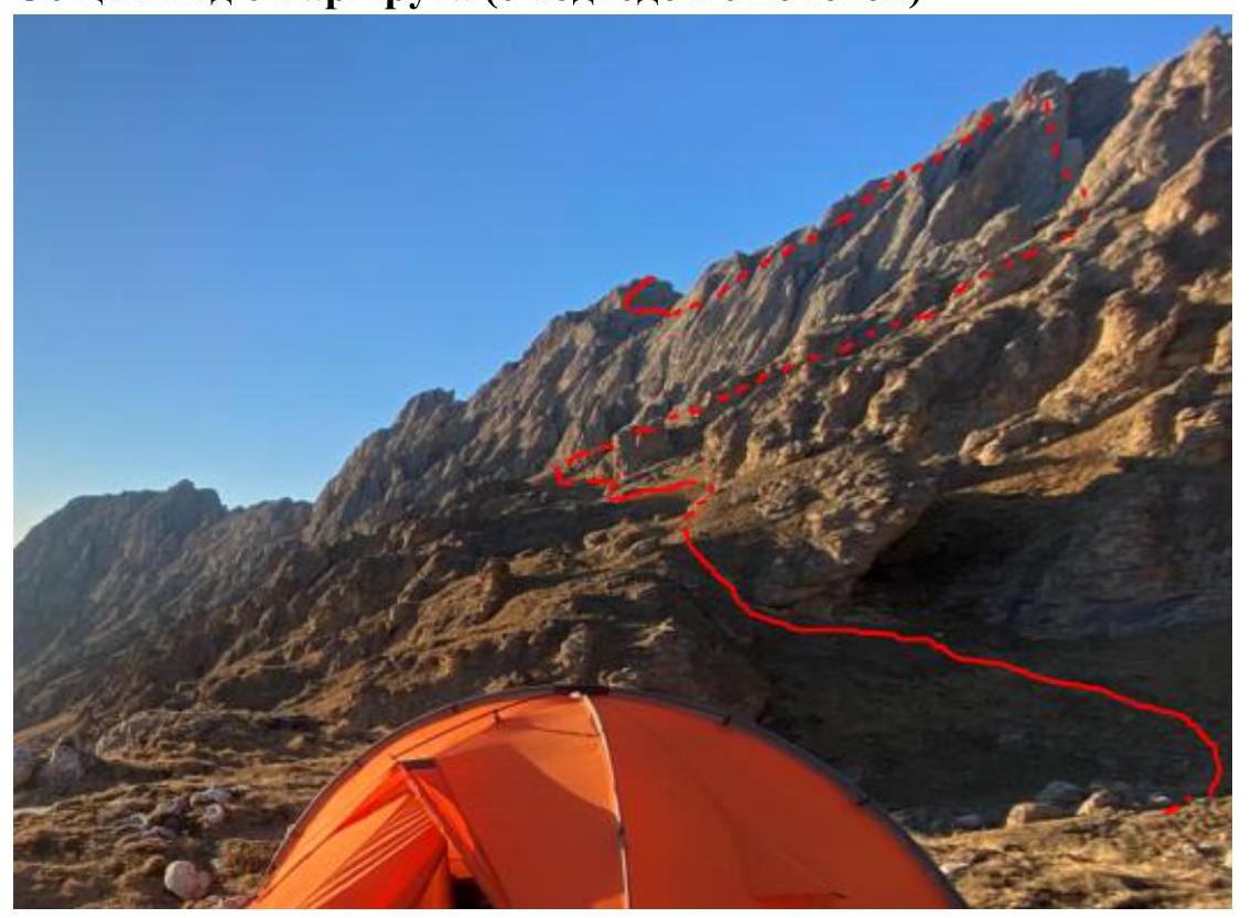
R0–R1
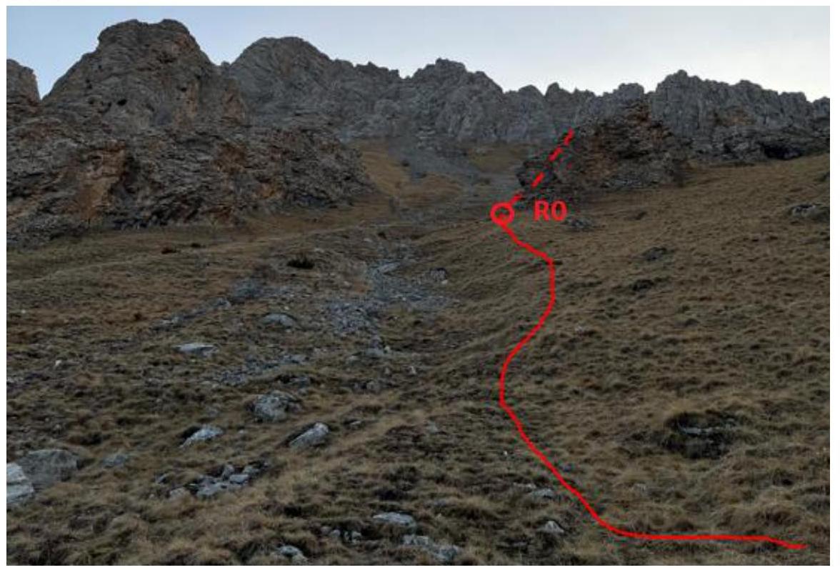
View from the middle of R0:
R1–R2
R2–R3
R3–R4–R5
R5–R6–R7–R8 (Djarlam summit)
R6–R7 (Close-up)
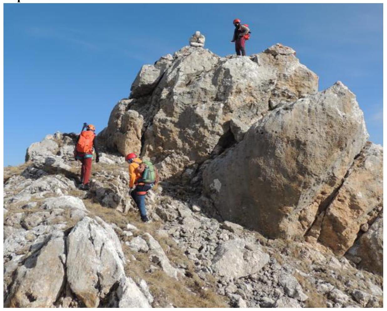
R7–R8 (Djarlam summit)
The Summit