
Report
ON THE SECOND ASCENT TO THE SUMMIT BASHNYA VIA THE SOUTHEAST RIDGE, CATEGORY 3B, BY THE FAIIS RO TEAM FROM MAY 6 TO MAY 6, 2021
I. Ascent Passport
| № | 1. General Information | |
|---|---|---|
| 1.1 | Full name, sports rank of the leader | Kudryashov Alexey Yuryevich, 1st sports rank |
| 1.2 | Full name, sports rank of the participants | Vabishchevich P.V., 3rd sports rank; Galka E.A., 3rd sports rank; Lepilin A.G., 3rd sports rank |
| 1.3 | Full name of the coach | Vasiliev A.S. |
| 1.4 | Organization | FAIiS RO |
| 2. Characteristics of the Ascent Object | ||
| 2.1 | Area | From pass Krestovy to peak Shaviklde |
| 2.2 | Valley | |
| 2.3 | Section number according to the 2013 classification table | |
| 2.4 | Name and height of the peak | Bashnya, 2930 m |
| 2.5 | Geographic coordinates of the peak (latitude/longitude), GPS coordinates | 42°51′4″ N, 44°48′48″ E |
| 3. Characteristics of the Route | ||
| 3.1 | Name of the route | Bashnya via the Southeast Ridge |
| 3.2 | Proposed category of difficulty | 3B |
| 3.3 | Degree of route exploration | 2nd ascent |
| 3.4 | Nature of the route terrain | Rocky |
| 3.5 | Height difference of the route | 250 m – rocky section, 750 m – total |
| 3.6 | Length of the route (in meters) | |
| 3.7 | Technical elements of the route | Category 3 rocky terrain – 160 m. Category 4 rocky terrain – 60 m. Category 5 rocky terrain – 20 m. rappel descent – 1 (50 m) |
| 3.8 | Descent from the peak | 350 m along a non-categorized ridge to the bivouac on pass Jarlam |
| 3.9 | Additional route characteristics | No water on the route, a platform on the pre-summit ridge |
| 4. Characteristics of the Team's Actions | ||
| 4.1 | Time of movement | 8 hours, 1 day |
| 4.2 | Overnight stays | On pass Jarlam |
| 4.3 | Departure on the route | 9:00 AM, May 6, 2021 |
| 4.4 | Reaching the peak | 5:10 PM, May 6, 2021 |
| 4.5 | Return to the base camp | 6:35 PM, May 6, 2021 |
| 5. Person Responsible for the Report | ||
| 5.1 | Full name, e-mail | Kudryashov Alexey Yuryevich, moto1986@mail.ru |
II. Ascent Description
1. Characteristics of the Ascent Object
1.1. General photo of the peak. The photo was taken on May 8, 2021, from p. Giriag.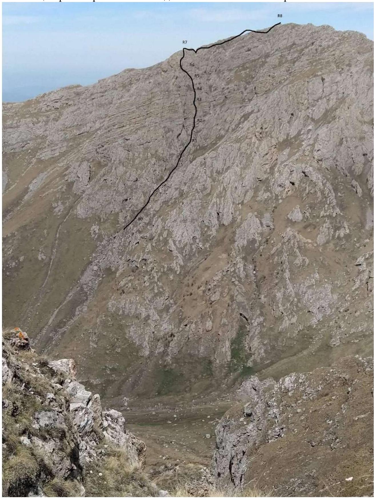 1.2. Photo of the route profile.
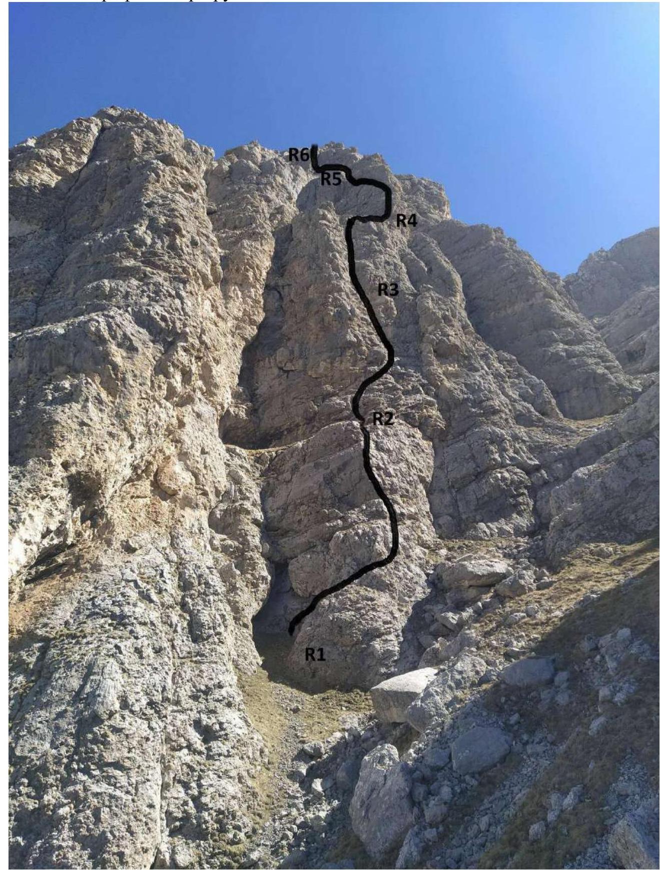
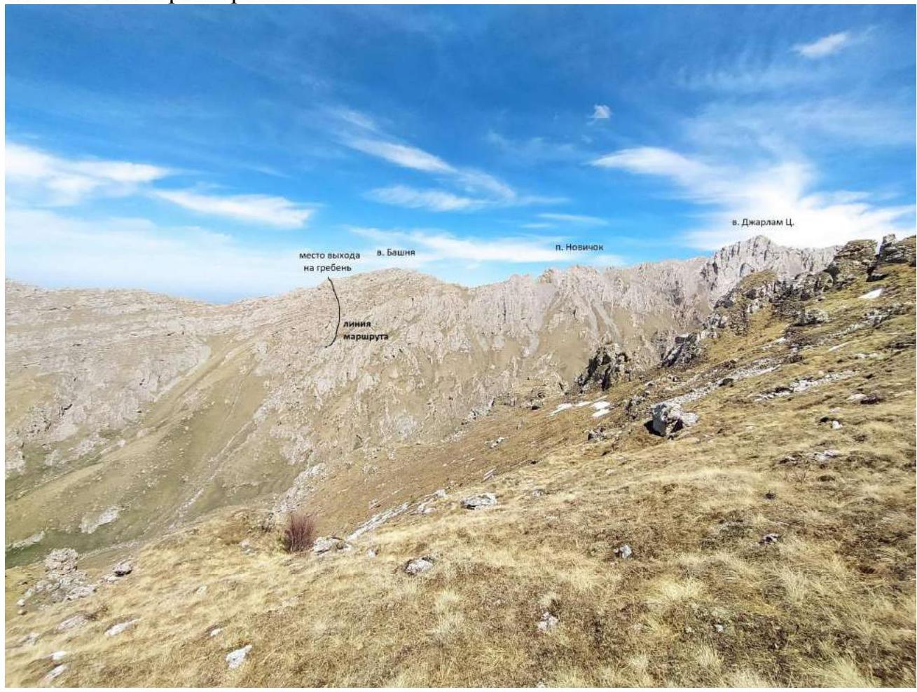
1.3. Photopanorama of the area.
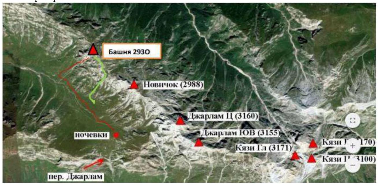
1.4. Map of the area
2. Characteristics of the Route
2.1. Technical photo of the route.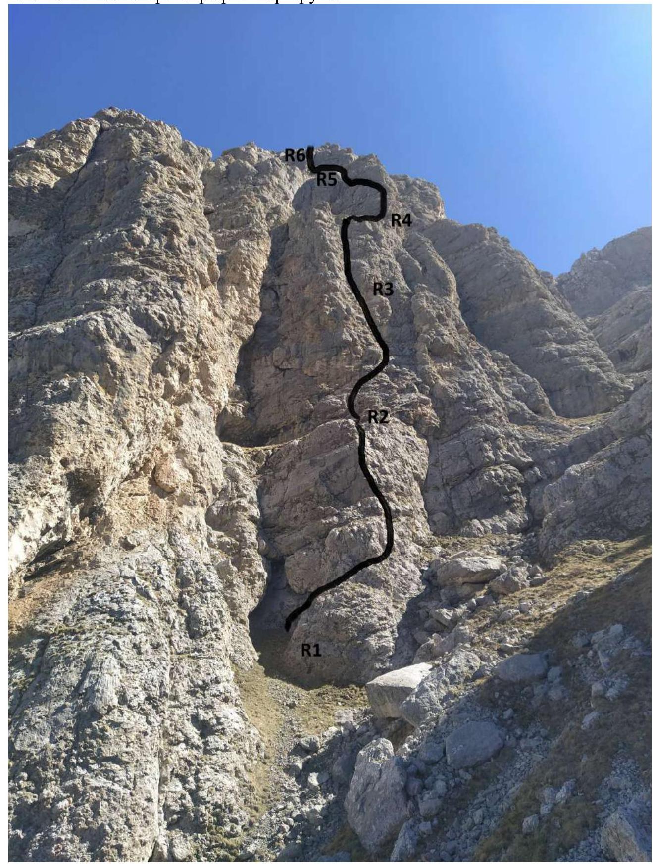 2.2. Technical characteristics of the route sections.
| Section | Nature of terrain | Category of difficulty | Length, m | Type and number of hooks |
|---|---|---|---|---|
| R0–R1 | Scree couloir | Non-categorized | 350 | 0 |
| R1–R2 | Rocky | 3 | 40 | 5 |
| R2–R3 | Rocky | 4 | 35 | 8 |
| R3–R4 | Rocky | 4/3 | 25/15 | 9 |
| R4–R5 | Rocky | 5/3 | 20/15 | 9 |
| R5–R6 | Rocky | 3 | 40 | 5 |
| R6–R7 | Rocky | 3 | 45 | 7 |
| R7–R8 | Rocky ridge | 1 | 100 | 0 |
3. Characteristics of the Team's Actions
| Section | Description | Photo number |
|---|---|---|
| R0–R1 | Up the couloir with grass and rocky ledges to the right upwards 300 m to the base of Bashnya. | 1,2 |
| R1–R2 | Rocky section, we recommend organizing the first station to the right of the "rocky paw", the left part is pierced by stones from the wall. Ascent up the wall on rocks of category 3, length 35–40 m depending on the station location. For belaying, hooks, medium and large friends, medium and large nuts are suitable (similarly throughout the route). Station R2 on sand glasses in the middle part of the ledge. | 3 |
| R2–R3 | From the ledge, move left up the wall, then into the inner corner, station R3 on a convenient ledge on anchor hooks. | 4,5 |
| R3–R4 | Up the chimney turning into an inner corner, length 25 m, then along the ledge to the right to the control tour. Station R4 on anchor hooks. | 6,7,8 |
| R4–R5 | The key section of the route. Up from the station along the edge of the wall 15 m, then left towards the ledge another 5 m, then along the ledge 20 m. Station R5 on friends and nuts. | 9,10 |
| R5–R6 | Up left from the station along the inner corner, then left along the ledge. Station R6 on a huge stone. | 11,12 |
| R6–R7 | From the station, move upwards, choosing the simplest terrain. The end of the section is the exit to the plateau, station R7 on anchor hooks. 10 m from the exit to the plateau – a control tour. | 13,14,15 |
| R7–R8 | Further along the ridge about 100 m towards the peak, on the peak a control tour with a summit note. | 16,17 |
Photo 1. Approach up the couloir to the wall.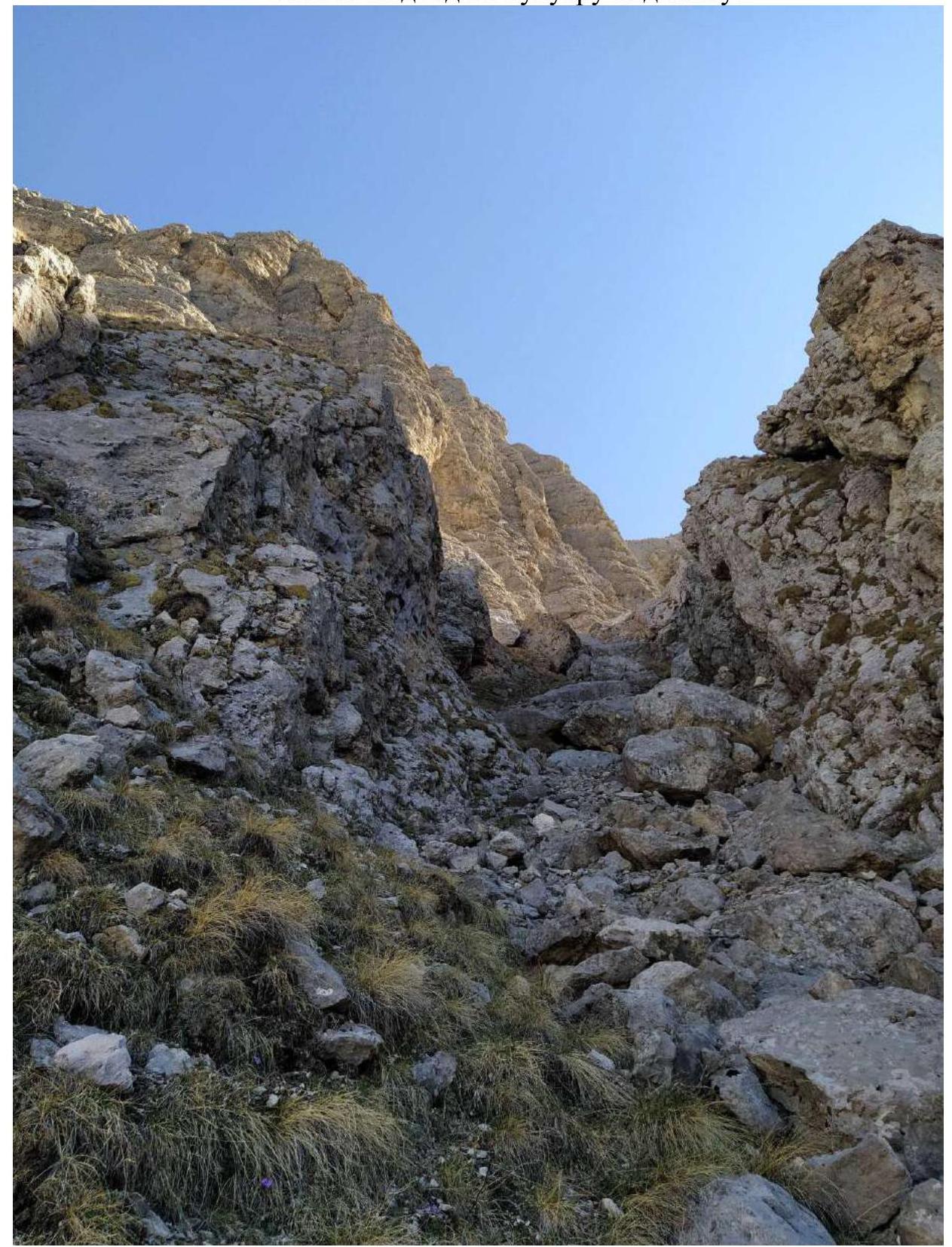
Photo 2.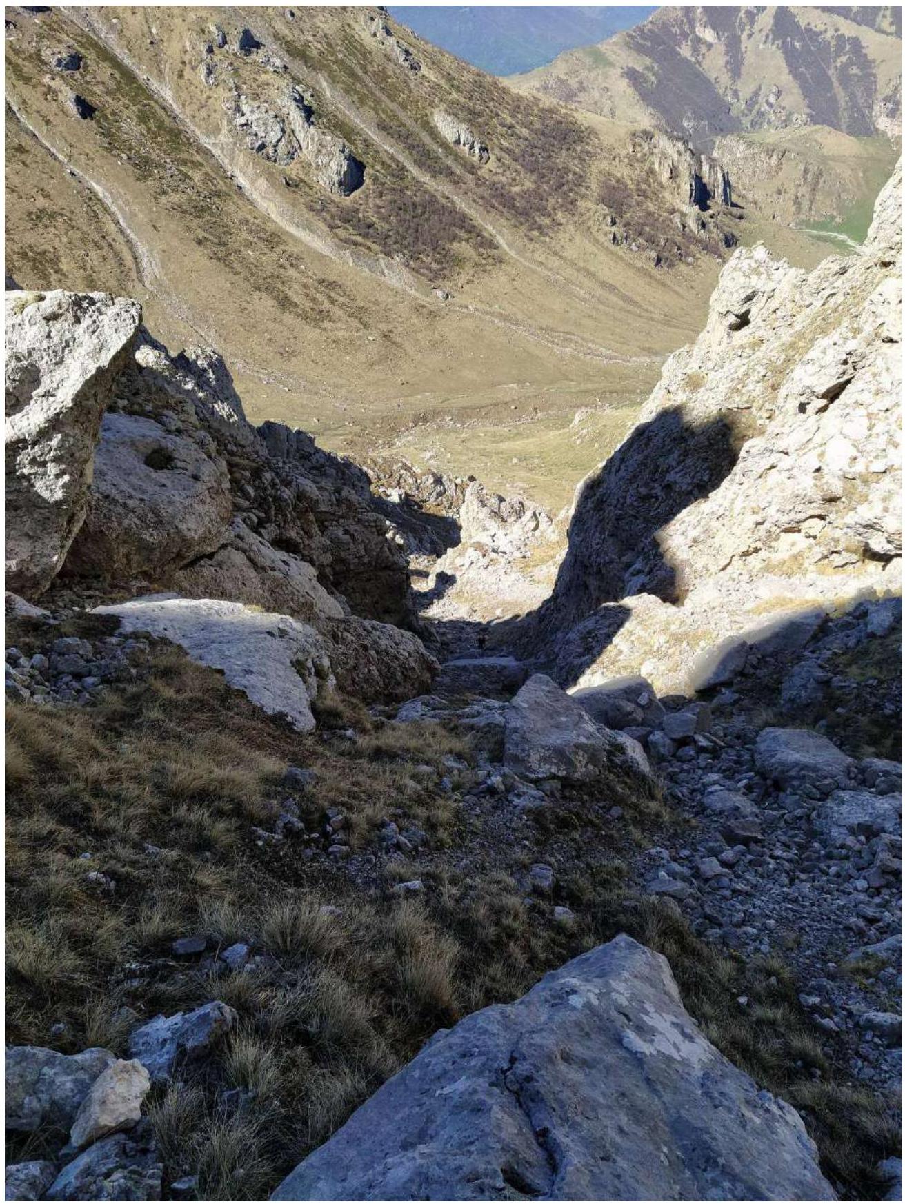
Photo 3. Sections R1–R2–R3–R4 are clearly visible.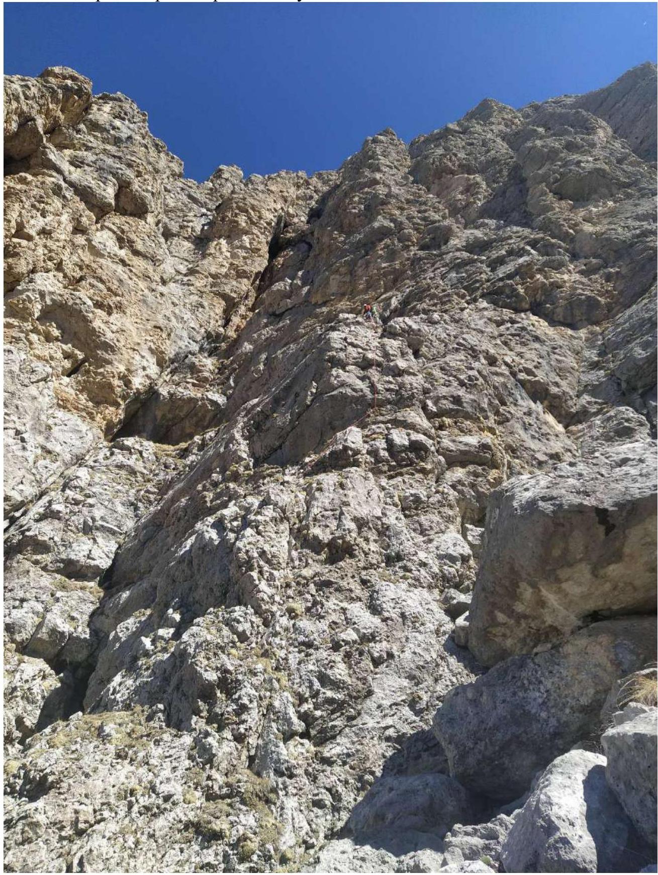
Photo 4. Section R2–R3.
Photo 5. Section R2–R3.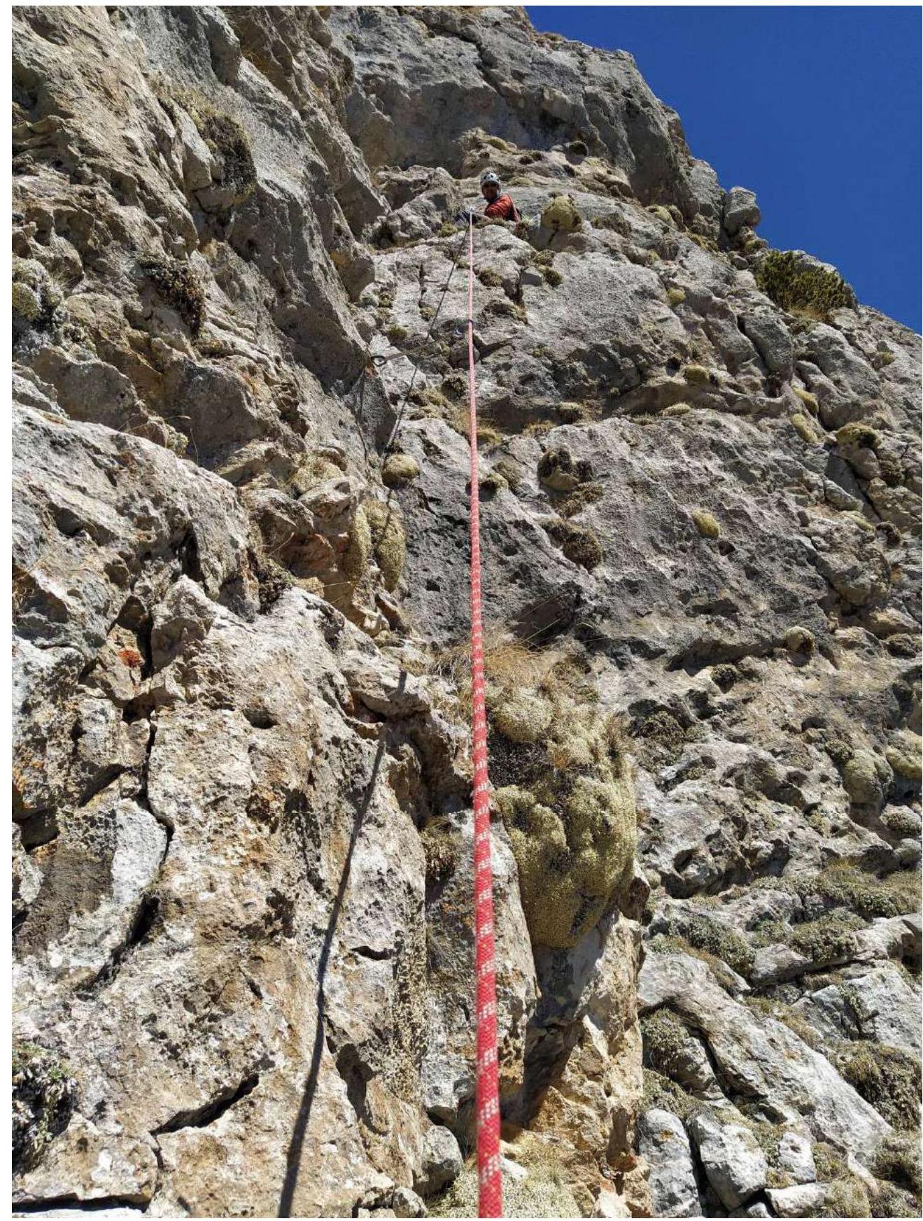
Photo 6. Section R3–R4.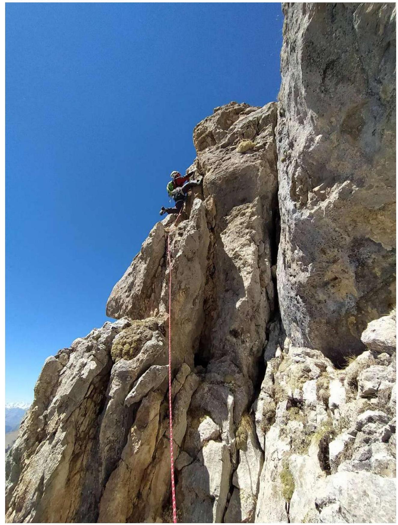
Photo 7. Section R3–R4.
Photo 8. Control tour near station R4.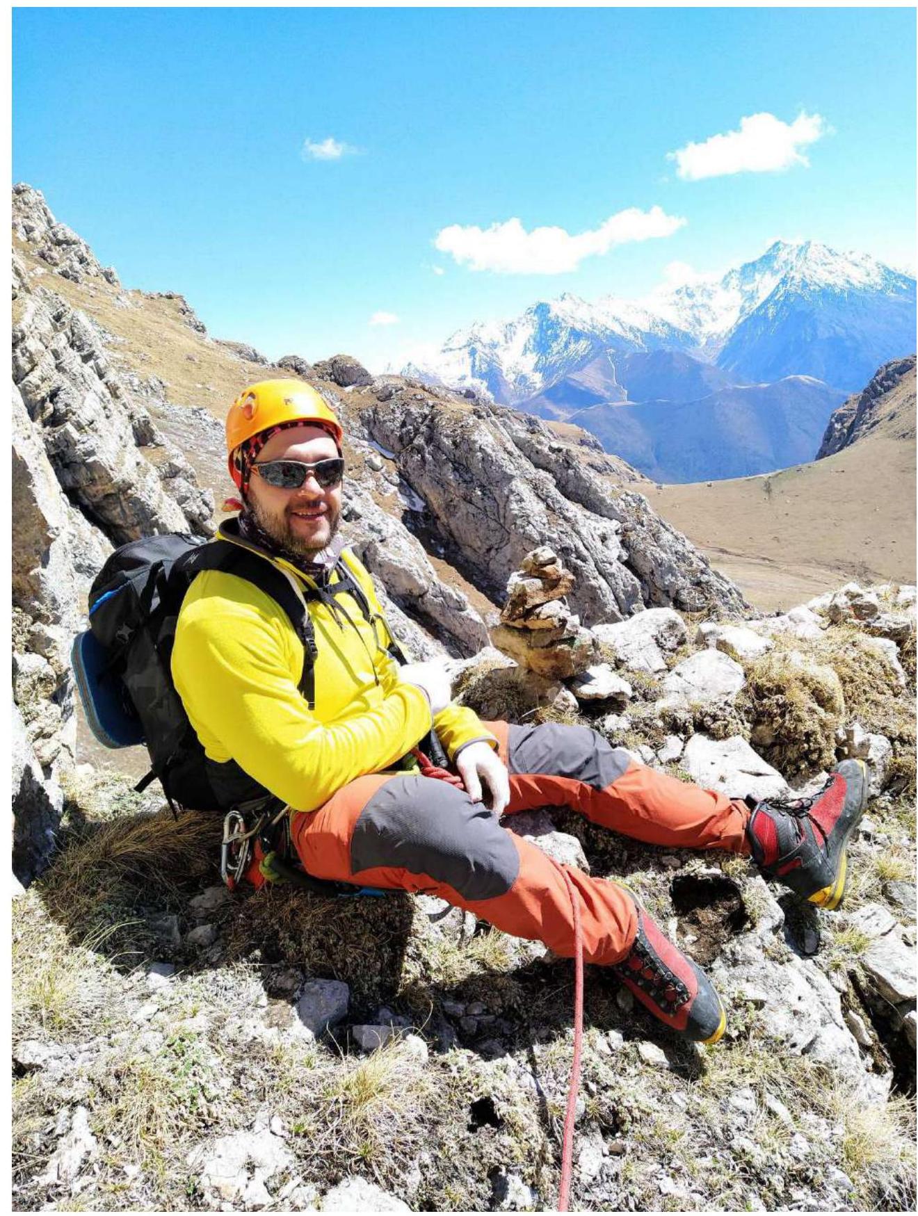
Photo 9. Section R4–R5. "Key" of the route.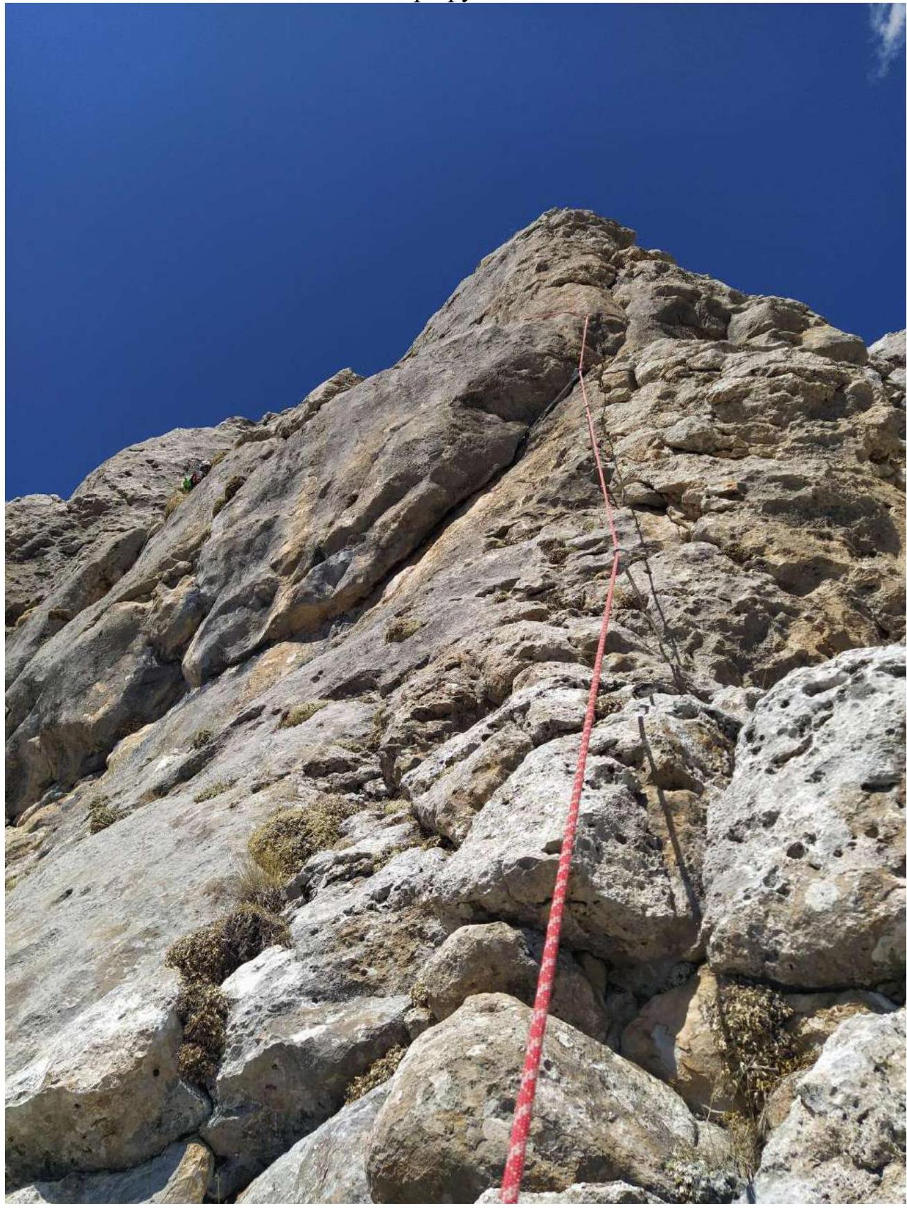
Photo 10. Section R4–R5. "Key" of the route.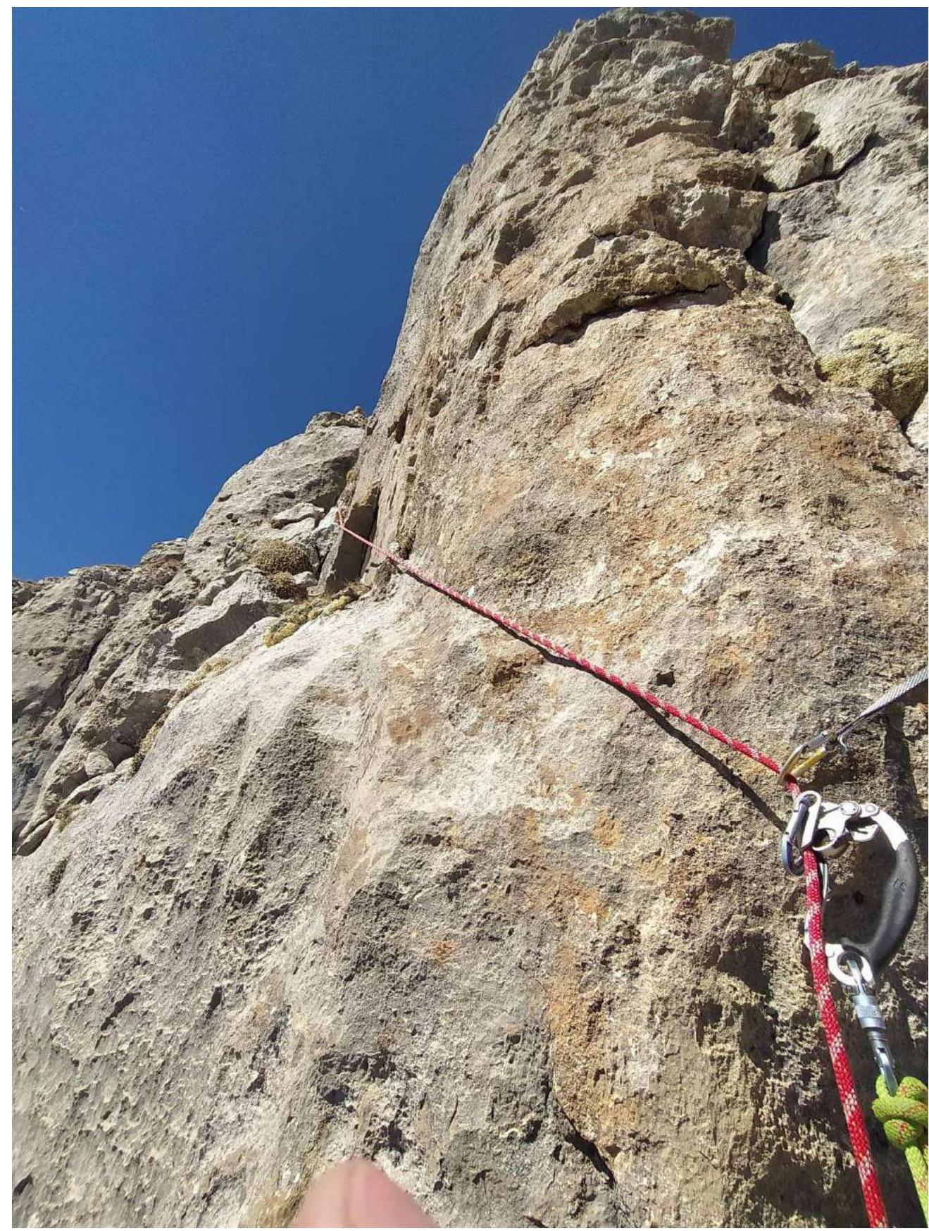
Photo 11. Section R5–R6.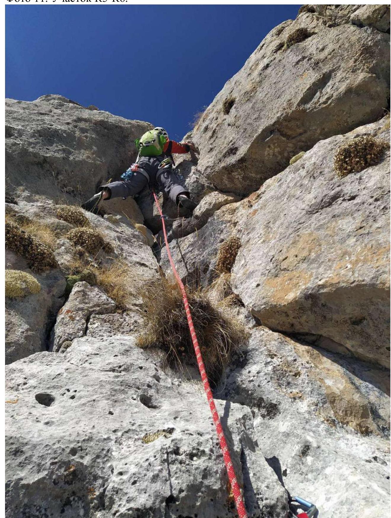
Photo 12. Section R5–R6.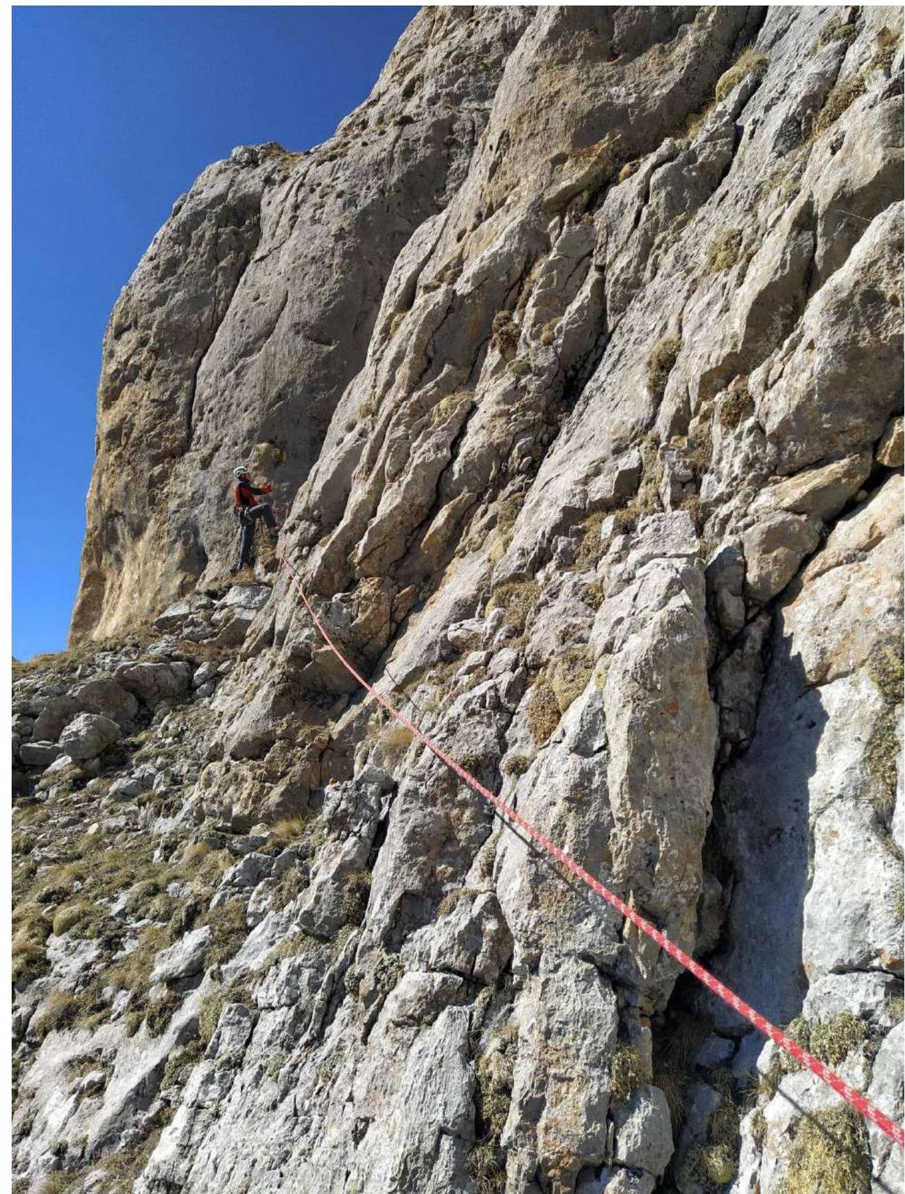
Photo 13. Section R6–R7.
Photo 14. Section R6–R7.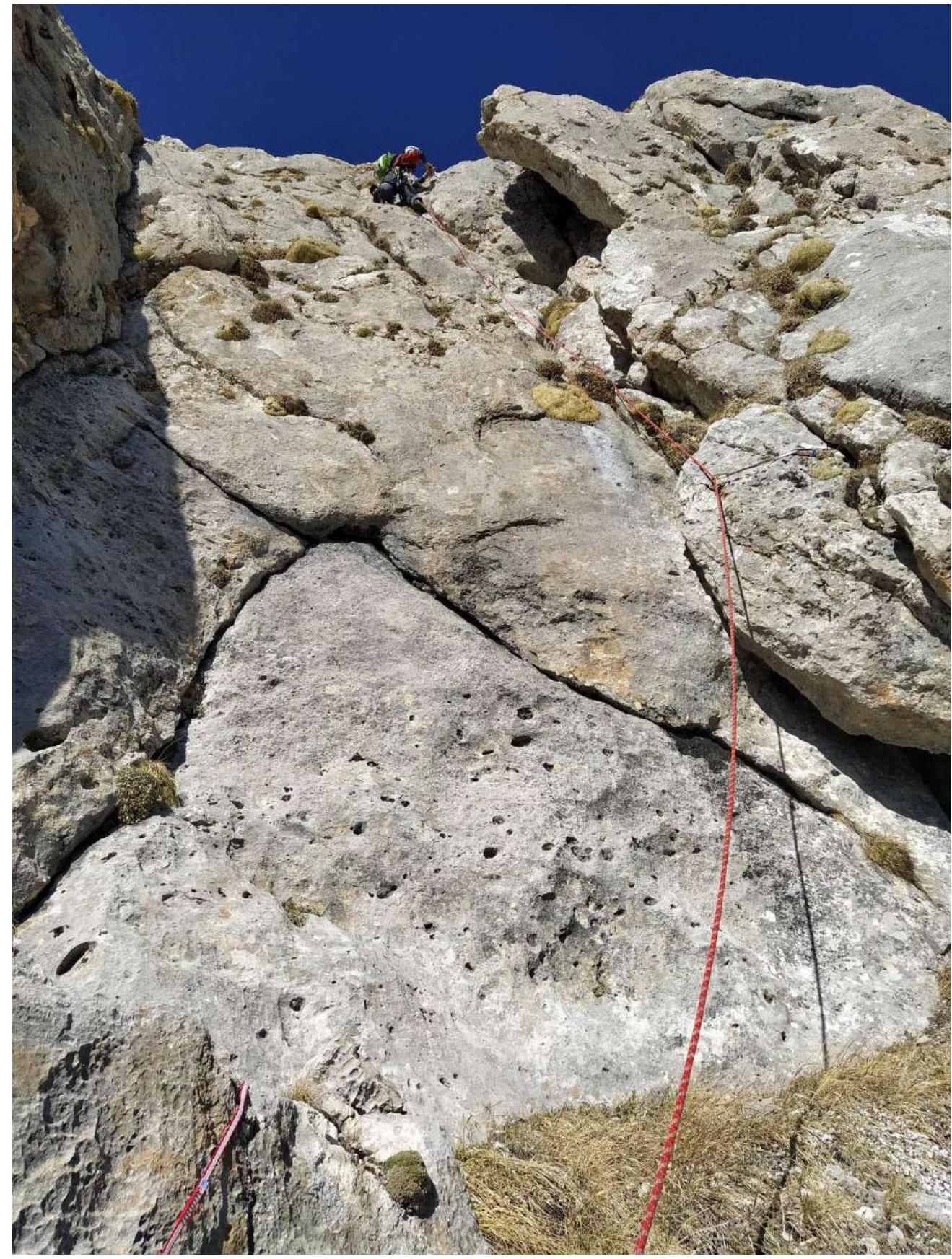
Photo 15. Section R6–R7.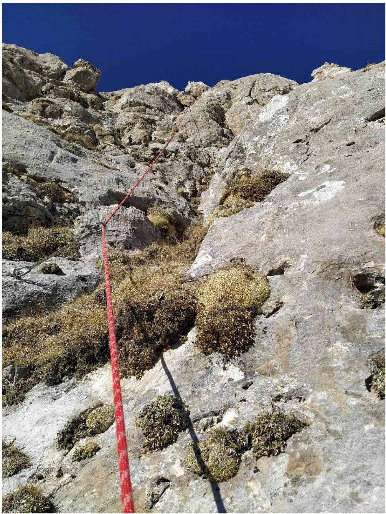
Photo 16. Exit from the wall to the ridge. Another control tour.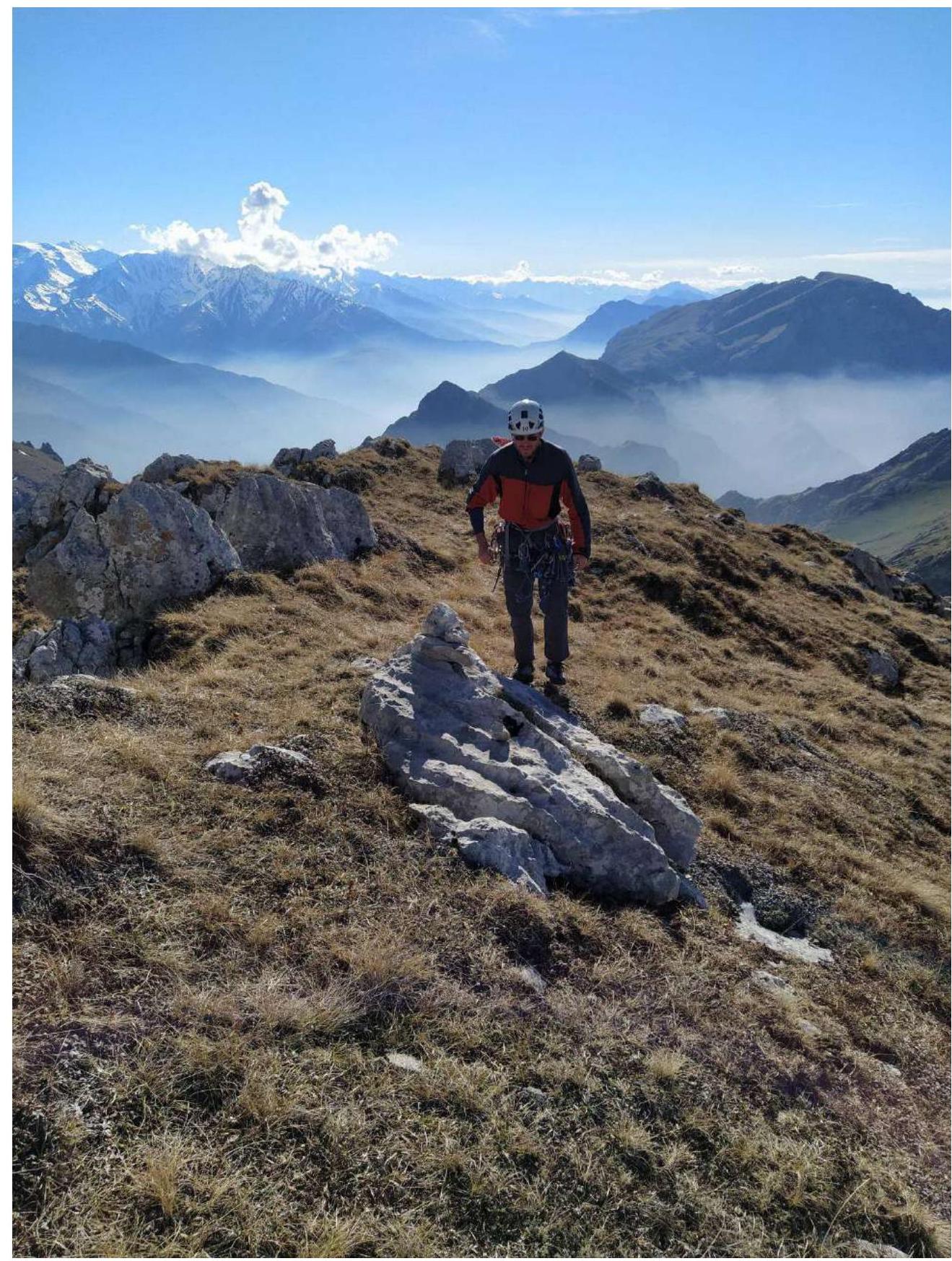
Photo 17. View of the ridge from the peak.
3.2. Photo of the team on the peak at the control tour.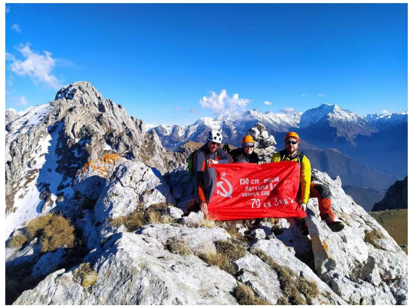
3.3. The route is quite monolithic, while there are "live rocks" on the ledges, the verticality of the route thread and movement along internal corners pose a danger to large groups. We recommend that groups of no more than 4 people undertake the route. There are sections where the leader must wait for other team members to pass under them. The terrain allows for all types of belay points (anchor hooks, medium and large nuts, medium and large friends). All stations are on convenient ledges. The descent path from the route is simple, from the peak to the tents on the pass takes about 1 hour. Descent from the ridge (before peak Novichok) into the scree couloir via rappel for the entire length of the rope – 50 m. Communication from the route with the "Kyazi" camp may be absent; we communicated through groups on other routes. We evaluate the route as a complex category 3B or 4A.