
Report
ON THE FIRST ASCENT TO THE SUMMIT OF TSEY-LOAM (KYAZI) VIA THE SOUTHERN BUTTRESS ROUTE 2B cat. diff. BY THE TEAM OF THE MOUNTAINEERING CAMPS MANAGEMENT FOR THE PERIOD FROM NOVEMBER 1, 2021 TO NOVEMBER 1, 2021
I. Ascent Passport
| №№ | 1. General Information | |
|---|---|---|
| 1.1 | Full Name, Sports Rank of the Leader | Utyashev Yuri Anatolyevich, 2nd sports rank |
| 1.2 | Full Name, Sports Rank of the Participants | Bobrinsky Konstantin Igorevich, 2nd sports rank |
| 1.3 | Full Name of the Coach | Yakovenko Alexander Nikolayevich |
| 1.4 | Organization | Mountaineering Camps Management |
| 2. Characteristics of the Ascent Object | ||
| 2.1 | Region | Caucasus, from the Kreстовый Pass to the Shaviklde peak |
| 2.2 | Valley | Armkhi |
| 2.3 | Section Number according to the 2013 Classification Table | 53 |
| 2.4 | Name and Height of the Summit | Tsey-Loam (Kyazi main) 3171 m |
| 3. Characteristics of the Route | ||
| 3.1 | Route Name | via the southern buttress |
| 3.2 | Proposed Category of Difficulty | 2B |
| 3.3 | Degree of Route Exploration | First Ascent |
| 3.4 | Terrain Type of the Route | Rock |
| 3.5 | Height Difference of the Route (altimeter or GPS data) | 555 m |
| 3.6 | Route Length (in meters) | 1190 m |
| 3.7 | Technical Elements of the Route (total length of sections of different cat. diff. with terrain type) | I cat. diff. rocks — 500 m. II cat. diff. rocks — 550 m. III cat. diff. rocks — 55 m. IV cat. diff. rocks — 20 m. Dülfer descent (on descent) — 65 m. |
| 3.8 | Descent from the Summit | Via 2B cat. diff. to the Kyazi alpine camp |
| 3.9 | Additional Route Characteristics | No water in summer |
| 4. Characteristics of the Team's Actions | ||
| 4.1 | Time of Movement (team's walking hours, in hours and days) | 10 hours |
| 4.2 | Overnights | None |
| 4.3 | Departure onto the Route | 5:00, November 1, 2021 |
| 4.4 | Reaching the Summit | 12:00, November 1, 2021 |
| 4.5 | Return to the Base Camp | 15:00, November 1, 2021 |
| 5. Responsible for the Report | ||
| 5.1 | Full Name, e-mail | Utyashev Yu.A. utashev@mail.ru |
II. Ascent Description
1. Characteristics of the Ascent Object
1.1. General Photo of the Summit
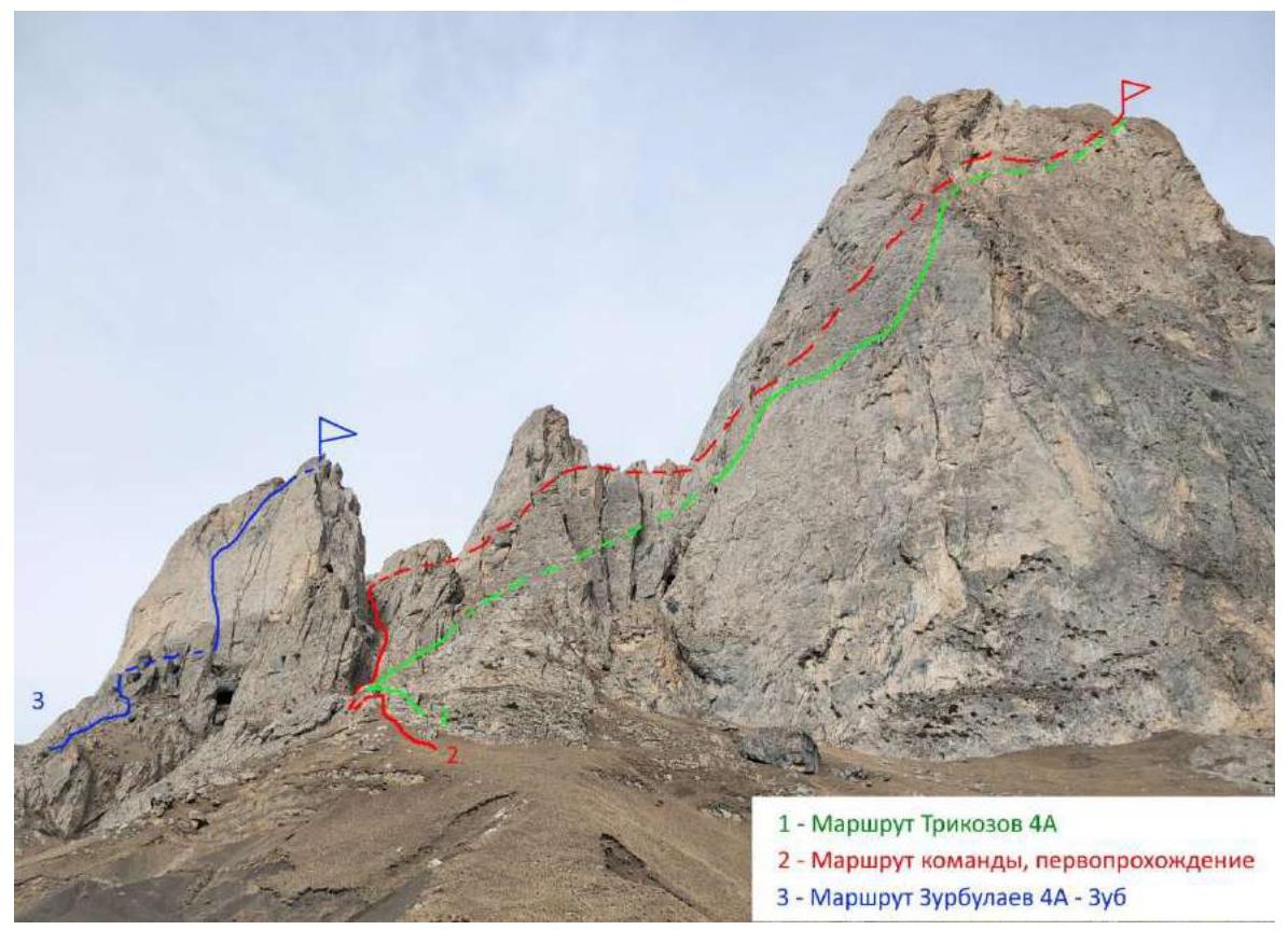
Fig. 1a. Photo from the approach from the base camp.
1.2. Photo of the Route Profile
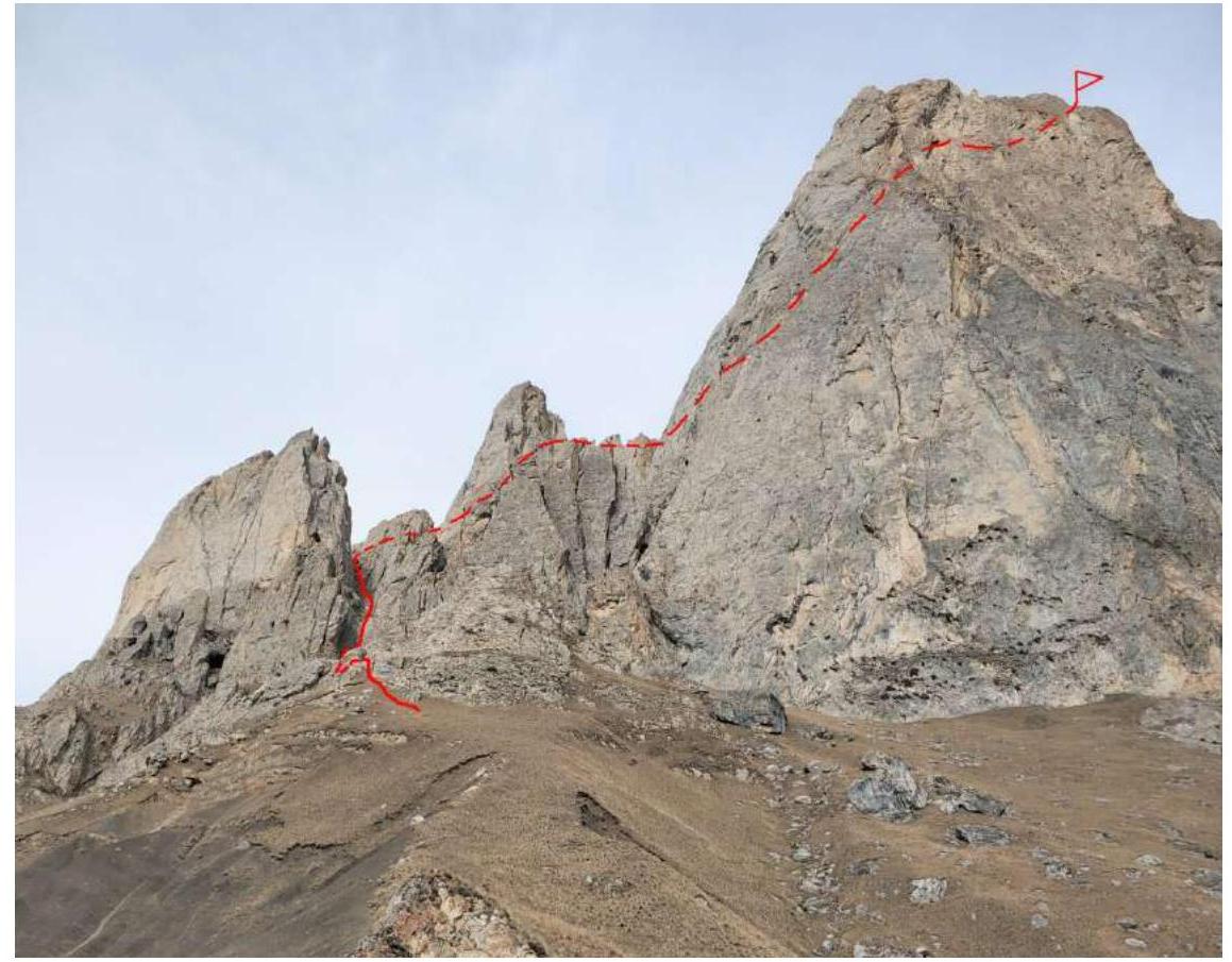
Fig. 1b. Photo from the approach from the base camp.
2. Characteristics of the Route
2.1. Technical Photograph
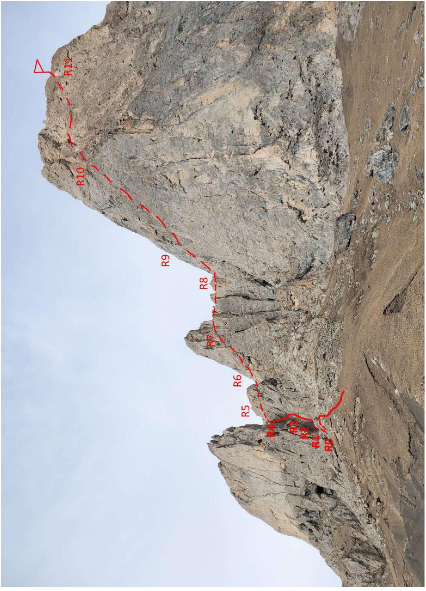
Fig. 1c. Photo from the approach from the base camp. Route diagram in UIAA symbols.
| Anchors | Friends (placements) | UIAA Symbols | Section Description |
|---|---|---|---|
| R11 | R10–R11 — bypassing a large genre de passage on the right along the slope and exit to the summit. | ||
| 1 station on a loop, 1 piton | R10 | R9–R10 — along the ridge to the 2nd genre de passage, then along the snowy oblique shelf on the left side of the genre de passage to the isthmus, movement in crampons, organization of belays. | |
| R9 | R8–R9 — bypassing the genre de passage through the upper part along the ledges. | ||
| R8 | R7–R8 — to the right 100 m along the grassy slope along the ridge past the "Sanctuary" grotto to the isthmus. | ||
| R7 | R6–R7 — up to the left 50 m along the scree to the ridge. | ||
| 1 station on a loop | R6 | R5–R6 — 25 m of climbing category 3 along the smooth rocks in the chimney, 45°, station on a rock. | |
| R5 | R4–R5 — 100 m traverse from the isthmus to the chimney with smooth rocks. At the beginning, simple climbing category 2. | ||
| R4 | R3–R4 — 100 m into the left couloir along the steep grassy slope to the isthmus. Landmark — orange tooth. | ||
 | R2–R3 — passage of the third chimney with a cork — 20 m of climbing category 3, 50°. Station on a rock. | ||
| 1 station on a loop | 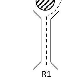 | R1–R2 — passage of the second chimney with a cork — 10 m of climbing category 3, 60°. Station on a rock. | |
| 3 anchors | 1 sand hourglass, 1 station on a loop | 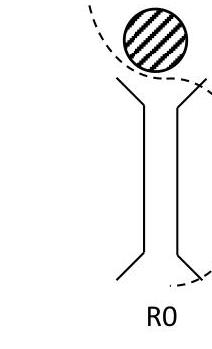 | R0–R1 — passage of the chimney with a cork — 20 m of climbing category 4, 50–70°, station under the rock (cork), sand hourglass or above it. Key to the route. |
UIAA Symbols
| λ | Sanctuary | □ | Summit |
|---|---|---|---|
| ~ | Sheep's foreheads | ++ | Snow, ice |
| ±± | Grass | × | Pitons |
| ○○ | Scree | ∅ | Cork |
| ∧ | Genre de passage | ~ | Chimney |
| □ | Shelf | --------- | Route line |
| TTTTTTTT | Ridge |
2.2. Section Numbers
Fig. 2. Section R0–R1. Key to the route.
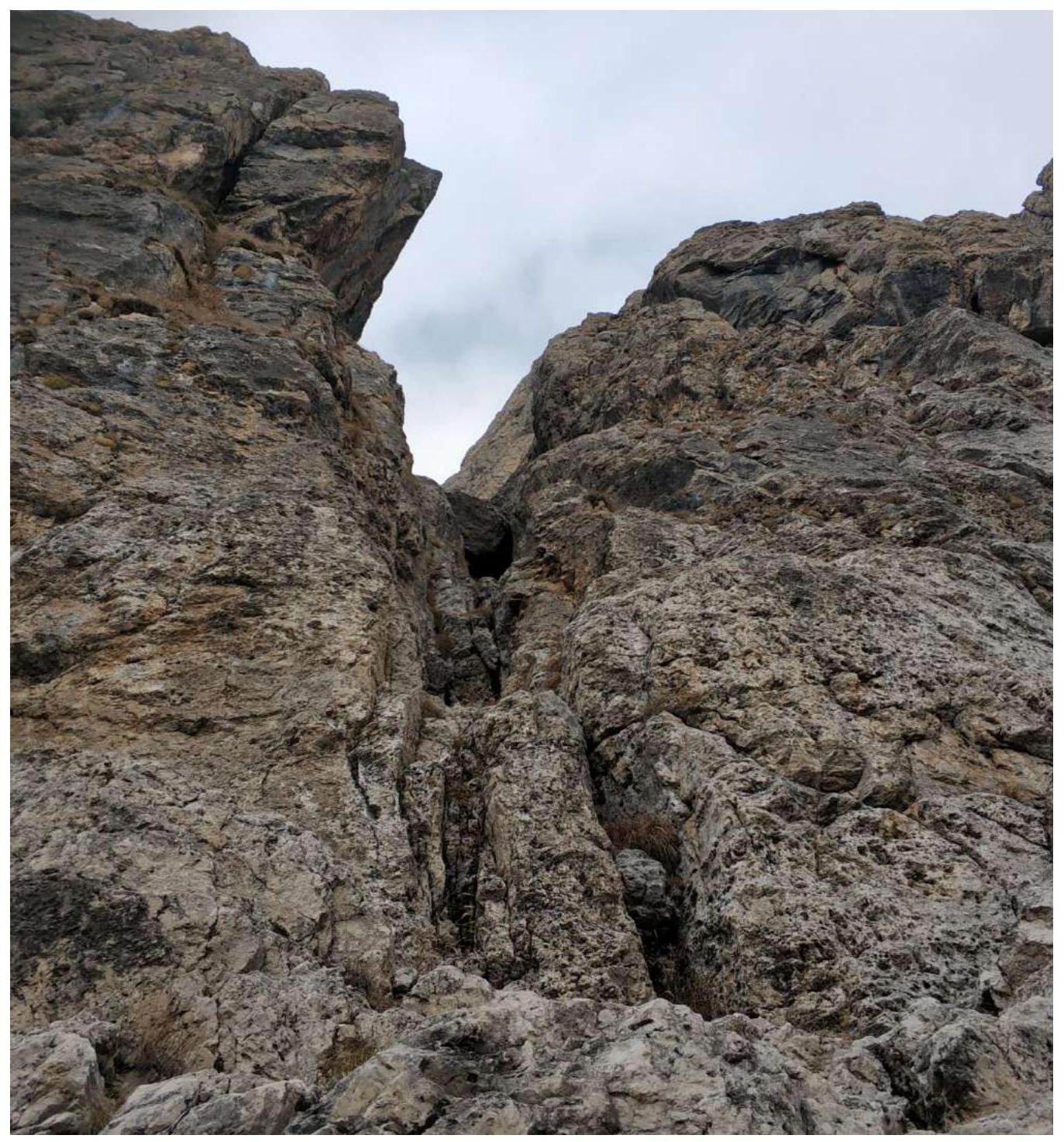
Fig. 3. Section R1–R2.
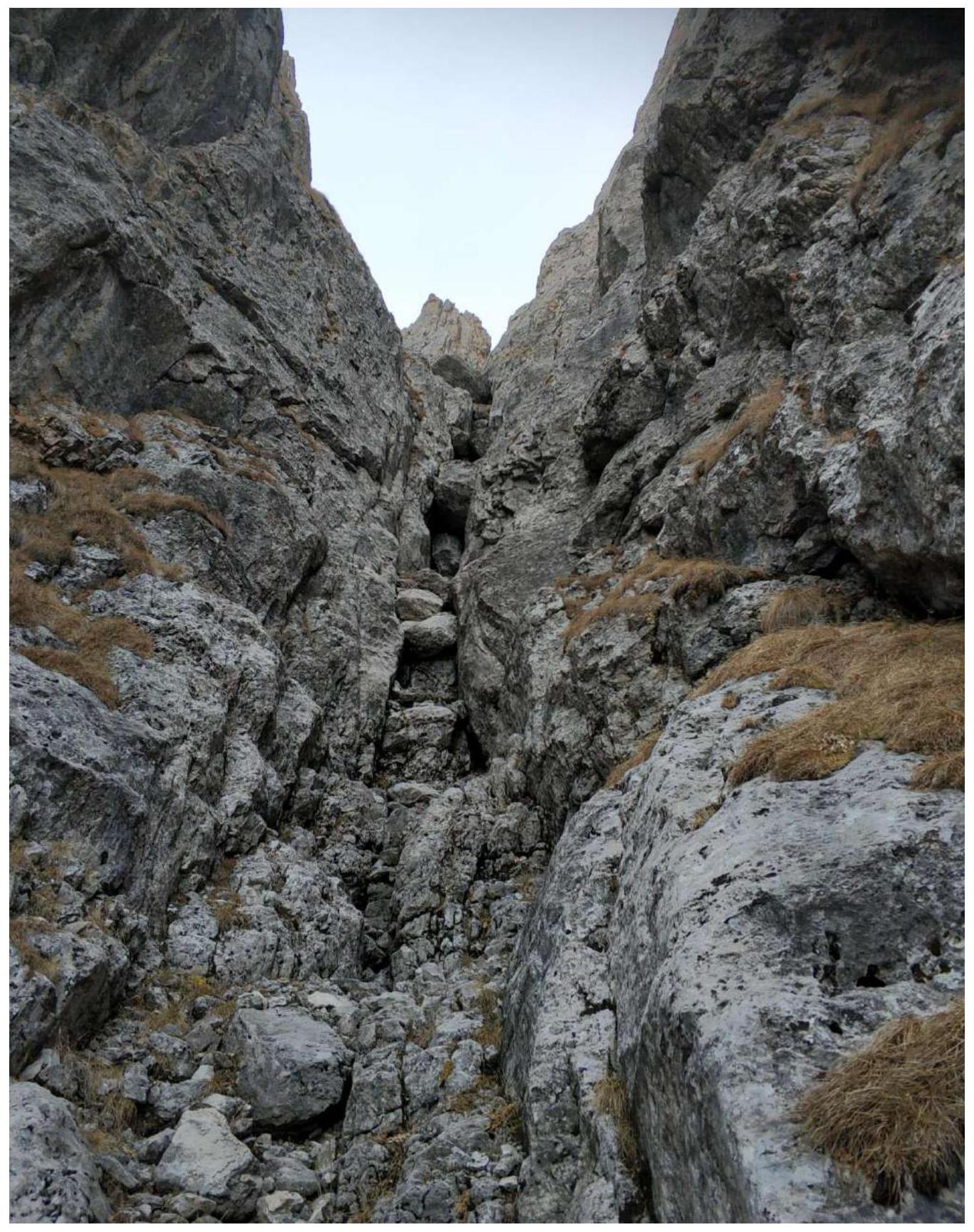
Fig. 4. Section R2–R3. View from above.
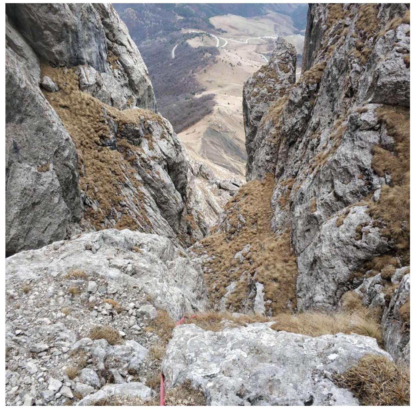
Fig. 5. Section R3–R4.
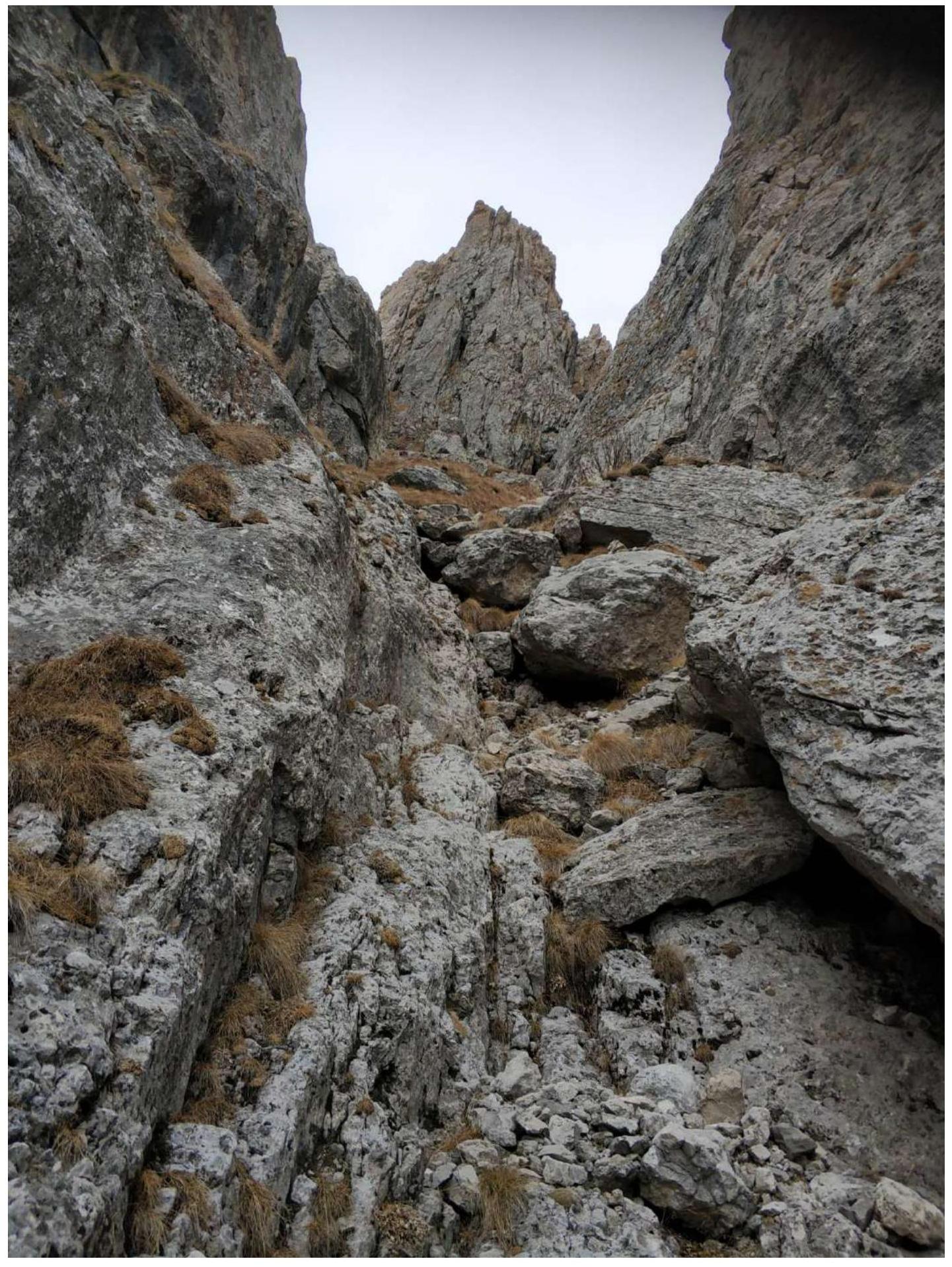
Fig. 6. Sections R4–R8. Traverse from the isthmus to the ridge.

Fig. 7. Section R5–R6.
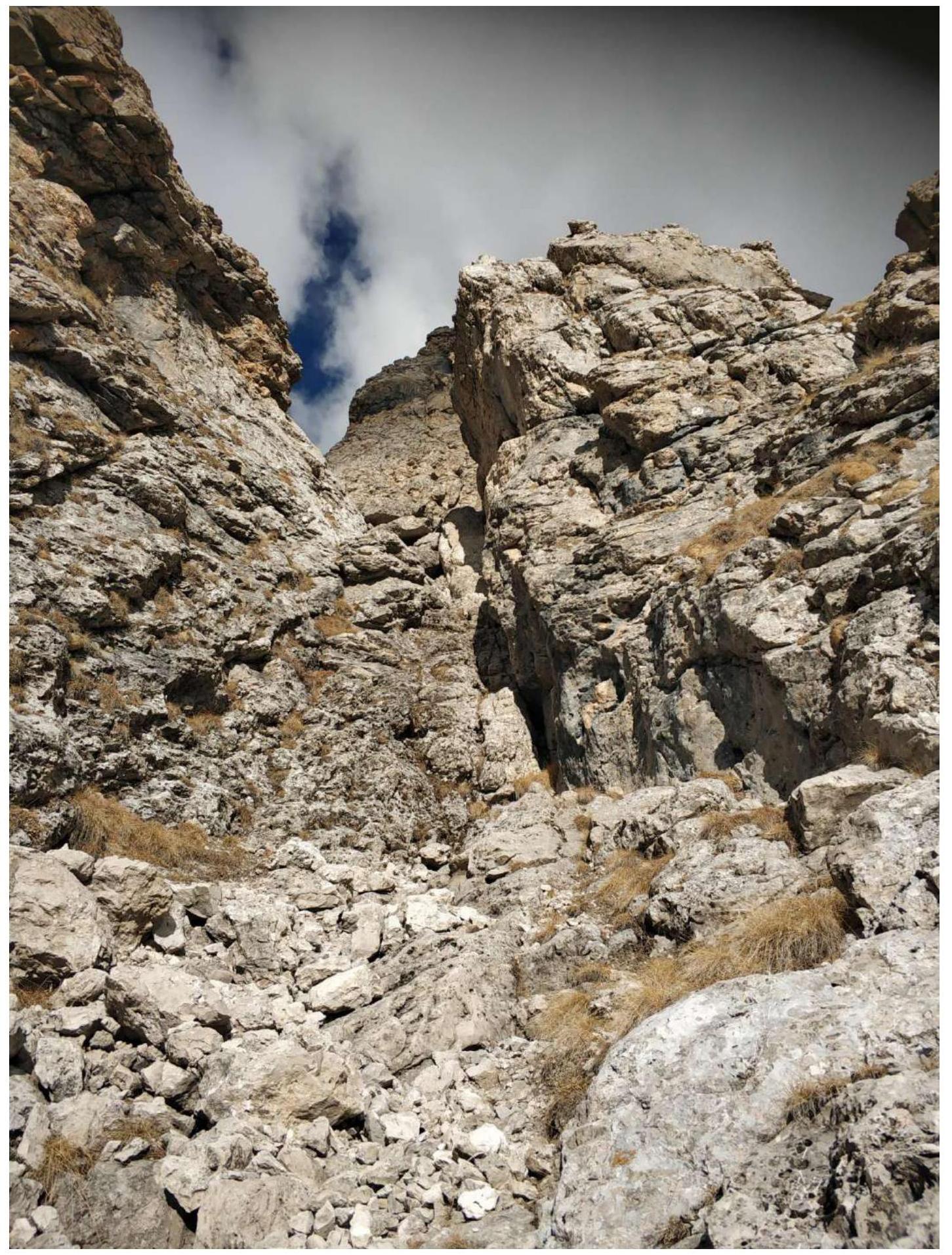
Fig. 8. Section R6–R7. View from above — to the isthmus at the tooth (R4).
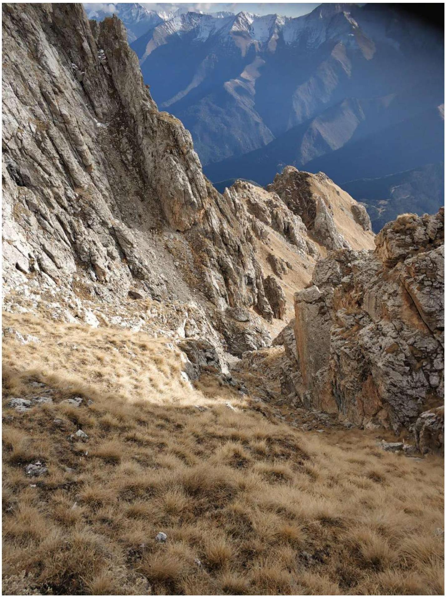
Fig. 9. Section R7–R8. Traverse along the ridge.
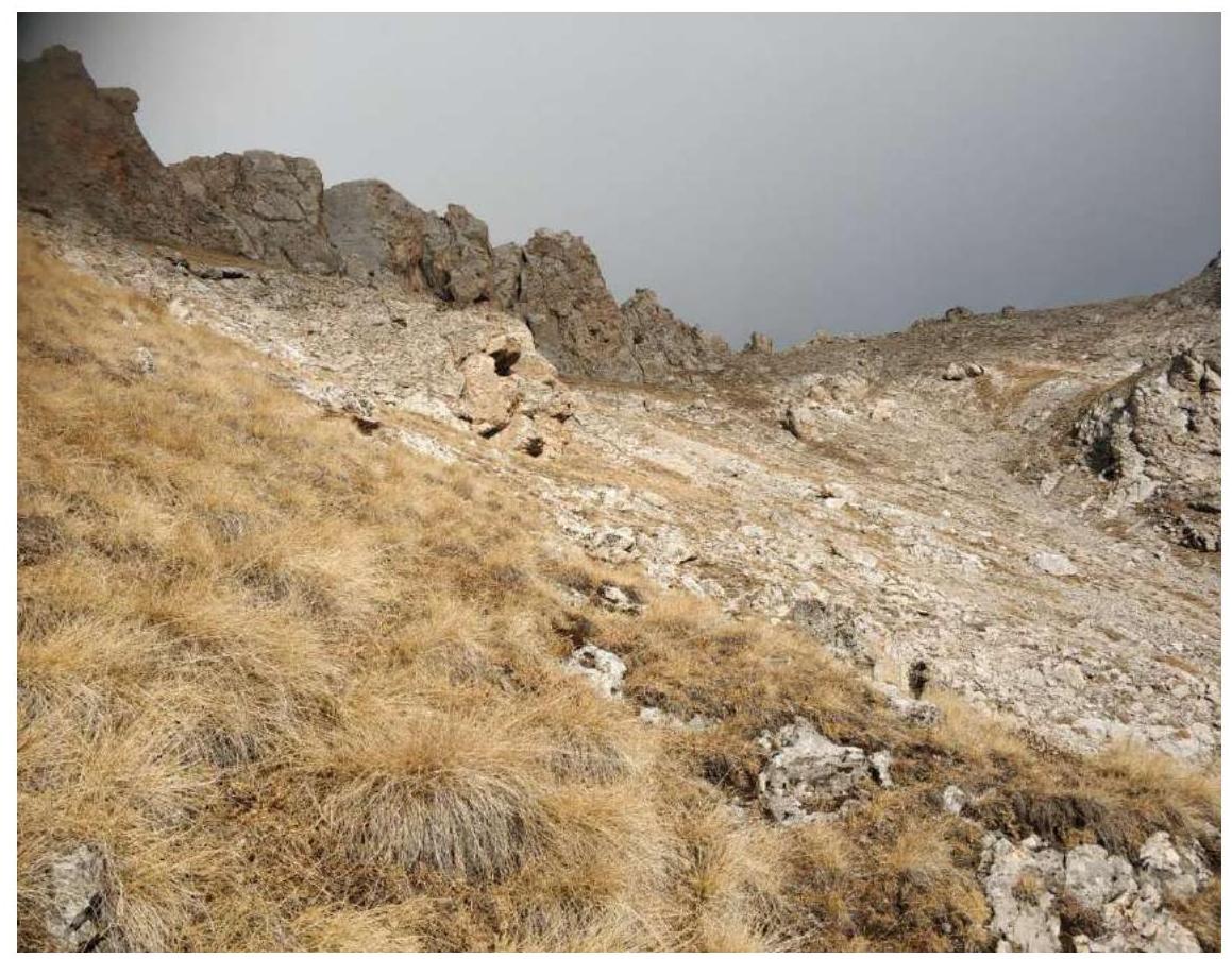
Fig. 10. Section R8–R11. Traverse along the ridge.
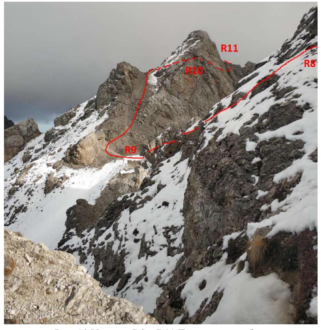
Fig. 11. Section R9–R10. Oblique shelf.
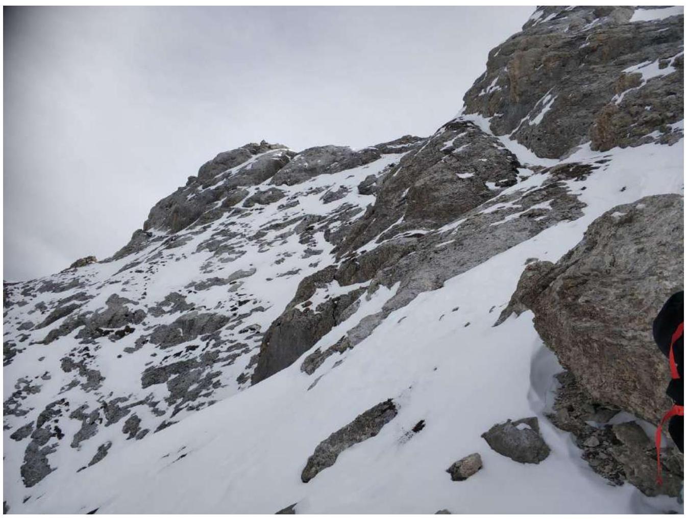
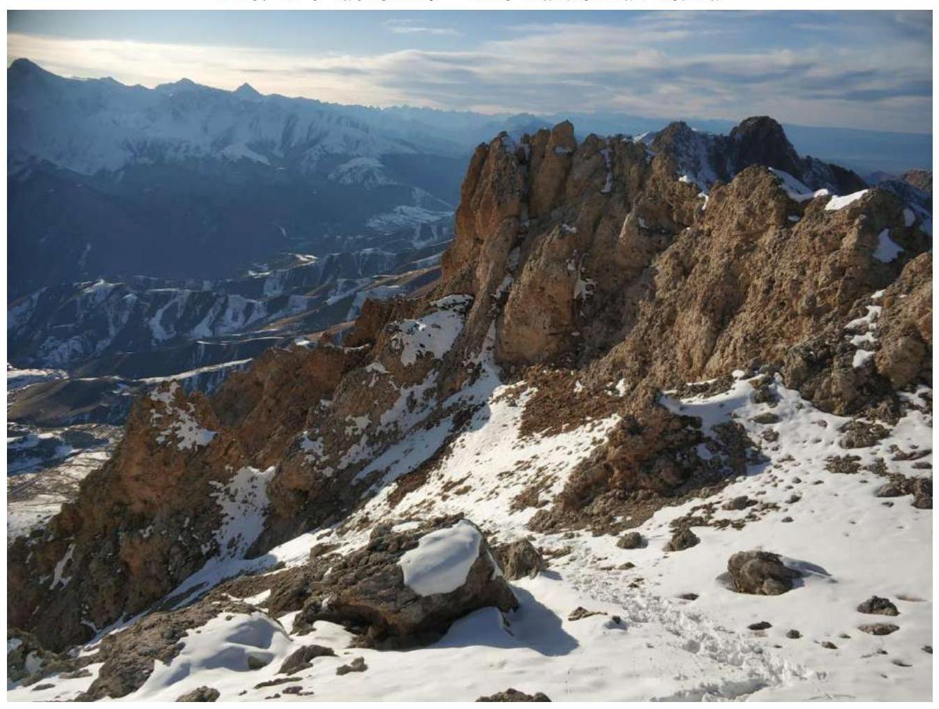
Fig. 12. Section R10–R11. View from the summit.
2.3. Technical Characteristics of the Route Sections
| Section № | Terrain Type | Cat. diff. | Length, m | Steepness, ° | Type and Number of Anchors |
|---|---|---|---|---|---|
| R0–R1 | Chimney with a cork | 4 | 20 | 50–70 | 3 anchors, 1 sand hourglass, 1 station on a loop |
| R1–R2 | Chimney with a cork | 3 | 10 | 60 | 1 station on a loop |
| R2–R3 | Chimney with a cork | 3 | 20 | 50 | 1 station on a loop |
| R3–R4 | Scree, grass, isthmus | 2 | 300 | 45 | 0 |
| R4–R5 | Rocks, grass | 1 | 300 | 10 | 0 |
| R5–R6 | Chimney with a cork, smooth rocks | 3 | 25 | 50 | 1 station on a loop |
| R6–R7 | Scree, grass | 2 | 50 | 35 | 0 |
| R7–R8 | Scree, grass | 1 | 100 | 10 | 0 |
| R8–R9 | Simple destroyed inclined slabs (rocks) | 2 | 100 | 35–40 | 0 |
| R9–R10 | Ridge, oblique shelf | 2 | 100 | 45–50 | 1 station on a loop, 1 piton |
| R10–R11 | Scree, grass | 1 | 100 | 100 | 0 |
3. Characteristics of the Team's Actions
3.1. Brief Description of the Route Passage
| Section № | Description | Photo № |
|---|---|---|
| R0–R1 | Overcome the chimney on the right along the wall, then under the cork, move to the left wall of the chimney, the cork is bypassed on the left. | Fig. 2 |
| R1–R2 | Overcome the chimney with a cork, station on a rock. | Fig. 3 |
| R2–R3 | Overcome the chimney on the left along the wall, station on a rock. | Fig. 4 |
| R3–R4 | Along the grassy slope up into the left couloir, exit to the isthmus. Simultaneous movement. | Fig. 5 |
| R4–R5 | Traverse along the slope, at the beginning simple rocks climbing. Simultaneous movement. | Fig. 6 |
| R5–R6 | Overcome the chimney with a cork, station on a rock. | Fig. 7 |
| R6–R7 | Along the scree up to the grassy slope. Simultaneous movement. | Fig. 8 |
| R7–R8 | Traverse to the right along the grassy slope along the ridge to the isthmus. Simultaneous movement. | Fig. 9 |
| R8–R9 | Up, then down along the inclined slabs to the isthmus. Alternating movement. | Fig. 10 |
| R9–R10 | Along the ridge to the oblique snowy shelf. Overcoming the shelf with alternating movement, organization of belays on the piton at the end of the shelf. | Fig. 11 |
| R10–R11 | Bypass the rocks on the ridge on the right and continue simultaneous movement along the couloirs to the summit. | Fig. 12 |
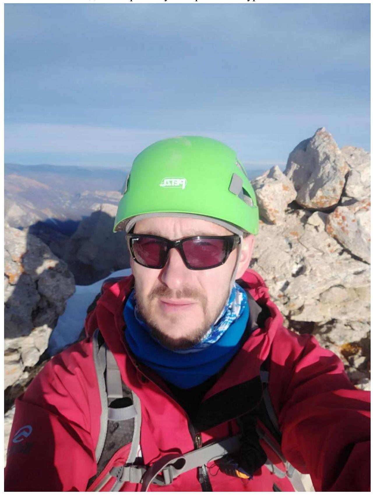
3.2. Photo of the Team on the Summit at the Control Tour
3.3. Route Safety Assessment
Route safety is satisfactory. Some sections, such as R1–R2, R2–R3, and R5–R6, have scree in the upper part — are rockfall-prone. Careful movement is required.
R9–R10 — in case of snow, movement in crampons is recommended, organization of belays.
Communication Options on the Route
In the couloirs — radio communication. On the ridge and summit — cellular and radio communication.
Recommendations for Subsequent Climbers
On snowy and steep grassy slopes, movement in crampons with ice axe insurance is recommended.
On the R7–R8 section, there is a "Sanctuary" grotto, where you can:
- organize a bivouac;
- shelter from bad weather.
Detailed Information on the Descent from the Summit with Landmark Indications
Descent from the summit — via the ascent route. On the R5–R6 section — Dülfer descent 25 m. On the R2–R3 section — Dülfer descent 20 m. On the R1–R2 section — Dülfer descent 10 m. On the R0–R1 section — Dülfer descent 20 m.
Conclusion on the Preliminary Route Assessment
Compared to the classified routes of the same cat. diff. in the experience of ascents of the team members, this route is assessed by us as 2B and fully meets its category.
Comments
Sign in to leave a comment