
Report
ON THE FIRST ASCENT TO THE SUMMIT CEЙ–ЛОАМ (КЯЗИ) VIA THE RIGHT COULOIR OF THE WESTERN RIDGE, CATEGORY 2A, BY THE TEAM OF THE MOUNTAINEERING CAMPS MANAGEMENT FOR THE PERIOD FROM 18:00 ON JANUARY 18, 2022 TO 18:00 ON JANUARY 18, 2022
I. Climbing Report
| № | 1. General Information | |
|---|---|---|
| 1.1 | Name, sports rank of the leader | Yаковенко Alexander Nikolаevich, Master of Sports |
| 1.2 | Name, sports rank of the participants | Yаковенко A. N., Master of Sports, Enatskiy A. N., 1st sports rank, Kergin I. V., 2nd sports rank, Kotiev A. A., Badge, Ramazanov I. B., Badge, Azamatov R. A., Badge, Altaev I. A., Badge, Tsindeliani B. O., Badge |
| 1.3 | Name of the coach | Yаkovenko Alexander Nikolаevich, Master of Sports |
| 1.4 | Organization | Mountaineering Camps Management |
| 2. Characteristics of the Climbing Object | ||
| 2.1 | Region | 2.9. From the Krestoviy Pass to the Shaviklde peak |
| 2.2 | Valley | Armhi |
| 2.3 | Number according to the 2013 classification table | 53 |
| 2.4 | Name and height of the summit | Tsey-Loam (Kyazi), 3171 m |
| 2.5 | Geographic coordinates of the summit (latitude/longitude), GPS coordinates | – |
| 3. Characteristics of the Route | ||
| 3.1 | Name of the route | Via the right couloir of the Western Ridge |
| 3.2 | Proposed category of difficulty | 2A |
| 3.3 | Degree of route exploration | First ascent |
| 3.4 | Nature of the route terrain | Rocky |
| 3.5 | Elevation gain (data from altimeter or GPS) | 543 m |
| 3.6 | Route length (in meters) | 1632 m |
| 3.7 | Technical elements of the route (total length of sections of varying difficulty with indication of terrain type: ice-snow, rocky) | Category I rocky terrain — 1515 m. Category II rocky terrain — 95 m. Category III rocky terrain — 29 m. Category IV rocky terrain — 0 m. Rappelling (on descent) — 25 m. |
| 3.8 | Descent from the summit | Via the ascent route |
| 3.9 | Additional characteristics of the route | No water available |
| 4. Characteristics of the Team's Actions | ||
| 4.1 | Time of movement (team's walking hours, in hours and days) | 1 day, 12 hours |
| 4.2 | Overnight stays | No |
| 4.3 | Departure on the route | 7:00, January 18, 2022 |
| 4.4 | Arrival at the summit | 14:30, January 18, 2022 |
| 4.5 | Return to the base camp | 19:20, January 18, 2022 |
| 5. Person responsible for the report | ||
| 5.1 | Name, e-mail | Ivan.kergin@mail.ru |
II. Description of the Ascent
1. Characteristics of the Climbing Object
1.1. General photo of the summit
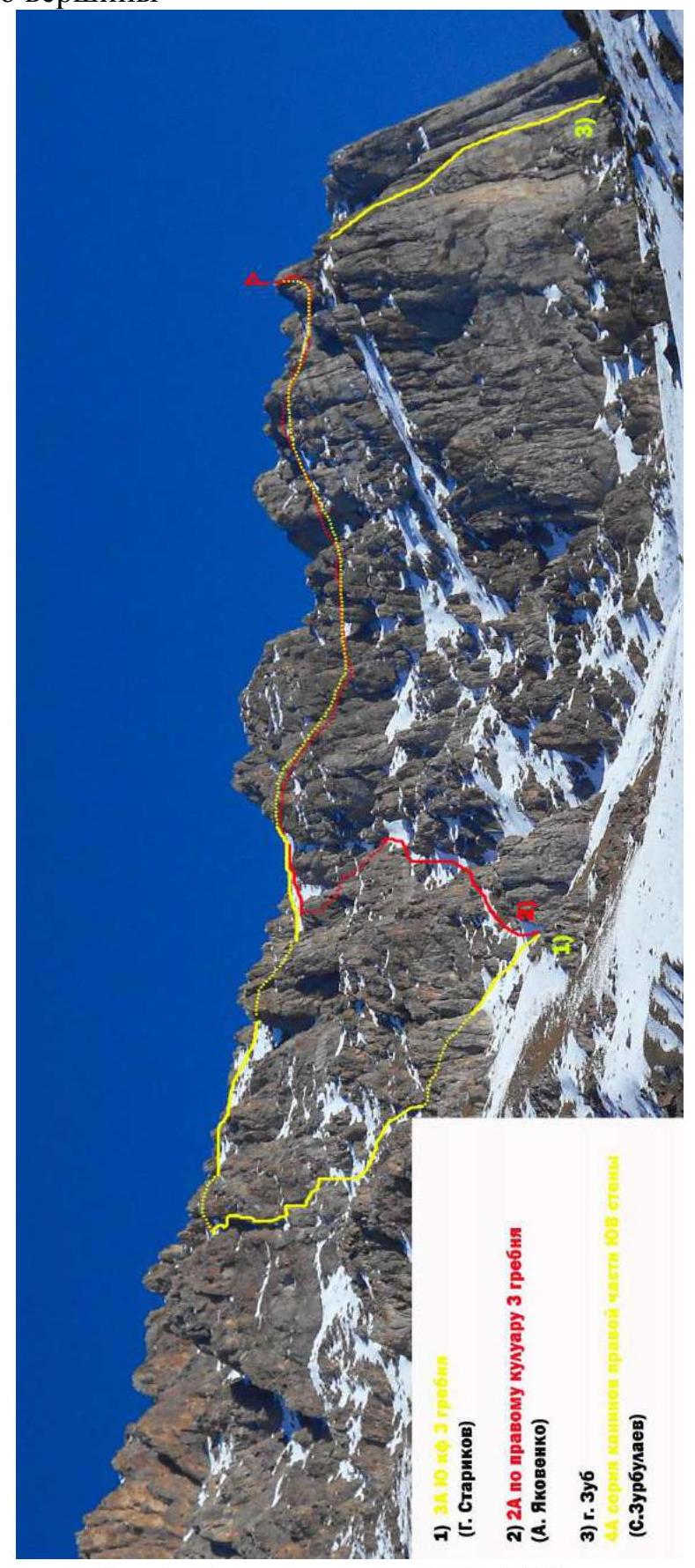
Fig. 1. Photo from the road on January 10, 2022
- ЗА НЮ кф 3 гребня (G. Starikov)
- 2А по правому кулуару 3 гребня (A. Yakovenko)
- g. Zub 4А серия канинов правой части ЮВ стены (S.Zurbulayev)
1.2. Photo of the route profile
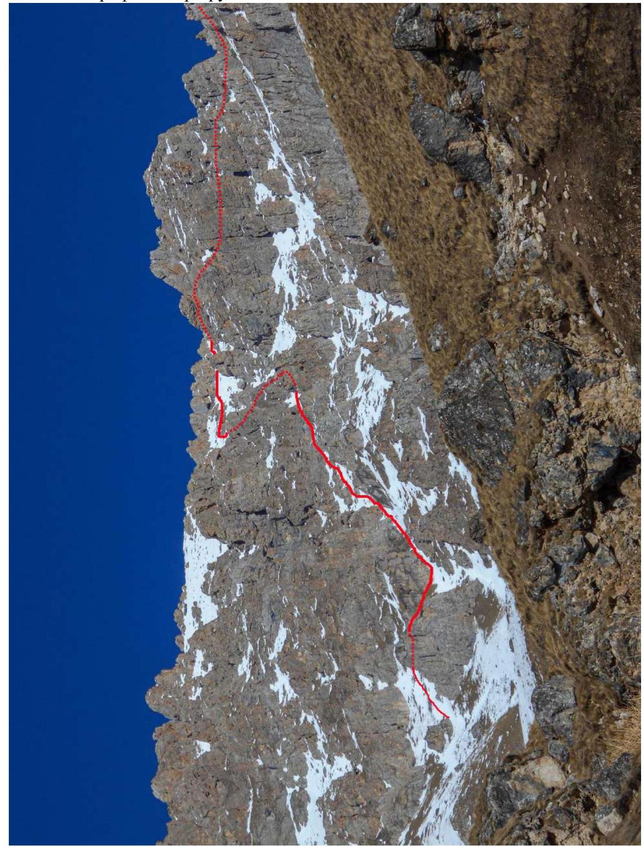
Fig. 2а. Photo from the road on January 13, 2022
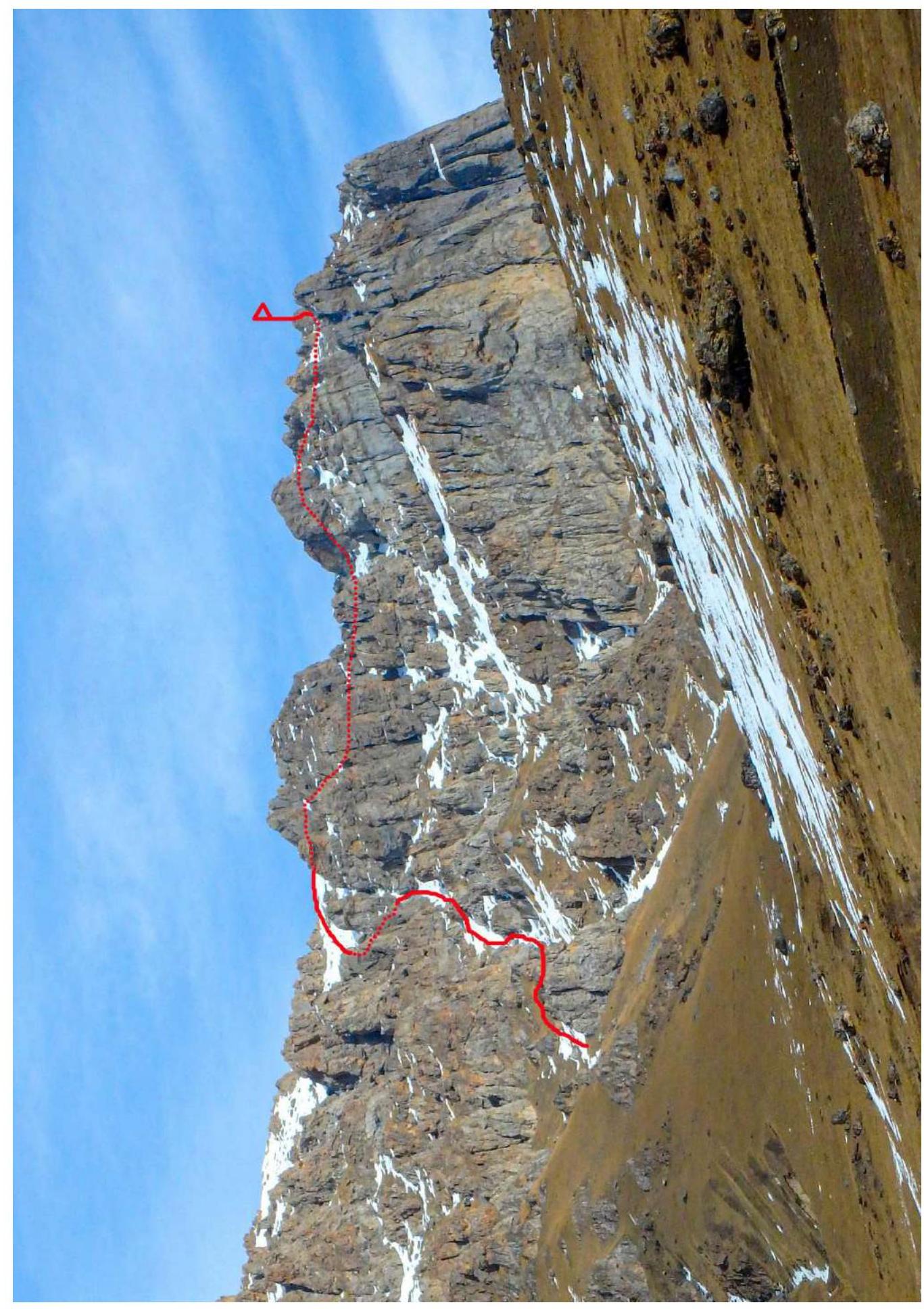
Fig. 2б. Photo from the road on December 13, 2021
2. Characteristics of the Route
2.1. Technical photograph
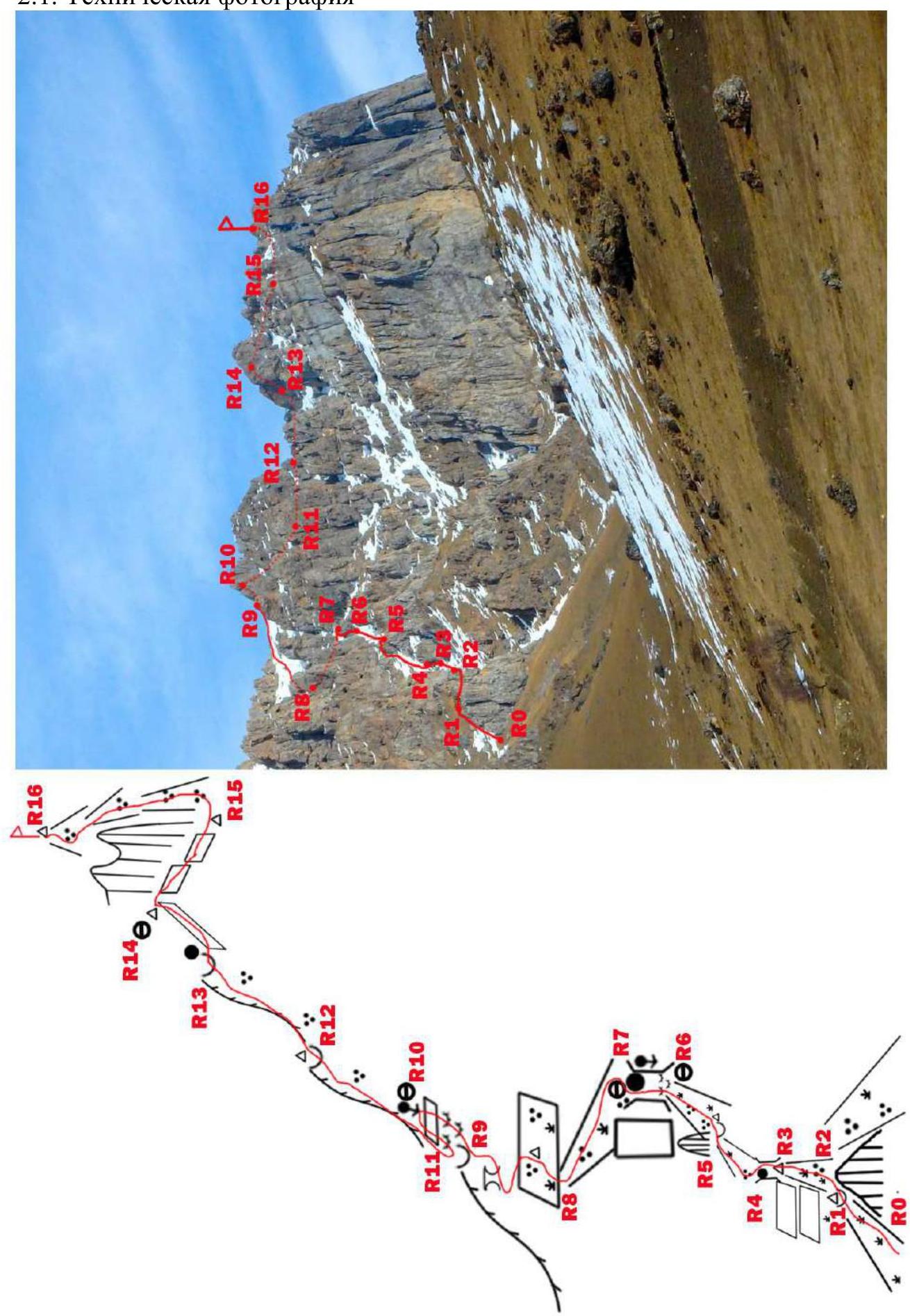
Fig. 3. Photo from the road where the monument to border guards is located
2.2. Section numbers
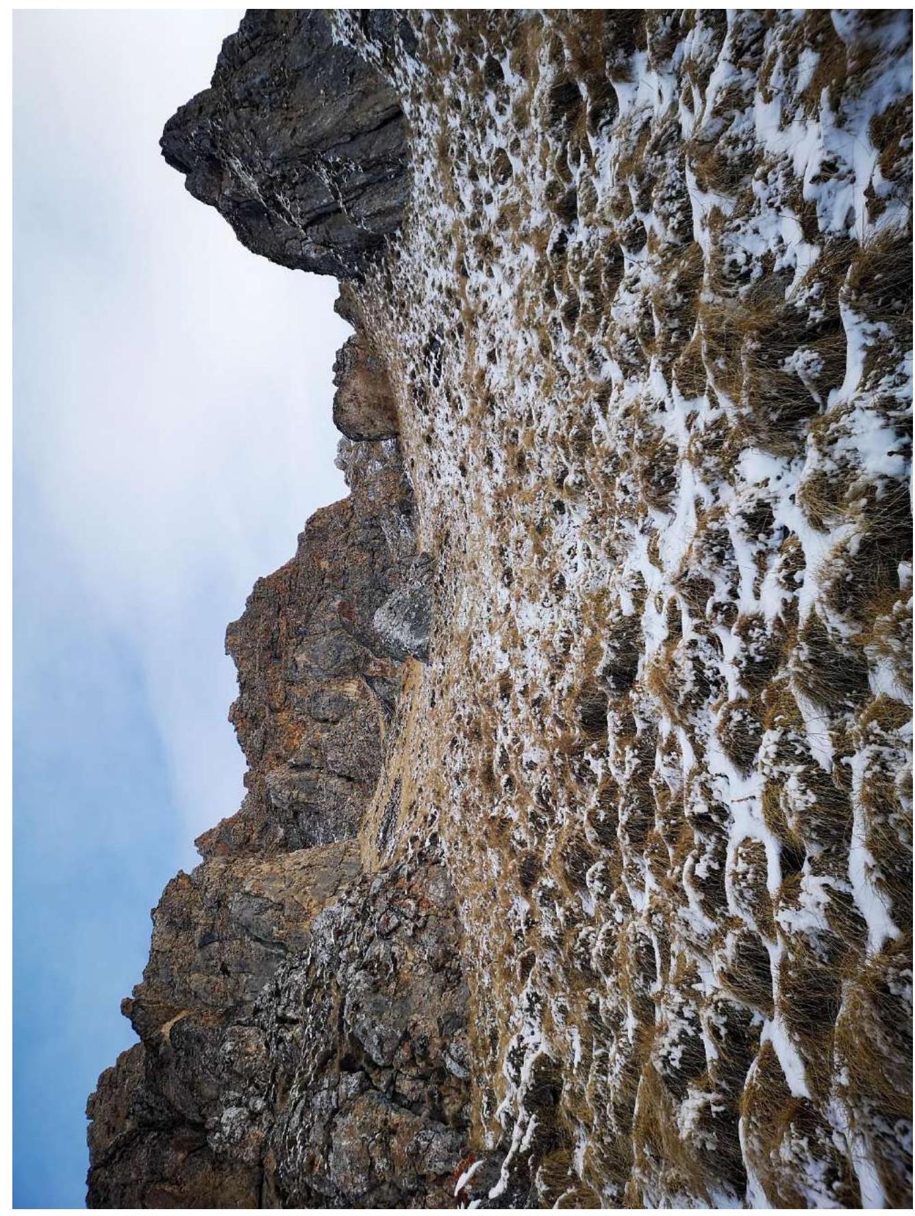
Fig. 4а. Section R0–R1
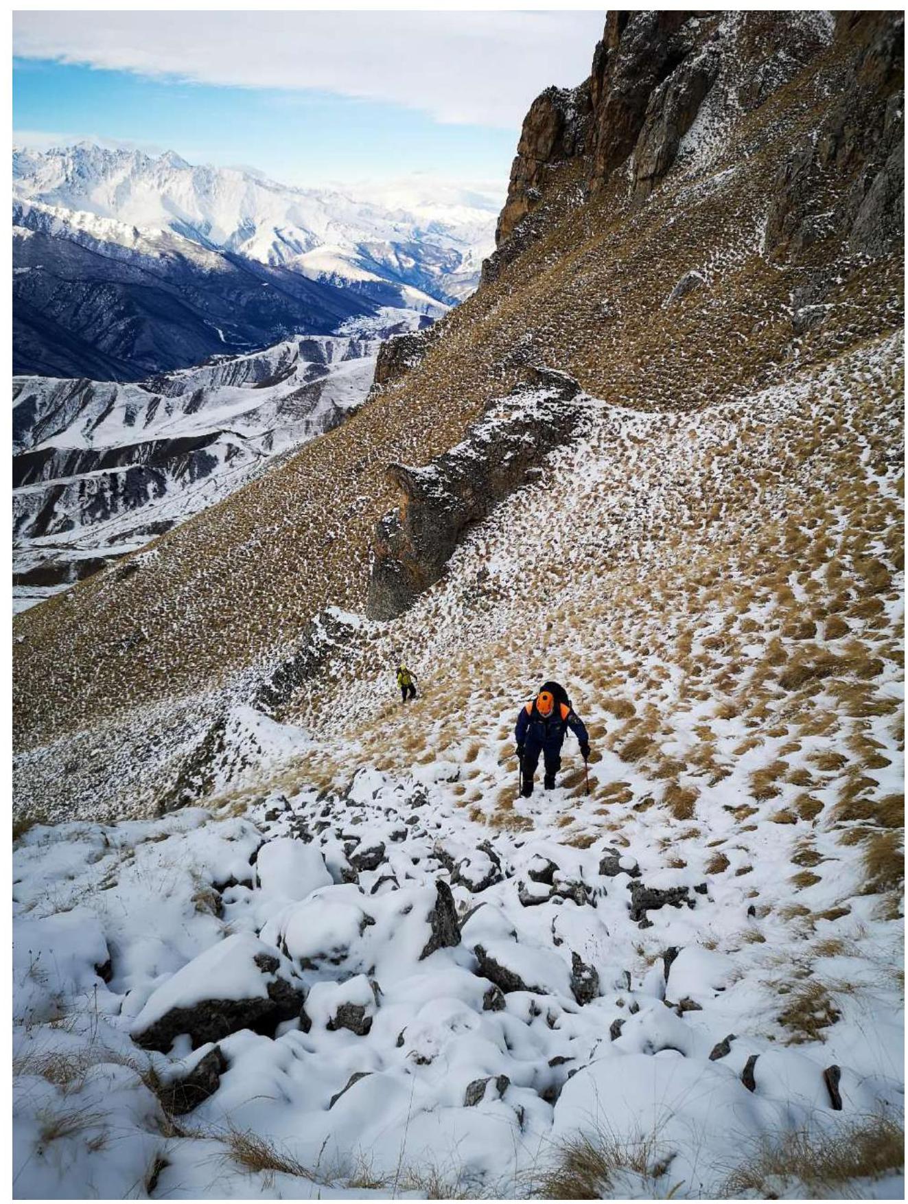
Fig. 4б. Section R0–R1. Photo from the saddle ...
2.3. Technical characteristics of the route sections
| Section | Terrain characteristics | Category of difficulty | Length, m | Steepness, ° | Type and number of pitons |
|---|---|---|---|---|---|
| R0–R1 | Grass | 1 | 120 | 35 | 0 |
| R1–R2 | Grass | 1 | 50 | 0 | 0 |
| ... | ... | ... | ... | ... | ... |
3. Characteristics of the Team's Actions
3.1. Brief description of the route passage
| Section | Description | Photo number |
|---|---|---|
| R0–R1 | Approach the triangular obelisk and go around it on the left, then ascend via the couloir to the saddle where an intermediate cairn is built. Simultaneous movement. | Fig. 4а, 4б |
| R1–R2 | From the saddle, traverse to the next couloir. Simultaneous movement. | Fig. 5а, 5б |
| ... | ... | ... |
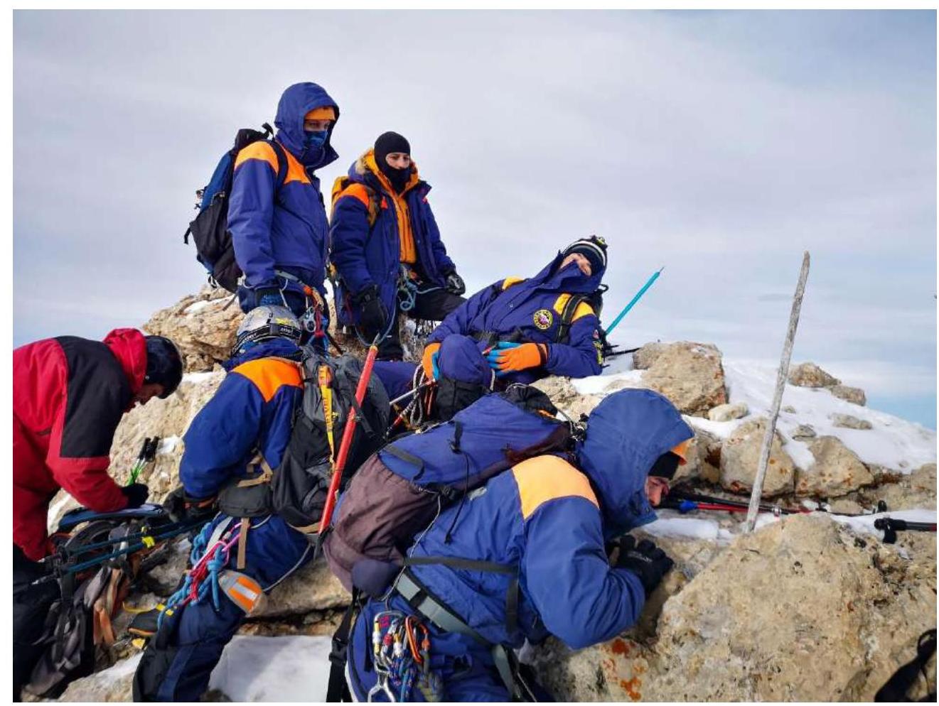
3.2. Photo of the team at the summit near the control cairn
3.3. Assessment of route safety:
The safety of the route is satisfactory. Certain sections, such as R6–R7, are rockfall-prone and require careful movement. R10–R11 represents smooth, destroyed rocks and is potentially hazardous in case of snow or rain. R13–R14 is the most uncomfortable section of the route in case of snow.
Options for communication on the route:
There is no communication in the couloirs. Cellular and radio communication are available at the summit.
Recommendations for subsequent climbers:
Depending on weather conditions, it is recommended to wear crampons on grassy sections and carry an ice axe. There is also a grotto on section R8–R9 where it's possible to set up a tent.
Detailed information on the descent from the summit with indication of landmarks:
The descent from the summit starts via the ascent route. On section R6–R7, rappel 25 m. Intermediate cairns are encountered throughout the route.
Conclusion on the preliminary assessment of the route:
Compared to classified routes of the same category of difficulty in the team's experience, this route is assessed as 2A and fully corresponds to its category.
Comments
Sign in to leave a comment