
Report
ON THE FIRST ASCENT TO THE SUMMIT OF GIRYAG VIA THE EASTERN RIDGE ROUTE, CATEGORY 1B, BY THE TEAM OF THE MOUNTAINEERING CAMP MANAGEMENT FOR THE PERIOD FROM NOVEMBER 5, 2019 TO NOVEMBER 5, 2019
I. Climbing Report
| № | 1. General Information | |
|---|---|---|
| 1.1 | Full name, sports rank of the leader | Rastorguev Alexander Alekseevich, Master of Sports |
| 1.2 | Full name, sports rank of participants | Belkin Sergey Valentinovich, no rank. Tsyganova Ekaterina Dmitrievna, no rank. Simutin Sergey Romanovich, no rank. Chernyshev Andrey Gennadievich, no rank. |
| 1.3 | Full name of the coach | Rastorguev Alexander Alekseevich |
| 1.4 | Organization | LLC "Mountaineering Camp Management" |
| 2. Characteristics of the Climbing Object | ||
| 2.1 | Region | Caucasus. From the Kreстовый Pass to the Shaviklde peak. |
| 2.2 | Valley | Dzheyrakhskaya |
| 2.3 | Number according to the 2013 classification table | 2.9 |
| 2.4 | Name and height of the summit | Giryag, 2863 m |
| 2.5 | Geographical coordinates of the summit (latitude/longitude), GPS coordinates | 42.84035, 44.79916 |
| 3. Characteristics of the Route | ||
| 3.1 | Route name | Via the Eastern Ridge |
| 3.2 | Proposed category of difficulty | 1B |
| 3.3 | Degree of route development | First ascent |
| 3.4 | Relief characteristics of the route | Rocky |
| 3.5 | Height difference of the route (GPS data) | 278 m |
| 3.6 | Route length | 912 m |
| 3.7 | Technical elements of the route | Steep grassy slope — 480 m. Category 1 grassy slope, rocks, ridge — 360 m. Category 2 rocks — 50 m. "Sport" descent on the route — 10 m. Rappel descent (on descent) — no |
| 3.8 | Descent from the summit | 100 m along the ascent path, category 1. Then down the steep northern grassy slope with a traverse to the right onto the Jarlam Pass. |
| 3.9 | Additional route characteristics | No water |
| 4. Characteristics of the Team's Actions | ||
| 4.1 | Time of movement | 1 day. 5 hours of climbing. |
| 4.2 | Overnights | no |
| 4.3 | Start of the route | 6:20 on November 5, 2019 from the Jarlam Pass |
| 4.4 | Reaching the summit | 11:45 on November 5, 2019 |
| 4.5 | Return to the base camp | 15:30 on November 5, 2019 to the "Kyazi" mountaineering camp |
| 5. Person Responsible for the Report | ||
| 5.1 | Full name, e-mail | Rastorguev A. A. ras@incomtech.ru |
II. Climbing Description
1. Characteristics of the Climbing Object
1.1. General Photo of the Summit
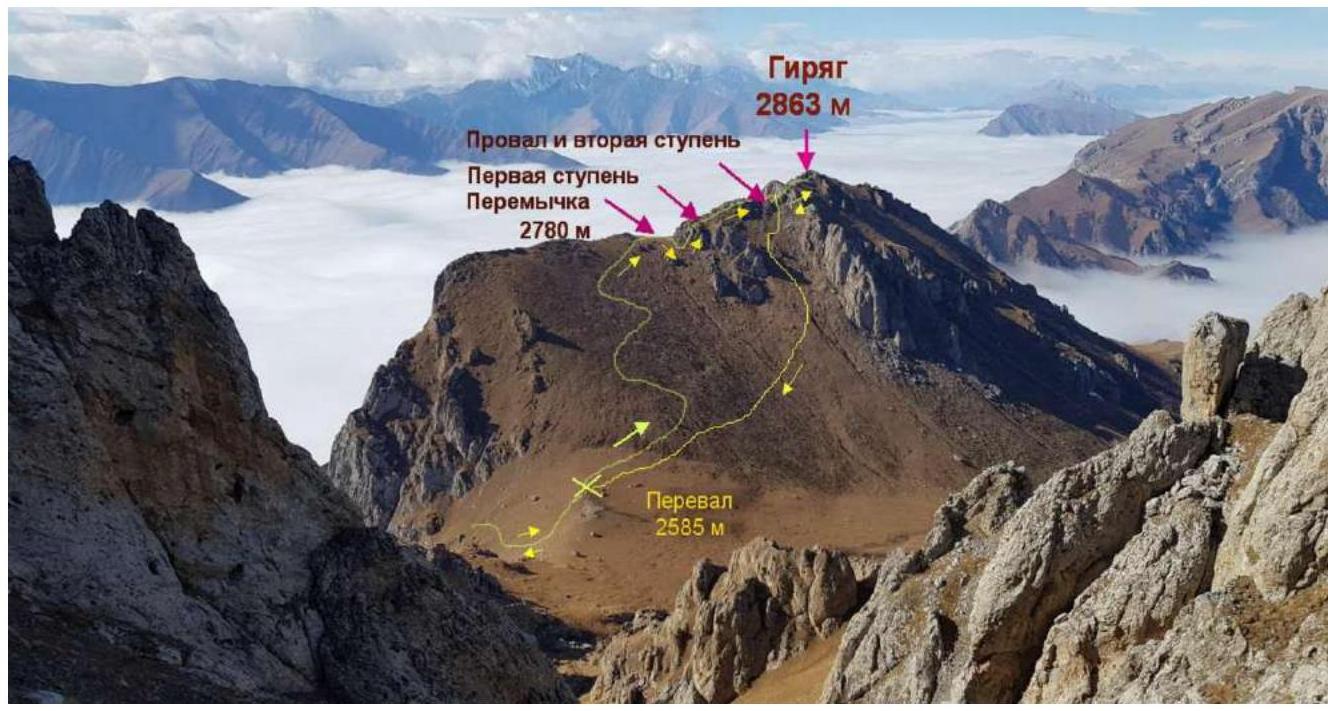
Fig. 1. Team's route. Taken on May 3, 2018 from the slopes of the Jarlam massif.
1.2. Photo of the Route Profile
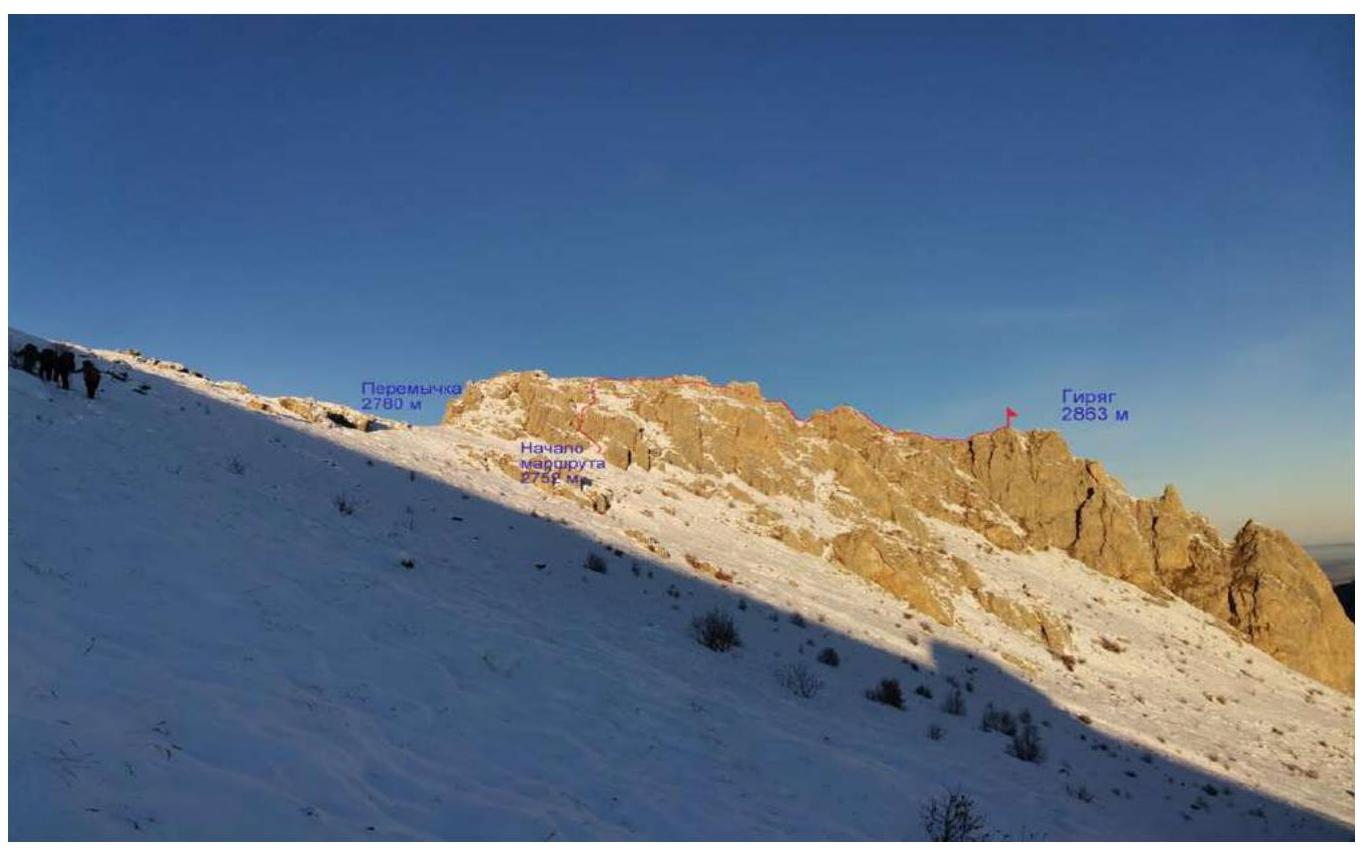
Fig. 2. View of the main part of the route. Taken on November 5, 2019 by S. Belkin.
1.3. Photopanorama of the Area

Fig. 3. View from the summit towards the Main Caucasian Range and the Lateral Range. Taken on November 5, 2019 by S. Belkin.
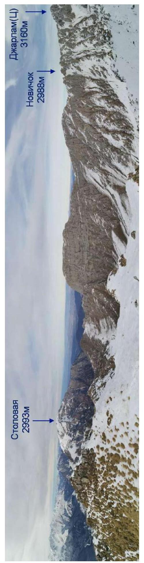
Fig. 4. View from the summit towards the city of Vladikavkaz. Taken on November 5, 2019 by S. Belkin.
1.4. Geographical Location of the Area
The object of the ascent — Mt. Giryag, height 2863 m, is located in the Caucasus mountain system. The rocky ridge (Tsey-Loam ridge) is in the Dzheyrakhsky district of the Republic of Ingushetia.
"...The rocky ridge has a monoclinal structure and a latitudinal orientation. Its southern slope is steep or cliffy, while the northern slope is more gentle. The surface is either rounded and smoothed or has sharp outlines in the form of teeth and pyramids. The highest point of the Rocky Ridge: – on the western segment between the Terek and Assa rivers — Mt. Stolovaya (Myat-Loam, 2993 m); – on the eastern segment — Leymoy-loam (3100 m); – between the Assa river and the sources of the Akkichu river — Mt. Skalistaya (Khakhalgi, 3032 m)."
("Ingush People". — M.: Nauka, 2014. — 509 p.)
Since February 2017, a mountaineering camp of LLC "Mountaineering Camp Management" "Kyazi" has been operating in the area. From Vladikavkaz city, it takes 1–1.5 hours to reach the mountaineering camp by car via the Dzheyrakhskoye valley, or from Nazran city via the Assinskoye valley.
To approach the route from the "Kyazi" mountaineering camp, one needs to drive along the road towards the village of Guli. Before reaching the first house, turn right and continue driving along the dirt road towards the Jarlam Pass. From the mountaineering camp to the start of the trail: – 20 minutes by 4WD vehicle; – or 1.5–2 hours on foot.
Then, ascend to the Jarlam Pass along a good trail. The name of the pass is used as it is commonly known among mountaineers, as it is not marked on available maps as a geographical object. From the start of the trail to the pass — 1.5–2 hours.
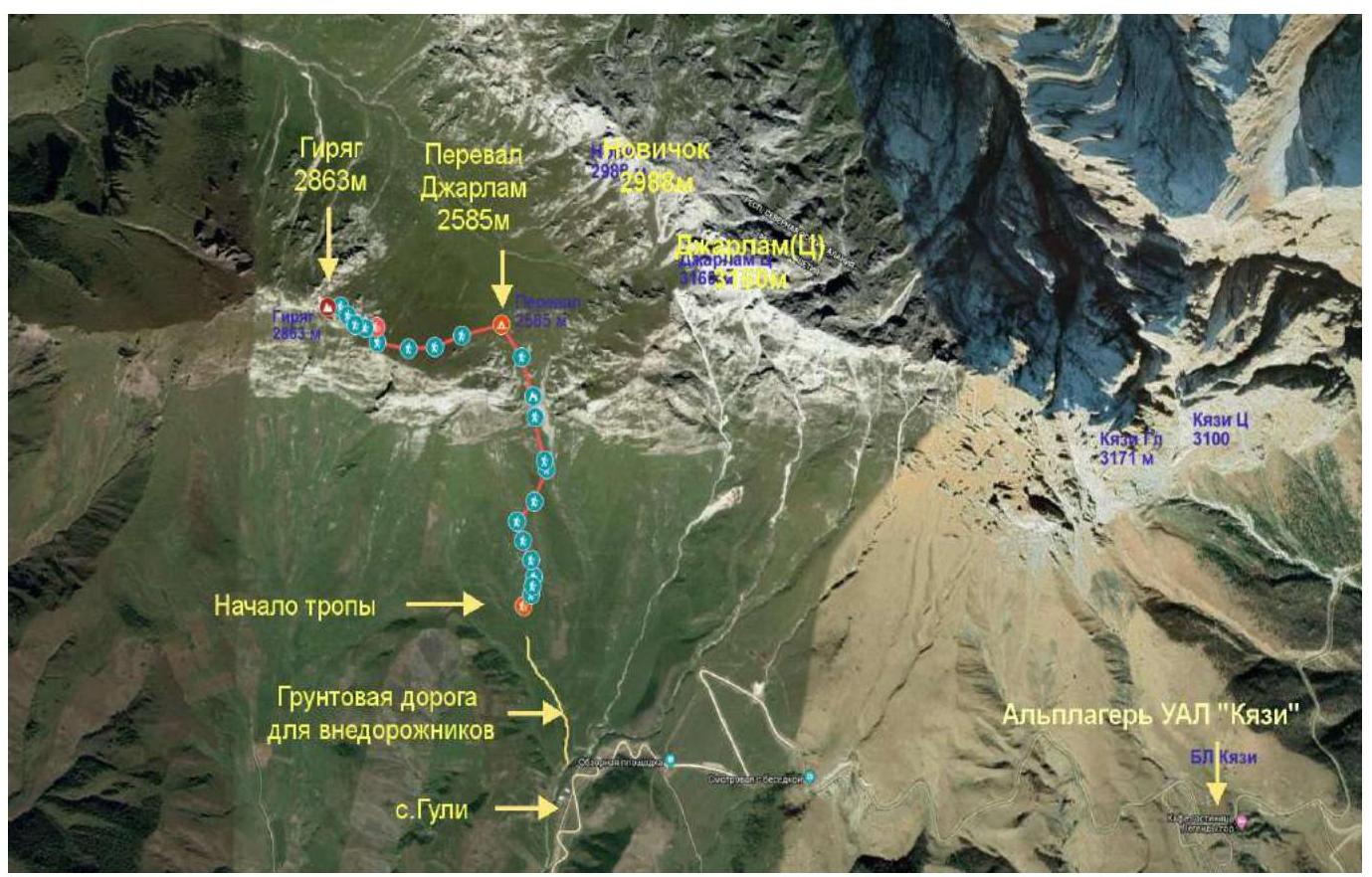
Fig. 5. Google Earth image of the area with the approach and route.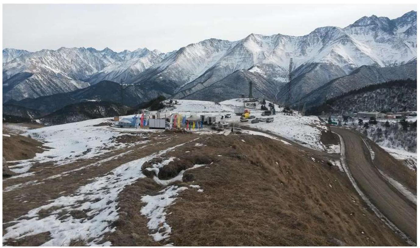
Fig. 6. View of the UAL "Kyazi" mountaineering camp. Taken on February 1, 2017 by A. Rastorguev.
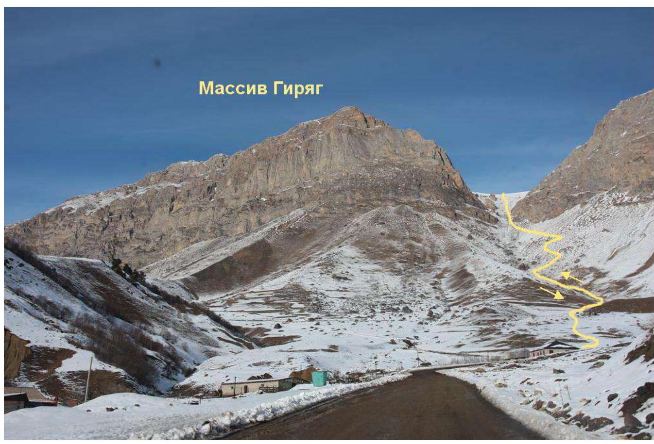
Fig. 7. View from the village of Guli towards the approach to the route. Taken on January 4, 2018 by A. Belogaev.
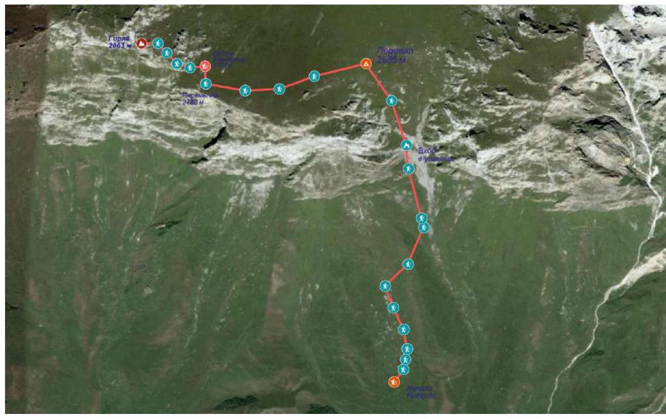
Fig. 8. Approach and route on a Google Earth image.
2. Characteristics of the Route
2.1. Technical Photo of the Route
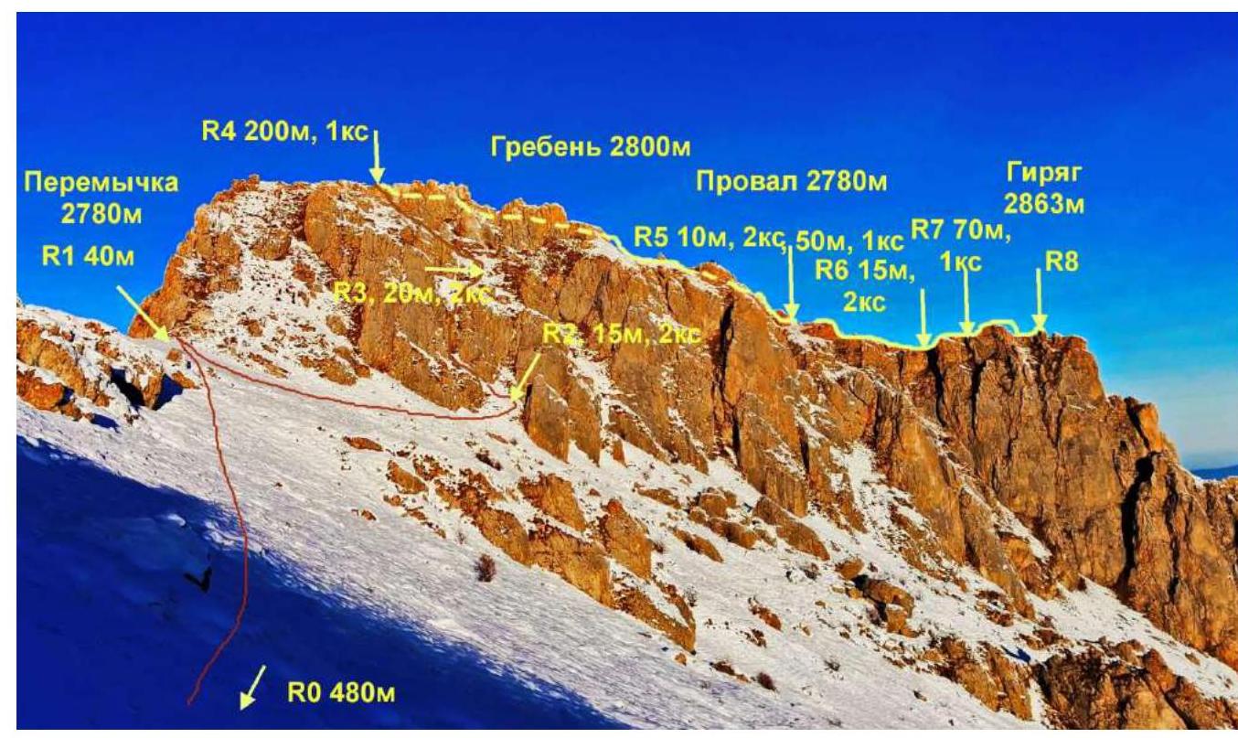
Fig. 9. Technical photo of the route. Taken on November 5, 2019 by S. Belkin.
2.2. Technical Characteristics of the Route Sections
| Section № | Relief Characteristics | Category of Difficulty | Length, m | Type and Number of Protection |
|---|---|---|---|---|
| R0–R1 | Grassy slope | Not categorized | 480 | - |
| R1–R2 | Steep grassy slope | 1 | 40 | - |
| R2–R3 | Rocks, internal angle | 2 | 15 | loop, 2 stoppers |
| R3–R4 | Rocky walls, steep grassy ledges | 2 | 20 | loop, 2 friends |
| R4–R5 | Grassy ridge with rock outcrops | 1 | 200 | - |
| R5–R6 | Short descent via rocks and rocky ridge | 2 1 | 10 50 | - |
| R6–R7 | Rocky walls, steep grassy ledges | 2 | 15 | 2 friends, loop |
| R7–R8 | Grassy ridge with rock outcrops | 1 | 70 | - |
2.3. Technical Photos of the Route Sections
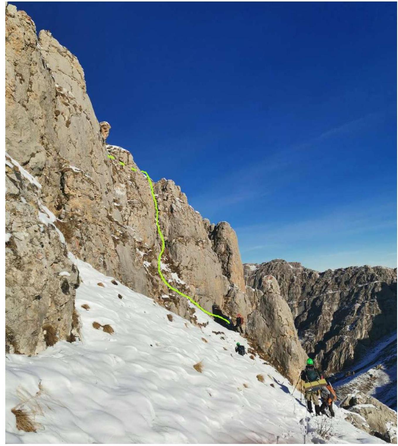
Fig. 10. Group on section R1–R2. S. Belkin.
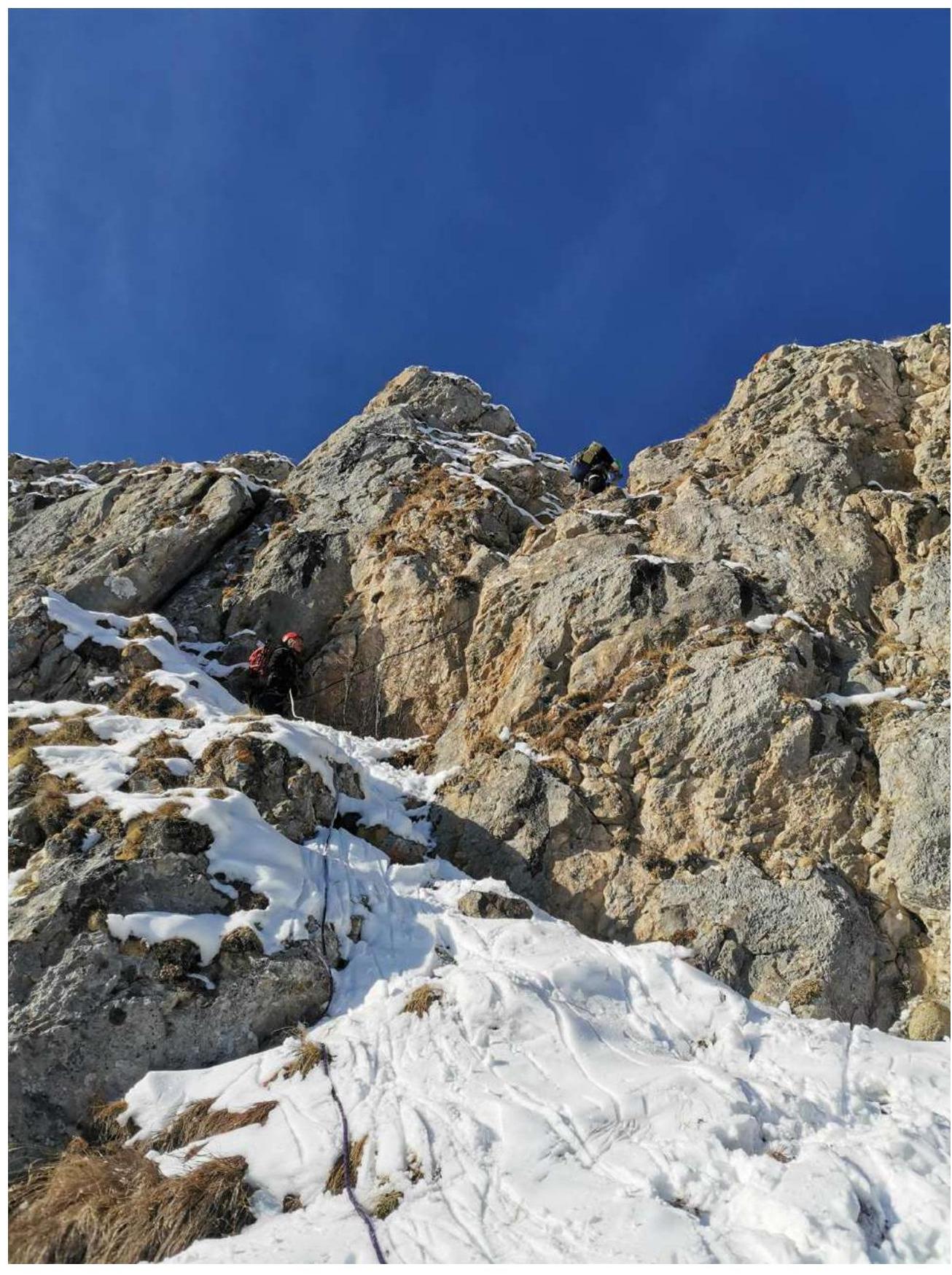
Fig. 11. Leader working on section R2–R3. S. Belkin.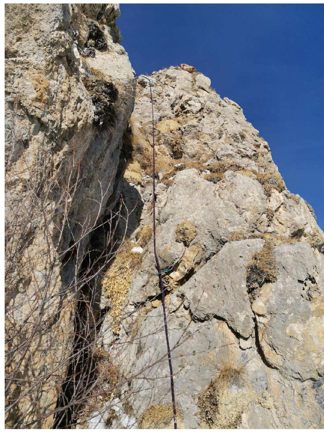
Fig. 12. Protection points on section R2–R3. S. Belkin.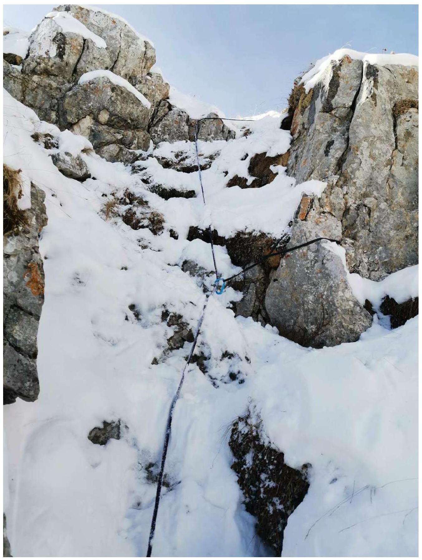
Fig. 13. Protection points on section R3–R4. S. Belkin.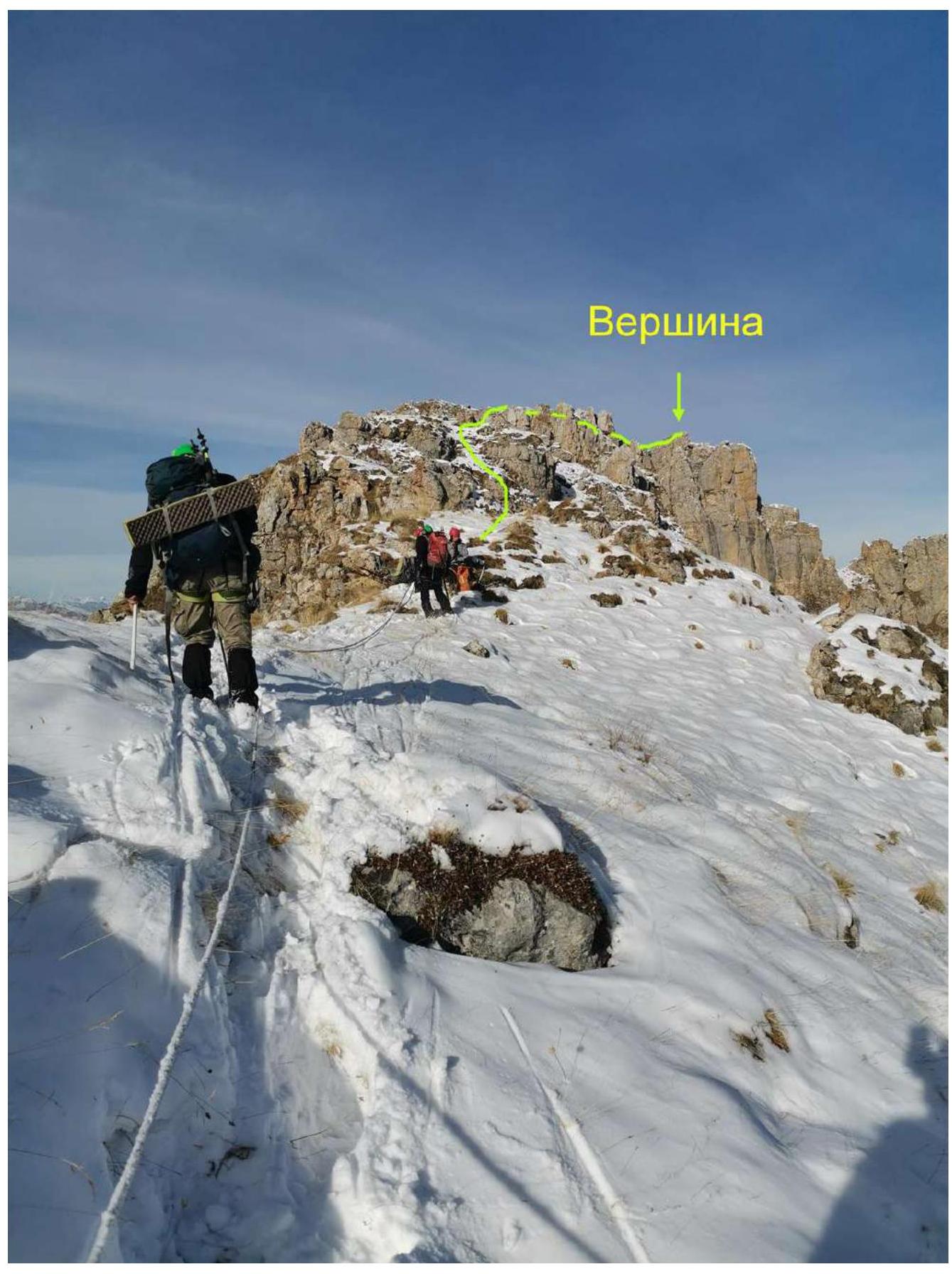
Fig. 14. Group on section R4–R5. S. Belkin.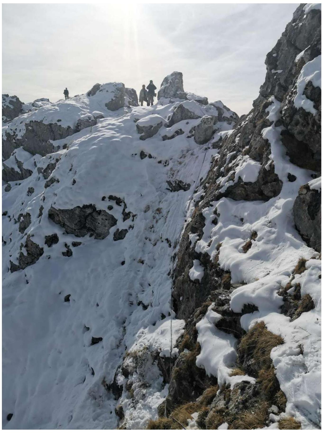
Fig. 15. Descent into the "gap" on section R5–R6. S. Belkin.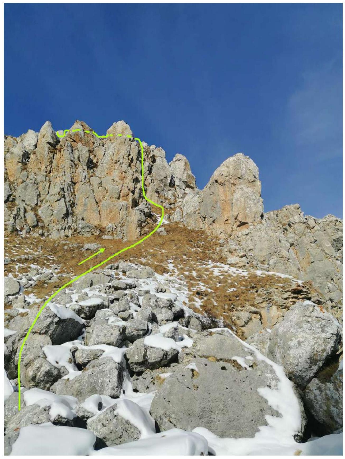
Fig. 16. Group's path on section R6–R7. S. Belkin.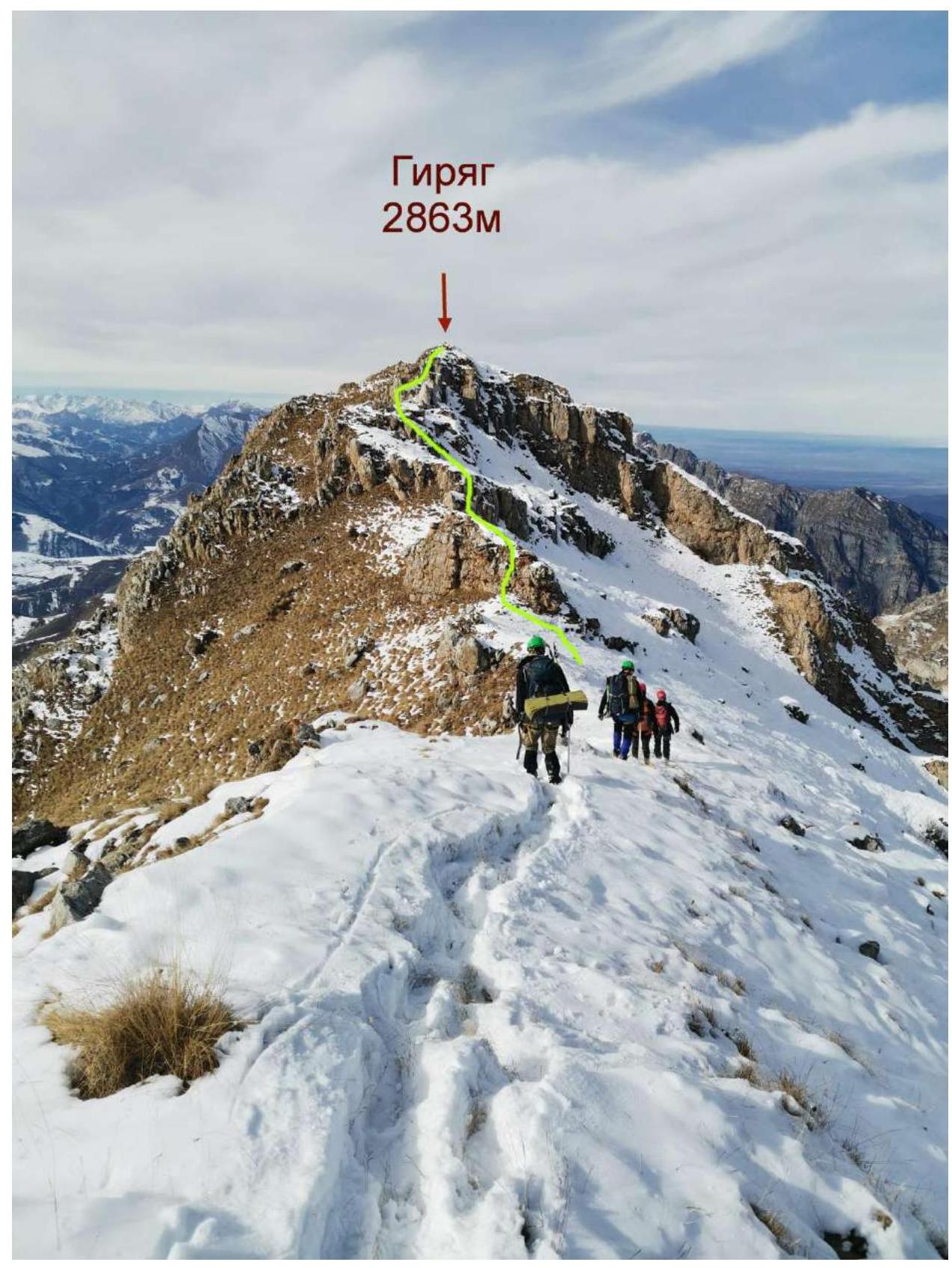
Fig. 17. Pre-summit ridge. Group's path on section R7–R8. S. Belkin.
3. Characteristics of the Team's Actions
3.1. Brief Description of the Route Passage
| Section № | Description | Photo № |
|---|---|---|
| R0–R1 | From the pass, ascend left upwards along a steep grassy slope to the saddle of the Eastern ridge towards the foot of its first rocky step. Backup with trekking poles. | Fig. 9 |
| R1–R2 | From the saddle, traverse right along a steep grassy slope with a loss of 30 m in height towards a characteristic isolated rocky outcrop. Simultaneous movement in rope teams with backup using ice axes. | Fig. 10 |
| R2–R3 | From the grassy ledges between the outcrop and the rocks, ascend upwards along a steep crevice turning into an internal angle. Convenient belay station on a rocky outcrop. Alternating movement by autonomous rope teams with their own intermediate protection points. Key section of the route. | Fig. 11–12 |
| R3–R4 | Left upwards towards the ridge along a system of medium-difficulty walls and grassy ledges. Convenient belay station on a rocky outcrop. Alternating movement by autonomous rope teams using intermediate protection points from the previous rope team. | Fig. 13 |
| R4–R5 | Along the rocky and grassy ridge towards the rocks of the second step. Simultaneous movement of rope teams on a shortened rope. Protection via terrain. | Fig. 14 |
| R5–R6 | Descent into the gap between two rocks ("gap"). "Sport" descent on a fixed rope led by an instructor, in rope teams on a shortened rope. And then along the ridge towards the rocks of the second step. Simultaneous movement of rope teams on a shortened rope. Protection via terrain. | Fig. 15 |
| R6–R7 | Upwards through the second step of the ridge along a system of medium-difficulty walls and grassy ledges. Convenient belay station on a rocky outcrop. Alternating movement by autonomous rope teams using intermediate protection points from the previous rope team. | Fig. 16 |
| R7–R8 | Along a simple grassy — rocky ridge to the summit. | Fig. 17 |
3.2. Photo of the Group on the Summit with the Control Tour
 ](https://summitx.info/media/1/1lysqpCmSKvWdzR4fSUUCUt4amB80OM3/img-17.jpeg","id":64757513} ↗)
3.3. Safety Assessment of the Route
The route, like any ridge route, can be dangerous during a thunderstorm. In poor visibility, one should be cautious on the ridge, which drops off on the southern side with steep walls. The grassy slopes above the Jarlam Pass can be avalanche-prone during occasional heavy snowfalls in winter.
Radio communication with the "Kyazi" mountaineering camp and mobile communication work throughout the route, except for a section on the ascent from the Jarlam Pass along the northern slope to the Eastern ridge.
The descent from the summit, depending on the group's training goals, is equally possible: – along the ascent path to the Jarlam Pass; – or along the ascent path to the pass with a deviation to the left (north) downwards along a steep grassy or snowy slope with a traverse to the right onto the Jarlam Pass and then south from the pass downwards along the ascent trail towards the village of Guli.
The route corresponds to category 1B year-round. It is less demanding in terms of physical strength for the participants but is more complex, diverse, and interesting from a technical standpoint compared to the route to Mt. Novichok via the SE ridge, category 1B, in the same area. Recommended for training groups at the initial stage (NP-1) as a first ascent of category 1B, where the instructor has more opportunities for safe practice of various technical techniques with beginners during the ascent.
The report was compiled by Belkin S. V. +79177502686 belkinsv@mail.ru. The report was supplemented and formatted by Rastorguev A. A. +79184605566 ras@incomtech.ru
Comments
Sign in to leave a comment