
REPORT
ON THE FIRST ASCENT TO THE SUMMIT OF GIRIAG VIA THE SOUTH FACE ROUTE OF 3A DIFFICULTY CATEGORY BY THE TEAM OF MOUNTAINEERING CAMPS MANAGEMENT FOR THE PERIOD FROM OCTOBER 29, 2020 TO OCTOBER 29, 2020
I. Ascent Passport
| №№ p.p. | 1. General Information | |
|---|---|---|
| 1.1 | Full Name, sports rank of the team leader | Kergin Ivan Vasilyevich — 2nd sports rank |
| 1.2 | Full Name, sports rank of the team members | Smorodina Natalia Valeryevna — 3rd sports rank |
| 1.3 | Full Name of the coach | Yakovenko Alexander Nikolayevich — Master of Sports |
| 1.4 | Organization | Mountaineering Camps Management |
| 2. Characteristics of the Ascent Object | ||
| 2.1 | Region | 2.9 from Krestovy Pass to Shaviklde peak |
| 2.2 | Valley | Dzheyrakh valley |
| 2.3 | Classification table section number (2013) | - |
| 2.4 | Name and height of the summit | Mt. Giriag, 2863 m |
| 2.5 | Geographical coordinates of the summit (latitude/longitude), GPS coordinates | 42.84035, 44.79916 |
| 3. Route Characteristics | ||
| 3.1 | Route name | South Face |
| 3.2 | Proposed difficulty category | 3A |
| 3.3 | Route exploration level | First ascent |
| 3.4 | Route terrain type | Rocky |
| 3.5 | Route elevation gain (altimeter or GPS data) | 317 m |
| 3.6 | Route length (in meters) | 965 m |
| 3.7 | Technical elements of the route (total length of sections with different difficulty categories and terrain type) | 1st cat. rock — 705 m; 2nd cat. rock — 30 m; 3rd cat. rock — 140 m; 4th cat. rock — 90 m; Closed glacier travel — 0 m; Rappelling (on descent) — 0 m |
| 3.8 | Descent from the summit | NW grassy slope, easy |
| 3.9 | Additional route characteristics | No water along the route; recommended to bring water; less of an issue in winter; lots of thorny grass |
| 4. Team Actions Characteristics | ||
| 4.1 | Travel time (team travel hours, in hours and days) | 1 day, 8.5 hours from the start of the route to "Kyazi" BL |
| 4.2 | Overnight stays | None |
| 4.3 | Route start | 10:00, October 29, 2020 |
| 4.4 | Summit ascent | 15:55, October 29, 2020 |
| 4.5 | Return to base camp | 18:30, October 29, 2020 |
| 5. Report Responsible | ||
| 5.1 | Full Name, e-mail | Kergin Ivan Vasilyevich, ivan.kergin@mail.ru |
II. Ascent Description
1. Characteristics of the Ascent Object
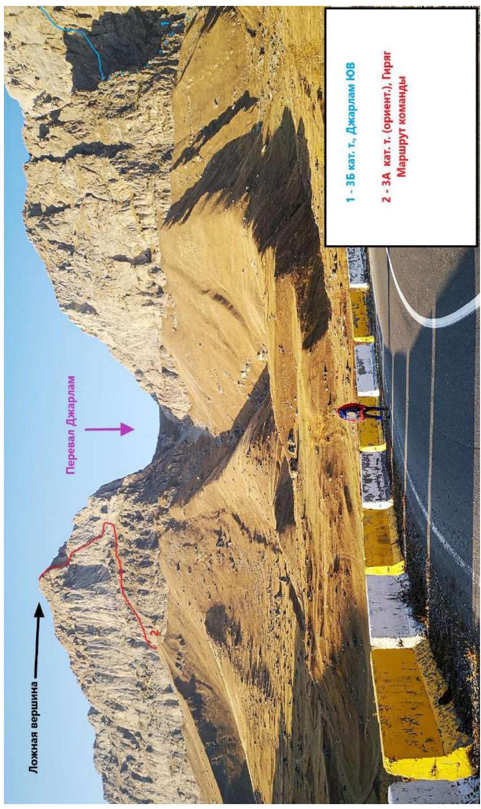
Fig. 1a. General view of the summit. Photo taken from the road just above the last house in Guli village. October 28, 2020.
Photo by: Ivan Kergin
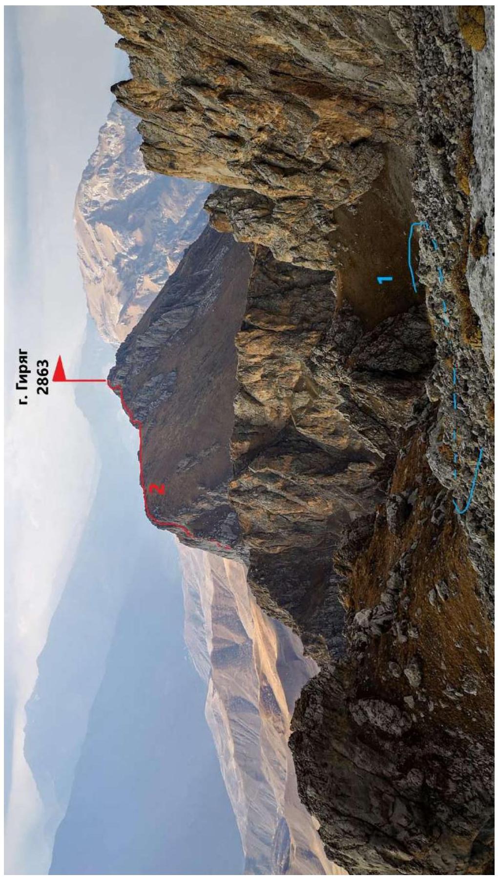
Fig. 1b. General view of the summit. Photo taken from the 3B route. On section R8–R9. October 31, 2020.
Photo by: Ivan Kergin
1.2. Route Profile Photo

Fig. 2. Route profile photo. Photo taken from the dirt road. View of the main technical part of the route. October 28, 2020.
Photo by: Ivan Kergin
1.3. Area Photopanorama
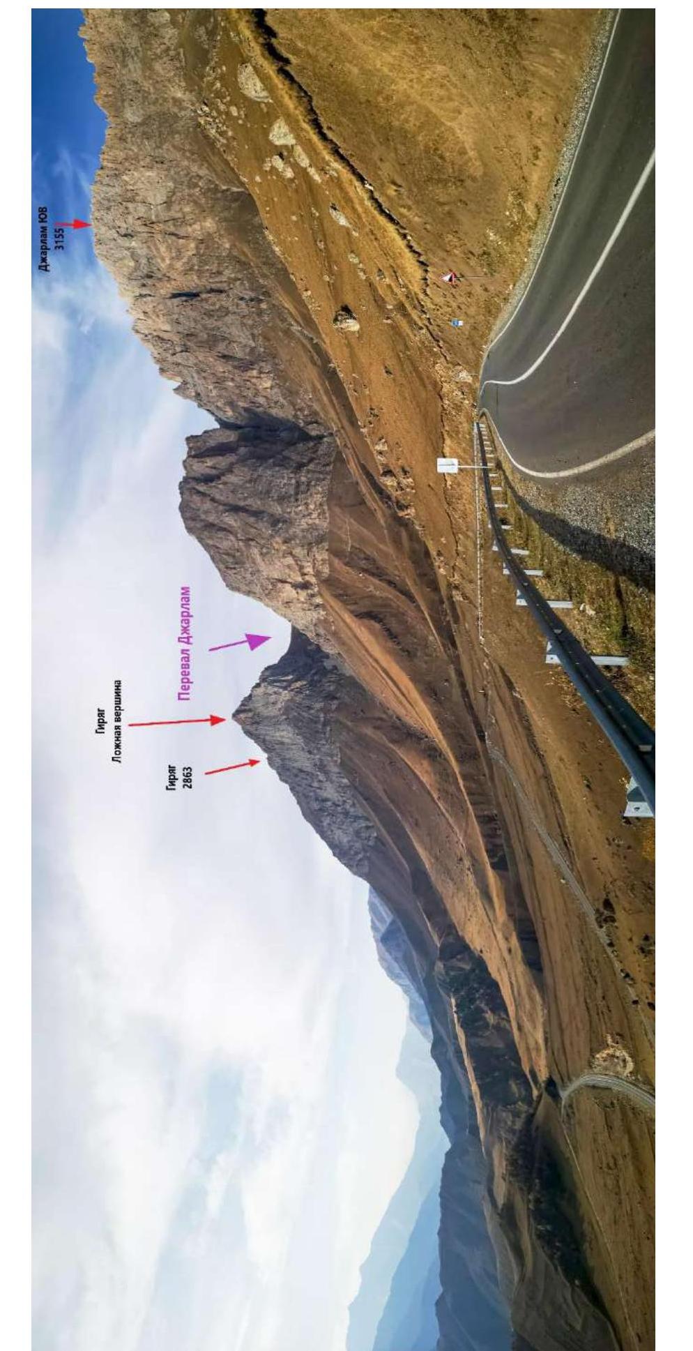
Fig. 3. Area photopanorama. Photo taken from the pass where Besedka is located. October 28, 2020.
Photo by: Ivan Kergin
1.4. Geographical Location of the Area
The ascent object — Mt. Giriag, 2863 m high, is located in the Republic of Ingushetia, Dzheyrakhsky district, Tsey-loam ridge (Rocky ridge) in the Caucasus mountain system.
"The Rocky ridge is a monoclinal structure with a latitudinal orientation. Its southern slope is steep or cliffy, while the northern slope is more gentle. The surface is either rounded and smoothed or has sharp outlines in the form of teeth and pyramids. The highest point of the Rocky ridge:
- on the western segment between Terek and Assa — Mt. Stolovaya (Myat-Loam, 2993 m);
- on the eastern segment — Leymo-loam (3100 m);
- and between Assa and the sources of the Akkichu river — Mt. Skalistaya (Khakhalgi, 3032 m)"¹.
To the south of this ridge lies a wide longitudinal North-Jurassic depression, covering the space between the foot of the Rocky ridge escarpment and the northern spurs of the Lateral ridge. The surface of the depression is composed of Lower and Middle Jurassic sandy-clayey-shale strata, weakly resistant to erosion. The longitudinal valleys of the rivers are confined to the areas where such rocks are deposited:
- Armkhi
- Galgachi
- Guloy-khi
- Thaba-choch
From the "Kyazi" alpine camp, one needs to move along the highway towards Guli village. From the first house on the right, turn right and continue along the dirt road. Then, in the direction of the Jarlam pass, follow the trail — approach the lower rocky belt of Mt. Giriag. Under the rocky belt, traverse the slope to the left and continue moving in the direction of a large hill (it is possible to drive up to the hill itself) until the end of the rocky belt.
Above the couloir, a ridge exit is visible (under the false summit) with a characteristic gray cornice. Then, along the wall, move up a wide grassy couloir (about 200 m) under the wall — control cairn. Then traverse (about 100 m) to a small grotto (to the right of it, there will be a large cairn, noticeable during the traverse of the grassy slope), from which a large inclined ledge begins. This is the start of the route.
From the base camp to the starting point — about 2.5 hours, if you drive under the Jarlam pass by car.
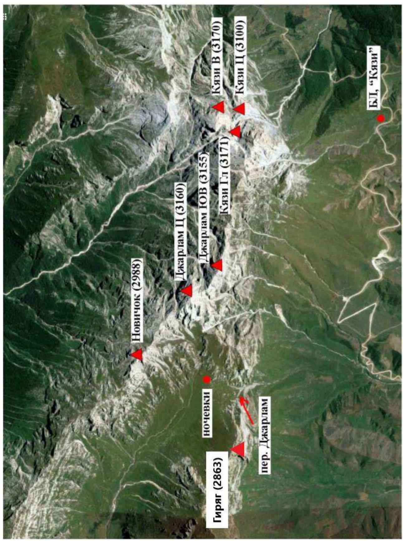
Fig. 4. Area map. Photo taken from the report "Traverse Jarlam Ts (3160)–Novice (2988) — 3A category"
2. Route Characteristics
2.1. Technical Route Photo
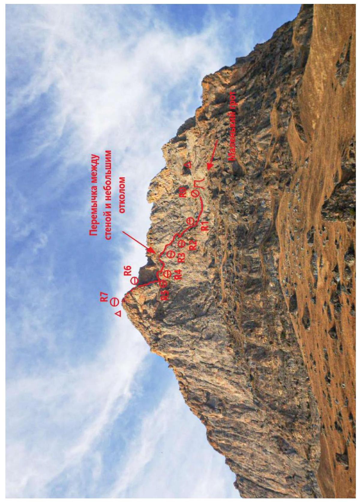
Fig. 5a. Technical route photo. Photo taken from the dirt road. October 28, 2020.
Photo by: Ivan Kergin
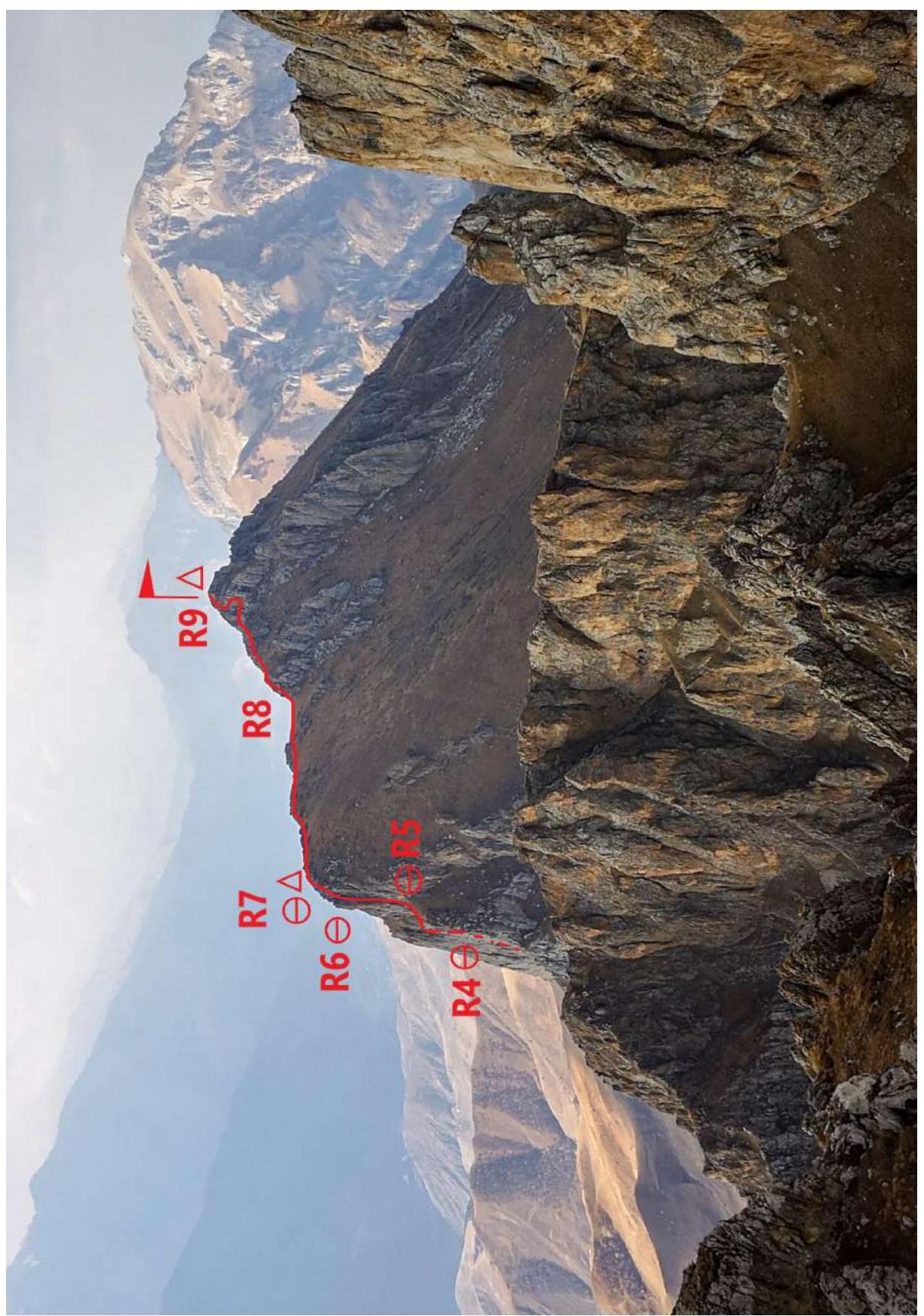
Fig. 5b. Technical route photo. Photo taken from the 3B route. On section R8–R9. October 31, 2020.
Photo by: Ivan Kergin
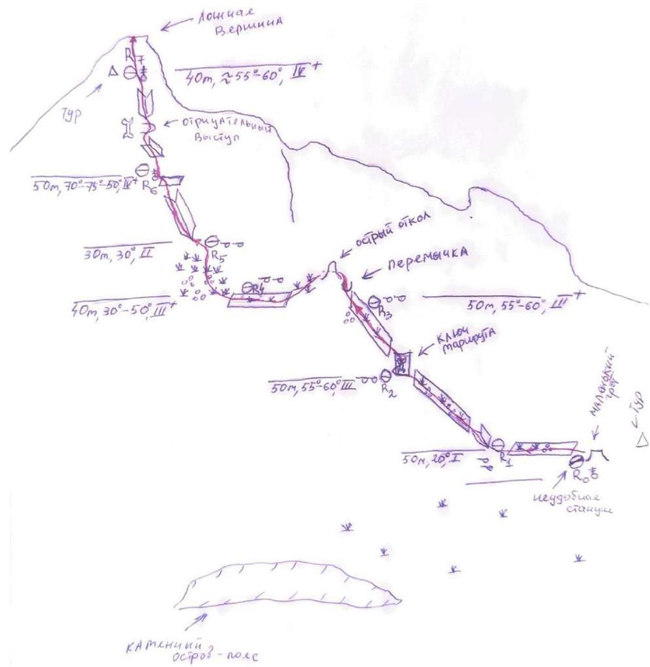
2.2. Section Numbers
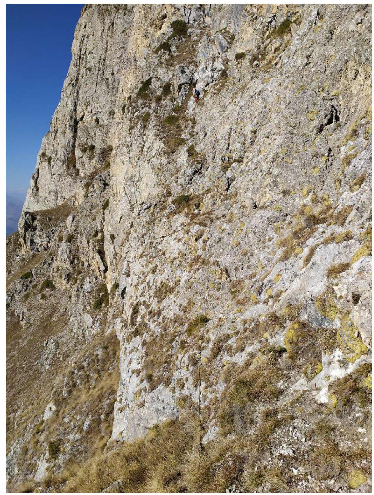
Fig. 6. Section R0–R1–R2. Photo by: Natalia Smorodina
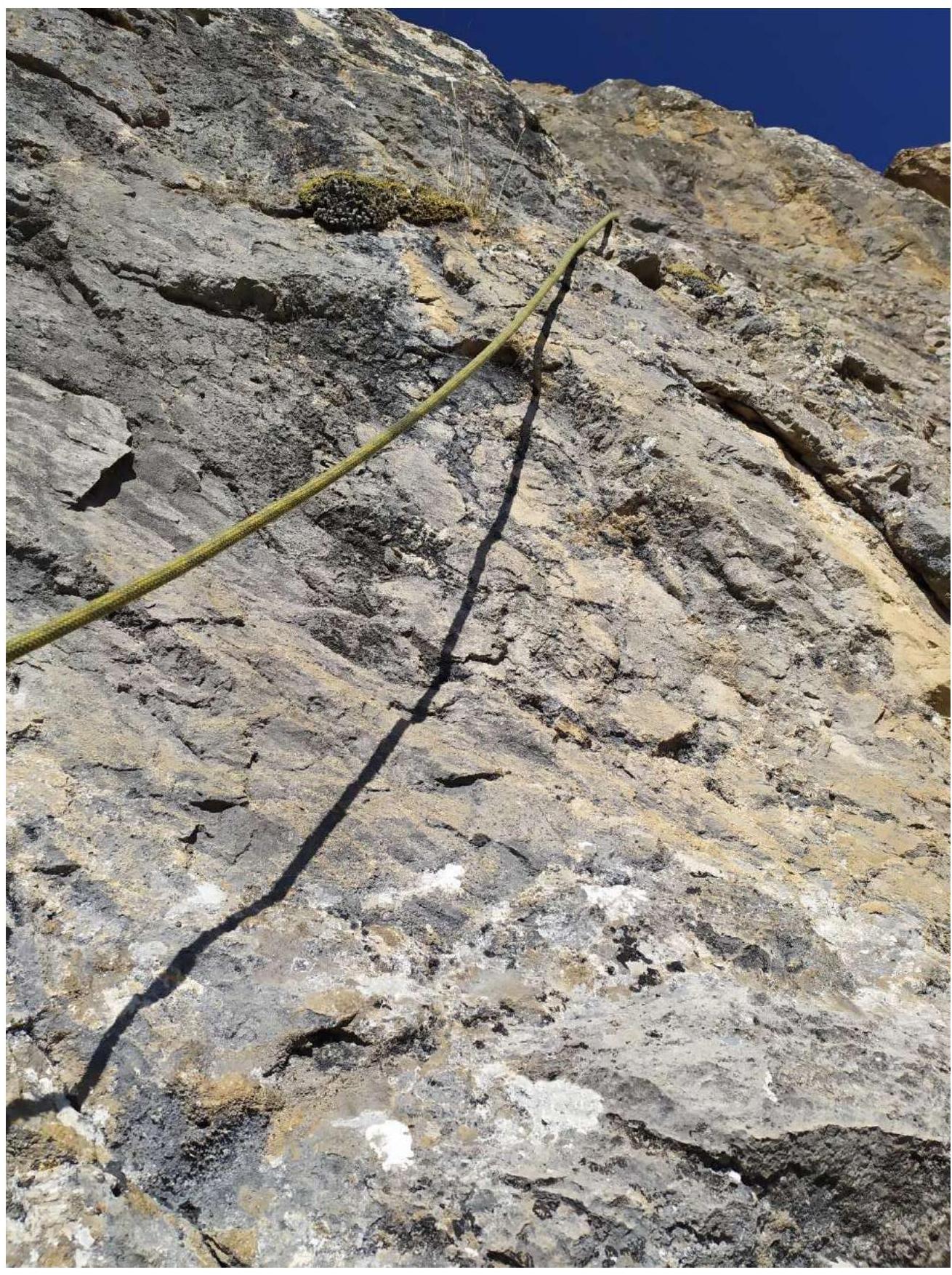
Fig. 7. Section R2–R3. From the second station — to the right (Route key #1). Photo by: Natalia Smorodina
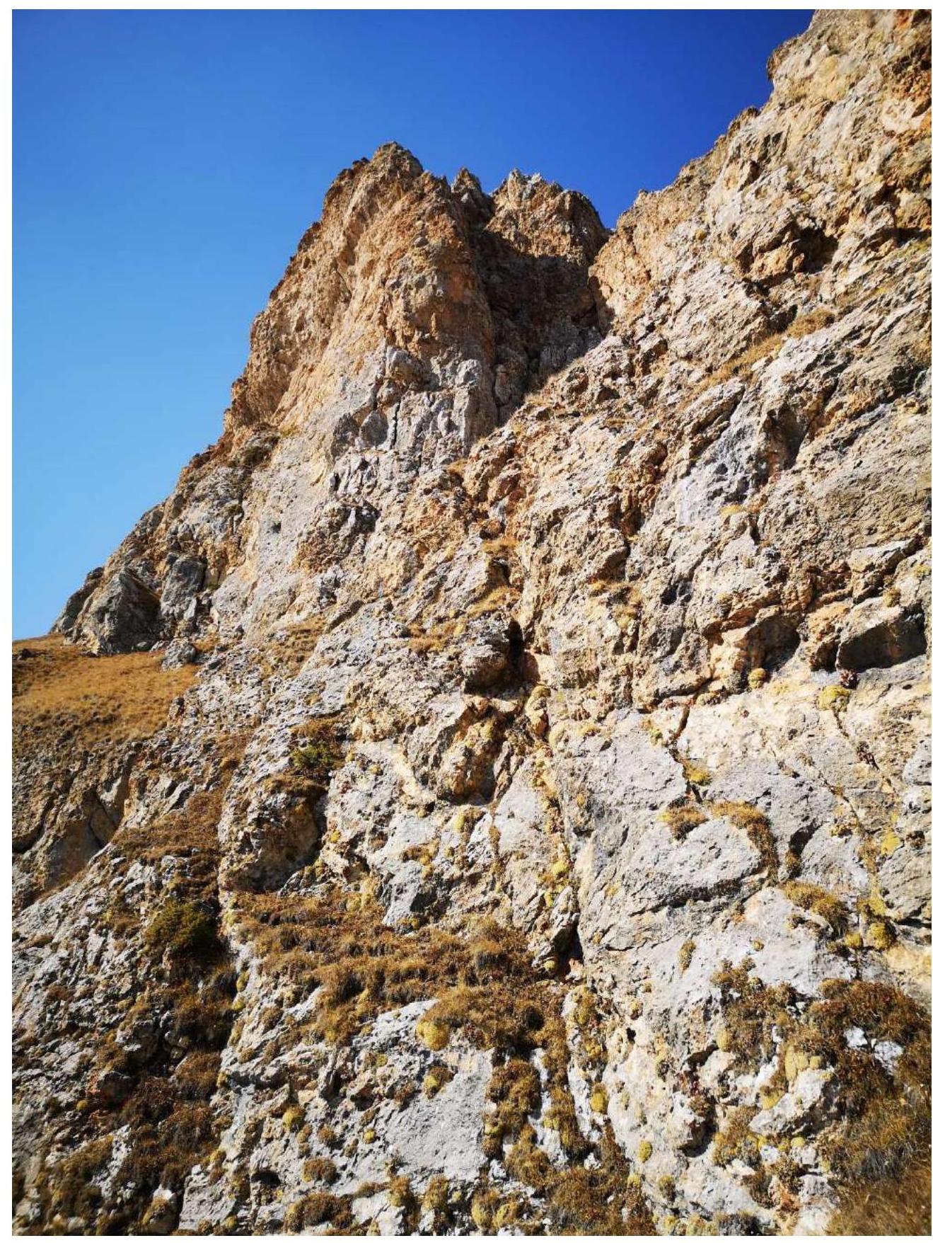
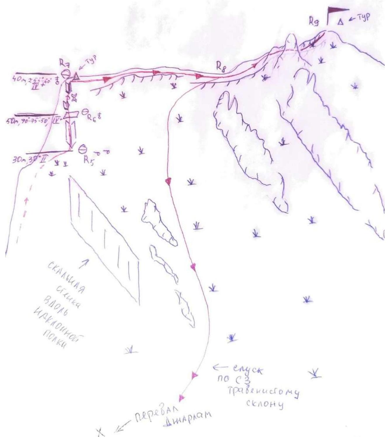
Fig. 8. Sections R3–R4–R5–R6–R7. Photo taken from the saddle. Photo by: Ivan Kergin
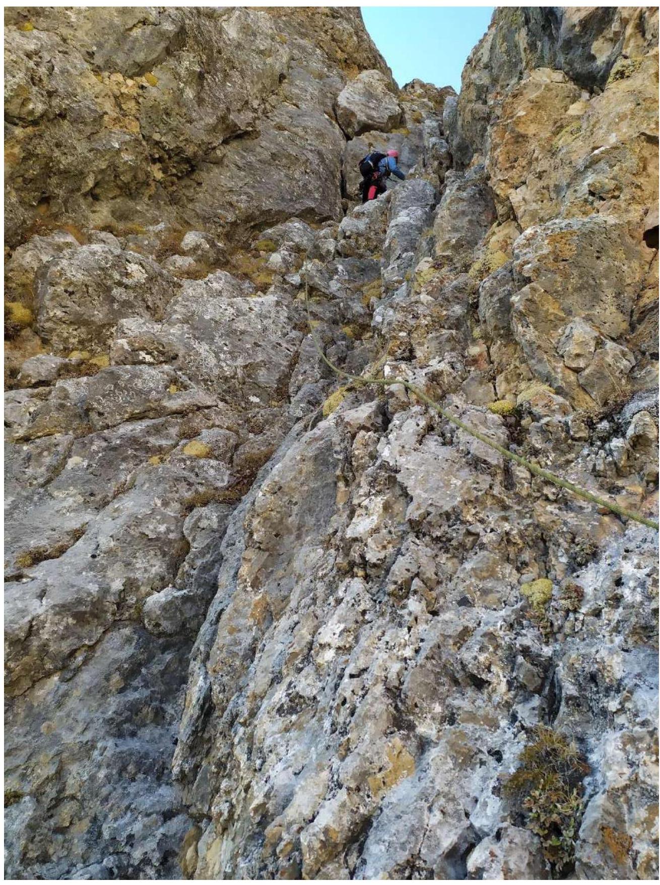
Fig. 9. Section R5–R6 (first part). Photo by: Natalia Smorodina
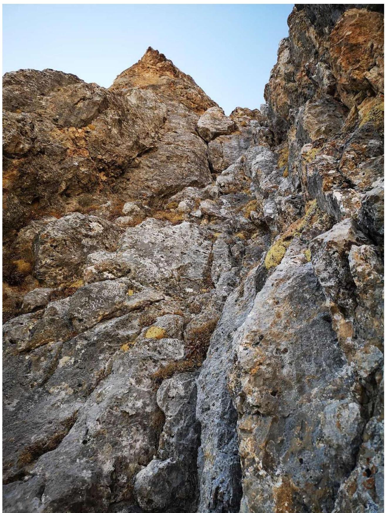
Fig. 10. Section R5–R6 (second part). Photo by: Ivan Kergin
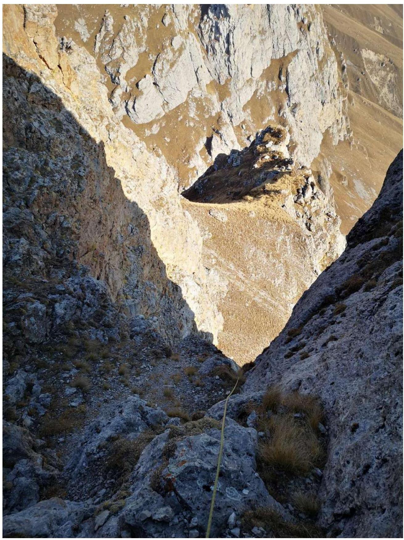
Fig. 11. Section R5–R6 (third part). Photo by: Ivan Kergin
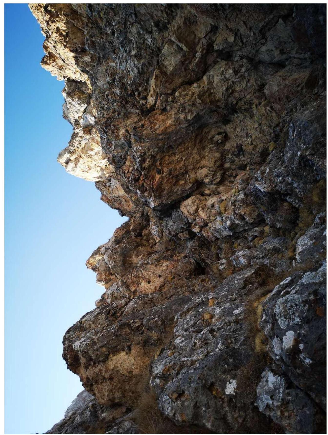
Fig. 12. Section R6–R7 (route key #2). Photo by: Ivan Kergin
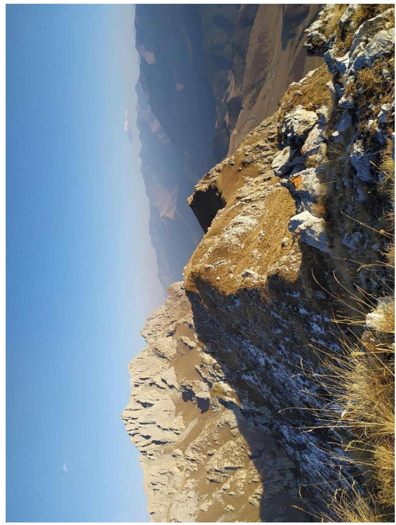
Fig. 13. Sections R7–R8–R9. Photo by: Natalia Smorodina
2.3. Technical Route Characteristics
| Section № | Terrain Type | Difficulty Category | Length, m | Steepness | Type, Number of Pitons |
|---|---|---|---|---|---|
| R0–R1 | Grassy ledge with small scree | 1 | 50 m | 20° | 0 |
| R1–R2 | Small internal angle, rocky walls, inclined ledge, juniper | 3 | 50 m | 55°–60° | Friend — 1; Stopper — 2; Anchor piton — 1 |
| R2–R3 | Rocky wall, inclined ledge | 3+ | 50 m | 55°–60° | Friend — 1; Stopper — 1; Anchor piton — 1 |
| R3–R4 | Inclined ledge, grassy ledge | 3+ | 40 m | 30°–50° | Friend — 1; Stopper — 2; Anchor piton — 2 |
| R4–R5 | Grassy ledge | 2 | 30 m | 30° | 0 |
| R5–R6 | Extended rockfall-prone internal angle, small and medium-sized loose rocks | 4± | 50 m | 70°–75° 50° | Friend — 3; Stopper — 2; Anchor piton — 1 |
| R6–R7 | Internal angle, small and medium-sized loose rocks, small protrusion with a slightly negative slope | 4± | 40 m | 55°–60° | Friend — 0; Stopper — 2; Anchor piton — 2 |
| R7–R8 | Grassy ridge | 1 | 300 m | 0° | 0 |
| R8–R9 | Grassy ridge, indistinct gendarmes | 1 | 355 m | 10°–15° | 0 |
2.4. Technical Route Characteristics in UIAA Symbols
Technical Route Characteristics in UIAA Symbols
Figure 1
Technical Route Characteristics in UIAA Symbols
Figure 2
3. Team Actions Characteristics
3.1. Brief Description of Route Passage
| Section № | Description | Photo № |
|---|---|---|
| R0–R1 | From an uncomfortable station on a rock (loop), move left along an inclined grassy-scree ledge. 50 m, Station on anchors. Used 0 intermediate belay points, belay through terrain. Organization of top belay for the second. | Fig. 6. |
| R1–R2 | From the station, continue moving along a weakly expressed internal angle, then overcome a series of small rocky ledges and approach a place where it is convenient to organize a belay station in 50 m. Station on anchors. Organization of top belay for the second. | Fig. 6. |
| R2–R3 | From the station, move to the right and overcome a meter-high rocky wall — Route key #1 and continue moving along an inclined ledge. 50 m. Station on anchors. Organization of top belay for the second. | Fig. 7. |
| R3–R4 | From the station, continue moving along an inclined ledge, parallel to the wall. Pass through a small col (sharp outcrop separating the ledge and the wall). After the col, exit onto a prolonged grassy ledge, where it is convenient to organize a belay station on anchors. 40 m. Organization of top belay for the second. | Fig. 8. |
| R4–R5 | From the station, traverse along the grass to the beginning of a large internal angle — organize a convenient belay station on anchors. 30 m. Simultaneous movement. Belay through terrain. | Fig. 8. |
| R5–R6 | Start moving along the internal angle, sticking to the left side. Rockfall hazard! Small and medium-sized loose rocks. The first 40 m of rope — 70°–75°, the remaining 10 m — 50°. 50 m. Station on a boulder. Loop. Organization of top belay for the second. | Fig. 8.; Fig. 9.; Fig. 10.; Fig. 11. |
| R6–R7 | From the station, move to the right towards a sharp col. Along the way, overcome a small protrusion with a slightly negative slope — Route key #2. After the col, move 5–7 m and make a station on a boulder. 40 m. Organization of top belay for the second. | Fig. 12. |
| R7–R8 | From the cairn with a stick, continue moving along the ridge to the first weakly expressed gendarme. Simultaneous movement. Belay through terrain. 300 m. | Fig. 13. |
| R8–R9 | Continue moving along the ridge and overcome several indistinct gendarmes and reach the summit, where a cairn is located. 355 m. | Fig. 13. |
3.2. Team Photo on the Summit at the Control Cairn
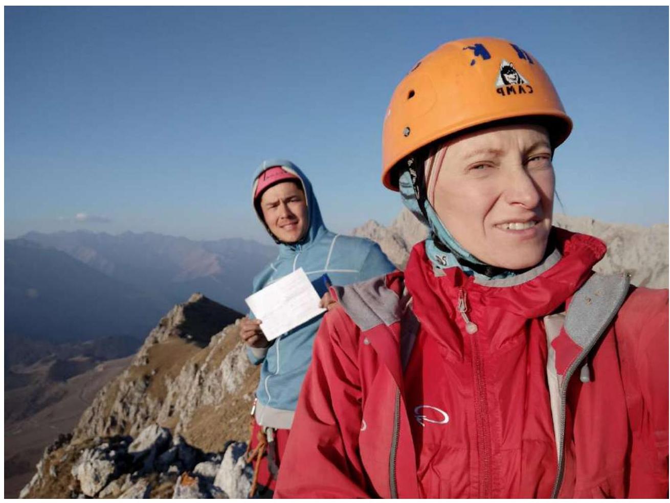
Photo by: Natalia Smorodina
3.3. Route Safety Assessment
The route turned out to be logical. Practically every 50 m, there are convenient places to organize a belay station where several people can gather. The only downside is the frequent presence of juniper, from which one needs to protect oneself by wearing gloves. The large internal angle is the most dangerous section of the route: if you move along the right side, you will often need to knock rocks down.
Throughout the route, there is a connection, both cellular and internet, and radio communication, through which it is convenient to contact the base camp. In addition, near the pass, there are traditional overnight stays for climbers, those who ascend the Jarlam peak, and others. There, you can find water if you have miscalculated your supplies, although the chances of this are very low. People often stay overnight at these sites, so it is also possible to transmit communication between groups or to the base camp through them.
Recommendation for future climbers: anchors and medium-sized protection work best. Do not forget to wear gloves to protect against thorns and sharp rocks. Be careful! On the descent, an ice axe or trekking poles may come in handy because the grass can be very slippery.
The descent begins from the summit to section R8. From R8 down the NW grassy slope. Then, head towards the Jarlam pass, and then follow a well-trodden trail down to the highway.
This route was completed on October 29, 2020. Along the route, specifically on sections R0–R7, there were no signs of human activity. We did not encounter any constructed cairn or discarded sports equipment along the way, which can only indicate that we have passed a new line on the well-known Giriag peak. A well-constructed cairn was found on the summit, but it did not contain a note. We left our note and headed down.
Based on the objective complexity of the technical part of the route on Giriag via the south face and comparing it with other routes previously completed by Kergin I. and Smorodina N., it is proposed to classify it as 3A category.
Moreover, on November 4, a sports group of UAL consisting of:
- Egorov S. — (1st sports rank),
- Utyashev Yu. — (2nd sports rank),
- Bobrinsky K. — (2nd sports rank)
repeatedly passed the route and confirms the 3A category.
Footnotes
-
¹ Ingush people. — M.: Nauka, 2014. — 509 p. ↩
Comments
Sign in to leave a comment