
Russian Mountaineering Championship, Ice-Snow Class
Report
On the ascent to the summit of Kyazi (Koazoy-Loam, Girech, Gaykomd) Central (3100 m) via the right buttress of the right part of the southeast wall, 5B (approximately) complexity category.
Team coach: Timoshenko T.I. Participants:
- Solovey A.I.
- Kananykhin I.V.
I. Ascent Passport
- General Information
| 1.1 | Leader's full name, sports rank | Solovey Alexey Igorevich, 1st sports rank |
|---|---|---|
| 1.2 | Participants' full names, sports ranks | Kananykhin Igor Vladimirovich, CMS |
| 1.3 | Coach's full name | Timoshenko Tatyana Ivanovna |
| 1.4 | Organization | St. Petersburg Alpine Federation |
- Ascent Object Characteristics
| 2.1 | Region | Republic of Ingushetia, Dzheyrakhsky district. From the Kitlod pass to the Gezevtssek pass (south of the Main Caucasian Range) |
|---|---|---|
| 2.2 | Valley | |
| 2.3 | Section number according to the 2013 classification table | 2.9 |
| 2.4 | Name and height of the summit | Kyazi (Gaykomd, Girech, Koazoy-Loam) Central, 3100 m |
| 2.5 | Geographic coordinates of the summit (latitude/longitude), GPS coordinates | - |
- Route Characteristics
| 3.1 | Route name | Via the right buttress of the right part of the SE wall, Solovey |
|---|---|---|
| 3.2 | Complexity category | 5B (approximately) |
| 3.3 | Route освоенности degree | First ascent |
| 3.4 | Route relief character | Rock |
| 3.5 | Route elevation gain (altimeter or GPS data) | 810 m |
| 3.6 | Route length (in meters) | 1150 m |
| 3.7 | Technical elements of the route (total length of sections of varying complexity with relief character indication) | Category I complexity, rocks — 10 m, Category II complexity, rocks — 240 m, Category III complexity, rocks — 410 m, Category IV complexity, rocks — 85 m, Category V complexity, rocks — 272 m, Category VI complexity, rocks — 133 m. |
| 3.8 | Average route steepness, (°) | Entire route — about 54° |
| 3.9 | Average steepness of the main route part, (°) | Wall part — about 76°. After reaching the ridge — about 35°. |
| 3.10 | Descent from the summit | Represents a series of 12–13 rappels towards the couloir between the Central and Main peaks. The first rappel starts from a ledge 5 m below the summit to the south. Traverse 30 m north along the ledge to a rock with a bolt and loop. Then descend via a cleft, gradually moving down and right to a large ledge in the middle of the wall. After traversing the ledge with simultaneous belay, another 4 rappels down to the couloir. It is recommended to check the anchors as some loops and anchors may need replacement. |
R0–R1. Start of the route — on the wall, 20 m before a large characteristic chimney. On the wall, it's written: "ЧР 2020", but it's unlikely to be visible. Passage of the section:
- 15 m up and slightly left along the wall, exit to a ledge (angle of inclination decreases);
- 7 m up a smooth plate (wall) with cavities to a grassy ledge. Station organization is complicated by unreliable rock. 15 m, 85° V; 7 m, 70° V+; 5 m, 30° II.
R1–R2. Left along the grassy ledge, bypassing the buttress, up a grassy and scree slope, approach to a grotto, station left of the grotto at the bottom on "sand clocks." 50 m, 30° II–III.
R2–R3. Through a wall 5 m to a ledge in the grotto. From the grotto right, "step on a rock outcrop" right 2 m and up a cleft 6 m. Climbing is tense, holds and points are not very reliable. Exit to a large, inclined grassy and scree terrace, station on a rock outcrop 15 m away. 5 m, 90° IV; 8 m, 90° VI+ A2; 15 m, 30° II.
R3–R4. Right up the terrace 150 m, climbing is easy, to a rocky inclined wall. Enter a narrowing of a large couloir, on the left side of the couloir, then 20 m up rocks of medium difficulty and again on an inclined grassy ledge, approach under the wall near a hanging grotto. 150 m, 30° II; 20 m, 50° IV; 30 m, 30° III.
R4–R5. Walk left, start climbing at a convenient spot, moving left and up along destroyed, grass-covered, steep rocks towards a small grotto on the wall. Belay is complicated by destroyed relief (in winter — snow). Station in a cleft inside the grotto within arm's reach (large points). 10 m, 80° IV–V; 20 m, 85° V.
R5–R6. Up an internal angle and through a small wall, exit to a ledge with a juniper, under an overhang. 25 m, 80° V.
R6–R7. Along the ledge left, bypassing an implicit ridge, then slightly up an inclined, grassy, and scree ledge to a large rock with a horizontal cleft. 60 m, 20° II.
R7–R8. 10 m up, under the wall, then slightly right along a slab to the top, complex transition left to an internal angle and up. 10 m, 35° II; 15 m, 85° V+–VI.
R8–R9. Through a system of internal angles, approach under a 3 m overhang, transition under the overhang right and up a wall right of the overhang. 25 m, 85° VI.
R9–R10. Up the wall and implicit internal angles, approach a large slab and at the top of the slab, station in deep clefts of a monolithic wall. 25 m, 80°–85° IV–V.
R10–R11. Left along the slab, then up a small internal angle formed by the wall and a large overhang adjacent to it. At the top of the overhang, station on a monolithic wall. 20 m, 20° III; 10 m, 85° VI.
R11–R12. 10 m left along the ledge, then up rocks, exit to a huge, T-shaped, inclined, grassy, and scree terrace, limited by two buttresses. Transition under the right buttress and up its left part, through a system of internal angles, approach a ledge under a sheer wall with an internal angle. 10 m, 65° IV; 30 m, 45° III; 110 m, 80°–85° IV–V.
R12–R13. 50 m up a system of internal angles and clefts. Tense climbing. 50 m, 80°–90° V+–VI.
R13–R14. Up an inclined internal angle right, exit to a ledge under an overhang, then right along the ledge, bypassing a large hanging rock, right and up, exit to the ridge. 25 m, 85° IV; 10 m, 10° I; 15 m, 80° IV.
R14–R15. Bypassing an implicit jammer right, up the slope (Caution! Avalanche danger in winter, belay from rocks under the snow), and moving up, exit to a saddle where the route converges with Andreev's and Glazunov's routes. Then transition to rocks right and up 10 m to an internal angle, station at its base. 50 m, 40° III; 10 m, 75° IV.
R15–R16. Up the internal angle. Approach under overhangs on the right. Approximately halfway through the section, a bolt left by Andreev's group is encountered. 25 m, 85°–90° VI.
R16–R17. Up the wall, approach under a rib, then bypass it left and immediately up a system of internal angles and chimneys, again exit to the ridge. 60 m, 80° V–VI.
R17–R18. Right of the ridge, along the edge of a fracture, exit to a slope (caution — avalanche danger) and, moving up, exit to the ridge. Along the ridge, approach a gentle couloir between the true and south peaks, up the couloir to a saddle and left. Summit. 230 m, 30°–45° II–III.
Descent from the Summit
The descent from the route represents a series of 12–13 rappels towards the couloir between the Central and Main peaks. The first rappel starts from a ledge 5 m below the summit to the south. Traverse 30 m north along the ledge to a rock with a bolt and loop. Then descend via a cleft, gradually moving down and right to a large ledge in the middle of the wall. After traversing the ledge with simultaneous belay, another 4 rappels down to the couloir. It is recommended to check the anchors as some loops and anchors may need replacement.
6. Route Recommendations and Safety Assessment
Route No. 19 was provided for ascent by the judging panel of the 2020 Russian Championship (head judge Zakharov N.N., consultant Balezina V.V.). We ascended it during the Championship according to the provided route description, without deviations. The assumed complexity category based on the ascent results is 5B.
- The route presents certain requirements for orientation on the wall. It turned out to be long and characterized by a large number of transitions between steep rocky sections. Key sections of the route are short, numerous, and clearly visible. Despite this, the route is logical and easy to follow.
- The relief in this part of the wall is typical for the region and is relatively safe. There is a lot of grass and earthy ledges on the route, which can be hazardous in warm weather and slippery in cold weather. The lower part of the route is heavily destroyed and overgrown with grass. The main landmark here is a large grotto, climbing over which via a negative wall presents a certain difficulty. Just before exiting to a large ledge, there are sections of heavily destroyed rocks with problems for belaying. Above the large ledge, the relief becomes more monolithic and steep. Climbing becomes easier and more interesting.
- The route is beautiful and interesting. There are many places for overnight stays. Communication with the base camp is stable. The key middle part of the route is visible from the camp.
- To move efficiently along the route, one must constantly change the climbing scheme, which places demands on the tactical preparation of teams. This is due to the great diversity and constant alternation of relief forms on the route.
- For efficient movement along the route, the leader needs good gear selection. Belays and stations are mostly on anchors. Small rocks often fall, sometimes large ones. Stopper nuts were practically not used. The start of the route is confidently climbed in boots; in the middle part, rock shoes are needed, and at the top, when exiting to the ridge, crampons are necessary.
IV. Report Photo Illustrations
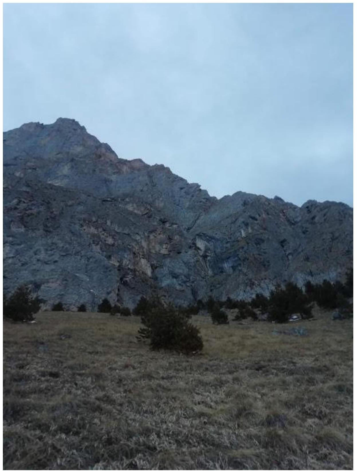
Fig. 6. View of the route on approach.
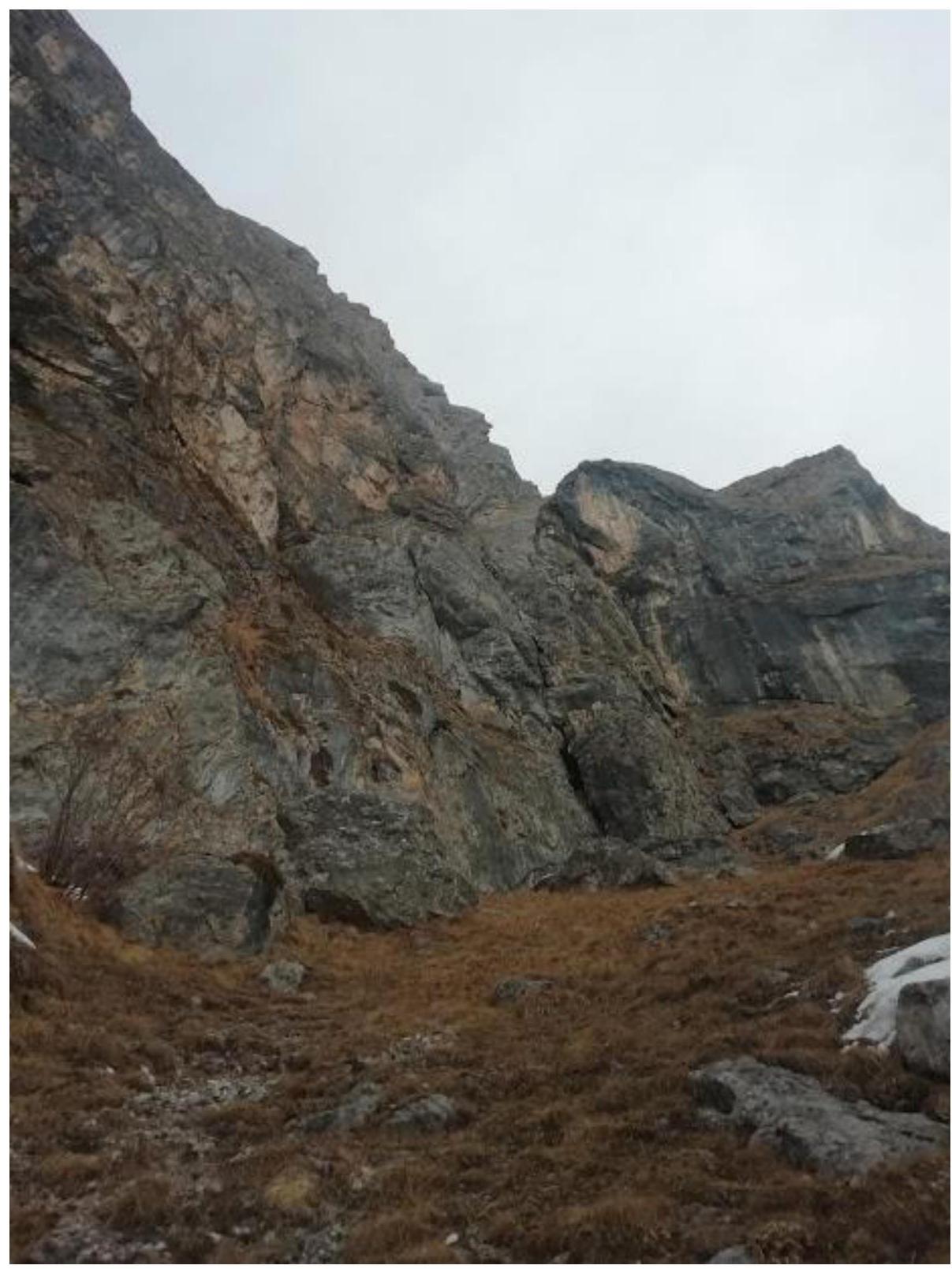
Fig. 7. Under the wall. In the center, a chimney is visible — the starting landmark of the route.
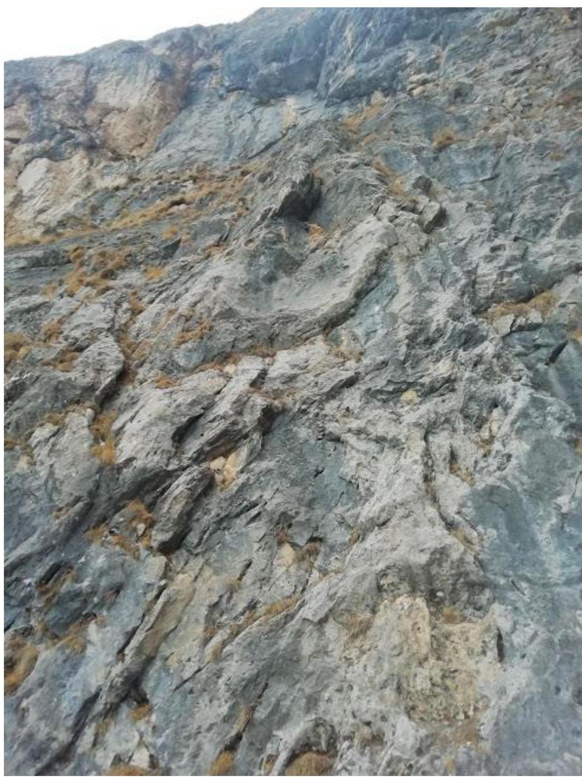
Fig. 8. Section R0–R1. On the wall, a mark "ЧР 2020" is left, but it's unlikely to be visible.
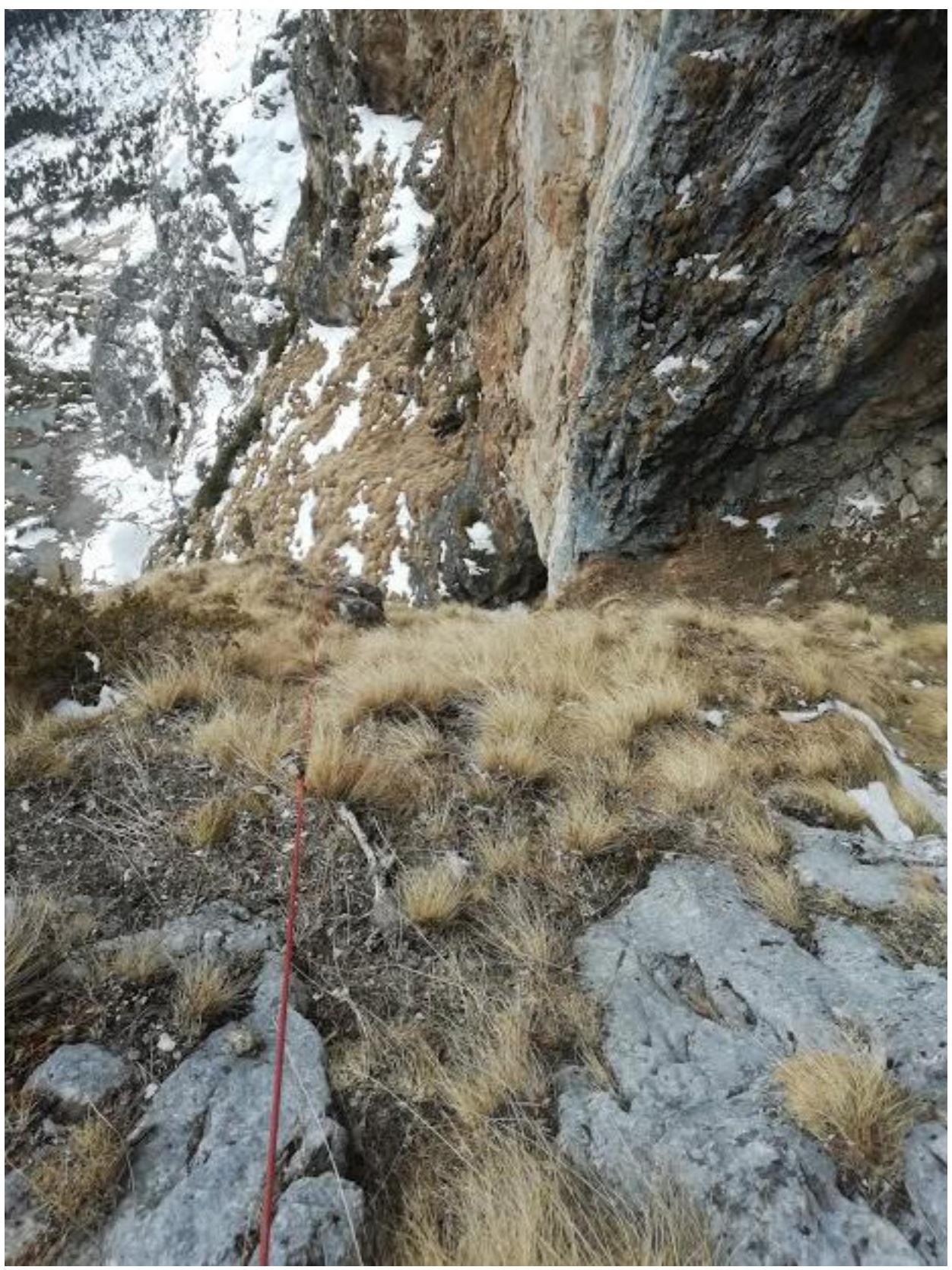
Fig. 9. View down from station R3 to the first key section R2–R3.
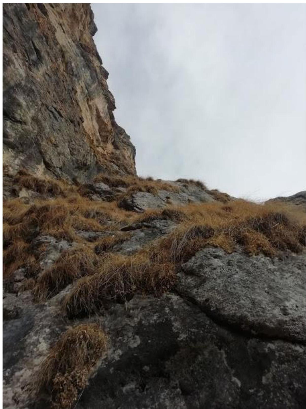
Fig. 10. View from station R3 to the start of section R3–R4. Large, grassy, and scree, inclined terrace.
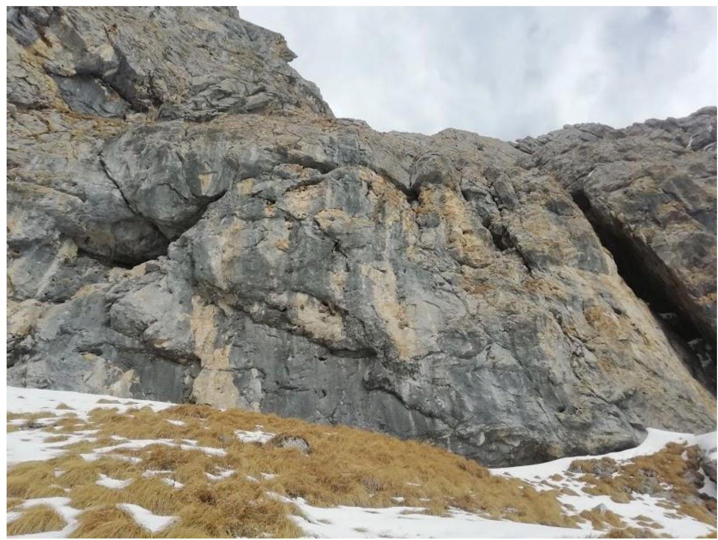
Fig. 11. View of station R4. Slightly left, a grotto with an overhang is not visible in the frame. From the station, left past this grotto and overhang, and up slightly destroyed, unpleasant rocks. Landmark — a small grotto-hole in the center of the wall. An implicit location.
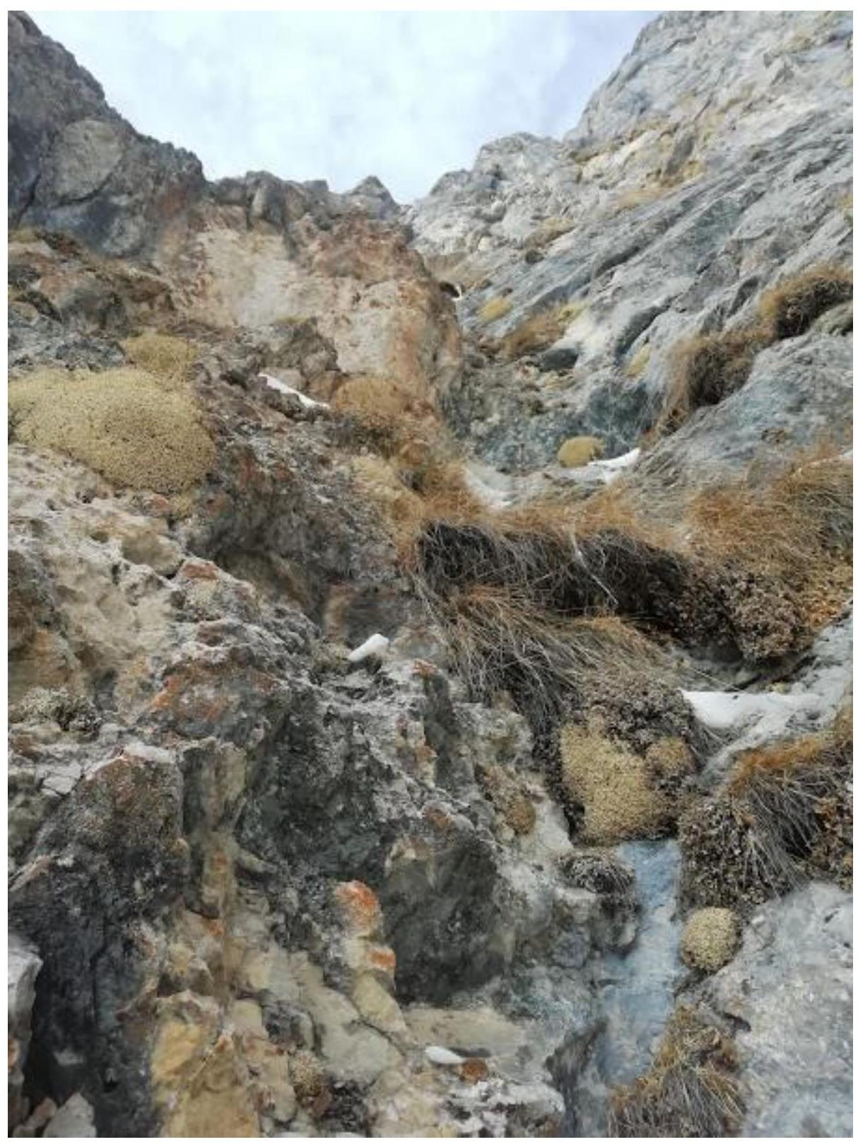
Fig. 12. View from station R5 to section R5–R6.
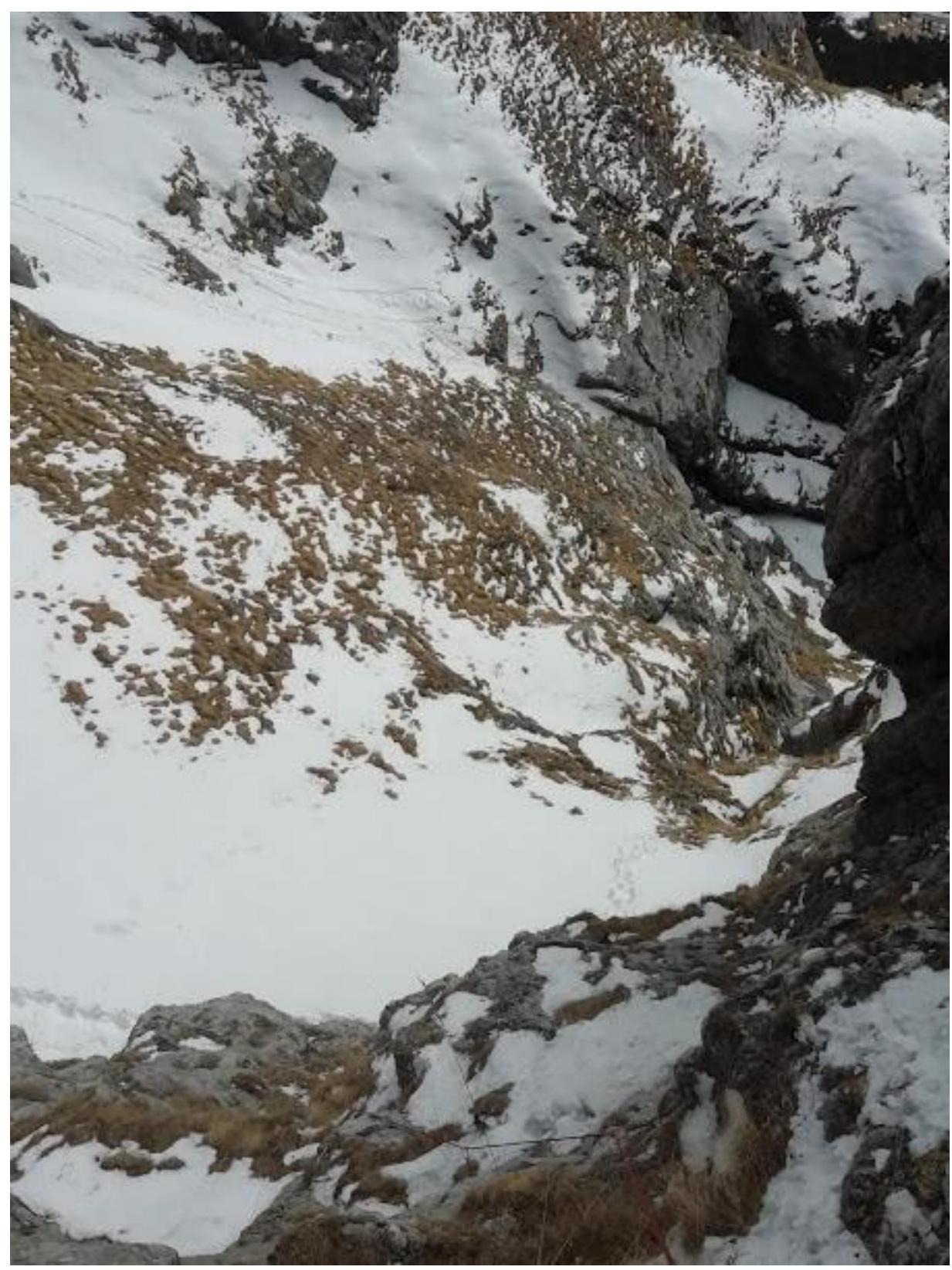
Fig. 13. View down from station R5 to section R4–R5. Looks simple and low, but belaying is complicated due to abundant vegetation and destroyed rock. The previous team only reached R4.
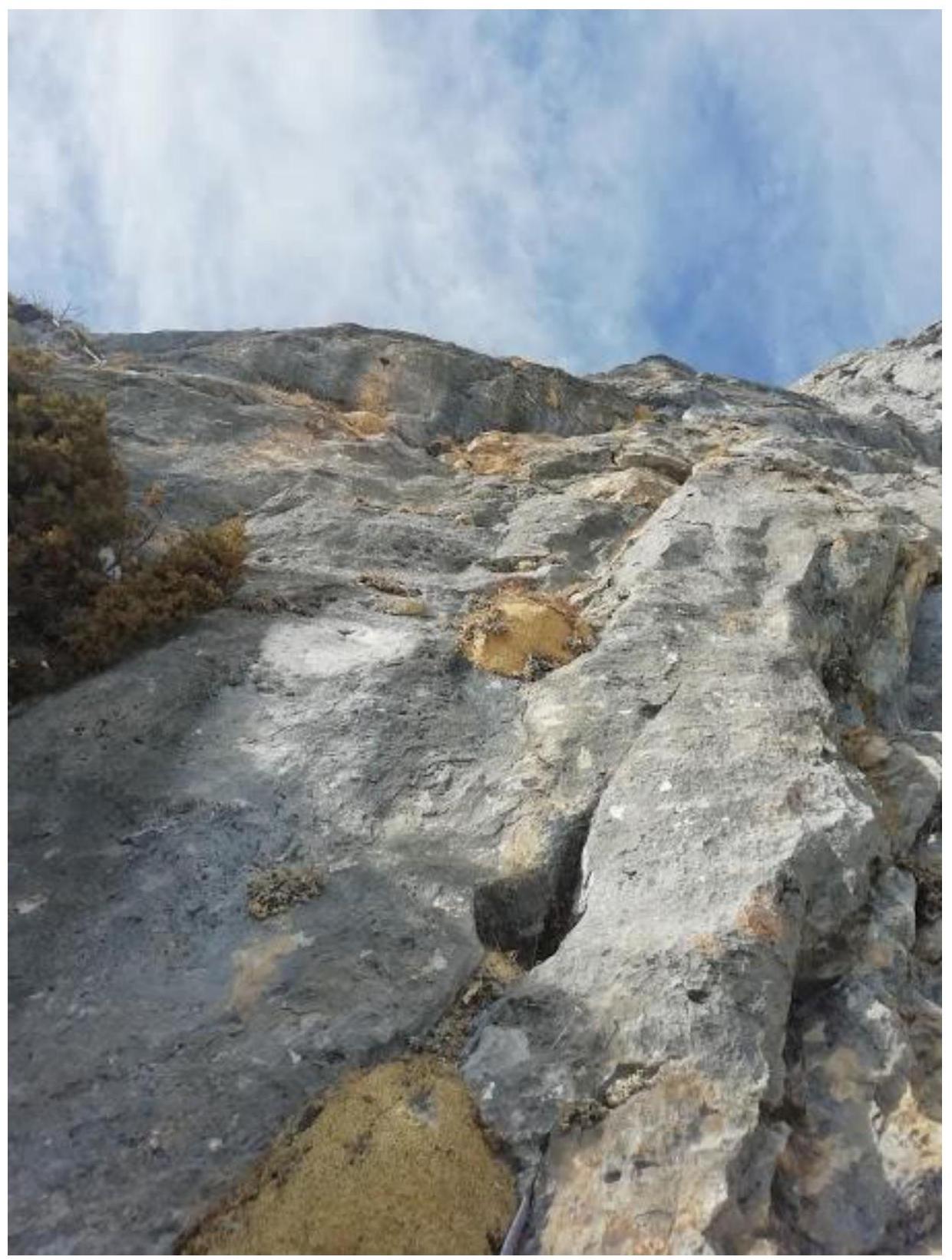
Fig. 14. View of section R7–R8. Leader's photo.
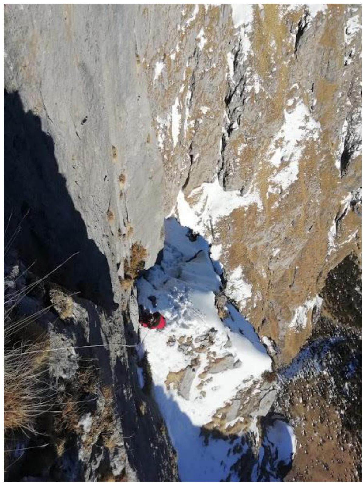
Fig. 15. View from station R11 to section R10–R11. The second jumar on the key section on the rope. The "saddle" landmark is clearly visible, and from this point, the team is in direct visibility from the camp.
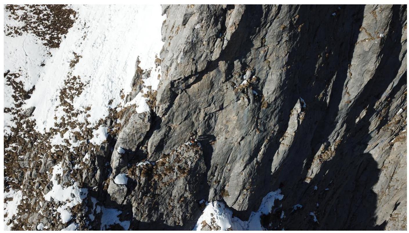
Fig. 16. View from a drone of sections R10–R11–R12. Both participants are visible in the photo.
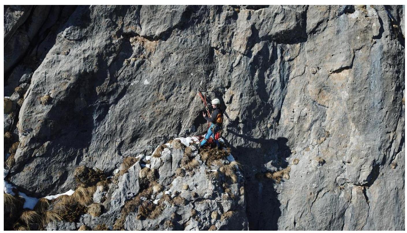
Fig. 17. View from a drone of station R11.
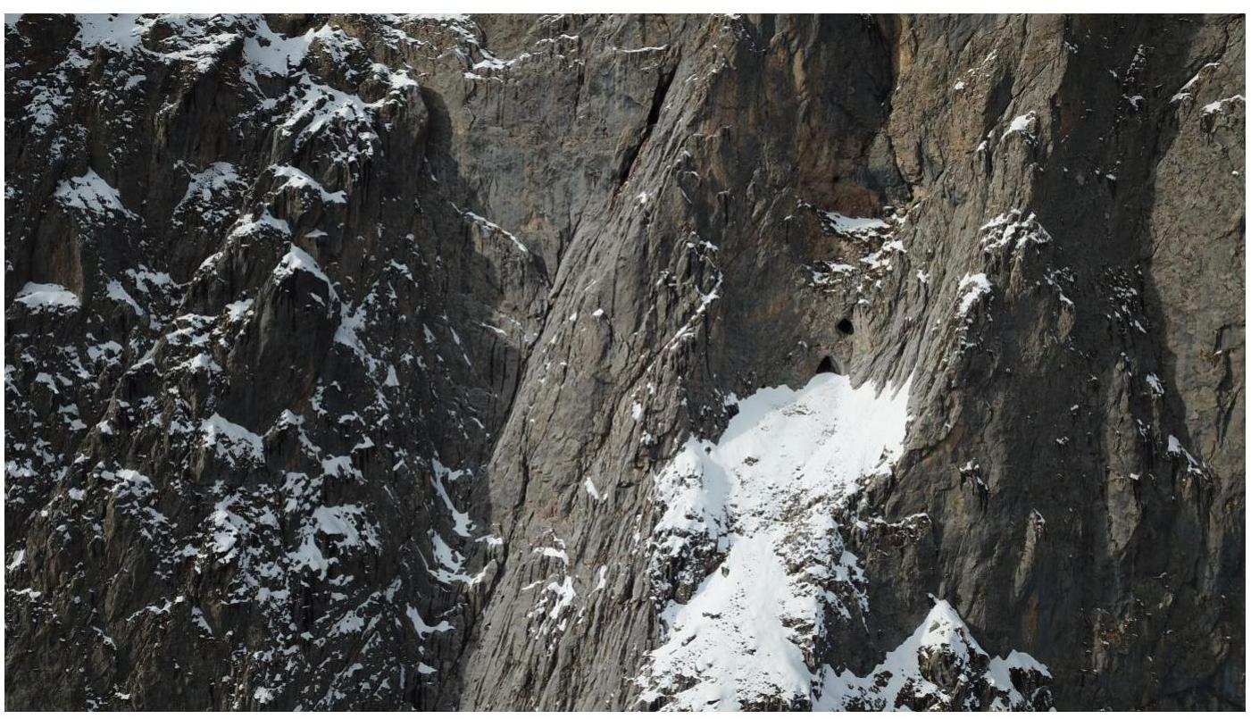
Fig. 18. View from a drone. Both key buttresses of routes 18 and 19 are visible, as well as the main landmark — the "Eyes" grotto. As it was later discovered, the grotto is connected by a passage and has a good overnight stay.

Fig. 19. View of the adjacent buttress of route No. 18 from section R11–R12.
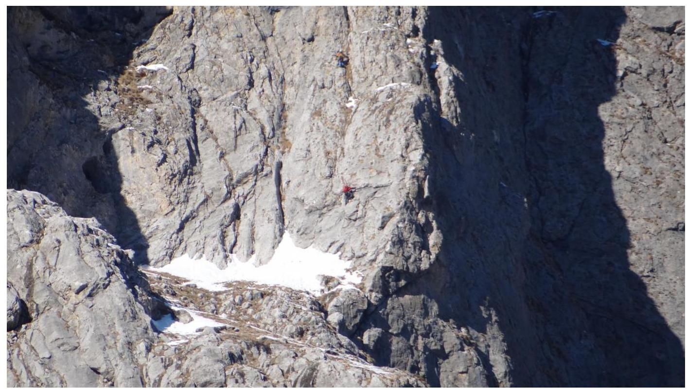
Fig. 20. Bird's-eye view. The team is working on section R11–R12.
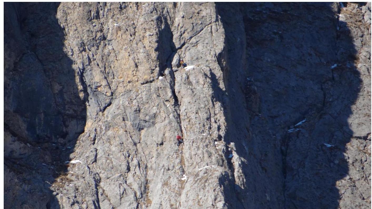
Fig. 21. Leader at station R12.
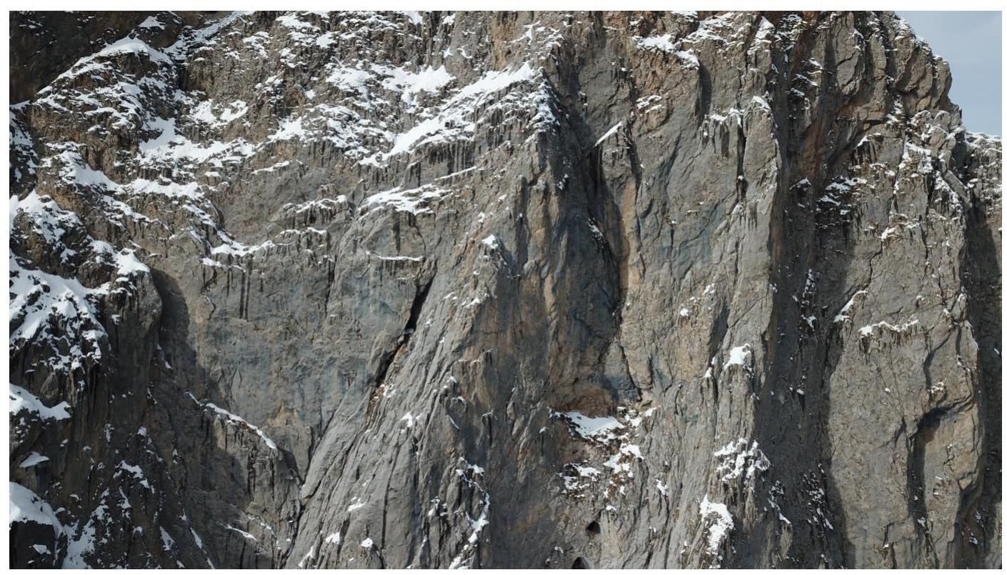
Fig. 22. Technical photo of sections R12–R14.
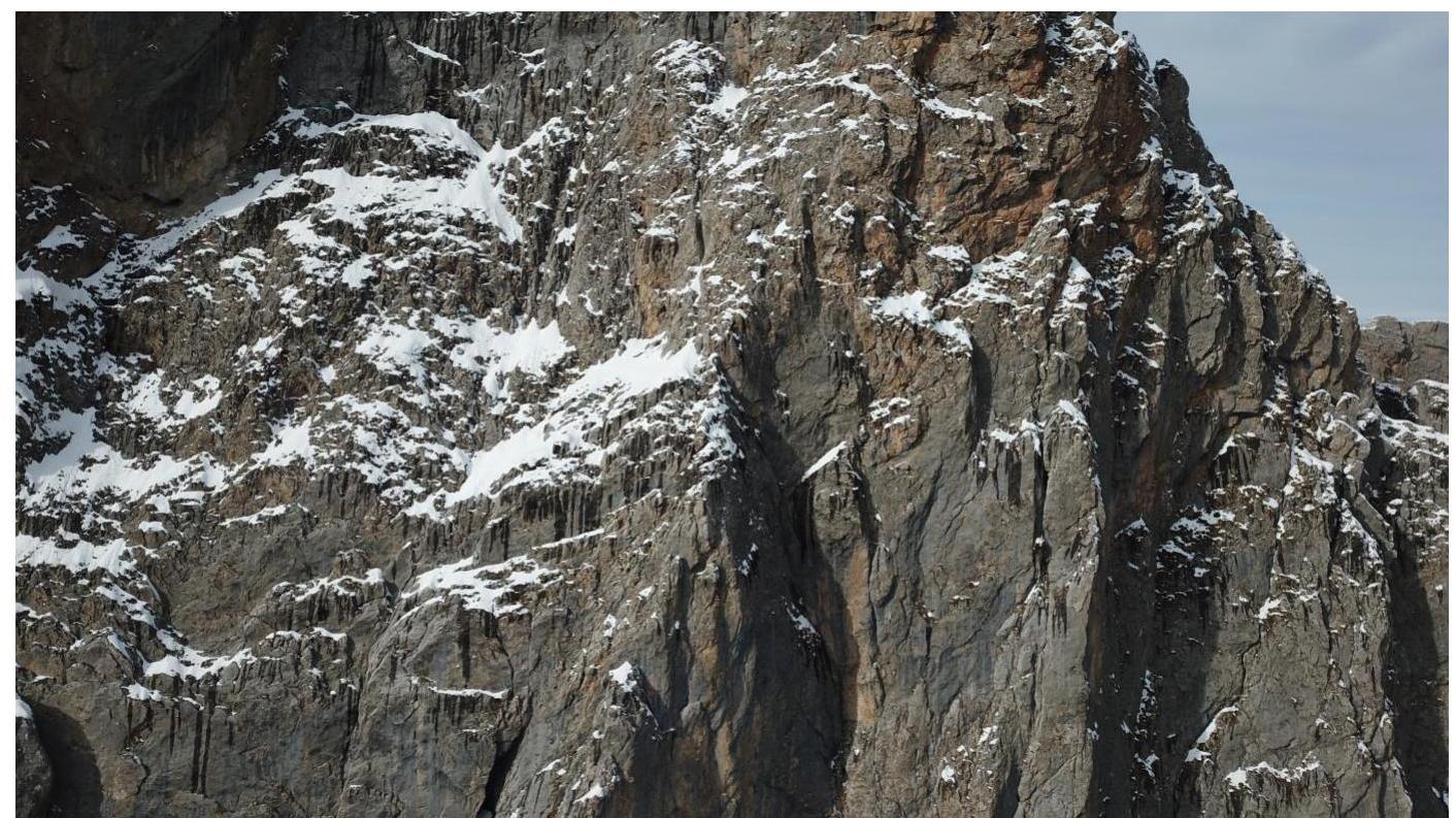
Fig. 23. Technical photo of sections R12–R14. Exit to the ridge.
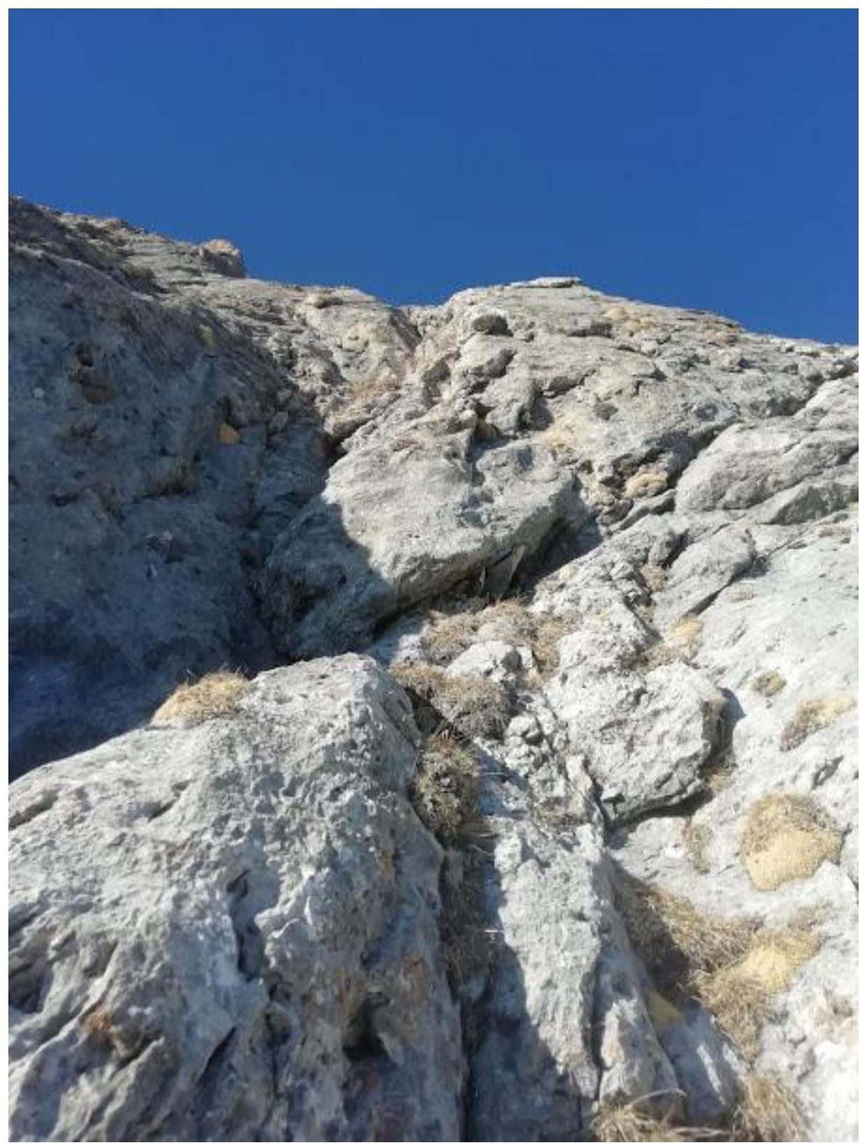
Fig. 24. View from station R12 to the start of section R12–R13.
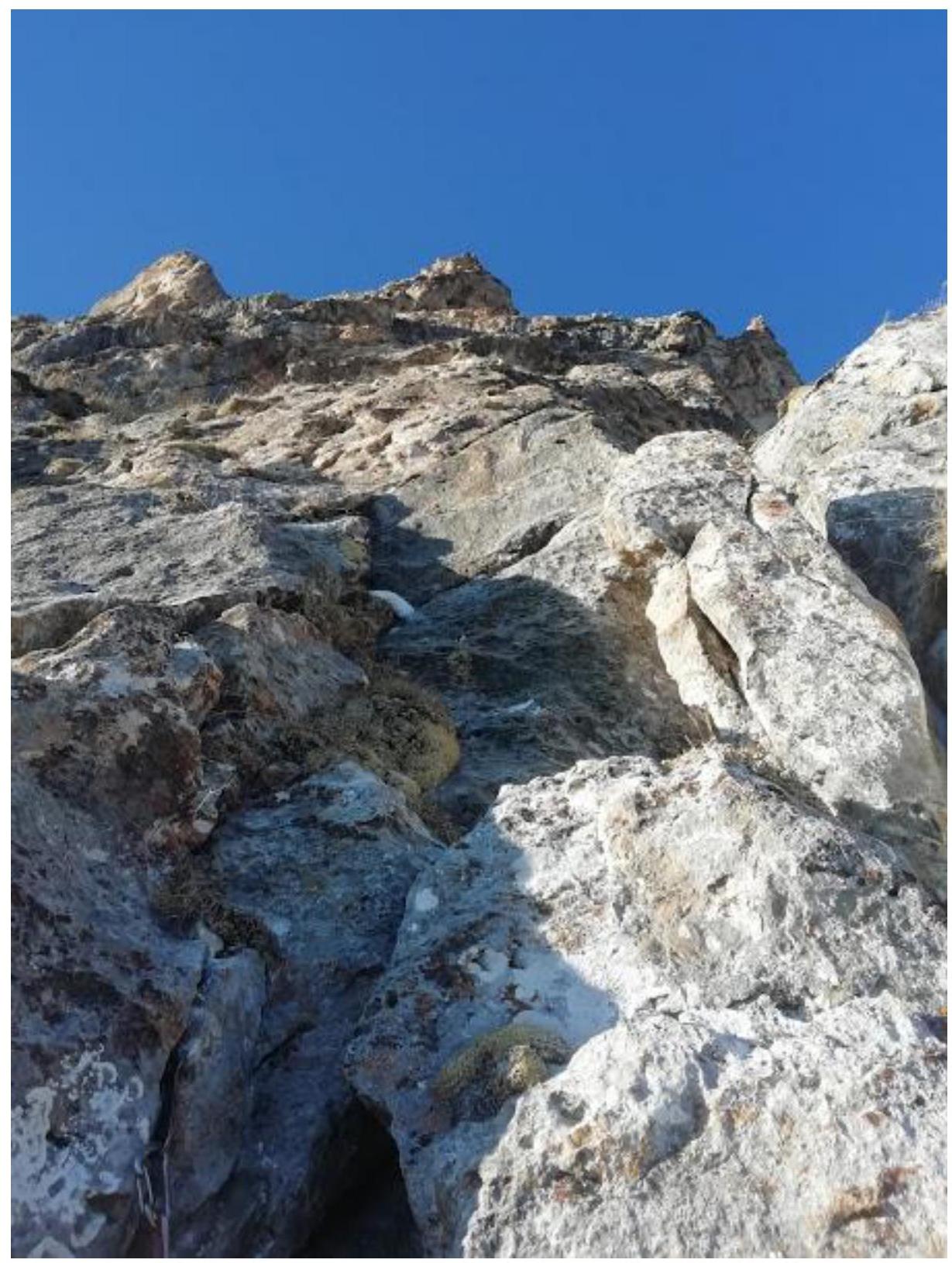
Fig. 25. View from station R13 to section R13–R14.
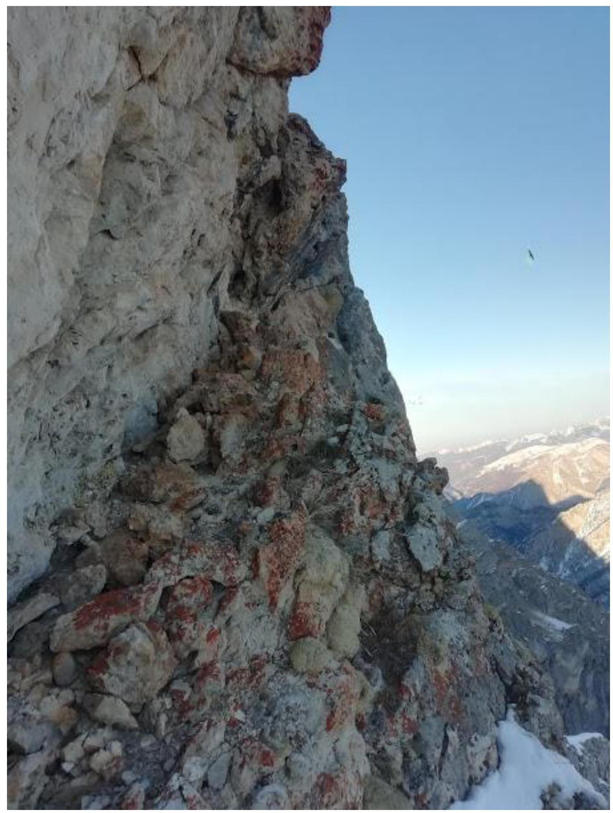
Fig. 26. View of a ledge with a "psychological place" on section R13–R14 before exiting to the ridge.
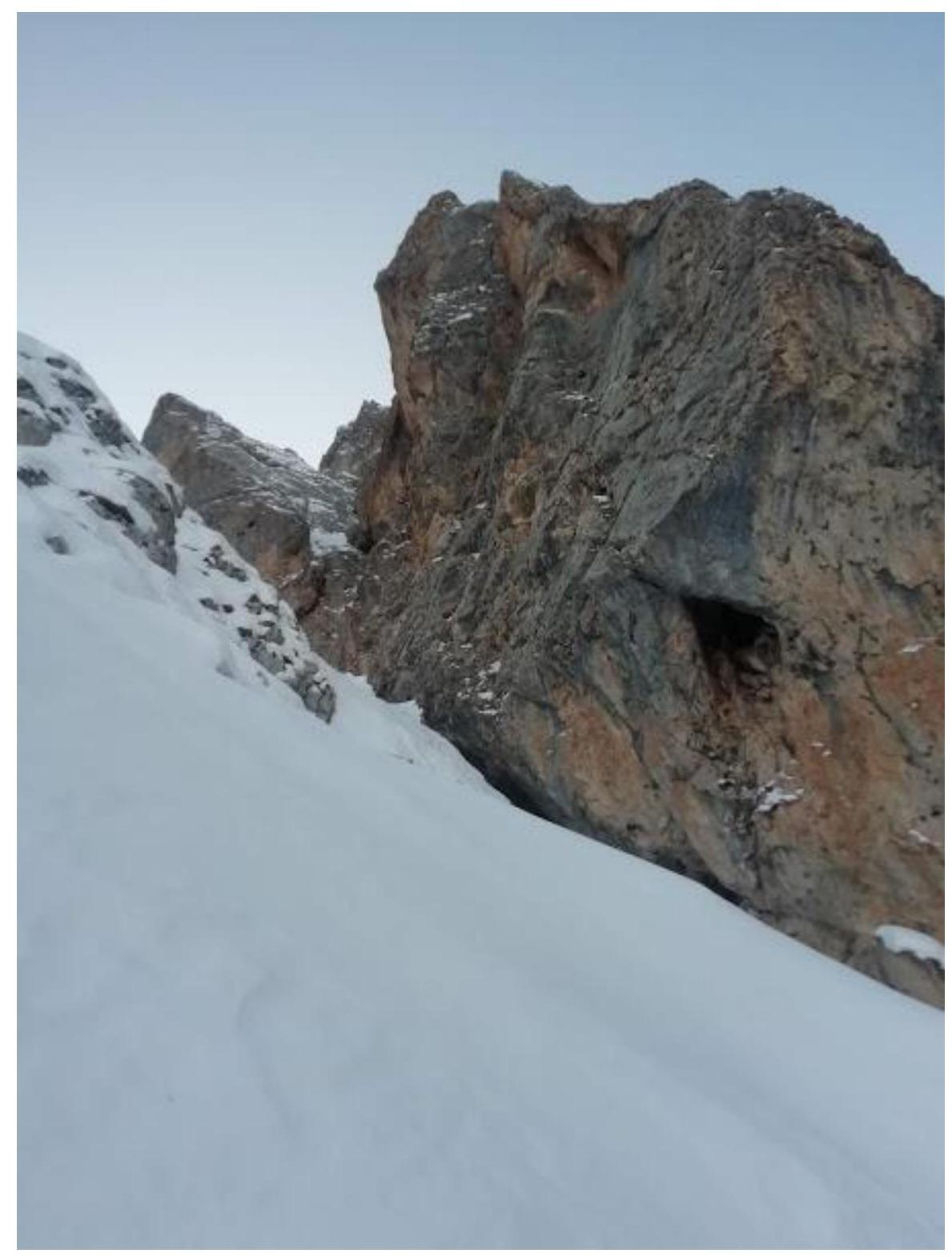
Fig. 27. On the ridge, on section R14–R15. Key ropes on Andreev's route No. 17 and Glazunov's route No. 18 are visible. At this point, three routes converge, including ours. Caution on the snowy slope, possible avalanche slab releases. Belay from rocks under the snow.
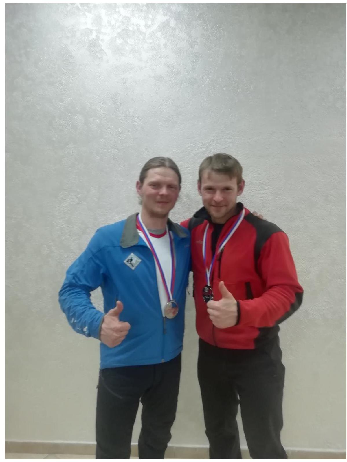
Fig. 28. No photo was taken on the summit; we were tired after two days of "running," and it was getting dark quickly with a strong wind picking up, making it necessary to bring rappel ropes along during the descent. Therefore, we attach a happy and satisfied photo of the participants of the Russian Championship on the ground.
Comments
Sign in to leave a comment