
Russian Mountaineering Championship
2020
Class: Ice and Snow
Report
On the first ascent by the team from Krasnoyarsk Krai - 1
On the peak Kyazi, 3171 m, via the center of the SE wall. First ascent, orient. 6B category of difficulty.
Team leader: Ratmir N. Mukhametzyanov
Participants:
- Egor V. Matveenko
- Mikhail V. Teplykh
Coaches:
- Nikolai N. Zakharov
- Valery V. Balezin
Report responsible: R.N. Mukhametzyanov, ratmir2810@mail.ru, +7-909-189-97-75
I. Ascent Passport
| 1. General Information | ||
|---|---|---|
| 1.1 | Leader's full name, sports rank | Ratmir N. Mukhametzyanov, Master of Sports |
| 1.2 | Participants' full names, sports ranks | Mikhail V. Teplykh, Master of Sports, Egor V. Matveenko, Master of Sports |
| 1.3 | Coach's full name | V.V. Balezin, N.N. Zakharov |
| 1.4 | Organization | Ministry of Sports of Krasnoyarsk Krai |
| 2. Ascent Object Characteristics | ||
| 2.1 | Area | Caucasus, from Pereval Kreстовый to v. Shaviklde |
| 2.2 | Valley | Alplager "Kyazi" |
| 2.3 | Section number according to the 2013 classification table | p. 2.9 |
| 2.4 | Peak name and height | Tsey-Loam (Kyazi main) 3171 m |
| 2.5 | Peak geographical coordinates (latitude/longitude), GPS coordinates | |
| 3. Route Characteristics | ||
| 3.1 | Route name | Via the center of SE wall |
| 3.2 | Proposed category of difficulty | 6B |
| 3.3 | Route development level | First ascent |
| 3.4 | Route terrain character | Rock |
| 3.5 | Route height difference (altimeter or GPS data) | 760 m |
| 3.6 | Route length (in meters) | 1025 m |
| 3.7 | Technical elements of the route (total length of sections of various categories of difficulty with terrain character indication (ice-snow, rock)) | 1st cat. sl. rocks/combination – 100 m. 2nd cat. sl. ice/rocks/combination – … m. 3rd cat. sl. ice/rocks/combination – … m. 4th cat. sl. ice/rocks/combination – … m. 5th cat. sl. rocks – 350 m. 6th cat. sl. rocks – 370 m. 6+ cat. sl. rocks – 205 m. Rocks 6, A3 – 190 m. Rocks 6, A4 – 75 m. |
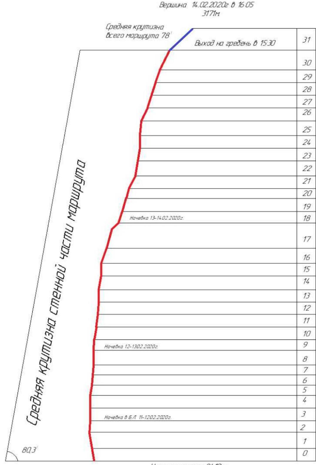
| 3.8 | Average route steepness (°) | 78° |
| 3.9 | Average steepness of the main route part (°) | 80° |
| 3.10 | Descent from the summit | Via 2A cat. sl. to Kyazi alplager |
| 3.11 | Additional route characteristics | No water in summer |
| 4. Team Actions Characteristics | ||
| :--: | :--: | :--: |
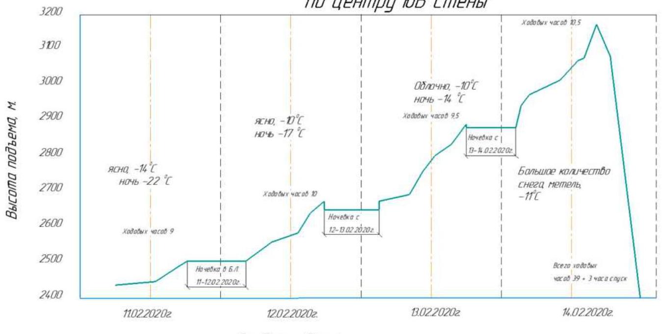
| 4.1 | Movement time (team's walking hours, in hours and days) | 40 h, 4 days |
| 4.2 | Overnight stays | on a platform |
| 4.3 | Route processing time | 9 h, 1 day |
| 4.4 | Route entry | 7:30, February 11, 2020 |
| 4.5 | Summit ascent | 16:30, February 14, 2020 |
| 4.6 | Return to base camp | 19:30, February 14, 2020 |
| 5. Weather Conditions Characteristics | ||
| 5.1 | Temperature (°C) | Day –5–15 °C, night down to –25 °C |
| 5.2 | Wind force (m/s) | Wind up to 10 m/s |
| 5.3 | Precipitation | Heavy snowfall on the third day evening and throughout the fourth day |
| 5.4 | Visibility (m) | Three days good, fourth day about 20 meters |
| 6. Report Responsible | ||
| 6.1 | Full name, e-mail | R.N. Mukhametzyanov, ratmir2810@mail.ru |
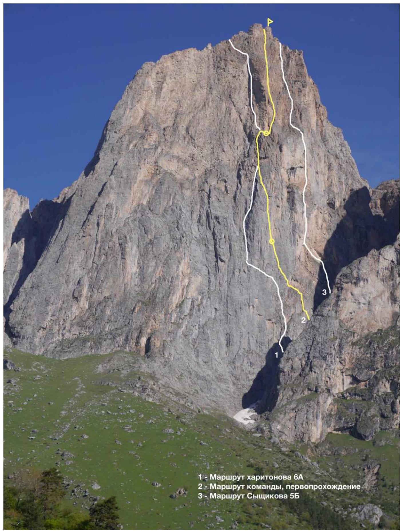
- 1 — Kharitonov's route 6A
- 2 — Team's route, first ascent
- 3 — Syzhikov's route 5B

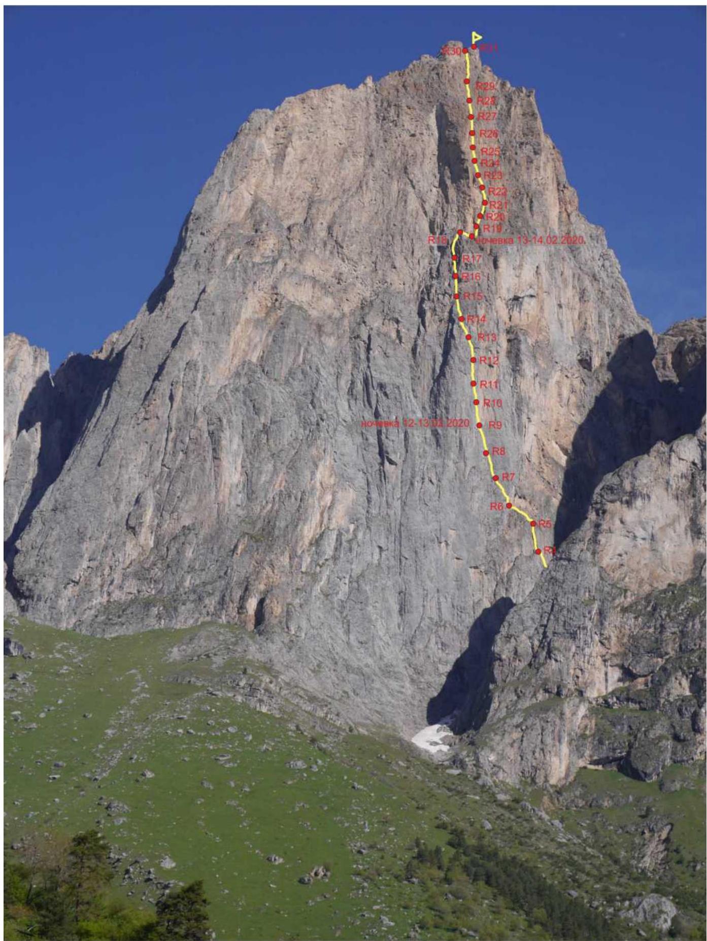
View of the route from the left
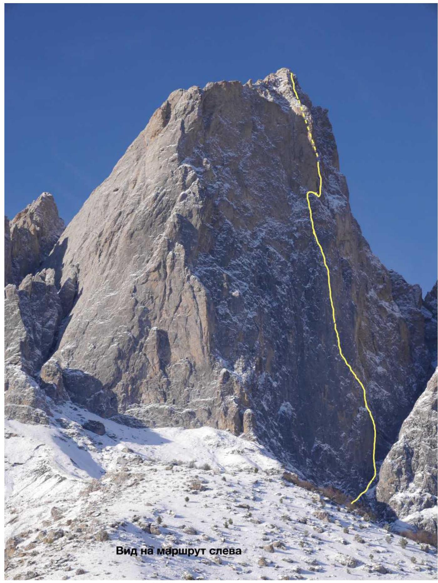
Taken during the ascent, February 11, 2020
Ascent graph to peak Tsey-Loam (Kyazi) Main 3171 m via the center of SE wall
Drawn Route Profile
Screenshot of weather forecasts from the site at the time of ascent
| February 10, 2020, Mon | February 11, 2020, Tue | February 12, 2020, Wed | February 13, 2020, Thu | February 14, 2020, Fri | February 15, 2020, Sat |
|---|---|---|---|---|---|
| –15°C ☀️ | –14°C ☀️ | –10°C ☁️ | –10°C ☁️ | –11°C ❄️ | –11°C ☁️ |
| –23°C ❄️ | –22°C ❄️ | –17°C ☁️ | –14°C ❄️ | –18°C ☁️ | –18°C ☁️ |
| February 16, 2020, Sun | February 17, 2020, Mon | February 18, 2020, Tue | February 19, 2020, Wed | February 20, 2020, Thu | February 21, 2020, Fri |
| –4°C ☁️ | –8°C ❄️ | –2°C ❄️ | –1°C ☁️ | –2°C ☁️ | –4°C ❄️ |
| –13°C ☁️ | –14°C ❄️ | –9°C ❄️ | –8°C ☁️ | –8°C ☁️ | –8°C ☁️ |
| February 22, 2020, Sat | February 23, 2020, Sun | February 24, 2020, Mon | February 25, 2020, Tue | February 26, 2020, Wed | February 27, 2020, Thu |
| –4°C ☁️ | –3°C ❄️ | –4°C ☁️ | –6°C ☁️ | –8°C ☁️ | +1°C ☁️ |
Ascent Area Overview
The Kyazi peak massif is located in the Skalisty Range of the Greater Caucasus, in the section of the ridge between the Terek River (to the west) and the Assa River (to the east). The peak Kyazi Main is the highest peak of the massif, towering above the Central and Eastern peaks. Previously, the peak was listed in the classifier under the names "Girech" and later "Gaikomt". The administrative border between the Republic of Ingushetia and North Ossetia-Alania runs along the Skalisty Range to the peak Kyazi and then turns north. The ascent route and approaches are located on the territory of the Dzheyrakhsky District of the Republic of Ingushetia.
It's most convenient to base in the "Kyazi" alplager near the Besht pass, 100 m before the turn to the "otdeleniye Besht" border post.
Border permits are not required for the area around the Kyazi peaks; however, it's necessary to notify the border post of your presence.
Cellular connection is available via Beeline and Megafon networks, and on the wall and at the top, MТС network is also available, along with mobile internet. The weather in the area is quite stable; snowfall periods last 2-3 days, and snow on the routes melts very quickly. This should be considered during prolonged wall ascents. In winter, after heavy snowfalls, be cautious in couloirs and on leeward slopes due to the risk of avalanches.
The approach to the route takes about an hour and a half. Move in the direction of the southern walls of the peak Gaikomt Main along the grassy ridge; 300 m before the wall, on a flattening of the ridge above the forest level, turn right and approach the beginning of the couloir between the peaks Kyazi Main and Kyazi Central. Up the couloir about 100 m, the start of the route is on the left, in a large hanging internal angle that abuts a cornice ceiling.
The Gaikomt ridge is composed of sedimentary limestone rocks, partly metamorphosed. The wall is rich in various cracks, gaps, and cavities; the relief is reminiscent of Crimean walls: Morcheka, Forossky Kant, and Sokol. Most of the relief is clogged with earth, grass, and tufts. It takes a long time to clean the relief for reliable point installation, and fine grass dust clogs the eyes. The upper third of the wall is quite steep and destroyed, with a white and yellow hue, reminiscent of Ak-Kaya and Kara-Kaya in Bezengi. The rock is fragile, with sections of soft chalk inclusions. It's very problematic to organize reliable belay points. Special attention should be paid to the reliability and placement of stations. Anchors work well for belaying.
Team Tactical Actions
In February 2020, the team from Krasnoyarsk Krai - 1, as part of the face-to-face Russian Mountaineering Championship in the technical class, quickly completed two graded ascents, leaving a week of free time. We decided to make a first ascent on the most challenging line on the wall and submit it to the ice-snow class. The route passes to the right of Kharitonov's route.
Attempts to ascend the route:
- In 2017, a team from Yekaterinburg led by Syzhikov ascended 15 m in half a day and descended.
- In 2018, a team led by Dmitriyenko (one of Russia's strongest ITО specialists) ascended about 40 m in less than a full day before abandoning the route.
On February 11, 2020, the team from Krasnoyarsk - 1, consisting of R.N. Mukhametzyanov, E.V. Matveenko, and M.V. Teplykh, left the base camp at 5:00. They reached the start of the route at 7:10 and began working at 7:25. They managed to ascend three 30-meter ropes that day.
The first two ropes are among the most challenging on this route. The destroyed hanging internal angle with many jammed stones inside and layered rock complicates belaying and doesn't allow for reliable points. Therefore, the first station was assembled on bolts. To ascend, they had to:
- clean the gap from "live" rock,
- move on large camalots in places,
- belay on anchors or anchor hooks.
The cornice (a 3-meter ceiling) was ascended via the left wall of the internal angle using:
- two short anchors (left pitons),
- stepping on a relief skyhook,
- one Friend,
- several anchors,
- small nuts.
The entire day, Egor Matveenko led, and Mikhail Teplykh followed. R. Mukhametzyanov observed from the ground. After a laborious day, they decided to leave the hung ropes and descend to the camp for a comfortable overnight stay.
On February 12, they left the camp at 5:00. The leader started working at 7:30.
Matveenko led, Teplykh followed, and Mukhametzyanov moved last with a bailout bag.
The relief after the cornice became more monolithic, but free climbing wasn't possible.
They ascended to R9:
- Mukhametzyanov stopped to set up a platform,
- Teplykh and Matveenko climbed to R10.
They set up the platform next to a small snow ledge.
On February 13, they started at 7:00. The intense ITО movement didn't allow them to catch up with Kharitonov's route until R16-R18, which is a common section. There's a good ledge for an overnight stay. They set up a platform above the ledge. A good landmark is a large rib resembling a "ship's bow." Their route bypasses this rib on the right. The weather worsened at night, with snowfall.
On February 14, they rose at 4:00 and began moving at 5:10. The snow-covered rocks greatly hindered movement. After three ropes, they encountered destroyed relief. Belaying was unreliable, and ITО movement was slow. Climbing wasn't feasible due to snow. Teplykh led, Matveenko followed, and Mukhametzyanov moved last with a bailout bag. Around 16:00, Teplykh ascended the wall section and reached the ridge. At 16:35, the team stood on the summit in full, reported to the camp, and recorded the time.
The descent to the road took about 2.5 hours. It's worth noting that the route they ascended was quite challenging and labor-intensive despite their high speed.
The team completed a 6A category ascent via Zhigalov's route in 16 hours just a week prior, a record time for one of the most challenging routes on this wall. They also ascended a 5B category route via Kurochkin's route in 7 hours as part of the championship, securing 1st place, which undoubtedly indicates their high level of training and teamwork. Previous failed attempts by other strong teams led by Syzhikov and Dmitriyenko attest to the complexity of the line.
The route they ascended has many sections of complex climbing, both psychologically and physically:
- ITО A4 – 75 m
- ITО A3 – 190 m
Most belay points are unreliable: anchor hooks stuck in deep cracks or earth and grass tufts. It took a long time and was labor-intensive to clean the relief for reliable belay points and to ascend. Camalots often popped out of wet chalk cracks.
The upper part features ITО and complex free climbing on crumbling cornices and "humming" slabs. 12 bolts were placed on the route. They spent 4 days and 40 working hours on this line.
Given the above, we believe the route corresponds to the 6B category of difficulty. The ascent was made during the face-to-face Russian Championship in the technical class under direct observation by judges.

Lower part of the route, view from the right
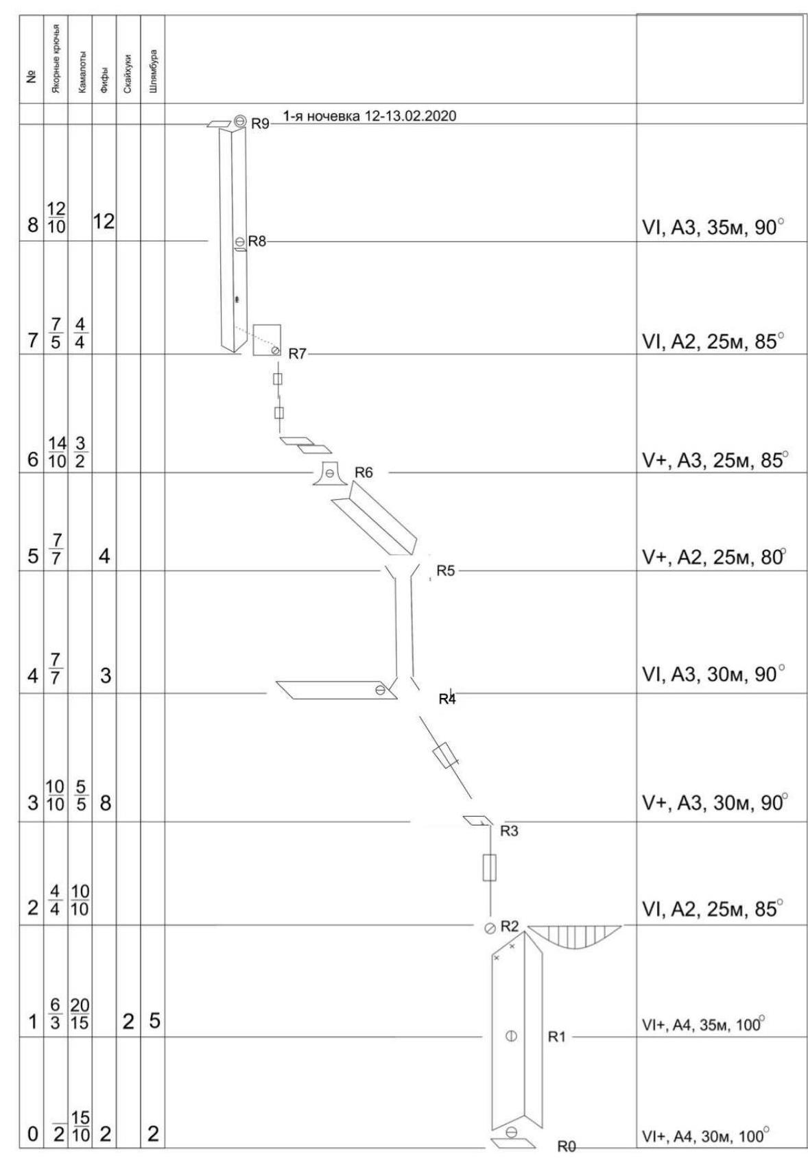
| № | Anchor hooks | Camalots | Friends | Skyhooks | Bolts |
|---|---|---|---|---|---|
| TOTAL | 196 | 134 | 91 | 26 | 12 |
Section-by-Section Description
Approach via the couloir to the large stone at the base of the internal angle with a large gap.
R0–R1. Start from a ledge on a large stone, via a destroyed internal angle, ITО A4 (30 m) — (had to clean the rotten, very destroyed gap for point installation), points are unreliable. After 15 m, they encountered a stopper; from here, A. Syzhikov's team descended. The station is above the second destroyed "live" plug. The plug is bypassed on the right, where there's a socket for an anchor. Two Ø8 mm anchors were hammered at the station (left pitons); anchors were hammered very easily — the rock in this section is soft.
6+, A4, e–2 m, 30 m, 100°.
R1–R2. Movement via the internal angle on large nuts, occasionally encountering sockets on the right side for anchors; the angle is heavily destroyed; a nut is placed a meter above the station for safe upward movement, as skyhooks chip the rock. An anchor with a carabiner is left above the third plug; from here, E. Dmitriyenko's team descended.
Further movement is on very large nuts:
- Used two 6th and one 5th camalot, repositioning them multiple times while moving upward.
- Large camalots often fell out of the destroyed gap despite thorough cleaning before installation.
- Therefore, they didn't rely on them for belaying but used anchors and anchor hooks instead.
The cornice was ascended via the left wall of the internal angle using:
- two short anchors (left pitons),
- several anchors,
- small nuts.
Three meters after the cornice — a station on anchors.
6+, A4, e–10 m, 35 m, 100°.
R2–R3. A 25-meter section, ITО A2, steepness 85°, move upward via a vertical system of gaps to a small oblique ledge — a station on the ledge on anchors.
6, A2, 25 m, 85°.
This concluded the first laborious day; overnight stay was in the base camp.
(Second Day)
R3–R4. Moved to a ledge with an outcrop (travrese left 2x15) (30 m), move left upward via destroyed relief ITО A3 15 m, climbing 5+ (5 m) or A2, station on anchors and camalots.
6, A3, 30 m, 90°.
R4–R5. Via a chimney to the top of the outcrop 20 m, section is heavily destroyed, belaying alternates between the left and right planes, ITО. Station above the outcrop on anchors.
6, A3, 30 m, 90°.
R5–R6. Traverse left-upward to a ledge with a small grotto ITО A2, station on anchors and large camalots.
5+, A2, 25 m, 80°.
R6–R7. Traverse left-left-upward along ledges toward a rib. 5 m up the rib, upward via sockets and rare deep cracks. Station is hanging on anchors.
5+, A3, 25 m, 85°.
R7–R8. Traverse to the middle of the gray wall left-upward 7 m, then upward via an internal angle past a juniper 10 m. Station on a ledge on anchors.
6, A2, 25 m, 85°.
R8–R9. Upward via an internal angle 35 m to a small ledge under a red overhang, on Friends via shallow sockets.
6, A3, 35 m, 90°.
R9–R10. From the right part of the small ledge upward via a crack to a ledge with a piton.
6+, A3e–15 m, 20 m, 85°.
A bolt is hammered for platform installation; overnight stay is 20 m below.
(Third Day)
R10–R11. Upward via a gap through an overhang. A couple of meters later, the gap becomes blind. Three anchors are hammered for belaying, a gray monolithic belt. Holes are made for skyhooks. ITО A4 (10 m). After the overhang — a flattening 15 m up the gray wall and slightly left.
6+, A4e–12 m, 30 m, 85°.
R11–R12. Tried to move right-upward via sockets; when the relief ended, moved left-upward.
6+, A3e–5 m, 30 m, 85°.
R12–R13. Upward to indistinct "ram's foreheads" via shallow, intermittent cracks 25 m — a hanging station.
6, A2e–2 m, 25 m, 85°.
R13–R14. Upward 5 m to a small niche. Then right 1 m and upward via a system of cracks; cracks periodically become blind internal angles, and they had to move 2 m right or left; station on anchors.
6+, A3, 30 m, 90°.
R14–R15. From the station left-upward 20 m, then upward via a crack for medium camalots 15 m. Station under a small overhang in a small internal angle.
6, A2, 35 m, 80°.
R15–R16. Right-upward through a small cornice on anchor-Friends, then along a slab with cracks to the second cornice, further via a crack through the cornice — exit to an internal angle ITО A2, upward via the internal angle. Station at the top of the internal angle on an outcrop on medium camalots.
6+, A2, 30 m, 90°.
R16–R17. Here, the line connects with Kharitonov's 6A route to a snow ledge. Move strictly upward via destroyed relief. Further, it flattens, but the rock crumbles heavily, and belay points are unreliable.
5+, A2, 30 m, 70°.
R17–R18. Move via an internal angle 45 m. Relief is heavily destroyed, ascended via climbing; it's necessary to climb carefully, as everything crumbles onto the second climber via the internal angle. ITО A1. After exiting under an overhang left-upward to an internal angle, and then through the overhang right-upward — exit to a large inclined ledge via the ledge 10 m, at the top — a station on anchors. These are the only two sections that, over the three previous days of work, are ascended via climbing.
6, A1, 45 m, 75°.
Then, from the station, right-downward along the wall via the ledge 7 m, where the platform was installed.
(Overnight Stay 2)
R18–R19. From the right (lower) part of the ledge via a crack right-upward past a cave (suitable for overnight stay). Station in an internal angle.
5, A1, 30 m, 70°.
R19–R20. Upward through a small cornice and right via gentle relief — easy climbing or ITО (if snowy, bypass the large "nose" of the wall from below). Exit to an oblique ledge.
5, A1, 30 m, 70°.
R20–R21. Further upward-right via the ledge, and then via an internal angle that becomes more vertical. Station on a plug of the internal angle.
6, A2, 25 m, 75°.
R21–R22. Further via the internal angle to a point where a traverse left-upward is possible. Station. Relief is destroyed.
5+, A1, 30 m, 65°.
R22–R23. Traverse diagonally left-upward (not upward via the angle, but left-upward!) via destroyed relief — a hanging station on anchors.
6, A3, 20 m, 80°.
R23–R24. Left-upward to pronounced cracks and fractures going vertically. Station in a niche on anchors. Caution — many large, loose stones.
6, A2 10 m, A3 25 m, 80°.
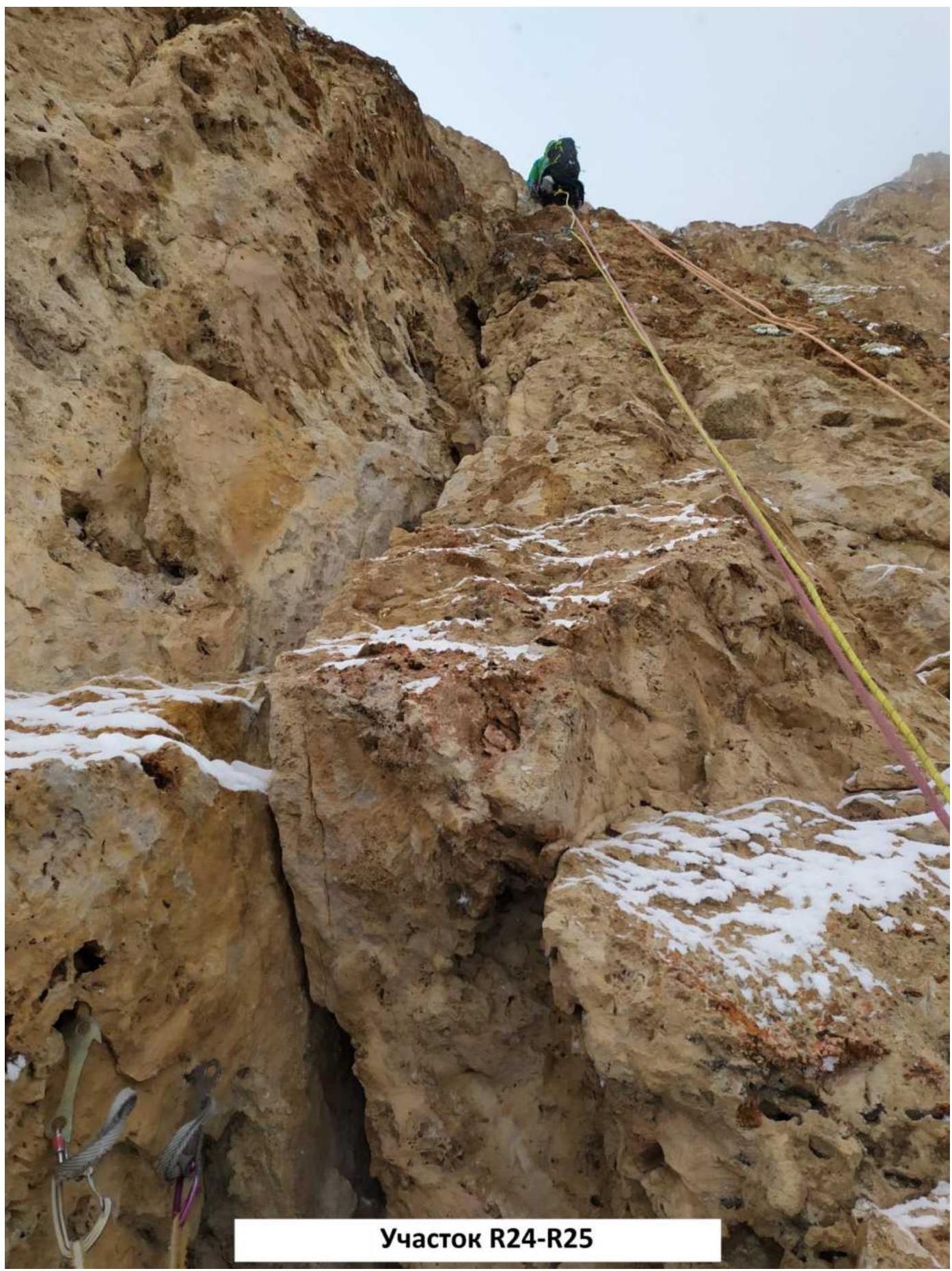
R24–R25. Upward via a crack through an overhanging niche. Station in a small overhanging internal angle; relief is destroyed.
6, A2, 30 m, 90°.
R25–R26. Upward via an internal angle. Station on a large oblique ledge.
6, A2, 35 m, 85°.
R26–R27. Depart from the ledge upward-right via logical relief to a point where it's convenient to make a traverse upward-left.
5, A1, 30 m, 65°.
R27–R28. Move upward-left to a gentle internal angle going upward (30 m).
5+, A1, 30 m, 75°.
R28–R29. Upward via a large internal angle with "live" stones. Convenient to set up a station in a small overhanging internal angle on the right to avoid being hit by stones and snow.
5+, A1, 30 m, 70°.
R29–R30. Upward via a large, gentle internal angle. After 60 m, you'll reach the ridge under the summit, from where it's a walk. Recommended to divide this section into two 30-meter parts, as it's challenging to pull the rope due to many bends.
5–6, A0–A1, 60 m, 65°.
R30–R31. Along the ridge not more than 100 m to the summit.
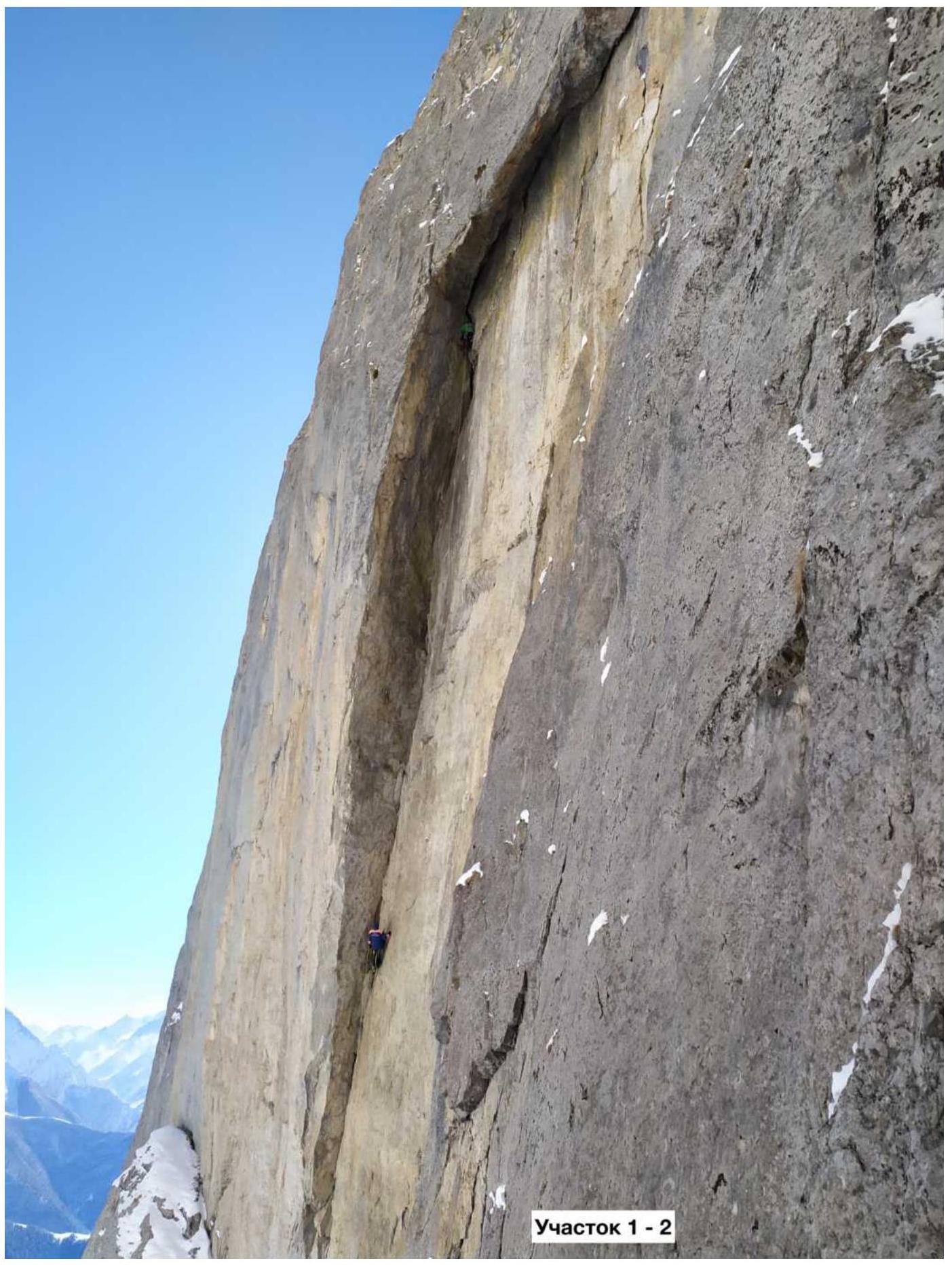
Section 1–2
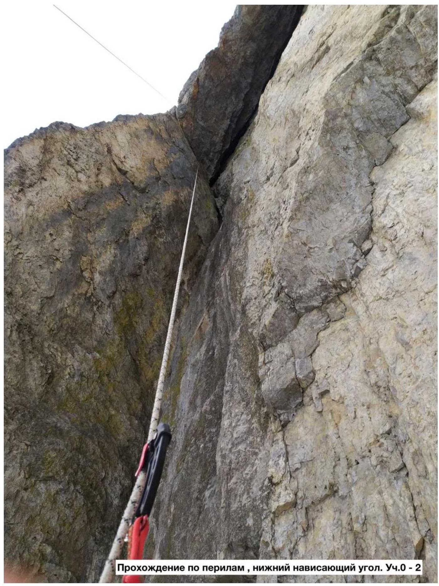
Ascent via the top ropes, lower hanging angle. Section 0–2
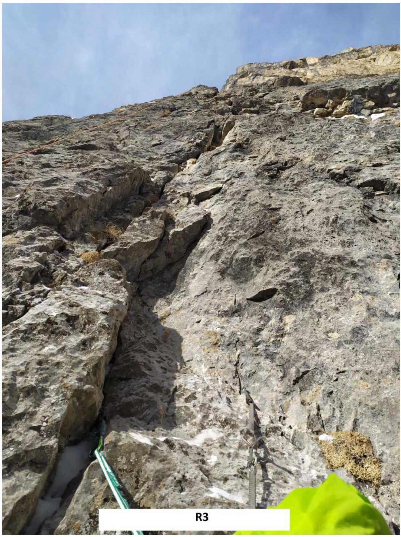
R3
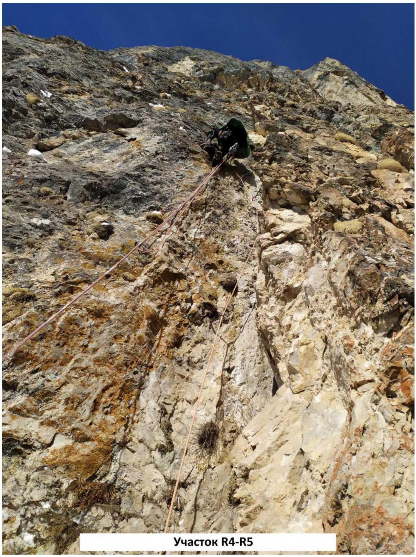
Section R4–R5
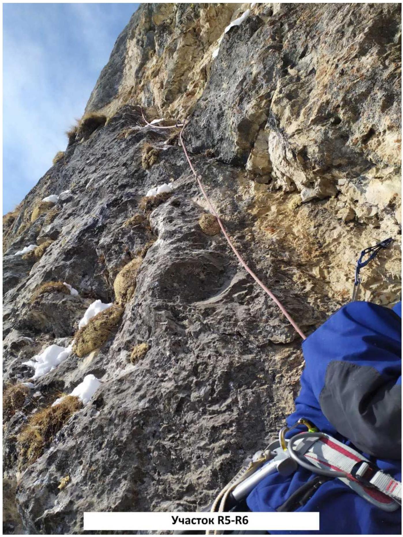
Section R5–R6
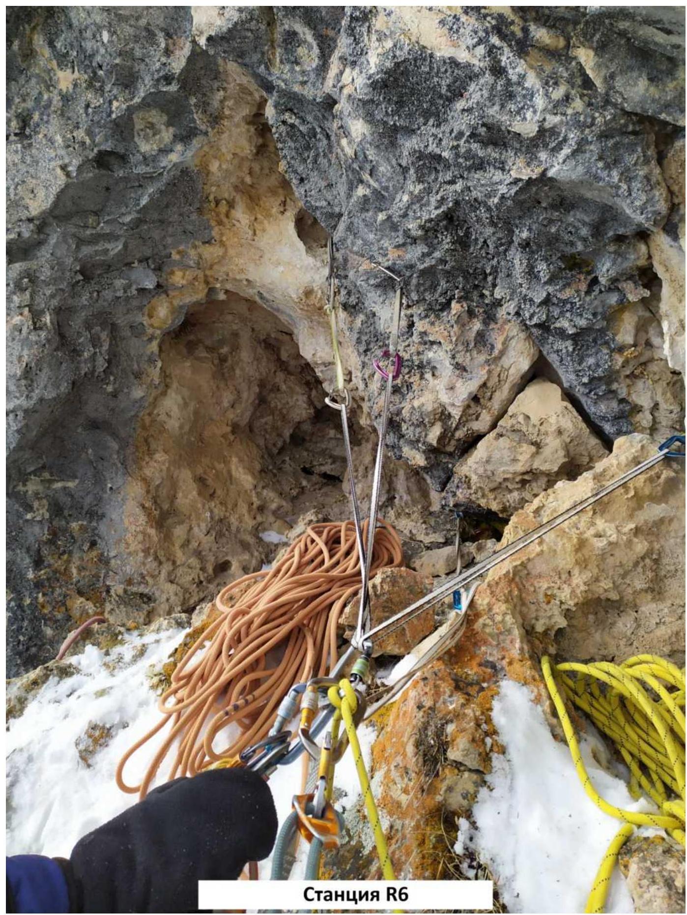
Station R6

Section R6–R7
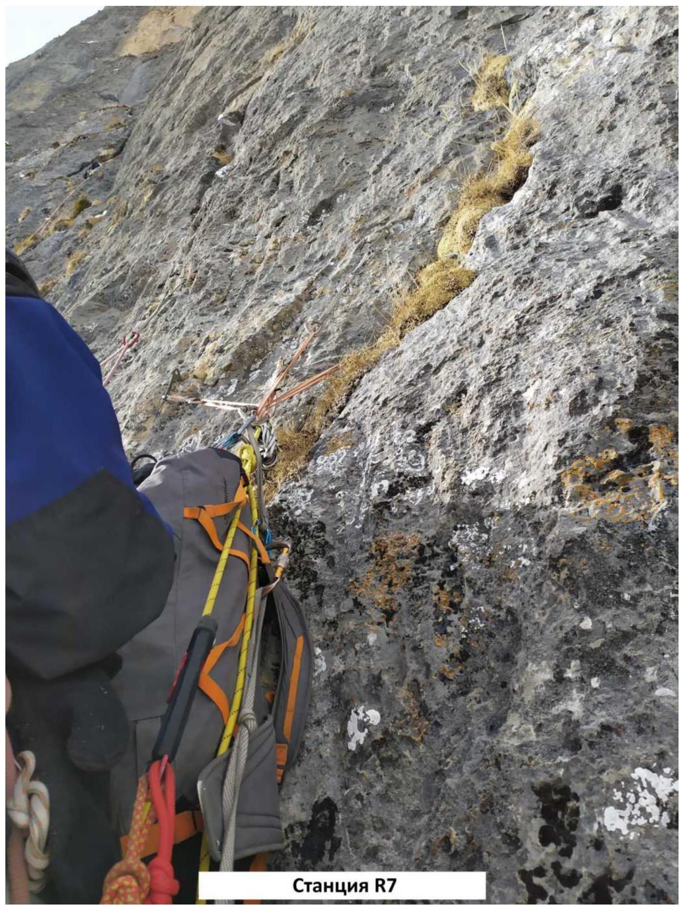
Station R7
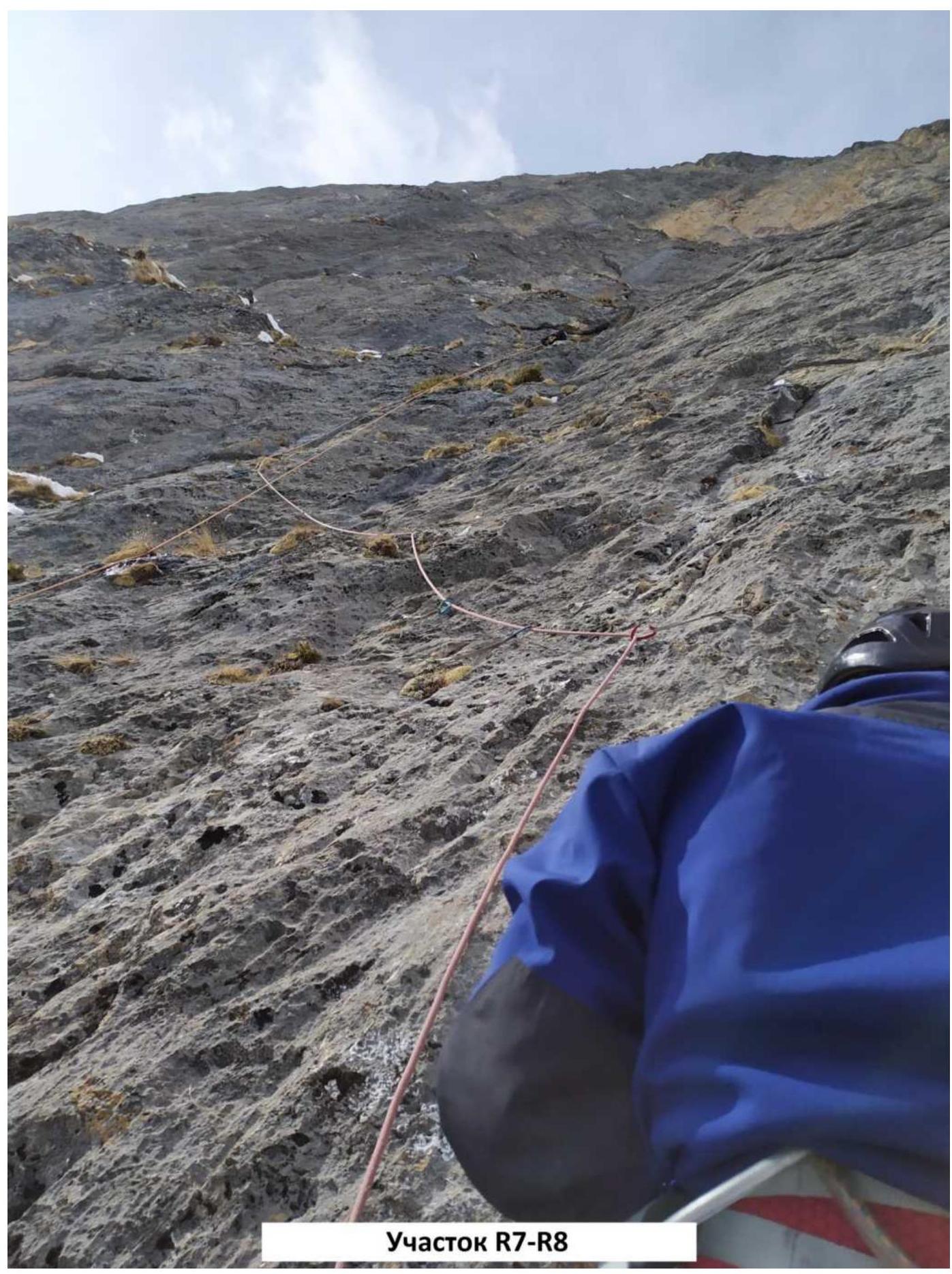
Section R7–R8
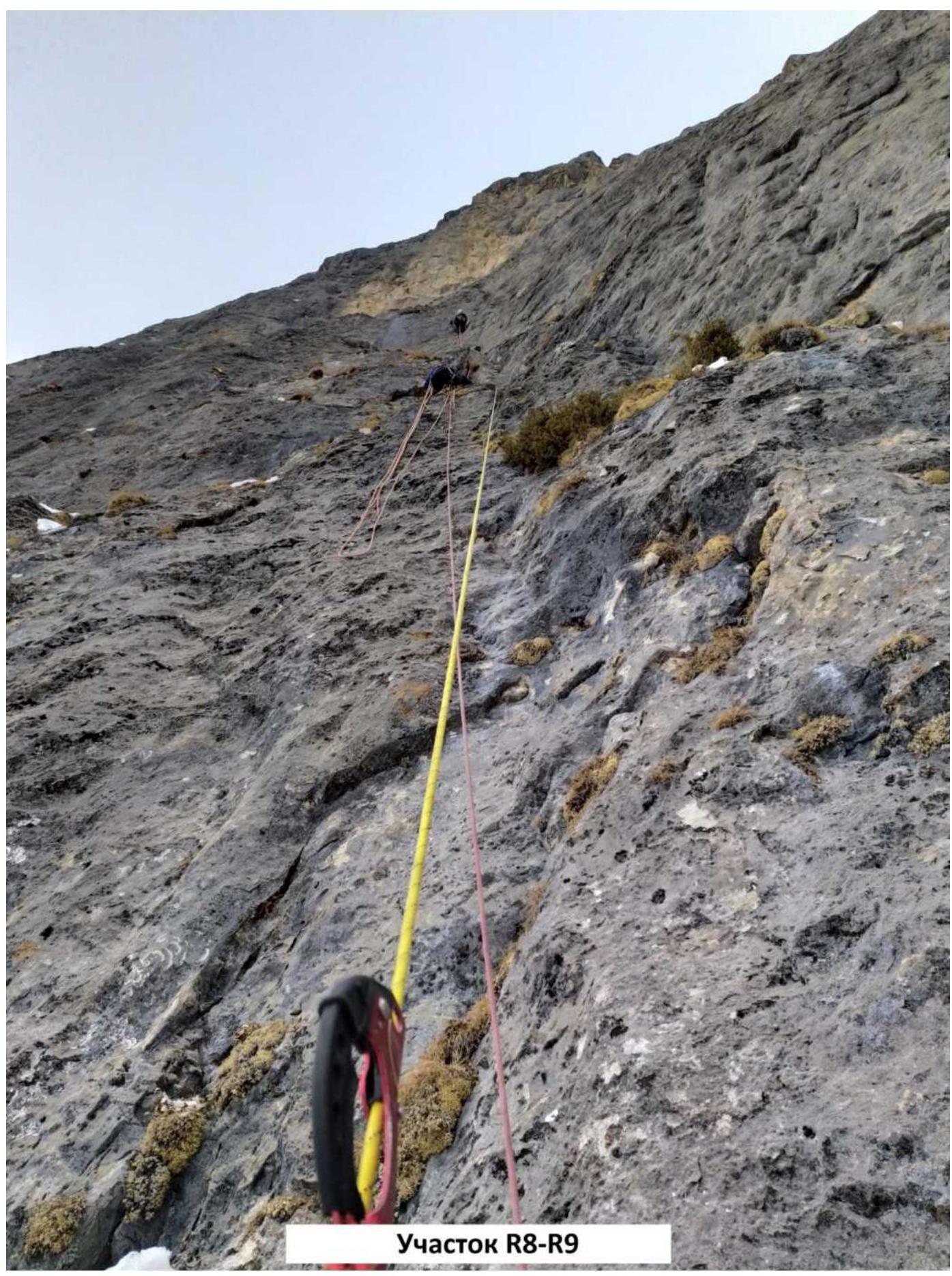
Section R8–R9
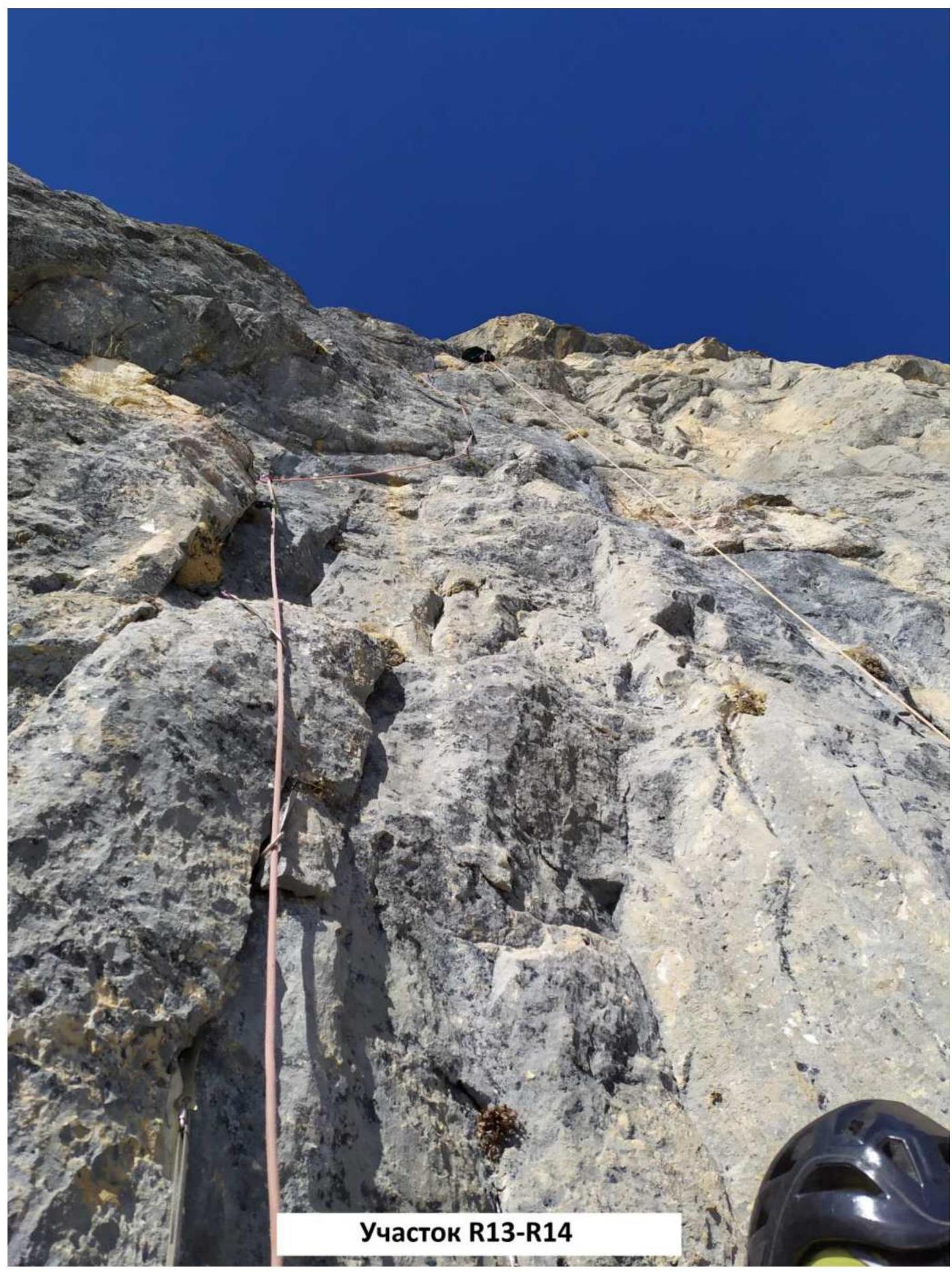
Section R13–R14
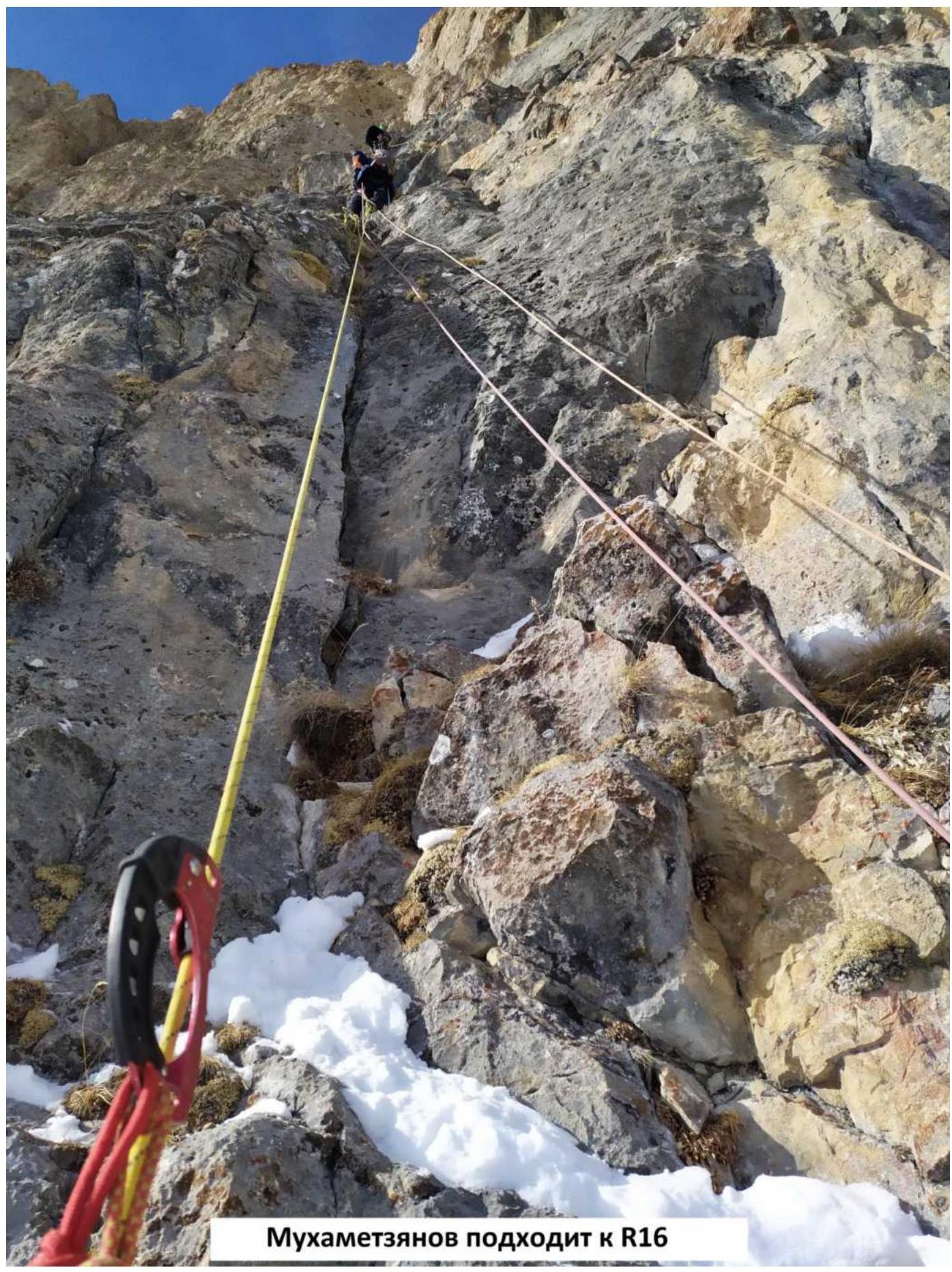
Mukhametzyanov approaching R16
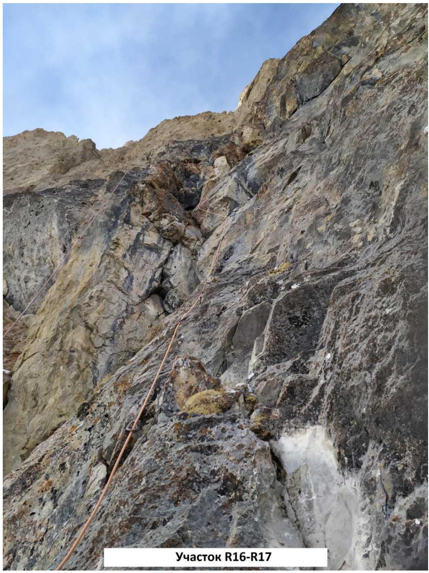
Section R16–R17
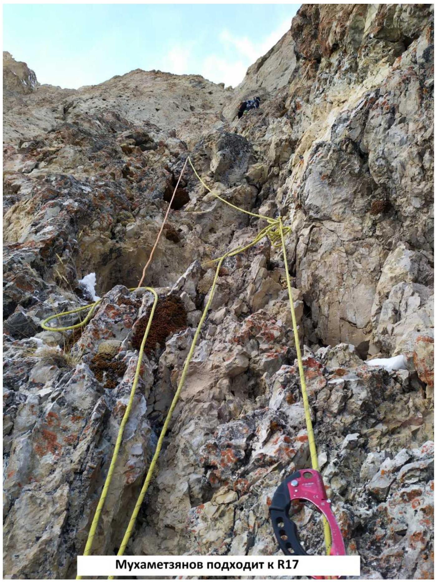
Mukhametzyanov approaching R17
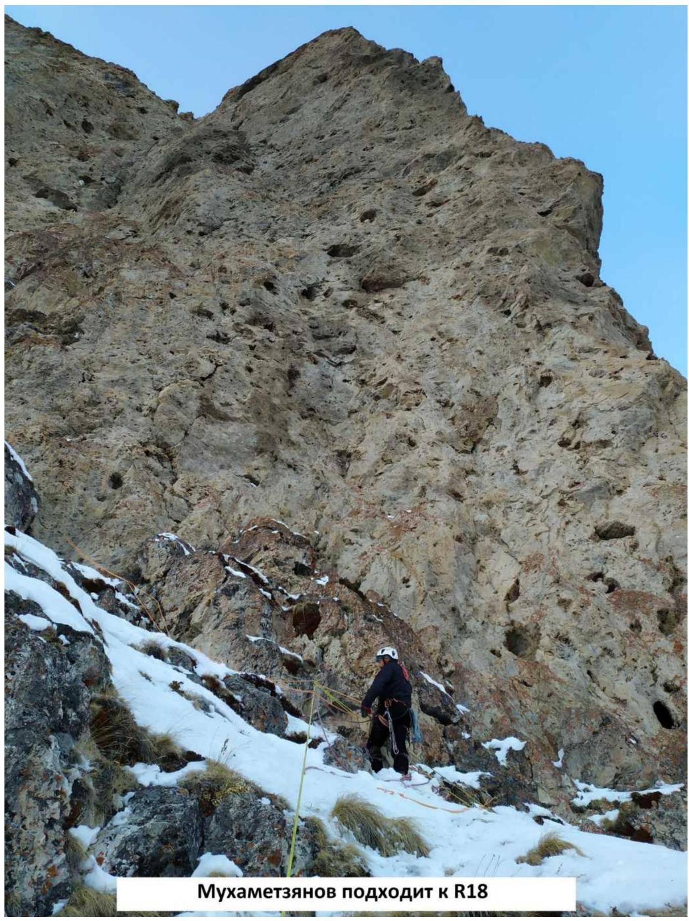
Mukhametzyanov approaching R18
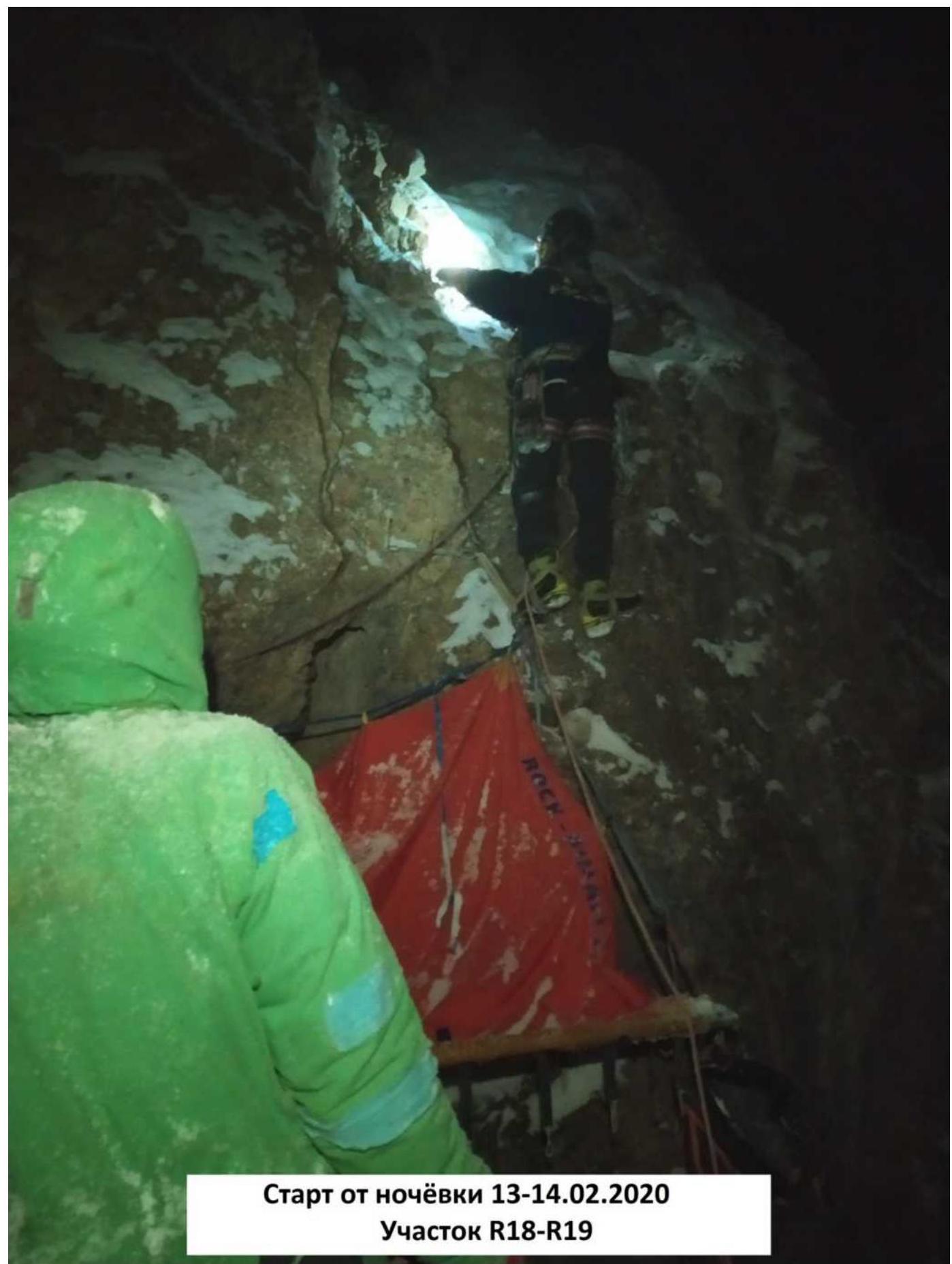
Start from the overnight stay on February 13-14, 2020
Section R18–R19
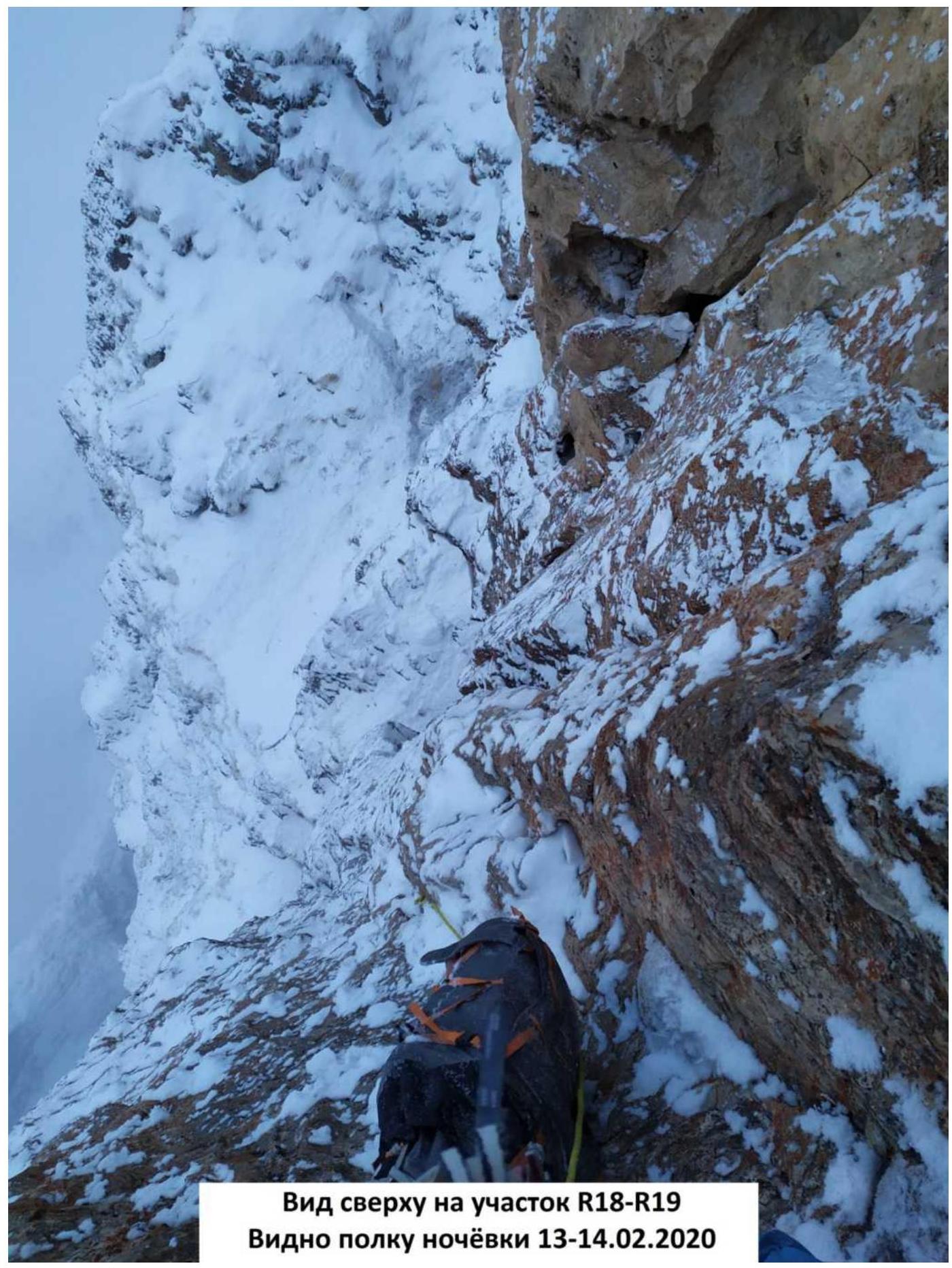
View from above on section R18–R19
The ledge for overnight stay on February 13-14, 2020 is visible
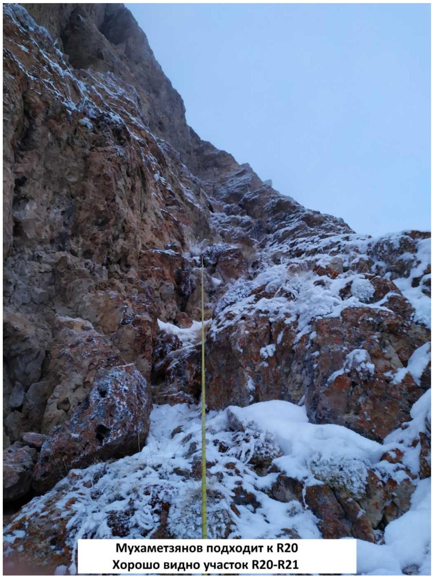
Mukhametzyanov approaching R20
Section R20–R21 is clearly visible
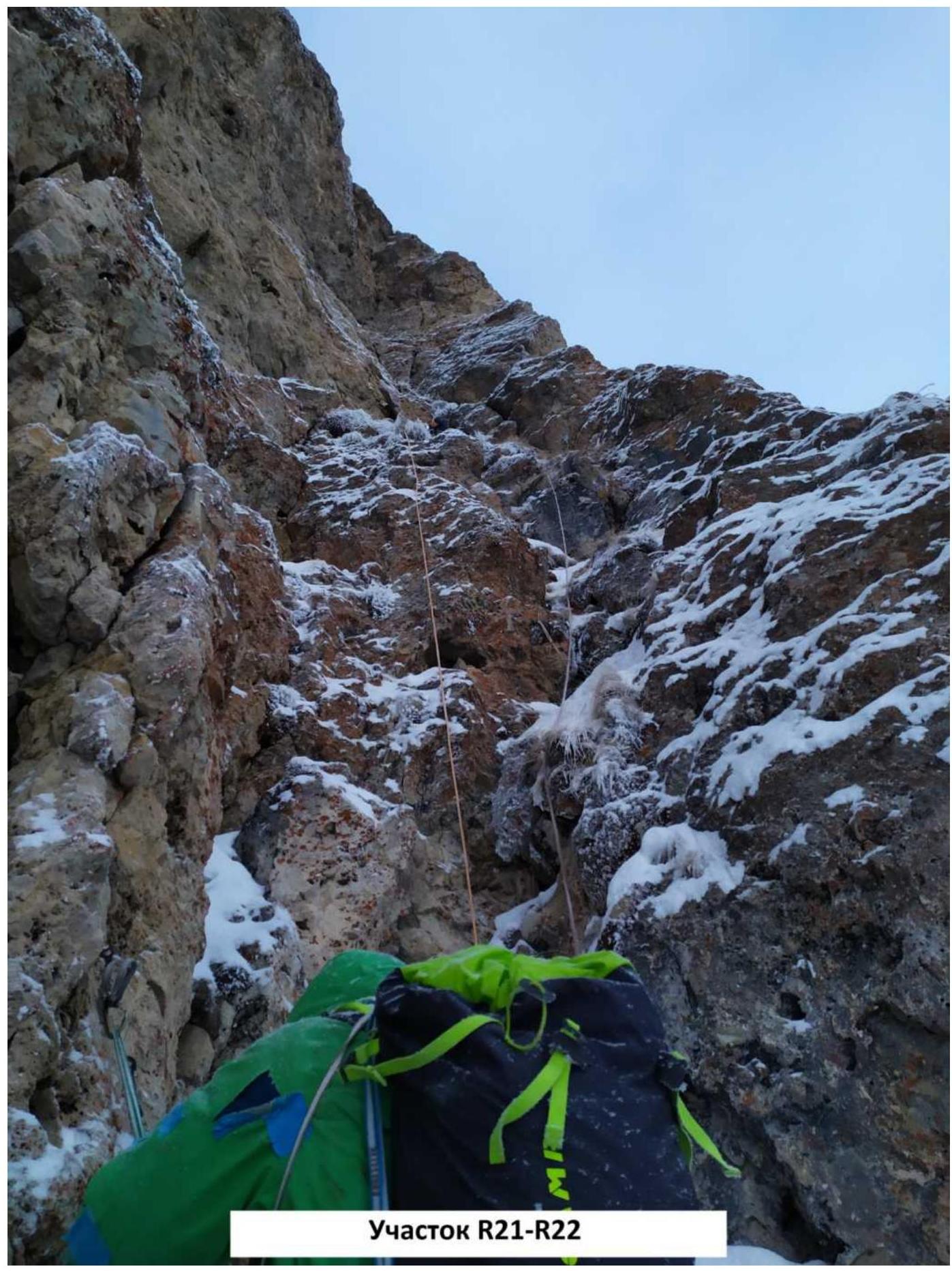
Section R21–R22
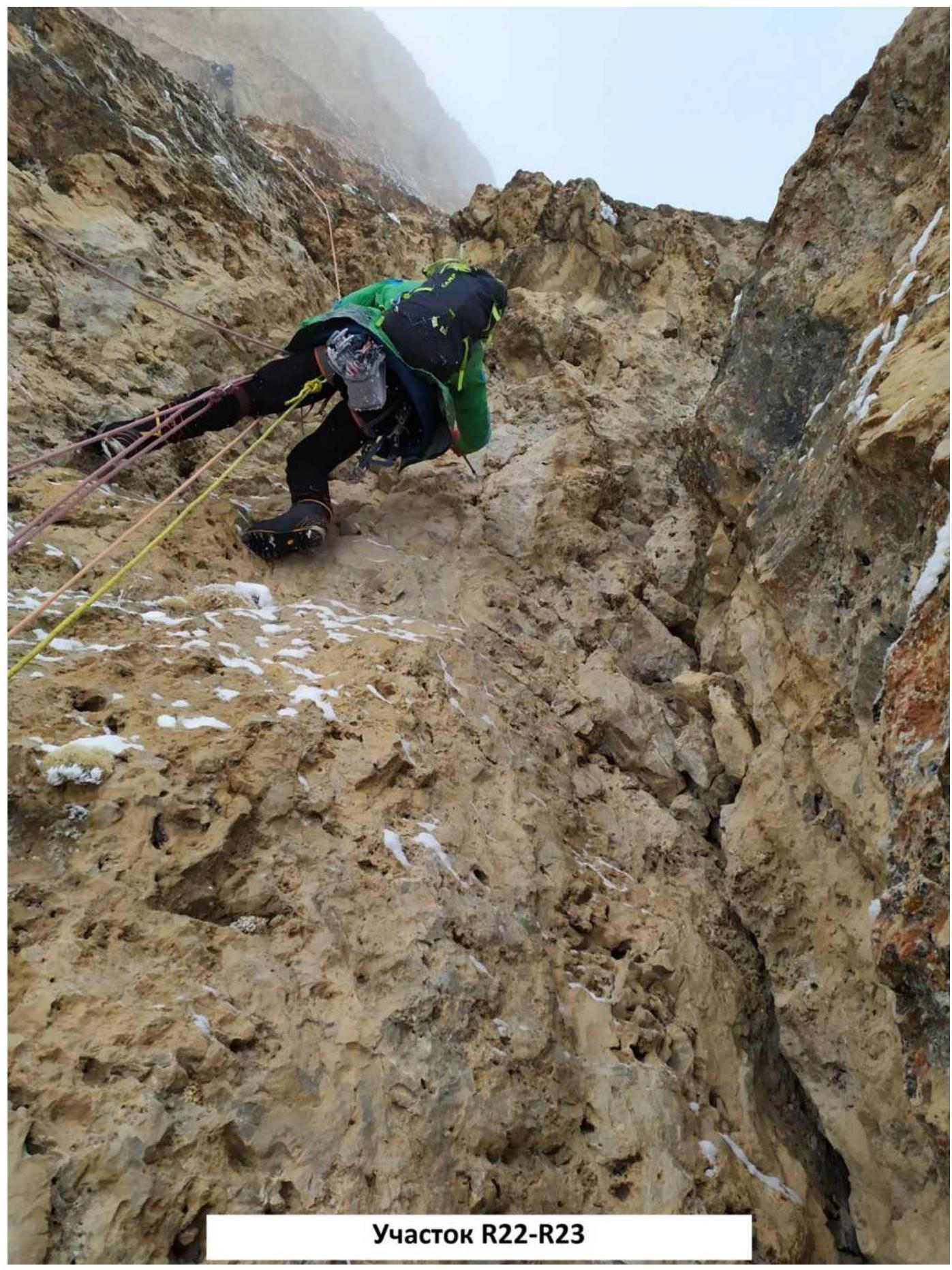
Section R22–R23
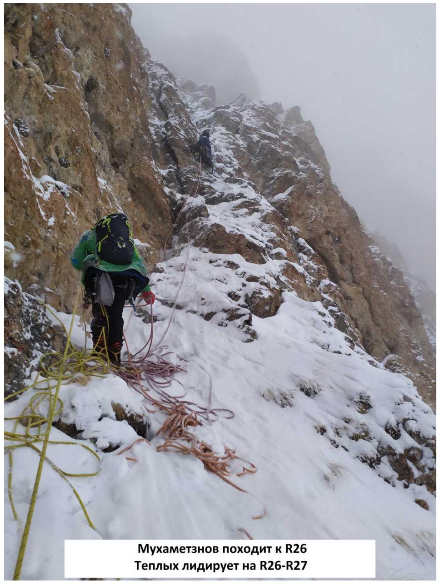
Mukhametzyanov approaching R26. Teplykh leading on R26–R27
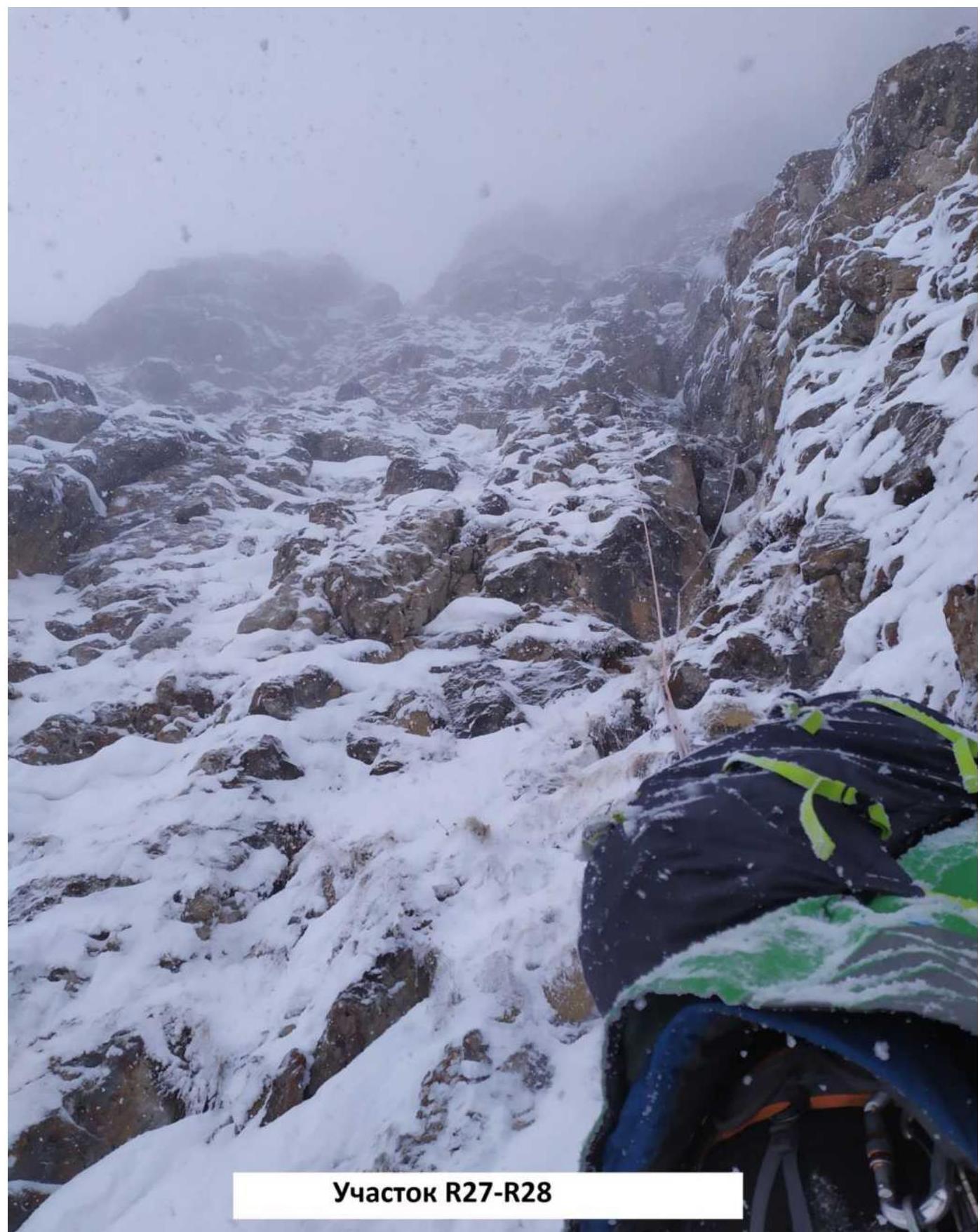
Section R27–R28
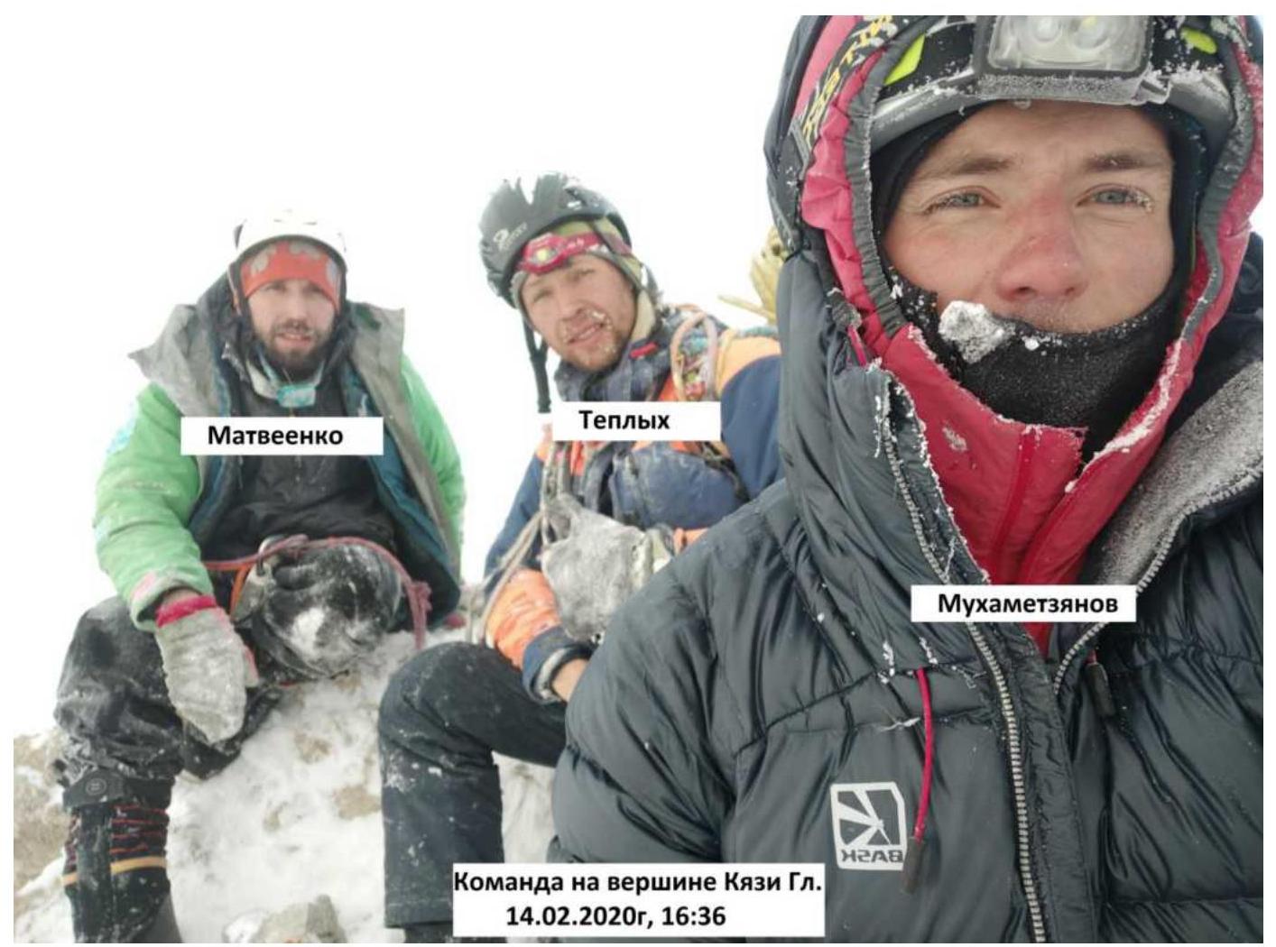
The team on the summit of Kyazi Main, February 14, 2020, 16:36
Comments
Sign in to leave a comment