
Report
on the ascent of Tsey-Loam (Kyazi) peak, 3171 m, via the left part of the SE-wall (K. Dorro route), 6A cat. diff., from October 29 to October 31, 2020 2020
I. Ascent Report
| 1. General Information | ||
|---|---|---|
| 1.1 | Full name, sports rank of the leader | Olenova Nadezhda Aleksandrovna, CMS |
| 1.2 | Full name, sports rank of the participant | Dyupina Mariya Vladimirovna, MS |
| 1.3 | Full name of the coach | Balezin Valeriy Viktorovich |
| 1.4 | Organization | Krasnoyarsk Krai Federation of Alpinism, PKDMOO "Federation of Alpinism and Rock Climbing" |
| 2. Characteristics of the Ascent Object | ||
| 2.1 | Region | Caucasus, 2.3. From Nakhar Pass to Chipperazau Pass |
| 2.2 | Valley | |
| 2.3 | Section number according to the 2013 classification table | 61 |
| 2.4 | Name and height of the peak | Tsey-Loam (Kyazi) peak, 3171 m |
| 2.5 | Geographical coordinates of the peak (latitude/longitude), GPS coordinates | 42°46′40″ N, 44°58′47″ E |
| 3. Route Characteristics | ||
| 3.1 | Route name | via the left part of the SE-wall |
| 3.2 | Category of difficulty | 6A |
| 3.3 | Degree of route exploration | – |
| 3.4 | Nature of the route terrain | Rock |
| 3.5 | Height difference on the route (data from altimeter or GPS) | 792 m |
| 3.6 | Route length (in meters) | 1180 m |
| 3.7 | Technical elements of the route (total length of sections of varying difficulty with indication of the terrain type (ice-snow, rock)) | Length of sections 6 cat. diff. — 175 m, 5 cat. diff. — 415 m |
| 3.8 | Average steepness of the wall part of the route | 75° |
| 3.9 | Descent from the peak | Via the 3rd ridge, 1B |
| 3.10 | Additional route characteristics | Lack of water, lack of ledges for overnight stay |
| 4. Characteristics of the Team's Actions | ||
| 4.1 | Time in motion (team's climbing hours) | 24 h 40 min |
| :-- | :-- | :-- |
| 4.2 | Overnight stays | 2 |
| 4.3 | Time spent on route preparation | – |
| 5. Weather Conditions | ||
| 5 | Clear, no precipitation, temperature approximately +12–15 °C. | |
| 6. Person Responsible for the Report | ||
| 6.1 | Full name, e-mail | Dyupina Mariya Vladimirovna, dupinamv@gmail.com |
II. Ascent Description
1. Characteristics of the Ascent Object
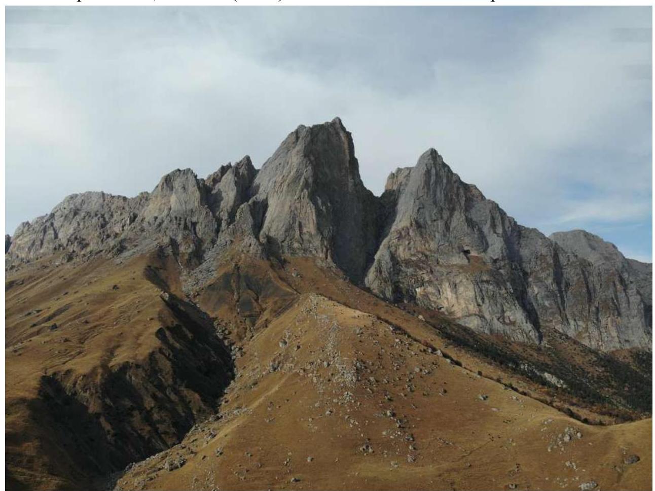
Panorama of the area
Tsey-Loam (Kyazi) peak on the left and Koazoy-Loam peak on the right.
2. Route Characteristics
2.1. Technical photograph of the route
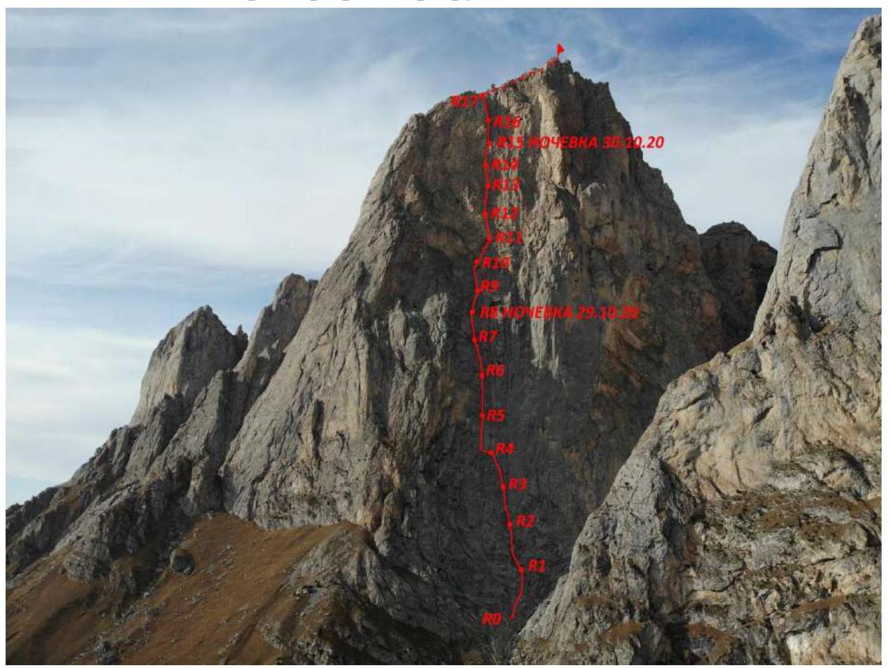 2.2. Section numbers on the technical photograph correspond to the section numbers on the UIAA route diagram.
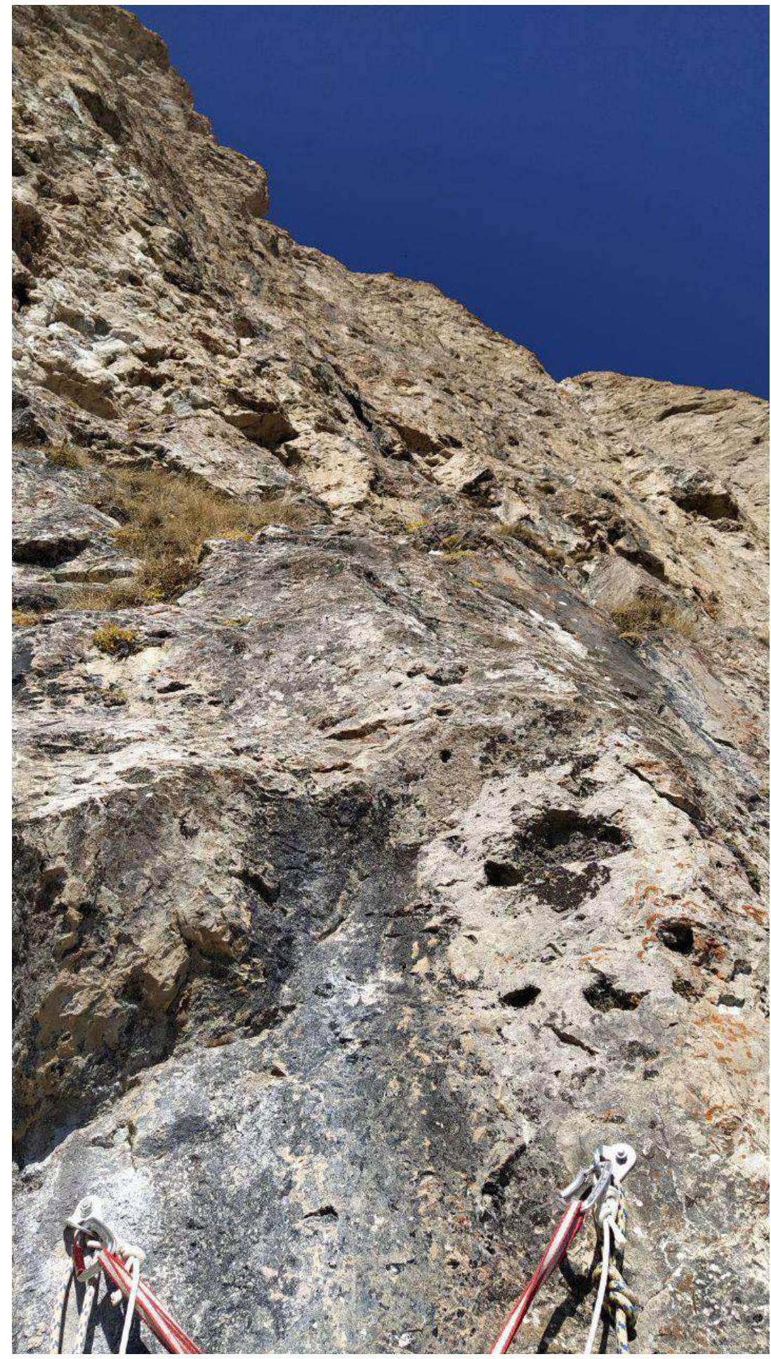
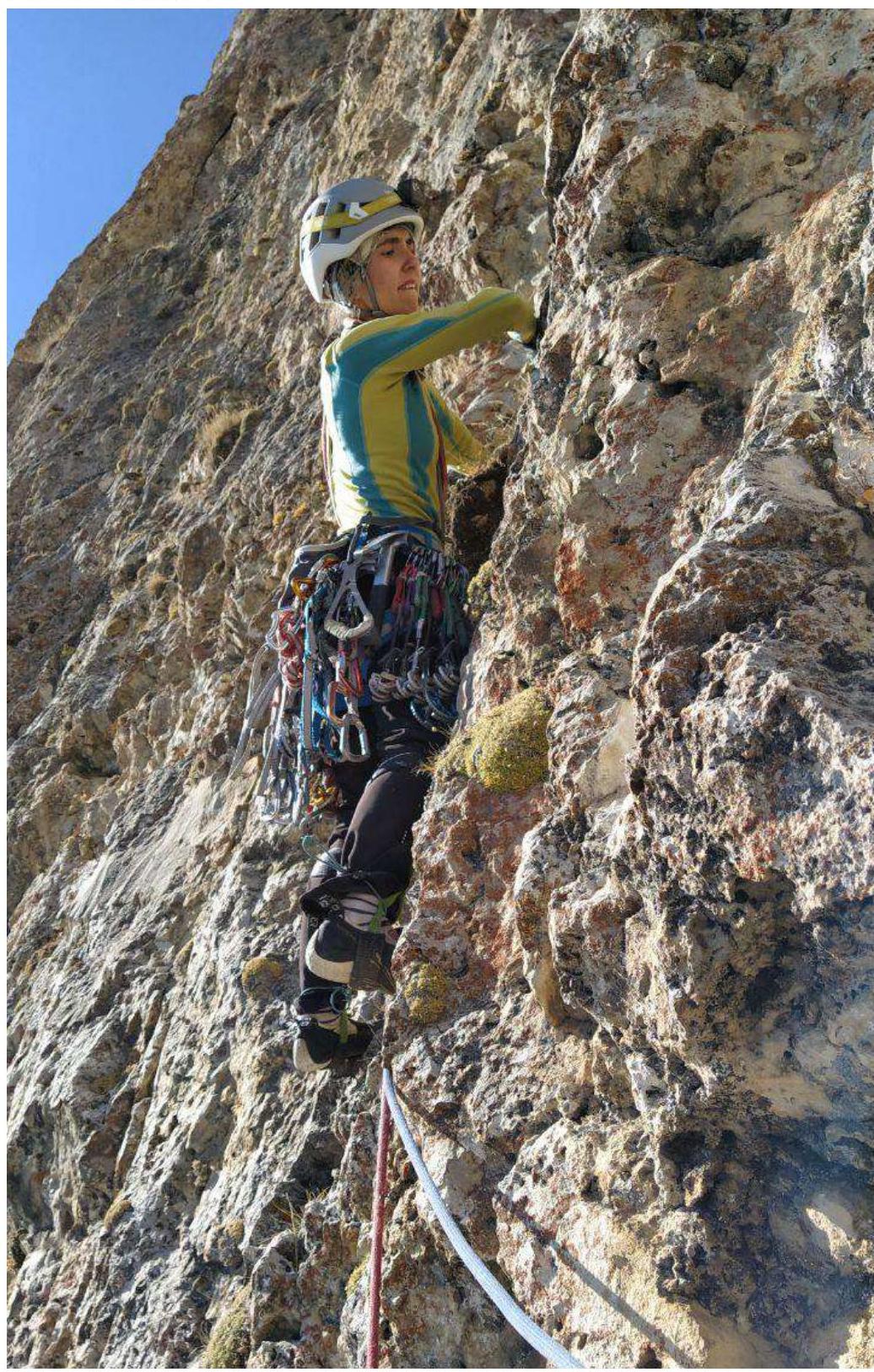
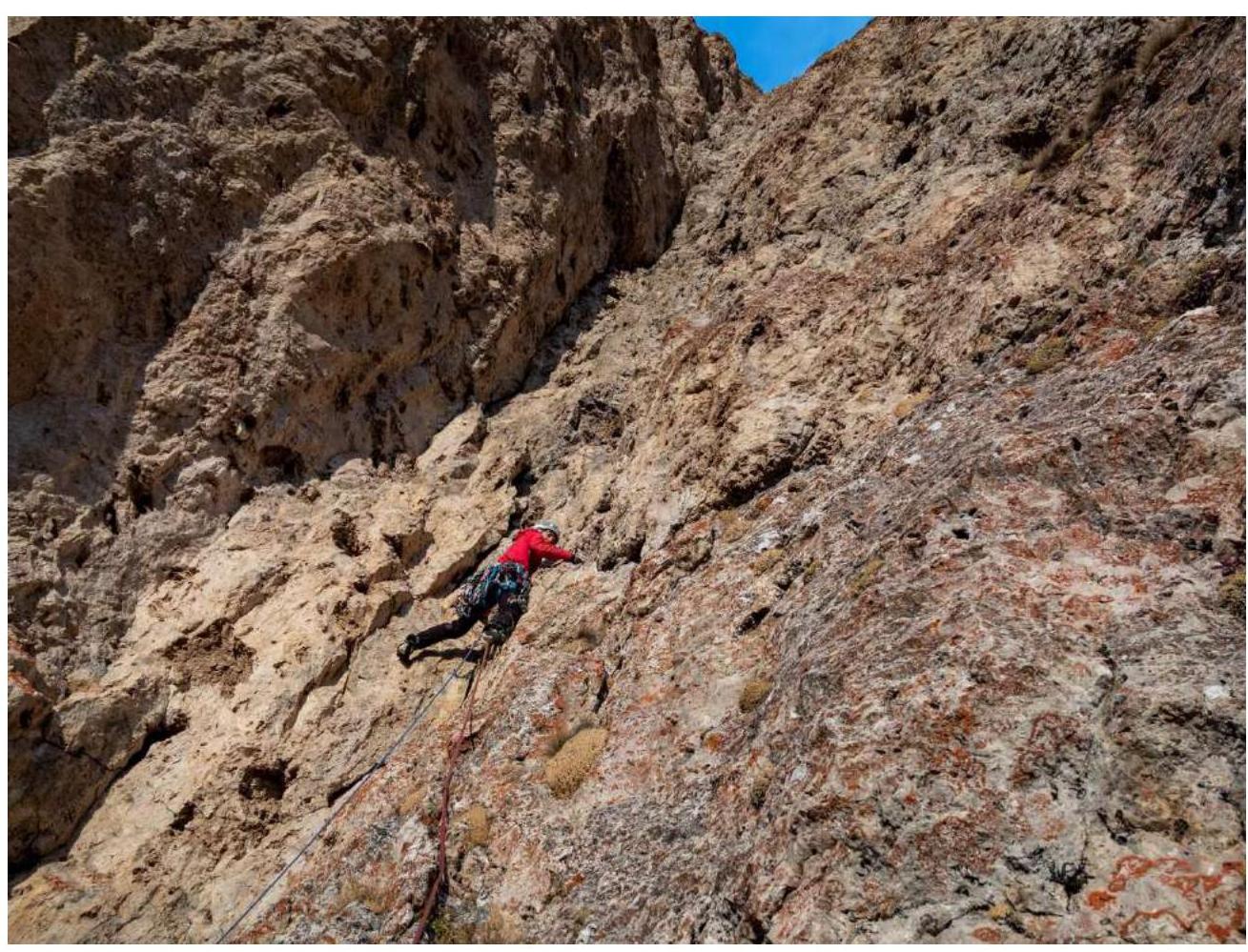
2.3. The route can be divided into two parts: the first half (up to R11) is relatively monolithic. The rock on the second half (from R11 to R18) is quite loose and hazardous. Visually, the two parts of the route differ in the color of the terrain: the lower part is gray, while the upper part is reddish. The red rocks are crumbling, and the holds are not reliable; some break apart in one's hands under load. Nevertheless, the terrain on the second half of the route is quite beautiful, with many cavities, shells, and curved niches containing beautiful white crystals and various other formations (white chalk, etc.).
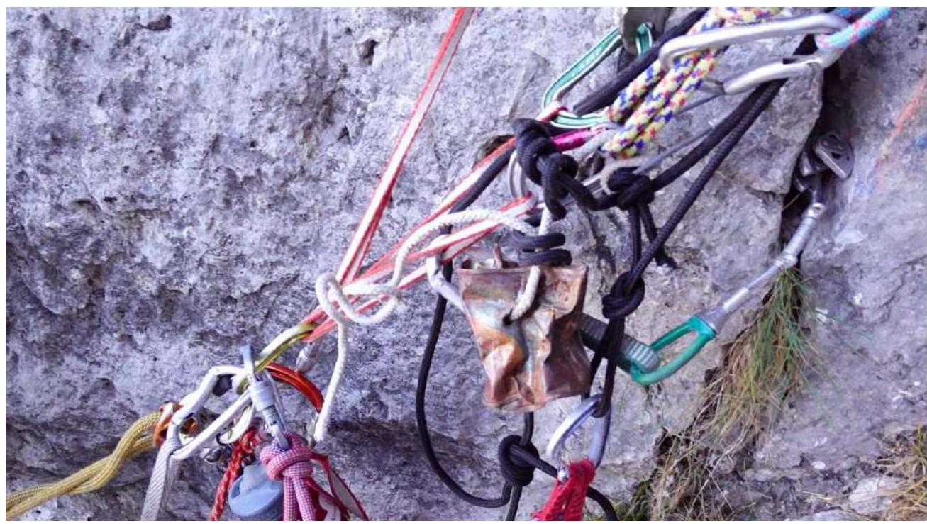
Sections R1–R9 are characterized by a large number of grassy tussocks, dirt in the cracks, and dust. There is a lot of dust and dirt, which gets into the mouth and eyes, making climbing less comfortable. We recommend using protective goggles or having eye drops in the first-aid kit to rinse the eyes during overnight stays. These sections have sufficient cracks for camming devices and nuts. The cracks are covered in dust, so it's essential to place camming devices carefully. There is a risk of them rotating and falling out upon a fall. Small camming devices do not hold well and are best avoided. We experienced two falls on small camming devices, which pulled out from seemingly reliable cracks. Anchors, including those with bent stems, worked well. We used 18 anchors, and on some sections of R1–R9, we used all of them.
Sections R11–R18 differ significantly from the first half of the route. Climbing is more hazardous due to the fragility of the rock. According to the first ascensionists, there are sections with A2 artificial climbing, but we did not load the protection and did not use artificial climbing techniques, completing the route via free climbing. Climbing on some sections is challenging. For protection, we mainly used anchors hammered into small cavities and holes. The protection is specific, and sometimes it's impossible to organize a protection point for up to 5 meters.
2.2. Section numbers on the technical photograph correspond to the section numbers on the UIAA route diagram.
2.3. The route can be divided into two parts: the first half (up to R11) is relatively monolithic. The rock on the second half (from R11 to R18) is quite loose and hazardous. Visually, the two parts of the route differ in the color of the terrain: the lower part is gray, while the upper part is reddish. The red rocks are crumbling, and the holds are not reliable; some break apart in one's hands under load. Nevertheless, the terrain on the second half of the route is quite beautiful, with many cavities, shells, and curved niches containing beautiful white crystals and various other formations (white chalk, etc.).
Sections R1–R9 are characterized by a large number of grassy tussocks, dirt in the cracks, and dust. There is a lot of dust and dirt, which gets into the mouth and eyes, making climbing less comfortable. We recommend using protective goggles or having eye drops in the first-aid kit to rinse the eyes during overnight stays. These sections have sufficient cracks for camming devices and nuts. The cracks are covered in dust, so it's essential to place camming devices carefully. There is a risk of them rotating and falling out upon a fall. Small camming devices do not hold well and are best avoided. We experienced two falls on small camming devices, which pulled out from seemingly reliable cracks. Anchors, including those with bent stems, worked well. We used 18 anchors, and on some sections of R1–R9, we used all of them.
Sections R11–R18 differ significantly from the first half of the route. Climbing is more hazardous due to the fragility of the rock. According to the first ascensionists, there are sections with A2 artificial climbing, but we did not load the protection and did not use artificial climbing techniques, completing the route via free climbing. Climbing on some sections is challenging. For protection, we mainly used anchors hammered into small cavities and holes. The protection is specific, and sometimes it's impossible to organize a protection point for up to 5 meters.
3. Technical Description of the Route
The UIAA diagram is taken from the first ascensionists' description:
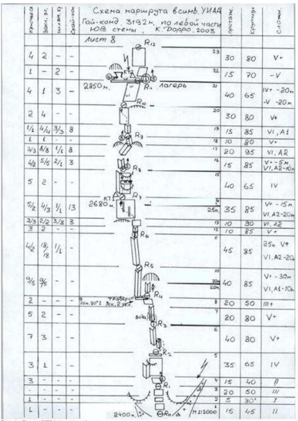
Fig. 1. UIAA diagram, part 1.
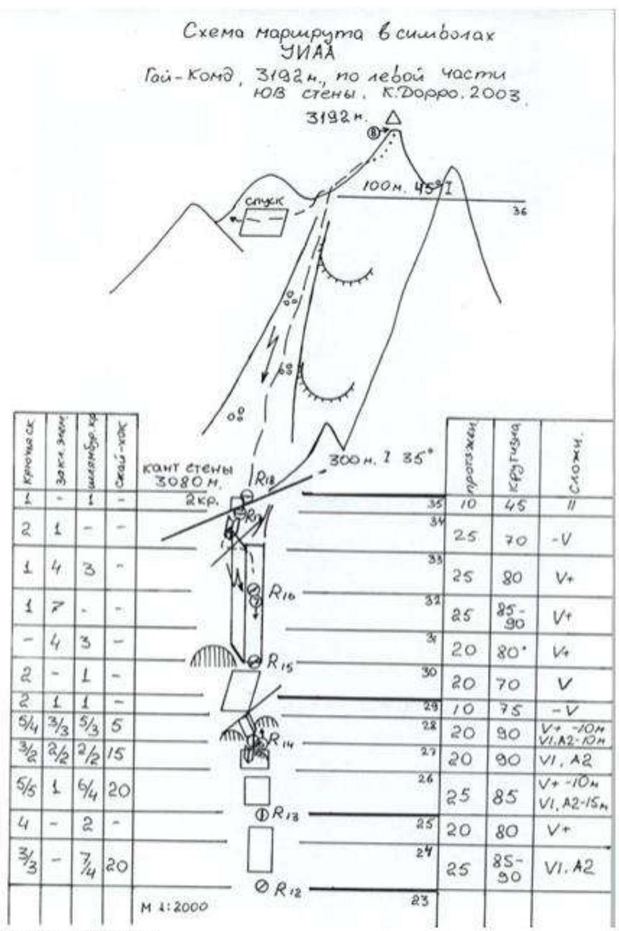
Fig. 2. UIAA diagram, part 2.
4. Characteristics of the Team's Actions
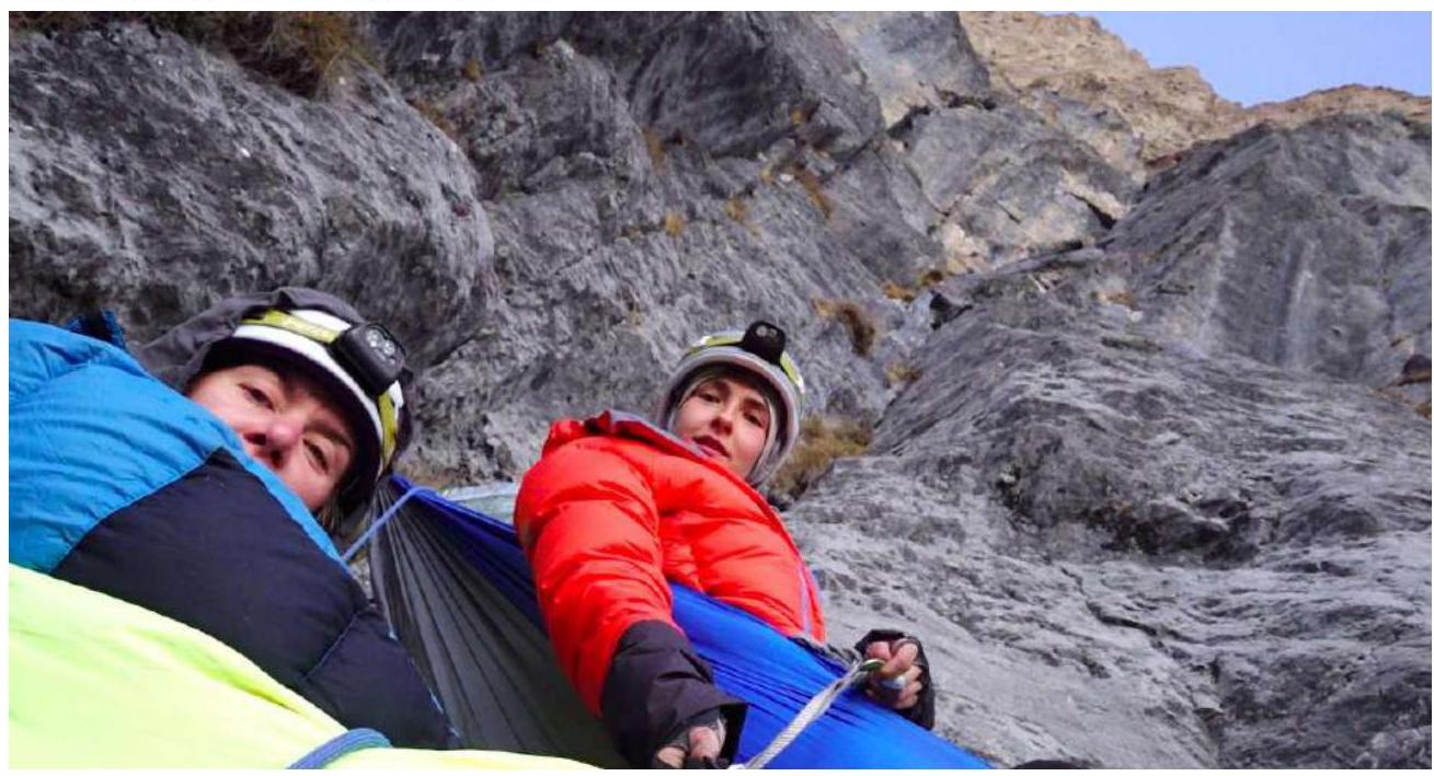
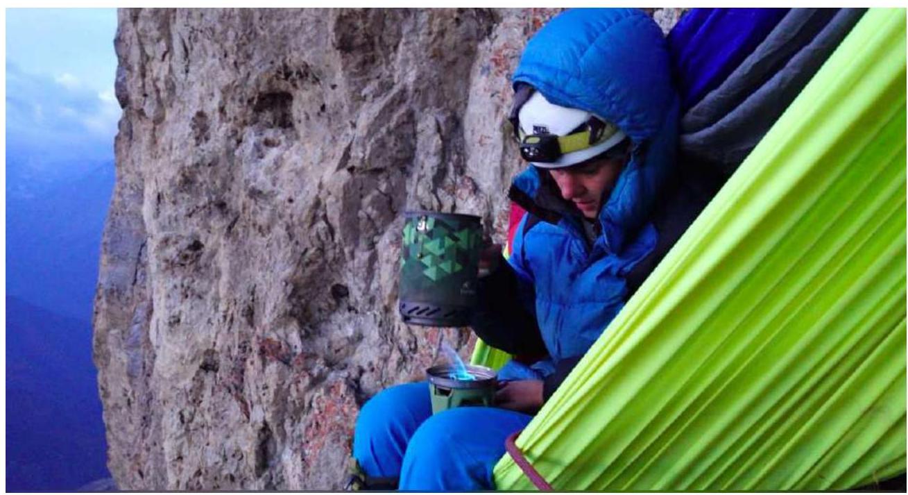
On October 29, 2020, we left the base camp at 5:00 AM. The ascent followed a grassy slope, then a forest, and finally a stony couloir to the base of the wall. The approach to the route took 1.5 hours; we began working on the route at 6:30 AM. We decided not to process the lower sections of the route for personal reasons. To transport the bivouac gear, food, and water, we used a haul bag weighing approximately 17 kg (due to the lack of water on the wall, we took 7.7 liters of water, calculated for two full days, plus a reserve). We decided to organize overnight stays in hammocks on the route. We abandoned the platform due to its significant weight for a two-person ascent. Each hammock weighed about 0.5 kg, which was an excellent decision to reduce the weight of the haul bag. It's essential to note that overnight stays in hammocks are only possible in:
- good weather;
- light wind.
For the ascent, we chose a sequential movement scheme. The second participant pulled the haul bag. We decided against a simultaneous movement scheme for several reasons. We organized belay stations at the locations described by the first ascensionists.
Ascent Schedule:
| Date | Start time | End time | Time in motion |
|---|---|---|---|
| October 29, 2020 | 6:30 | 17:00 | 10 h 30 min |
| October 30, 2020 | 7:20 | 17:30 | 10 h 10 min |
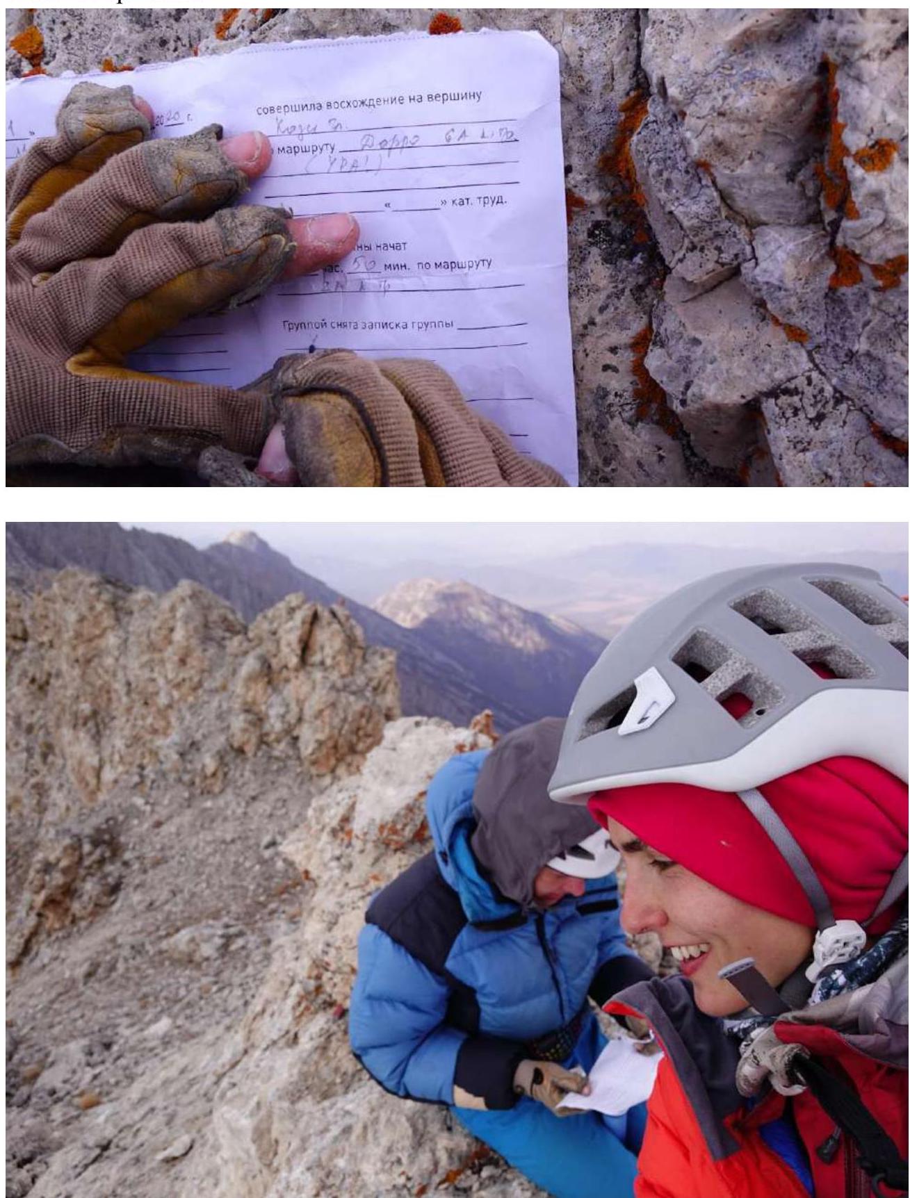
| October 31, 2020 | 7:00 | 11:20 (summit) | 4 h 20 min |
Team's altitude profile
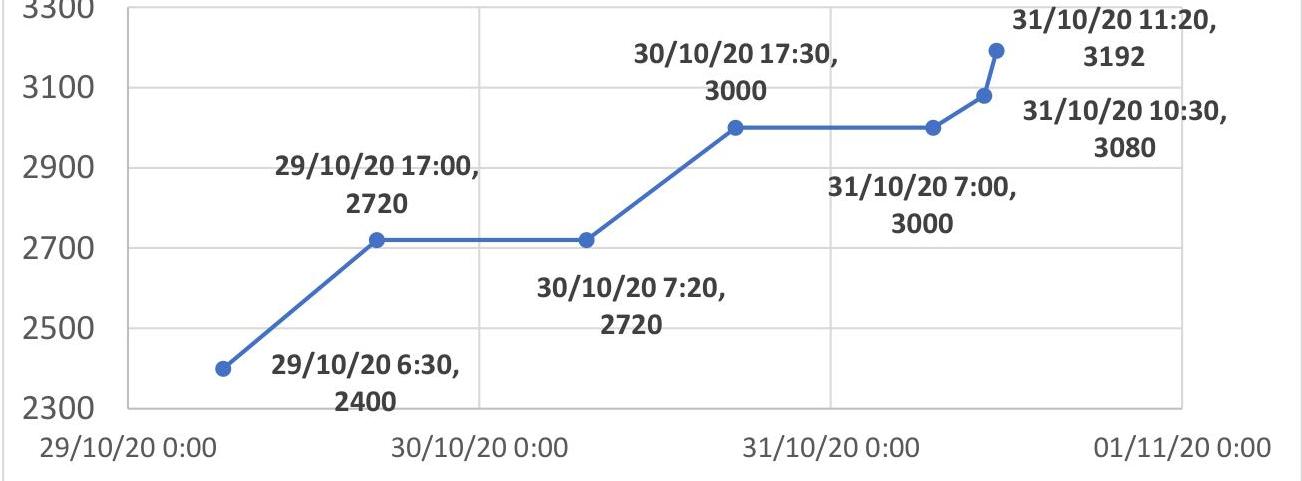 The total time in motion on the route was 25 hours. The end of work at 17:00 was due to the onset of darkness, making it unsafe to continue.
Overnight stays:
- First overnight stay on section R8
- Second overnight stay on section R15
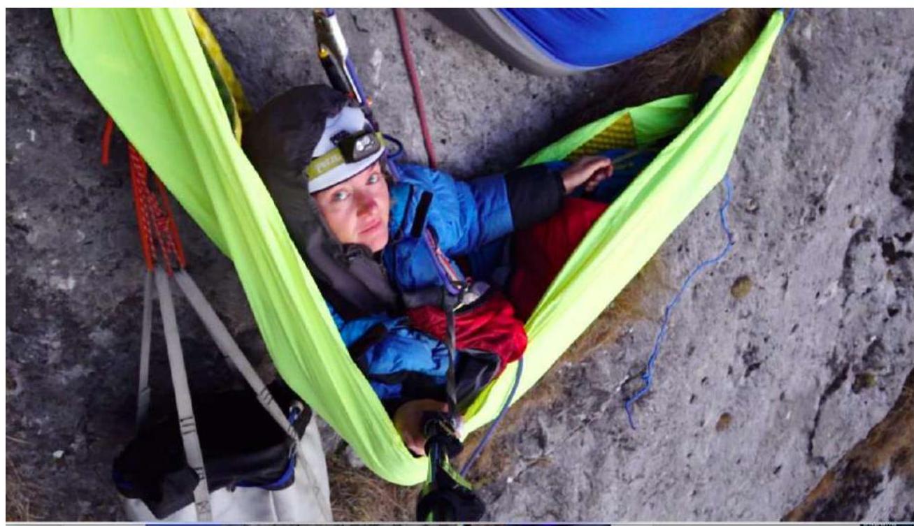
Both overnight stays in hammocks were excellent and very comfortable. On the second night, there was a strong wind, but it did not cause any issues.
Description of work on sections:
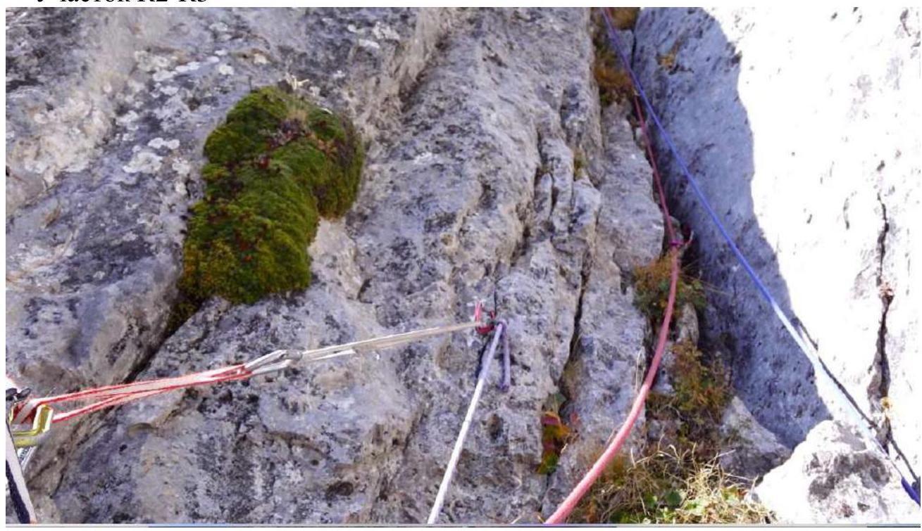
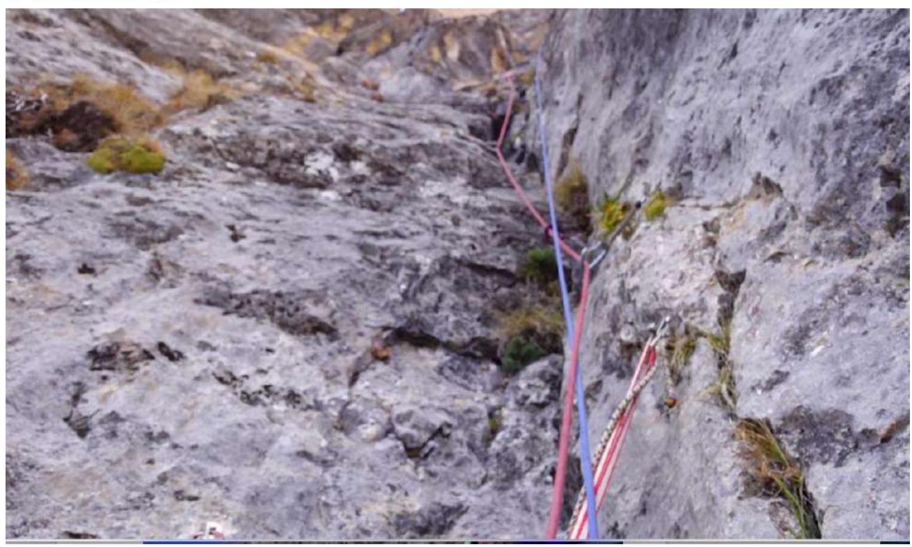
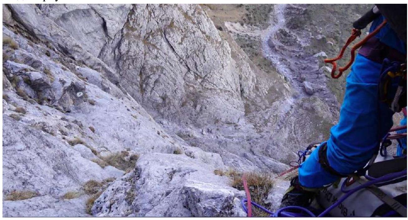
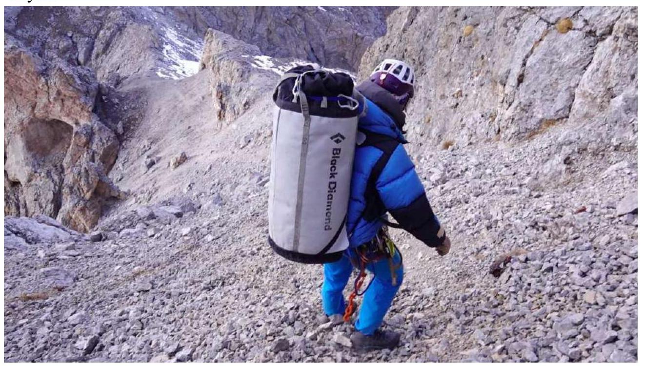
R0–R1: Ascend simple rocks to a ledge. Belay station on a bolt. R1–R2: From the station, move left along an internal corner overgrown with grass, then right and up to a comfortable ledge. Belay station on pitons. R2–R3: A system of steep internal corners begins, with earth and rocks, some of which are loose. R3–R4: Up the internal corner, which flattens out to the left, to a grassy ledge. Comfortable belay station on a large ledge with bolts. R4–R5: From the station, traverse 6 meters left along the ledge (bypass an external corner) and then climb a vertical internal corner. Mainly pitons for protection on this rope. The belay station is hanging, with a control cairn (tin can). R5–R6: Continue up the same internal corner. Climbing is relatively easy. However, the cracks are filled with earth and dust. The grassy tussocks are particularly unpleasant, as they release dust when touched. R6–R7: Climb the corner, bypassing a cornice on the right, to a slab. Traverse the slab left and up, entering an internal corner. Belay station. R7–R8: Continue up the internal corner, with some grass and tussocks. The rope is not too difficult. Location of the first overnight stay. R8–R9: Move right and up an angle with sounding slabs through a slight overhang. Climbing is not too difficult; there is a bolt to the right before exiting the overhanging angle. Belay station on a bolt and a piton on a widening to the right. R9–R10: From the station, move 1 meter left and then climb. The steepness increases. Used artificial protection on a wall with corners and cracks. Anchors for protection. Then, move left and up, bypassing overhangs, to a widening. R10–R11: Continue up a gentle slab to the right and up to a ledge and a niche. Climbing is easy. Belay station on two bolts. There is a ledge about 1 meter wide for a lying-down overnight stay, but space for a tent is limited. R11–R12: From this rope onwards, the second half of the route begins. The rock is fragile and brittle. Much destruction. From the station, move 3 meters to the right and then left. Climbing is not too difficult. Protection is sparse. R12–R13: From the station, first move slightly left, then slightly right. Climbing is more challenging through cavities, shells, uneven holes, and depressions in the rock. The terrain appears unreliable. Protection is sparse. The belay station is hanging. R13–R14: From the station, climb left and up, orienting towards trampled grassy tussocks. Then climb slightly to the right along a non-obvious external corner (climbing is challenging, the terrain is unreliable, and there are issues with setting protection points; one doesn't want to load the protection at all). Then move right and up under overhanging blocks. Belay station under the overhanging blocks on a new bolt and a piton. There is a second bolt for setting a platform, but the overhanging huge blocks pose a significant risk; they seem to be holding by a thread and would immediately destroy both the platform and the station upon a fall. R14–R15: From the station, climb the angle, carefully bypassing overhanging blocks. Then move left and up to an external corner (climbing becomes easier), and continue right and up along easy terrain. Belay station at the base of a large internal corner to the right of it (pass along a small ledge to the right of the internal corner's base). Belay station on two bolts. Location of the second overnight stay. R15–R16: From the station, enter the large internal corner and climb it. In our opinion, this is the most hazardous section of the route due to the destruction of the terrain. It is very crumbly. Climbing is not too difficult, but most holds break off. Moreover, rocks fall directly onto the belayer. Therefore, it's necessary to climb very carefully. Protection with camming devices inside the corner. R16–R17: Continue climbing the internal corner. Climbing becomes easier. Belay station on a large boulder on the ridge. Section length is 60 meters. R17–R18: Then move right. The rocks are simple. Walk along crumbly rocks towards the summit. R18–Summit: Descent via category 1B, marked with flags, very long (initially descend crumbly rocks to the right from the cairn, then climb a couloir to the left and up, followed by a grassy slope past a large grotto / a large grotto, which remains on the right, and finally descend to the right along a long couloir filled with stones. The descent along stones and "ram's foreheads" is lengthy, followed by a slight ascent to the right along a path to a grassy field, and then a walk along it to the road). The descent with the haul bag took 4 hours.
Summit Photos:

Route Photos by Sections.
Section R2–R3
Section R5–R6:

Section R6–R7
View from above R7
Control cairn on R7
Overnight stay on R8
View from the overnight stay on R8–R9
Section R11–R12:
Work on R13:
Overnight stay on R15
Section R15–R16:
Summit Photos:
Descent
Comments
Sign in to leave a comment