Championship of the Southern and North Caucasian Federal Districts in mountaineering 2021 Class of high-altitude and technical ascents
REPORT
on the ascent to peak Tsey-Loam (Kyazi) 3171 m via the center of the southern wall (Kurochkin route, 1983), category 5B October 27, 2021
I. Ascent Passport
| 1. General Information | ||
|---|---|---|
| 1.1 | Leader | Pushkar P.N. — 1st sports category |
| 1.2 | Participants | Lisin A.A. — 2nd sports category, rock climbing MS |
| 1.3 | Coach | Orekhova V.T. |
| 1.4 | Organization | FAiS RO |
| 2. Characteristics of the Ascent Object | ||
| 2.1 | Region | Caucasus |
| 2.2 | From the Krestovy pass to the top of Shaviklde | |
| 2.3 | Section number according to the 2020 classification table | 2.9. |
| 2.4 | Name and height of the peak | Tsey-Loam (Kyazi) 3171 |
| 3. Route Characteristics | ||
| 3.1 | Route name | via the center of the southern wall |
| 3.2 | Difficulty category | 5B |
| 3.3 | Degree of route exploration | - |
| 3.4 | Relief characteristics of the route | rock climbing |
| 3.5 | Height difference of the route | 640 m |
| 3.6 | Length of the wall part of the route | 700 m |
| 3.7 | Technical elements of the wall part of the route (including IT) | III–IV cat. diff. — 160 m, V cat. diff. — 295 m, VI cat. diff. — 245 m (90 m) |
| 3.8 | Average steepness of the route, (°) | - |
| 3.9 | Average steepness of the wall part of the route, (°) | 70° |
| 3.10 | Number of pitons used on the route (including IT) | Anchors — 112/27, Friends — 35/1, bolts (stationary) — 8/6 |
| 3.11 | Descent from the summit | Category 2A complexity |
| 3.12 | Additional route characteristics | Lack of water on the route |
| 4. Characteristics of the team's actions | ||
| 4.1 | Movement time | 13 hours, 1 day |
| 4.2 | Overnight stays | No overnight stays |
| 4.3 | Route processing time | No processing |
| 4.4 | Start of the route | 6:00, October 27, 2021 |
| 4.5 | Summit | 19:00, October 27, 2021 |
| 4.6 | Return to the base camp | 21:40, October 27, 2021 |
| 5. Responsible for the report | ||
| 6.1 | Name, e-mail | Pushkar P.N., pasheka80389@narod.ru |
II. Ascent Description
1. Characteristics of the Ascent Object
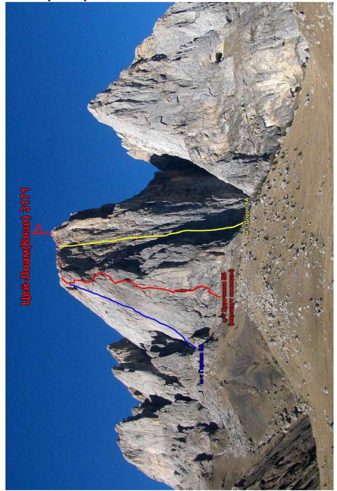
1.1. General photo of the peak
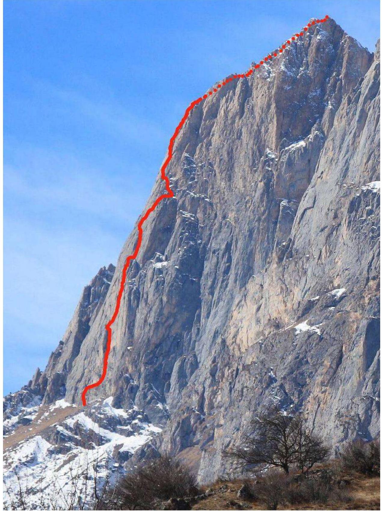
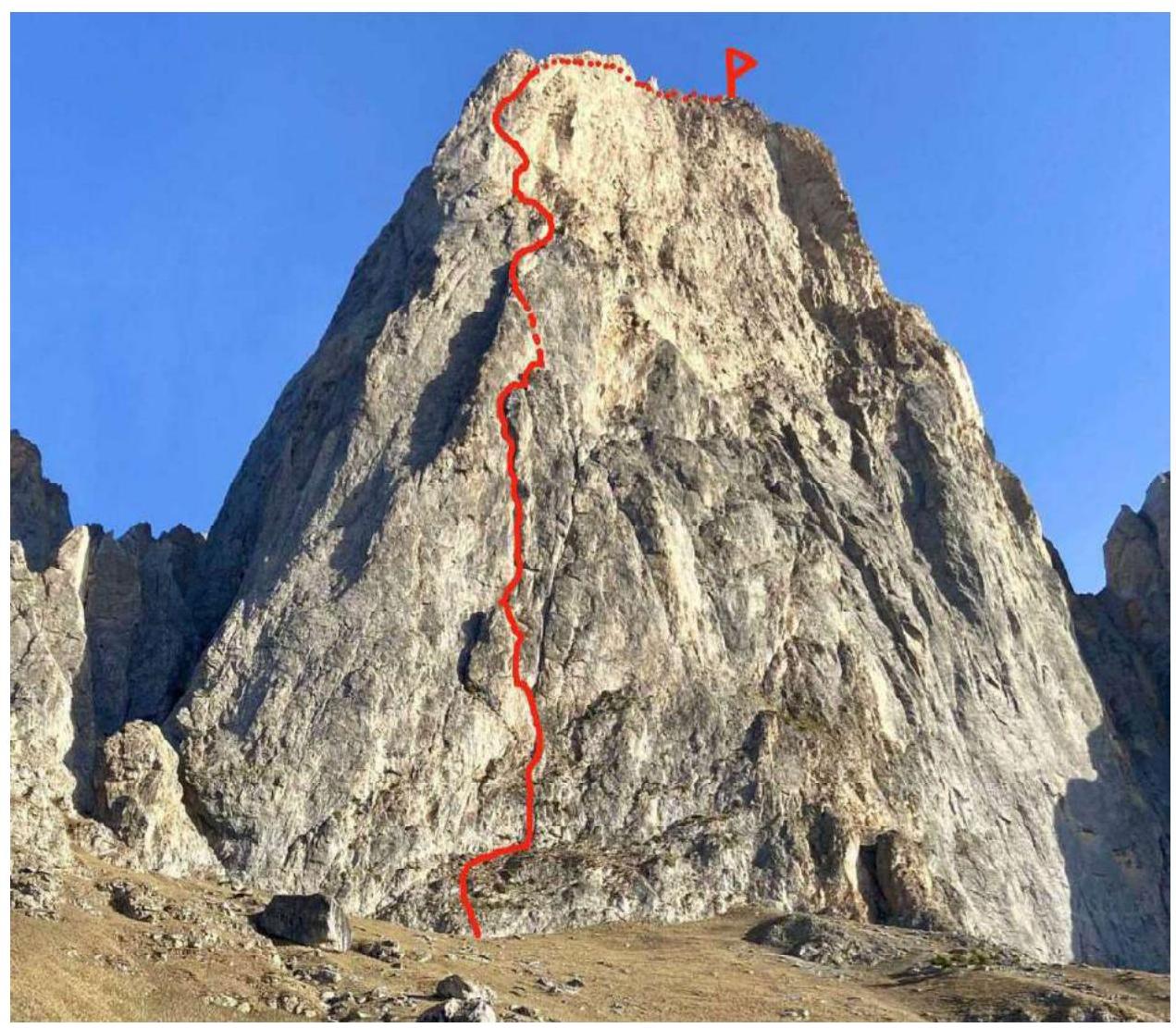
1.2. Photo of the route profile
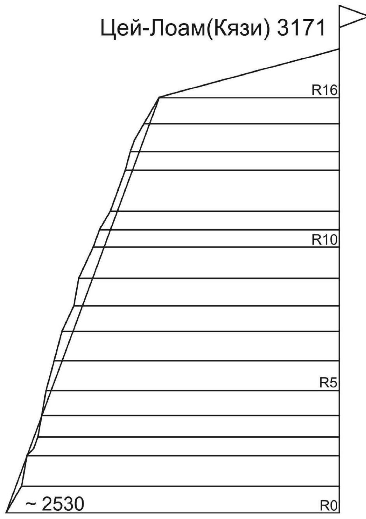
1.3. Drawn route profile
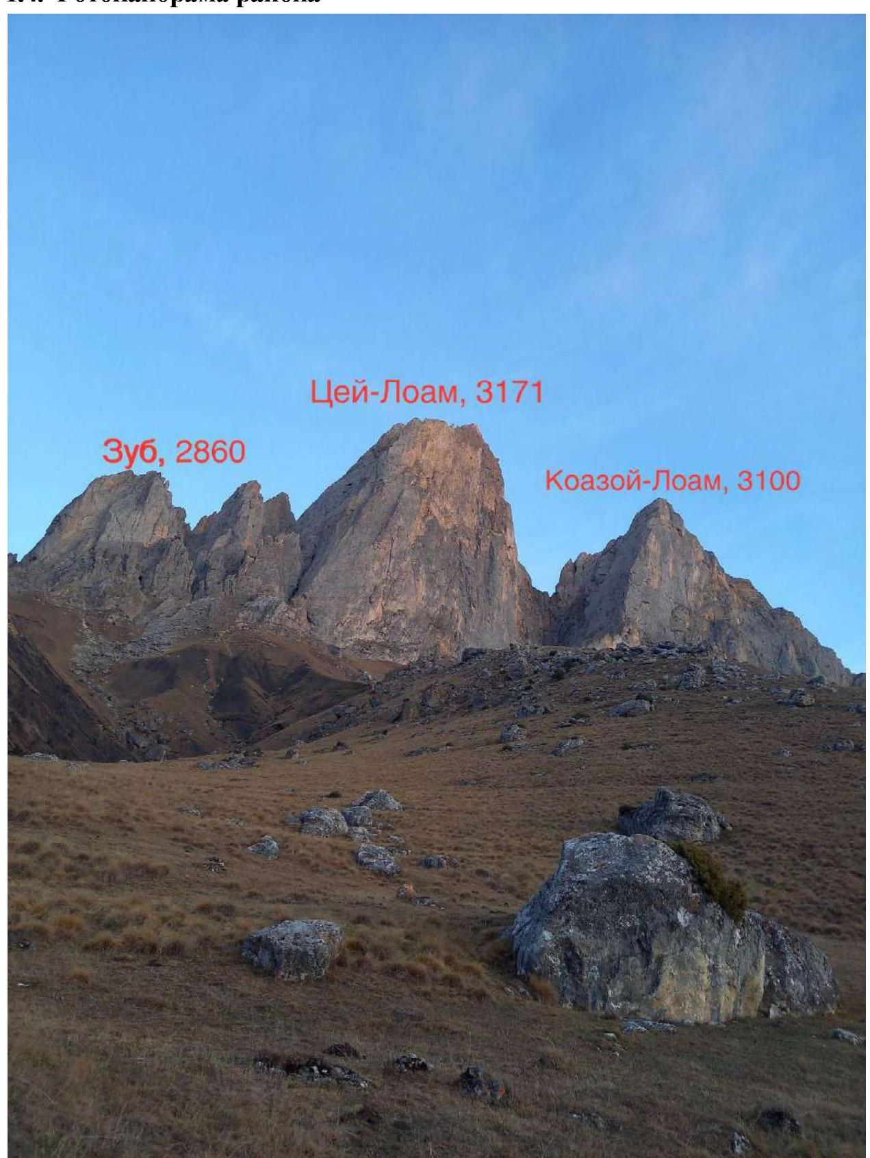
1.4. Photopanorama of the area
1.5. Map of the area
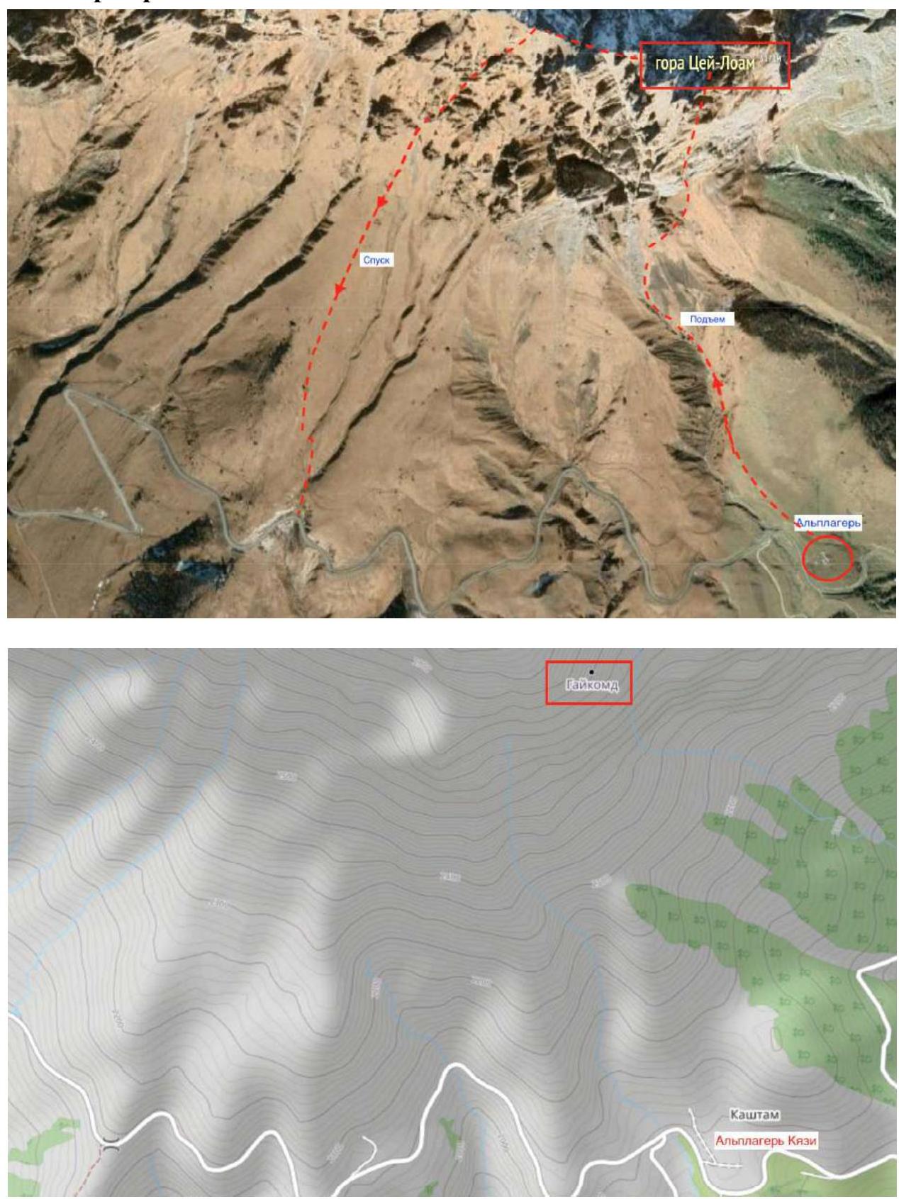
The approach from the alpine camp to the wall takes 1.5 hours.
2. Route Characteristics
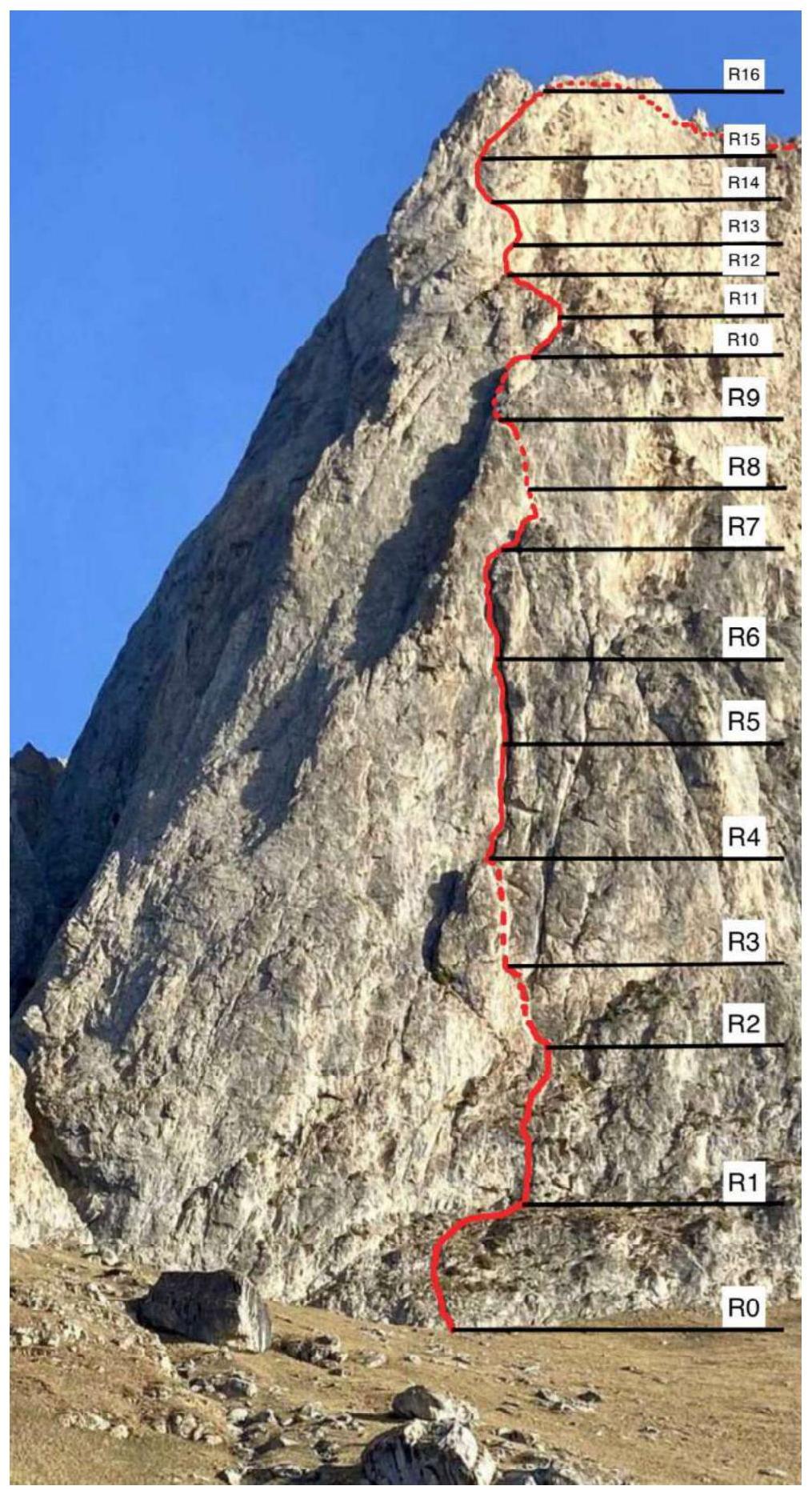
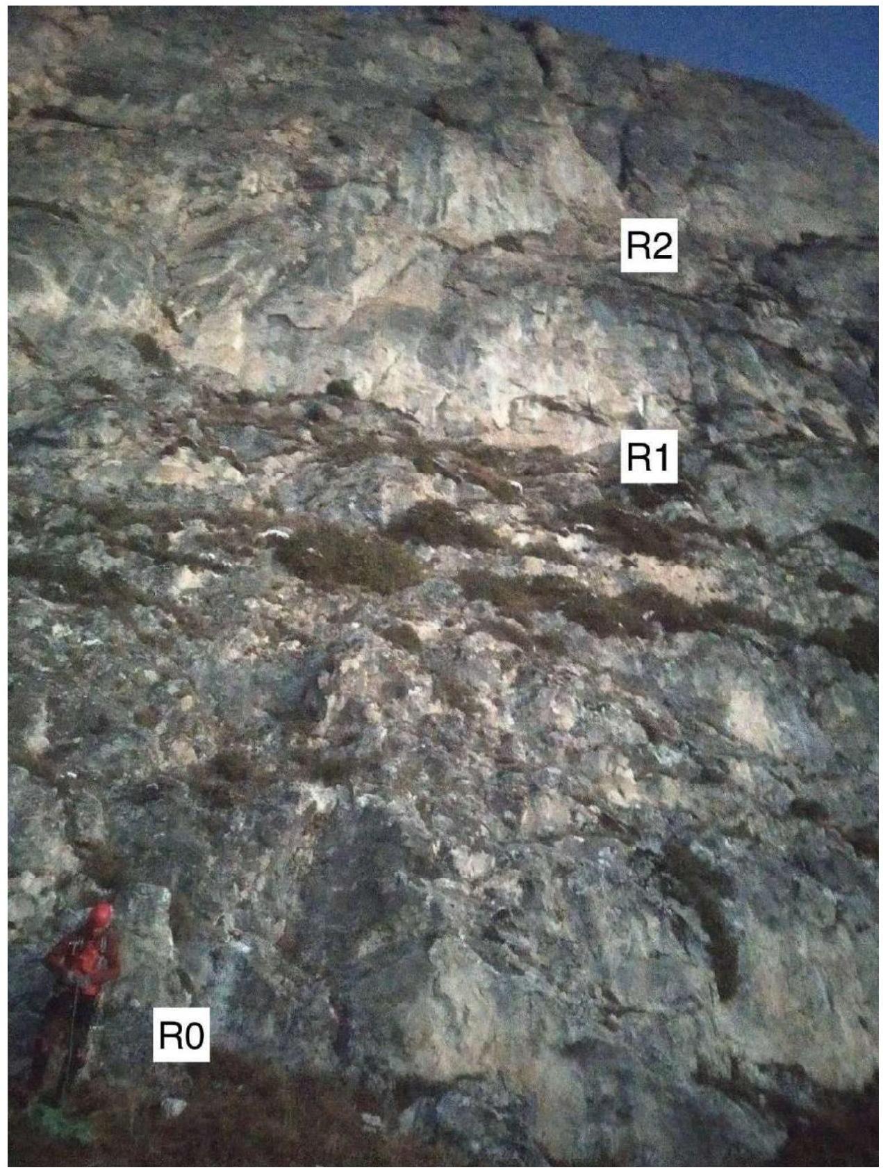
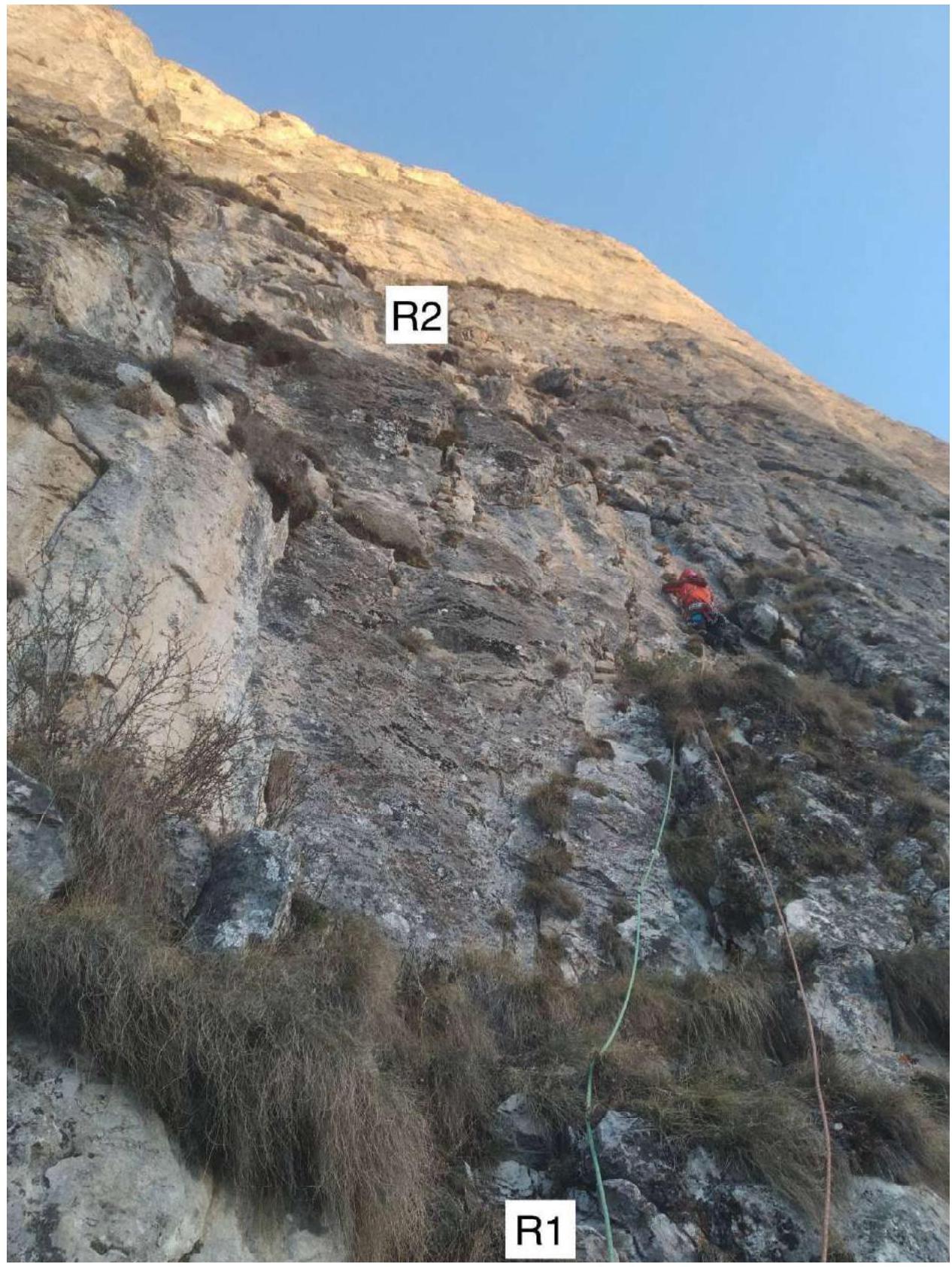
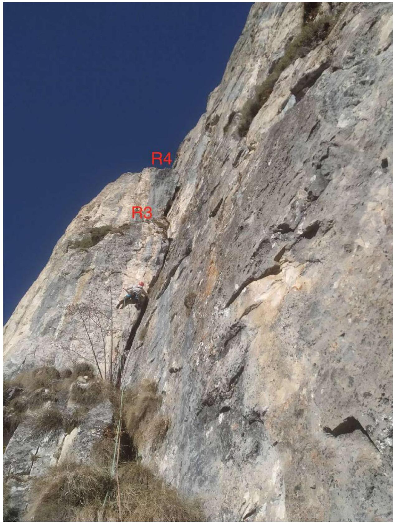
2.1. Technical photograph of the route
2.1. Technical photograph of the route with sections
2.2. Route description
R0–R1 (60 m): 40 m 60° III, 20 m 0° I. From the base of the wall, ascend via simple grassy rocks to a rocky wall and then along a grassy ledge — traverse right. Station on anchors.
R1–R2 (40 m) 80° V:
- Ascend the wall with cracks and internal corners (a "carrot" is hammered in the left corner).
- Reach a grassy ledge.
Station on anchors.
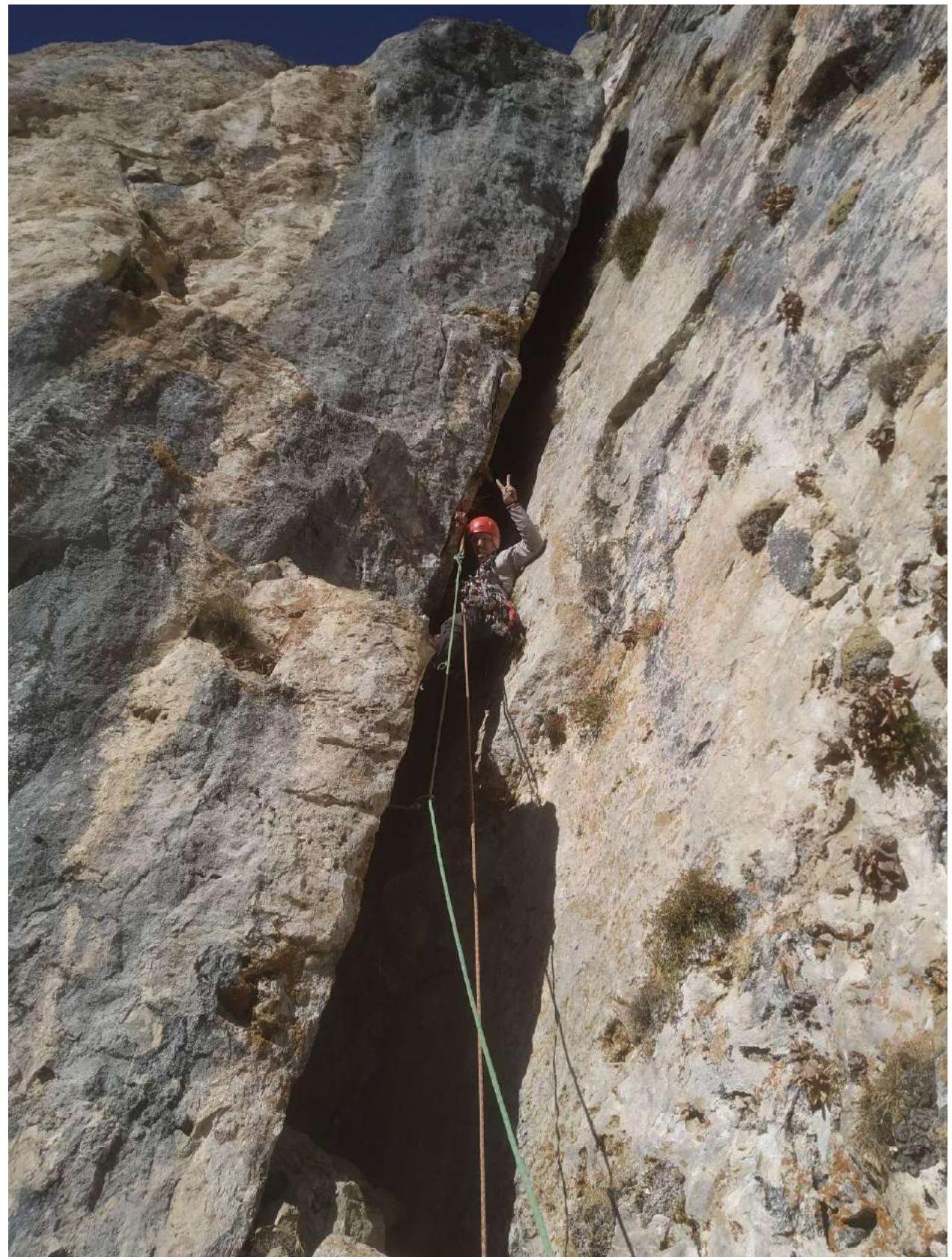
R2–R3 (30 m) 10 m 45° III, 20 m 70° VI+ A1. Approach a chimney — a wide off-width that narrows towards the top. Difficult climbing with poor protection, first through the chimney and then moving left onto the wall of the outcrop. There are two stone plugs around which loops can be wrapped. Exit onto a ledge. On the wall of the outcrop, there is a control cairn on a bolt. Station on anchors.
R3–R4 35 m 80° VI
- Ascend the wide chimney, initially with your back to the wall.
- After 15 meters, turn to face the wall; there is relief and old pitons.
- Exit the chimney onto a large ledge.
Station on a rock.
R4–R5 (40 m): 30 m 80° V+, 10 m 85° VI. From the ledge, move up and right along a crack-outcrop that transitions into an internal corner. Then, through an overhang, reach the station.
R5–R6 (40 m) 80° V+/VI A1. Ascend the wide internal corner-chimney. Climbing is difficult, with some IT.
R6–R7 (40 m) 75° V+/VI A1. Ascend the chimney, bypassing overhangs on the left. Difficult climbing, with some IT. Then, exit right and up onto a ledge. This is a good spot for an overnight stay.
R7–R8 (40 m): 30 m 65° IV, 10 m 70° V. Exit onto the next ledge through a large outcrop and then move left along the wall to the base of the chimney.
R8–R9 (45 m): 20 m 80° VI A1, 25 m 70° V+. Ascend and move right along the wall to approach the base of a wide chimney. There is a control cairn. Then, ascend a monolithic wall with bolts. IT on bolts and anchors; a holey skyhook may be required (if not available, an anchor can be hammered in nearby). Move left and up along small walls until you pass the bend. Station on a rock.
R9–R10 40 m 65° V. Ascend left behind the bend into a large internal corner. Then, enter a chimney in its left part and exit onto a ledge.
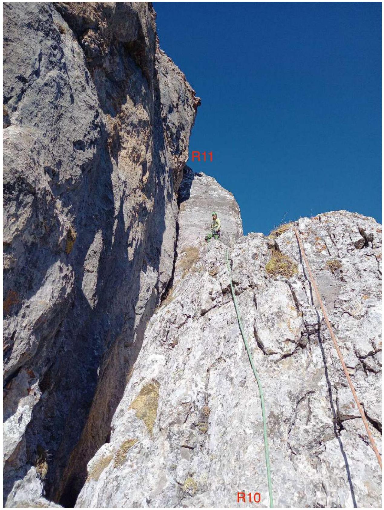
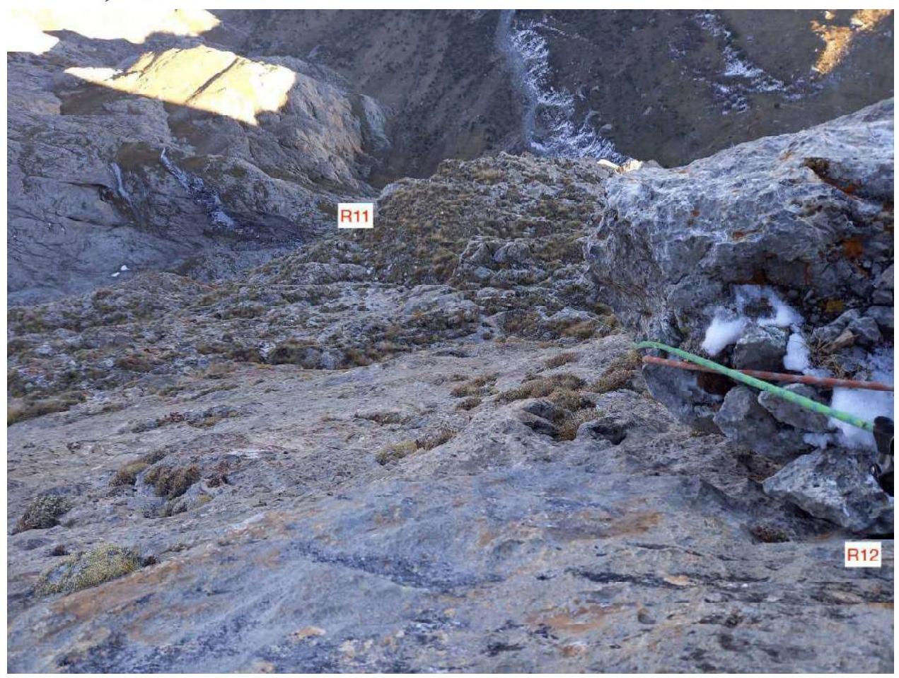
R10–R11 30 m 65° IV/V+. Move along the ridge and a wide monolithic slab to reach a ledge under a three-meter wall.
R11–R12 (55 m): 5 m 90° VI, 40 m 65° III, 10 m 70° V. Climb the wall (boulder) and then move left and up along grassy ledges towards an internal corner. Climb onto an outcrop. Station on anchors.
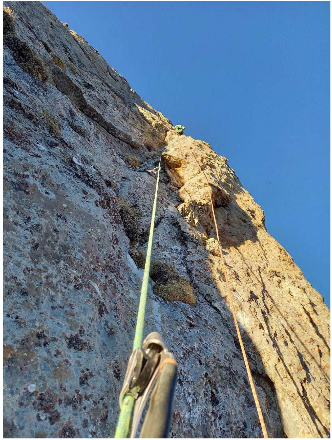
R12–R13 (45 m) 80° VI+ A2. From the outcrop, ascend directly (a "carrot" is hammered to the right). Difficult climbing and IT on anchors; there is a bolt. Then, climb a few meters along an open internal corner. Hanging station on anchors.
R13–R14 (40 m): 15 m 80° VI A2, 25 m 80° VI — ascend via a crack to the right using IT on your own points; exit onto a ledge. Then, climb a monolithic internal corner and pass a monolithic block to the left onto a small ledge.
R14–R15, 30 m, 70°, V — move left and up to exit onto a ledge. Station on anchors.
R15–R16, 60 m, 65°, IV–V
- Move up towards the ridge via rocks of medium difficulty.
- Reach a rock with a loop.
- From the rock, rappel 10 m onto ledges.
R16–R17, 300 m, easy
- Move along ledges, simple rocks, and talus slopes to reach the summit.
- On the approach to the summit, there are markers — these are landmarks for the descent route.
2.3. UIAA route diagram
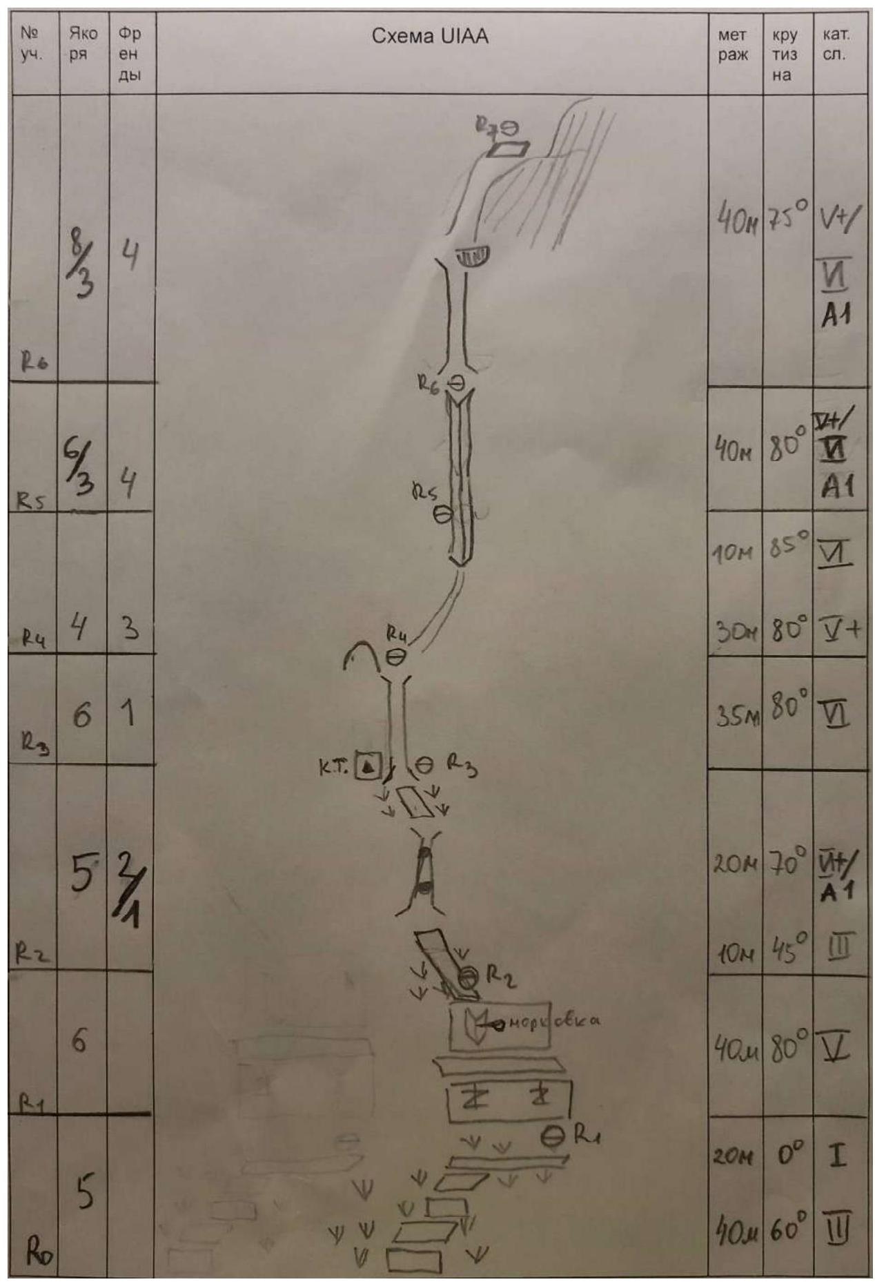
| № | Anchor | Friends | UIAA Diagram | Length | Steepness | Category |
|---|---|---|---|---|---|---|
 | 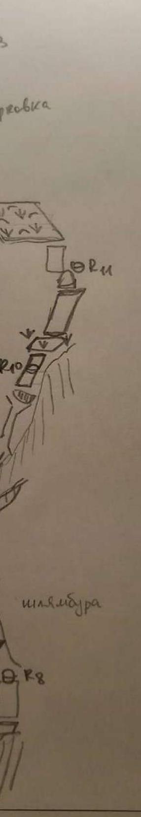 | 45 m | 80 | Y1 A2 | ||
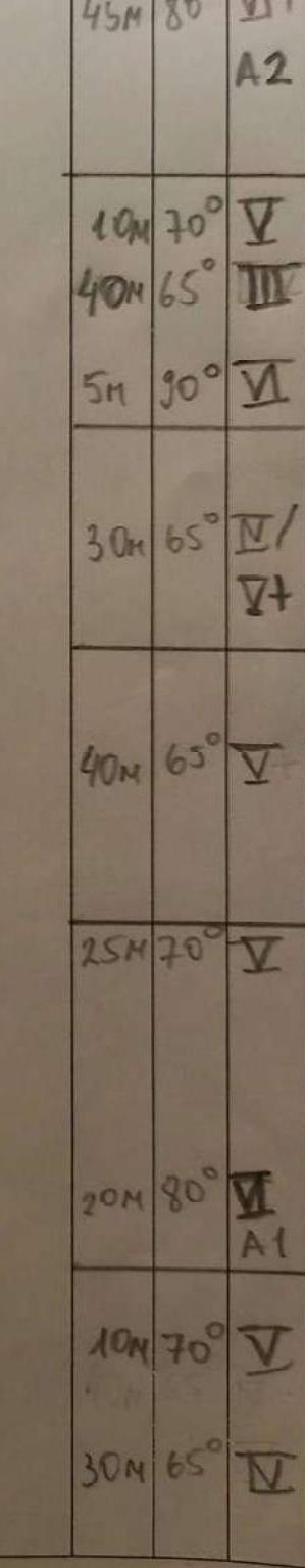 | 10 m | 70 | ∇ | |||
| 40 m | 65 | III | ||||
| 5 m | 30 | ∇ | ||||
| 30 m | 65 | II/ | ||||
| ∇ | ||||||
| 40 m | 65 | ∇ | ||||
| 15 m | 30 | ∇ | ||||
| 10 m | 80 | ∇ | ||||
| 7 m | A1 | |||||
| 30 m | 70 | ∇ | ||||
| 30 m | 65 | ∇ | ||||
| № | Anchor | Friends | UIAA Diagram | Length | Steepness | Category |
| :--: | :-------------------------------------------------------------------------------------------------------------------------------------------------: | :------: | :--------------------------------------------------------------------------------------------------------------------------------------------------: | :------: | :--------: | :-------------------------------------------------------------------------------------------------------------------------------------------------: |
| 1 |  |  | ||||
| 2 | 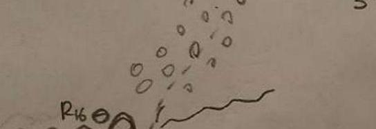 |  | ||||
| 3 |  |  | ||||
| 4 | 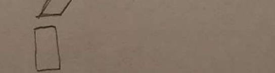 | 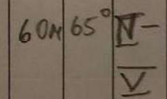 | ||||
| 5 | 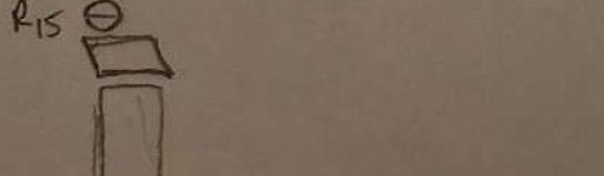 | 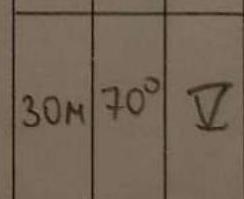 | ||||
| 6 | 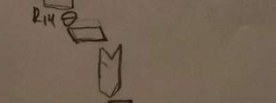 | 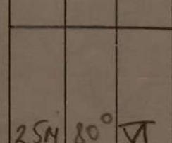 | ||||
| 7 | 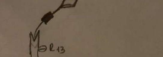 |  | ||||
| 8 |  |  | ||||
| 9 |  |  | ||||
| 10 |  |  | ||||
| 11 |  |  | ||||
| 12 |  |  | ||||
| 13 |  |  | ||||
| 14 |  |  | ||||
| 15 |  | 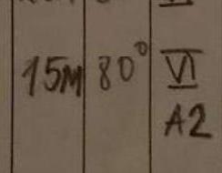 | ||||
| 16 |  |  | ||||
| 17 |  | |||||
| 18 |  | |||||
| 19 |
3. Characteristics of the team's actions
3.1. Tactical actions of the team
Before attempting the planned route, the team climbed routes ranging from category 3A to 5A in the area. Category 5A was chosen on a neighboring wall — the Gorin route, where:
- they assessed the relief;
- practiced simultaneous movement techniques;
- evaluated the pace of the rope team during simultaneous movement.
The day after the climb, the weather deteriorated: it cooled down, snow fell, and the team waited for three days for an improvement. On October 26, 2021, it was a clear day, and the wall had dried. The forecast for October 27, 2021, promised clear weather, and the team planned to start in the morning.
The Kurochkin route was chosen for the following reasons:
- it is a classic line to the top of Tsey-Loam;
- the line is visible from the alpine camp;
- the route is monolithic and logical;
- several teams had climbed it in one day.
Although the line is classic, there was no written description of this route before; they relied on photos and consultations.
Chronology for October 27, 2021:
- 4:00 — left the alpine camp;
- 5:20 — arrived under the wall, waited for dawn, and put on gear;
- 6:00 — started;
- 9:00 — reached station R3, control cairn;
- 18:20 — completed the wall part of the route (R16), had a snack;
- 19:00 — reached the summit;
- 19:10 — began descent via route 2A;
- 21:00 — descended to the grassy slope;
- 21:20 — descended to the highway;
- 21:40 — returned to the alpine camp.
Movement was simultaneous, using two 60-meter dynamic ropes. The leader climbed without a backpack and with self-insurance. The second climber moved on a jumar and krol along the fixed rope while simultaneously belaying the leader on a gri-gri. The leader made stations every 30–40 meters when protection points ended; the second climber passed the protection points to the leader via the rope. Thus, both participants worked on the route continuously, stopping only to pass gear.
The second climber carried a backpack. During the ascent through chimneys R2–R4, the backpack had to be hung, as the chimneys were narrow.
On IT sections:
- Bolts were quite old.
Compared to 5A Gorin:
- the route is longer and more labor-intensive;
- climbing is more difficult and varied;
- from R12 onwards, navigation on the wall is required.
3.2. Route comments
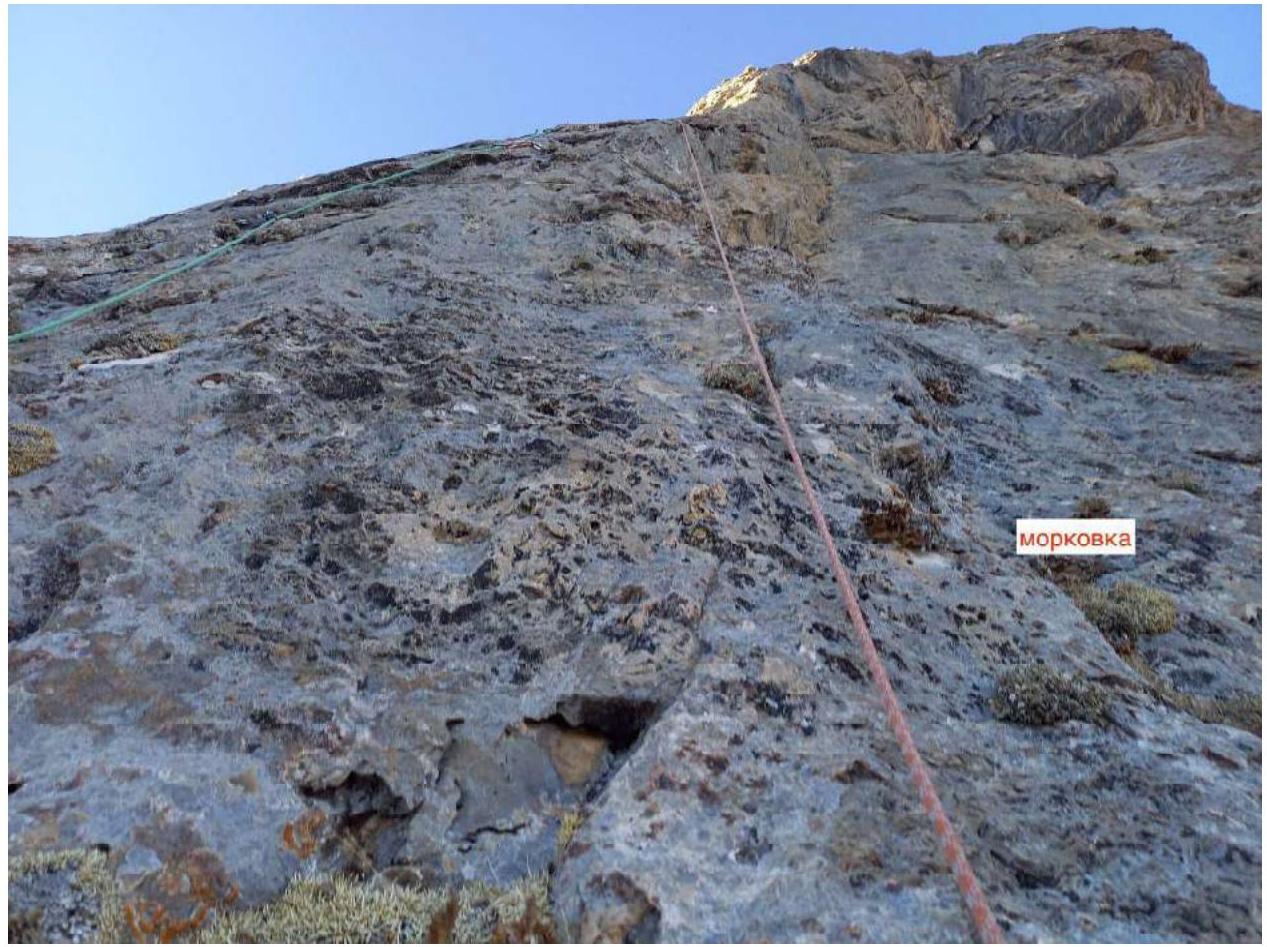
The route is solid and logical. Throughout the route, one must climb, and the climbing is pleasant, sometimes unusual (chimneys R2–R4), with a difficulty of up to 6c (French grade). There is a fair amount of existing hardware. Protection is generally good, except for some small sections.
Our gear included:
- 12 anchors (small and medium);
- 14 slings 60 cm;
- a set of cams: 0.3, 0.4, and 0.5 (purple) to 2 (yellow) in duplicate;
- two 60-meter dynamic ropes;
- 1 set of hook nuts with ladders.
During simultaneous movement, there were sometimes not enough anchors, so it's better to take 16 and, accordingly, more slings, or take pre-assembled anchors with quickdraws. This will speed up the rope team's work, as the leader won't have to wait for the second to pass the gear.
The route line is visible from the alpine camp, allowing the team to be monitored through binoculars. There are several spots for sitting overnight stays and at least one where a tent can be pitched. With good climbing skills, teamwork, and favorable weather, the route can be completed in one day without overnight stays.
The descent from the summit is done via route 1B or 2A, with markers along the way. It is advisable to scout the descent route in advance to avoid getting lost, especially in the dark. Part of the descent route is on a north-facing slope, with two sections where snow lies year-round. With good navigation, the descent to the grassy slopes takes an average of 2 hours.
3.3. Ascent by other teams
Immediately after us, a team from Samara prepared to climb the same route: Igor Erokhov and Nikita Varlamov. On October 27, 2021, they made a cache. On October 28, 2021, they started, and at 17:00, they stopped for an overnight stay at section R7. They reached the summit on October 29, 2021, at 20:00. Their total ascent time was 22 hours and 40 minutes over 2 days.
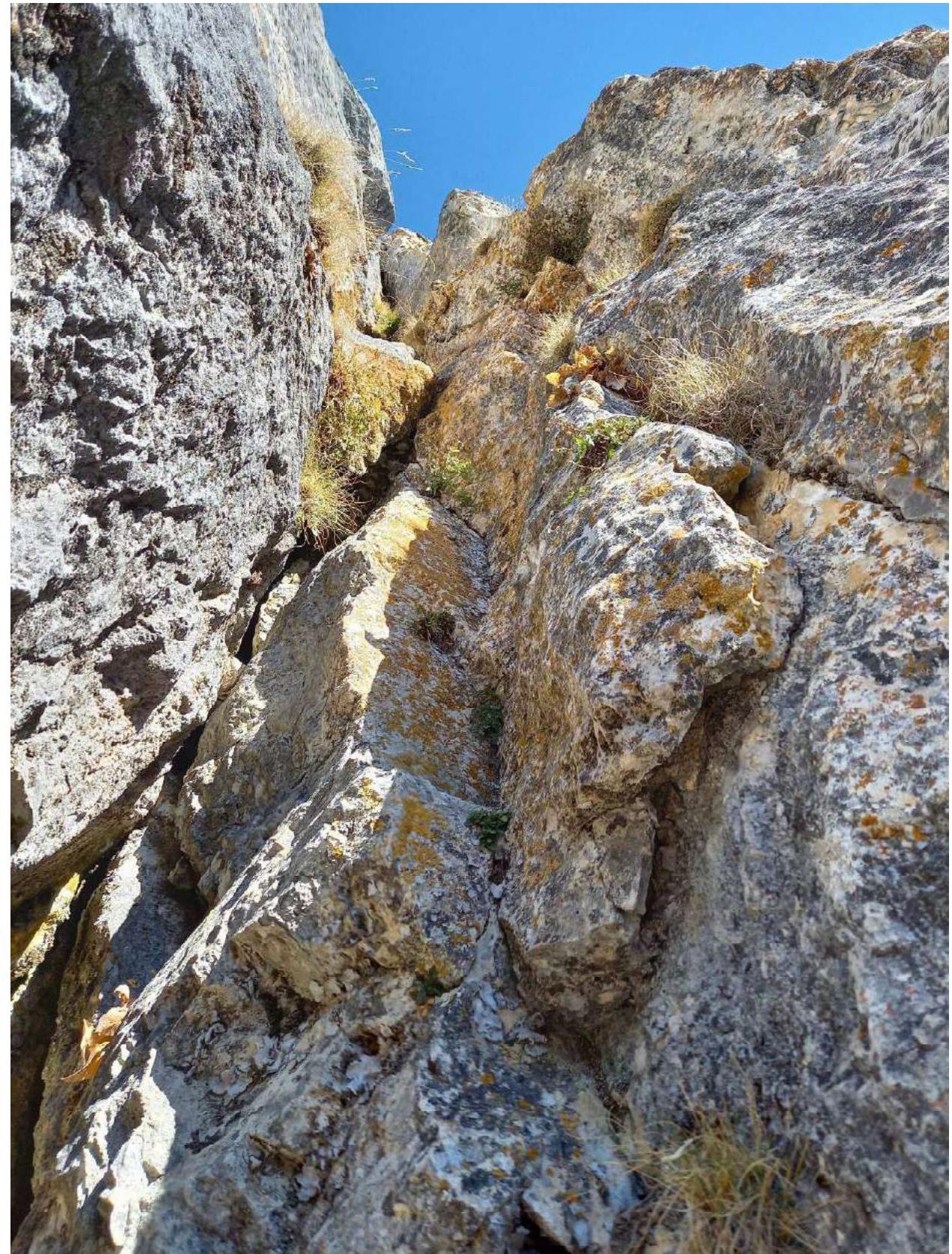
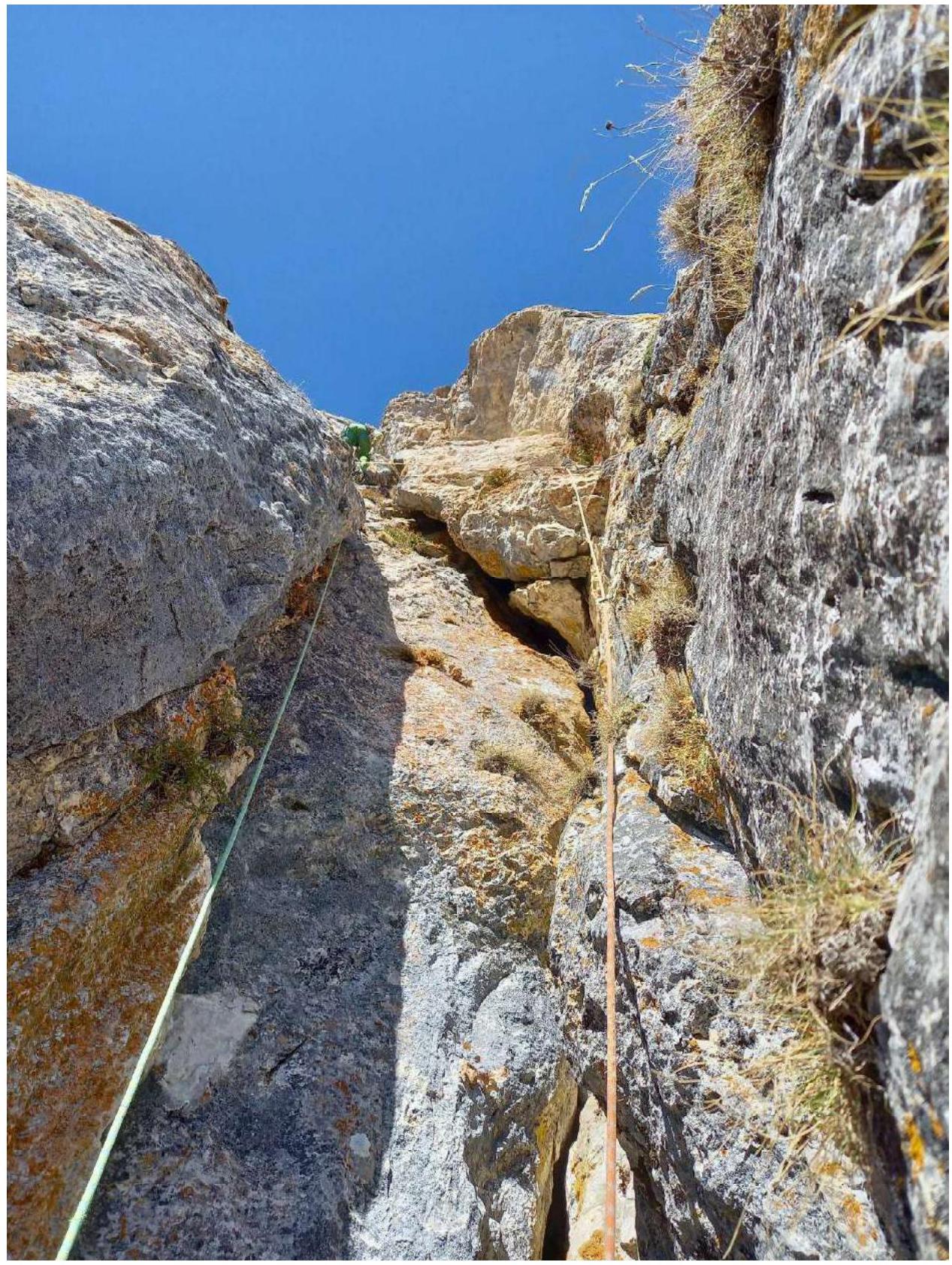
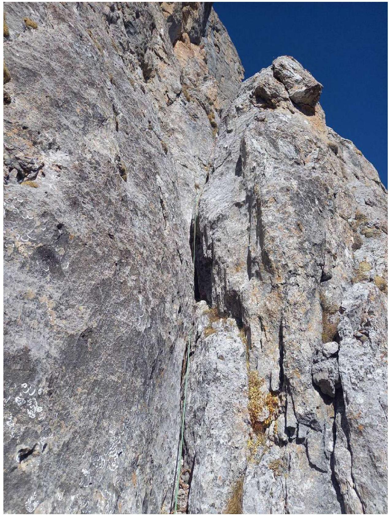
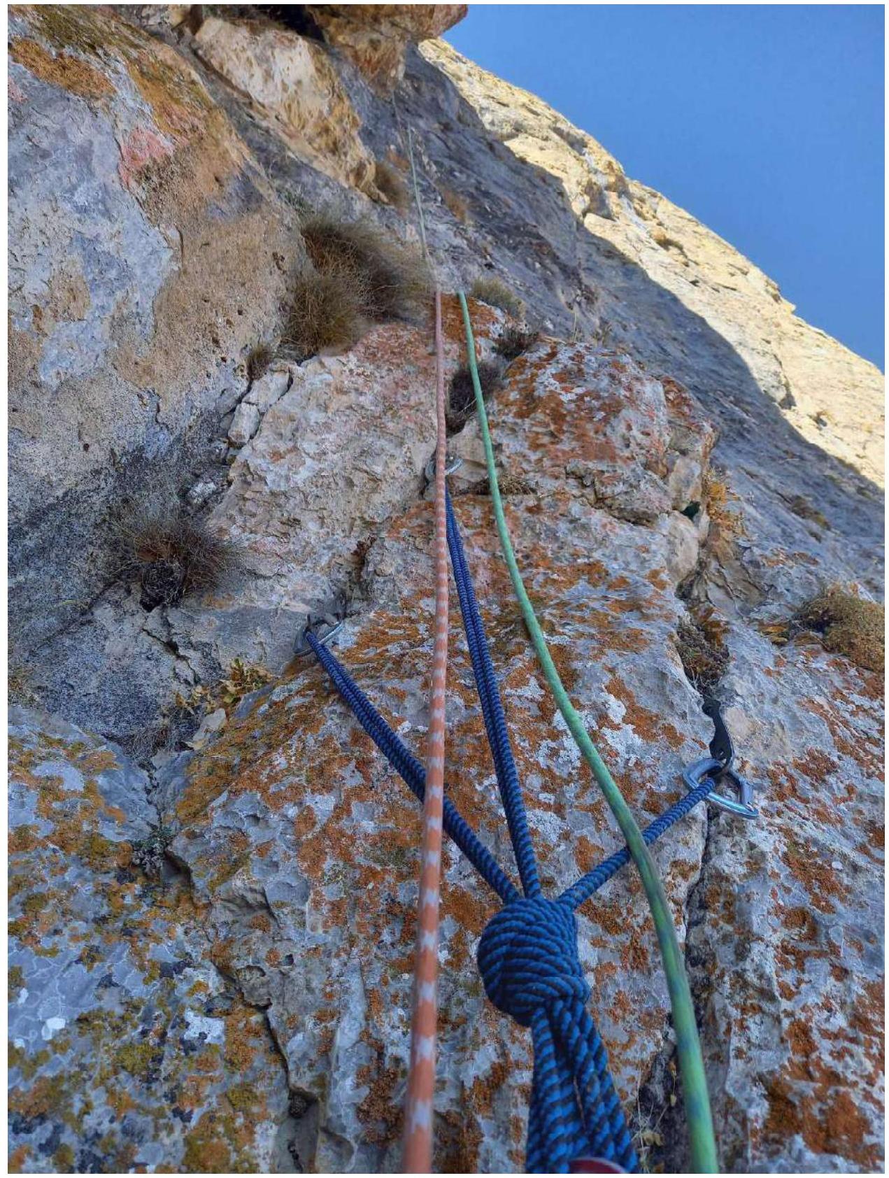
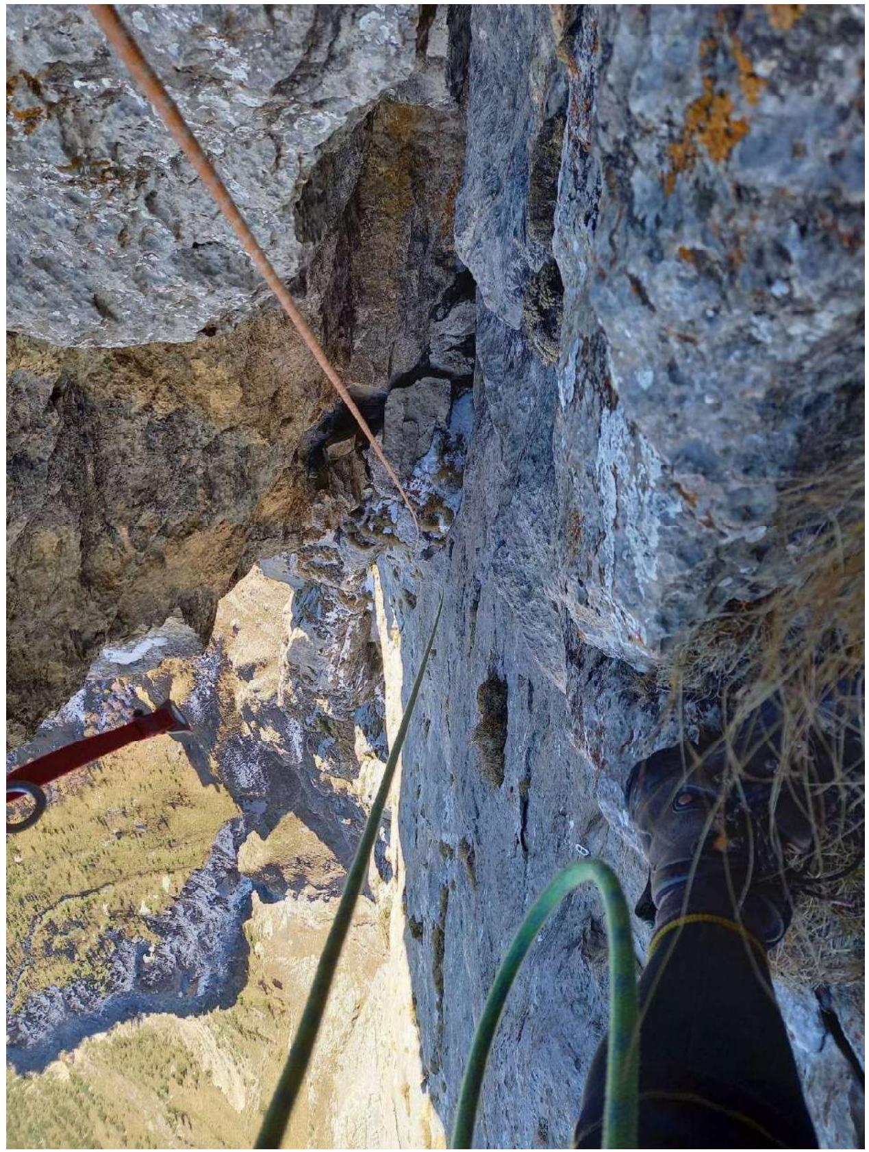
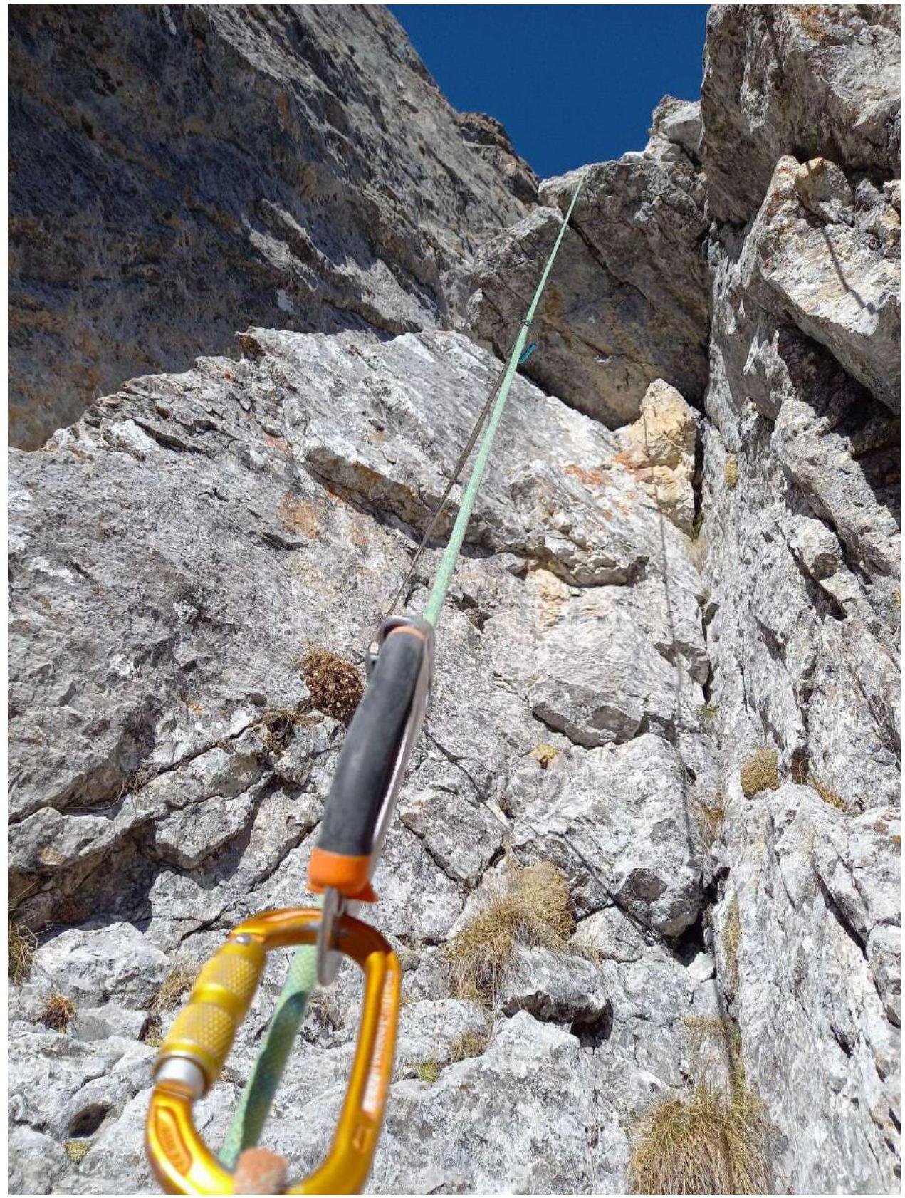
3.4. Photographs of route sections
- R0–R1
- R1–R2
- R2–R3
- R3–R4
- R5–R6
- R6–R7
- R7–R8
- R8–R9
- R8–R9, IT section — wall with bolts
- R9–R10, exit beyond the bend
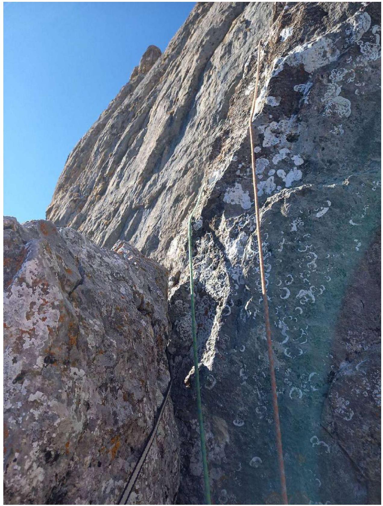
- R9–R10
- R10–R11
- R11–R12, view from station R12
- R12–R13
- R12–R13, transition from the wall (IT) to the internal corner
- R13–R14, IT along the crack

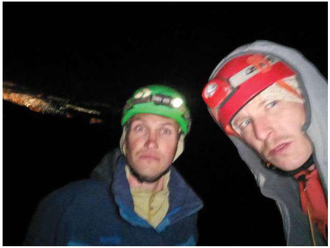
- Team photo on the summit