North-Western and Central Federal Districts Alpine Championship 2024 (high-altitude technical class)
Report on the ascent of Tsей-Лоам via the SW wall (Gorin route) by the St. Petersburg team from 13.03.2024 to 13.03.2024
on the ascent of Tsей-Лоам via the SW wall (Gorin route) by the team of St. Petersburg from 13.03.2024 to 13.03.2024
St. Petersburg
I. Ascent Passport
| 1. General Information | ||
|---|---|---|
| 1.1 | Full name, sports rank of the leader | Ivanov A.S., Master of Sports |
| 1.2 | Full name, sports rank of participants | Kuropatkin Nikolai Anatolyevich, 2nd sports rank |
| 1.3 | Full name, sports rank of participants | Mironovskaya Maria Leonidovna, 2nd sports rank |
| 1.4 | Full name of the coach | Ivanov A.S. |
| 1.4 | Organization | "Technolog", Federation of Alpinism of St. Petersburg |
| 2. Characteristics of the ascent object | ||
| 2.1 | Region | Caucasus |
| 2.2 | Area | From the Krestovyy pass to the Shaviklde peak |
| 2.3 | Section number according to the classification table | 2.9.55 |
| 2.4 | Name and height of the peak | Tsей-Лоам (Kyazi), 3171 m |
| 2.5 | Coordinates of the peak | 42°50′09″ N 44°50′57″ E |
| 3. Characteristics of the route | ||
| 3.1 | Route name | via the SW wall |
| 3.2 | Difficulty category | 5A |
| 3.3 | Degree of route exploration | explored |
| 3.4 | Relief characteristics of the route | rocky |
| 3.5 | Height difference of the route | 505 m |
| 3.6 | Length of the route | 555 m |
| 3.7 | Technical elements of the route | II–IV cat. rocky, combined relief — 155 m, 5 hours |
| 3.8 | Average steepness of the route | 70 degrees |
| :--: | :--: | :--: |
| 3.9 | Average steepness of the wall part of the route | 70 degrees |
| 3.10 | Descent from the peak | Via route 2A along the NW ridge |
| 3.11 | Additional characteristics of the route | icy conditions in winter |
| 4. Characteristics of the team's actions | ||
| 4.1 | Time of movement | 13 hours (from R0 to the peak) |
| 4.2 | Overnight stays | none |
| 4.3 | Time of route processing | without processing |
| 4.4 | Start of the route | 13.03.2024, 6:00 — departure from the Kyazi alpine camp, 7:30 — start of work on the route |
| 4.5 | Reach the peak | 13.03.2024, 20:35 — peak |
| 4.6 | Return to the base camp | 14.03.2024, 1:00 — back in the Kyazi alpine camp |
| 5. Characteristics of weather conditions | ||
| 5.1 | Temperature | −3–5°C in the morning and evening, around 0°C during the day |
| 5.2 | Wind speed | 2–4 m/s |
| 5.3 | Precipitation | none |
| 5.4 | Visibility | good |
| 6. Responsible for the report | ||
| 6.1 | Full name, e-mail | Mironovskaya Maria, mironovskaya239@gmail.com |
II. Description of the Ascent
1. Characteristics of the Ascent Object
Tsей-Loam is a mountain range in the Dzheyrakhsky district of the Republic of Ingushetia. The main peak is the eponymous Tsей-Loam (Gaykomd). (Ingush: KhaъkІoamtІe or Khey-KІoam). The height above sea level is 3171 m.
Tsейloam has been considered a sacred mountain by the Ingush people since ancient times. Many Ingush legends and myths are associated with it. The incredibly beautiful rocky peak attracts more and more climbers. Routes from the 2nd to 6A difficulty category have been established on Ts ей-Loam.
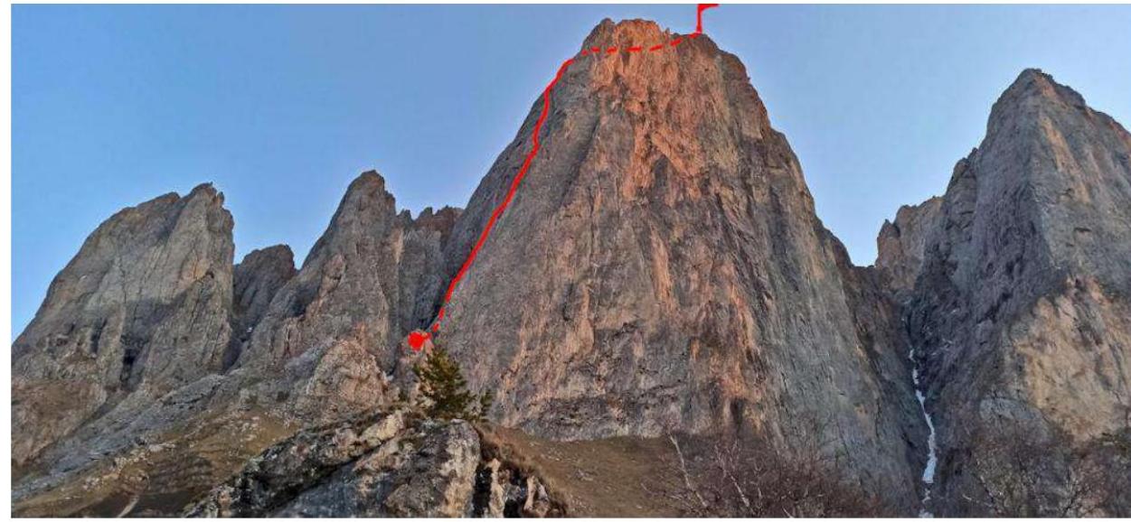
1.1. Fig. 1. General photo of the peak and the route line
The ridge with the peaks Tsей-Loam and Koazoy-Loam is an attractive object for alpine ascents, considering:
- good transport accessibility,
- developing infrastructure of the "Kyazi" alpine camp and short approaches from it (1.5–2 hours),
- beautiful and logical lines of rocky routes and good exploration of the southern walls,
- mild climate, allowing ascents to be made practically year-round.
1.2. Fig. 2 Panorama of the Tsей — Loam ridge, view from the side of the aul Kyazi
 1.3.
Fig. 3 Map of the area with the route thread
1.3.
Fig. 3 Map of the area with the route thread
2. Characteristics of the Route
2.1. General Characteristics of the Route
The Gorin route on Tsей — Loam (first ascent in 1983) is undoubtedly the most popular "five" in the area, due to its beauty, logic, monolithic nature, and safety.
Route features:
- Relatively easy orientation
- Convenient ledge for overnight stay on R7 — suitable for less fast groups or acclimatization
- Practically no destroyed fragile rocks and dry grassy knolls, infamous among Kyazi climbers
Fig. 4. Technical photo of the first ascenders with sections
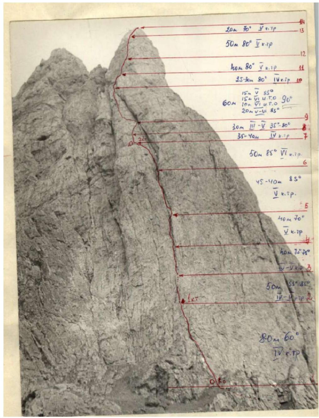 Fig.
5: "Let's go there": participant Nikolai Kuropatkin on the eve of the ascent.
Fig.
5: "Let's go there": participant Nikolai Kuropatkin on the eve of the ascent.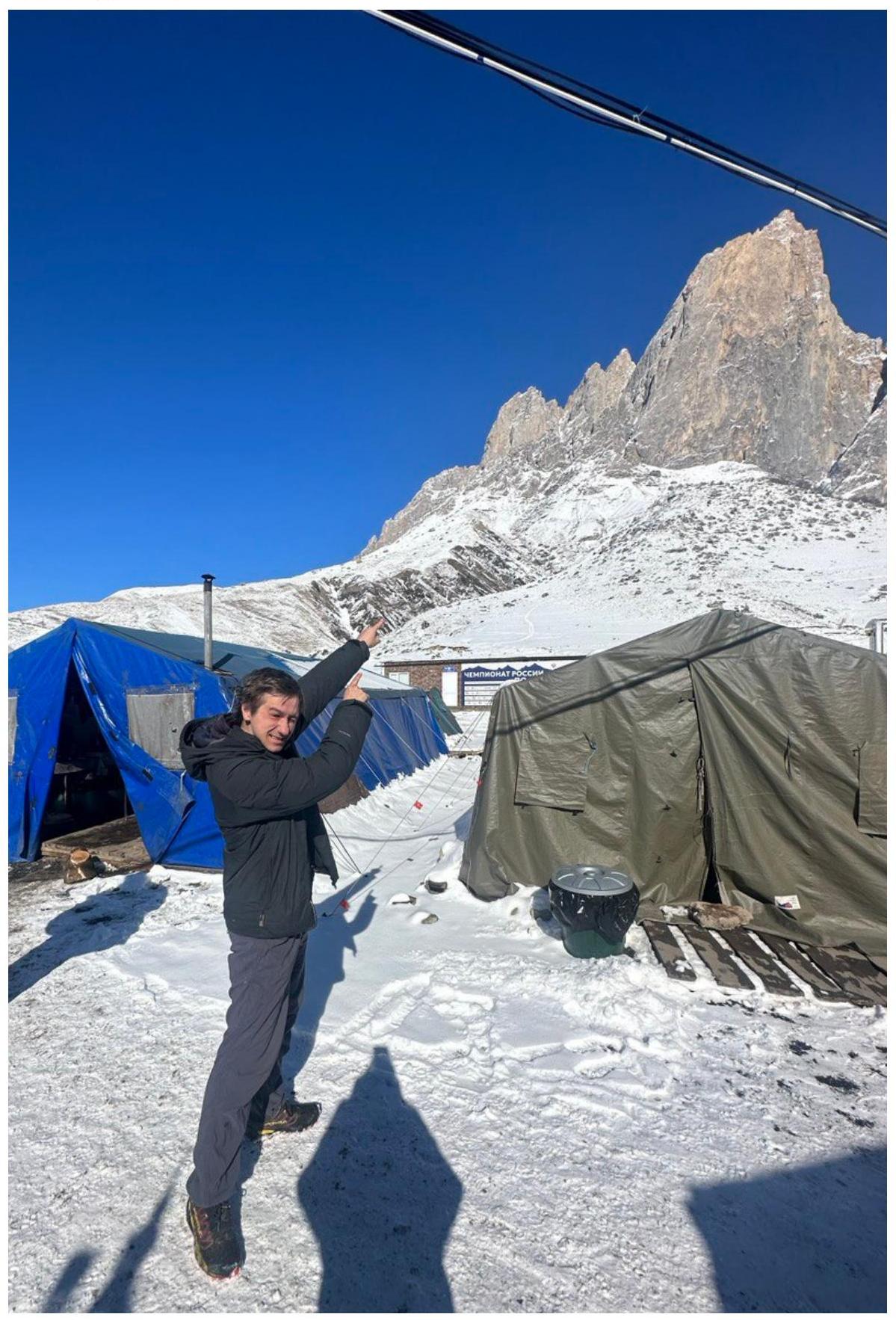
2.2 Description of the Route
2.2.1 Description of the Route by Sections
From the initial overnight stay in the base camp near the upper kosha, the ascent up the grassy steep slope under the southern wall takes about 1 hour. Traversing the slope under the wall to the left in the direction of a large rocky couloir, with a large gendarme on the left and along the bottom of the couloir (rocky "ram's foreheads") we ascend 150 m to the base of the SW wall.
The route on the wall is limited by two large, converging chimneys in the upper part of the wall, and in the lower part it passes through the right chimney. At the beginning of the route in the couloir, a cairn is built for orientation (may be snow-covered in winter).
- R0–R1: From the cairn, ascent straight up the wall for 80 m (1–2) over rocks of 4th cat. diff. with grassy ledges and walls with "live" stones (5 rock hooks) to a small ledge for 2 people, on which the first control cairn is suspended on a bolt hanger.
- R2–R3From the ledge, ascent up the wall for about 17 m, rocks 4th cat. diff., 50–55° to a small shoulder, from the left part of which a chimney (about 25 m) with sheer walls of 5th cat. diff. (hook protection (3 rock hooks and 1 nut)) ascends, at the exit from which there is a small debris shoulder, and above it is a stepped wall of 4th cat. diff., 80°, after passing another 8–10 m, a belay station can be organized (section 2–3).
- R3–R4: From the end of the belay station, another 8 m along the stepped wall, bypassing a small ridge on the right, at the point where it approaches the wall, transition to the beginning of the chimney (3–4), along which (rocks 5th cat. diff.) the inclined bottom of the chimney is 70–75°, the walls (80–85°) ascent to the end of the rope.
- R4–R5: Further 40 m — continuation of the chimney (4–5), to its overhanging part. Ascent along the left, sometimes right part of the chimney, walls are sheer, few footholds.
- R5–R6 — from the end point of the section (4–5) (large niche in the chimney) ascent 5 m up the left sheer wall of the chimney and further up the chimney (5–6) to its upper part (rocks wet) with an overhanging large stone, bypassing which on the left, we exit onto a debris ledge ("live" stones), from which the continuation of the chimney (60 m) ascends, 8–10 m wide.
- R6–R7From the ledge to the left and upwards (6–7) along the sheer left wall of the chimney (red rocks with few footholds) ascent to the left and upwards for 50 m (8–9 hooks) onto a large rocky ledge, on which the 2nd control cairn is built. On the ledge, an overnight stay can be organized, it is a large monolithic, slightly inclined slab.
- R7–R8: From the ledge upwards, the upper triangular part of the wall ascends, limited by two converging chimneys. Ascent from the 2nd control cairn 40 m upwards (7–8) (3 hooks) over rocks of the type of a destroyed internal angle of 4th cat. diff. with "live" stones, to a small ledge for 2–3 people under the base of the slab-like part of the wall.
- R8–R9: From here, along the right part of the wall (8–9), along slabs (5th cat. diff., 80°) ascent for 25 m to an inclined ledge (30°, 3rd cat. diff.), leading into the upper part of the right chimney under an overhang.
R9–R10
From the middle of the ledge, ascent 20 m along slabs with very few footholds (difficult climbing of 6th cat. diff., 70–75°) to the smooth part of the wall ("mirror"), along which ascent another 6 m using ITO (5 bolt hangers, ladders) under the base of a sheer crack (8–9 m), passable with ladders (3 rock, 1 bolt hanger) and leading into a destroyed internal angle (15 m, 60°, 5th cat. diff.). In its upper part, a belay station can be organized. This section (9–10) is the key section of the route. R10–R11. Further along the internal angle, consisting of blocks with many "live" stones (section 10–11, 25 m, 80°, 4th cat. diff.), we exit onto an extended wide ledge, on which an overnight stay can be organized. R11–R14. From the ledge straight up to the pre-summit tower — 2 ropes (40 and 50 m), rocky 5th cat. diff., 80° with hook protection, and further along the internal angle (20 m, 70°, 5th cat. diff.) of smooth slabs — exit to the top of the pre-summit to a large stone (section 11–14). At this point, the wall part of the route ends. Further movement is simultaneous, adhering to the left debris part of the ridge to the peak. From the peak, after descending along the debris, move in a northerly direction, crossing 3 debris couloirs in the upper part, and then along a noticeable descent trail, first debris, then grassy, descent down to the trail leading to the koshas, and further to the base camp.
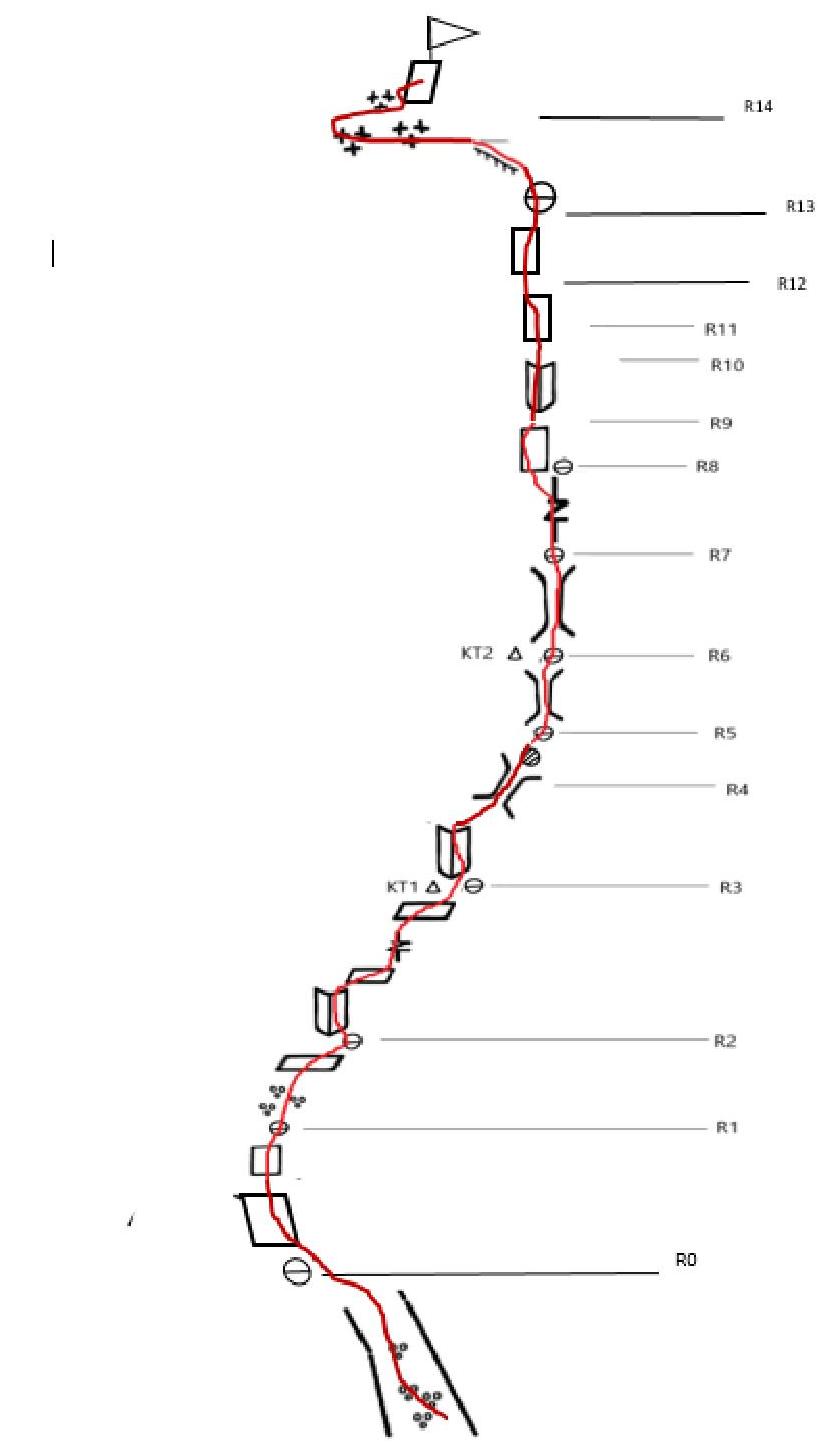
2.2.2 Route Diagram in UIAA Symbols
- Characteristics of the Team's Actions
3.1. Tactical Actions of the Team
The team set the following goals:
- to complete the route without prior processing;
- to complete the route without overnight stay.
After arriving at the alpine camp, the team conducted rock climbing training and made several training ascents on routes of 2–4 difficulty categories. In particular, during the ascent of Tsей-Loam via route 2A, the descent path from the Gorin route was scouted.
After our arrival in the area at the end of February, the weather remained unstable, heavy snowfalls occurred, and our rocky route was covered with fresh snow. For several days before the ascent, we waited for:
- the peaks of Tsей and Koazoy to emerge from the clouds,
- the sun to come out,
- the snow to melt a bit.
After a sunny day on March 12, the ascent was scheduled for March 13. We departed from the base camp at 6:00, began working on the route at 7:30, overcoming deep snow in the couloir on the approach. The first two sections from the couloir to the control cairn R2 were completed in crampons on snow-covered ledges, on R2 the leader put on rock shoes and the more vertical chimney part of the route began.
On the steep part of the route R2–R12, we moved according to the so-called "Krasnoyarsk" scheme with intermediate stations every 30 m and spaced-out equipment. It was challenging to pass the plug on R5–R6 (12:30), especially for the leader in rock shoes: all walls and the plug were covered in a thick layer of rime ice.
We did not stop at the ledge under the traditional overnight stay on R7, continued movement along the chimney on the right, with an exit through a complex left wall of the chimney (ITO) onto the "mirror" with a bolted ladder. After the wall on section R9–R10 (16:00), the route gradually becomes easier. We reached R12 in the twilight around 18:00.
Further movement along the ridge to the peak occurred in the dark and was accompanied by stumbling through deep snow. The pace of movement noticeably decreased. Moreover, one of the participants lost a crampon in the deep snow and realized it only after 20 minutes of movement. After a half-hour search, the crampon was miraculously found. This was quite timely, considering the icy inclined ledge that awaited us on the descent.
We reached the peak at 20:30. Thus, the team completed the route to the peak in approximately 13 hours. In winter conditions and considering the large amount of snow in the lower part of the route, we assess the pace of movement as good.
The pace of movement on the descent was not high due to:
- fatigue of the participants,
- necessary caution on slippery sections in the dark.
The descent passed without incidents, traversing along the saddle of the northern ridge (with rigged belays on a sloping ledge) and further along route 2A and along a well-marked and familiar descent trail to the koshas and the highway.
We returned to the camp at 1:00 on March 14.
3.2. Photographs from the Route
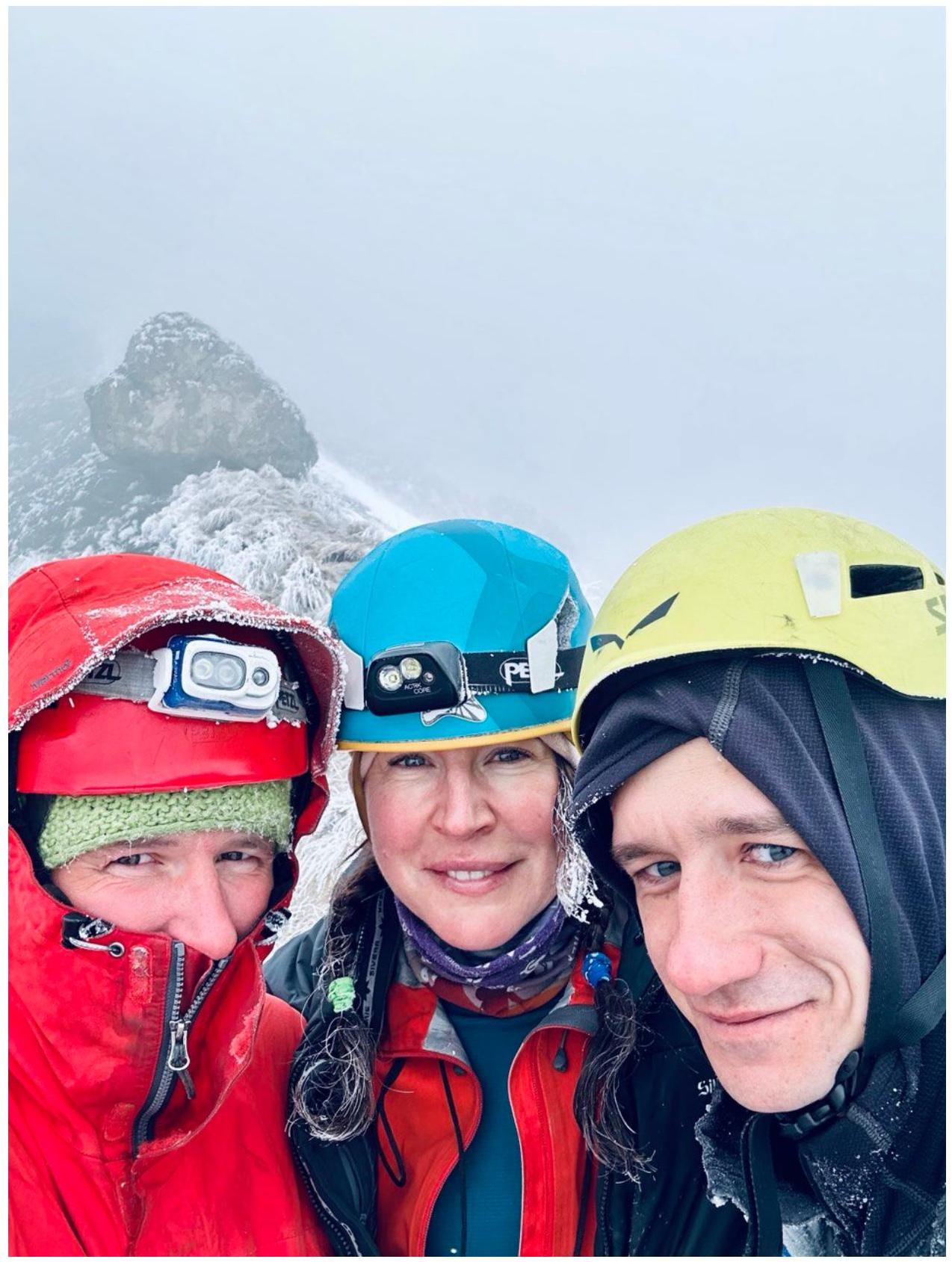
Fig. 6: Waiting for the weather. The team during training on 10.03.24
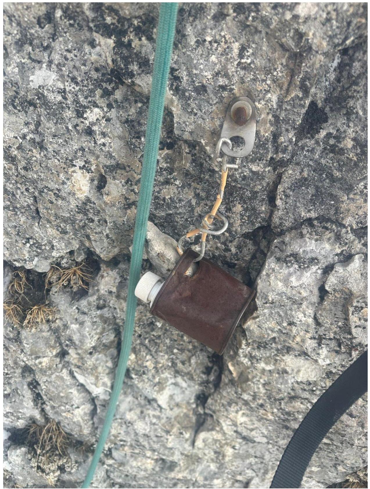
Fig. 7: CT-1, R2
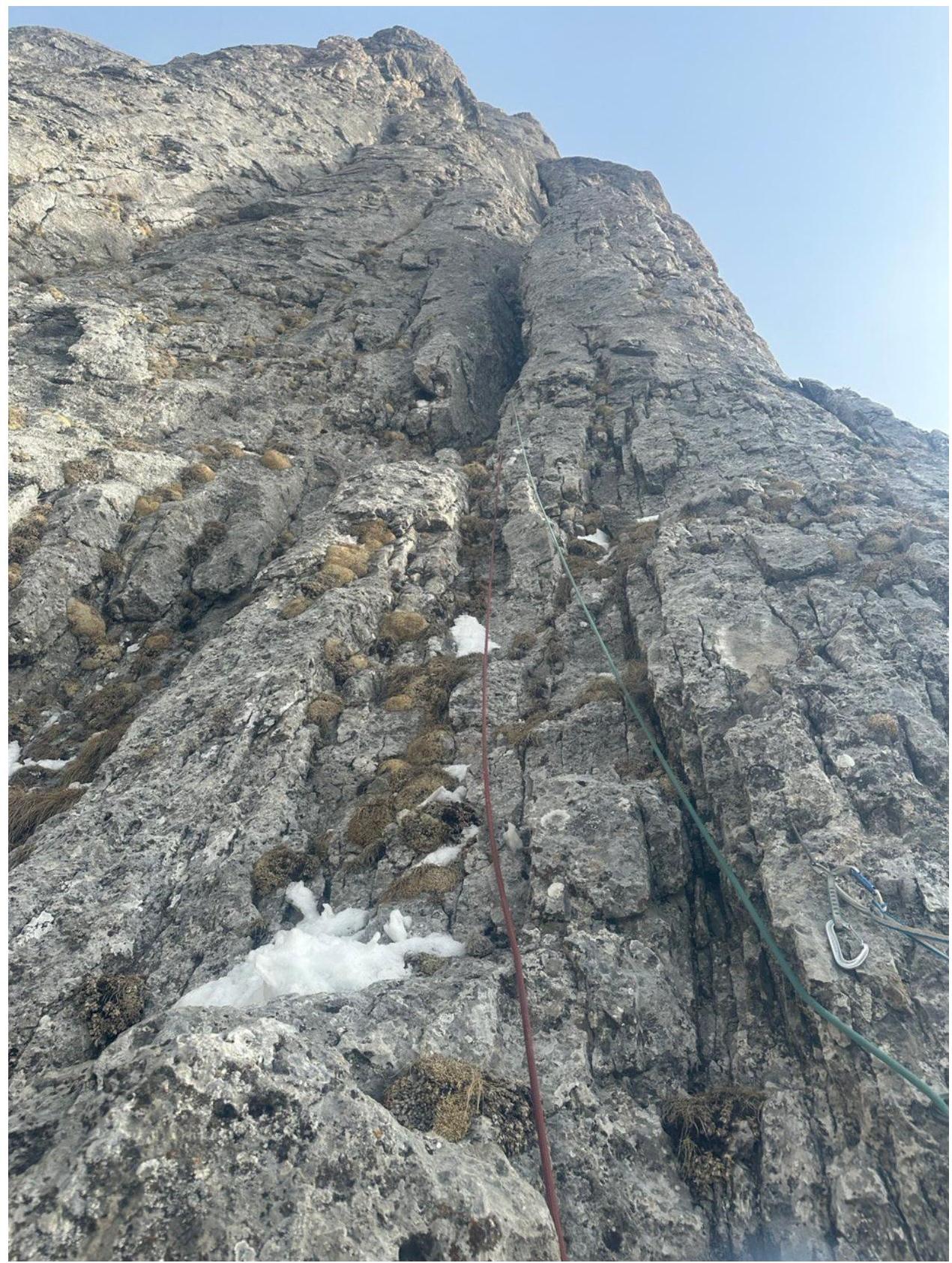
Fig. 8: R3–R4
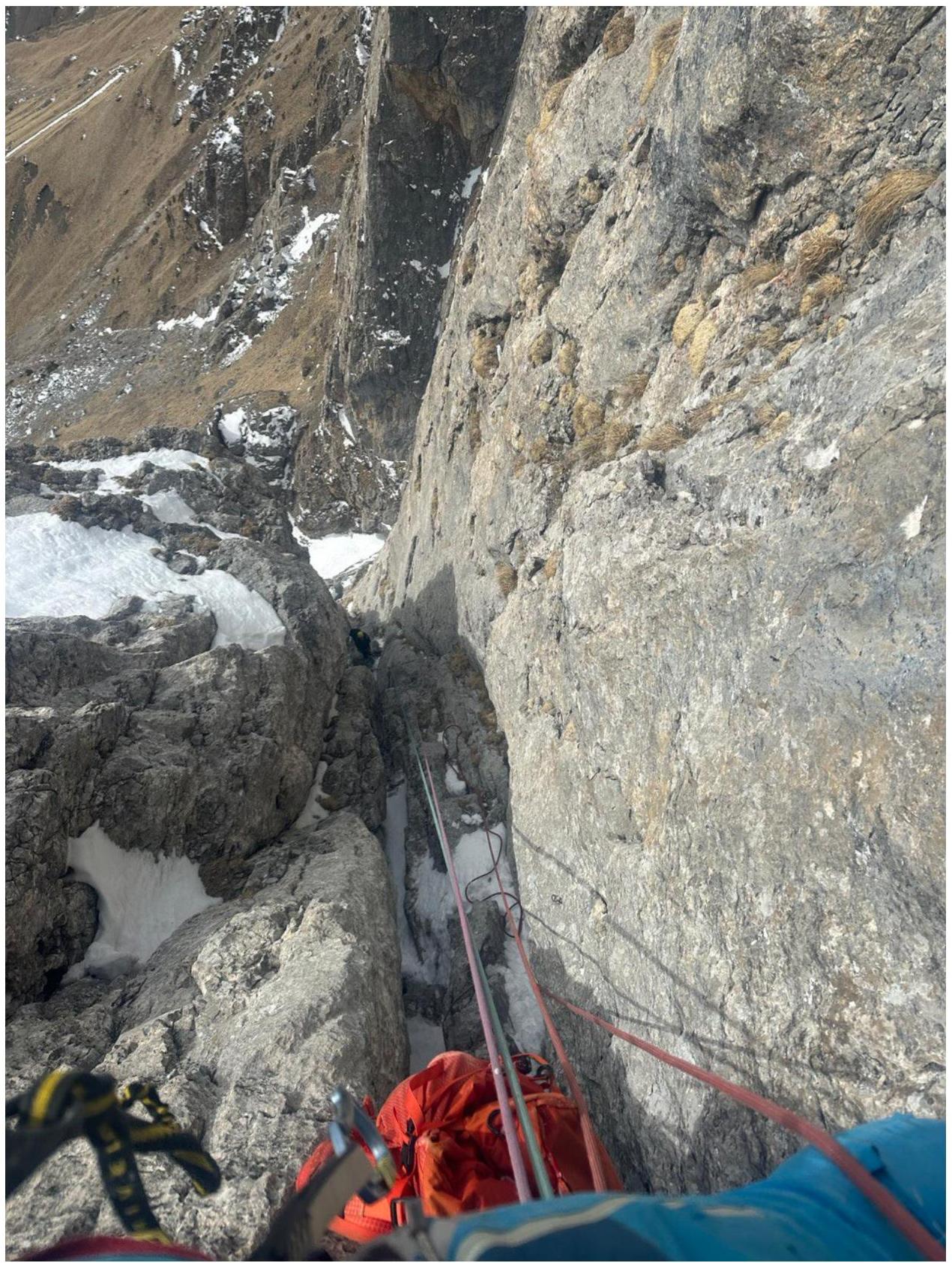
Fig. 9: R4–R5,
rucksacking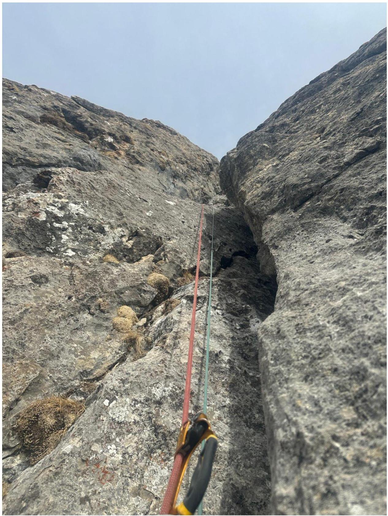
Fig. 10:
R6–R7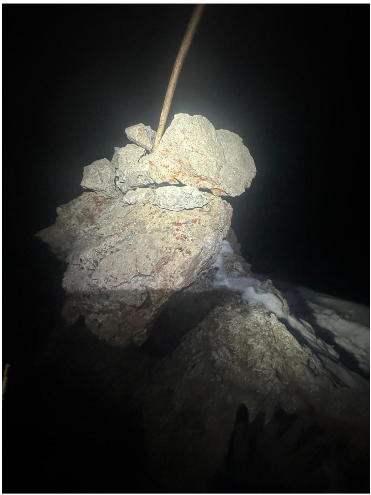
Fig. 11:
Peak.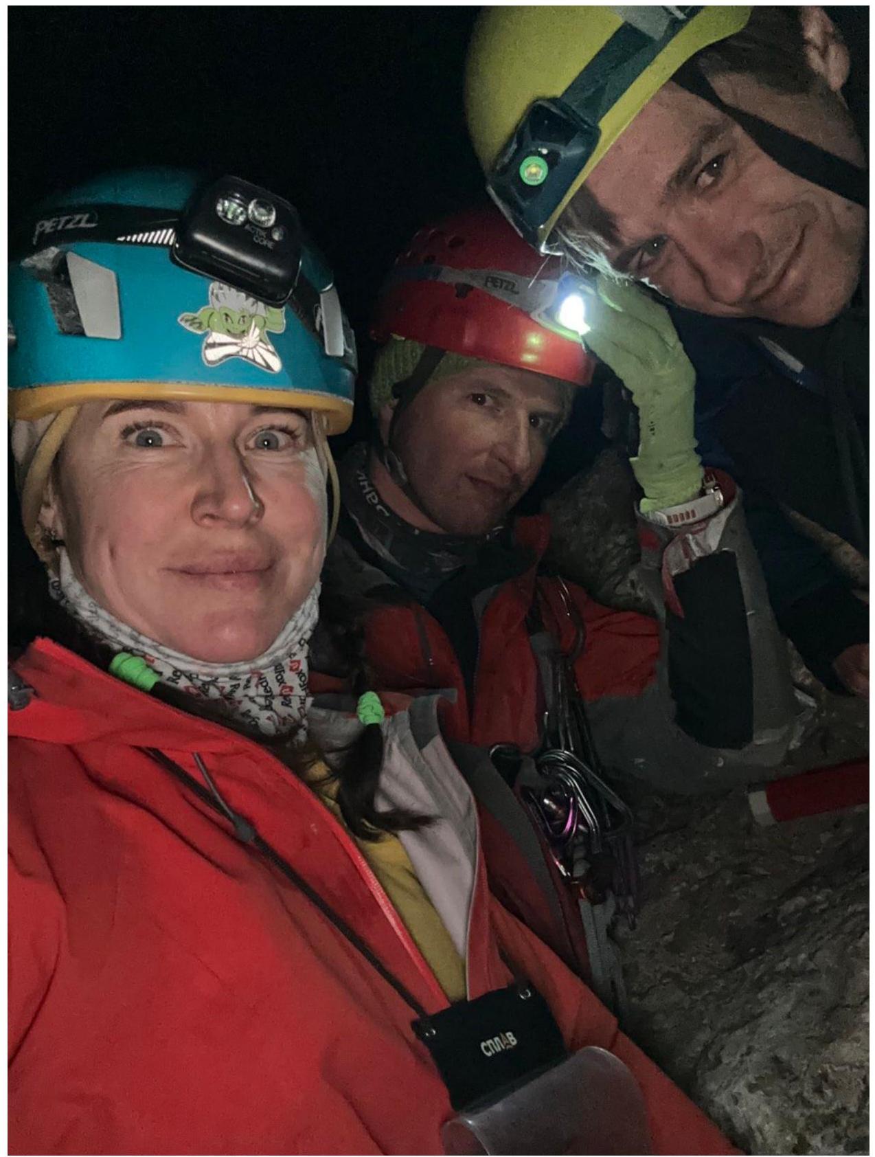
Fig. 12: On the peak
4. List of Equipment
-
Dynamic rope 60 m — 3 pcs.
-
Quickdraws with carabiners 30 cm — 10 pcs.
-
Carabiners — 15 pcs.
-
Station loops — 4 pcs.
-
Friends Black Diamond — set
-
Rock hammers — 3 pcs.
-
Anchor hooks — 10 pcs.
-
Crampons — 3 pairs
-
Harness + self-belay device — 3 sets
-
Unloading device — 1 pc.
-
Helmets — 3 pcs.
-
Belay device "Grigri" — 1 pc.
-
Belay device ATC — 3 pcs.
-
Jumar — 2 pcs.
-
Jumar foot pedal — 1 pc.
-
Foot clamp "pantin" — 1 pc.
-
Headlamps — 3 pcs.
-
Thermos — 1 pc.
-
Hydrator — 1 pc.
-
First aid kit — 1 pc.
-
Radio station — 2 pcs.
-
Emergency tent (Terranova Bothy4) — 1 pc.
-
Burner, pot
-
Down jackets — 3 pcs.