Ascent Passport
- Ascent class — rock
- Ascent area — Eastern Caucasus, Skalisty Range, Armkhi - Assa rivers watershed, Chechen-Ingush ASSR.
- Peak, its height, ascent route — Girech Glavnaya (3171.7 m), via the right couloir of the S wall and W ridge
- Route characteristics: a) height difference on the route — 920 m on the wall; b) route length — 1540 m; c) average steepness of the route — 37°
- Pitons hammered for belay/for creating belay anchors:
- rock — 3
- ice — none
- bolt — none
- Number of climbing hours on the route: to the summit — 7–8 hours
- Number of bivouacs and their characteristics: none
- Proposed difficulty category — 2A cat. dif.
- Full name of the leader, participants and their qualifications:
- Popel N.A. 1st sports category
- Khazov V.A. Candidate Master of Sports
- Vasilenko A.I. Candidate Master of Sports
- Pyltsyn V.N. Candidate Master of Sports.
- Team coach — Kurochkin A.G.
- Date of departure on the route and return to the base camp: a) departure on the route — September 31, 1984 b) reaching the summit — September 31, 1984 c) return to the camp — September 31, 1984
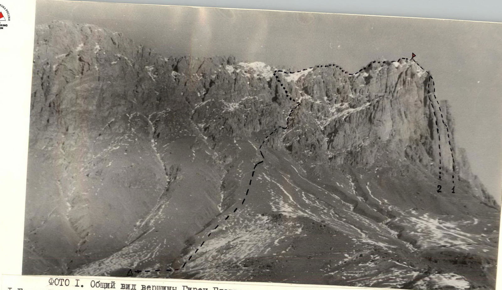
PHOTO 1. General view of Girech Glavnaya peak.
- Girech Glavnaya, 3171.7 m, 5B cat. dif., rock, via the center of the S wall, first ascent, Kurochkin A.G., 1983.
Additional data:
- tourist center "Ullutau"
- III Caucasus Championship
- rock class
- 2nd place
- Girech Glavnaya, 3171.7 m, 5B cat. dif., rock, via 10–3 wall, V. Gorin, 1983 (tourist center "Ullutau")
Route Description
From the bivouac, go right, cross the canyon and ascend straight up the grassy slope to the rocks of the Girech massif. 1.5 hours from the bivouac.
Under the rocks, turn right and traverse 40 m along the rocks on a grassy slope (30-degree) to the entrance to the couloir.
Ascend the couloir straight up 250 m to a small saddle. Couloir:
- grassy with rock outcrops
- scree in places
"Live" rocks!
On the saddle, move left 60 m and ascend up the snowy 35-degree slope 40 m to the entrance to a narrow rocky couloir with a plug. The couloir is climbed on the left on gentle, smooth rocks like "ram's foreheads." Belay! The plug is bypassed on the right. At the exit from the couloir — "Live" rocks!
Then turn left and ascend the scree snowy couloir with rock outcrops 150 m in the direction of the ridge.
On a 20-degree scree slope — exit to the ridge. Landmark — a rocky niche in the ridge gendarme.
Then 300 m traverse up on a 30-degree snowy slope of the ridge to the gendarme.
The gendarme is bypassed on the left on a 30–40 m long ledge. Then descend 60–70 m to the snowy ridge on 30–45-degree simple, heavily destroyed rocks.
Then 150 m on a sharp snowy ridge and 60 m on 30–40-degree scree ascent to a saddle between two gendarmes. The right big gendarme with "red" slabs is bypassed on the left on a 60 m long ledge.
Belay!
- Ropes
- Pitons
From the ledge, exit to a 60-meter snowy ridge. Then on 25–40-degree destroyed rocks up to the wall of the pre-summit ridge.
From under the wall, traverse left 5 m to a crevice.
Belay!
- Pitons
On an 8-meter 80-degree crevice up to the ridge. "Live" rocks!
On a sharp rocky destroyed ridge (40 m) and then on 30-degree simple rocks (20 m) exit to the summit. 7–8 hours from the bivouac.
Descent from the summit via 1B cat. dif. route (via the left couloir of the S wall).
Table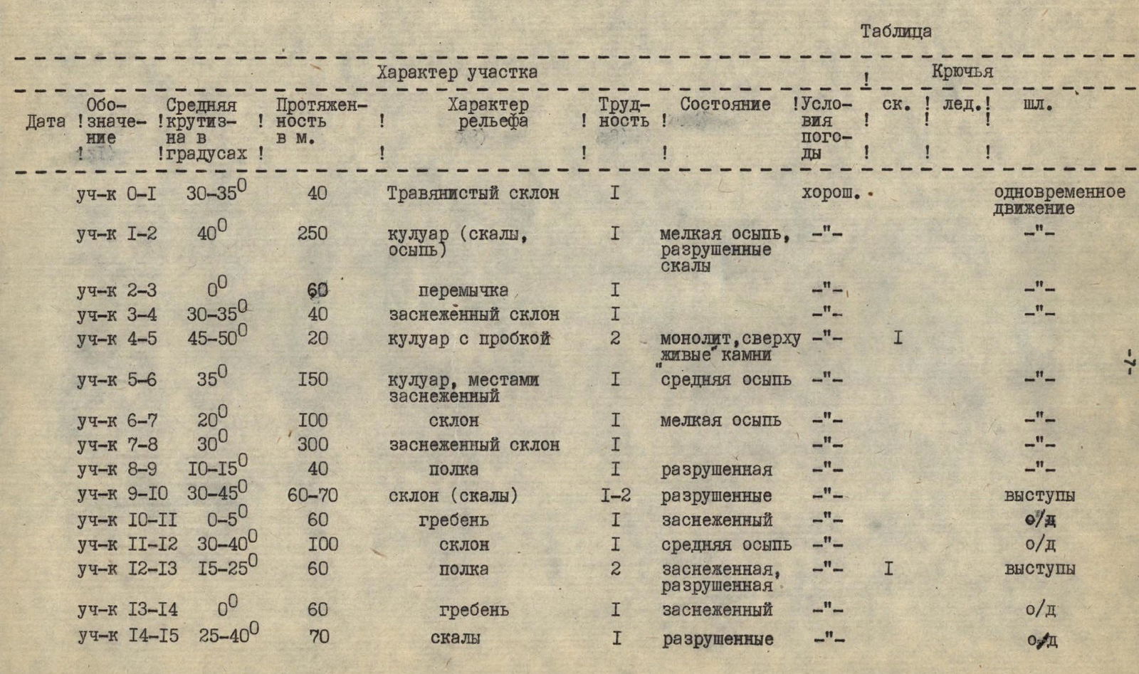 Continuation of the table.
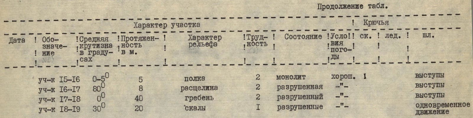
R1–R2 section. Exit from the couloir to the saddle.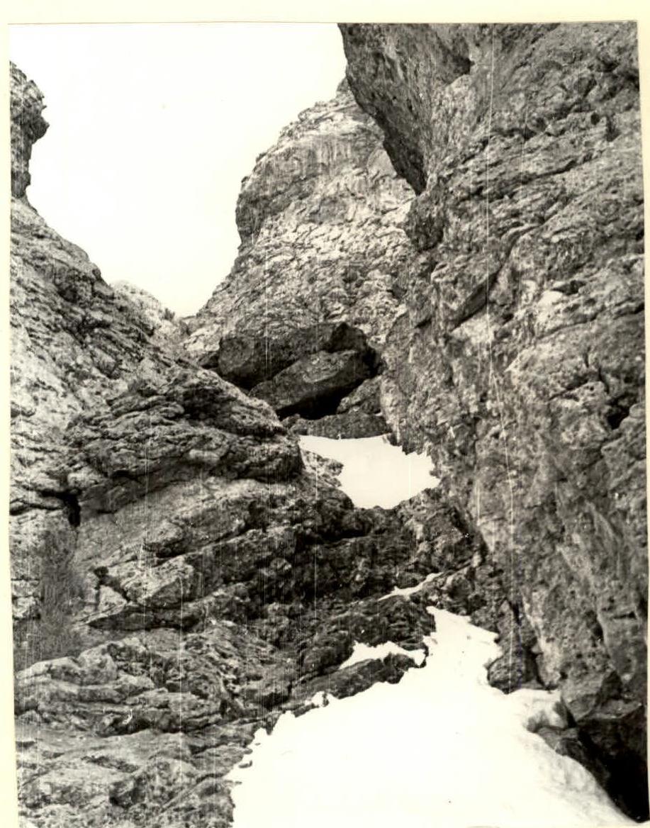
R4–R5 section. Couloir with a plug.