Ascent Certificate
- Ascent category — Rock climbing
- Ascent area — Eastern Caucasus, Shavana ridge
- Peak, its height, route — Salgi peak, 3961 m, via the Eastern counterfort.
- Route description: a) height difference — 700 m. b) route length — 1100 m. c) average steepness of the route — 50–55°
- Pitons hammered for belay (I.T.O.):
- rock pitons — 8
- ice screws —
- bollards —
- Number of travel hours on the route: to the summit — 7 hours.
- Number of overnight stays and their description: none.
- Proposed category of difficulty — 2A.
- Full name of the leader, participants, their qualification:
- Mintuev Kh.Ts. — 1st sports category.
- Vdovychenko V.I. — 1st sports category.
- Governorov S.S. — 1st sports category.
- Maslennikov A.M. — Candidate for Master of Sports.
- Team coach: Vasilenko A.A.
- Date of departure to the route and return to the base camp: a) departure to the route — September 30, 1984. b) reaching the summit — September 30, 1984. c) return to the base camp — September 30, 1984.
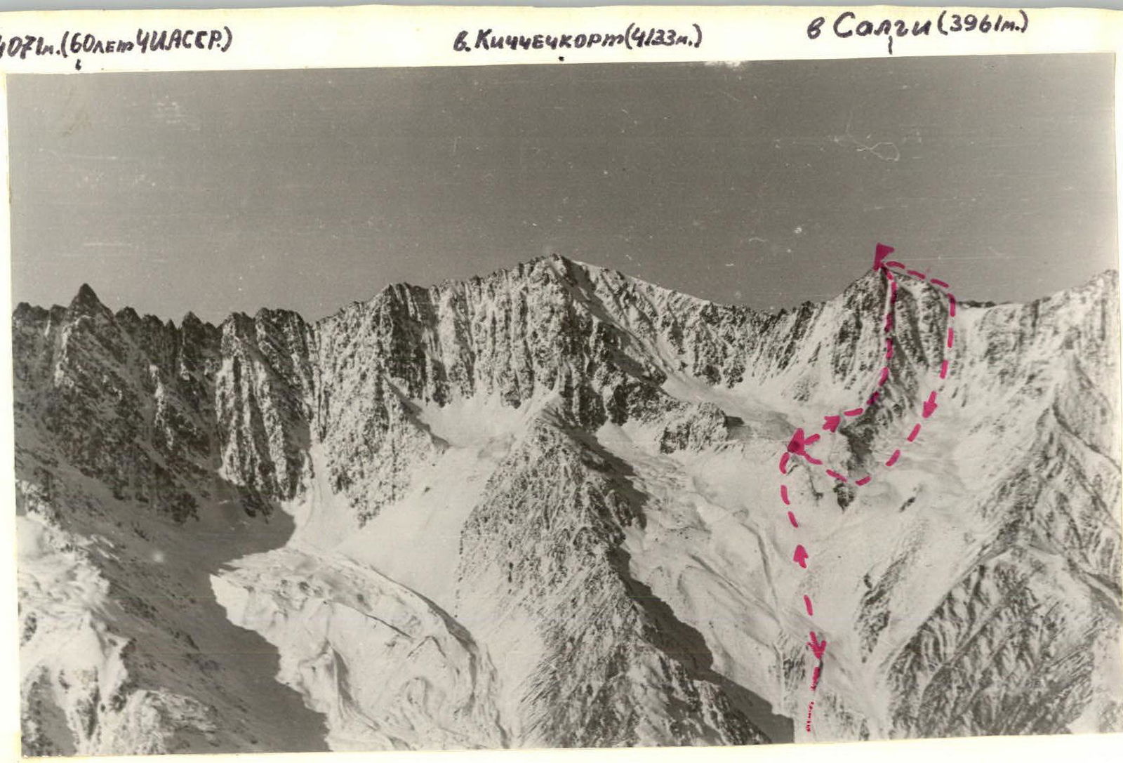 Photo 1. General view of Salgi peak (3961 m)
Description of the ascent route to Salgi peak via the eastern counterfort
From the bivouac in the northern direction, the eastern counterfort of Salgi peak is clearly visible, along which the ascent route passes. The counterfort differs from others by its lighter rock color.
In the middle part of the counterfort, a clear landmark is visible — a rocky outcrop resembling a rooster's comb ("Petukh"), from which the ascent route begins.
From the bivouac, move north, crossing the glacier, then ascend along the talus to the eastern slope of Salgi peak, and further along the ledge under the wall of the eastern counterfort to the saddle between the counterfort wall and "Petukh". Here is a control cairn with a note.
From "Petukh", the path to the counterfort ridge is on the right, in the direction of travel. The ascent is along rocks of medium difficulty with good handholds. There are few protrusions for belay and self-belay. It is necessary to hammer 1–2 rock pitons (the cracks are wide!).
The length of the ascent is 50–60 m.
Alternating belay.
Along the counterfort ridge with alternating and simultaneous belay to a small (5–6 m) rocky wall under the pre-summit "tower". Bypass the tower on the ledge on the left, in the direction of travel, and along the destroyed rocks — exit to the summit.
The route is approximately 2A category of difficulty.
Recommended group size: 4–6 people.
Time breakdown:
- Bivouac — control cairn at "Petukh": 1–1.5 hours.
- Control cairn — exit to the ridge: 2–2.5 hours.
- Central part of the ridge — summit: 2.5 hours.
- Descent from Salgi peak: 2.5–3 hours along the ascent route.
Route sections table
| Section designation | Average steepness (°) | Section length (m) | Terrain character | Category of difficulty | Condition | Rock pitons | Ice pitons | Bollards |
|---|---|---|---|---|---|---|---|---|
| R0 | 30° | 300 m | Talus slope | 1 | Medium talus | talus | ||
| R1 | 60° | 22 m | Rocky wall | 3 | Destroyed rocks "Live rocks" | 2 | ||
| R2 | 45–60° | 60 m | Rocky wall | 3 | Monolithic wall with good handholds. Protrusions for belay. | 4 | ||
| R3 | 30–45° | 200–250 m | Rocky ridge | 1–2 | Destroyed rocks of the ridge. Many gendarmes. | |||
| R4 | 60–70° | 15 m | Rocky wall | 3–2 | Monolithic rocks | 2 | ||
| R5 | 30–45° | 300 m | Rocky ridge | 1 | Destroyed rocks of the ridge | |||
| R6 | 60° | 30 m | Rocky wall (Pre-summit ascent) | 2 | Destroyed rocks |
Total travel hours to the summit — 7 hours.
Descent along the NE ridge.
Description of the ascent area
The object of the ascent is located in the Eastern Caucasus, in the southern part of the Chechen-Ingush ASSR, in the Shavana ridge.
The object of the ascent is located in the center of the Shavana ridge, which separates the valleys of the Kristinka and Shan-don rivers. This ridge includes peaks Shan (4451 m), Dzeneladze (4400 m), Rustavi (4350 m), Kichchechkort (4133 m), and others. Routes of category 1B to 4B difficulty have been established to the peaks of this ridge (from the Kristinka valley). No ascents had been made from the Shan-don river valley before.
At the 21st km of the Military Georgian Road, the Terek River is joined by its left tributary — the Armkhi River. The road leads to the village of Armkhi (12 km); from there, regular buses run from the city of Ordzhonikidze.
From the village of Armkhi, follow upstream along the Armkhi River to its confluence with the Shan-don River (about 2 hours walking).
Then continue upstream along the Shan-don River (direction — south), the valley is covered with forest, good trail. At the forest boundary near the lake (2071 m) — base camp. From the village of Armkhi to the base camp — 6–7 hours.
From the base camp to the eastern cirque of the peaks Kichchechkort — Salgi, follow along the wide couloir-slope on the left bank of the Shan-don River to ascend to the Eastern Kich glacier. The glacier is covered with moraine. Overnight stay under the Eastern rib of Kichchechkort peak near a large "reddish" boulder (3200 m). Water is available in a crevasse of the glacier. From the base camp to the overnight stay — 5–6 hours.
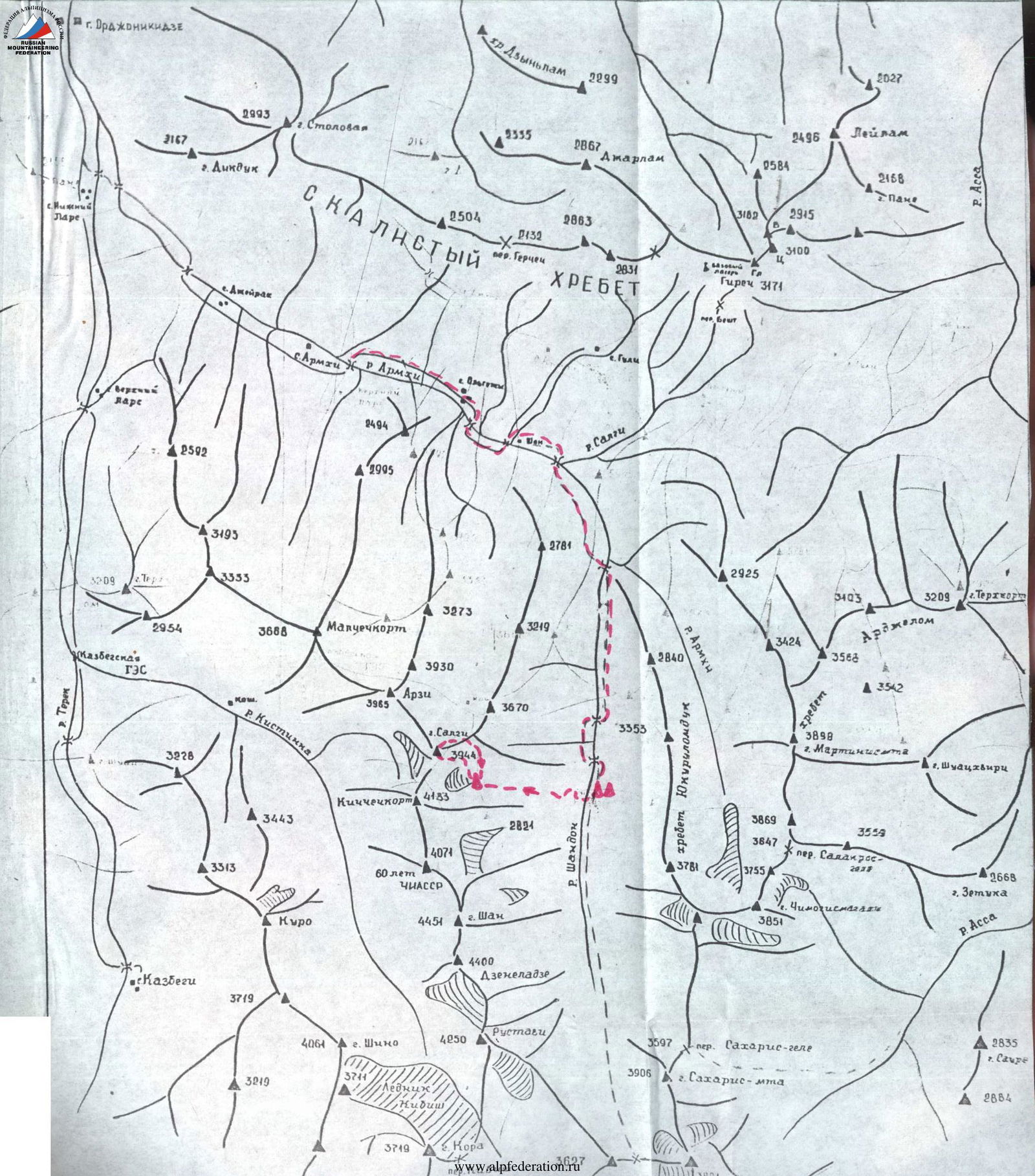
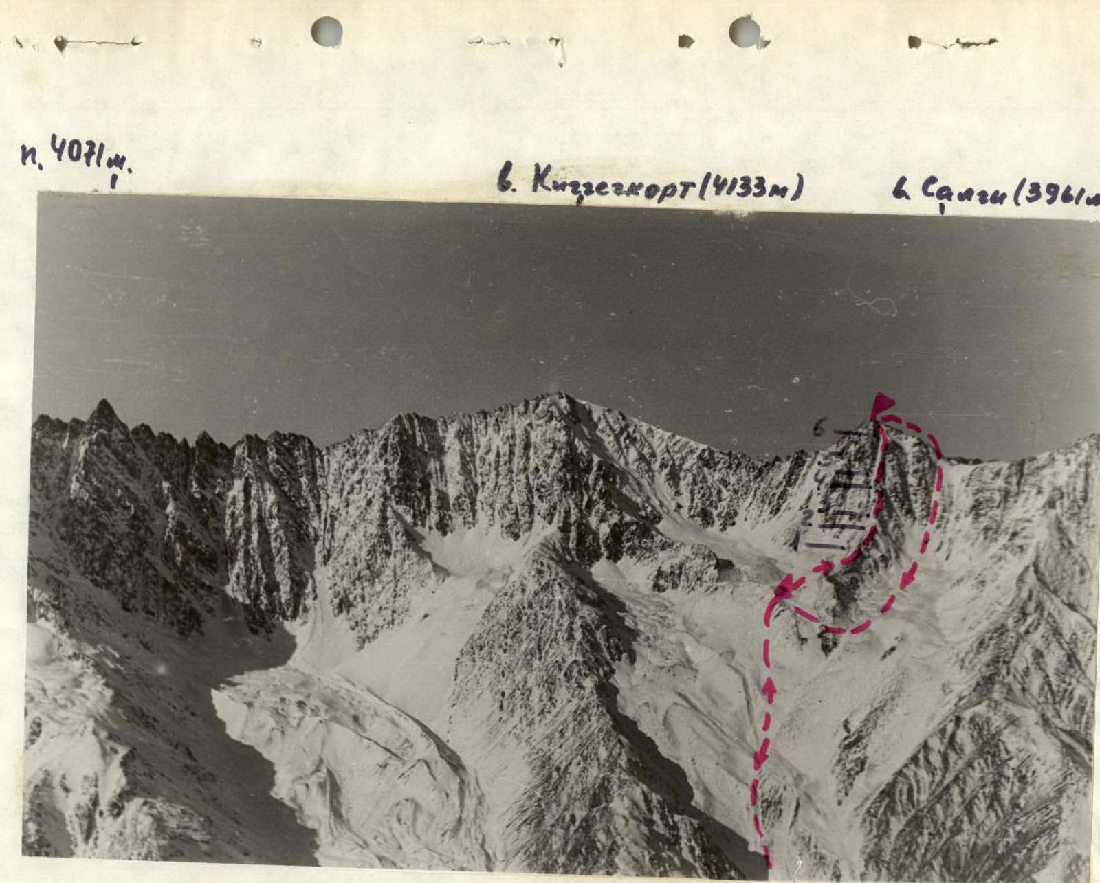 Photo 2. Technical photo of the route.