Report
First ascent of Gaikomd Central peak via South-East wall (through the cave)
Climbing Details
-
Climbing area – 2.9. Caucasus, from the Pereval Kreстовый to the peak Shaviklde
-
Object of ascent – Gaikomd peak, via SE wall (through the cave)
-
Category of difficulty ≈ 5B
-
Character of the route – rock climbing
-
Characteristics of the route:
Height difference – 690 m Route length – 1045 m Length of sections with 5–6 cat. diff. – 295 m Average steepness of the entire route – 66° Average steepness of the wall section – 78°
-
Protection used on the route:
Rock pitons – 60, bolt hangers – 1, chocks and 'friends' – 197, pitons left on the route – 3, including bolt hangers – 1
-
Number of climbing hours – 25.49
Climbing days – 2
-
Bivouacs on the route:
1st (lying) on section R4; 2nd (lying) on section R9
-
Participants:
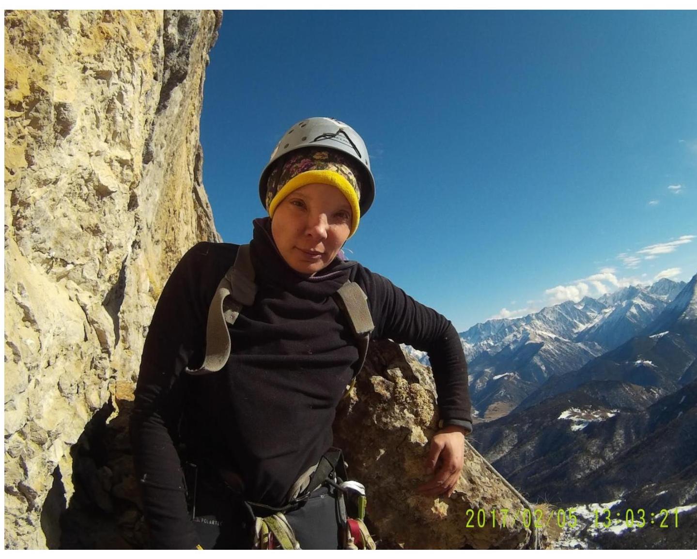
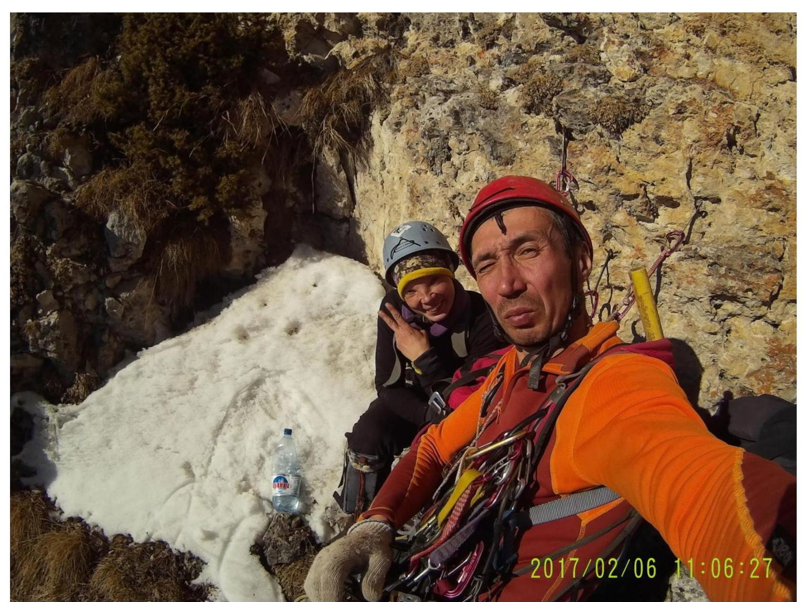
Participant – Agatha Mavrinskaya, participant – Rasim Kashapov
-
Exit to the route – February 5, 2017 from the base camp at 8:00
– Route started – February 5, 2017 at 10:53 – Summit – February 7, 2017 at 19:48 – Return to camp – February 8, 2017 at 13:00
-
Descent from the summit via 4B category difficulty route.
-
Responsible for the report: Agatha Mavrinskaya, bestewhole@gmail.com, tel. 8 904 973-41-72.
Panoramic View of the Area
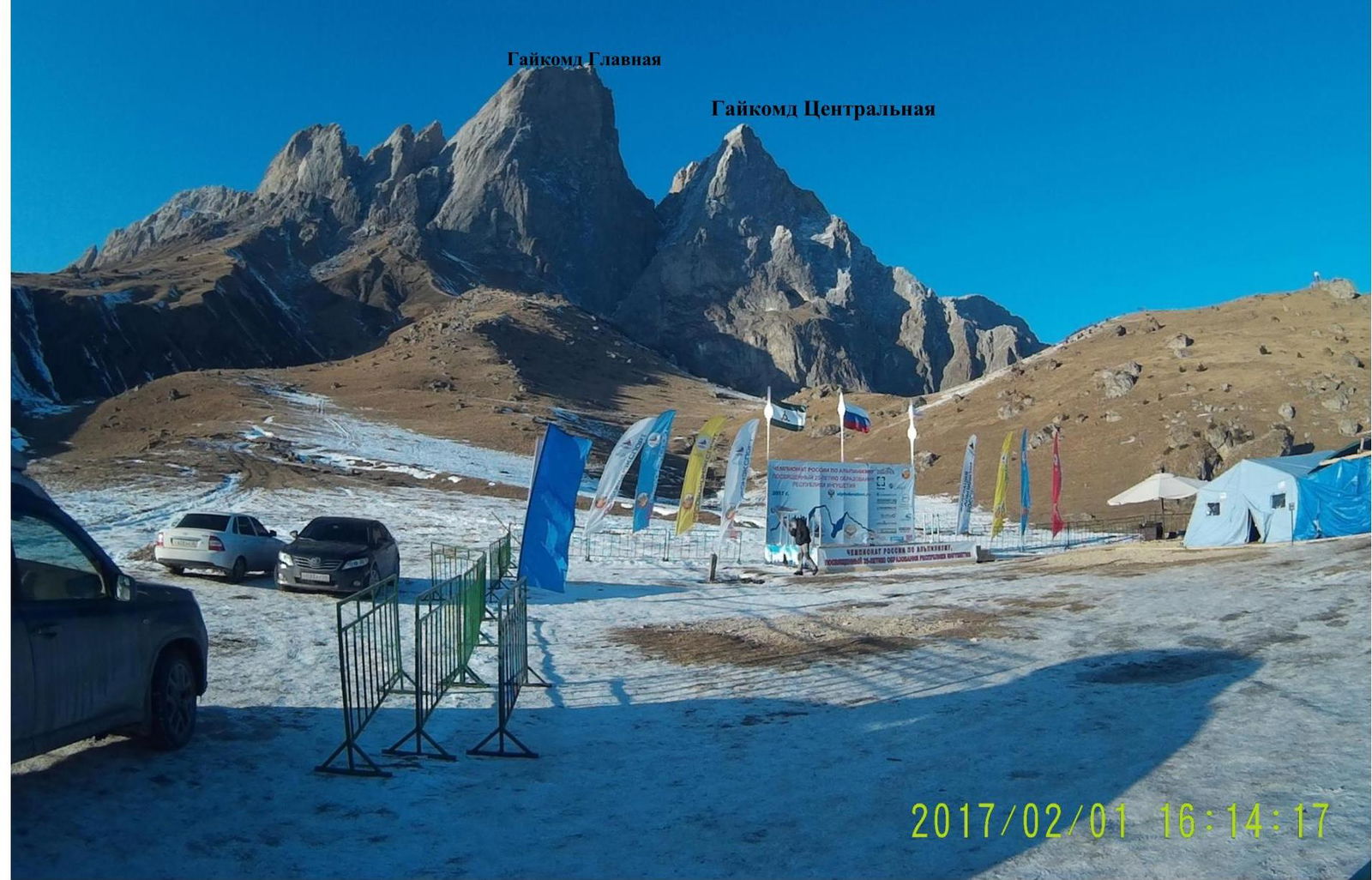
Overview of the Climbing Area
Gaikomd (Girech) Central peak (3100 m) is located in the rocky ridge of the Greater Caucasus, in the section of the ridge between the Terek River (to the west) and the Assa River (to the east). The administrative border between the Republic of Ingushetia and the Republic of North Ossetia-Alania runs along the ridge of the rocky ridge to Gaikomd peak from the west, and then goes north. Gaikomd Central peak is the third highest peak in the massif, уступая по высоте Главной (3171 m) and Eastern (3161 m) peaks. The ascent route and approaches are located on the territory of the Dzheyrakhsky district of the Republic of Ingushetia.
The base camp is best set up in the area of the Besht pass, 100 m before the turn to the border post "Besht outpost", to the left of the slope on a clearing 100 m from the road. There is water at the water intake here all year round. It is also planned to build an alpine camp here in the future.
Border permits are not required for the Gaikomd peaks area, however, it is necessary to inform the border post of your presence in the area.
Stable cellular connection is available only on the Beeline network. The weather in the area is stable, snow on the routes melts very quickly. In winter, after heavy snowfalls, be more careful:
- avalanches are possible in the couloirs;
- avalanches are possible on the leeward slopes!
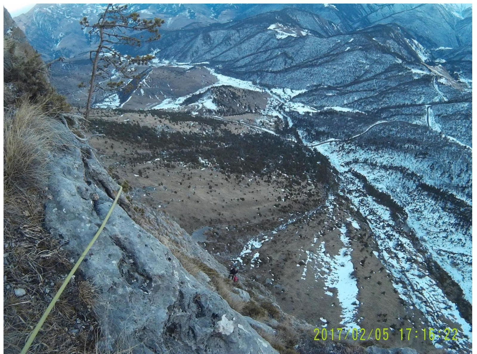
It is best to approach the route by first going down the road for about 20 minutes to the couloir that comes straight to the road. Then go up this couloir almost to the start of the route. The approach takes an average of 1–1.5 hours.
The route starts to the left of a not very pronounced grassy ledge.
Ascent Tactics
The route is relatively monolithic, but there are destroyed areas, mainly in the lower and upper thirds of the route. The relief is very diverse - from deep cracks only for anchor pitons to large cracks for medium and large friends. Sand clocks and shells are very helpful on the route. Although there was snow on the ledges along the way, the route was climbed in good dry weather on almost clean rocks. In cloudy weather and with a large amount of snow, the route becomes much more complicated due to the grassy areas, and without crampons it becomes dangerous!
Descent via 4B category difficulty route (along the left edge of the South-West ridge). There are stations every 30–40 m, but rappel loops must be carefully checked!
The route was climbed as part of the Russian Alpine Championship in the technical class, so the team was strictly regulated in terms of working on the route (from 7:00 to 17:00). On section R7:
- A time penalty of almost 3 hours was given;
- Neighboring routes were quite close;
- Teams above often dropped stones down.
The route was climbed with two overnight stays on the wall and one on the summit. From the bivouac was taken:
- 1 gas cylinder 250 ml;
- 3.5 liters of water (in addition to melting snow on the stands, of which there was an abundance);
- 1 sleeping bag for two and one down jacket;
- Instead of a tent, a platform tent was used;
- Food was taken for three days.
The entire route is quite logical and interesting.
Table in UIAA symbols
Total: rock pitons — 60, chocks/friends — 197, bolt hangers — 1. Total route length — 1125 m. Summit – February 7, 2017 at 19:48.
| Rock Pitons | Chocks/Friends | Bolt Hangers | UIAA | R | Length, m | Difficulty | Steepness, degree | Time |
|---|---|---|---|---|---|---|---|---|
| 2 | 17 | 0 | R13 | 100 | 3 | 60° | ||
| 9 | 34 | 0 | R12 | 150 | 5–4 | 70° | ||
| 5 | 12 | 0 | R11 | 50 | 6 | 80° | ||
| 6 | 10 | 1 | R10 | 40 | 6 | 90°–85° | ||
| 5 | 13 | 0 | R9 | 50 | 6 | 90° | 07.02.2017 | |
| 7 | 31 | 0 | R8 | 150 | 4 | 65° | ||
| 5 | 13 | 0 | R7 | 80 | 5 | 65° | ||
| 10 | 2 | 0 | R6 | 50 | 4 | 65° | ||
| 0 | 3 | 0 | R5 | 150 | 1 | 45° | ||
| 4 | 10 | 0 | R4 | 80 | 4 | 60° | 06.02.2017 | |
| 4 | 9 | 0 | R3 | 80 | 4–3 | 60° | ||
| 2 | 15 | 0 | R2 | 50 | 6 | 80° | ||
| 0 | 11 | 0 | R1 | 25 | 5 | 75° | ||
| 1 | 17 | 0 | R0 | 70 | 3–4 | 70° | 05.02.2017 10:53 |
Route Description by Sections
The route starts to the left of a not very pronounced grassy ledge.
R0–R1 – along the ledge 5 m to the right, then straight up under a clearly visible huge stone. 70 m III–IV cat. diff. 70°. Mainly medium-sized friends and stoppers are used. Station on a ledge to the left of the internal corner. Rocks are destroyed, protection is hampered.
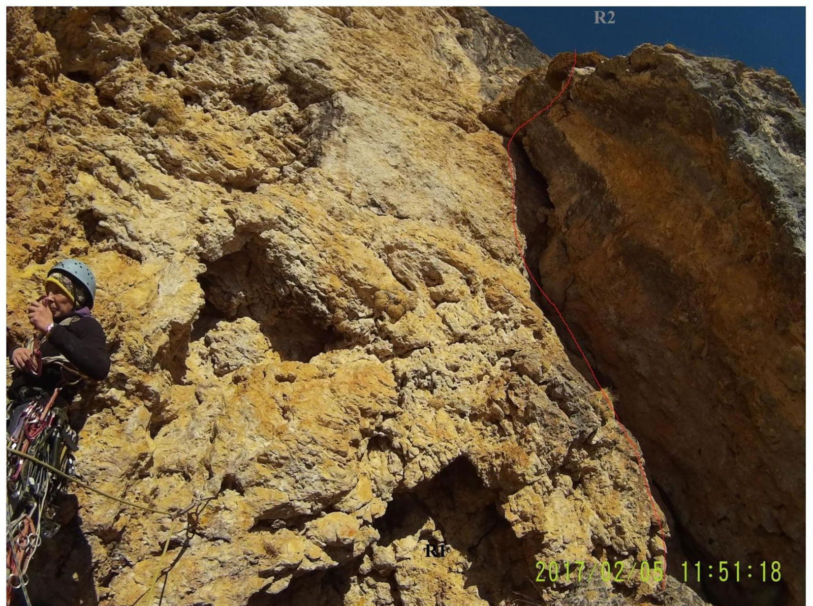
R1–R2 – to the left along the internal corner 25 m. 5 cat. diff. steepness 75°. Station on a convenient ledge for protection.
R2–R3 – from the station to the left along the crack 50 m. 6 cat. diff. 80°. Protection mainly with large chocks.
R3–R4 – the route starts to veer slightly to the left along the simplifying rocks 80 m IV–III cat. diff. steepness 60° to a convenient ledge. Overnight stay.
R4–R5 – 80 m IV cat. diff. 60° to a large, strongly inclined grassy ledge (45°). Protection mainly with pitons.
Be very careful with protection when exiting onto the grassy ledge!
R5–R6 – 150 m along the grassy ledge to the cave 1 cat. diff. 45°.
R6–R7 – up to the left from the cave 50 m IV cat. diff. 65°. Piton protection.
R7–R8 – up 80 m V cat. diff. 65° to the beginning of the internal corner.
R8–R9 – up to the right along the internal corner to a good wide ledge. Overnight stay. 150 m IV cat. diff. 65°. Mainly medium-sized chocks are used for protection. Station on anchor pitons.
R9–R10 – to the left along the ledge simultaneously on foot until it almost turns into a ridge. From here up 2 m along the overhang (100°) and along a not very pronounced corner to the right up to a convenient ledge for a station under a large and low cornice. 50 m VI cat. diff.
R10–R11 – get out from under the cornice to the left, then up 40 m VI cat. diff. 90°–85°. A bolt hanger is hammered here.
R11–R12 – first up 35 m, then to the left. 50 m VI cat. diff. 80°.
R12–R13 – up along a series of internal corners to the ridge along slightly simplifying rocks. 150 m V–IV cat. diff. 70°.
R13–R14 – to the left along the ridge to the summit 100 m. Protection is hampered due to a large amount of snow and inclined slabs III cat. diff. 60°.
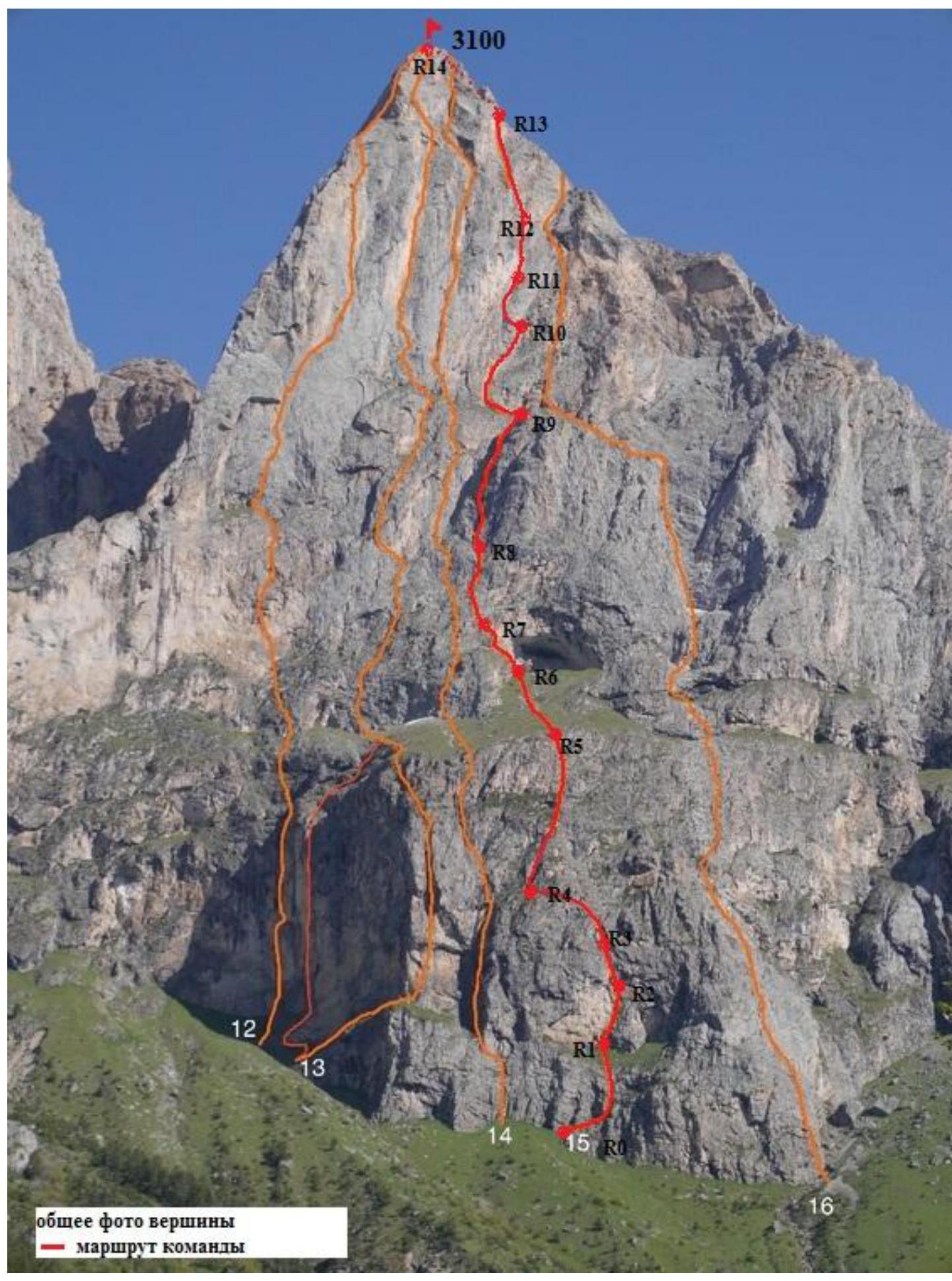
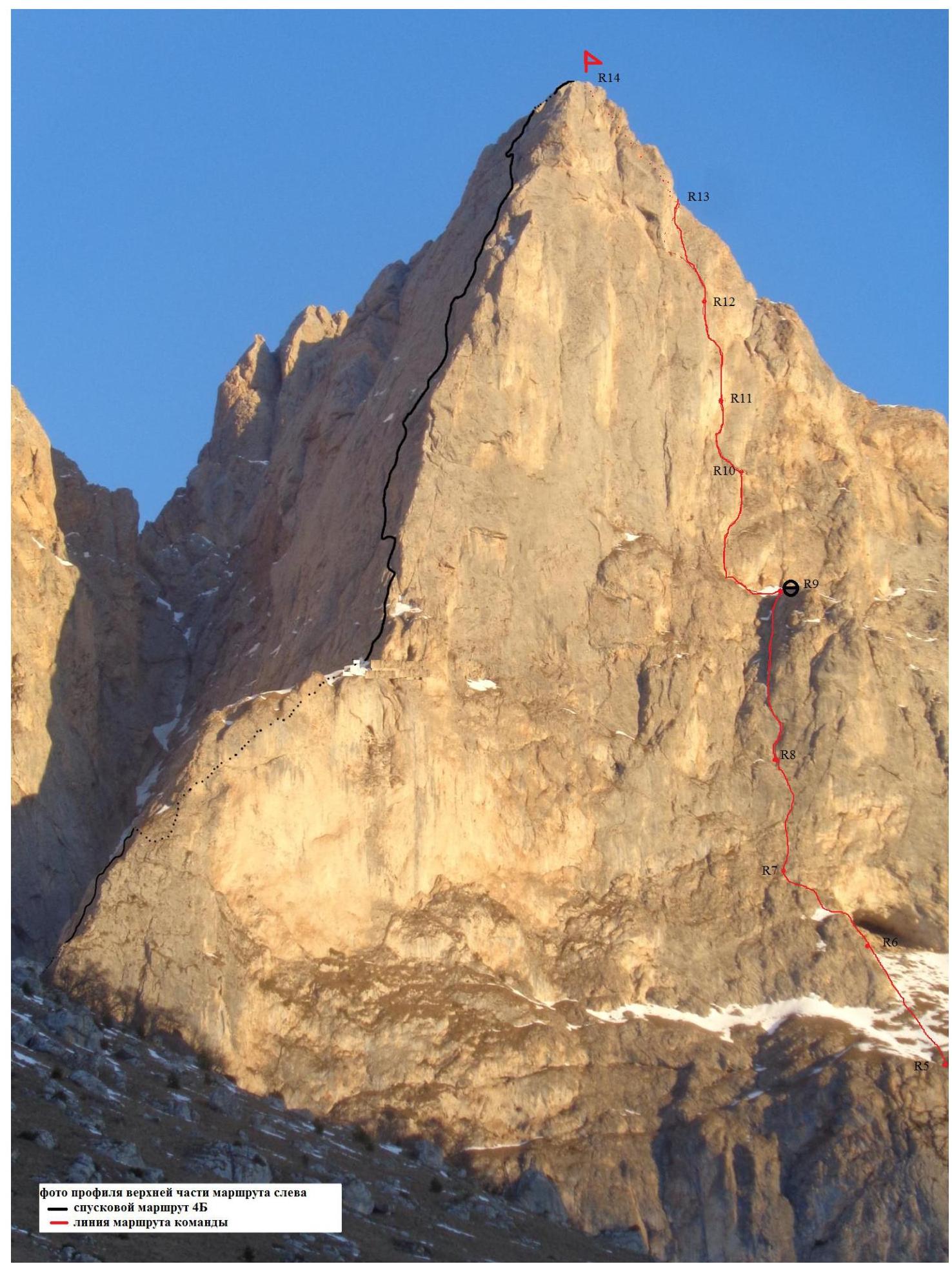 Photo of the profile of the upper part of the route on the left: descent route 4B — team's route line.
Route profile:
- Average steepness of the route: 66°.
- R13

Photo Illustrations for the Report
First ascent of Gaikomd Central peak via South-East wall (through the cave)
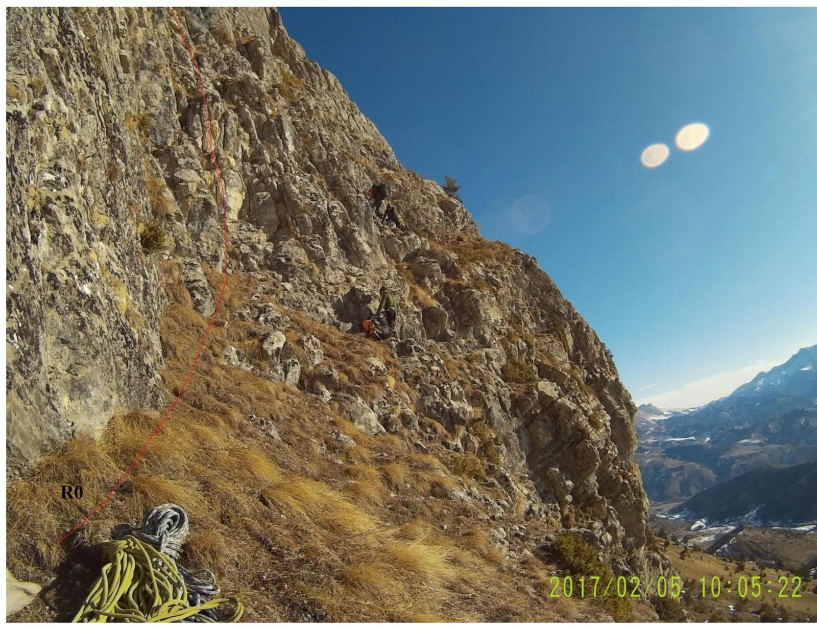
Start of the route. R0
Mavrinskaya at station R1
At station R2
Towards station R4
At station R7

Section R11–R12