
REPORT ON THE ASCENT OF THE TRAVERSE DZHarLAM CENTRAL 3160 m – DZHarLAM SOUTH-EAST 3155 m
Route: from the west and along the western ridge, 2B cat. diff.
Team: Management of Alpine Camps.
Climbing period: from April 24, 2024 to April 24, 2024.
I. Climbing Passport
| № п.п. | 1. General Information | |
|---|---|---|
| 1.1 | Full name, sports rank of the leader | Chikin Artem Borisovich CMS |
| 1.2 | Full name, sports rank of participants | Gayunov Alexander unranked, Plyuta Dmitry unranked |
| 1.3 | Full name of coach | Yakovenko Alexander Nikolaevich, MS |
| 1.4 | Organization | Management of Alpine Camps |
| 2. Characteristics of the Climbing Object | ||
| 2.1 | Region | 2.9. From Krestoviy pass to Shaviklde peak |
| 2.2 | Valley | Armhi |
| 2.3 | Section number according to the 2013 classification table | 11,9 |
| 2.4 | Name and height of the peak | Dzharlam (Central), 3160 m – Dzharlam SE 3155 m |
| 2.5 | Geographical coordinates of the peak (latitude/longitude), GPS coordinates | - |
| 3. Characteristics of the Route | ||
| 3.1 | Route name | from the west and along the western ridge |
| 3.2 | Proposed category of difficulty | 2B |
| 3.3 | Degree of route development | - |
| 3.4 | Relief characteristics of the route | Rocky |
| 3.5 | Height difference of the route (altimeter or GPS data) | 400 m |
| 3.6 | Route length (in meters) | 1785 m |
| 3.7 | Technical elements of the route (total length of sections of varying difficulty with relief characteristics (ice-snow, rocky)) | 1st cat. diff. rocks – 250 m. 2nd cat. diff. rocks – 195 m. 3rd cat. diff. rocks – 90 m |
| 3.8 | Descent from the peak | Via route 2B, along the Western ridge |
| 3.9 | Additional route characteristics | No water |
| 4. Characteristics of the Team's Actions | ||
| 4.1 | Travel time (team's walking hours, in hours and days) | 13 h 40 min |
| 4.2 | Overnights | No |
| 4.3 | Entry onto the route | 04:20, April 24, 2024 |
| 4.4 | Reaching the peak | 09:00, April 24, 2024 – 12:00, April 24, 2024 |
| 4.5 | Return to base camp | 18:00, April 24, 2024 |
| 5. Responsible for the report | ||
| 5.1 | Full name, e-mail | Chikin Artem Borisovich, artem.chikin@mail.ru |
II. Description of the Ascent
1. Characteristics of the Climbing Object
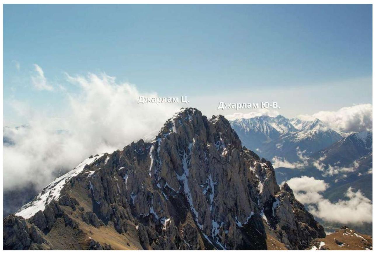 1.1. General photo of the peak
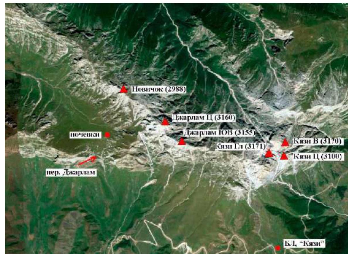 1.2. Map of the area
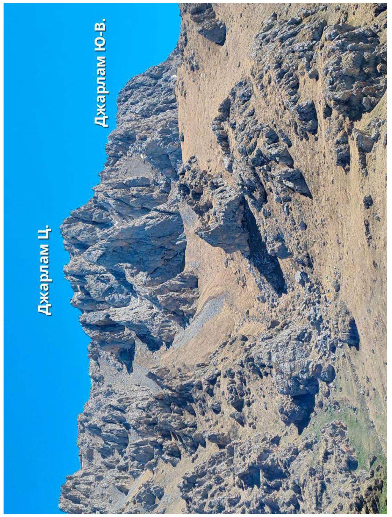 1.3. Photopanorama of the area
2. Characteristics of the Route
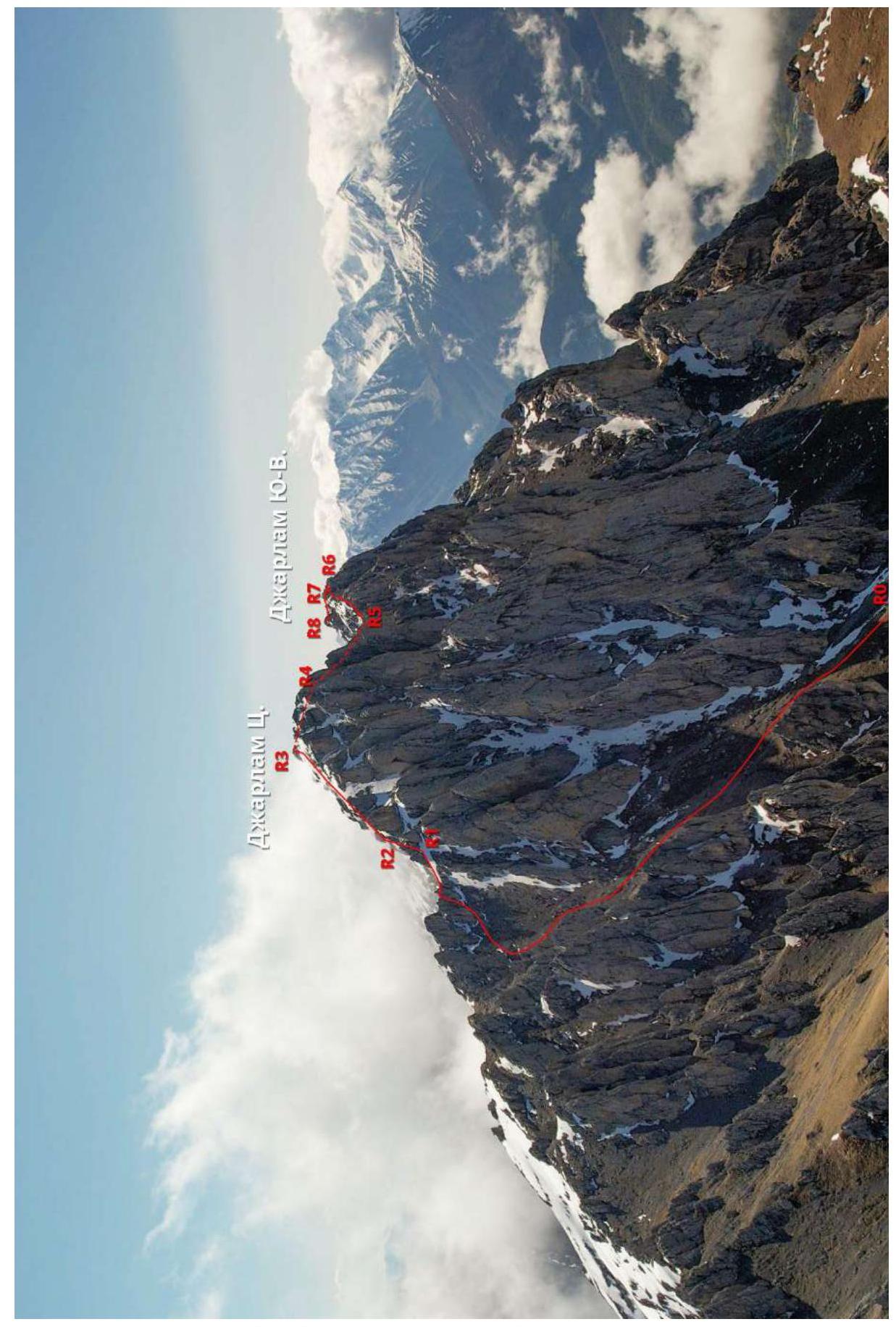 2.1. Technical photograph of the route
2.3. Technical characteristics of route sections
| Section № | Relief characteristics | Category of difficulty | Length, m | Steepness | Type and number of anchors |
|---|---|---|---|---|---|
| R0–R1 | Small, medium scree, grass | 1 | 900 m | 30° | 0 |
| R1–R2 | Series of internal corners | 2 | 15 m | 45° | 2 anchors 1 friend |
| R2–R3 | Scree, grass, col, cairn, rock gate, ridge | 1+ | 250 m | 15°–35° | 0 |
| R3–R4 | Scree, ledges | 1+ | 200 m | 35° | 0 |
| R4–R5 | Ridge, cork | 3 | 40 m | 30° | 1 anchor 1 friend protrusions |
| R5–R6 | Ridge, wall ledges, rappel | 2 | 100 m | 10° | Protrusions |
| R6–R7 | Ridge, walls, ledges | 2 | 80 m | 15°–35° | Protrusions |
| R7–R8 | Chimney, ridge, walls, ledges | 1–3 | 200 m | 15°–60° | 2 anchors |

2.4. Technical characteristics of sections of route 1B to Dzharlam C. UIAA [50 m, 15°] [1+, 25–30°–55 m] [2, 10 m, 40–45°] – Route –[15 m; 1] –[1+; 15–45°; 100 m] R1 – [500 m, 40°, 1] R0 – [260 m, 30–35°, 1]
3. Characteristics of the Team's Actions
3.1. Brief description of route passage
| Section № | Description | Photo № |
|---|---|---|
| R0–R1 | From Dzharlam pass turn right and proceed to the rocky "fin". From the "fin" exit onto small and partly medium scree, then proceed straight to the rocky wall (ridge). Traverse along the pronounced trodden path – 15°. During the movement, there will be a gendarme on the left. Then the path leads to a destroyed inclined slab – 45°. Further exit onto a large inclined ledge with a col, continue moving from the wall to the right and reach the key of route 1B. Simultaneous movement | Photo 1 |
| R1–R2 | Climb the wall and internal corner to a large stone, station there. | Photo 2 |
| R2–R4 | Traverse along the path to the col with a cairn. From the cairn continue moving along the ridge (along the path) and approach the rock gate. Overcome them with simultaneous movement and exit to the cairn. From the cairn onto the western ridge and move towards the peak along small scree. Simultaneous movement. | Photo 3, 4 |
| R3–R4 | From the peak of Dzharlam C. descend southwest along scree ledges towards the gendarme in the depression of the western ridge, ascend the ridge to the left of the gendarme via a small couloir. | Photo 5, 6 |
| R4–R5 | Behind the gendarme, traverse along the rocky ridge from the north to large stones forming a small chimney with a cork, through the cork and further slightly down to the col, connecting with route 2B Sedykh. | Photo 7, 8, 11 |
| R5–R6 | Further along the ledges that run along the ridge (with a slight descent), move with alternating or simultaneous belay 90–100 m to a pronounced internal corner, which leads to a ledge, from the ledge descend south 15–20 m via rappel. | Photo 9, 10, 11 |
| R6–R7 | Further along the ledges (alternating or simultaneous belay) exit onto the ridge 80–100 m. | Photo 12 |
| R7–R8 | The section represents a narrow chimney 6 m long. After the chimney, exit onto the ridge, along which after 280 m approach the summit ascent (in the chimney alternately, and further simultaneous movement). Ascend the rocks of moderate difficulty to the peak. | Photo 13, 14 |
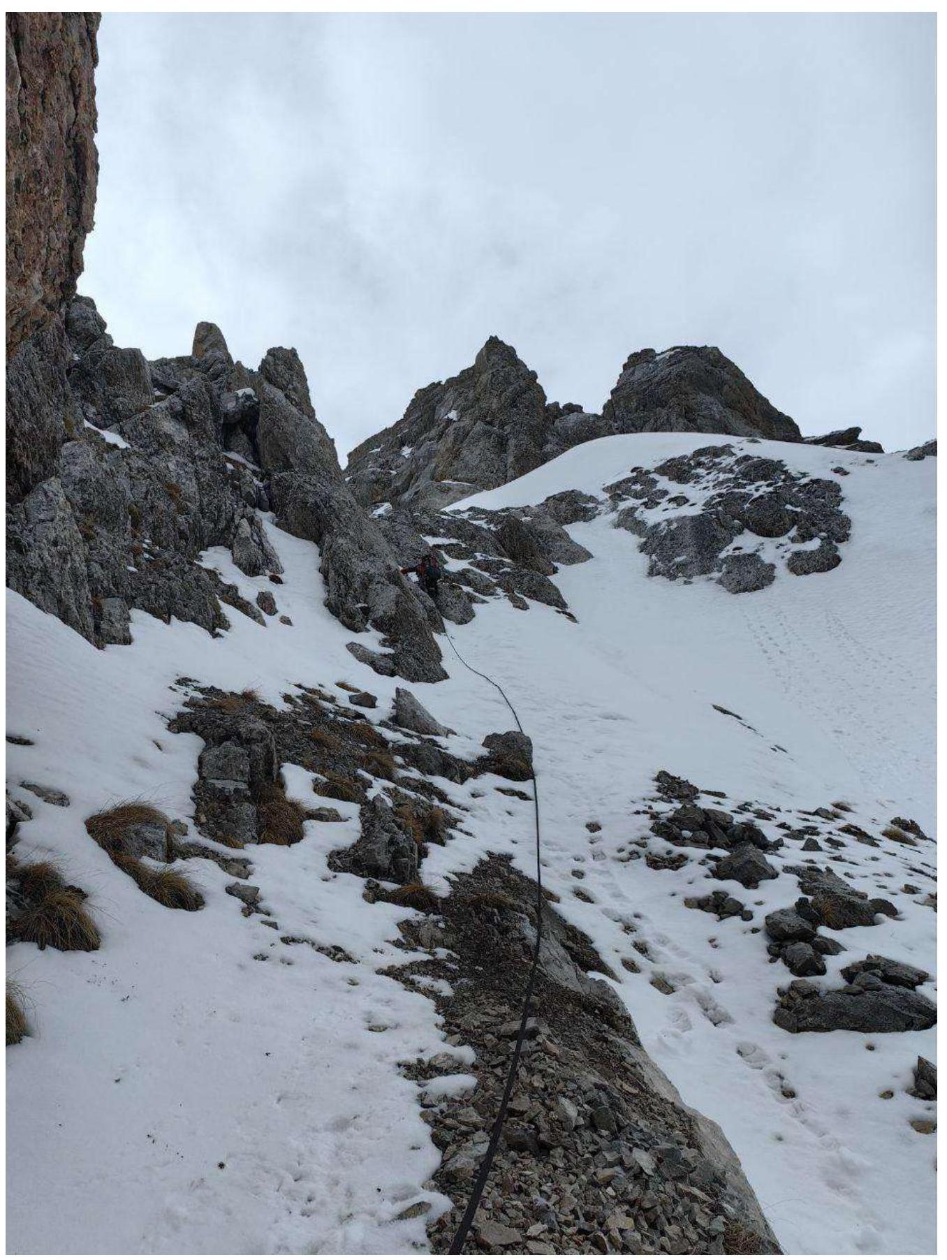
Photo 1. R0–R1
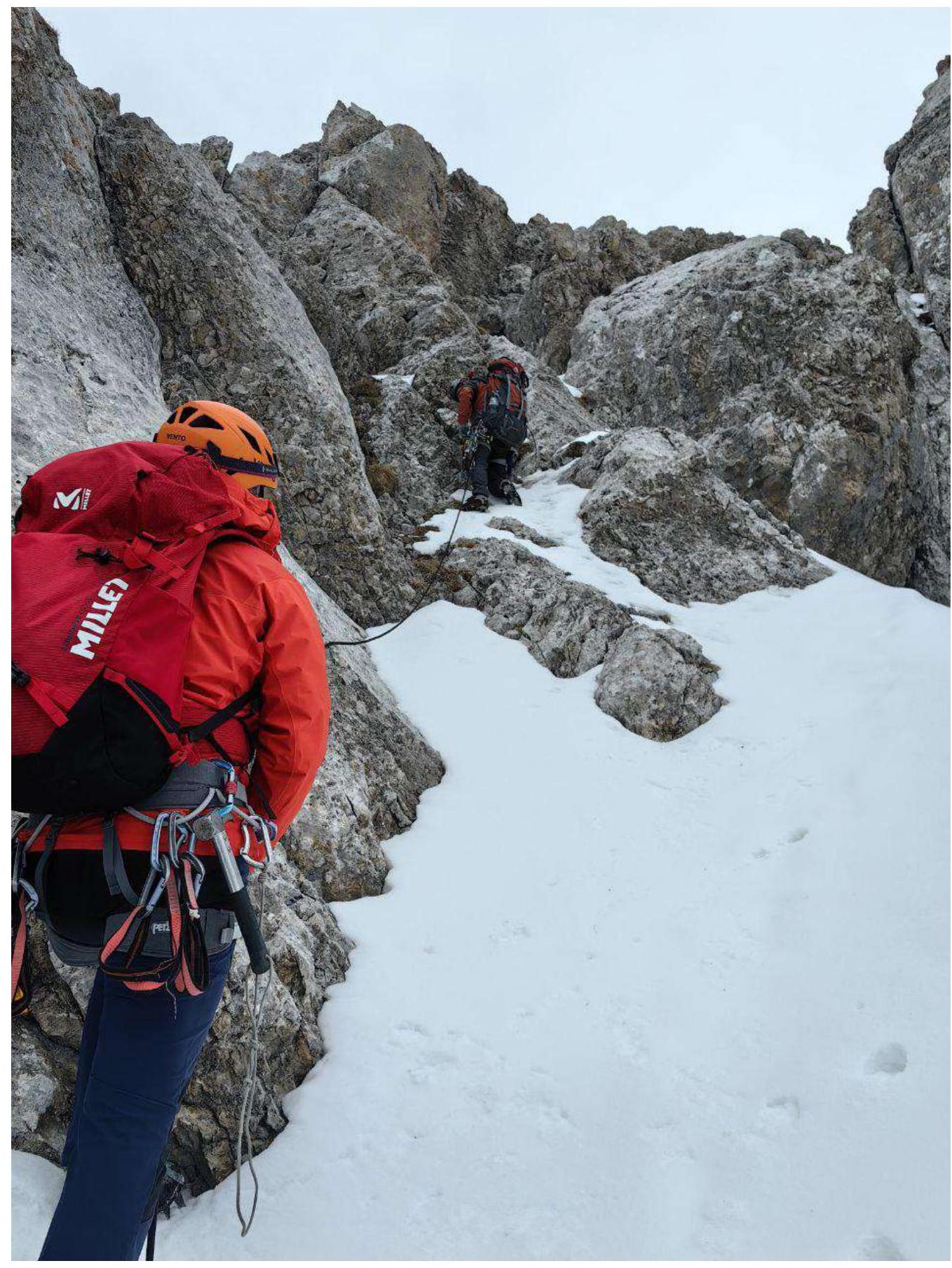
Photo 2. Section R1–R2
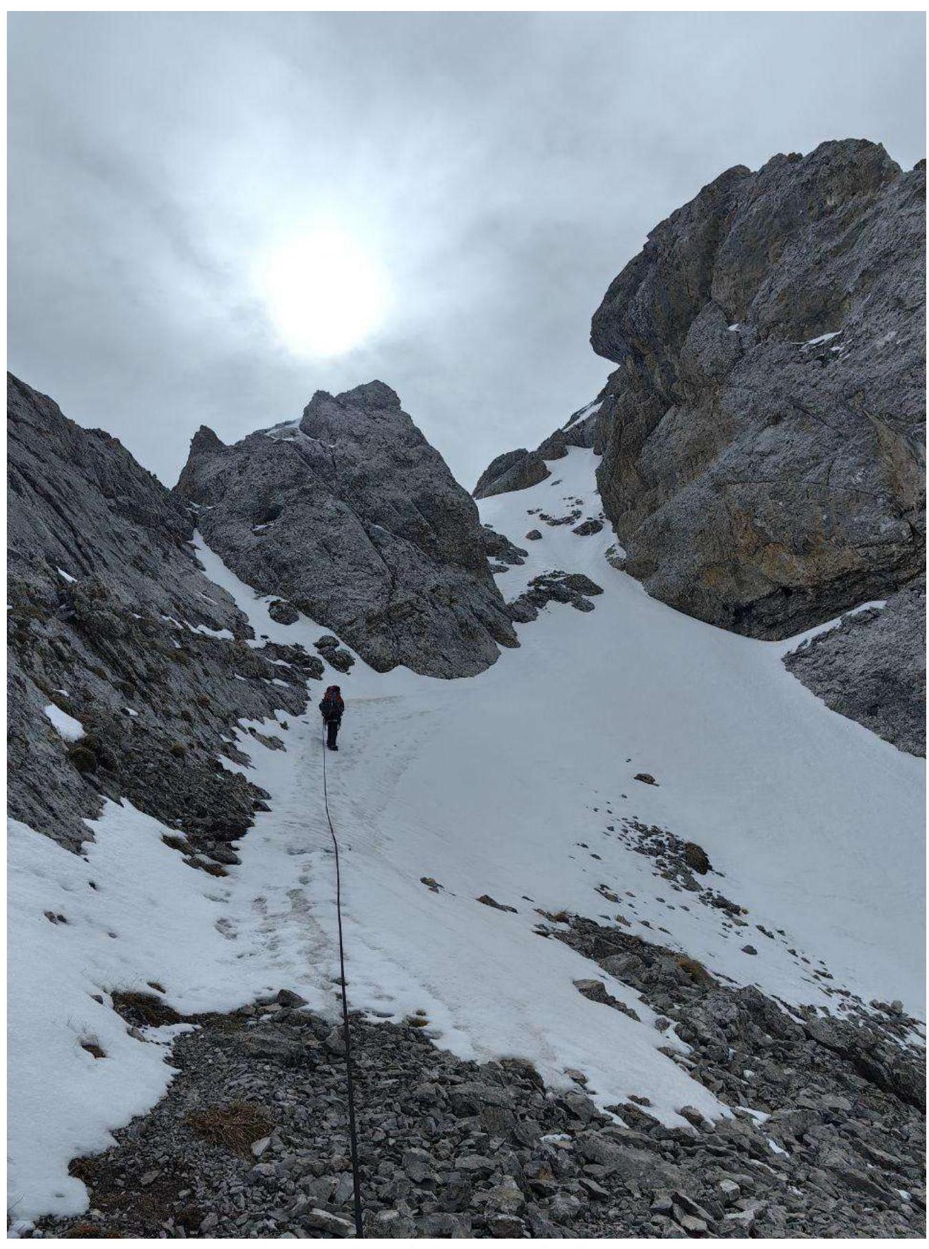
Photo 3. Section R2–R3
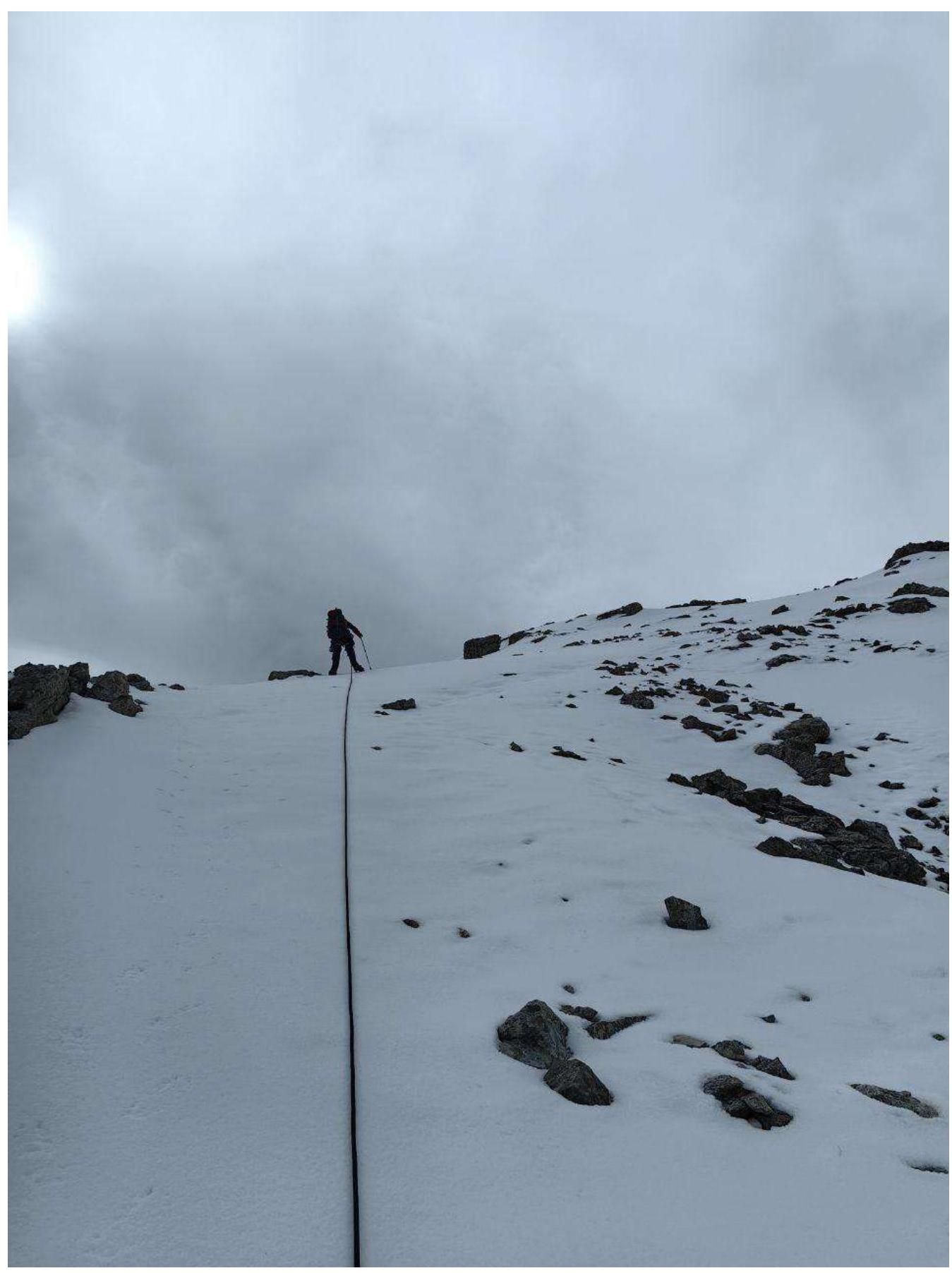
Photo 4. Section R2–R3, exit to the peak of Dzharlam C.
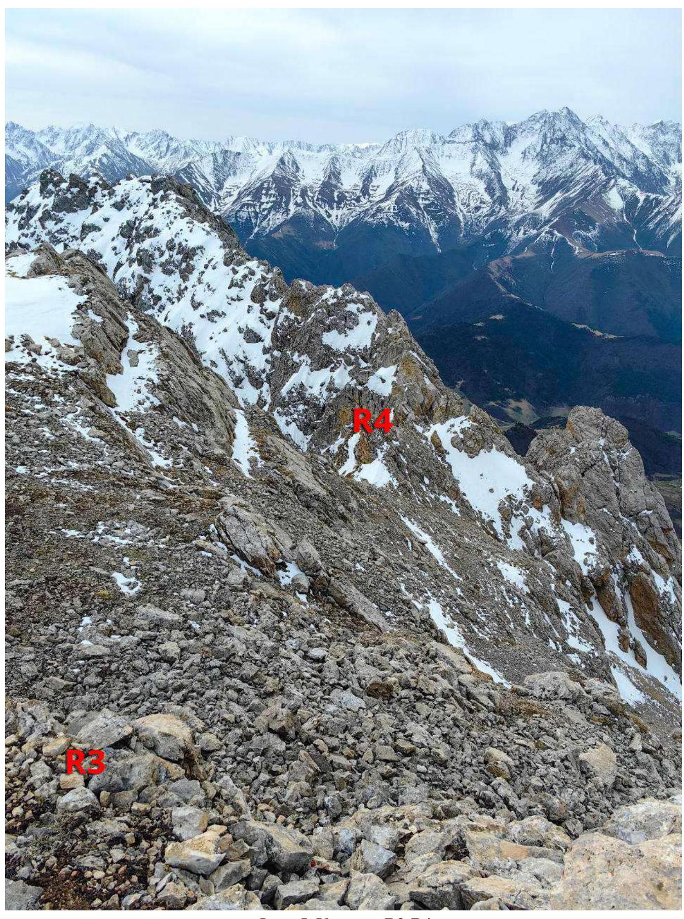
Photo 5. Section R3–R4
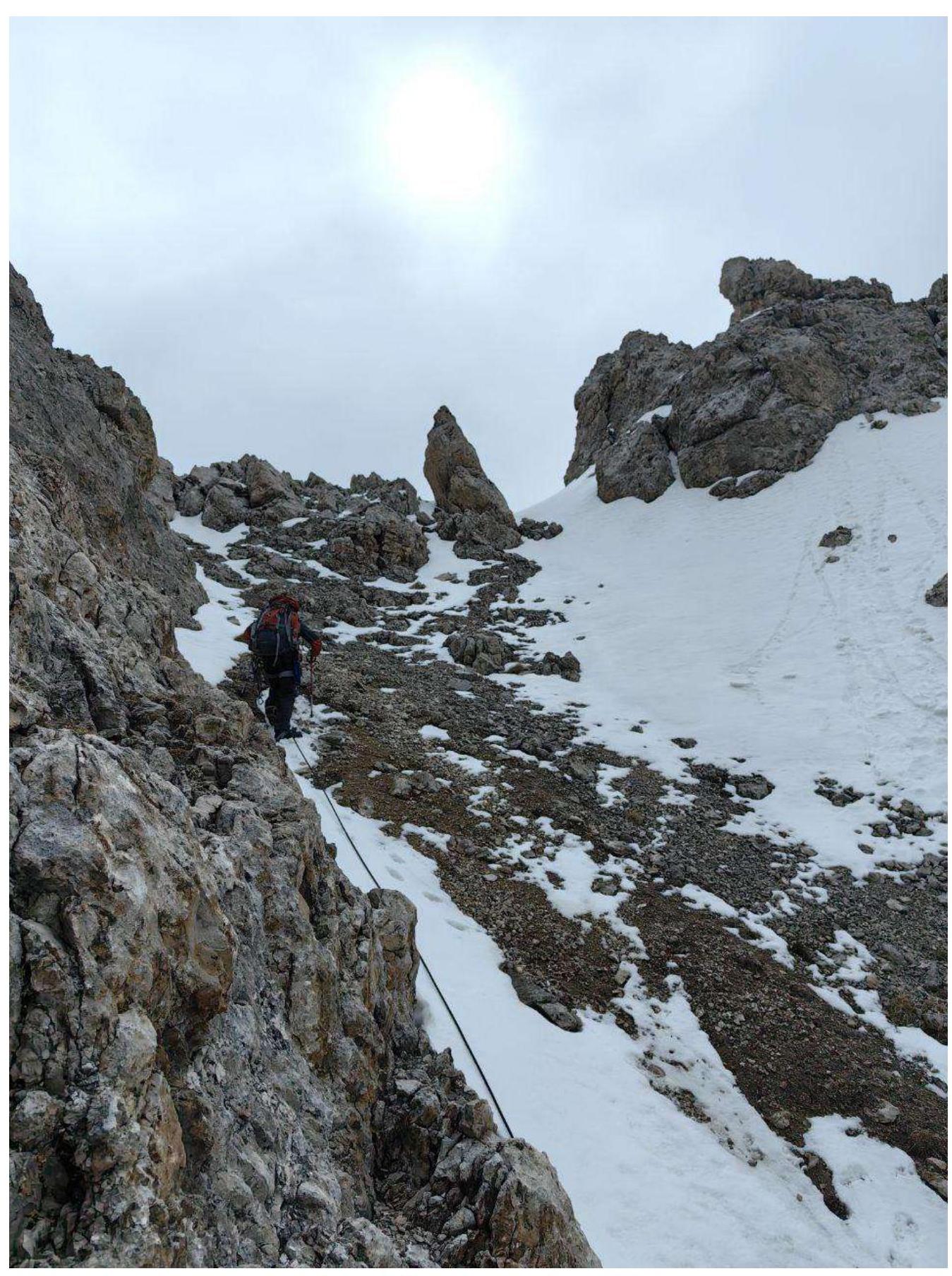
Photo 6. Exit to the ridge to R4
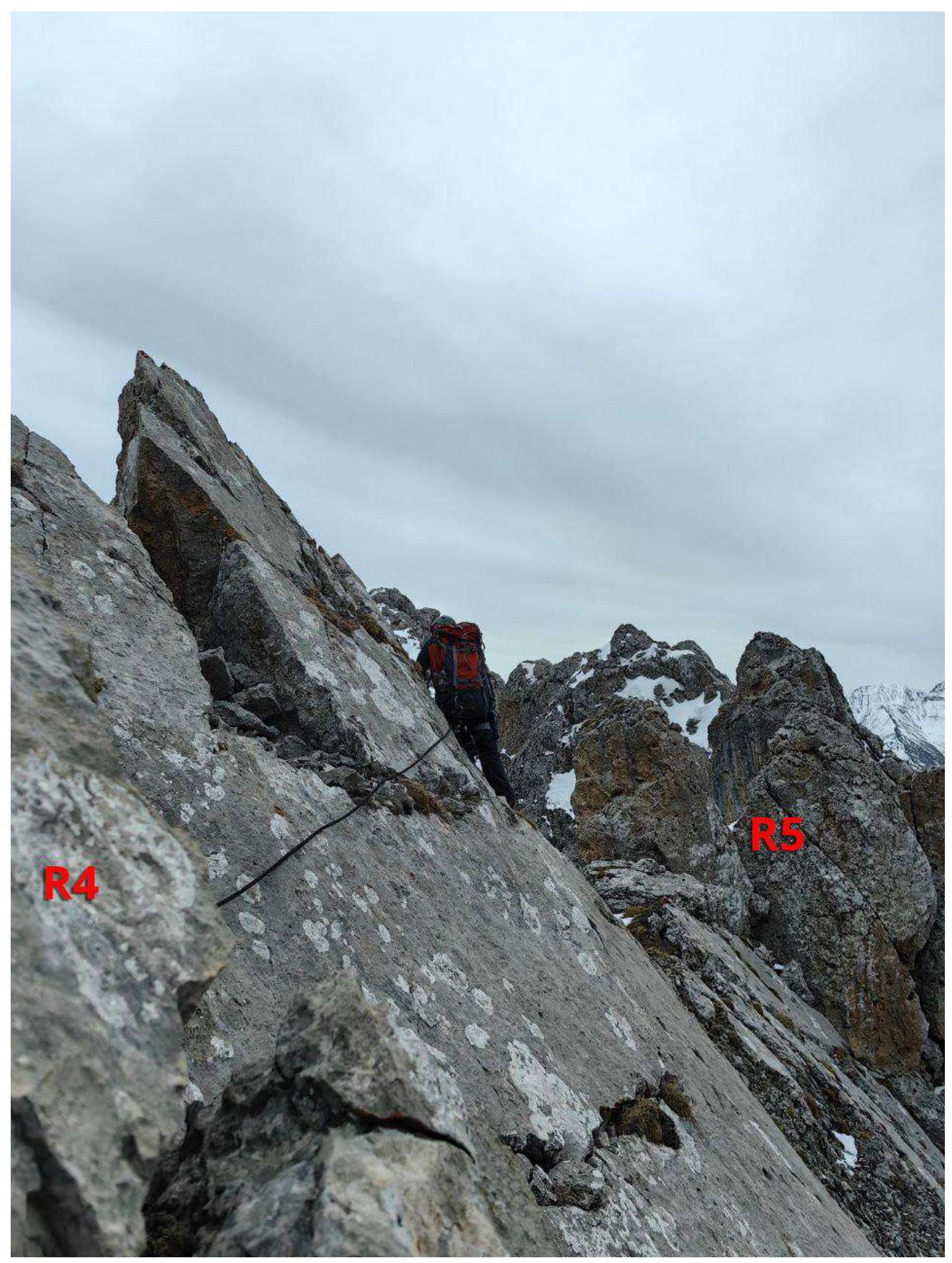
Photo 7. Section R4–R5
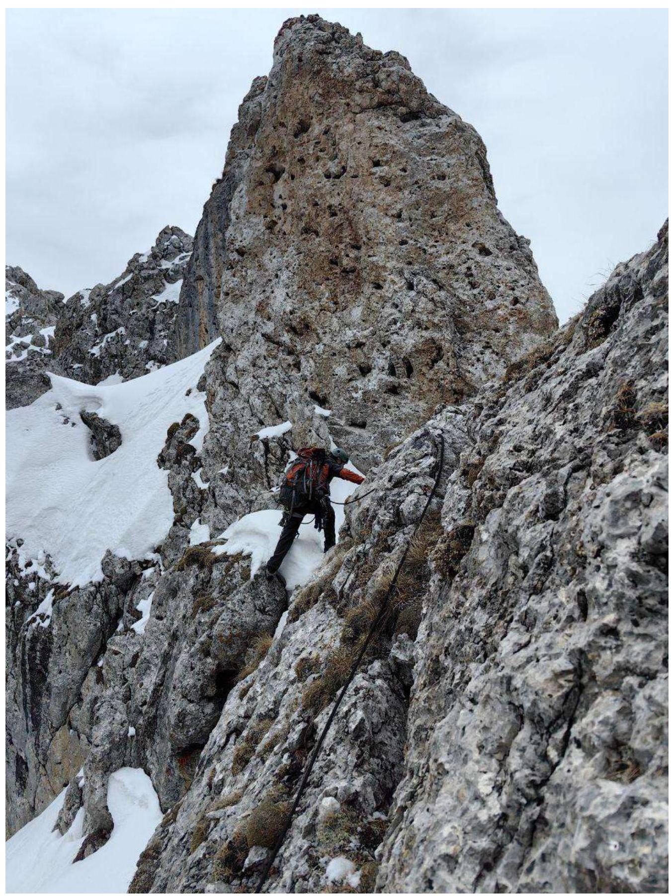
Photo 8. Section R5
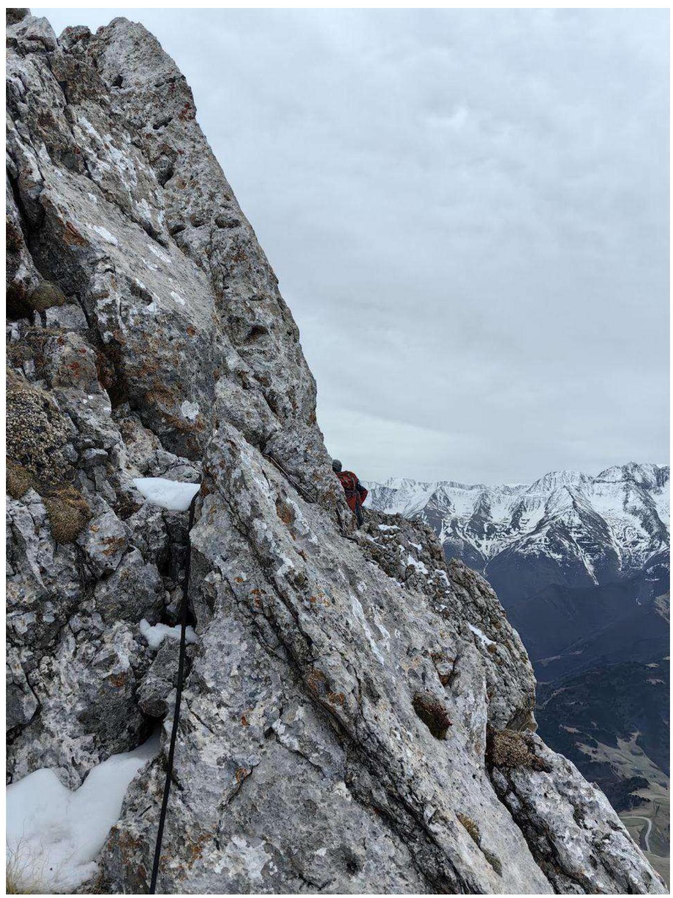
Photo 9. Section R5–R6
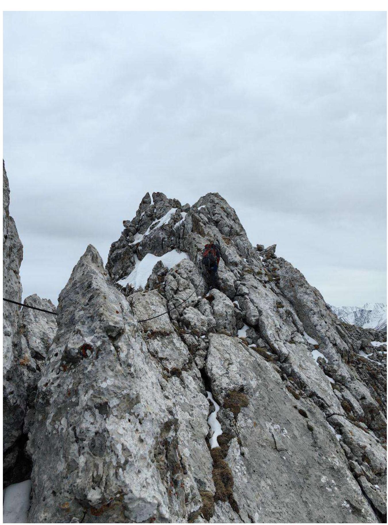
Photo 10. Section R5–R6
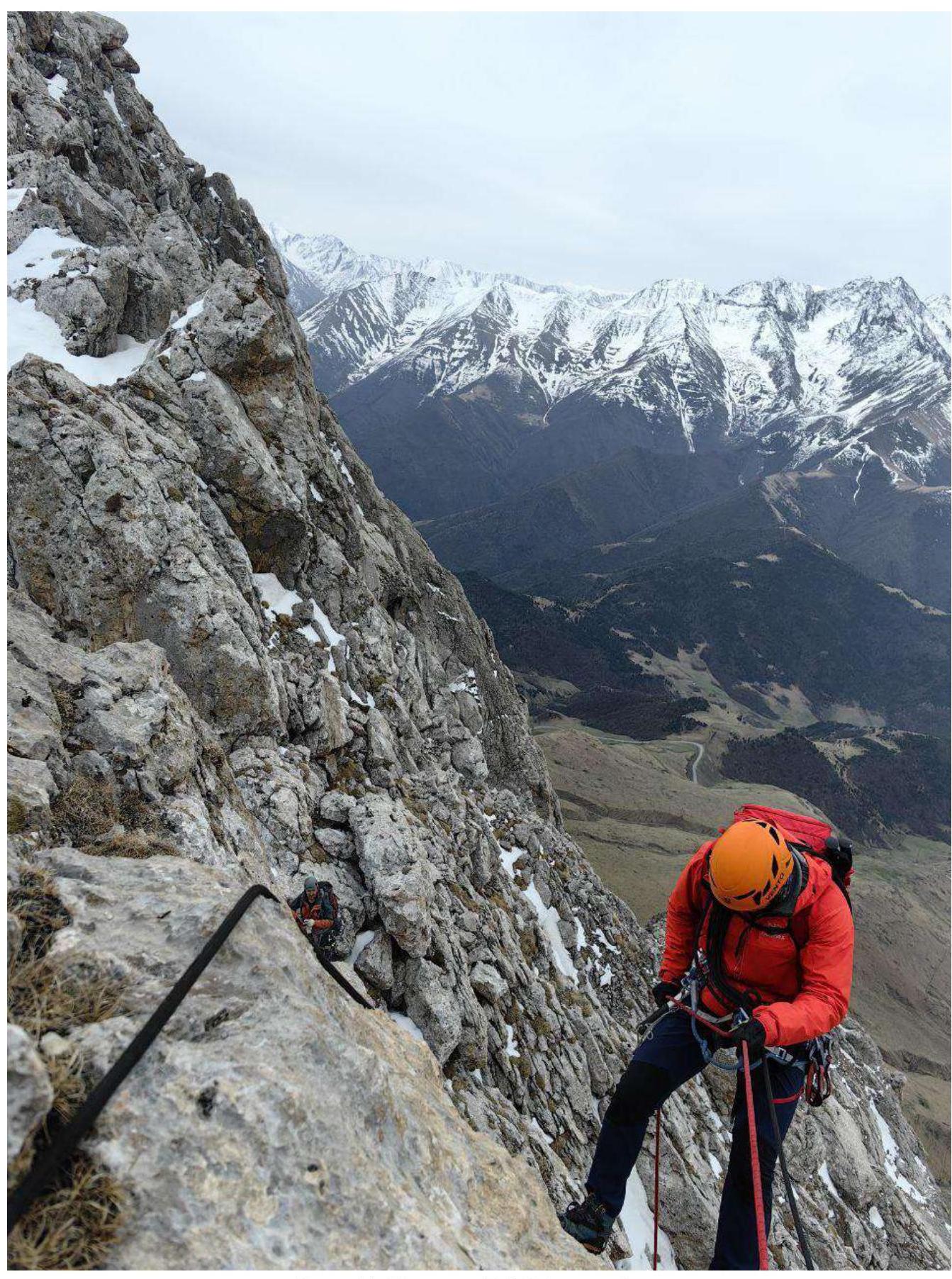
Photo 11. Section R5–R6, rappel.
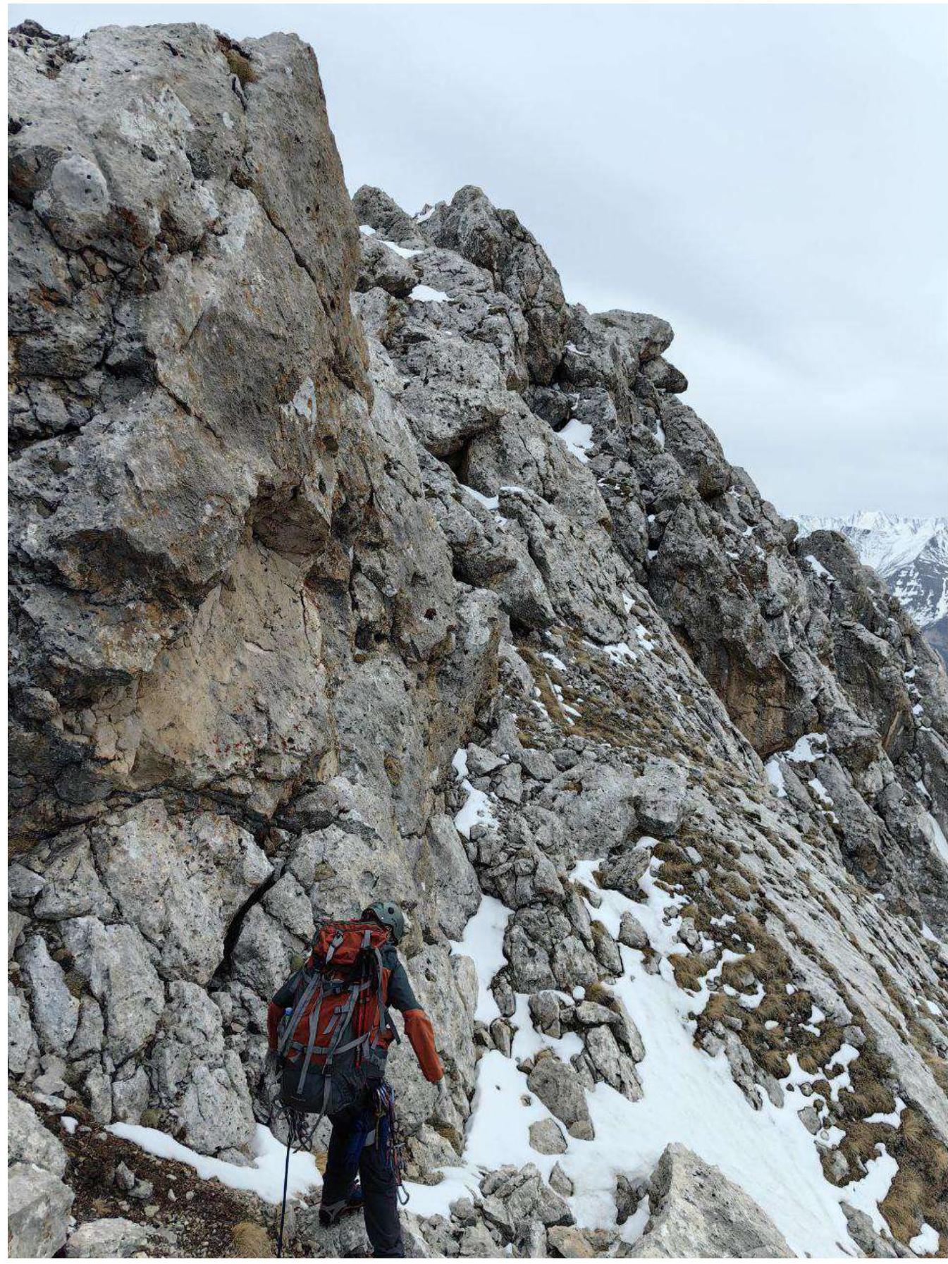
Photo 12. Section R6–R7
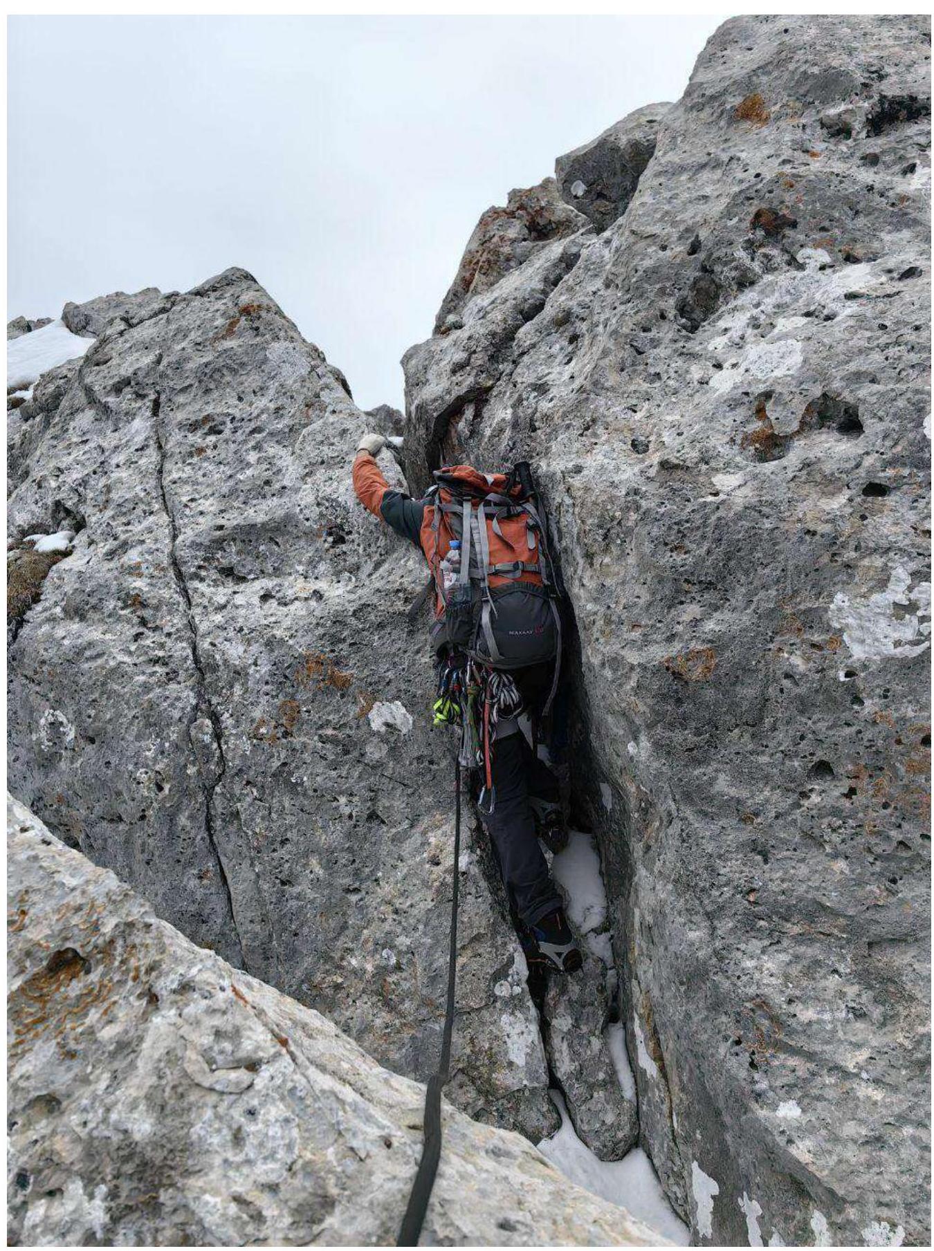
Photo 13. Section R7–R8
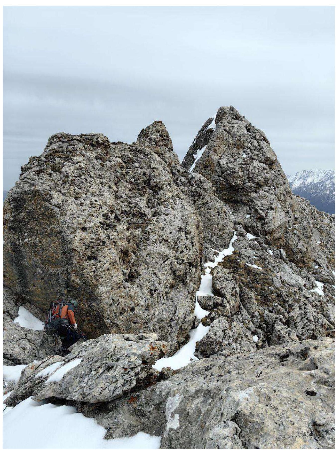
Photo 14. Section R7–R8
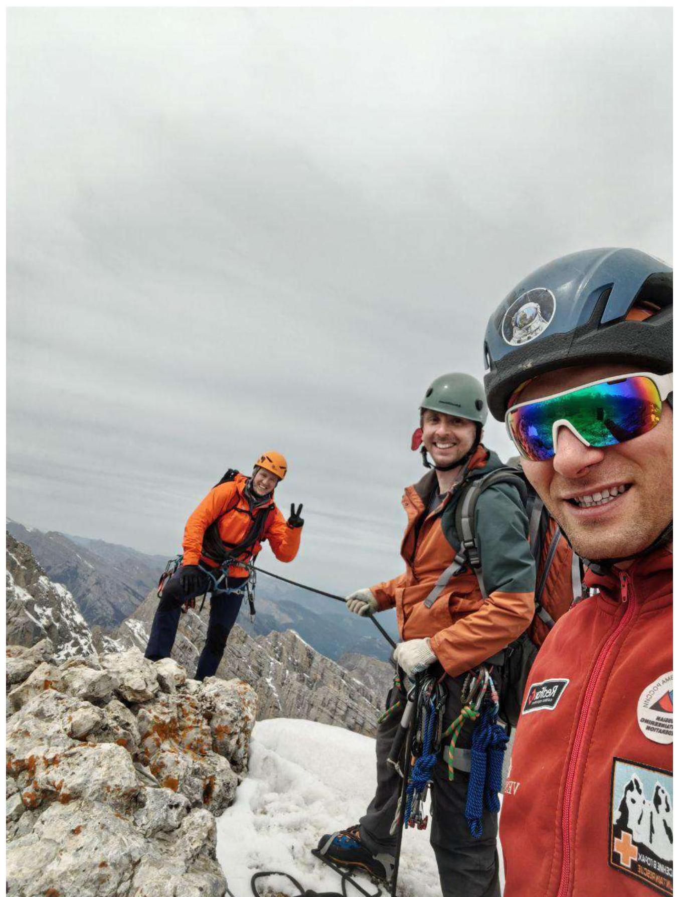
3.2. Photo of the team on the peak at the control cairn
3.3. Route safety assessment:
Overall, the entire route is considered safe. Quite lengthy, with a lot of rope work, especially during simultaneous belaying. When moving along the northern side of the western ridge of Dzharlam SE, snow is possible, which may complicate passage.
Communication options on the route:
- Cellular connection is available along almost the entire route: Megafon and Beeline.
- Exceptions may be natural obstacles that sometimes cause signal loss.
- Radio communication works but not everywhere.
- On the peak – excellent.
Recommendations for future climbers:
- Recommend bringing crampons.
- Hard snow crust is possible.
- Recommended for a small group of up to 4 people.
- In case of not finishing within daylight, options include descending via 1B from Dzharlam C. and via route 2B from Dzharlam SE.
Descent from the peak of Dzharlam SE along the ascent route and entirely via route 2B Sedykh along the Western ridge.
Conclusion on the preliminary assessment of the route: Based on the climbers' experience and general opinion, it can be stated that this route corresponds to the declared category of difficulty, as the set of obstacles objectively reflects its complexity.
Comments
Sign in to leave a comment