Ascent Passport
- Region 2.9: from Krestovy Pass to Shaviklde peak
- Dzharlam, Central, 3160 m, via 3rd ridge Geographic coordinates of the summit (latitude/longitude): 42.841989 / 44.827054
- Proposed — category 3B difficulty, first ascent (classified as 3A)
- Route type: rock
- Height difference of the route: 300 m Route length: 695 m. Average steepness: main part of the route — 50°; total route — 40°.
- Number of pitons left on the route: total 0; including bolted pitons 0
- Team's travel time: 8 hours, 1 day
- Leader: Vasiliev Andrei Sergeevich, Master of Sports
Team members:
- Grankova Maria Mikhailovna, 2nd sports category
- Kravchenko Inna Anatolievna, 3rd sports category
- Kravchenko Timur Nikolaevich, 3rd sports category
- Tekuchev Alexey Viktorovich, 3rd sports category
- Coaches: Vasiliev Andrei Sergeevich, Sapotnitsky Yuri Grigorievich
- Exit to the route from the base camp: 11:00, May 3, 2018
Route started: 5:30, May 4, 2018. Summit reached: 13:30, May 4, 2018. Descent from the summit: via the northwest ridge, category 1B difficulty;
-
Organization: "Planeta" climbing club, Rostov-on-Don
-
Responsible for the report: Vasiliev A.S. Email and phone: andre.vasiliev@gmail.com, +79054559237
General Photo of the Summit
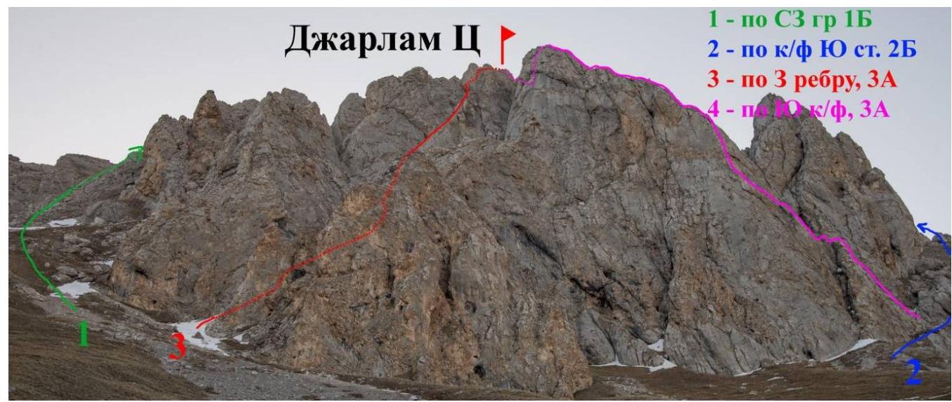
May 4, 2018, taken from the approach to the
route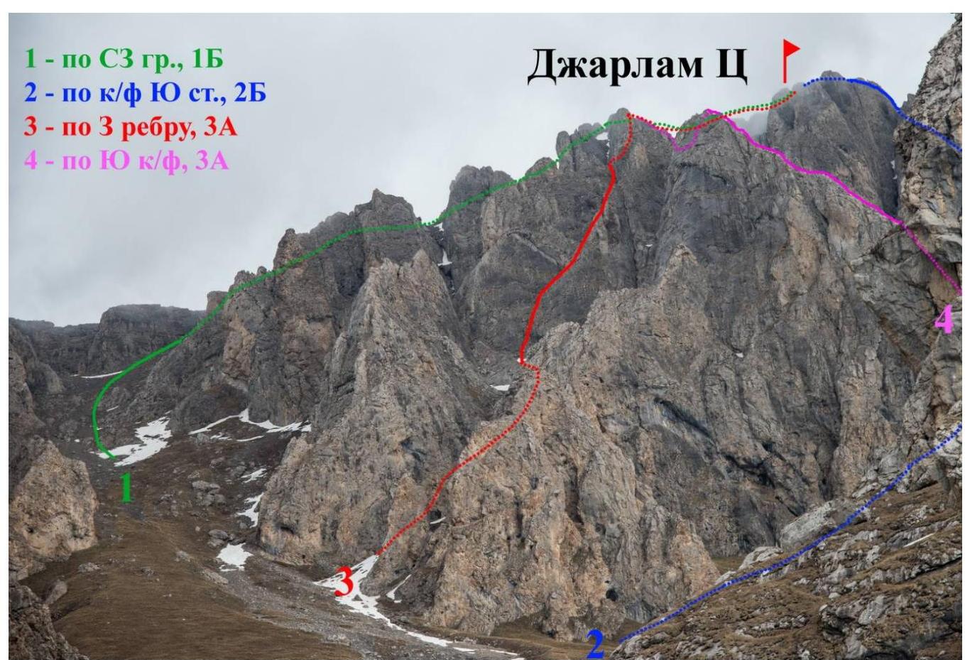
May 4, 2018, taken from the bivouac on Dzharlam Pass. Map of
the area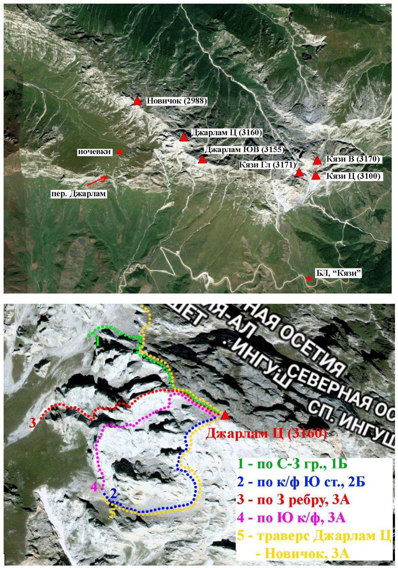
Routes on Dzharlam Central. Photopanorama of
the area Route Diagram by Sections
| Section # | Length | Steepness | Terrain Character | Difficulty Category | Number of Pitons |
|---|---|---|---|---|---|
| R0–R1 | 80 m | 35° | Snowy | I | |
| R1–R2 | 15 m | 50° | Rocky | III | 4 |
| R2–R3 | 150 m | 30° | Mixed terrain | II | |
| R3–R4 | 10 m | 75° | Rocky | IV+ | 3 |
| R4–R5 | 50 m | 45° | Rocky | III | 6 |
| R5–R6 | 10 m | 75° | Rocky | IV | 2 |
| R6–R7 | 40 m | 45° | Rocky | III+ | 5 |
| R7–R8 | 45 m | 45° | Rocky | III | 5 |
| R8–R9 | 55 m | 50° | Mixed terrain | III | 2 |
| R9–R10 | 50 m | 55° | Rocky | III | 4 |
| R10–R11 | 40 m | 50° | Rocky | III | 3 |
| R11–R12 | 50 m | 40° | Rocky | III | 1 |
| R12–R13 | 100 m | 20° | Mixed terrain | I |
Route Description
From the "Kyazi" alpine camp, move towards the monument for 40–60 minutes (can be reached by car), then left, crossing two gullies, and up to Dzharlam Pass for 1.5–2 hours. Bivouac to the right of the pass towards Dzharlam Central massif. No water, only snow. From the bivouac, move towards the scree gully to the left of Dzharlam Central massif until the first gully that goes to the right. Turn into the gully (in May, it's snowy), this is the start of the route.
- R0–R1. Up the gully for 80 m until the rock wall.
- R1–R2. The rock wall is passed on the left with alternating belay.
- R2–R3. Continue up the gully (snow, rock outcrops) towards the black streaks located under a large characteristic internal angle (gully) on the southern wall of the western ridge.
- R3–R4. Careful climbing slightly to the left of the black streaks leads to the start of the internal angle (gully). In May, there may be formed ice in the morning.
- R4–R8. The internal angle widens, move straight up through it, overcoming short sections of tense climbing, with some snow. Reach the point where the internal angle turns into a narrow chimney; here, a logical transition over the ridge to the northern side (photo 4).
- R8–R9. Traverse along a steep grassy slope covered in snow, with some rocky outcrops and ice. Reach a snowy saddle.
- R9–R12. From the saddle, initially up and to the right along logical terrain, then up to a sharp, crumbling ridge that leads to the NW ridge.
- R12–R13. Along a snowy slope and easy rocks, reach the summit. Triangulation tower.
Descent via the category 1B route along the northwest ridge (in the lower part of the ridge, a 10 m rappel from a protrusion). To the bivouac in 1 hour.
The route is logical, orientation is straightforward. The terrain is fairly monolithic. Belays are reliable. Anchor pitons work well for belays; there are places for medium-sized friends. All belay stations are on their points; there are no convenient ledges for organizing stations. In May, there may be short sections of formed ice. Particular attention should be paid to choosing locations for belay stations on sections R3–R8, as a falling stone could fly along the group's path.
Technical Photograph of the Route
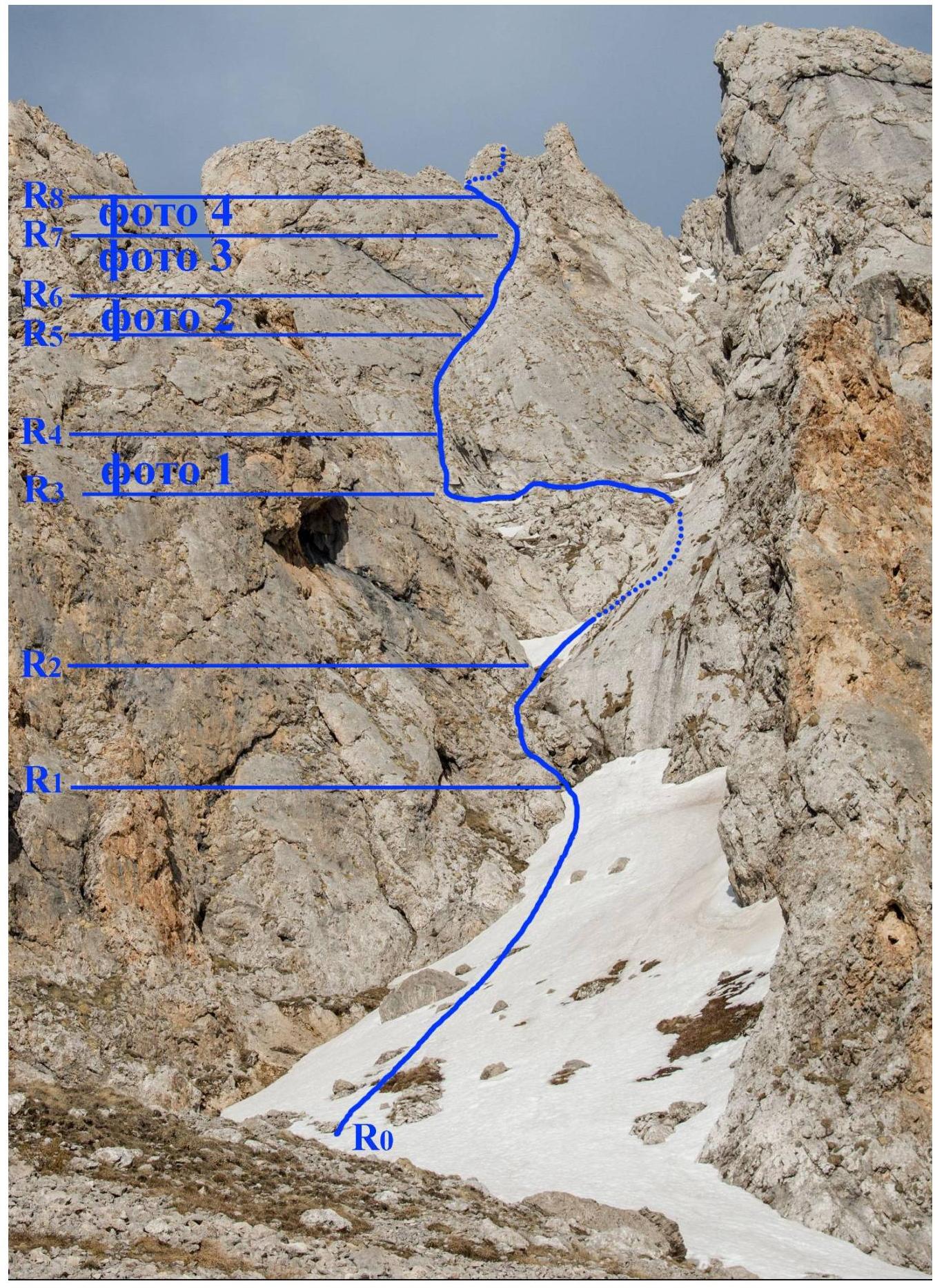
Photo Report
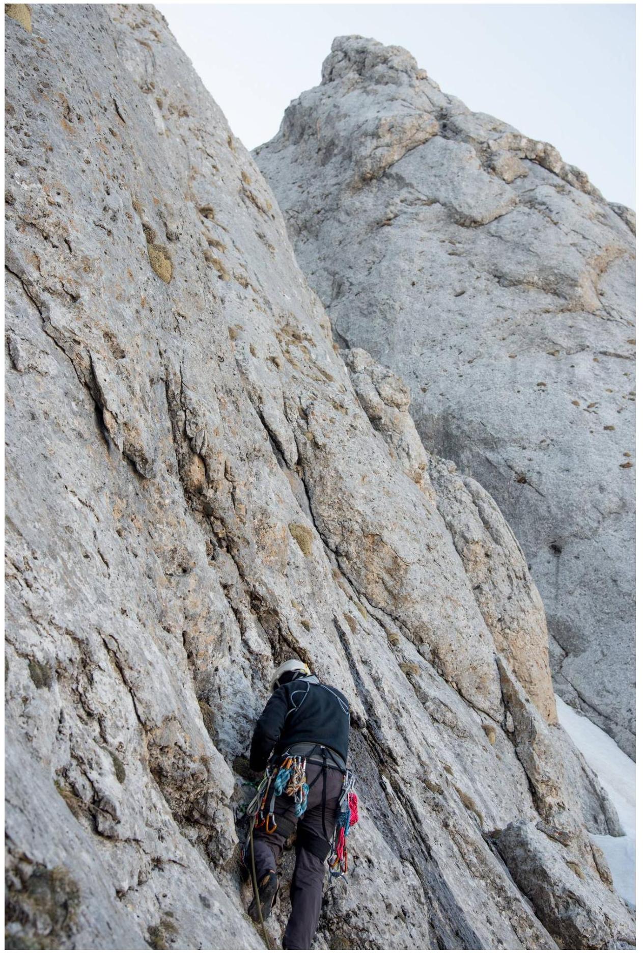
Photo 1. Section R3–R4.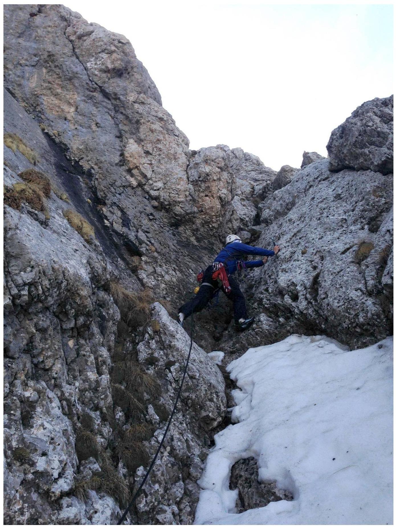
Photo 2. Passage of section R5–R6.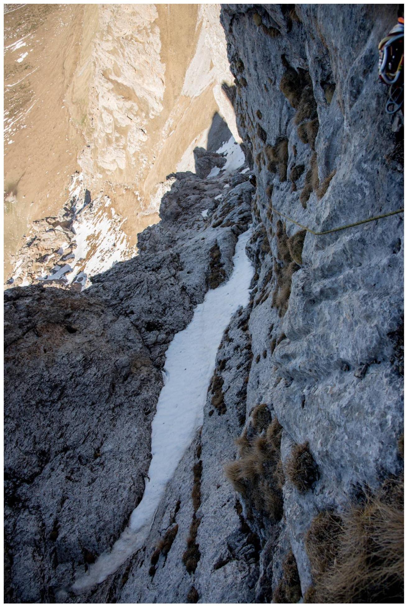
Photo 3. Section R6–R7, taken from R7.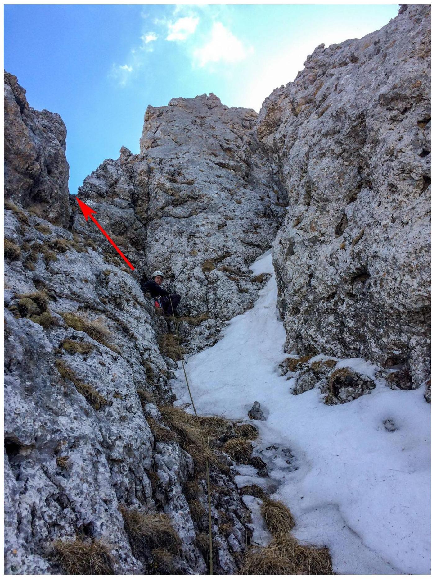
Photo 4. Belay station on R8. Bypassing the gendarme from the northern side.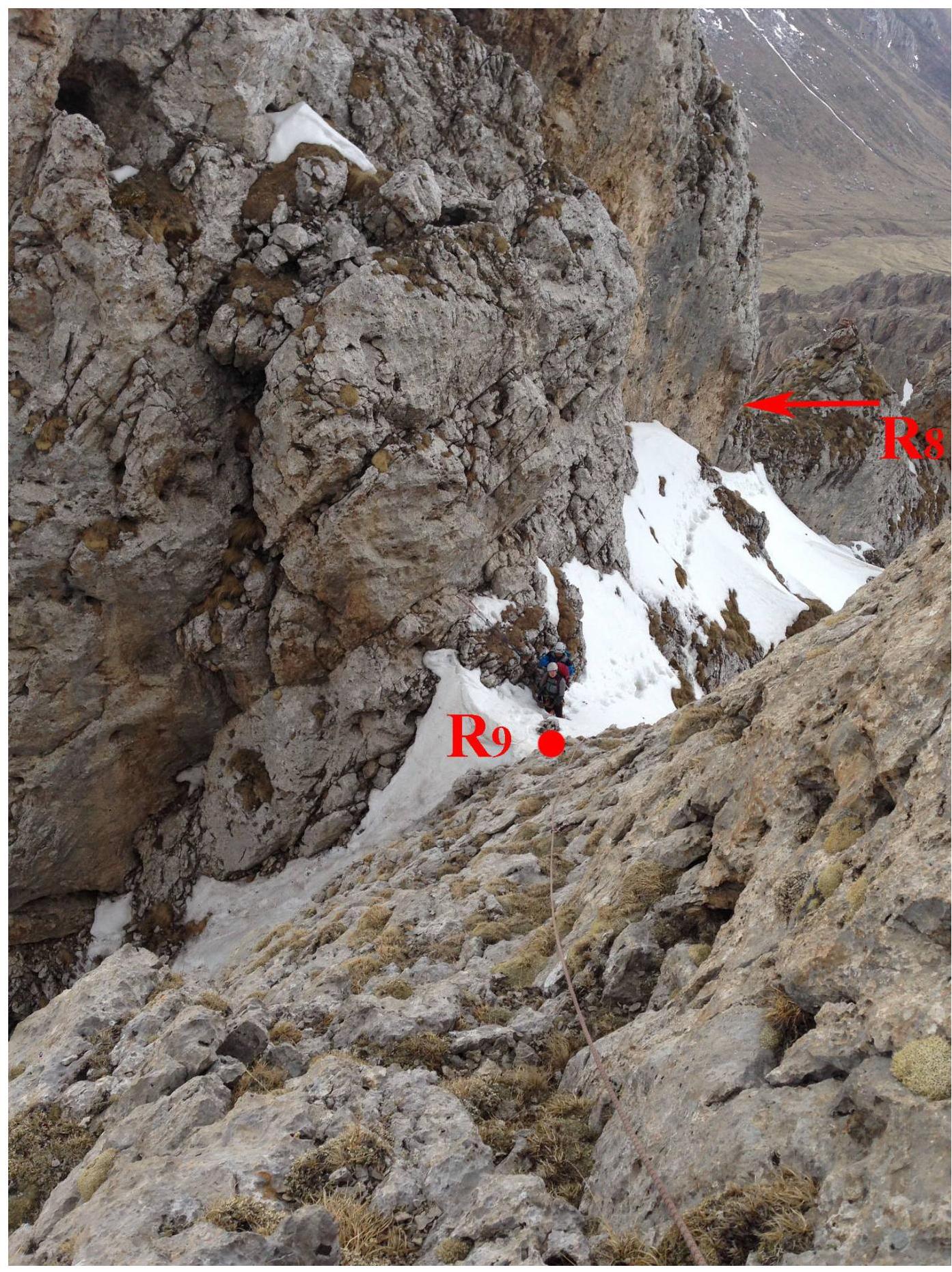
Photo 5. Section R8–R9. Taken from the middle of R9–R10.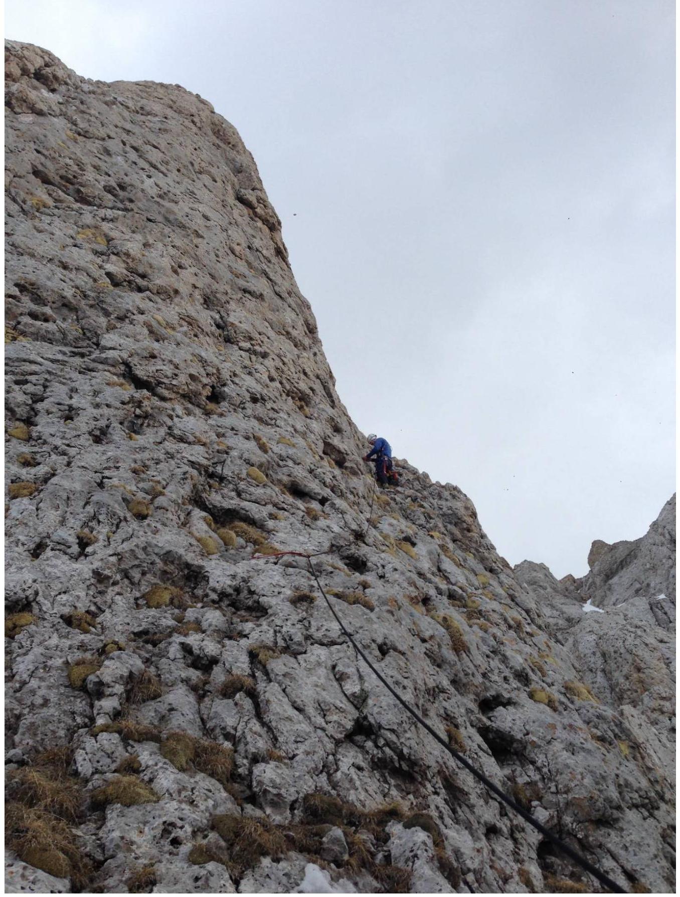
Photo 6. Section R9–R10.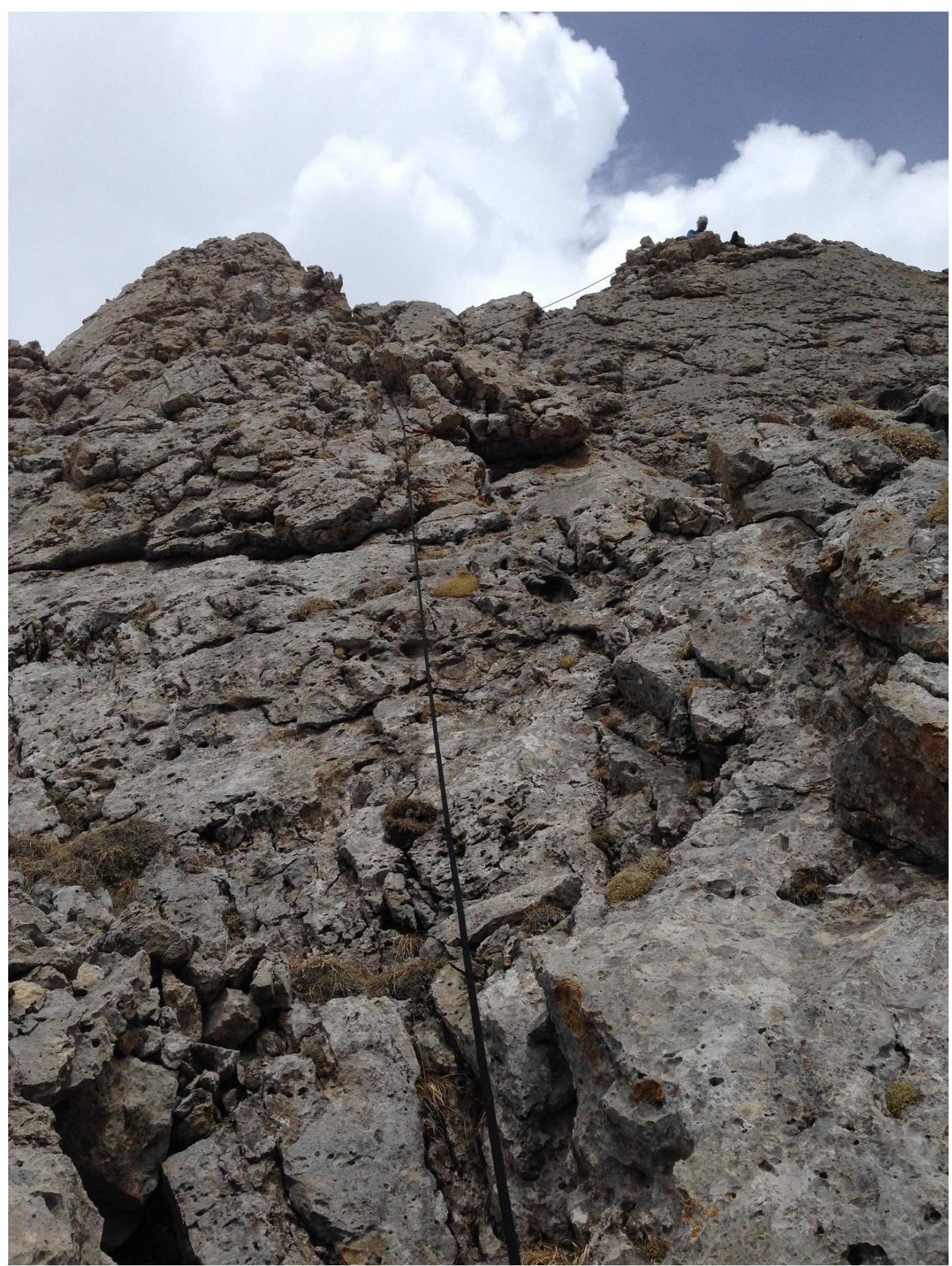
Photo 7. Section R10–R11.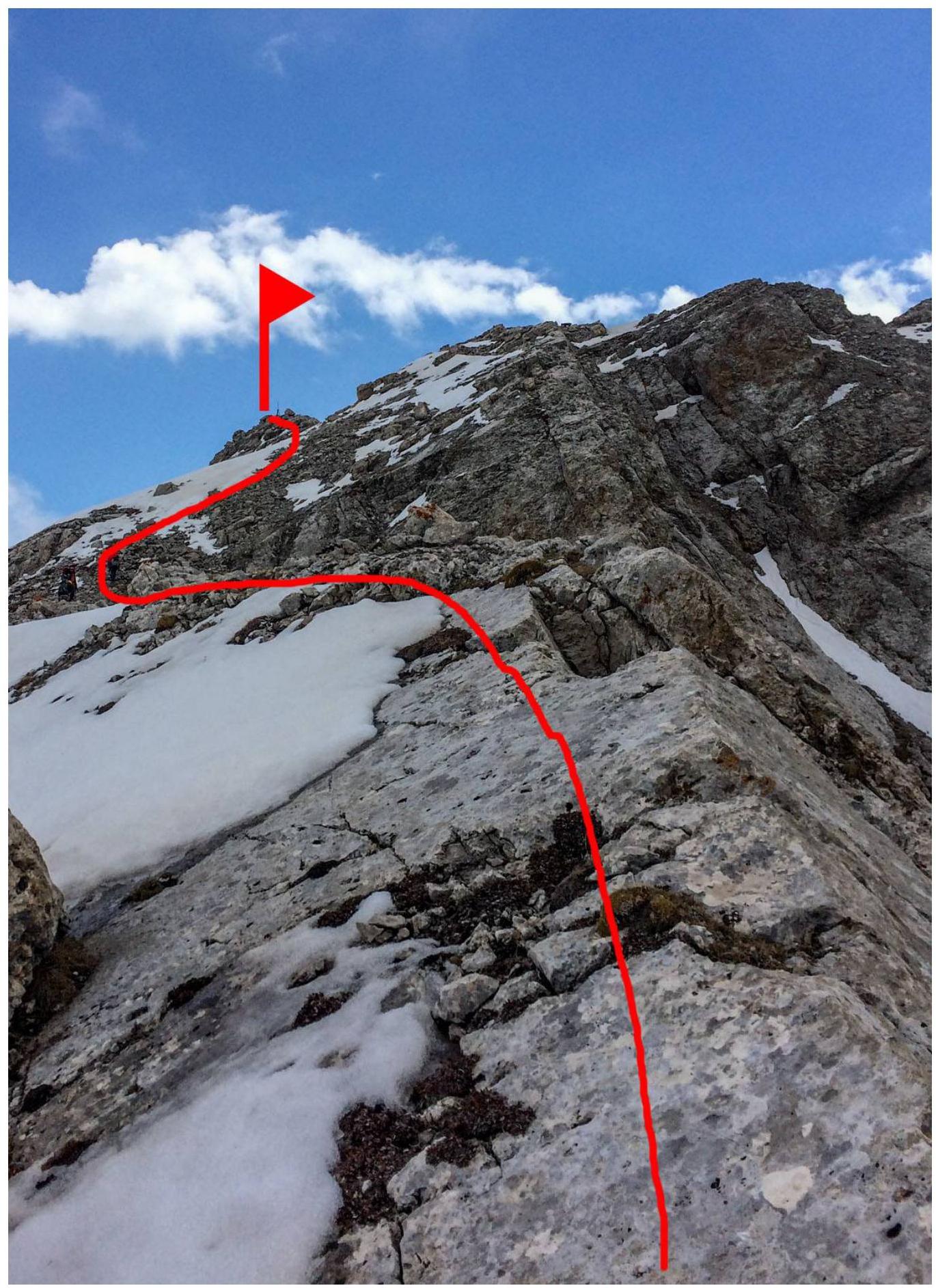
Photo 8. Section R12–R13.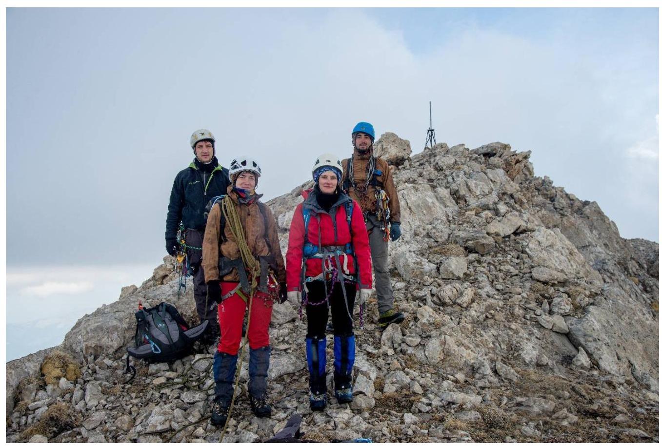
Photo 9. Summit