Report
on the first ascent of Pik Alania via the North-Eastern ridge, category 1B, by the Alpinism Federation of the Republic of North Ossetia — Alania team, July 23, 2021.
1. Ascent Passport
| № | 1. General information | |
|---|---|---|
| 1.1 | Full name, sports rank of the leader | Egorin S.V. — Master of Sports |
| 1.2 | Full name, sports rank of the participants | Koklin D.A. — 2nd sports rank |
| 1.3 | Full name of the coach | Egorin S.V. |
| 1.4 | Organization | Alpinism Federation of the Republic of North Ossetia — Alania |
| 2. Characteristics of the ascent object | ||
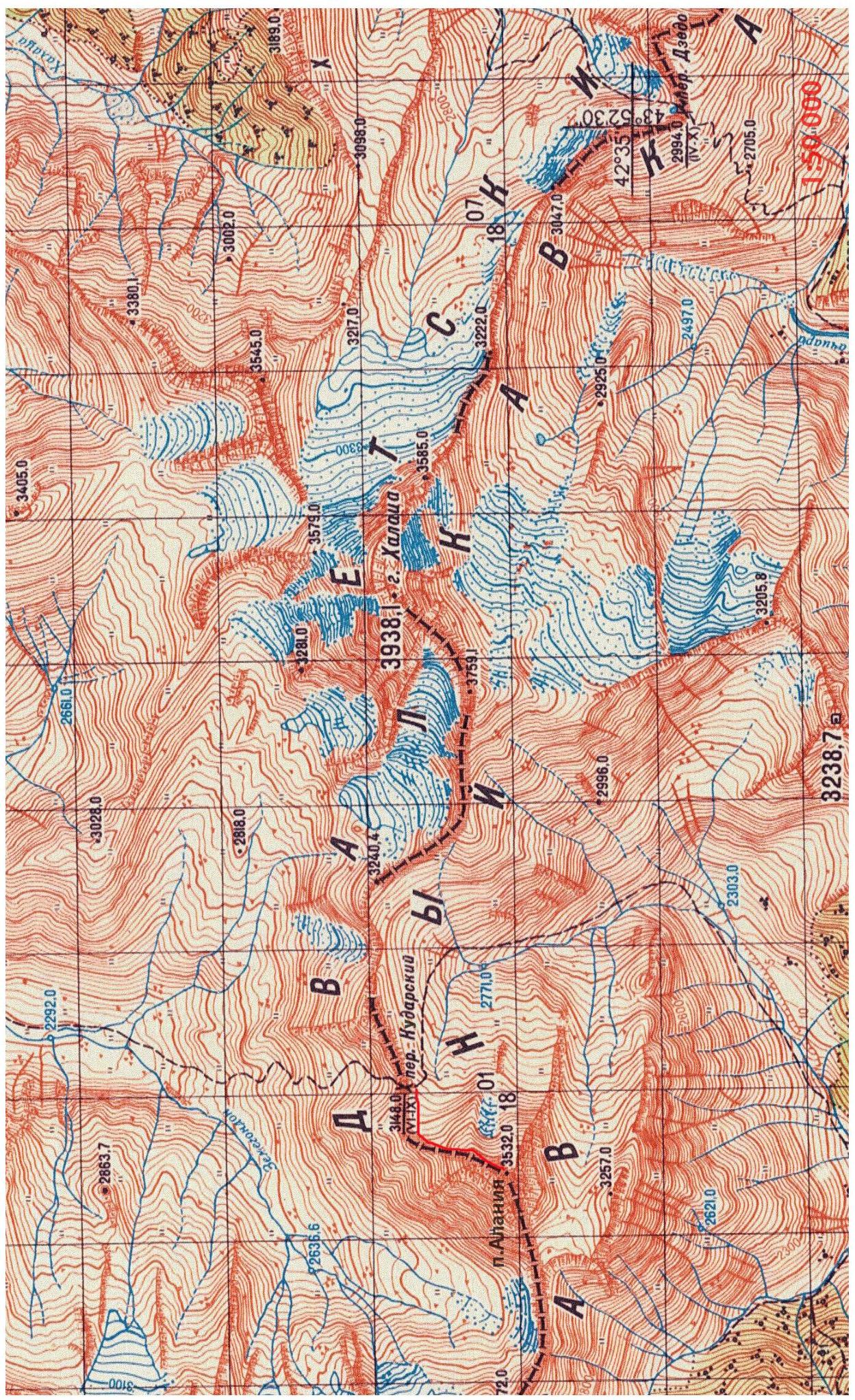
| 2.1 | Region | Caucasus, Main Caucasian Ridge |
| 2.2 | Valley | Mamison |
| 2.3 | Section number according to the 2020 classification table | 2.8 |
| 2.4 | Name and height of the peak | Pik Alania 3532 m |
| 2.5 | Geographical coordinates of the peak | 42.590561° N, 43.785361° E |
| 3. Route characteristics | ||
| 3.1 | Route name | North-Eastern ridge |
| 3.2 | Proposed category of complexity | 1B |
| 3.3 | Degree of route exploration | First ascent |
| 3.4 | Relief characteristics of the route | Rocky |
| 3.5 | Elevation gain of the route | 380 m |
| 3.6 | Route length | About 1 km |
| 3.7 | Technical elements of the route | Category 1 difficulty, ice/rock/combination — 500 m. Category 2 difficulty, ice/rock/combination — 200 m. Category 3 difficulty, ice/rock/combination — 30 m. Category 4 difficulty, ice/rock/combination — 20 m. Movement on a closed glacier — none. Dülfer descent (on descent) — none. |
| 3.8 | Descent from the peak | Via the ascent route |
| 3.9 | Additional route characteristics | The route follows the border between Russia and the Republic of South Ossetia |
| 4. Team actions characteristics | ||
| 4.1 | Movement time | 5 hours |
| 4.2 | Overnights | none |
| 4.3 | Start of the route | 7:00, July 23, 2021 |
| 4.4 | Reaching the peak | 12:00, July 23, 2021 |
| 4.5 | Descent to the pass | 16:00, July 23, 2021 |
| 5. Responsible for the report | ||
| 5.1 | Full name, e-mail | Egorin S.V., e.s.128@mail.ru |
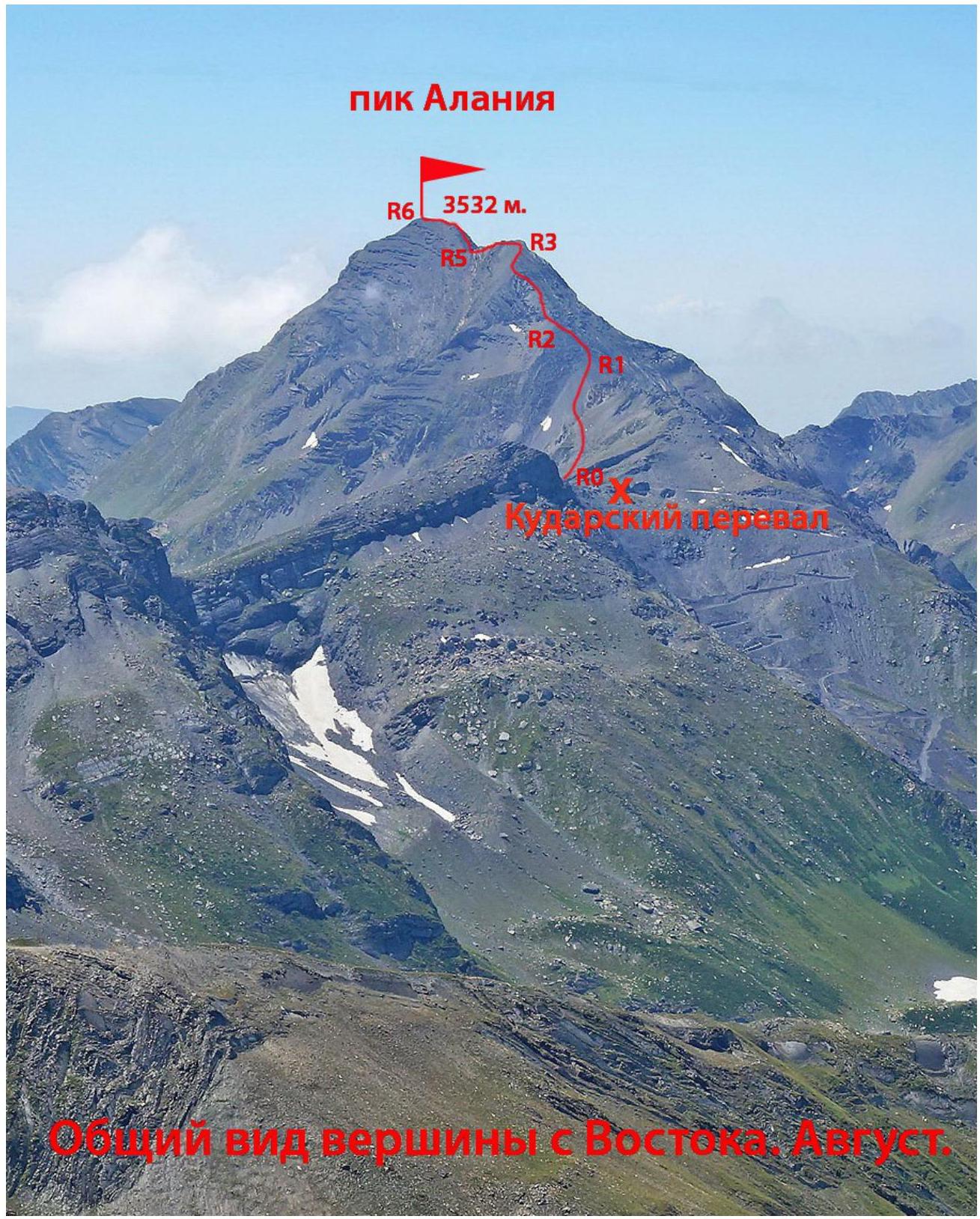
2. Technical characteristics of the route sections
| Section | Relief characteristics | Category of complexity | Length, m | Type and number of hooks |
|---|---|---|---|---|
| R0–R1 | Wide rocky-scree ridge — slope | n.c. — 1 | 400 m | - |
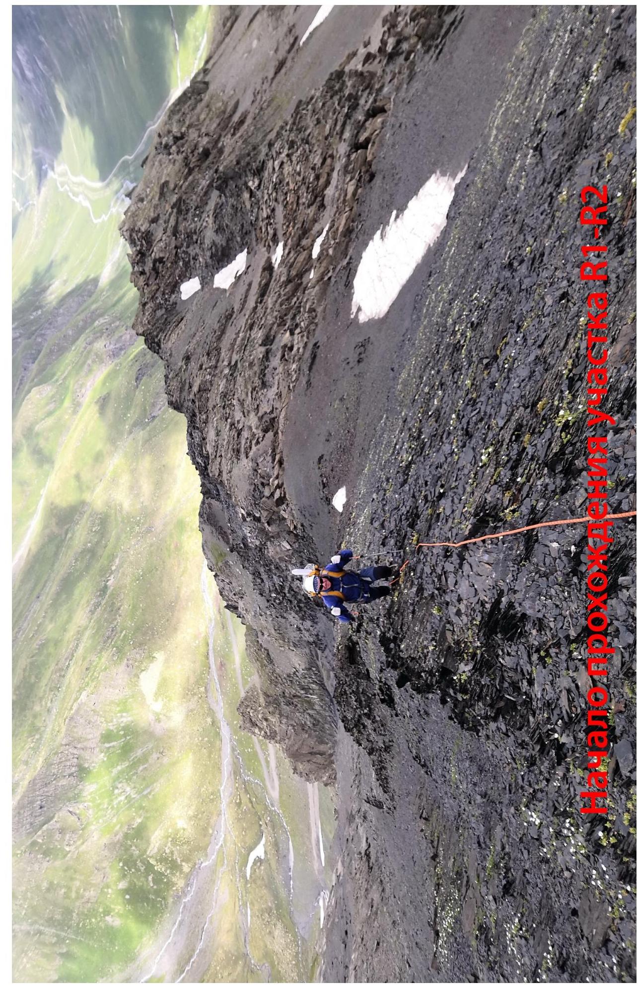
| R1–R2 | Rocky-scree destroyed ridge | 1–2 | 100 m | - |
| R2–R3 | Rocky-scree ridge | 1–2 | 250 m | - |
| R3–R4 | Rocky-scree ridge | 1–3 | 40 m | 2 wedges |
| R4–R5 | Rocky ridge | 2–4 | 50 m | 3 wedges |
| R5–R6 | Rocky-scree ridge | 1–2 | 160 m | - |
3. Characteristics of team actions
3.1 Description of approaches to the route
From Vladikavkaz to the start of the road in the Mamison valley along the Transcaucasian Highway is about 100 km. Before the dam of the Zaramag Hydroelectric Power Station, we turn right down and enter the Mamison valley via a dirt road, passing through the village of Zaramag.
We drive up the valley, passing through the villages of Tib, Lisri, and Kalak. Above Tib, there is no cell phone coverage.
At an altitude of about 2000 m, there is a border post. Further movement is only possible after registration at the post.
- Residents of North Ossetia can register on the spot.
- Others need to obtain border permits in advance at the outpost in Buron.
After the post, we drive a 4x4 vehicle up the valley of the East Zemegon river towards the Kudar Pass — into South Ossetia. In 2009, the world's highest gas pipeline was built here. Our path follows the technological road.
In some years:
- the upper serpentines of the road are constantly blocked by avalanche snow.
- further movement to the pass is only possible on foot.
From Vladikavkaz to the Kudar Pass takes 4–5 hours.
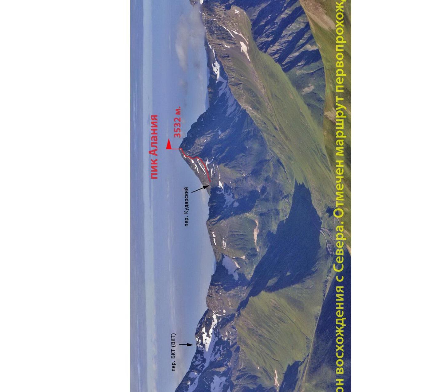 View of the ascent area from the North. The first ascent route is marked.
 General view of the peak from the East. August.
3.2 Brief description of the route passage
| Section | Description |
|---|---|
| R0–R1 | After reaching the pass, we turn right. We move to the left of the North-Eastern ridge line, across scree fields with rock outcrops. Before the black slate ascent of the ridge, we reach its line. |
| R1–R2 | To the right of the ridge line, we ascend via narrow inclined ledges through a belt of destroyed rocks. Belaying is difficult due to tile-like rocks. |
| R2–R3 | Further up the rocky-scree ridge, straight up, bypassing individual rock outcrops, we ascend to the shoulder of the ridge. |
| R3–R4 | From the shoulder, we approach the exit of strong sandstones. We bypass the first step from below on the left, with a subsequent return to the ridge. Belaying to R5 is provided by ridge outcrops. |
| R4–R5 | Along the narrow ridge, composed of monolithic blocks, moving mainly along the ridge line, we reach a scree saddle. |
| R5–R6 | Up the wide rocky-scree ridge to the peak. |
3.3 Recommendations
Descent from the peak is via the ascent route. Descent to the East or South-East is not recommended, as it constitutes an illegal crossing of the state border.
The route via the North-Eastern ridge is safe and corresponds to category 1B.
This ascent was a reconnaissance for a mass ascent as part of the "Immortal Regiment of Ossetia on Pik Alania" campaign.
The first ascent to the peak was made via the n.c., South-Eastern slope by South Ossetian climbers in 2018. Their note is included in this report.
The 3532 m peak is located on the border of two Ossetias — the Republic of North Ossetia — Alania (Russia) and the Republic of South Ossetia, whose second name, as stated in their Constitution, is the State of Alania.
By a decision of the Parliament of South Ossetia, the 3532 m peak was named Pik Alania. In the near future, the Parliament of North Ossetia will initiate a similar decision to be made by higher authorities.
Pik Alania
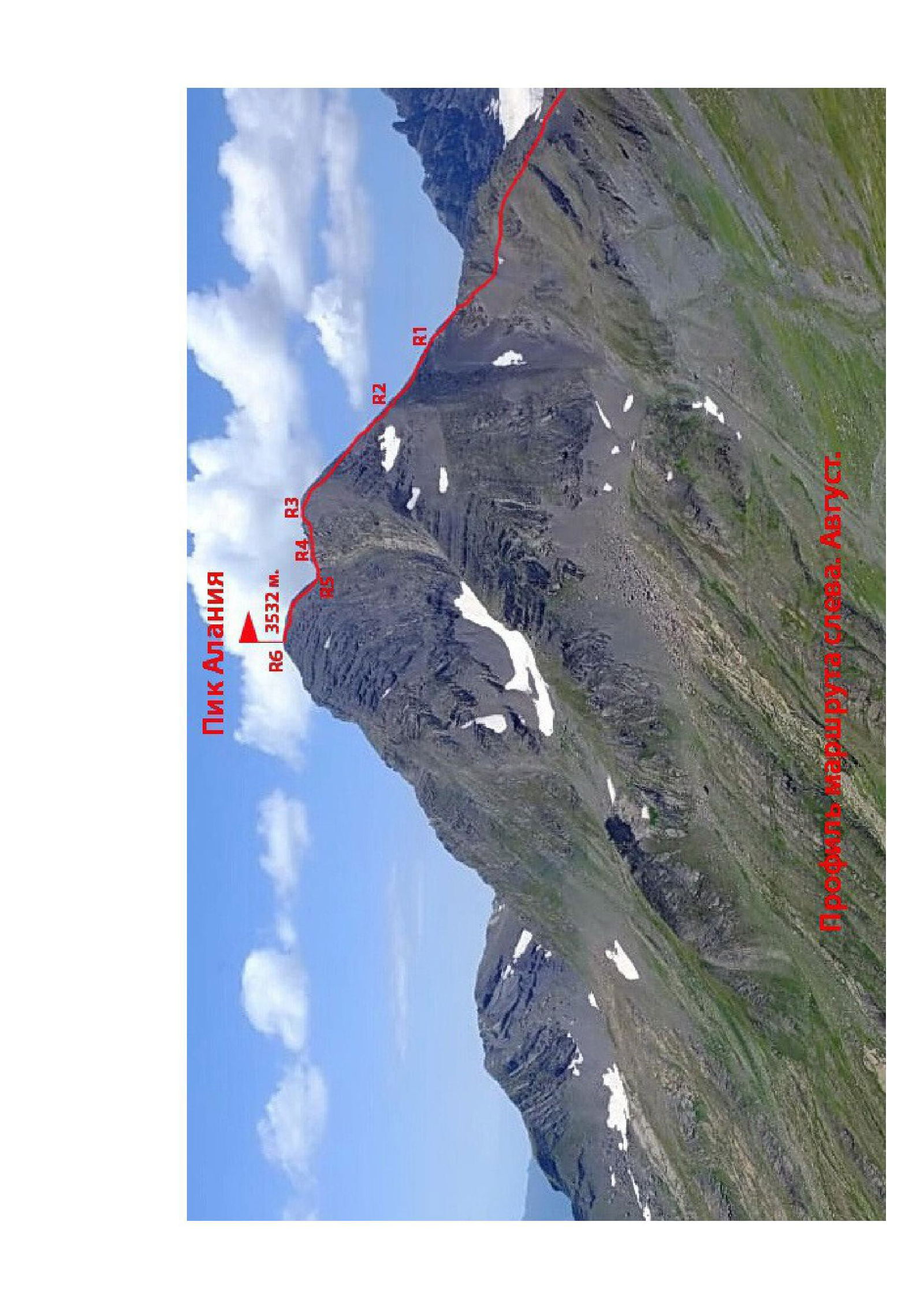
 View of the ridge from the left. August.
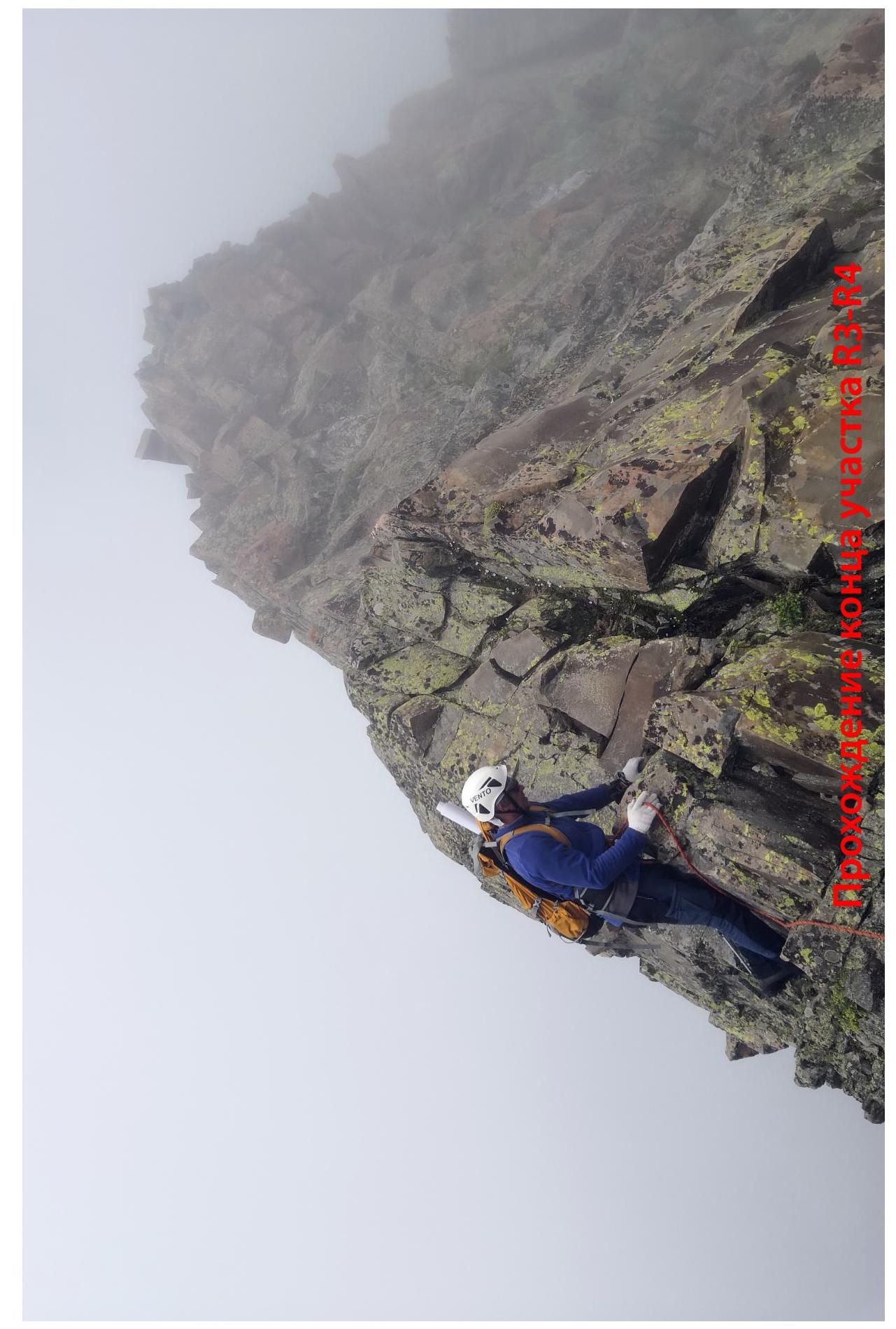
 Passage of the end of section R1.
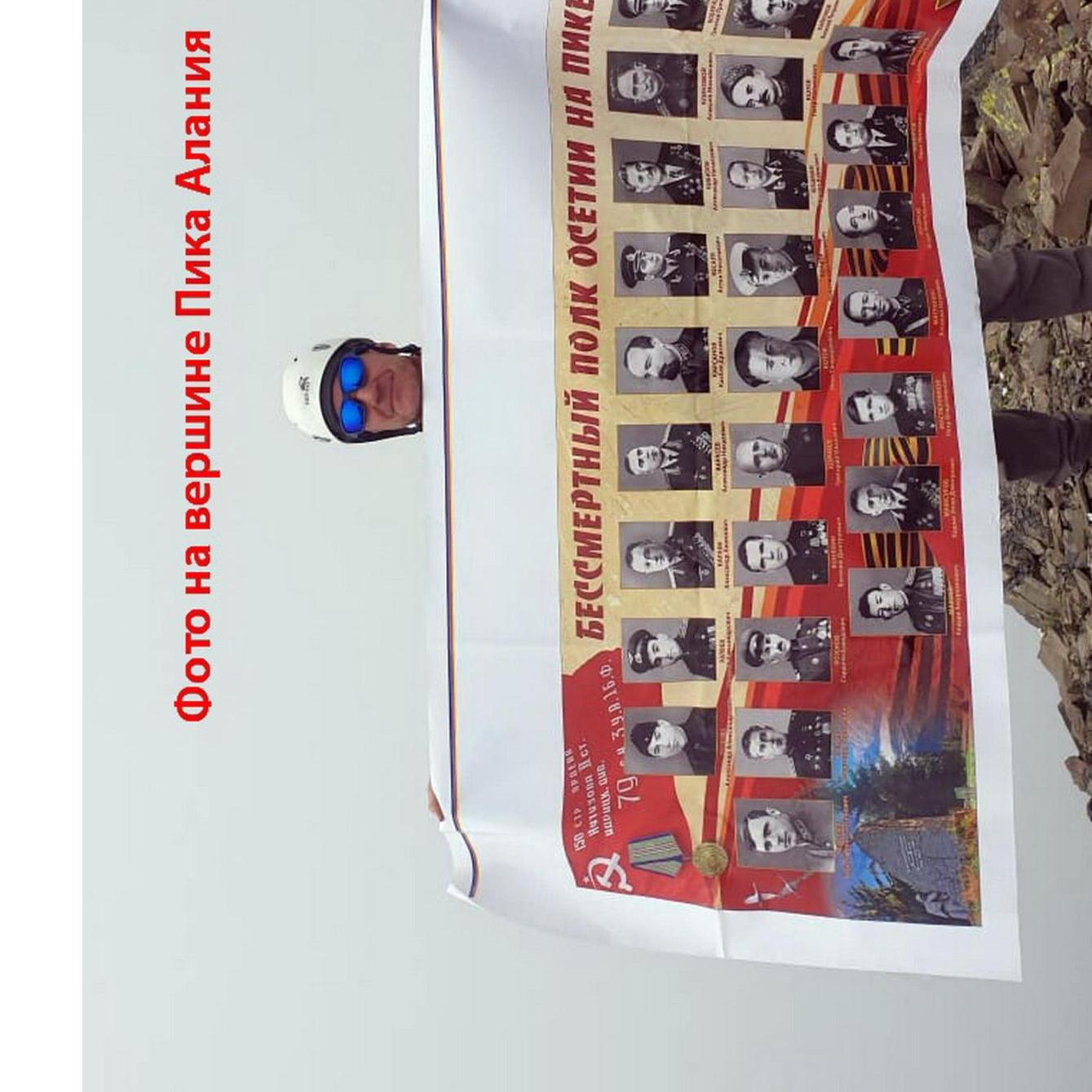
Photo on the summit of Pik Alania
 IMMORTAL REGIMENT OF OSSETIA ON PIK "ALANIA"
Time 9:28. August 20, 2013. A group of climbers led by the President of the Republic of South Ossetia ascended Pik Alania to commemorate the 10th anniversary of recognition by the Russian Federation. The ascent included participants from the State Security Service of the Republic of South Ossetia, the Ministry of Emergency Situations of the Republic of South Ossetia, the Federation of Mountain Climbing and Mountaineering of the Republic of South Ossetia, and the Ministry of Emergency Situations of North Ossetia — Alania!!!