Ascent Passport
- Ascent Class — Technical
- Ascent Region — Central Caucasus
- Summit — Pik Shestirekh via the South Face
- Estimated Difficulty Category — 5B
- Route Characteristics:
- Elevation Gain — 1100 m
- Average Steepness — 65°
- Pitons Driven:
- Rock Pitons — 95
- Ice Pitons — 0
- Chocks — 145
- Bolt Pitons — 0
- Total Climbing Time — 33 hours
- Number of Nights — 2
- Ascent Participants:
- Tortladze Gia Otarovich, MSMS (captain)
- Gigani Afi Azaretovich, MSMS
- Otarashvili Gela Givievich, MSMS
- Nemsitsveridze Merab Nikolaevich, MSMS
- Chantladze David Vladimirovich, MS
- Gegidze Shalva Ilich, CMS

- Brief Geographical Description and Sporting Characteristics of the Region
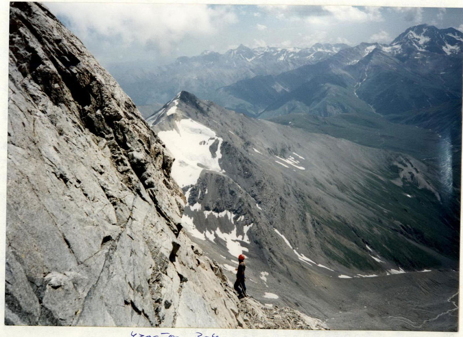
The unclimbed peak (4100 m) is located on the southern side of the Main Caucasian Range and is connected to the Chanchakh peak by a col. The southern slopes of the peak drop down to the Chanchakhi Glacier, and the eastern slopes — to the Tbilisa Glacier.
The peak is 20 km away from the Shovi settlement. The base camp was located at the foot of the Mamisoni Pass (2500 m), near the motor road.
As the first ascenders, the peak was named "Pik Shestirekh" in honor of the Georgian climbers who died during the descent from Ushba in the winter of 1984.
The south faces of Pik Shestirekh and Chanchakhi had not been climbed. We chose a route up the south face of Pik Shestirekh due to its high technical difficulty.

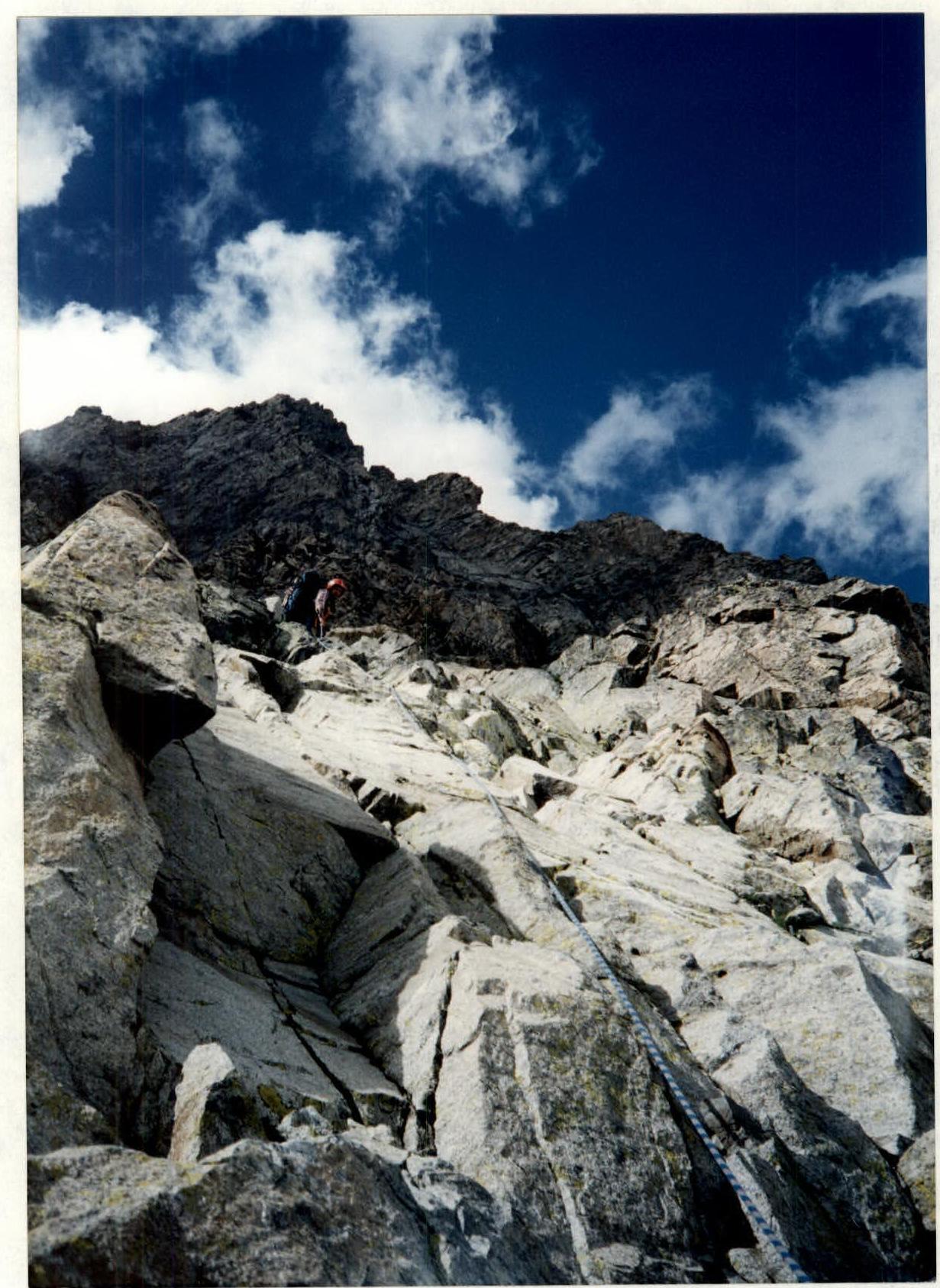
Section R2–R3
- Organizational and Tactical Ascent Plan
The organizational and tactical ascent plan provided for thorough and consistent preparation of the team for the planned ascent. The ascent was preceded by serious training both before heading to the mountains and during the training period in the mountains. Special equipment was tested. Particular attention was paid to reducing weight and improving its quality.
The tactical plan was based on reconnaissance data. The following were taken into account:
- technical preparedness of each team member;
- moral and volitional preparedness of each team member;
- physical preparedness of each team member.
The tactical plan was designed to maximize safety. The final plan was drawn up and refined after studying the wall from a close distance. In case of bad weather, the plan included two reserve days.
During the ascent, the group had a light, high-calorie ration. The total weight of food was 13 kg, and equipment — 20 kg. The average backpack weight was 13 kg.
To ensure safety and observation, a monitoring group and a rescue team were stationed at the base camp. Radio communication was carried out using a "Lastochka" type radio station.

Section R3–R4
- Route Description
August 2. Departure at 7:00. We simultaneously traverse a snowy couloir. The R1–R2–R3 section of rocky terrain is traversed with variable protection. Movement along the rocks (R3–R4) is done with the help of ropes. Protection is piton-based (R4–R5) — an internal corner. Challenging climbing. The section is traversed using chocks and pitons. The Otarashvili — Gigani rope team is working.
August 3. Departure at 7:00. The Chantladze — Nemsitsveridze rope team works up to the R9–R10 section. Challenging climbing along walls, ledges, and slabs. Protection is piton-based, and chocks are also used.
August 4. Departure at 8:00. The leading rope team Gegidze — Tortladze:
- the first 80 m — moderate climbing, piton protection;
- the remaining 170 m of the serrated ridge is of medium difficulty, culminating in the summit.
Descent to the Chanchakhi col and then to the Tbilisa Glacier.
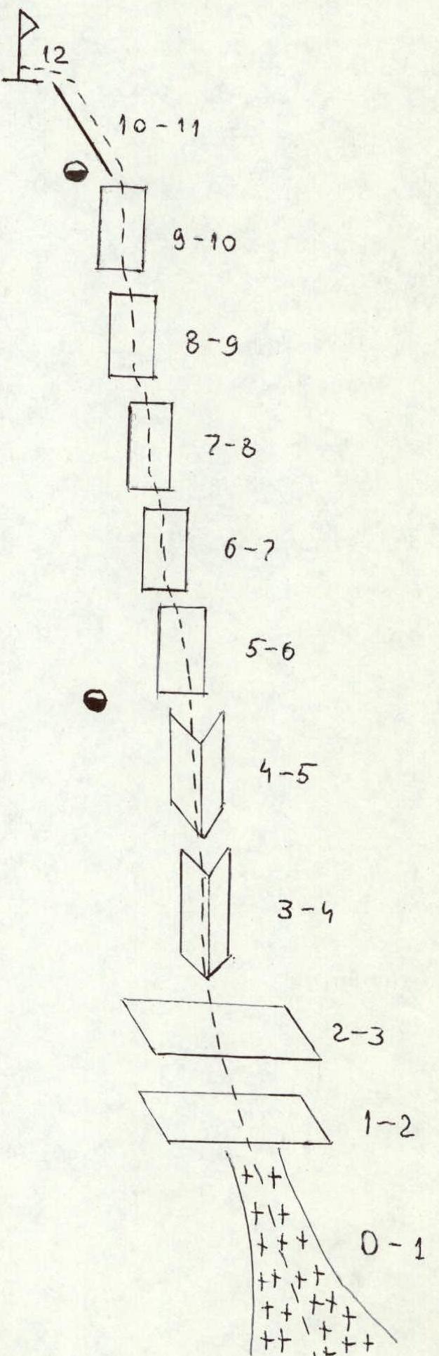
Section R4–R5
Table of Main Characteristics of the Route up the South Face of Pik "Shestirekh"
| Date | Sections Traversed | Average Steepness | Vertical Length | Terrain Type | Difficulty Category | Method of Overcoming | Weather Conditions |
|---|---|---|---|---|---|---|---|
| Aug 2 | R0–R1 | 30 | 250 | rocky | 1B | simultaneous | good |
| R1–R2 | 40 | 150 | rocky | 3A | piton | good | |
| R2–R3 | 45 | 150 | rocky | 3B | piton | good | |
| R3–R4 | 55 | 50 | rocky | 4B | piton | good | |
| R4–R5 | 80 | 90 | rocky | 6A | piton | good | |
| Aug 3 | R5–R6 | 70 | 100 | rocky | 5B | piton | good |
| R6–R7 | 70 | 120 | rocky | 5B | piton | good | |
| R7–R8 | 65 | 60 | rocky | 5B | piton | good | |
| R8–R9 | 75 | 80 | rocky | 5B | piton | good | |
| Aug 4 | R9–R10 | 75 | 100 | rocky | 5B | piton | good |
| R10–R11 | 65 | 80 | rocky | 4B | piton | good | |
| R11–R12 | ridge | 170 |
UIAA Route Diagram
General View of Pik Shestirekh

