
Report
On the first ascent to the summit of Tbau Glavnaya via the Southwest Ridge from Kakadursky Pass, category 1B, by the GSK "Krokus" team, May 12, 2019
2019
1. Ascent Passport
| № | 1. General Information | |
|---|---|---|
| 1.1 | Full name, sports rank of the leader | Egorin S.V. — Master of Sports |
| 1.2 | Full name, sports rank of participants | Dryaev Yu.G. — 3rd sports rank, Koklin D.A. — 2nd sports rank, Gudieva M.V. — 2nd sports rank. |
| 1.3 | Full name of the coach | Egorin S.V. |
| 1.4 | Organization | GSK "Krokus" |
| 2. Characteristics of the Ascent Object | ||
| 2.1 | Region | North Ossetia, Skalisty Range. |
| 2.2 | Valley | Border of Kurtatinsky and Dargavsky valleys |
| 2.3 | Number according to the 2013 classification table | 2.2.8 |
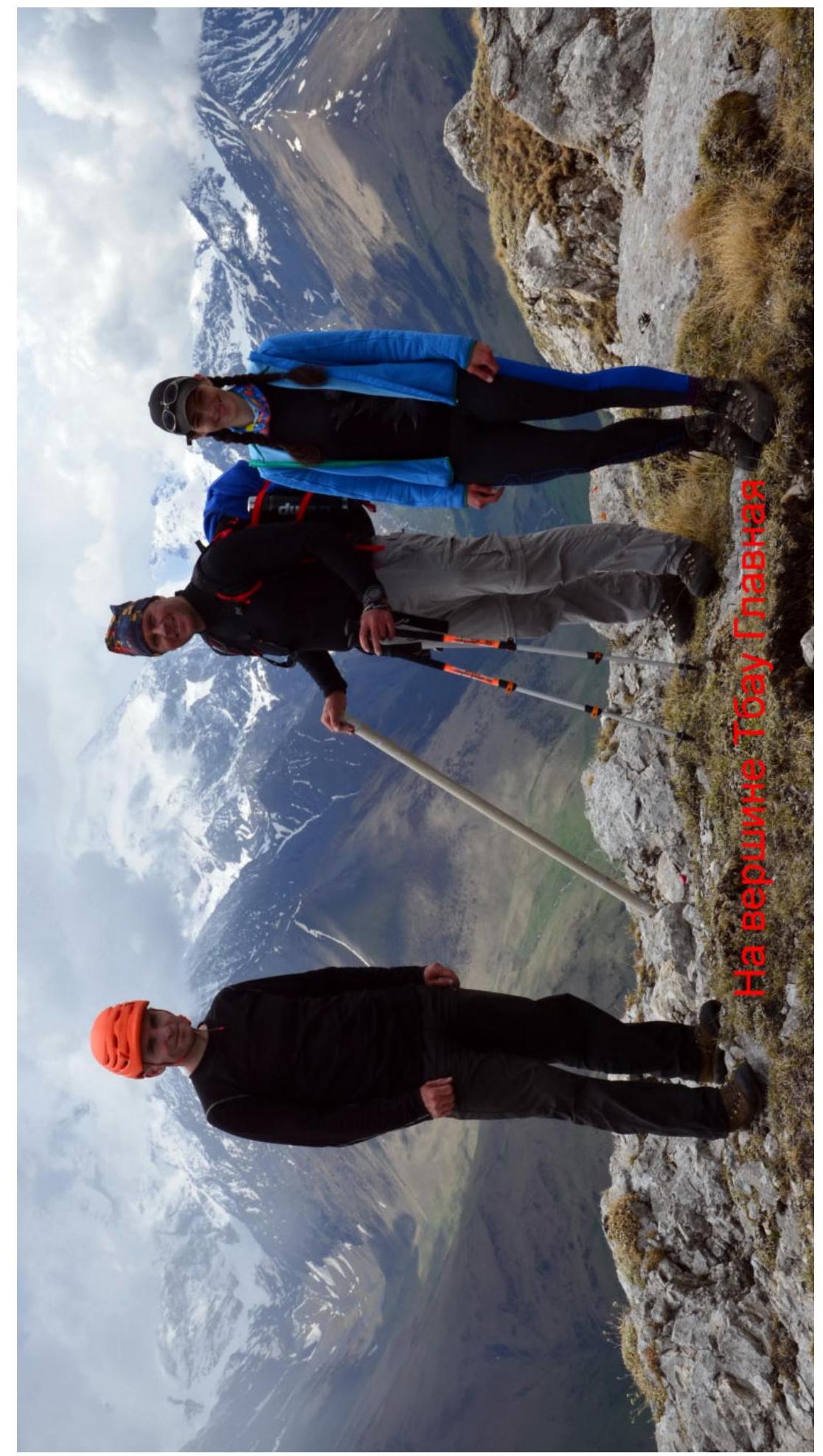
| 2.4 | Name and height of the summit | Tbau Glavnaya, 3007 m |
| 2.5 | Geographical coordinates of the summit | 42°52.035′ N, 44°23.668′ E |
| 3. Route Characteristics | ||
| 3.1 | Route name | Via the Southwest Ridge, from Kakaudursky Pass |
| 3.2 | Proposed category of difficulty | 1B–1B winter |
| 3.3 | Degree of route development | First ascent |
| 3.4 | Route terrain character | Rocky |
| 3.5 | Route elevation gain | 1200 m from Kakaudursky Pass |
| 3.6 | Route length | 1200 m from R0 (Uatsillakhoh summit) |
| 3.7 | Technical elements of the route | I cat. diff. ice/rock/combination — 300 m. II cat. diff. ice/rock/combination — 200 m. III cat. diff. ice/rock/combination — 20 m. IV cat. diff. ice/rock/combination — 10 m. Movement on closed glacier — no. Dülfer descent (on descent) — no. |
| 3.8 | Descent from the summit | Via the South slope of the East Ridge — category 1A |
| 3.9 | Additional route characteristics | Presence of water — snow on the north side of the ridge, in winter and inter-season. |
| 4. Characteristics of the Team's Actions | ||
| 4.1 | Movement time | 6 hours |
| 4.2 | Overnights | no |
| 4.3 | Route entry | 6:00, May 12, 2019 |
| 4.4 | Summit ascent | 12:00, May 12, 2019 |
| 4.5 | Return to base camp | 16:00, May 12, 2019 |
| 5. Responsible for the Report | ||
| 5.1 | Full name, e-mail | Egorin S.V., e.s.128@mail.ru |
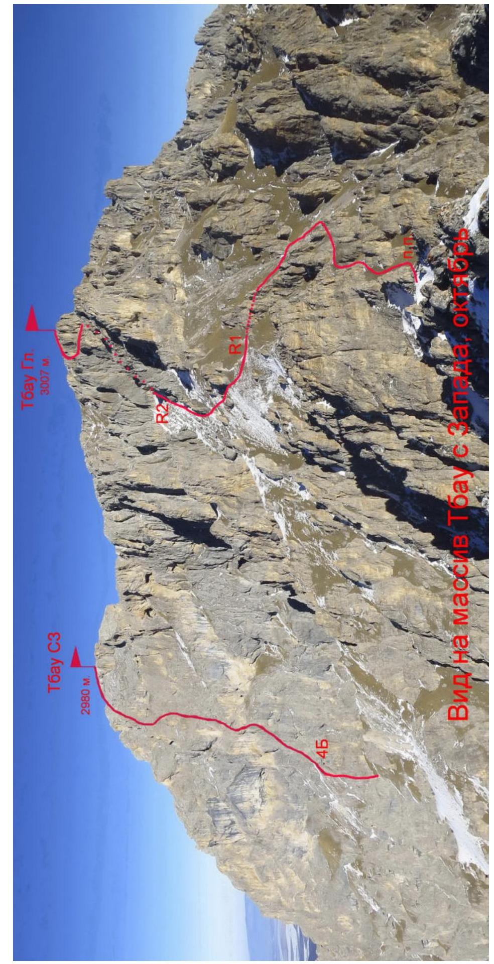
 4B. Tbau NW, 2980 m. Tbau Gl., 3007 m. R1, R2. View of the Tbau massif from the west, October.
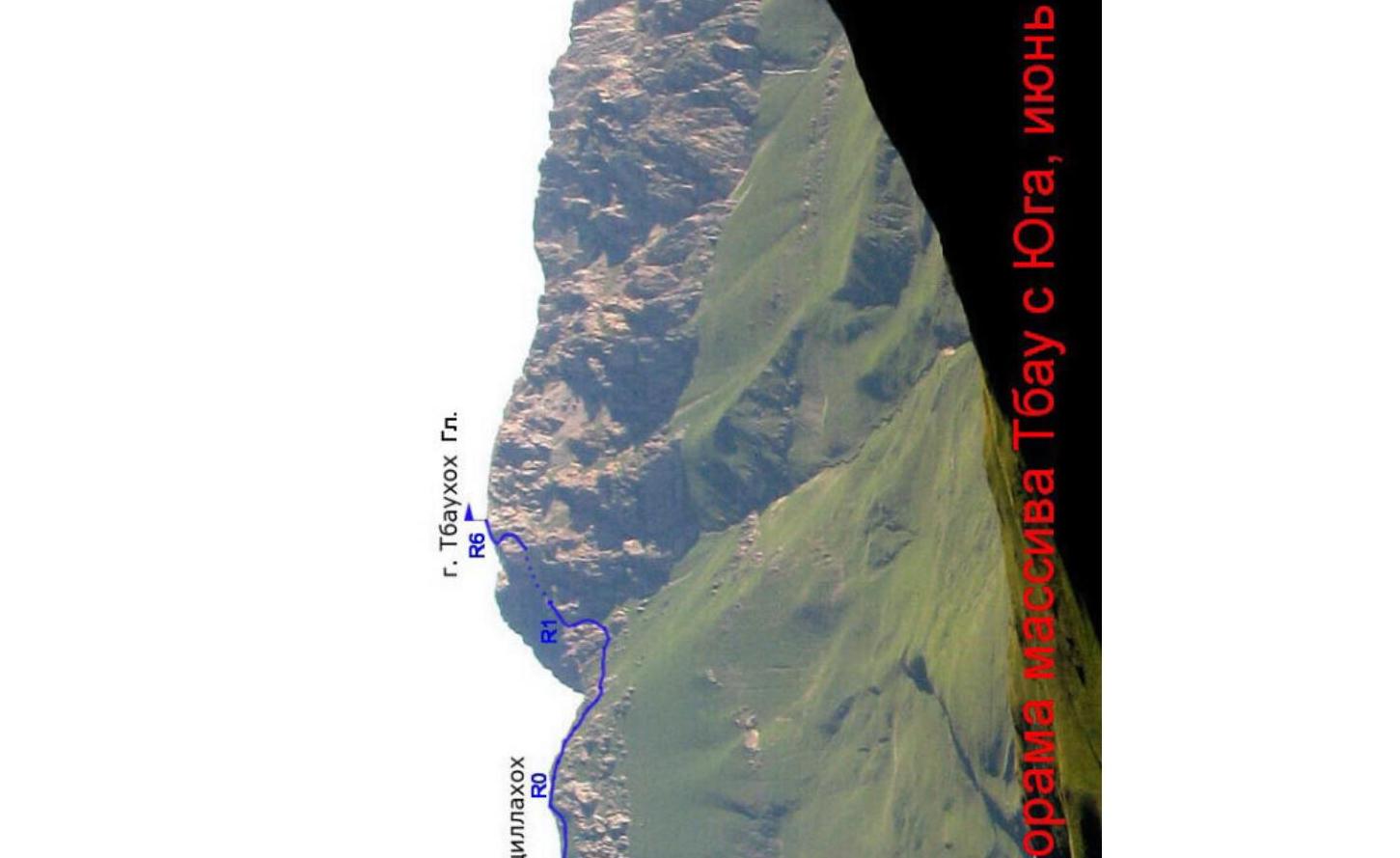
 Panorama of the Tbau massif from the south, June. g. Uatsillakhoh R0, R1. g. Tbaukhoh Gl. R6. East 5B w. Photo by Golubev M.
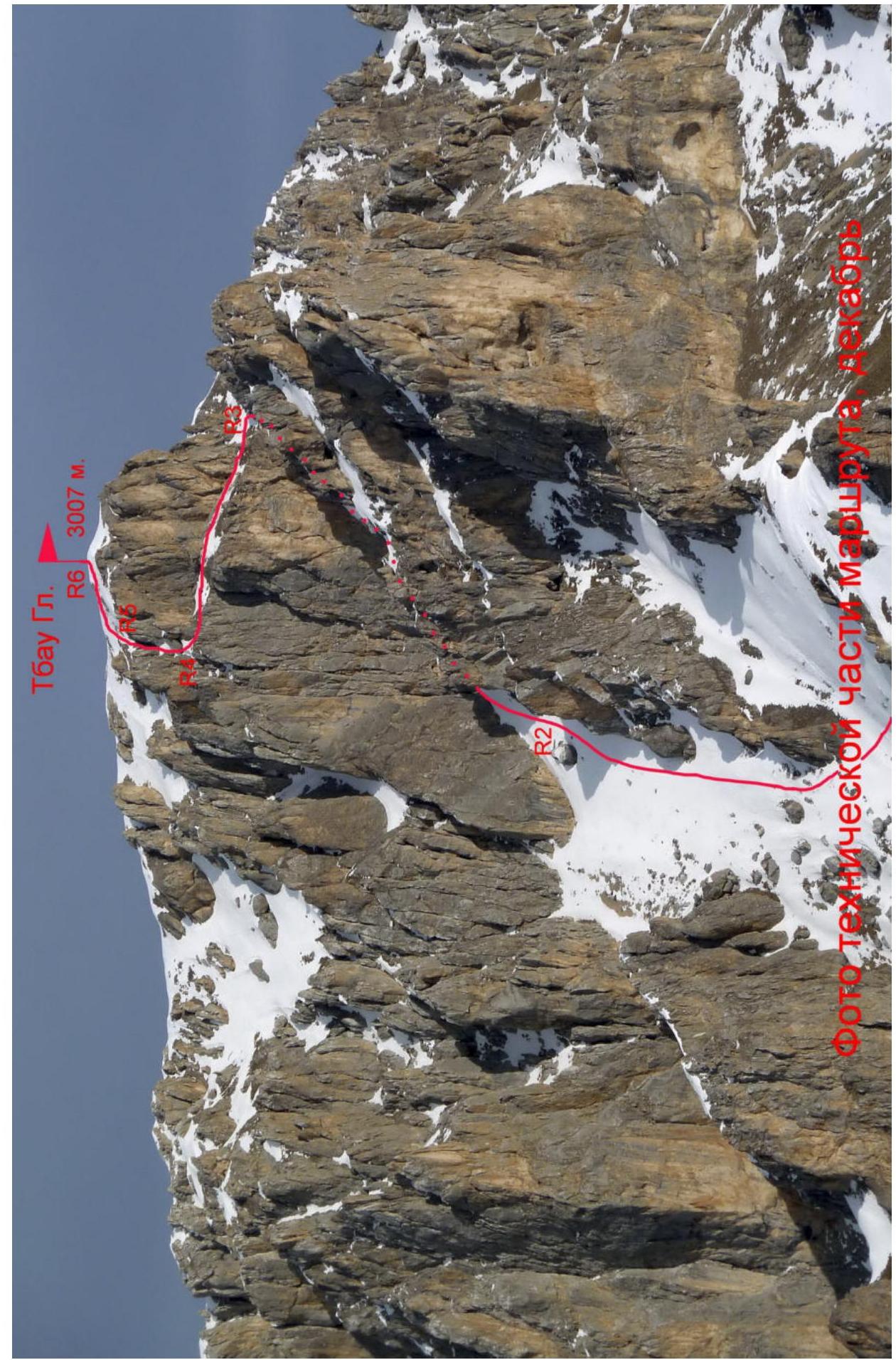
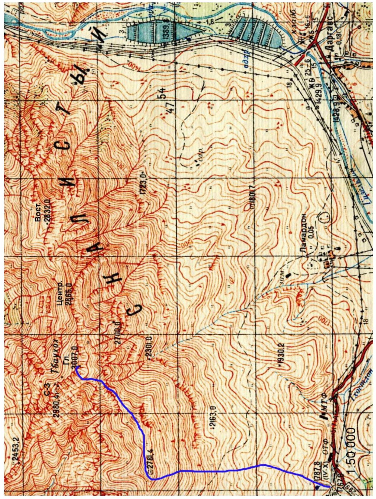 Photo of the technical part of the route. Tbau Gl. R6, 3007 m. R2.
2. Technical Characteristics of the Route Sections
| № section | Terrain character | Category of difficulty | Length, m | Type and number of hooks |
|---|---|---|---|---|
| R0–R1 | Rocky-grassy ridge | 1–2 cat. diff. | 700 m | - |
| R1–R2 | Scree slope | 1 cat. diff. | 200 m | - |
| R2–R3 | Rocky-scree terrace | 1–3 cat. diff. | 120 m | - |
| R3–R4 | Scree ledge | 1–2 cat. diff. | 60 m | |
| R4–R5 | Rocky internal angle | 2–4 cat. diff. | 20 m | 2 placements |
| R5–R6 | Scree slope | 1 cat. diff. | 100 m | - |
3. Characteristics of the Team's Actions
3.1. Description of the Approach to the Route
From the city of Vladikavkaz, by car to Kakaudursky Pass is about 60 km.
From the pass, we head north along the grassy slope towards the 2781 m mark. In the upper part, the slope steepness increases to 30°.
At the 2781 m mark (triangulation point), we turn right and along the broad ridge approach the first rock outcrops. This is the Uatsillakhoh summit. Here is the start of the route.
3.2. Brief Description of the Route Passage
| № section | Description | Photo number |
|---|---|---|
| R0–R1 | After reaching the Uatsillakhoh summit, we descend along the Southwest Ridge towards Tbau Gl. Movement goes along the right side of the ridge, on the South slope. Rock outcrops are bypassed along the ledges. After the ridge saddle, a large gendarme is bypassed on the right, along the ledges between the rocks, descending below the ridge line up to 100 m. Then we again ascend to the Southwest Ridge, not reaching the pre-summit rocks. | |
| R1–R2 | From the ridge saddle, we move left upwards along the West slope. Movement is left of the ridge rocks, traversing the scree slope. Behind the edge of grey rocks, we move right upwards along the scree slope under the monolithic walls. | |
| R2–R3 | Further, we move upwards along the scree terrace with individual rock outcrops. In the upper part, it is blocked by a rocky belt, which is overcome on the right side along a narrow crevice. With a large amount of snow, the section is avalanche-prone. | Photo 1–2 |
| R3–R4 | After the rocky belt, we exit onto the ridge shoulder and move left along the inclined scree ledge to its narrowing. Along the narrow psychological ledge, we approach the base of the internal angle. | |
| R4–R5 | Further, along the internal angle — chimney straight up — and exit onto the summit plateau. | Photo 3–4 |
| R5–R6 | Along the summit plateau, we ascend to Tbau Gl. |
3.3. Recommendations
Descent from the summit along the East Ridge and South slope towards s. Lamardon is category 1A.
Almost the entire route has cellular coverage. The passed route via the Southwest Ridge is interesting as an ascent to the highest point of the Tbau massif, and is comparable in complexity and length to the category 1B route on Tbau NW.
The route was first ascended in February 2001, and repeated this year for a more detailed description and photography.
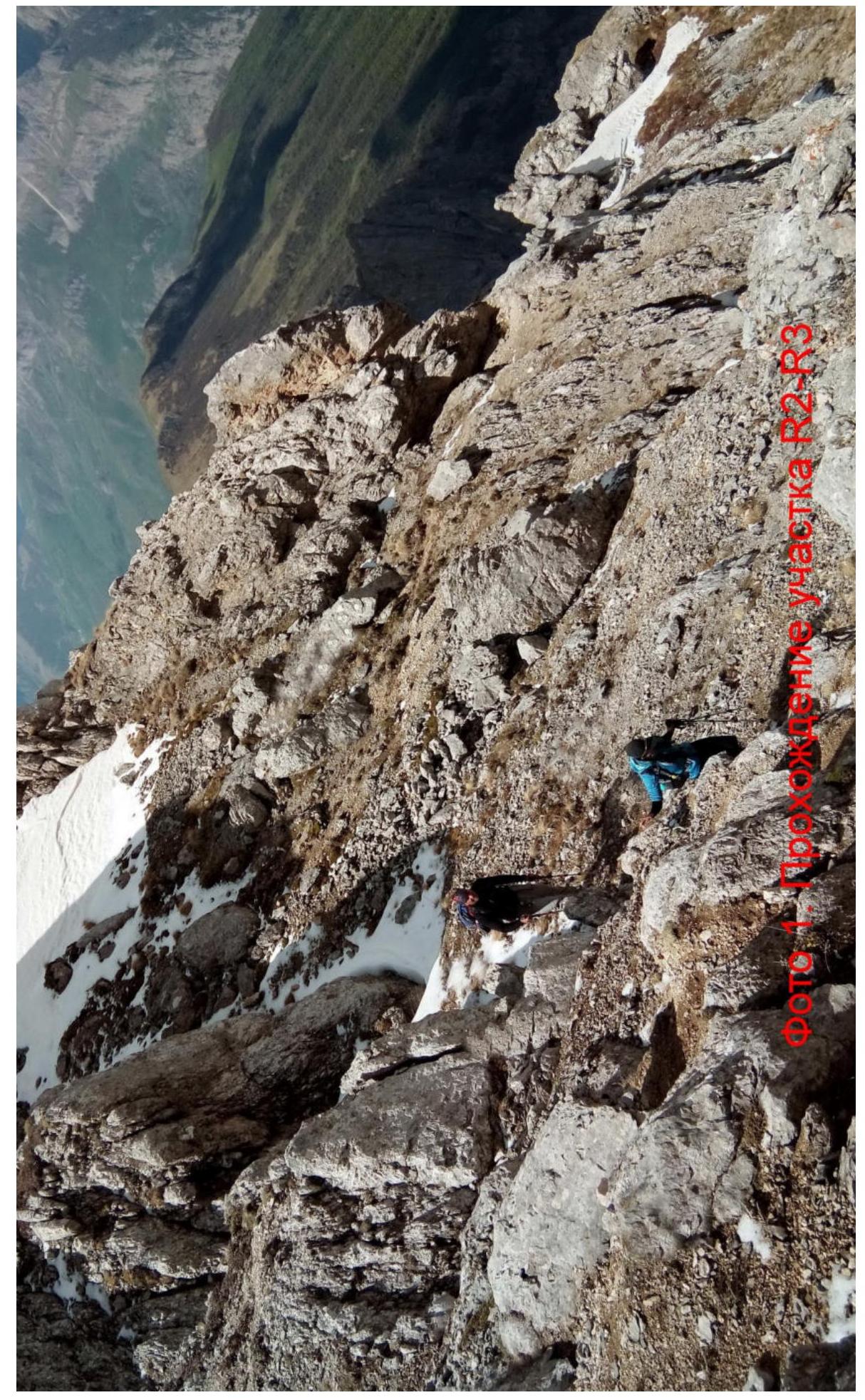 Photo: Passage of section R2–R3.
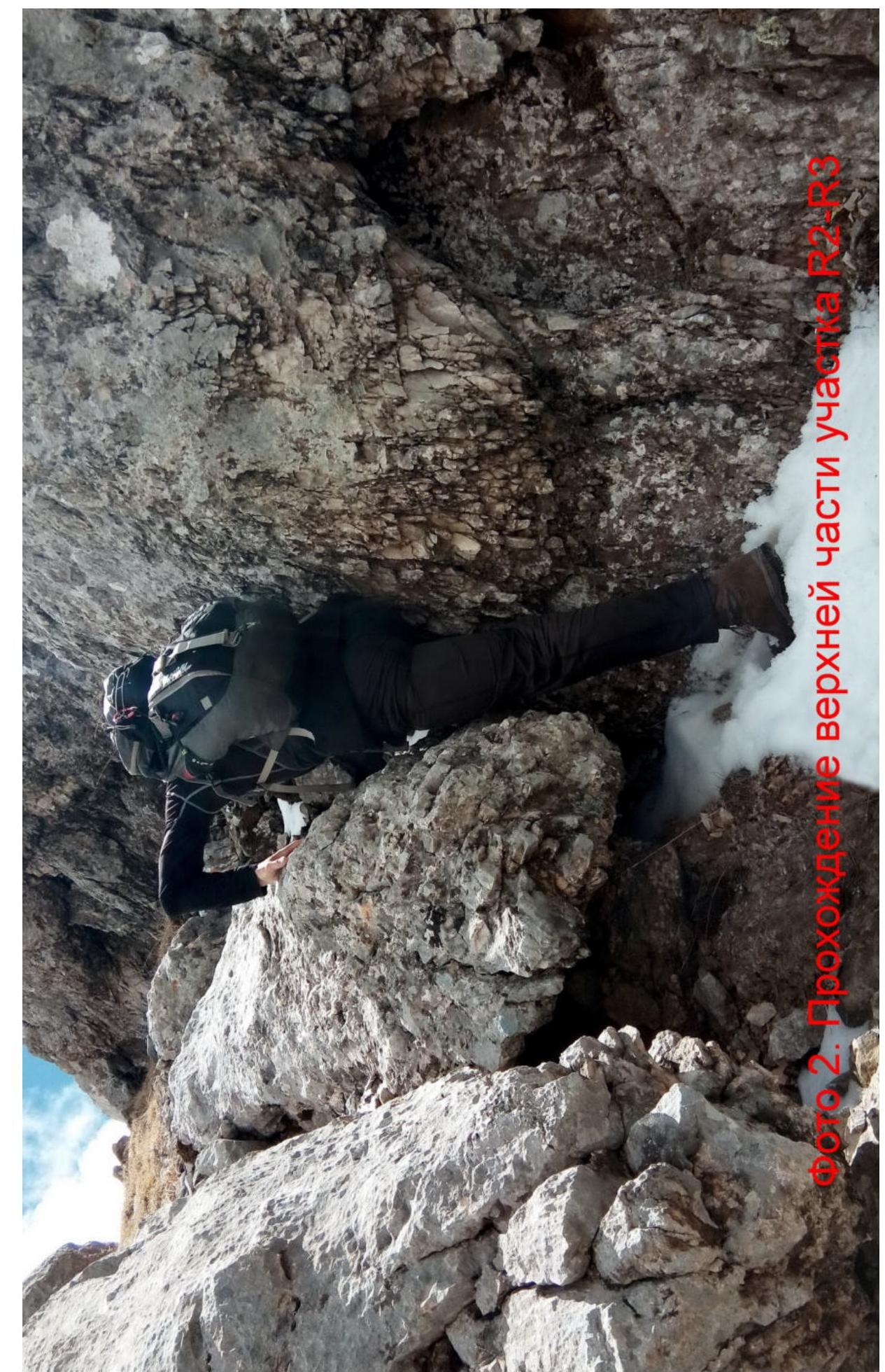 Photo 2. Passage of the upper part of section R2–R3.
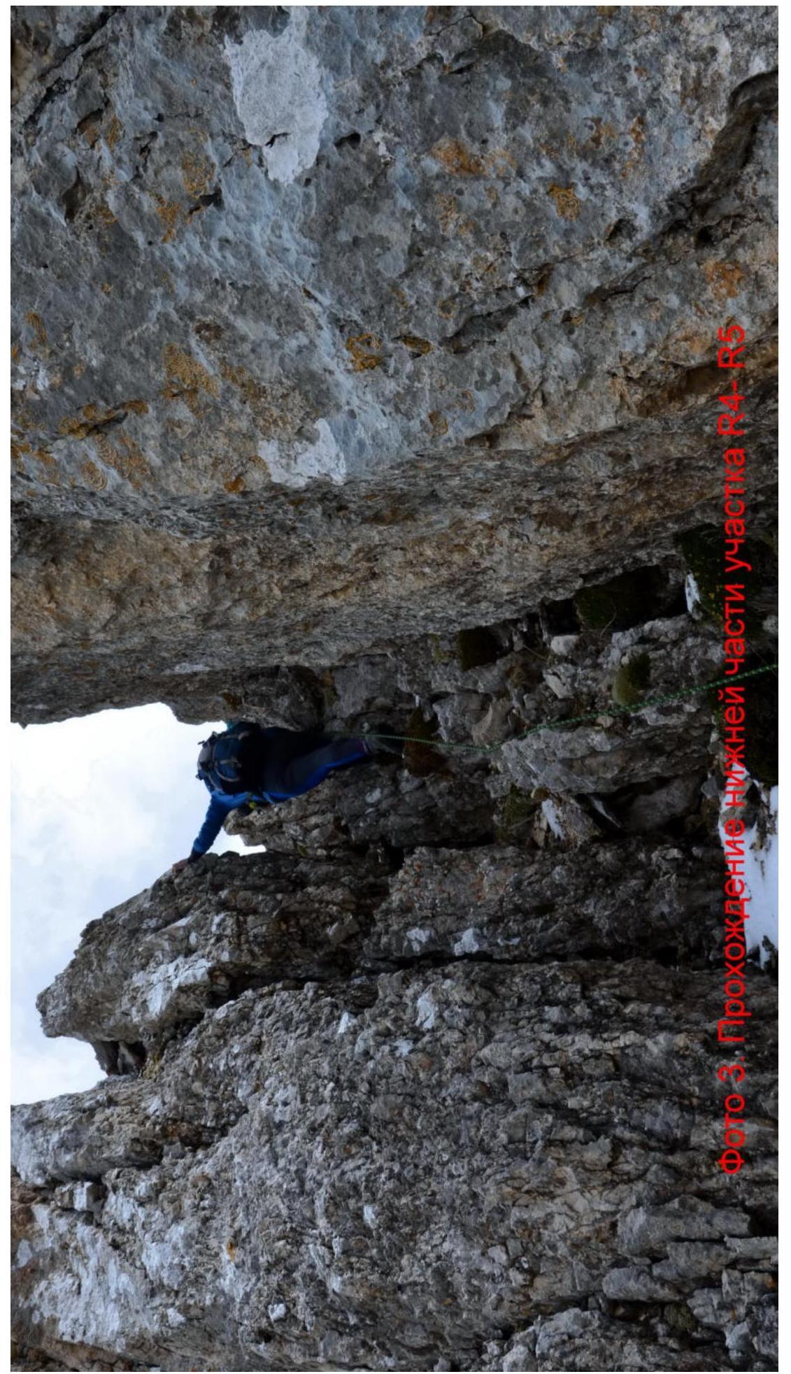 Photo 3. Passage of the lower part of section R4–R5.
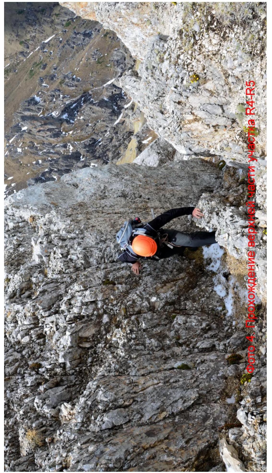 Photo 4. Passage of the upper part of section R4–R5.
Comments
Sign in to leave a comment