
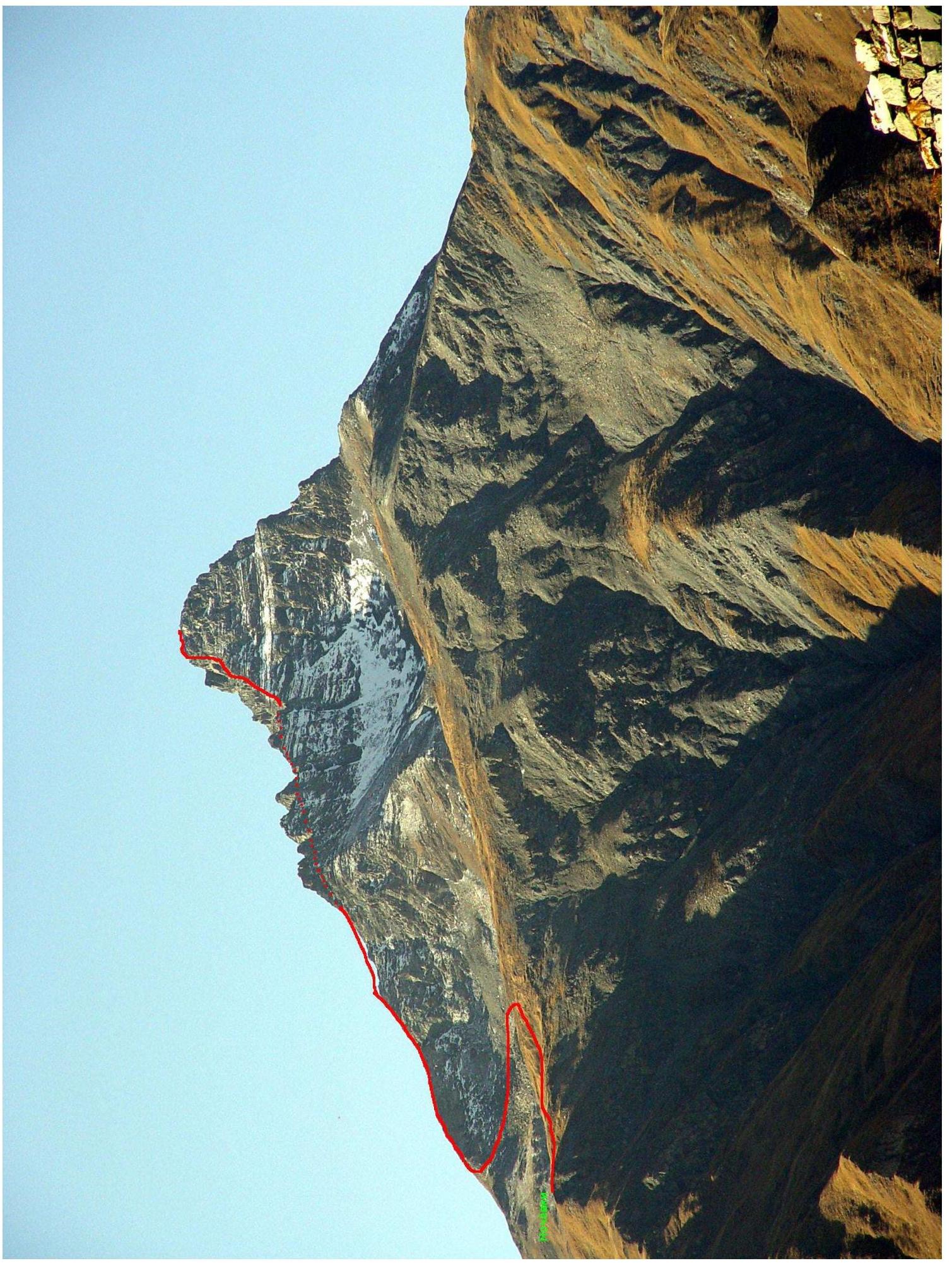
The route to the summit of Pik Skryabina via the Northeast Ridge (first ascent). The summit elevation is 3456 m.
Introduction
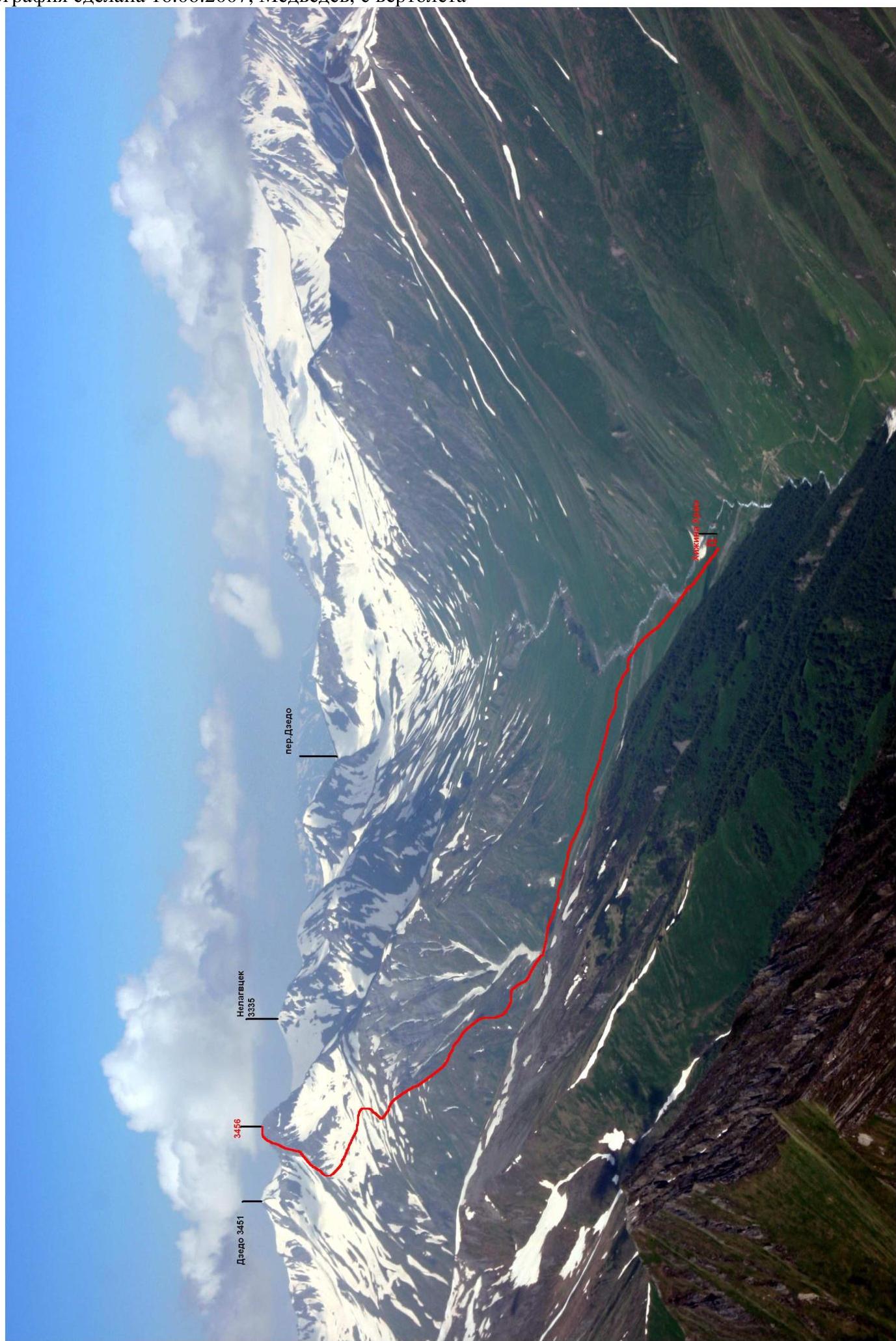
Pik Skryabina is located in a short spur of the Main Caucasian Range between the peaks of Khalatsa and Zekkara in the upper Zrug gorge. The distance from the village of Nar to the foot of the mountain is 12 km. The Transcaucasian Highway rescue team is based in Nar. The Zrug gorge is in a border zone, so it is necessary to obtain permits in advance.
10 km from Nar, on the riverbank, there are ruins of a 10th-century temple on a hill. It is possible to spend the night in a hut near the temple. In the summer, ascents to the surrounding peaks can be made from the hut.
Ascent Details
- North Caucasus, Zrug gorge, Main Caucasian Range, classification point – 2.8.
- Name of the peak: Pik Skryabina, route: via the Northeast Ridge.
- Proposed category: 3B.
- Route type: rock.
- Route length: 830 m.
Length of the rock section: 330 m. Average slope: main part of the route — 50°, entire route — 40°.
-
Pitons left on the route: total 5; including bolted pitons — Pitons used on the route:
- Rock pitons: 12 (including aid climbing – 1)
- Protection gear: 8 (including aid climbing – 0)
-
Team's total climbing time: 7 hours, 1 day.
-
Leader: Ryzhanov Oleg Nikolaevich, Candidate Master of Sports Team members: Pavlovich A. – II, Begizov T – III, Kegeev T – III.
-
Coach: Ryzhanov O.N.
-
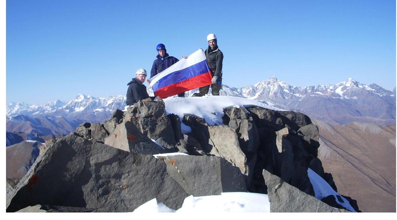
Start of the route: 8:00, November 2, 2008. Summit reached: 14:00, November 2, 2008. Return to base camp: 17:00, November 2, 2008.
General Photo
The photograph was taken on October 10, 2007, by Tavaseev R., taken from a helicopter
Panoramic Photo of the Area
The photograph was taken on June 16, 2007, by Medvedev, from a helicopter
Approach
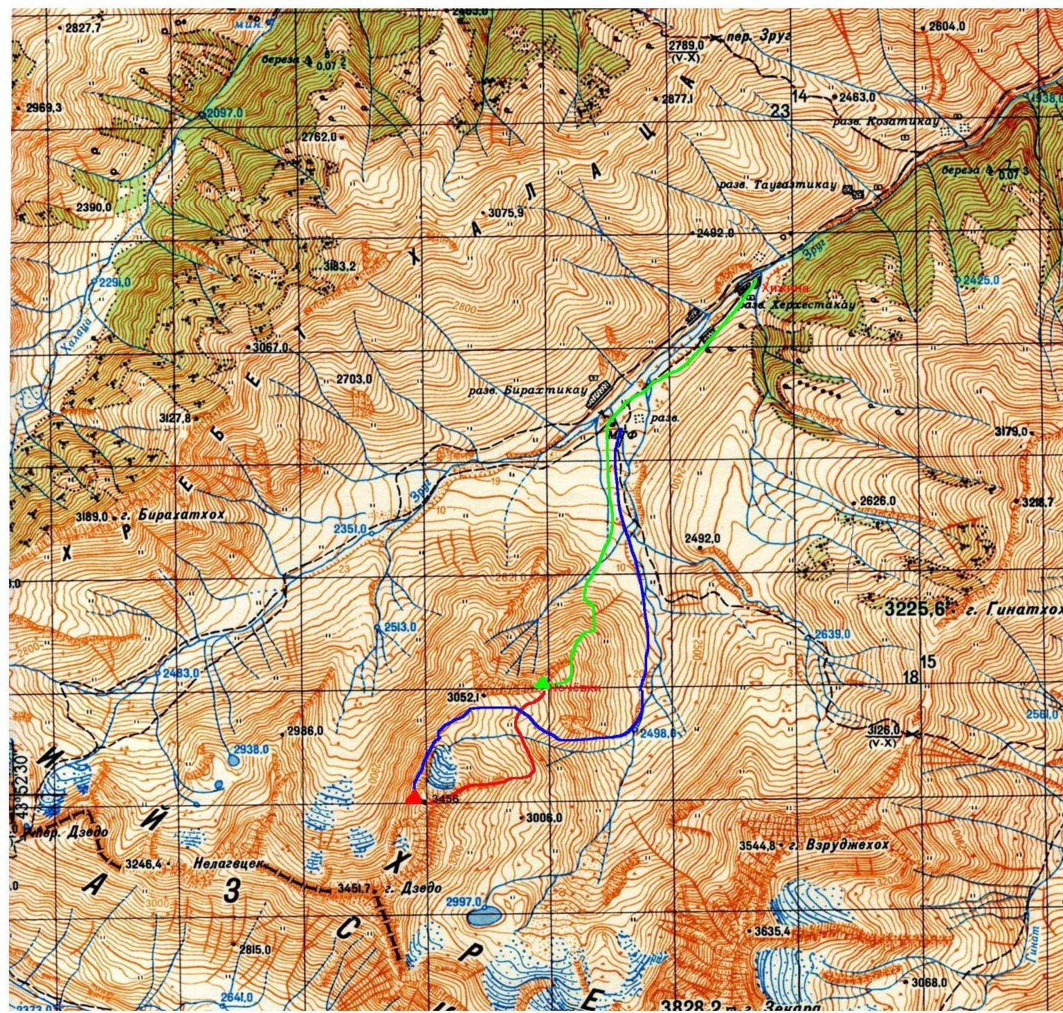
The route is marked in red, the approach in green, and Glazov's route (2A) in blue. Since we climbed the mountain in early November with a short daylight period, we spent the night directly below the route in the northern cirque of the mountain. Pik Skryabina is located in a spur that divides the Zrug gorge into two branches in its upper part.
From Vladikavkaz to Nar — 100 km, accessible by bus going to Tskhinval. In the Nar area, descend into the floodplain of the Ardon River, walk along the river to a small church. There, turn and walk along the Zrug River, which flows into the Ardon River from the left. You can get advice from the Transcaucasian Highway rescue team (Nar village).
From the hut near the temple, walk along the old abandoned road to a stream that flows in from the left, cross the stream, and walk along it to the beginning of a grassy ridge. Ascend the ridge to the northern cirque. Camping on the grassy areas in the cirque. From the hut to the campsite — 4 hours.
| № | Characteristics, pitons/ITO | UIAA SCHEME | Pik Skryabina | Category of difficulty, m, ° |
|---|---|---|---|---|
| R7 | 3 pitons, 2 protection gear | IV, 30 m, 65° | ||
| R6 | 2 pitons, 2 protection gear | IV, 20 m, 50° | ||
| R5 | 2 pitons | III, 40 m, 45° | ||
| R4 | 2 pitons, 1 protection gear | III, 80 m, 35° | ||
| R3 | 2 pitons, 1 protection gear | III, 50 m, 40° | ||
| R2 | 1 piton | 3rd gendarme | II, 50 m, 35° | |
| R1 | 2nd gendarme | I, 60 m, — | ||
| R0 | approach | I, 500 m, 30° |
Brief Description of the Route
R0–R1. From the campsite in the cirque, ascend the old moraine to the Northeast Ridge under the base of the 1st gendarme.
R1–R2. Then, moving along the eastern slope, bypass the first three gendarmes and ascend a scree couloir to the ridge between the 3rd and 4th gendarmes.
R2–R3. Traverse the 4th gendarme along a faint ledge and ascend an internal corner to the col behind it.
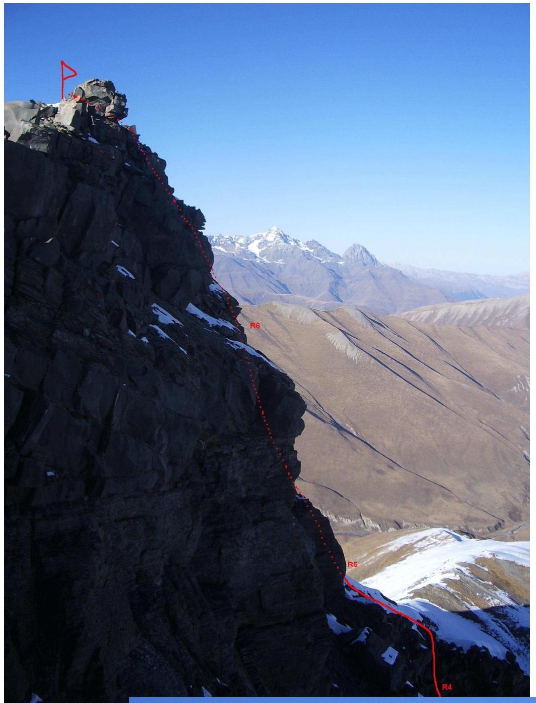
R3–R4. Moving along the ridge, approach the base of a small steep wall that leads to the pre-summit tower via broken rocks.
R4–R5. Ascend a cleft in the wall and a snowy ridge to a smooth, worn wall that transitions into a steep ledge-slab.
R5–R6. Ascend the wall and slab to a small cornice in the right part of the slab. Cross the cornice on the left side (1st aid climbing point).
R6–R7. Then, ascend steep, large-block, snowy rocks to the summit.
Descent from the Summit
Descent from the summit via the ascent route. Three rappel loops are left in the upper part of the route, followed by 150 m with alternating protection.
Notes from Control Points and the Summit
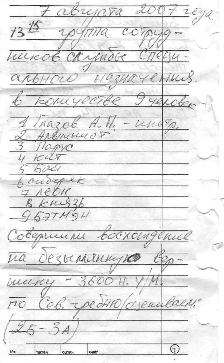
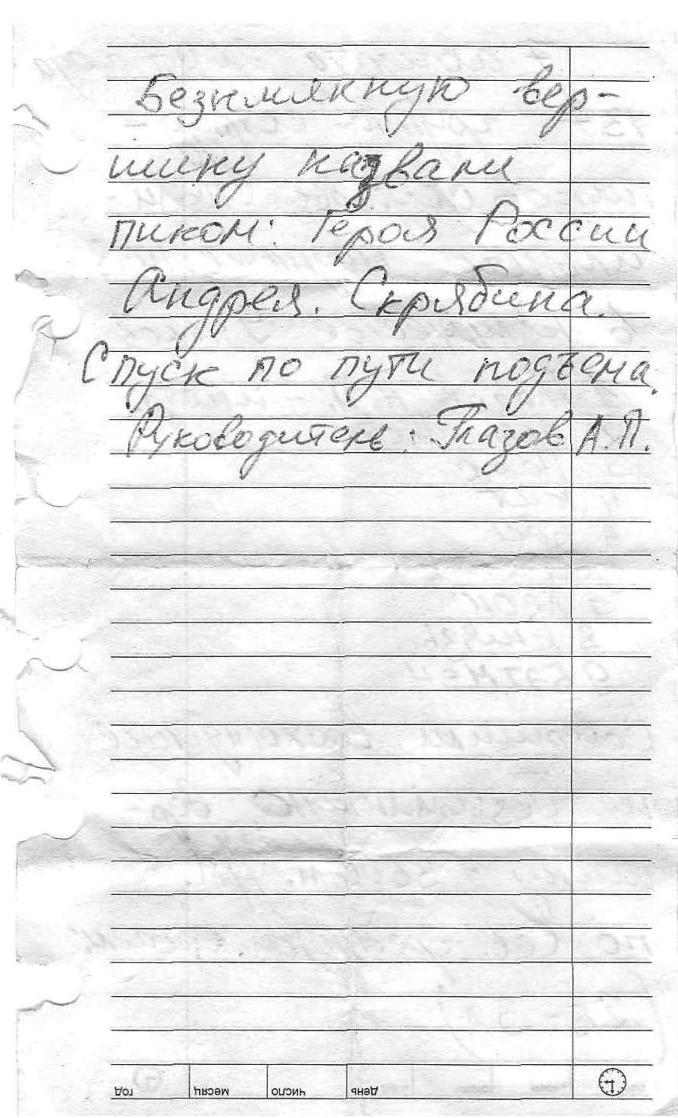
August 7, 2007. A group of special forces personnel, 9 people.
- Glazov A.P. — instructor
- Alpinist
- Parus
- Kut
- Bal
- Sibiryak
- Levk
- Knyaz
- 9677MH Completed an ascent of the unnamed peak — 3600 m. via the Soviet Ridge, rated 2B–3A. The unnamed peak was named Pik Geroya Rossii Andreya Skryabina (Peak of the Hero of Russia Andrey Skryabin). Descent via the ascent route. Leader: Glazov A.P.
Photo Illustration of the Route
Photographs taken on November 2, 2008, by Ryzhanov O.

- Section R1–R2
- R2–R3
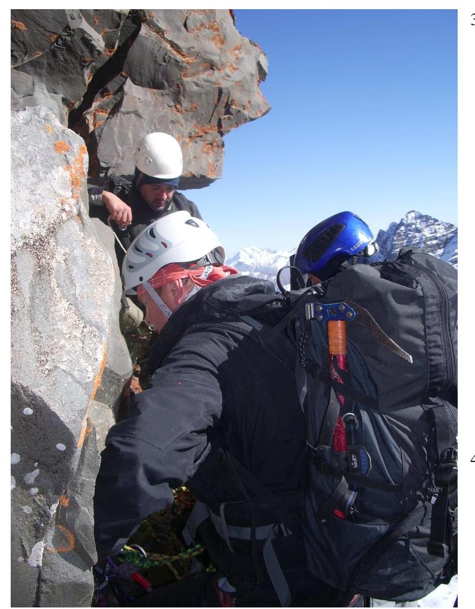
- R3–R4. Belay station
- R4–R5.
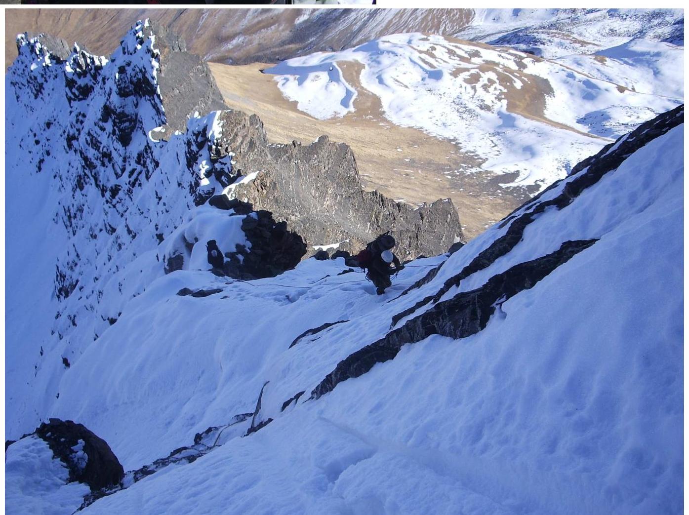
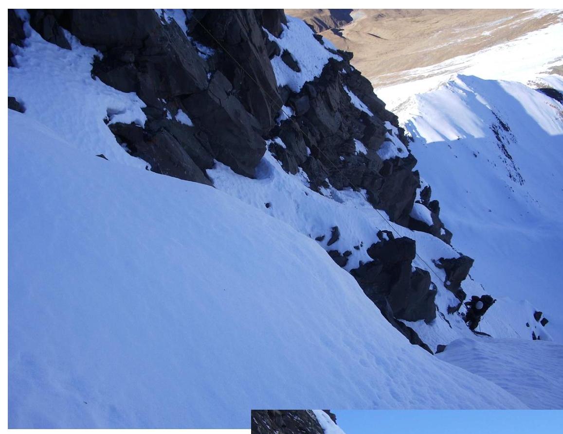
- Beginning of section R5–R6.

- Profile of the pre-summit tower.
- Photo from the summit
Comments
Sign in to leave a comment