
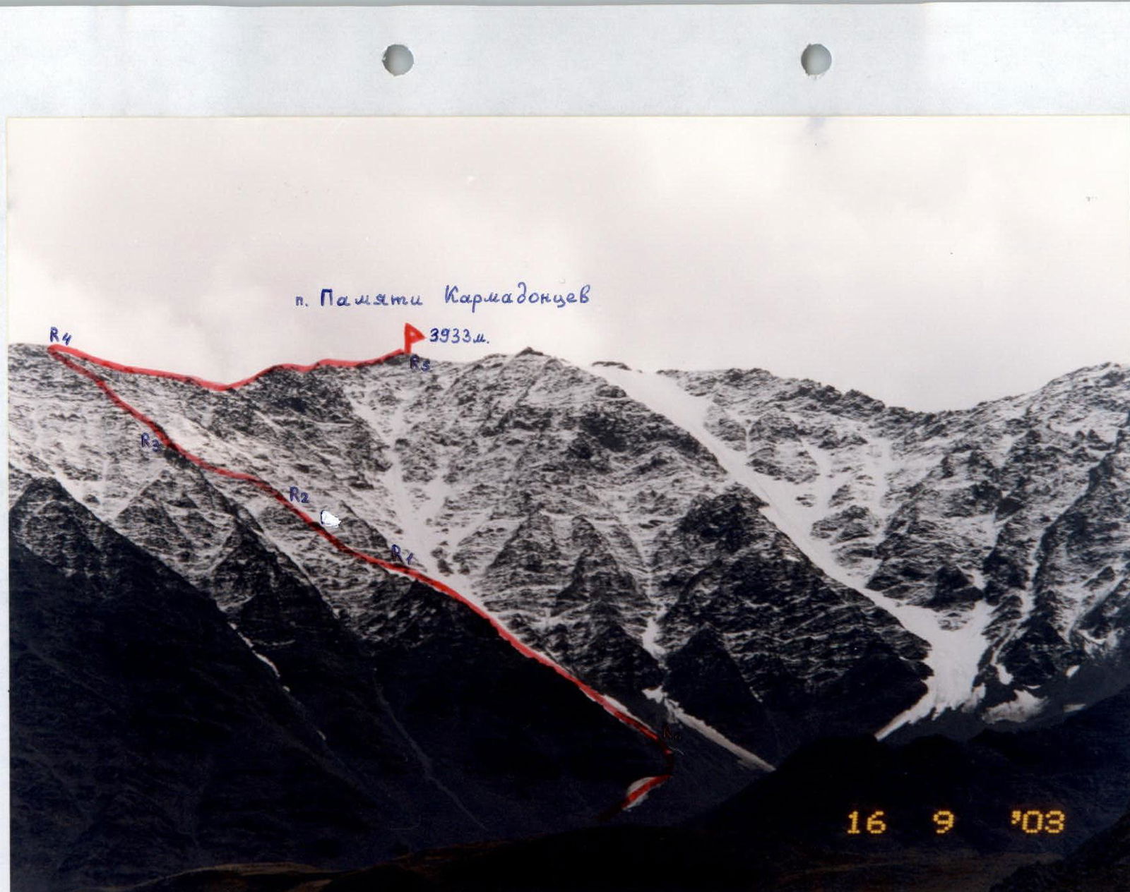
Photo 1. General view of peak 3933 m (“Pamyati Karmadontsev”). The first ascent route is marked. Photo taken from the middle part of the Kauridon gorge.
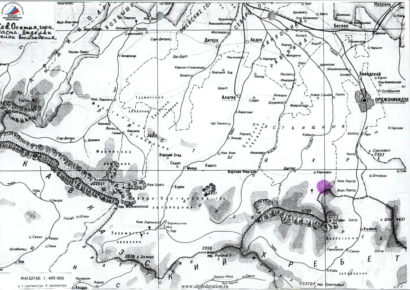
MACLUTAE 1:400000
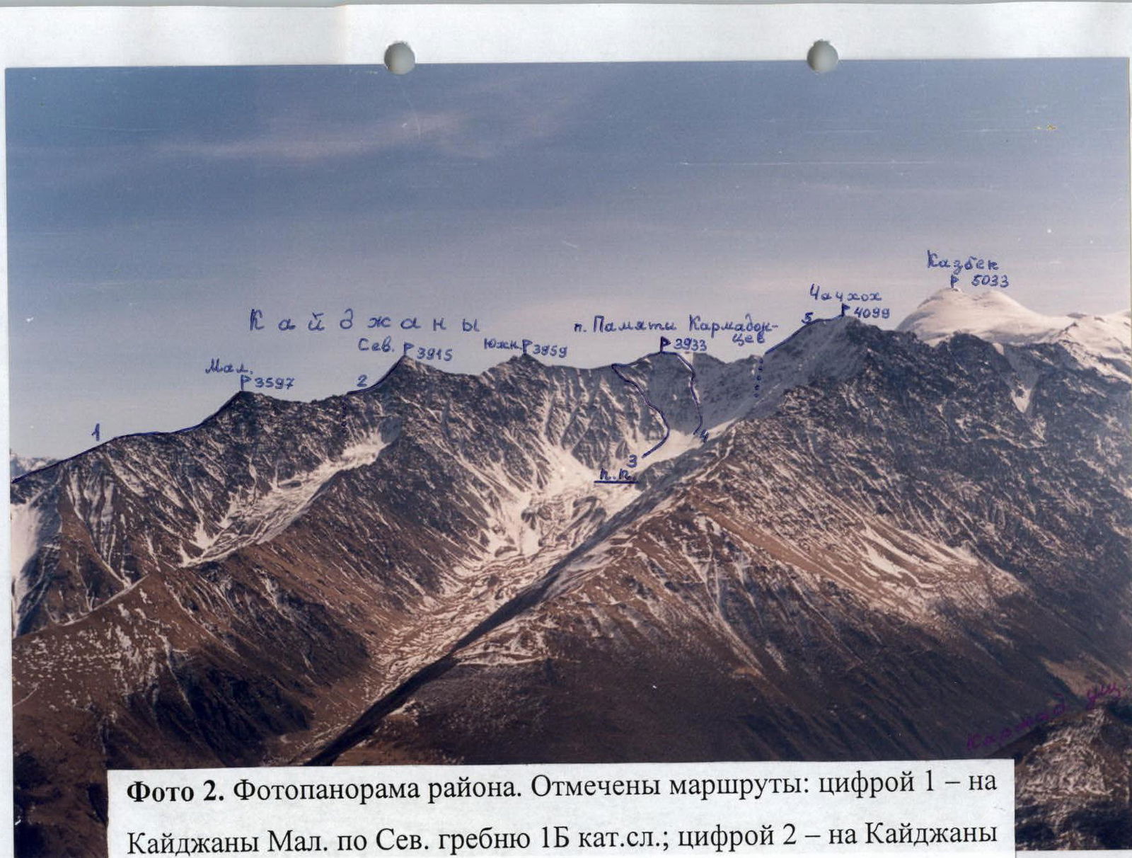
Photo 2. Panoramic view of the area. Routes marked:
- number 1 – to Kaydzhany Mal. via North ridge, category 1B;
- number 2 – to Kaydzhany Severnaya via North ridge, category 2A;
- number 3 – first ascent route to peak 3933 m (“Pamyati Karmadontsev”). Also marked:
- number 4 – to peak 3933 m via North edge – category 3A;
- number 5 – to Chachkhokh via East ridge – category 2B.
Brief Overview of the Climbing Area
The area where the ascent took place is located in the Republic of North Ossetia – Alania, 10 km north of Kazbek (5033 m), situated in the Lateral Range. A ridge branches off to the north from Kazbek, serving as the border between Russia and Georgia. From Chachkhokh peak (4099 m), the ridge turns east and continues through peak 3933 m and Kaydzhany Yuzhnaya (3959 m) to Kaydzhany Severnaya (3915 m). Here, from this peak, the ridge branches into four spurs descending into the gorges of the following rivers:
- Genaldon – to the north,
- Terek – to the east.
On the segment between Chachkhokh – peak 3933 m – Kaydzhany Yuzhnaya, the North ridge serves not only as a border but also as a watershed between the rivers:
- Kauridon – to the north (Genaldon basin),
- Amalidon – to the south (Terek basin).
An ascent to peak 3933 m from the north, from the Kauridon gorge, was made in August 1965 by T. Khakurinov and V. Kuprin. This is now classified as a category 3A route via the North edge (clause 2.8.68). However, the Classification incorrectly lists the peak's height as 3850 m. The correct height is 3933 m – see the topographic map. No notes from the first ascenders were found on the summit.
In September, coinciding with the anniversary of the Kolka glacier collapse in September 2002 and the loss of 126 lives, the Alpinism Federation of North Ossetia decided to petition for peak 3933 m to be named “Pamyati Karmadontsev” by completing an ascent via a new route. Currently, the Government of North Ossetia is preparing documents to be sent to the GU GK for the official naming of the peak.
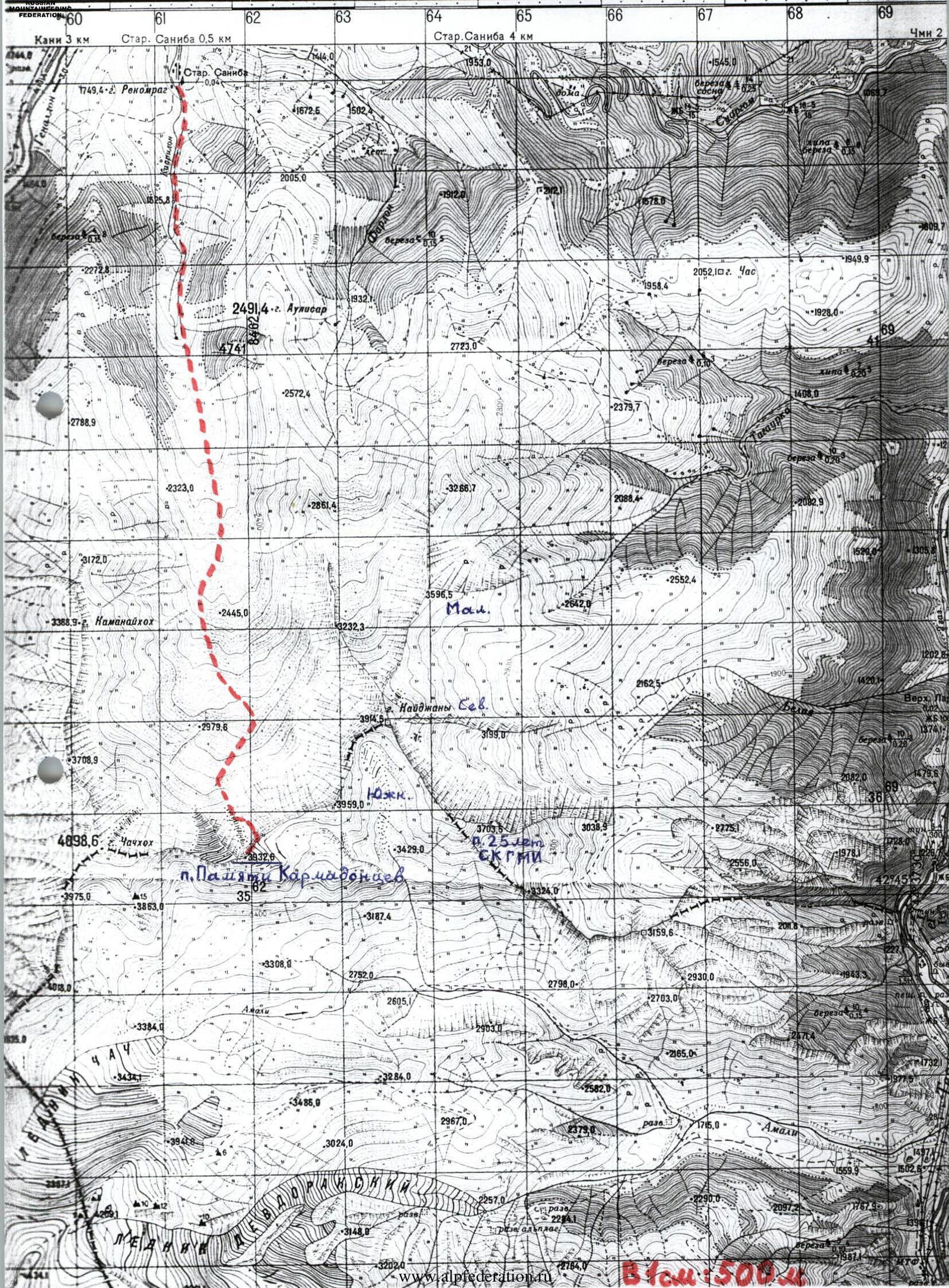
Photo 3. View of the Kaydzhany Yuzhnaya – Chachkhokh ridge from the Northwest. January, taken from a helicopter. The first ascent route to peak 3933 m (“Pamyati Karmadontsev”) is marked.

Diagram. Route schematic. VIEW FROM THE NORTH.
Description of the Approach to the Route
After the Kolka glacier collapse in 2002, the passage through the Genaldon gorge was destroyed. Travelers need to go from Vladikavkaz along the Military Georgian Road to the village of Chmi. From there, via the Saniban pass (1910 m) and the border post, descend to the village of Gornaya Saniba (1300 m). After passing through the village, continue on foot up the Kauridon river gorge.
Ahead, the ridge closing the gorge is visible: Kaydzhany Yuzhnaya – peak 3933 m (“Pamyati Karmadontsev”) – Chachkhokh. Peak 3933 m is located in the center of this ridge. One must ascend via the trails above the river on the left (in the direction of travel) side of the gorge.
After the river disappears at a height of about 1900 m, cross the meadows to the center of the gorge. If you move towards the right side, at a height of 2300 m, under the slope in a hollow, you can spend the night in a hunter's hut (5–6 people).
Water in the second half of summer:
- is available in the river below,
- or by going up to the right from the gorge bottom to the last forested counterforts (water is available there – 10–15 minutes from the hut).
There is no water higher up in the second half of summer!
Further from the hut, move up and to the left through a steep, grassy moraine ascent. Bypass the rocky counterfort descending from the North ridge of Chachkhokh on the left via the moraines. Upon reaching the covered glacier, head towards the visible peak 3933 m. To the left of the North edge of the peak, a long snowy couloir runs, which is icy in its upper part. The goal is to reach its base; approach it via the scree (height 3200 m).
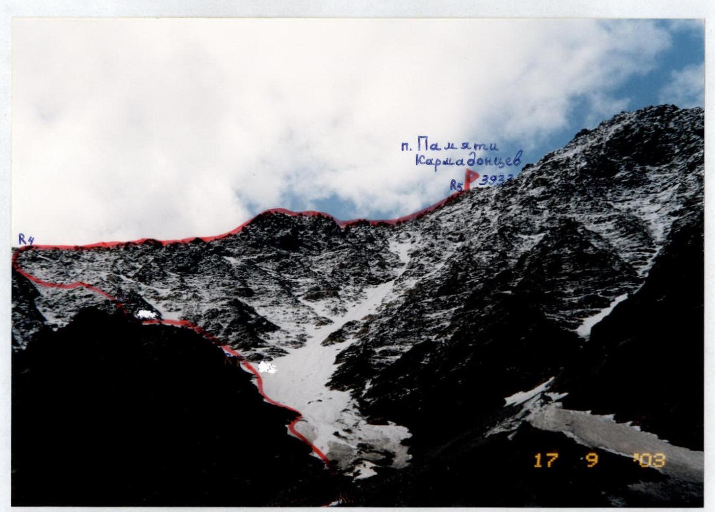
Photo 4. View of the first ascent route from the Kaur glacier. The team's path is marked.
Description of the Route Ascent
To the left of the North edge, which is wide and rhomboid in its lower part, begins a snowy couloir. Approach it via the surface moraine of the Kaur glacier.
R0–R1:
- Ascend directly up the left part of the snowy couloir until it branches off to the right and left.
- There may be ice under the snow – crampons are necessary!
- Rockfall is possible from above!
- Section difficulty is 1–2 category; slope 20–30°.
- The length is about 500 m.
R1–R2:
- At the point where the couloir branches, turn left and exit onto the rocky-scree counterfort of the left side of the couloir.
- Ascend directly up this counterfort, category 1–2.
- Pass the Black gendarme wall on its right side (5 m, category 4).
- Further complex sections on the counterfort are bypassed on the right via rocks, category 2.
- Above, exit onto a scree shoulder before a wide wall with ledges.
- Traverse the wall via ledges on the left and continue directly up to the easing slope (category 2–3).
- The entire section is about 300 m; slope 20–50°.
R2–R3:
- From the easing slope, start moving left via rocks towards a shoulder on a neighboring counterfort.
- Approach a narrow couloir-gutter via ledges, category 2.
- Cross the couloir (snow, ice), and move left onto a shoulder – rockfall is possible from above via the couloir!
- The entire section is about 400 m; slope 20–40°; category 1–2.
R3–R4:
- From the shoulder, ascend directly up the counterfort.
- Overcome the first wall head-on (category 4; 5 m).
- Continue directly along the counterfort ridge or bypass complex sections on the right, exiting onto the Northeast ridge of peak 3933 m.
- The entire section is about 400 m; category 2–4; slope 20–40°.
R4–R5:
- On the Northeast ridge, turn right.
- Bypass complex sections via southern scree slopes, ascending to peak 3933 m – “Pamyati Karmadontsev”.
- The entire section is about 400 m; category 1–2; slope 10–30°.
- From the hut, the ascent takes about 8 hours.
- The summit offers a good panoramic view of the Kazbek massif.
- No notes were found on the summit.
- Descent via the ascent route takes about 4 hours to the hunter's hut.
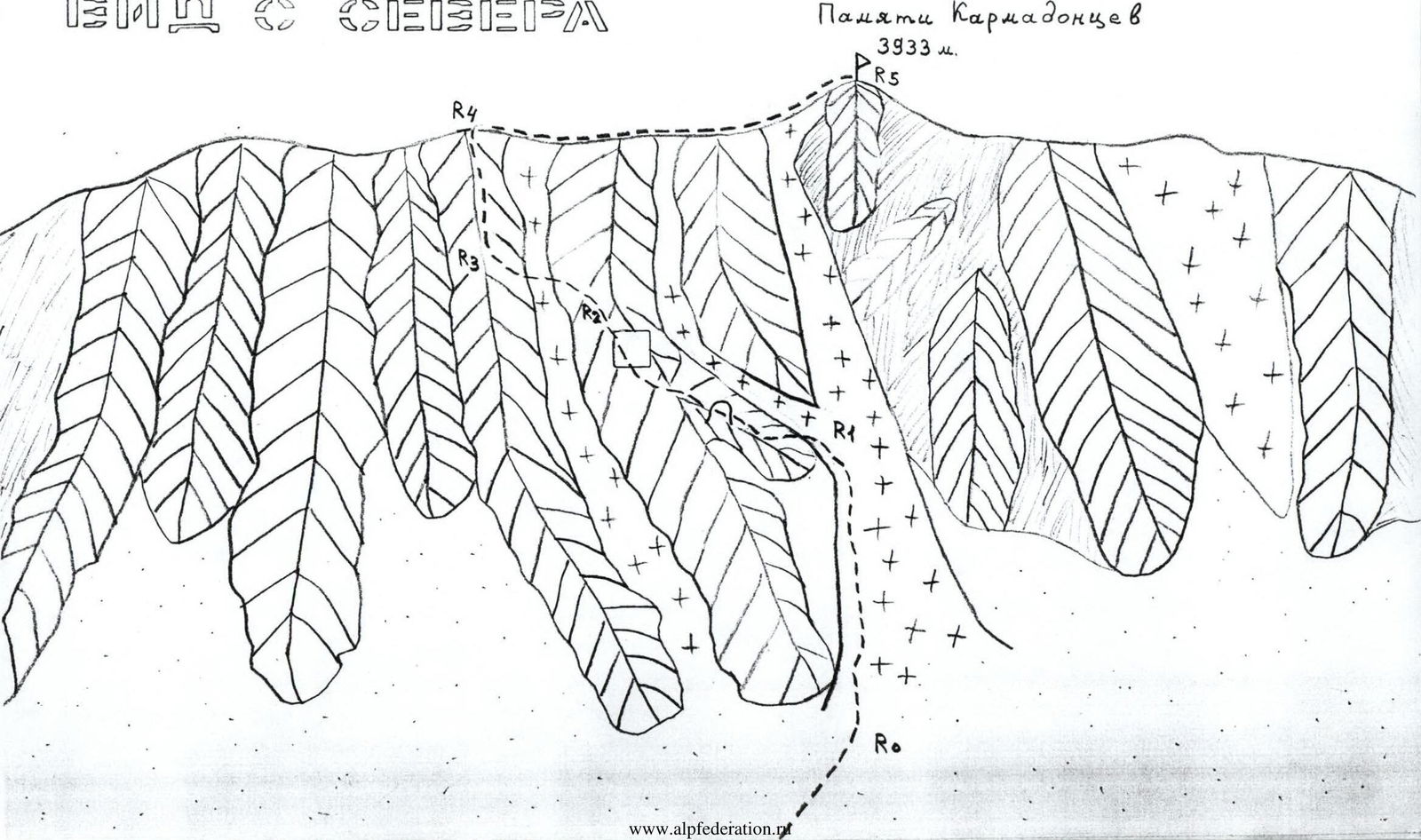
Photo 6. Passage of the end of section R1–R2. Traverse via ledges to the left, bypassing the wide wall.
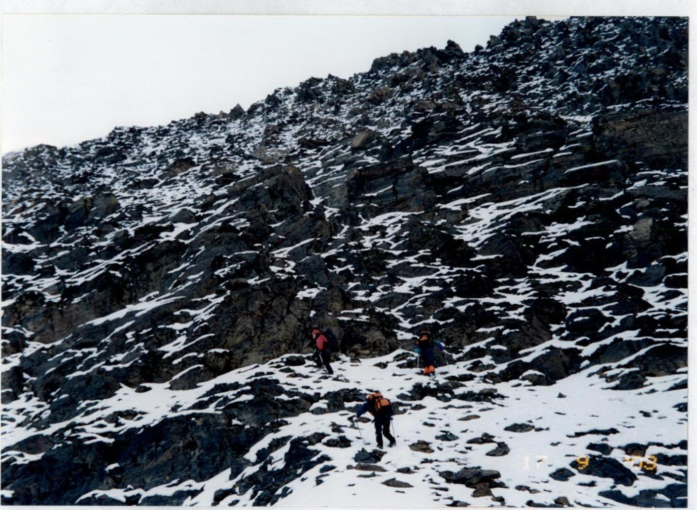
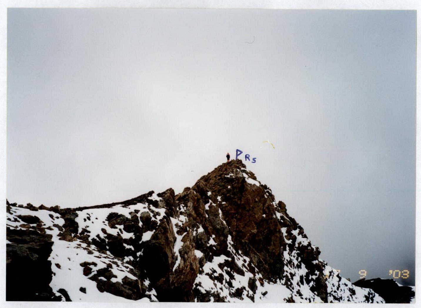
Photo 8. View from the Northeast ridge onto peak 3933 m (“Pamyati Karmadontsev”).
Conclusions and Recommendations for the Route
The route to peak “Pamyati Karmadontsev” via the Northwest counterforts of the Northeast ridge corresponds to category 2A. It can be recommended for ascent by training and sports groups.
Water in the second half of summer:
- is available in the lower part of the gorge (in the river up to 1900 m);
- ice is available higher up – above 3000 m.
The route is not straightforward for navigation; therefore, it should be studied thoroughly from the approaches or via photographs. Crampons may be necessary when moving through couloirs. The lower couloir should be traversed early in the morning – rockfall is possible! The rocks on the route are fragile – schist. Protection is via protrusions and pitons. The route ascended can serve as a descent route from peak 3933 m.
To visit the Kauridon river gorge, a border zone permit is required, obtainable from the border guard unit in the village of Verkhny Redant.
Comments
Sign in to leave a comment