Report
on the first ascent of the Southern tower of the Mirrotvorcev Peak, 3411 m via the Southern ridge.
Approximately — category 2B. Completed by a group of climbers from the Mountain Sports Federation of the Republic of South Ossetia on July 14, 2012, led by Tedeev Tamerlan Taimurazovich. The ascent is dedicated to:
- the 20th anniversary of the introduction of Peacekeeping Forces
- that stopped the war on the territory of the Republic of South Ossetia.
Address: Republic of South Ossetia, Tskhinval, A. Dzhioev Avenue, 114, Tedeev_t@mail.ru +79284848861
Ascent Passport
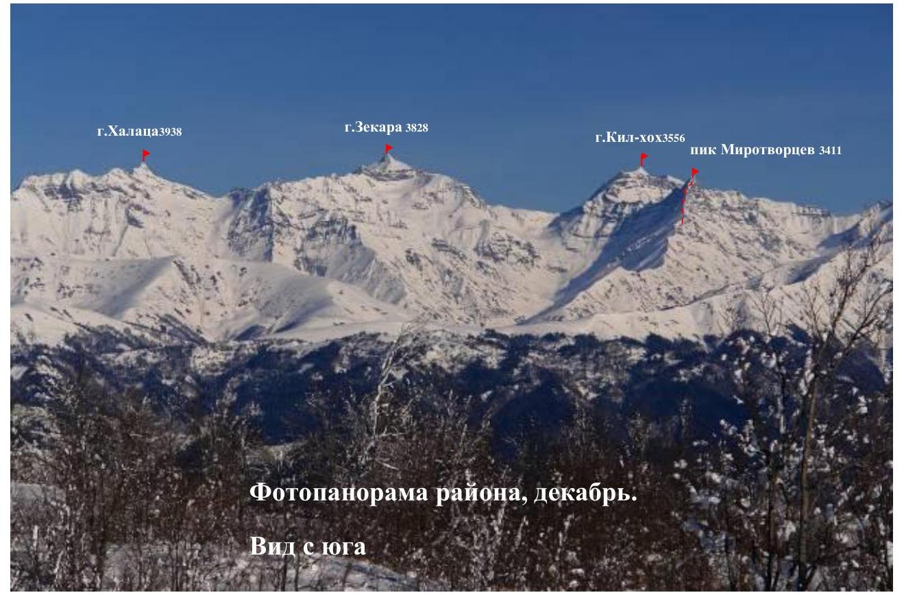
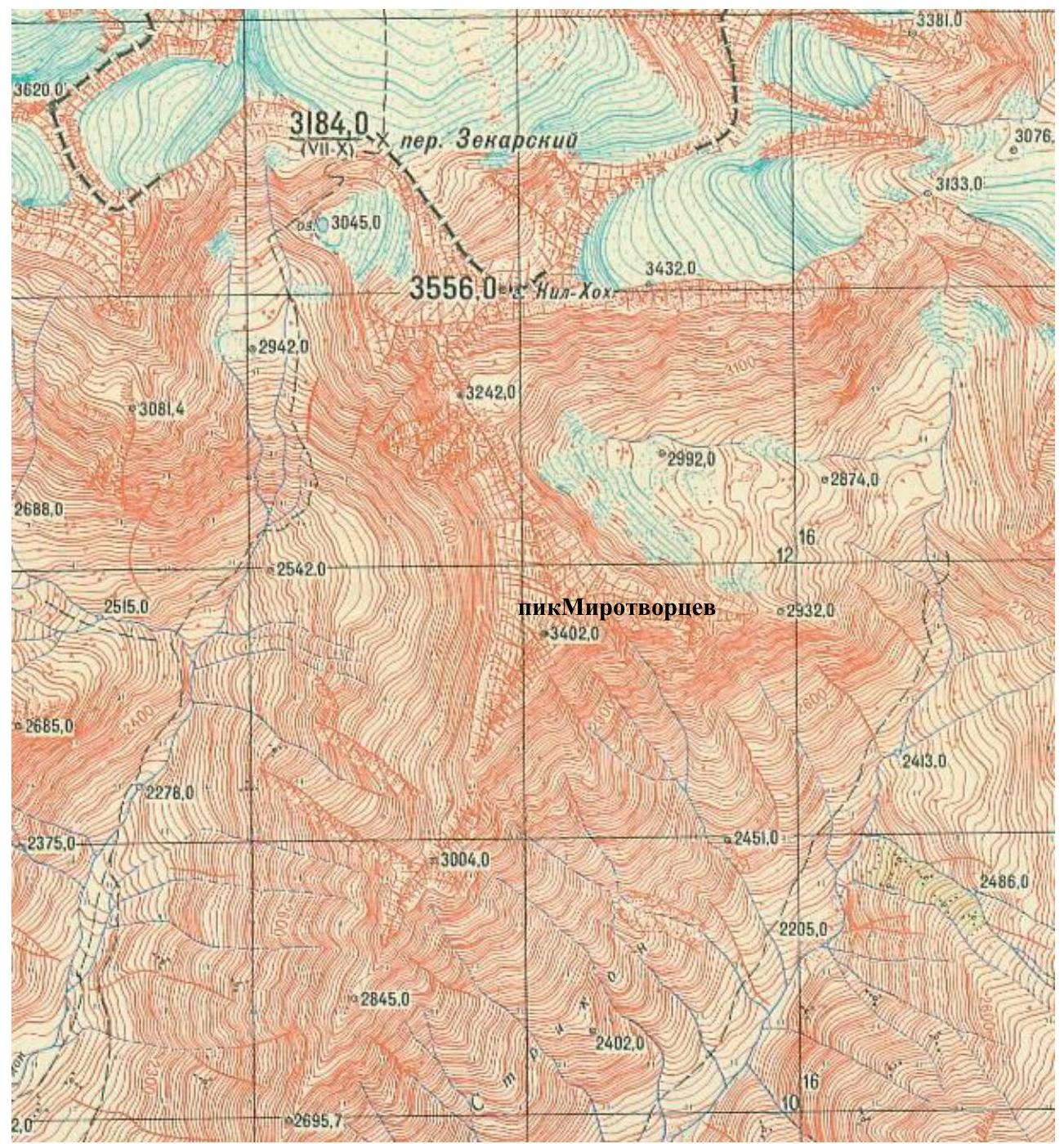
- Caucasus, section number in the classifier 2.8:, upper reaches of the Cheselt-don river south of the Main Caucasian Ridge, between the Zekara-don gorge to the west and the Strikom gorge to the east
- Southern tower of the Mirrotvorcev Peak (3411 m), Southern tower via the Southern ridge.
- Assumed category 2B, first ascent.
- Route type — rocky.
- Height difference of the route — about 280 m Route length — about 335 m Length of sections: category 2 — 130 m, category 3 — 115 m, average steepness of the main part of the route — 60°
- Used cams — 12, "friends" — 8
- Number of climbing hours / days: 11 / 1
- Number of nights: 1 — at a bivouac
- Leader: Tedeev T. — 2nd sports category Participants: Pukhaev A. — 2nd sports category, Tedeev A. — 3rd sports category.
- Coach: Tedeev Tamerlan Taimurazovich
- Departure to the route: July 14, 2012, 05:00 Moscow time Return to the bivouac: July 14, 2012, 16:00 Moscow time
- Organized by: Mountain Sports Federation of the Republic of South Ossetia. Leader — Tedeev Tamerlan Taimurazovich
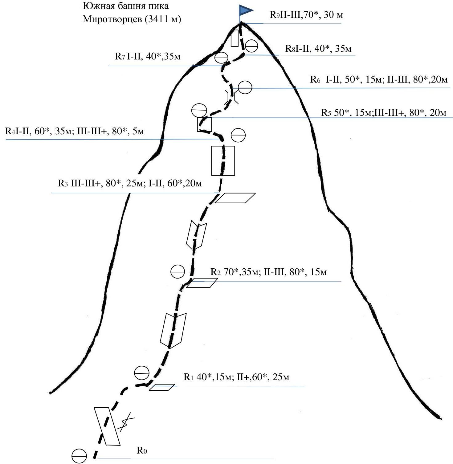
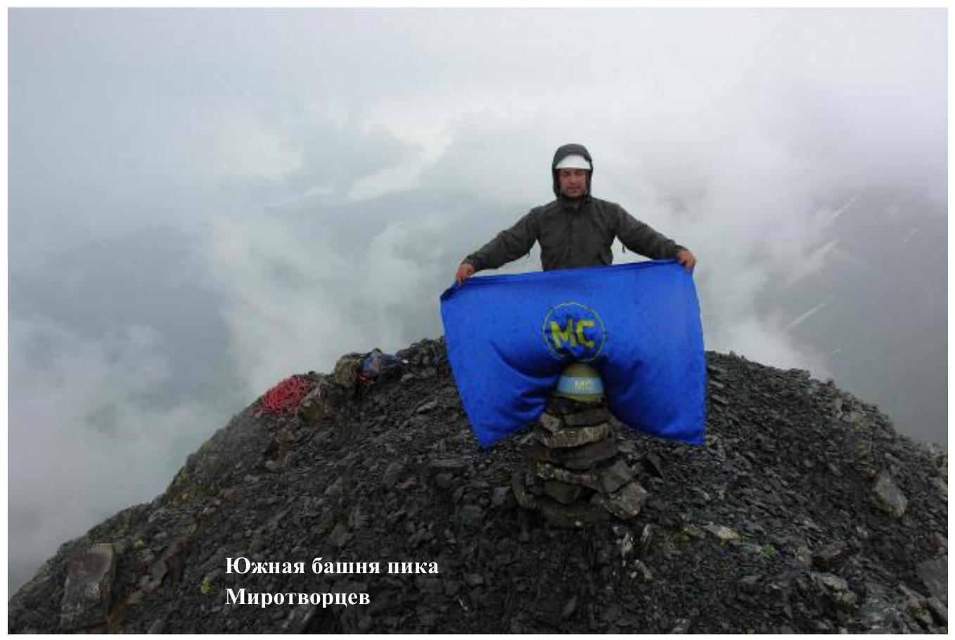
Southern tower of the Mirrotvorcev Peak 3411
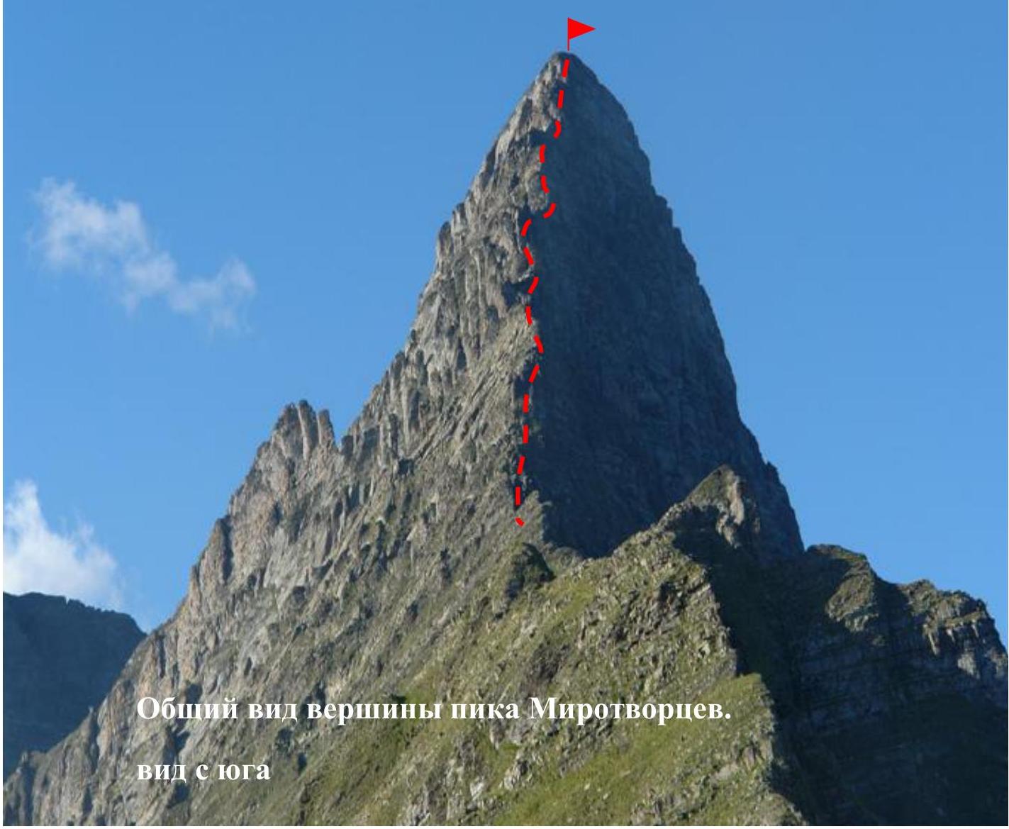
The first ascent route is marked in red
The first ascent route is marked in red
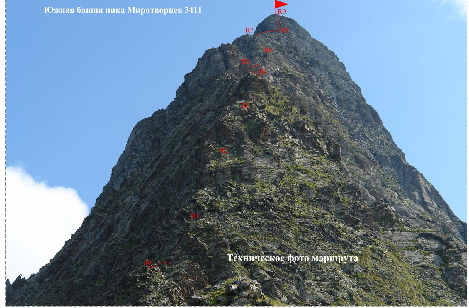
Route Characteristics by Sections
| Section # | Steepness, ° | Length, m | Terrain characteristics | Difficulty category | Belay |
|---|---|---|---|---|---|
| R0–R1 | 30–40 | 15 | Rocky ridge | ---- | Movement with alternating belay using cams for belay |
| 50–60 | 25 | Steep, inclined shelf | 2 | ||
| R1–R2 | 70 | 35 | Rocky ridge | ---- | |
| 75–80 | 15 | Internal corner | 2–3 | ||
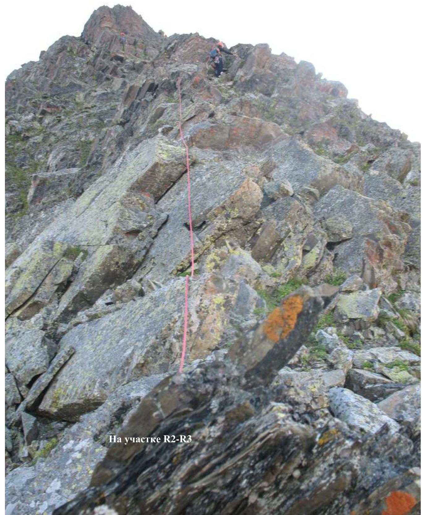
| R2–R3 | 80 | 25 | Internal corner | 3 | |
| 50–60 | 20 | Rocky ridge | 1–2 | ||
| R3–R4 | 50–60 | 35 | Simple rocks | 1–2 | |
| 80 | 5 | Rocky wall | 3 | ||
| R4–R5 | 40–50 | 15 | Rocky ridge | ---- | |
| 80 | 10 | Rocky wall | 3 | ||
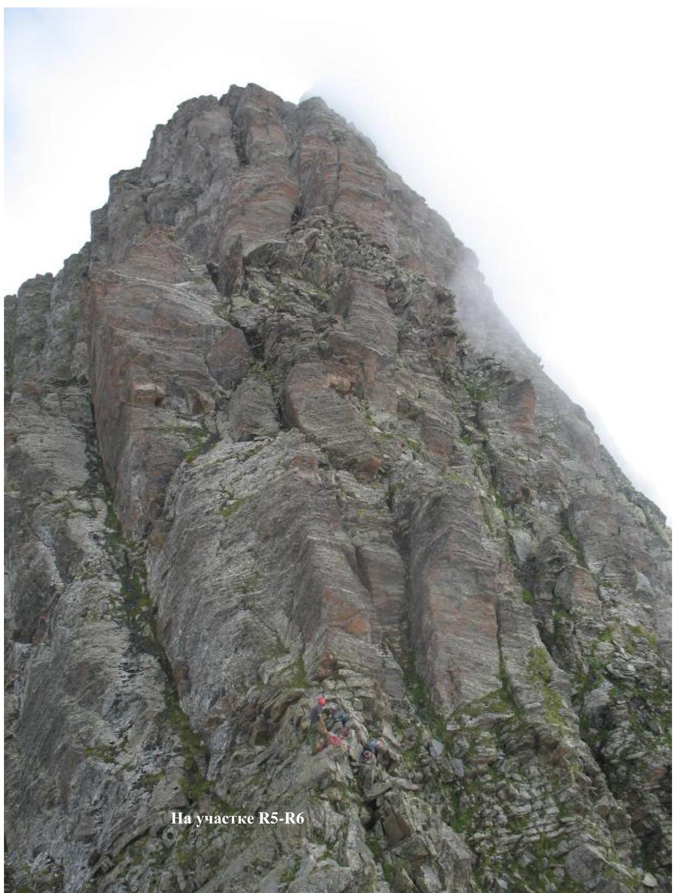
| R5–R6 | 40–50 | 15 | Simple shelves | 1–2 | |
| 70–80 | 20 | Chimney | 2–3 | ||
| R6–R7 | 50–60 | 35 | Rocky ridge | 1–2 | |
| R7–R8 | 40 | 35 | Gentle rocky ridge | ---- | |
| R8–R9 | 70 | 30 | Wall, exit to the summit | 2–3 |
Southern tower of the Mirrotvorcev Peak 3411 m
Description of Approaches to the Route
From the city of Tskhinval to the village of Duodonastau in the Cheselt gorge, it takes about 2 hours by car. From the village of Duodonastau, a ridge begins, leading towards the Main Caucasian Ridge through a nameless peak, named on July 14, 2012, Mirrotvorcev Peak. The direction of movement is north. The ridge is mostly grassy with rocky outcrops. At an altitude of 2844 m, three gendarmes from the start of the route, there is a small area for a tent. Further along the ridge, there are no convenient places for a tent. From the bivouac, the mountain and the route are visible. There is no water on the approaches and on the route!!!
From the village of Duodonastau to the bivouac 6–8 hours.
Before the village of Duodonastau, you need to cross the Keshelta river. The river is quite turbulent, and only an SUV can cross it. If there is no such car, there is a pedestrian bridge. In this case, the approaches increase by 40 minutes to 1 hour.
Description of the Ascent Route
Section R0–R1: After the last, small gendarme on the ridge, from the saddle, the technical part of the route begins. You need to move first along simple rocks 30–40°, 15 m. Then you need to go around the vertical crack from the left along the shelf and go slightly to the right 50–60°, 25 m, category 2. We come out onto a shelf. Here we organize a belay station using:
- cams,
- friends,
- a belay loop.
Section R1–R2: From the station, we ascend along simple rocks of the ridge 70°, 35 m. Further along the internal corner, we exit onto a shelf. Along the shelf, we move to the right — 75–80°, 15 m, category 2–3. On the shelf, we organize a belay station.
Section R2–R3:
- Along the internal corner, partially overgrown with grass and moss, we ascend to a ledge 80°, 25 m, category 3.
- Further along the destroyed rocks, we move to the right and upwards — 50–60°, 20 m, category 1–2.
- We exit onto a shelf. Here is a belay station.
Section R3–R4: along simple rocks 50–60°, 35 m, category 1–2, overgrown with grass and moss, we ascend under the wall 80°, 5 m, category 3. Above the wall, there is a convenient place for a belay station.
Section R4–R5: along a gentle ridge 40–50°, 15 m, we move to the left under the wall 80°, 10 m, category 3. Above the wall, there is a shelf — a convenient place for a belay station.
Section R5–R6: from the shelf, we ascend to the right and upwards along simple rocks overgrown with grass and moss 40–50°, 15 m, category 1–2, under a chimney 70–80°, 20 m, category 2–3. Above the chimney, there is a convenient place for a belay station.
Section R6–R7: from the station, we ascend along a simple ridge to a small shelf 50–60°, 35 m, category 1–2. Belay station.
Section R7–R8: after the station, along the ridge, we move to the right under the summit tower 40°, 35 m.
Section R8–R9: along steep, monolithic rocks, we ascend to the summit, bypassing the monolithic wall to the right 70°, 30 m, category 2–3.
Descent is via the ascent route. Two rappel rings were left on the descent.
Conclusions and Recommendations
The height difference from the village of Duodonastau to the bivouac is 1104 m. From the bivouac to the start of the route is 287 m. From the bivouac to the summit is 567 m. From the car to the summit is 1671 m. On the maps, the height of the mountain is indicated as 3402 m. The actual height, taking into account GPS data, is 3411 m.
Village Duodonastau — 1740 m, Bivouac — 2844 m, Start of the route — 3131 m, Summit — 3411 m.
The route along the Southern ridge is logical, potentially safe, and is recommended for strong training groups due to its remoteness and length.
The ridge is mostly destroyed — in some places, belaying to outcrops is problematic due to the possibility of breaking them off.
There are cracks on the route suitable for using cams such as "friends", cams, and anchor pitons — it is desirable to have one set of each. You can also use belay loops.
The sections are predominantly more than 40 m, so 50 m ropes are necessary. On the ridge, use belay to outcrops. Rappel rings will be needed.
According to the difficulty and length of the key sections, the complexity of the route corresponds to a classic category 2B–3A route.
Comparing the route taken with already completed and classified routes, we recommend classifying the route along the Southern ridge of the Southern tower of the Mirrotvorcev Peak as a category 2B route. Southern tower of the Mirrotvorcev Peak (3411 m)
On section R2–R3
On section R2–R4
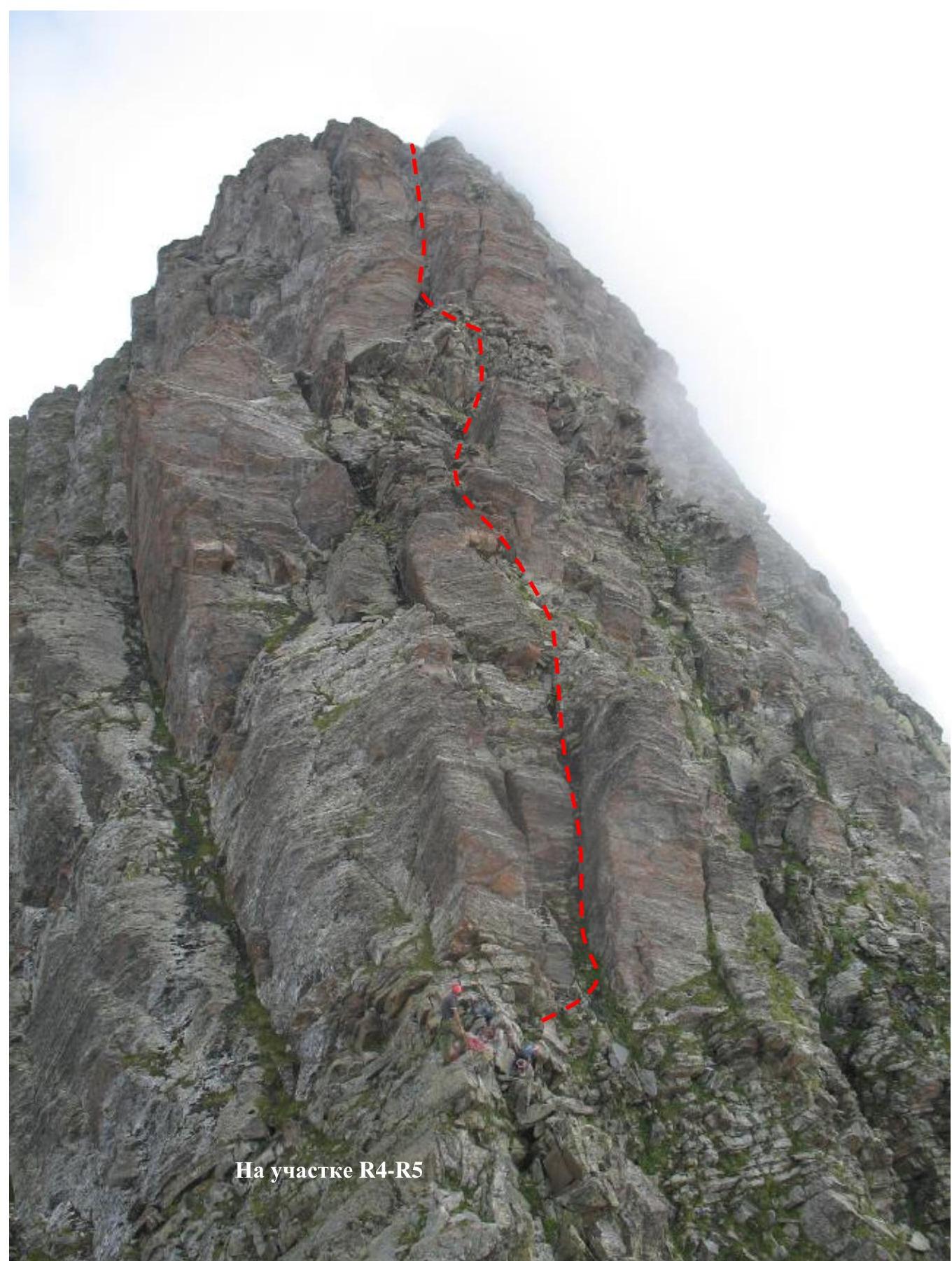
On section R4–R5
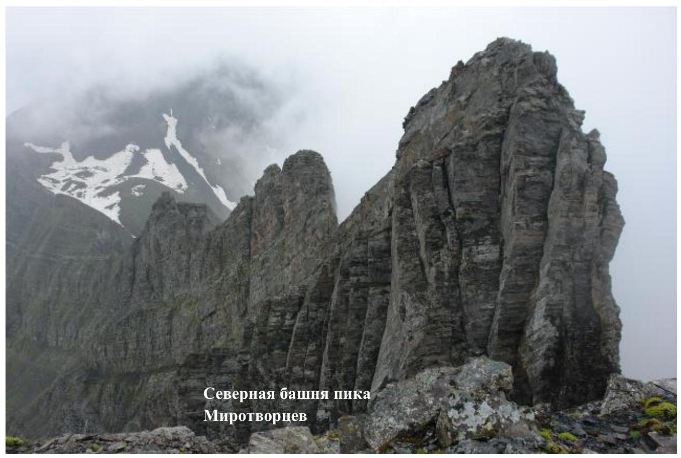
Northern tower of the Mirrotvorcev Peak