Severnye Kaidzhany (3969 m)
(Peak of the Kazbek high-mountain region)
The summit is located on the north-eastern spur of Peak Spartak (4510 m) (on the Kazbek plateau), where a number of peaks rise: Peak Ordzhonikidze (4005 m); Peak Iriston (3969 m), Chach-khokh (4098 m), Peak "3850", South Kaidzhany (3916 m), North Kaidzhany (3969 m) and Peak 25th anniversary of SKGMI (3865 m).
From the city of Ordzhonikidze, the pointed peaks of Kaidzhany are clearly visible against the backdrop of Kazbek's snowy cap. Since 1947, the summit has been repeatedly visited by climbers from Ordzhonikidze. The most popular routes are from the south from the Chach gorge and along the North ridge.
Description of the ascent route to North Kaidzhany from the south 1B – P-A cat. difficulty.
Day 1. From the city of Ordzhonikidze, they drive for 1 hour to the village of Gvileti, from where they ascend along a wide pack trail to the confluence of the Amali and Chach-khi rivers (1 hour walk).
After crossing the rickety bridge over the Amali River and overcoming the steep ascent of the trail, they turn right into the Chach gorge along the trail. The trail crosses to the left (orographic) bank of the Chach-khi River, where it is poorly defined. Gradually climbing higher up the slope, they reach the "sheep's foreheads".
Having overcome the "sheep's foreheads" along one of the shelves dividing them, they need to move up the grassy slope under the rocks, where the trail is well-trodden. Moving along the rocks, they reach the shoulder forming the 1st "gates" of the gorge.
From the confluence of the rivers to the pass point of the first "gates" is 1 hour 30 minutes walk. The "sheep's foreheads" are passed with caution, with gymnastic belay.
Along the trail, traversing grassy slopes and a number of scree couloirs, they reach the second "gates" in 50 minutes, which are a rocky defile in the river floodplain.
They descend to the "gates" along the scree. The "gates" can be passed:
- along the left (orographic) slope of the gorge
- by climbing directly in the defile near the river
On the right (orographic) bank of the river, before the second "gates", there is a convenient terrace where they can organize an overnight stay.
It is more expedient to move further, so that in 40 minutes of walking they reach the place where the river floodplain widens in front of the third "gates", where they can organize a comfortable bivouac.
A wide trough-shaped couloir descends to this place, originating from the trough of the Kaidzhany glacier.
Day II. Departure no later than 5:00. They move up the slope, leaving the mentioned couloir on the left. After the grassy slopes, they ascend along the scree, climb onto a hill of an ancient terminal moraine and enter the glacier cirque. Along the calm glacier, in rope teams, they ascend to the saddle between South and North Kaidzhany. The pointed summit of the latter is clearly visible from the trough directly ahead.
The ridge, going to the right, leads to the summit of North Kaidzhany. The ridge is uncomplicated; snowy and firn sections alternate with small rocky ascents, which are overcome with mutual belay.
The summit is a rocky tower formed by the junction of three slate ridges. From the trough of the Kaidzhany glacier, from the south, the summit can be ascended by reaching the south-eastern ridge of North Kaidzhany. Both paths have the same difficulty.
Ascent time: from the gorge to the summit is about 4-5 hours of work.
Descent is made along the ascent route and takes up to 2-2.5 hours to the bivouac.
Further descent:
- Through the gorge - 2-2.5 hours.
- On the same day, from the village of Gvileti (38th km), they can return to the city of Ordzhonikidze.
Equipment recommended for a group of 4 people:
- Main ropes 20 m - 2 ends
- Rock climbing hooks - 4 pcs.
- Group carabiners - 3 pcs.
- Hammer - 1 pc.
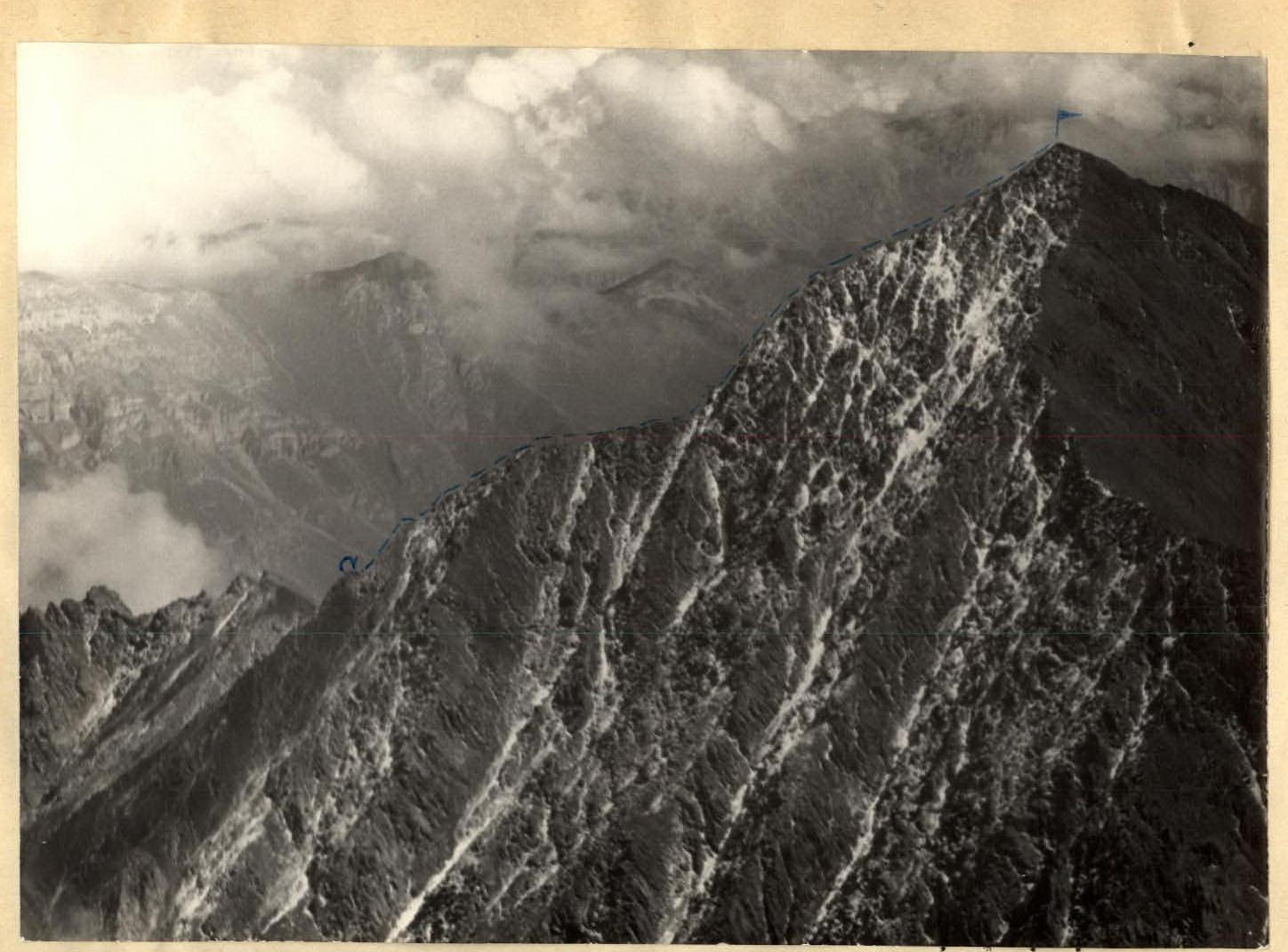
Severnye Kaidzhany. Route along the North ridge
Photo by R. Proskuryakov.