Ascent Passport
- Ascent category: rock (combined)
- Ascent area: Caucasus, 2.8, Midagrabindon River valley
- Peak, route: Donchenty (4192), E ridge
- Estimated category of difficulty: 1B rock, partially traversed
- Route characteristics: height difference — 850 m, route length — 1250 m, length of sections with category 2 difficulty — 120 m, average steepness of the main part of the route — 45°
- Pitons hammered: protection through ice axe and rock outcrops.
- Number of walking hours/days — 12/1 (7 hours).
- Number of overnight stays: 1 — on the approach.
- Leader: Levkovsky Yu.V. — Candidate Master of Sports.
Participants:
- Bogdanov S.V. — 3rd sports rank.
- Zubenko V.S. — 3rd sports rank.
- Slivko A.M. — 3rd sports rank.
- Coach: Lamitsaev K.B. — Candidate Master of Sports.
- Departure to the route: May 29, 1999. Return to the bivouac: May 29, 1999.
- Organization: KAM FA RSO-A.
Brief overview of the ascent area
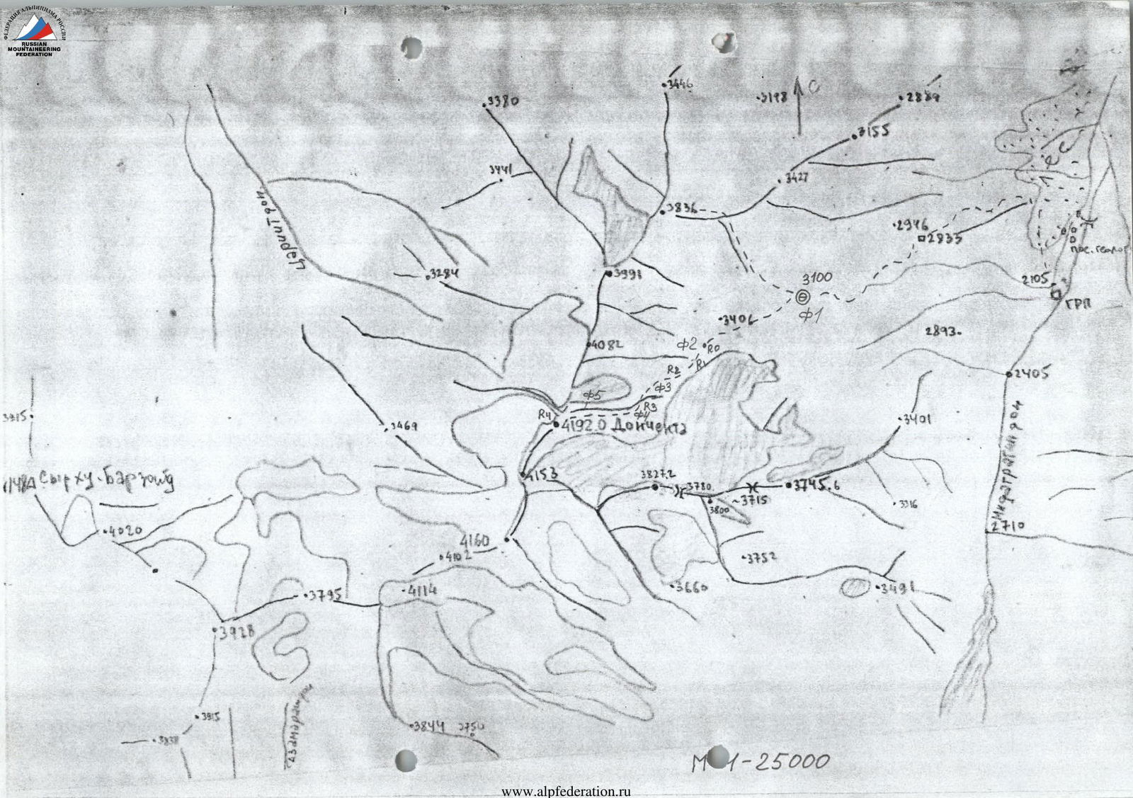
The ascent area is located in the eastern part of the Central Caucasus in the Midagrabindon River basin.
The peak Donchenty (4192) is situated in a ridge between the Tsariutdon River to the west and the Midagrabindon River to the east. It is actually the highest peak limiting the Midagrabin Plateau from the north.
Small, extinct glaciers descend from all slopes of the peak. The peak and the massif are composed of destroyed schist.
The peak offers a panoramic view of:
- Midagrabin Plateau.
- Peak Shau-Khokh (4713) and others.
Ascents were made:
- from the Midagrabin glacier via category 1B difficulty.
- from the Tsariutdon River side.
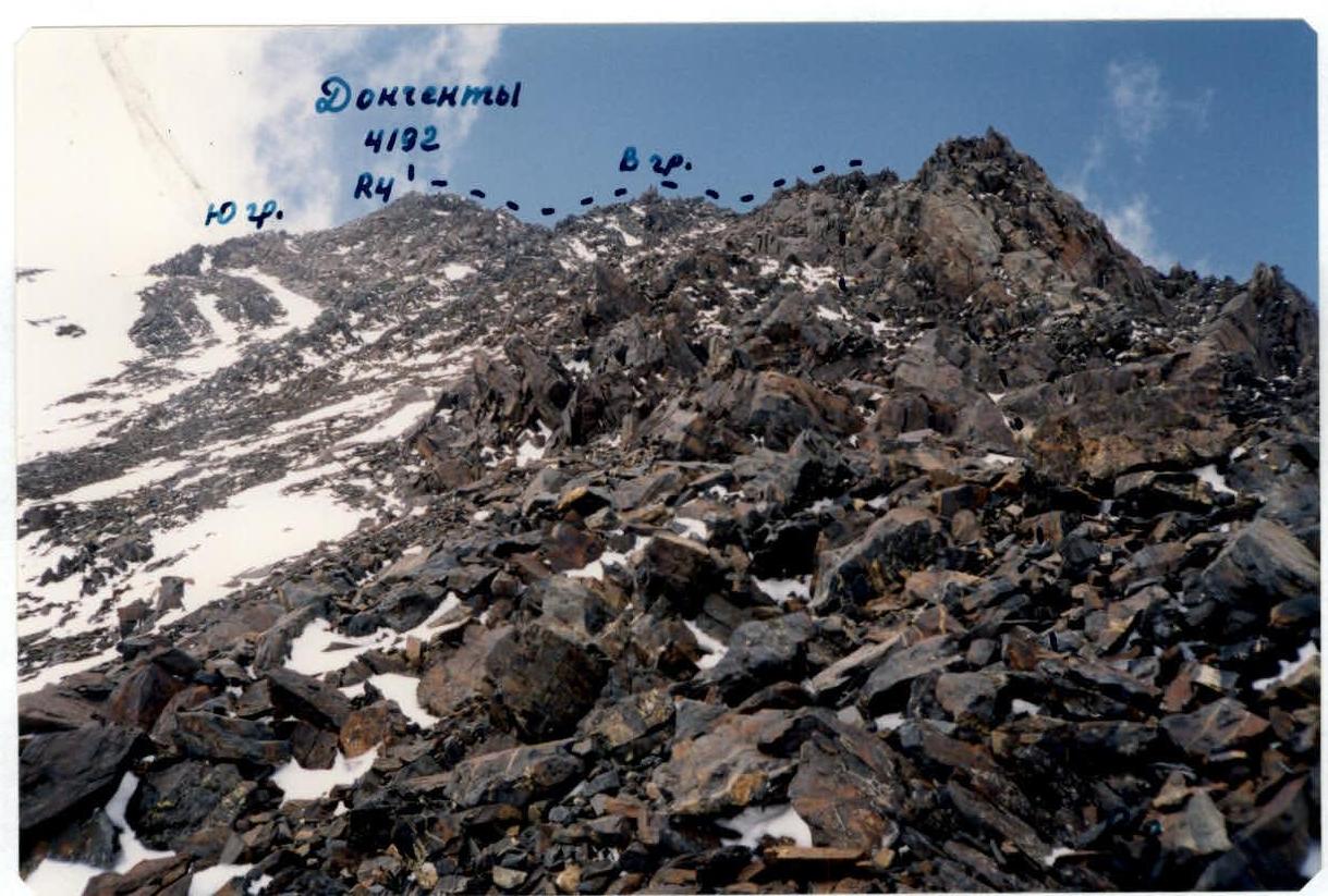
View from the East
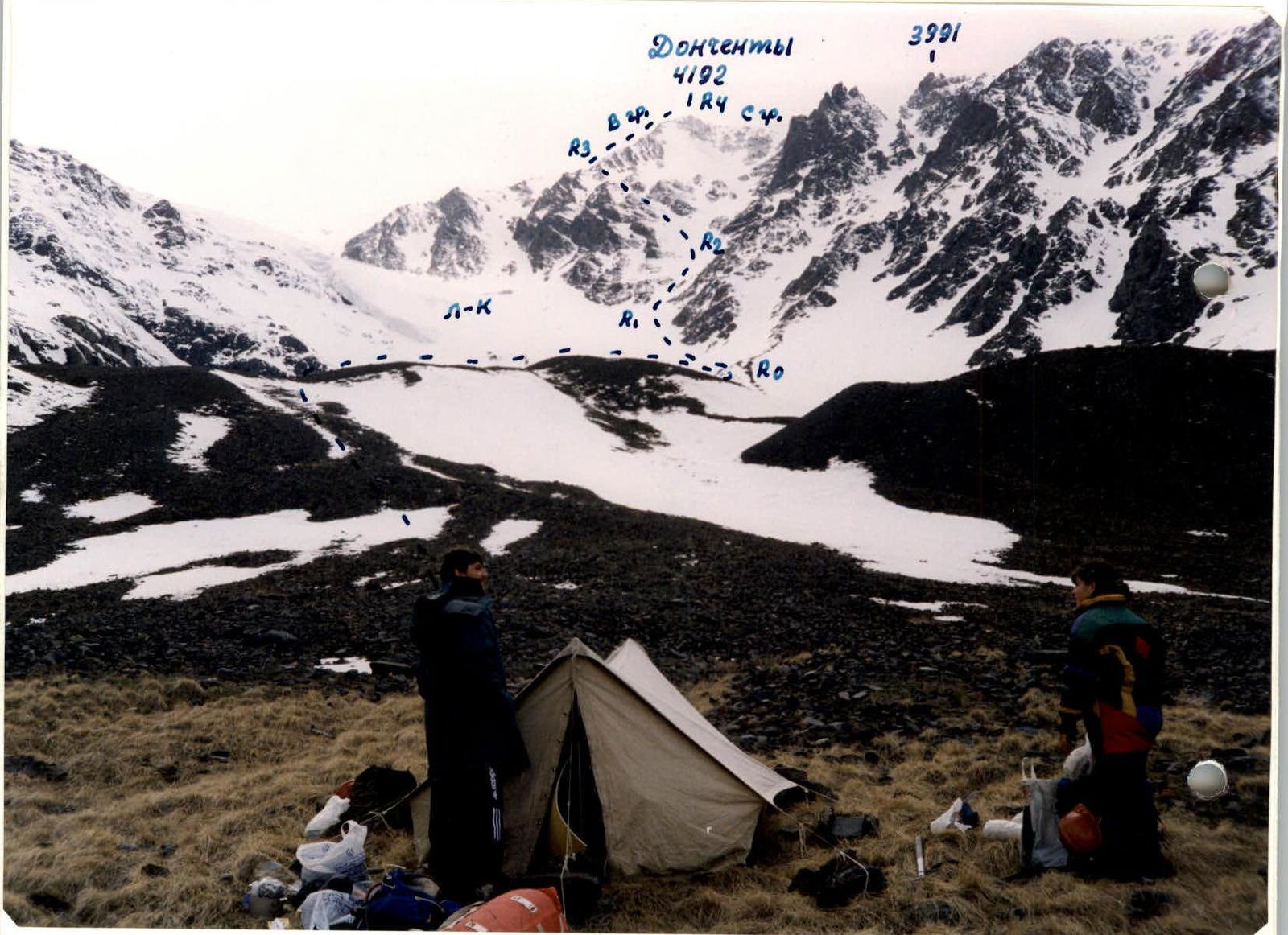
Cirque of the Khrustalny Stream, shooting height — 3100 m, shooting time — May 28, 1999.
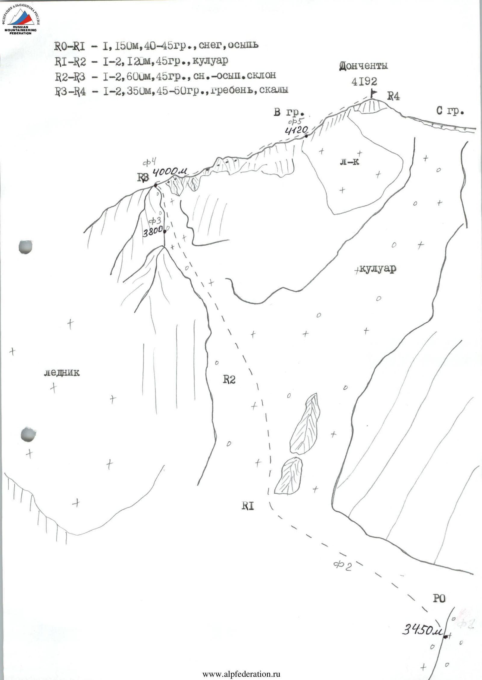
Route 1B Levkovsky, partially traversed, May 29, 1999.
- R0–R1 — 1, 150 m, 40–45°, snow, scree.
- R1–R2 — 1–2, 120 m, 45°, couloir.
- R2–R3 — 1–2, 600 m, 45–60°, snow-scree slope.
- R3–R4 — 1–2, 350 m, 45–50°, ridge, rocks.
Route description
From the bivouac in the Khrustalny Stream cirque, ascend to the moraine, and along its ridge, approach its end under the cliffs of the counterfort descending from the saddle between peak Donchenty and peak 3991 m — 2 hours.
Turn left, traverse the snowy slope — 250 m, 40–45°, and enter the beginning of the couloir descending from the saddle between peak Donchenty and peak 3991 m.
Ascend directly up the steep couloir 120 m, 45°, and then left-up to the steep snowy slope of the Eastern ridge spur, along which 400–420 m, 45–50° — ascend to the beginning of the Eastern ridge of peak Donchenty — 4–5 hours, protection through ice axe.
Reach the Eastern ridge, turn right, along simple destroyed rocks of category 1–2 difficulty, 120–150 m, 50°, approach under the rise of the ridge leading to the peak.
Along simple destroyed rocks of the rise, category 2 difficulty, 30 m, 55°, then along the rocks of the Eastern ridge, category 1–2 difficulty, 100–120 m, 45–50°, protection through outcrops — ascend to the peak.
From the bivouac — 7–8 hours. Descent via the ascent route — 4–5 hours.
Preparation for the ascent
During preparation for the ascent, preliminary reconnaissance of the approaches to the peak was conducted using a map and during the ascent to peak 3836 m in 1998, consultations were held, photographs were taken, and principles of radio communication were determined.
Approach description
Drive from Vladikavkaz to GRP:
- By car — 1.5 hours.
- By bus to Dzhimara village, then on foot along the road for 2 hours to GRP.
From the half-destroyed GRP building, move right, traverse the grassy slope overgrown with forest, along a pack trail laid by geologists.
In 30 minutes, cross Khrustalny Stream and continue ascending along the trail winding like a serpentine to the top of the counterfort.
- Good sites.
- Water.
From GRP — 2 hours.
Move left, cross the stream, along the trail, ascend to the shoulder of the counterfort, from which traverse right-up along the steep small scree (trail is lost) to the trail leading to the cirque filled with moraines and scree.
- Good bivouac.
- No water.
- Snow is possible.
From the sites — 2.5 hours.
View from the East

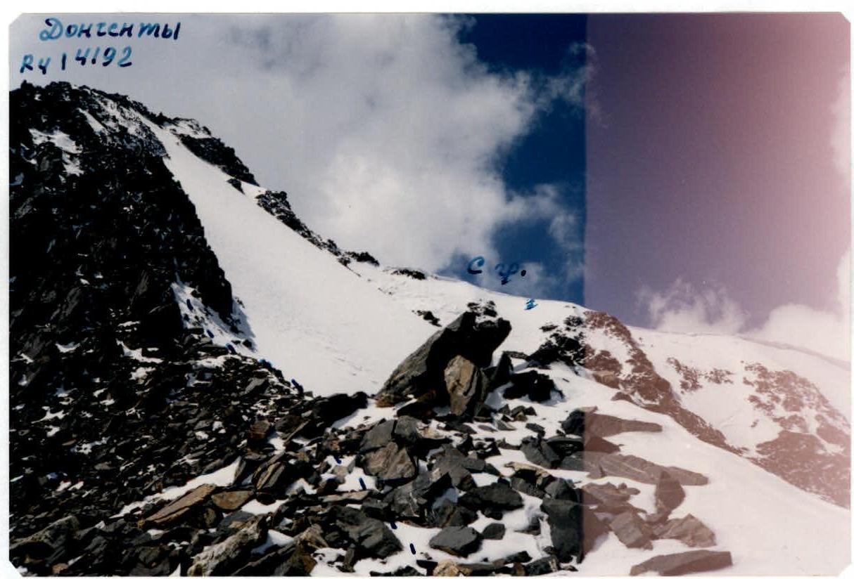
Entering the couloir (between peak Donchenty and peak 3991 m). Shooting height — 3450 m. Shooting time — May 29, 1999, 7:30.
View from the North
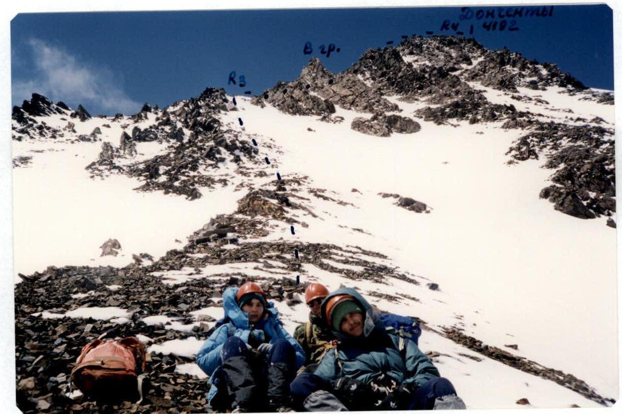
Reaching the ridge of peak Donchenty. Shooting height — 3800 m. Shooting time — May 29, 1999, 11:00.
View from the East
On the ridge of peak Donchenty. Shooting height — 4000 m. Shooting time — May 29, 1999, 12:00.
View from the East
Before ascending to the peak. Shooting height — 4120 m. Shooting time — May 29, 1999, 13:00.