Description of the state of the route to the summit of Shau-khokh (4636 m) via the eastern ridge, category 2B complexity. The nature of the route as of September 2015:
- snow-ice
- rock sections do not present technical difficulties
Approaches
To get to the village of Verkhny Koni, register at the border post (the summit is located in a border area, and a permit is required to climb; it's best to obtain it in advance), then go up to the village of Tmenikau. 2 km further up the gorge is a border post, the farthest point reachable by car.
From the border post, a gentle, wide trail (formerly a geological road) leads up the Genaldon gorge to the warm mineral springs in front of the tongue of the Maili glacier. This is where the base camp for climbing Mt. Kazbek from the north is located. There are places for tents and water.
The distance from the border post to the springs is about 9 km, taking around 4 hours on foot.
The trail continues over a suspension bridge across the Genaldon river to the lateral moraine of the Maili glacier, ending at the glacier's tongue. Then:
- climb onto the tongue of the Maili glacier (morphology changes frequently, from a steep ice wall to a gentle passage consisting of moraine deposits) near its western edge,
- cross to the lateral moraine and move along it beside the Genaldon river until a left (orographic) tributary flows into it,
- cross the river at this point.
Northeast of the confluence of the lateral gorge, on a wide platform, a complex of scientific equipment and a hut for several people are installed. It's about 3 hours from the mineral springs.
Continue up the left (orographic) side of the lateral gorge along an indistinct trail to the upper cirque. The upper cirque has a convenient spot for a camp.
- To the north lies the peak Geodesist
- To the west, the cirque is bounded by the ridge between peak Geodesist and Shau-Khokh
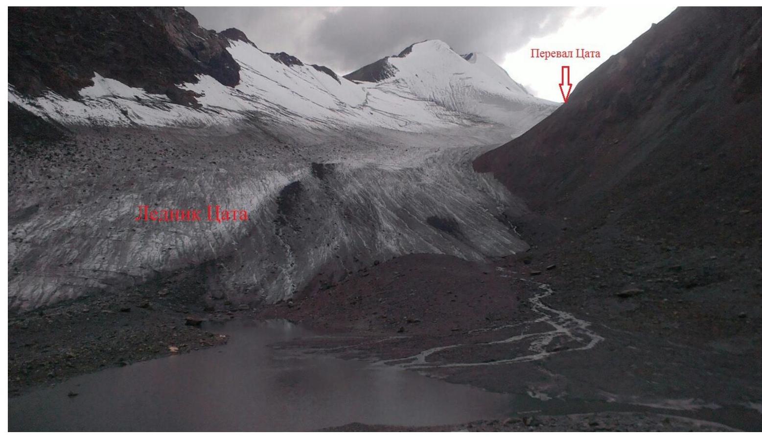
- On the southern part of this ridge lies the Tsata pass
Move across the upper cirque in a southwest direction towards the tongue of the Tsata glacier. About 3 hours from the hut. Enter the glacier and move up along its northern edge towards the Tsata pass, about 1.5 hours.
Near the Tsata pass, set up an assault camp. 200 m below the Tsata pass, on the lower part of the ridge to peak Geodesist, there's a shelf suitable for a camp.
There are also ready-made platforms for tents:
- On the ridge itself, 100 m north of the Tsata pass (1 tent).
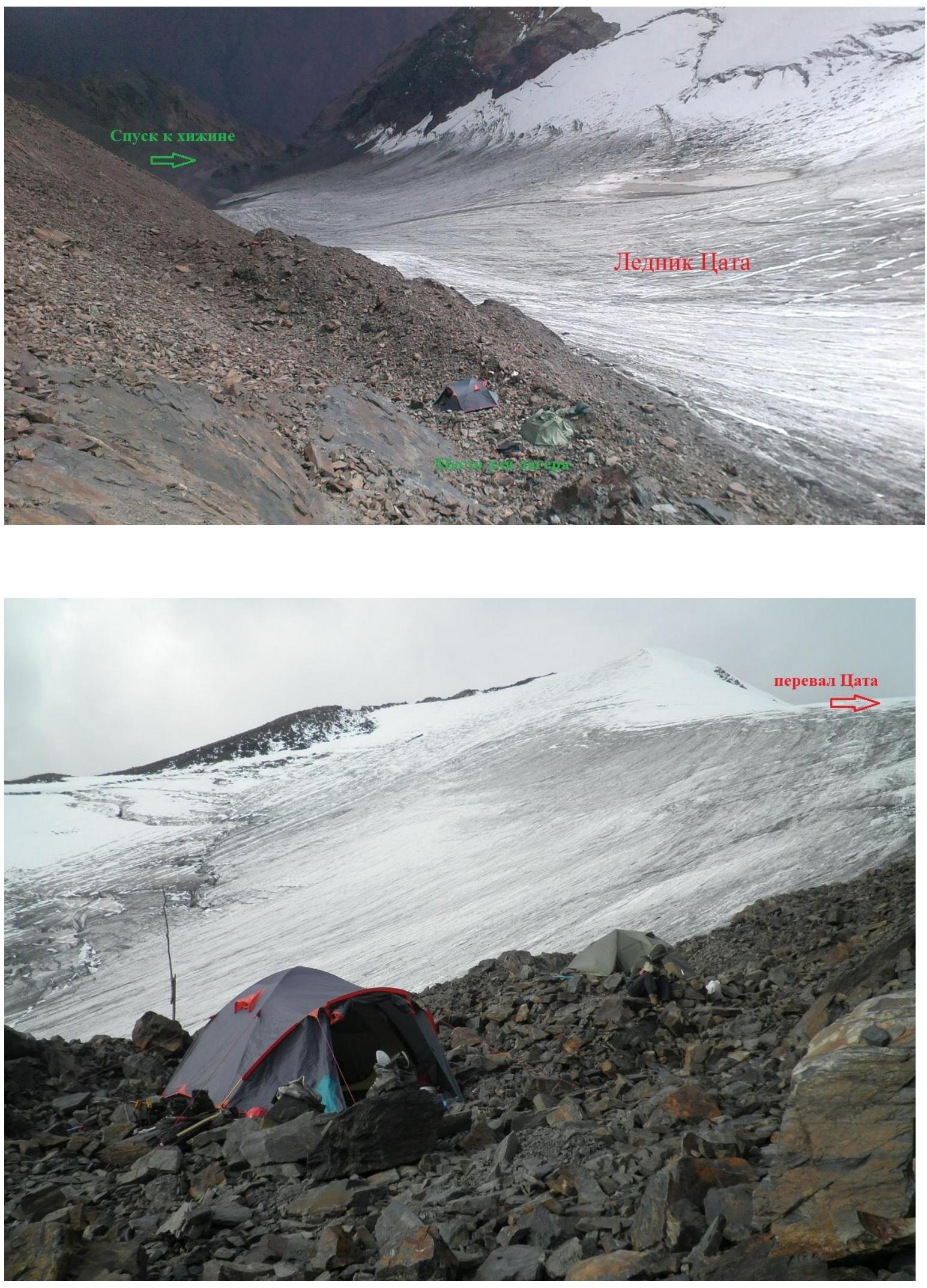
Tsata pass
Route
The route starts from the Tsata pass area, traversing a steep (up to 45°) snow-ice slope above the zone of obvious crevasses to the eastern ridge of Shau-khokh. Section 1–2 on the diagram.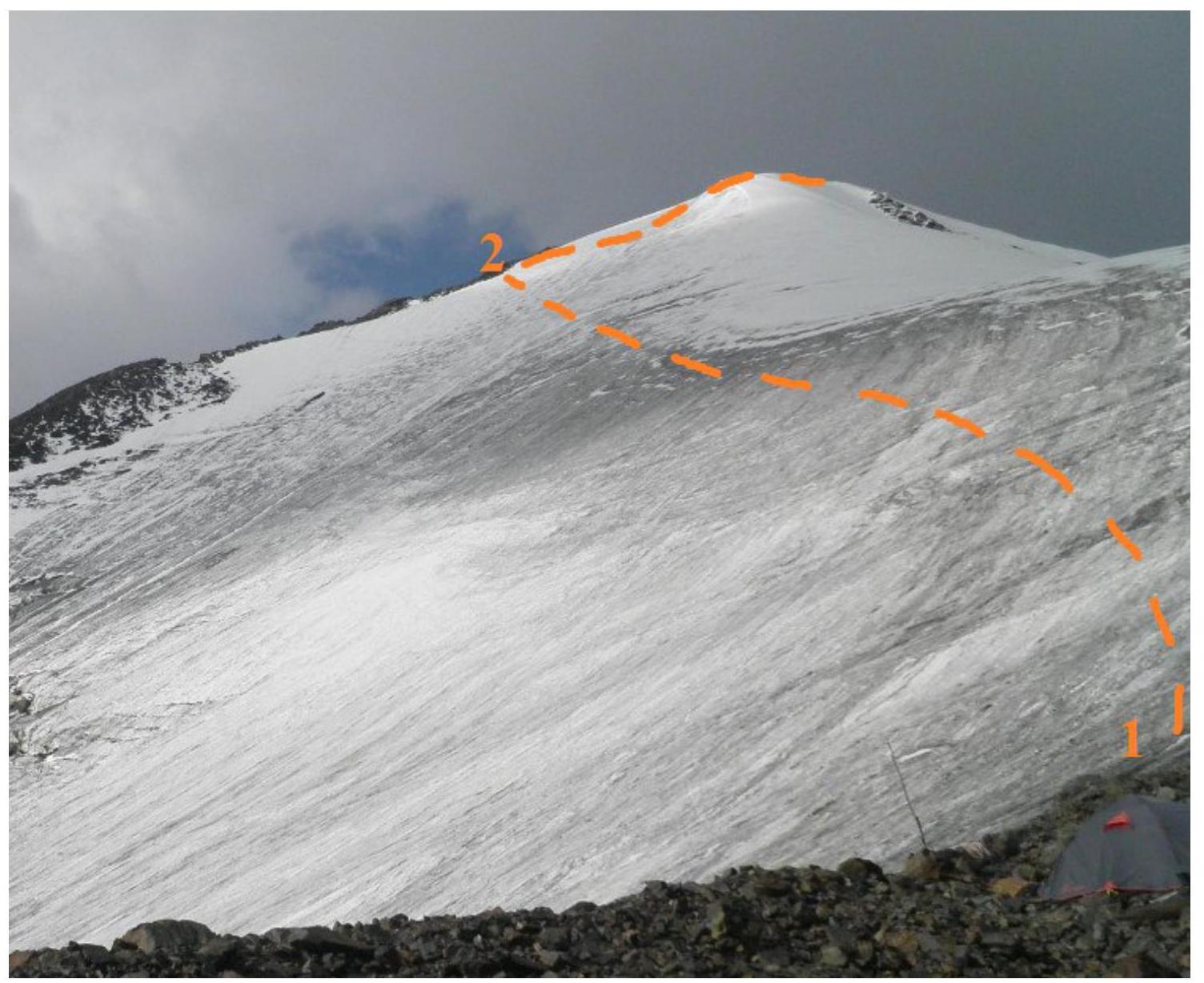
On the slope, there are several hidden bergschrunds up to 1.5 m wide. Piton protection is possible. Time from the start of the route is about 1.5 hours.
Then move along the gentle ridge to a sharp ascent. About 1 hour from the ridge. Section 2–3 on the diagram.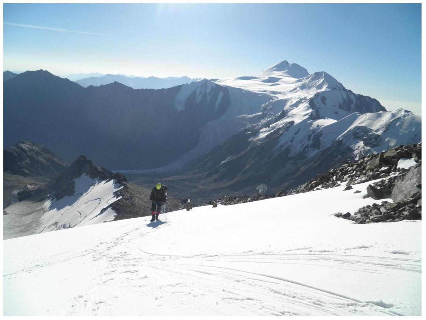
The ascent is traversed from the left; piton protection is possible. Time taken is about 1 hour. Section 3–4 on the diagram.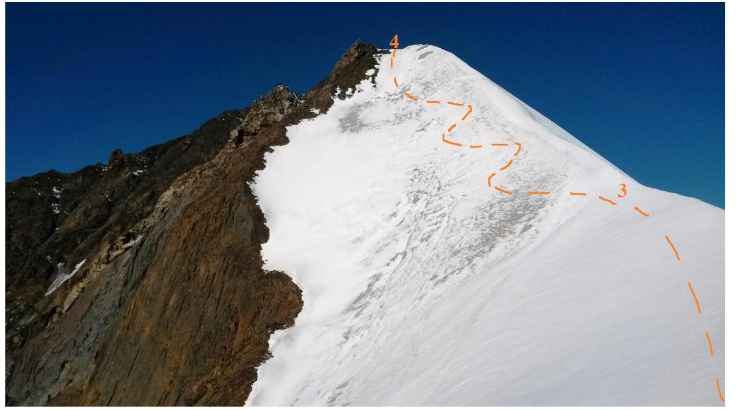
Above the ascent, there's a platform, then a gentle ridge leads to a zone of transverse bergschrunds. Time from the ascent is about 40 minutes.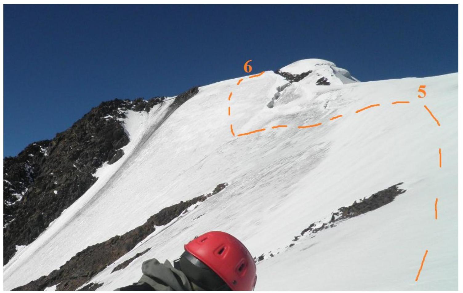
This section is bypassed by traversing a steep (up to 50°) slope from the left below, 56 ropes. Piton protection is mandatory. Time taken depends on the group's size and preparedness.
Then move along the ridge, passing sections of rock that don't present technical difficulties, to a second steep ascent. The ascent is 2–3 ropes long. Piton protection is possible.
Then there's a straightforward section of ridge to a steep snow "step" several meters high, which can be climbed freely.
Above the step, the pre-summit ascent begins. The summit has a spacious platform with a cairn at the exit. About 1 hour from the end of the crevasse zone.
Descent is via the ascent route.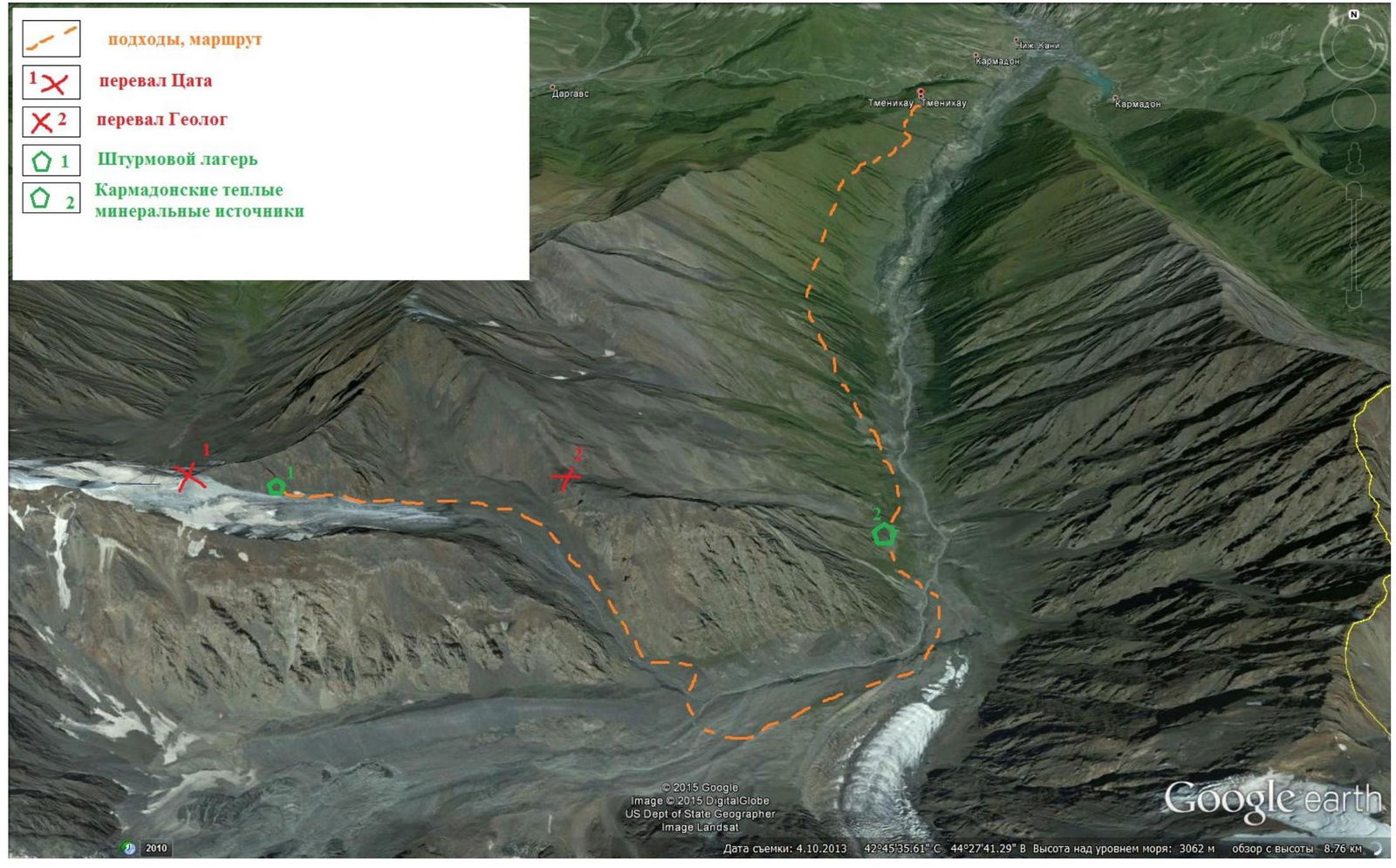
Approaches, diagram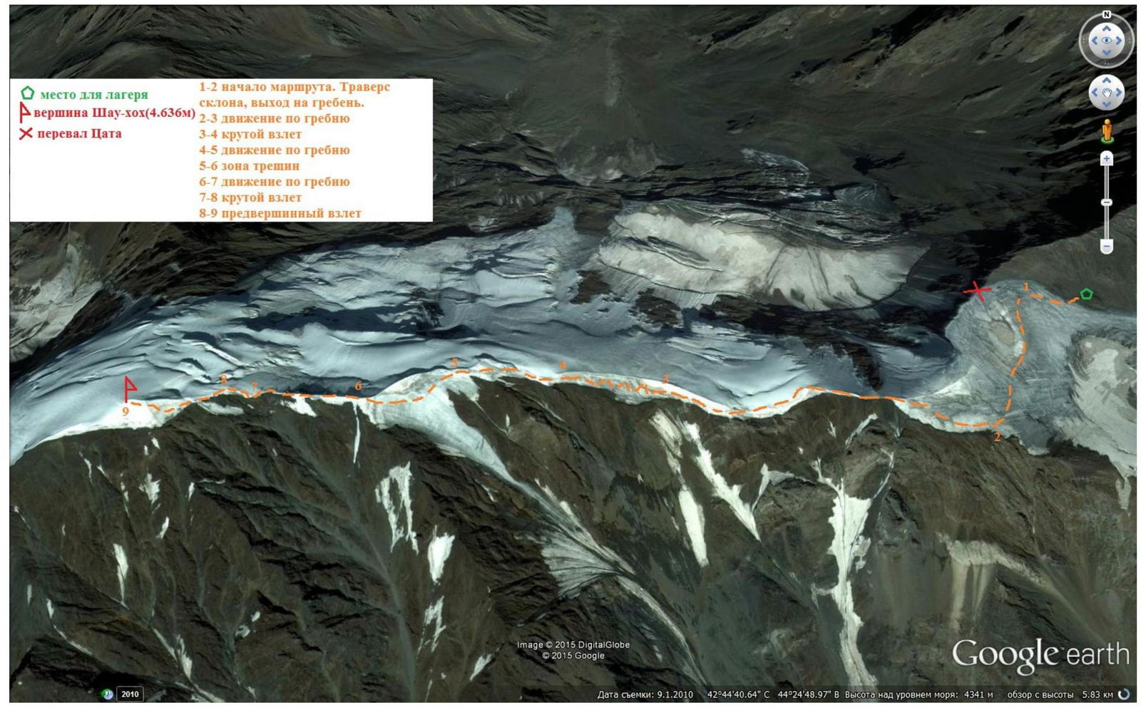
Route, diagram