Ascent Passport
- Caucasus, Rock Ridge, Classification section number 2.8.
- Dashtsar (2918 m) – via the South face.
- Proposed category: 3B, first ascent.
- Route type — rock climbing.
- Route elevation gain — 320 m (from point R0).
Total route length — 580 m. Length of sections with category 5 difficulty — 20 m. Crux pitch steepness — up to 95°. Average steepness of the wall section — 70°.
- Pitons left on the route — 3.
Pitons used on the route — 9. Chocks used on the route — 15.
-
Climbing time — 5 hours; days — 1.
-
Leader:
Participants:
- Egorin S. V. — Master of Sports
- Abisalov A. D. — 1st sports category
- Zhirnov D. N. — 1st sports category
- Rodin A. V. — 2nd sports category
-
Coach: Egorin S. V.
-
Route start: November 9, 2006.
-
Organization: North Ossetian Search and Rescue Team, EMERCOM of Russia.
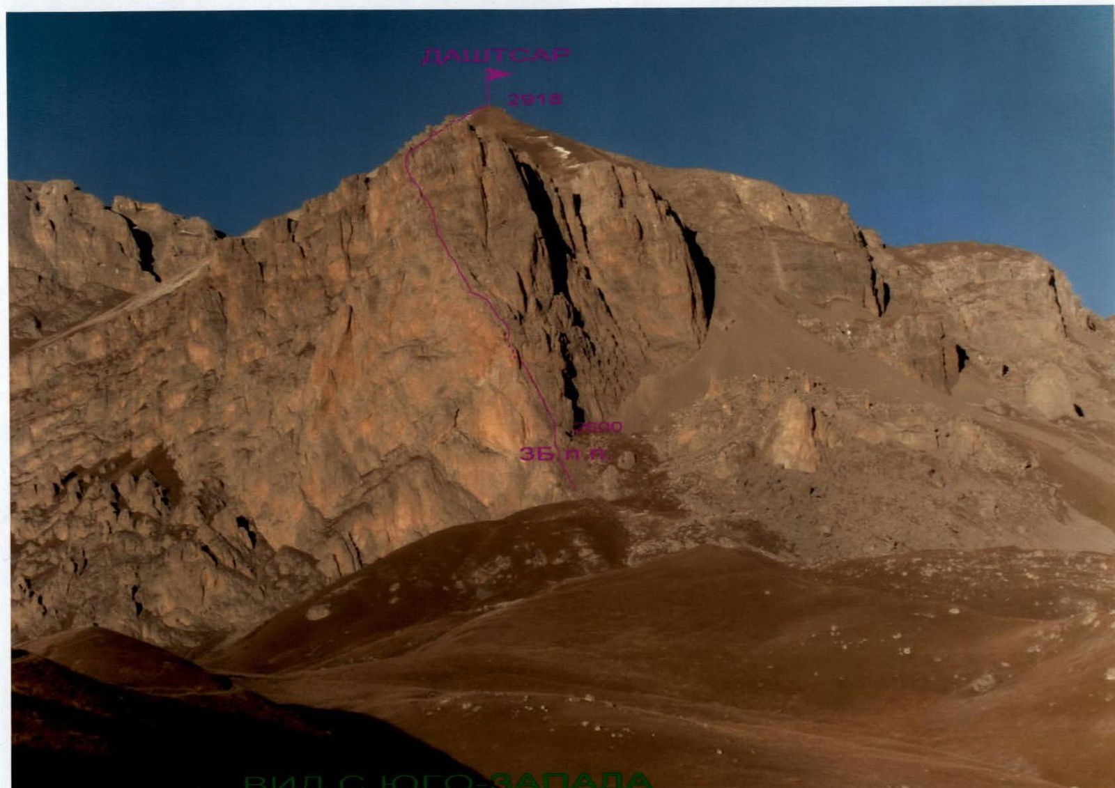
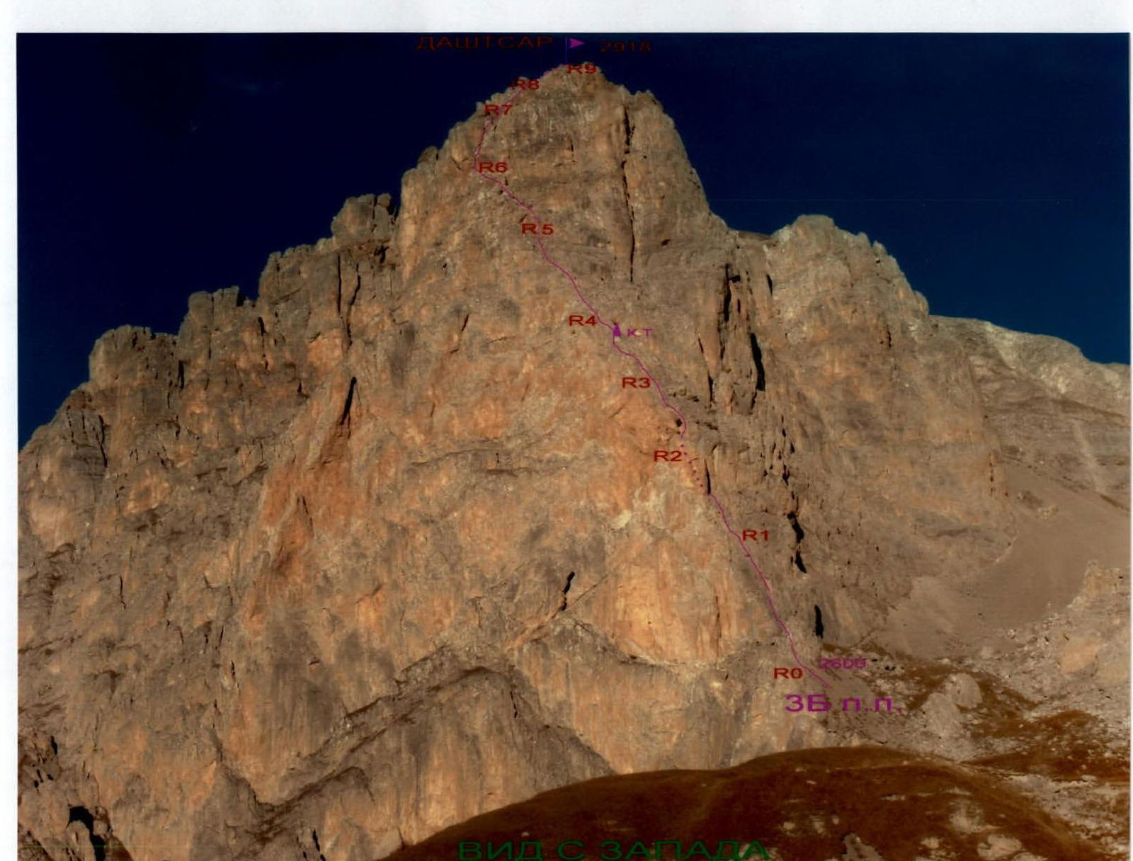
GENERAL VIEW OF THE PEAK
Marked:
- Red color — first ascent route.
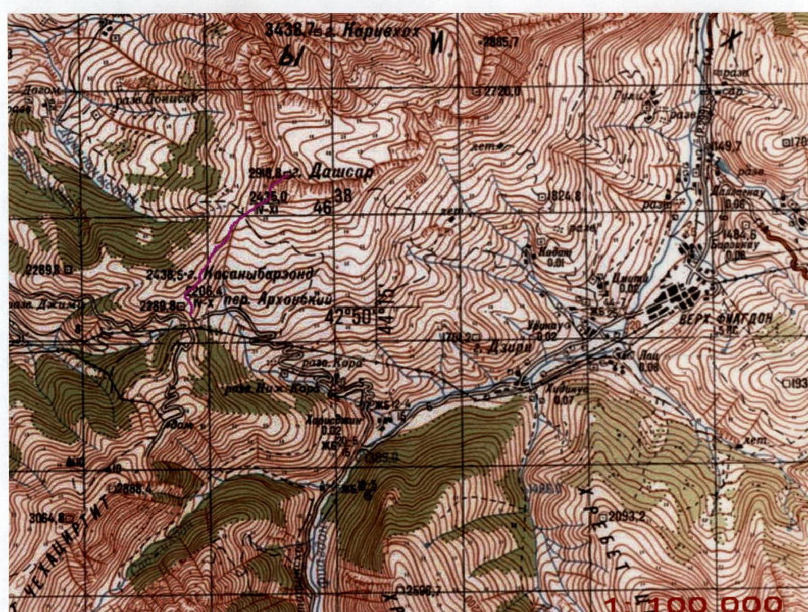
AREA MAP OF THE ASCENT
Marked:
- Red color — approach paths and the route.
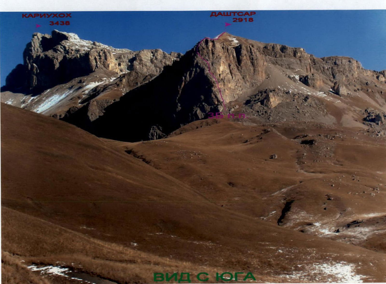
PHOTO PANORAMA OF THE ASCENT AREA
Marked:
- Red color — first ascent route.
Description of Approaches to the Route
From Vladikavkaz city to the working village of Fiagdon in the Kurtatinsky gorge, take a bus for about 1 hour. Then, by car, move up the gorge to the border post before entering the settlement of Kharisdzhin. Behind the barrier, turn right and, passing through the village of Kharisdzhin, start ascending to the Arkhon pass (2206 m) via a dirt road.
At the pass, turn right and follow the remains of the old road to the North, towards the visible peak of Dashtsar. The direction of movement is towards the base of the South face. First, follow the grassy slopes, then go up the small scree to the left part of the South face. Behind a small rocky ridge approaching the left part of the wall, from the scree shoulder, is the start of the route. The South face is cut by a chimney going up to the left. Elevation 2598 m. GPS coordinates of the route start in WGS-84 format: N 42°50.959′ latitude and E 44°13.760′ longitude.
Description of the Ascent Route
Section R0–R1: Up the chimney starting from the left part of the South face, straight up. The path goes mainly through its left part.
- In the middle of the section, there is a wall: 7 m, 93°, 5.
- Entire section: 50 m, 70–93°, 3–5.
- In the chimney under an overhanging rock — a station.
Section R1–R2: Further, again up a narrow chimney on the wall to the left. After 10 m, the partner is not visible. Another 10 m:
- Traverse left across the slabs, or
- Move higher under the rocks, through a gap, towards a narrow chimney-split.
Inside it, ascend to a small shoulder under a large cornice. The entire section is 50 m, 60–80°, 3–4.
Section R2–R3: From the shoulder, ascend, to the right of the large cornice.
- First, through an inside corner, 80°, 4+.
- After 7 m, move right (pitons).
- Further, through an overhang, 95°, 5, right up to ledges, another 7 m.
- Then straight up the rocks, to the left of a small rib, 3–4, 60–70°, about 30 m.
Section R3–R4: Then move right behind the rib and go straight up the rocks, 3–4, 60–70°, about 30 m, to a small grotto with a control cairn. From the grotto, move left and exit onto ledges via a small rib. Another 15 m, 3–4, 60–70°.
Section R4–R5: Further, across small walls 3–3+, with ledges between them, move left up, towards the left edge of the South face. Section 40–60°, about 50 m.
Section R5–R6: Approaching the rust-colored smooth rocks, then go up the right inside corner, 80–90°, 15 m, 4+, 5-. After it, across the wall 3–4, 60–70°, another 30 m, to a small shoulder on the wall.
Section R6–R7: From the shoulder, traverse left, to the start of the inside corner — chimney. Up it, 40 m. Initially, the relief is:
- 4–4+,
- 70–80°,
then the steepness and complexity of the rocks decrease to:
- 40–50°,
- 3–3+.
Section R7–R8: Further, the wall becomes less steep. We move further right up, across a system of ledges 1–2, about 50 m, to the exit onto the South grassy ridge-slope.
Section R8–R9: Up the South grassy, first ridge, then slope, ascend in 200 m to the peak of Dashtsar (2918 m). From the start of the route, about 5 hours.
The peak is an excellent panoramic point of the entire Kazbek-Jimara region.
Descent from the peak:
- First, along the East grassy ridge, 500 m, to a narrow scree gully cutting through the South faces of the peak Dashtsar.
- Then traverse the South slopes to the West.
- Again, exit under the start of the route — from the peak, 30 minutes.
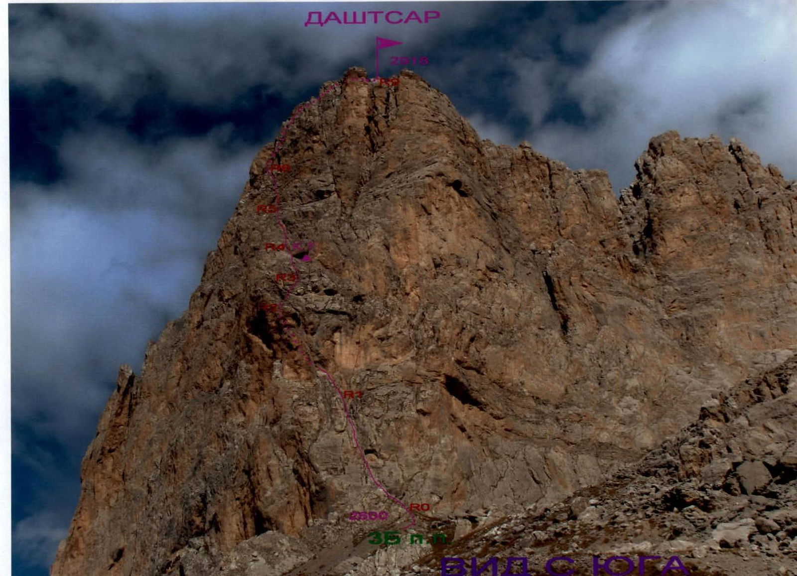
TECHNICAL PHOTOGRAPH OF THE ROUTE
The route is marked by sections:


ROUTE PROFILE FROM THE LEFT
The route is marked:
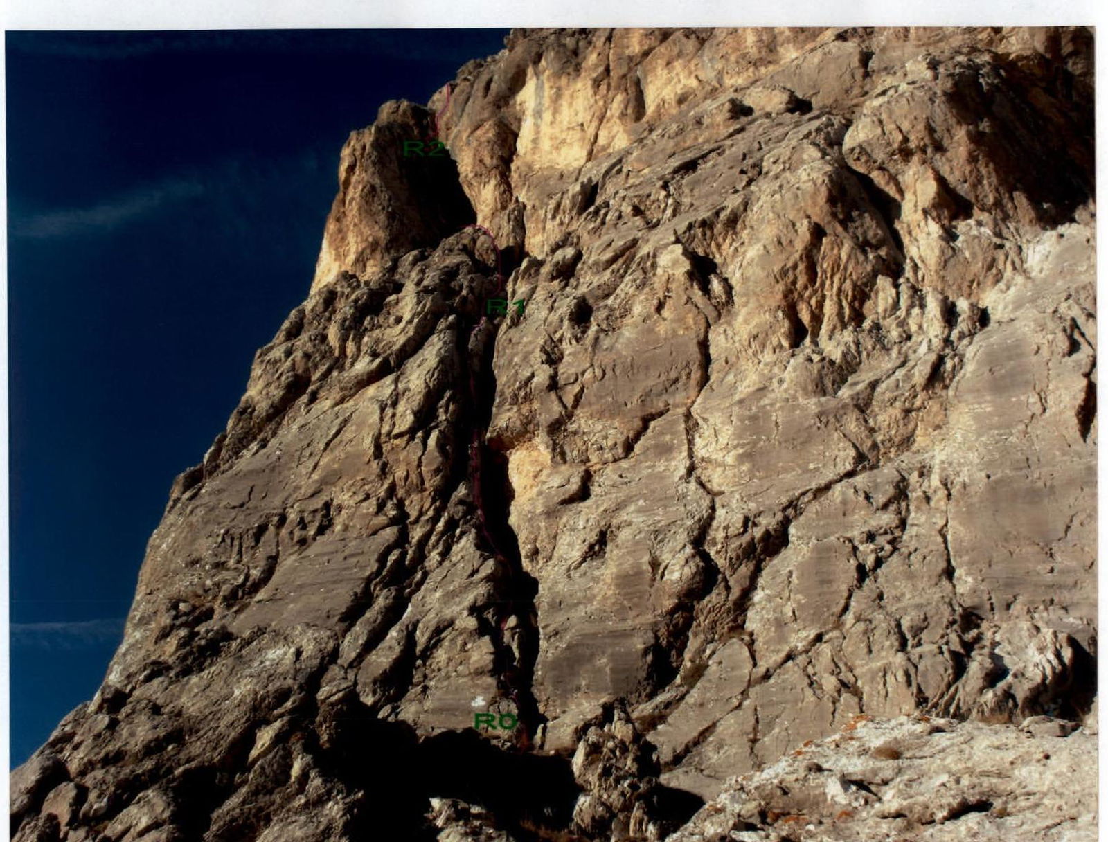
LOWER PART OF THE ROUTE
The route is marked
PASSAGE OF THE MIDDLE SECTION R0–R1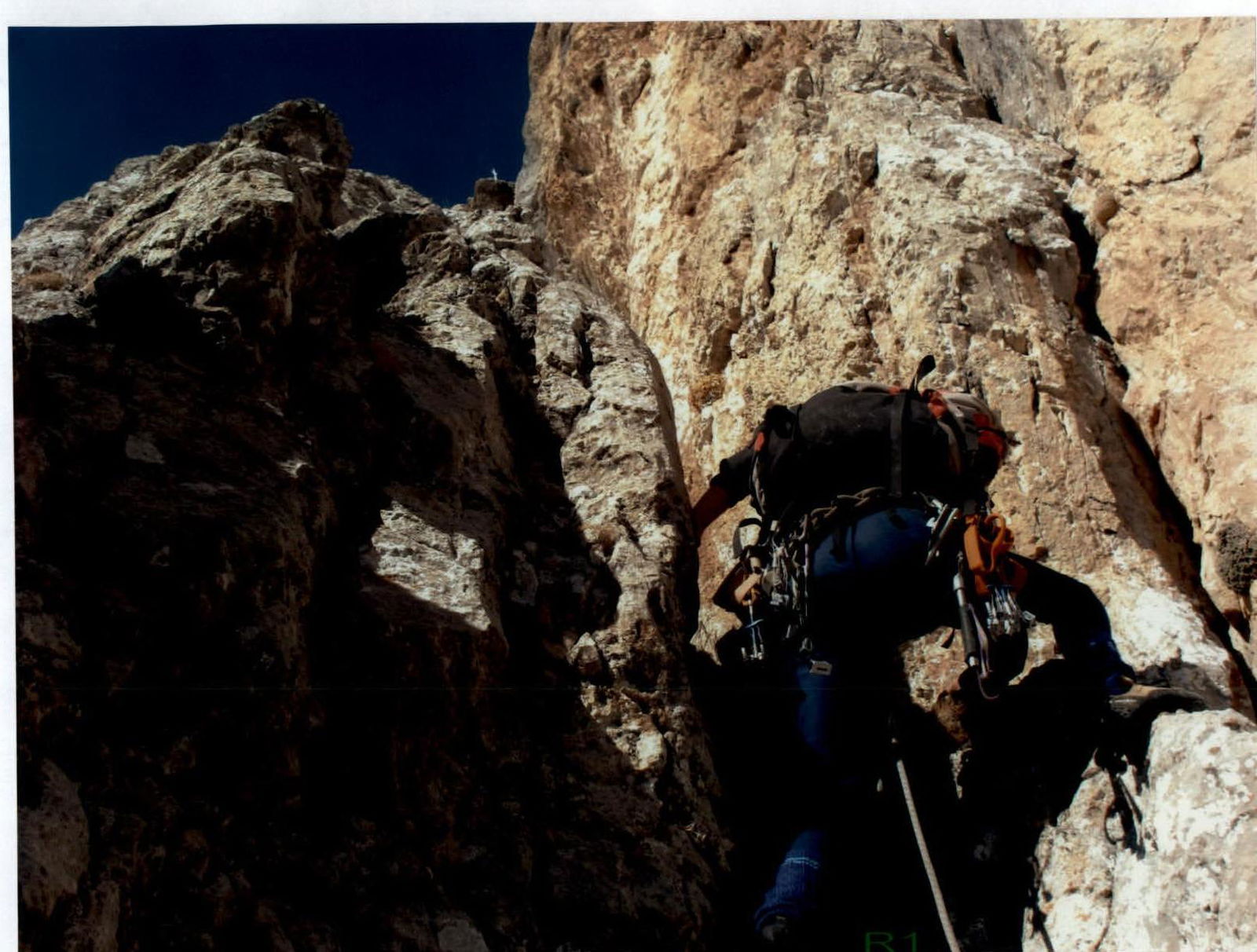
PASSAGE OF THE BEGINNING OF SECTION R1–R2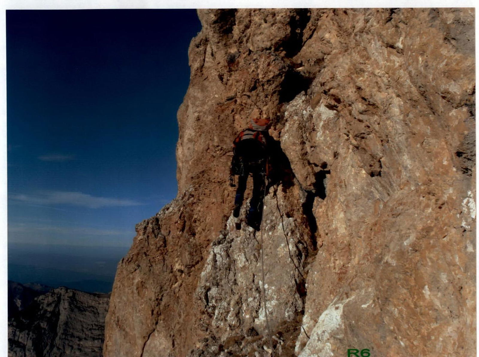
PASSAGE OF THE BEGINNING OF SECTION R6–R7
Conclusions and Recommendations for the Route
The route up the South face to the peak Dashtsar is logical, potentially safe, and is recommended for sports teams and strong training groups. The route goes up the south-facing wall, and due to this, it can be climbed in the off-season and even in winter.
The rocks on the route are mostly monolithic, but there are many loose rocks on the ledges.
During the ascent, friends go well, it is advisable to have one set.
The sections are predominantly over 40 m, so it is necessary to have 50 m ropes.
The route is interesting for climbing chimneys of various widths and develops wall climbing skills.
It is convenient due to its close proximity to the road — 1 hour to the wall.
In terms of difficulty and length of the crux pitches, the route complexity corresponds to a classic category 4A route.
However, comparing this route with already climbed and classified routes in the Rock Ridge, we recommend classifying the route up the South face to the peak Dashtsar as a category 3B route.