Ascent Passport
- Caucasus, Skalisty Range, Classification section number 2.8.
- Dashtsar (2918 m) — via the left part of the West wall.
- Proposed category: 3A, first ascent.
- Route type — rock.
- Route height difference — 350 m (from point R0).
Total route length — 700 m. Length of sections with 5th category difficulty — 8 m. Steepness of key sections — up to 95°. Average steepness of the wall part of the route — 60°.
- Pitons left on the route — none.
Pitons used on the route — 12. Chocks used on the route — 12.
- Climbing hours — 6; days — 1.
- Leader: Egorin S.V. — Master of Sports
Participants:
- Zhirnov D.N. — 1st sports category
- Porhun O.I. — 3rd sports category
- Ramonov A.A. — 3rd sports category
- Horanov A.A. — 3rd sports category
- Hutuiev R.G. — 3rd sports category
- Coach: Egorin S.V.
- Approach to the route, summit, descent: May 28, 2010.
- Organization: North Ossetian Search and Rescue Team, EMERCOM of Russia.

The first ascent route is marked in red.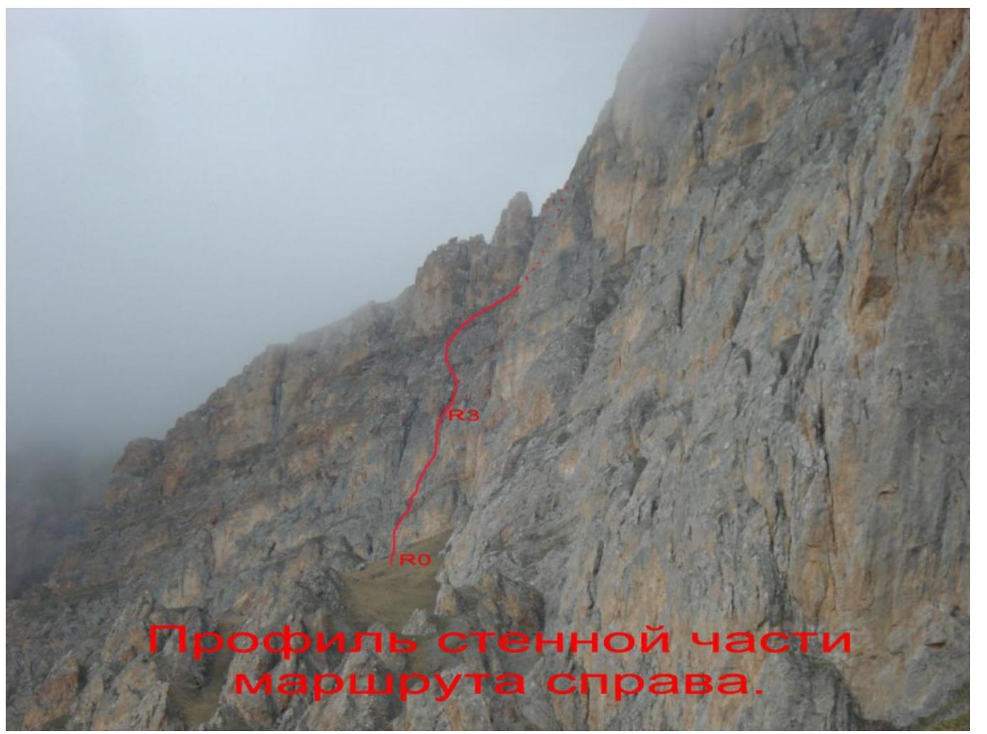
Profile of the wall part of the route on the right.
The first ascent route is marked in red. The classified 3B category route via the South wall (2006) is marked on the right.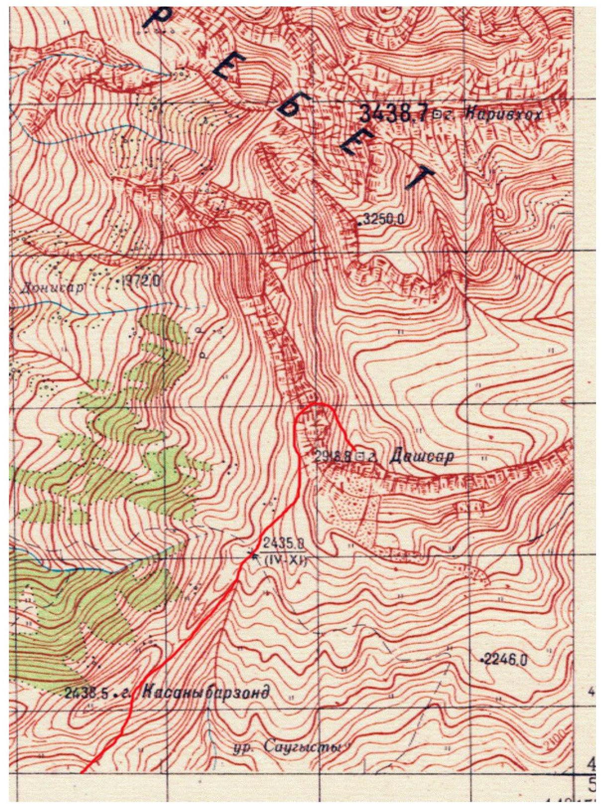
Route Description by Sections
| Section | Length (m) | Steepness, ° | Terrain Characteristics | Difficulty Category | Number of Belay Points |
|---|---|---|---|---|---|
| R0–R1 | 50 m | 50–60° | Rocky wall with individual ledges. | 2–3+ category | 4 |
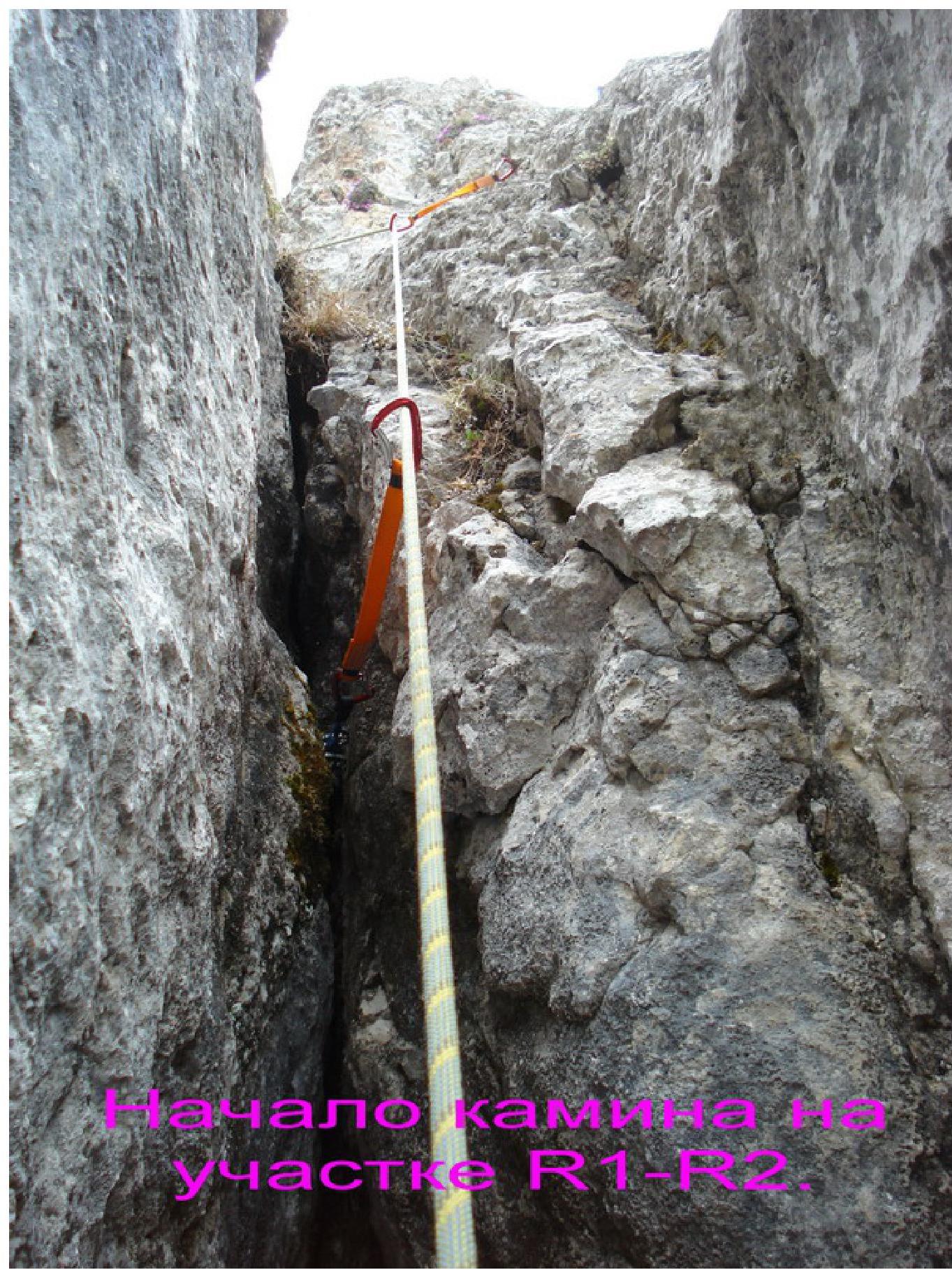
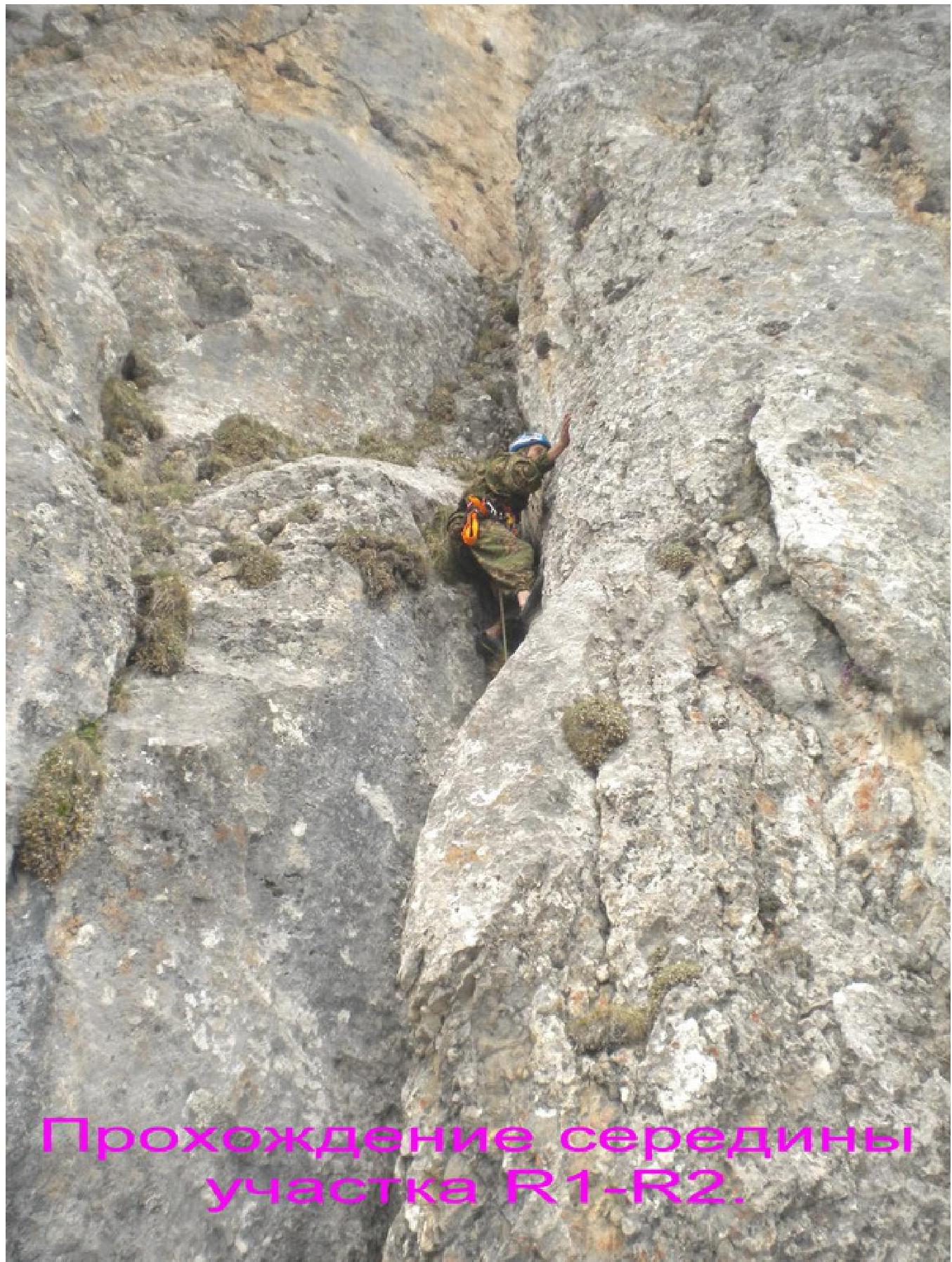
| R1–R2 | 35 m | 60–95° | Approach to the chimney via a ledge. Narrow chimney with an overhang in the middle. | 3–5+ category | 6 |
| R2–R3 | 45 m | 60–70° | Chimney turning into an inner corner. | 3–4+ category | 4 |
| R3–R4 | 50 m | 40–60° | Series of small walls with grassy ledges between them. | 3–4 category | 4 |
| R4–R5 | 40 m | 40–60° | Series of small walls with grassy ledges between them. | 3–3+ category | 3 |
| R5–R6 | 30 m | 40–60° | Series of small walls with grassy ledges between them. | 3–4 category | 3 |
| R6–R7 | 450 m | 20–30° | Grassy-scree slope. | 1 category | - |
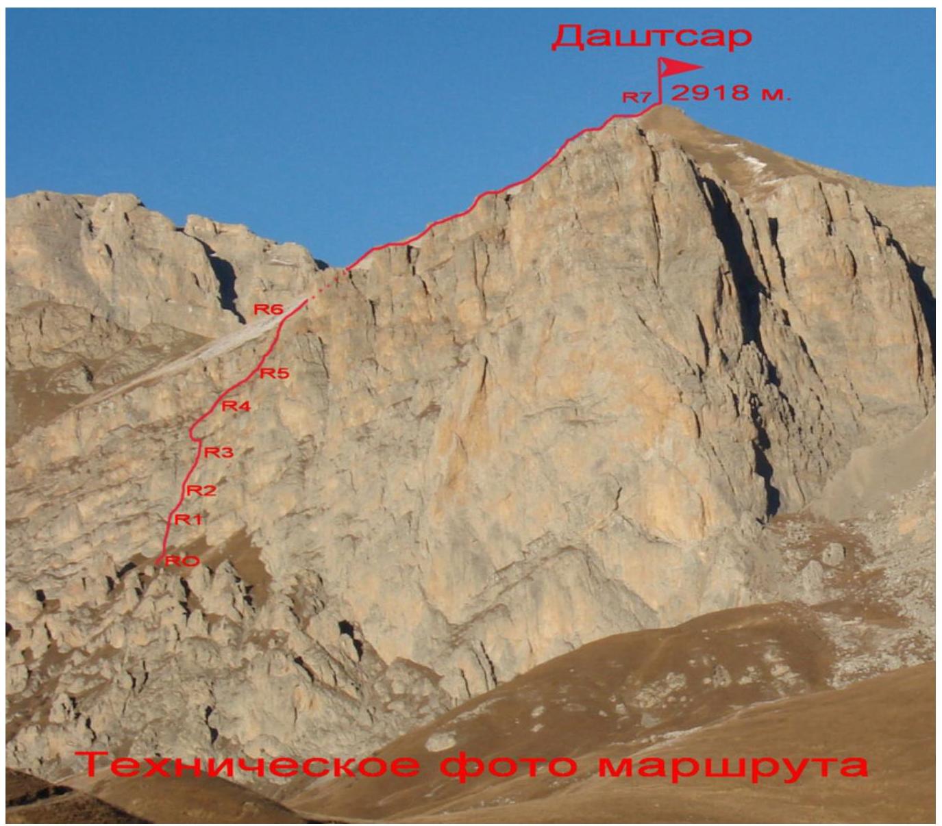
Dashtsar (2918 m)
Approach to the Route Description
From Vladikavkaz to the working village of Fiagdon in the Kurtatinsky gorge, take a bus for about 1 hour. Then drive up the gorge to the village of Kharisdzhin. Turn right after the bridge and, having passed through Kharisdzhin, start ascending to Arkhonsky pass (2206 m) via a dirt road.
At the pass, turn right and follow a narrow dirt road northwards, towards the visible peak of Dashtsar — it's possible to drive on this road with a high-clearance vehicle. The direction of movement is towards the base of the West wall. First, follow the grassy slopes, then approach the walls via small scree. To the left (north), under the walls of Dashtsar, there is a grassy inclined terrace. Follow it upwards to the left.
After approximately 200 m, we arrive at the base of the left part of the West wall. A landmark for the start of the route is a standalone rock, 15 m high, located 50 m opposite.
From Arkhonsky pass: 1.5–2 hours.
Route Description
Section R0–R1: Opposite the standalone rock, at the base of the left part of the West wall of Dashtsar, the start of the route is visible. Move up the wall at 50–60°, 2–3+ category, to the right of a narrow chimney visible above. The wall has a form of a not clearly defined ridge and alternates with small grassy ledges. After 50 m, on a large ledge, it's possible to secure the rope. To the left, 7 m away, is the entrance to the chimney.
Section R1–R2: From the station on the ledge, descend left and downwards to the base of the monolithic wall. After 15 m, with a height loss of about 7 m, enter the chimney. The chimney is narrow at the bottom. It's impossible to observe the first climber from the station on the ledge. Climb the chimney: feet against one wall, back against the other, 8 m, 5–5+ category, 80°. At the top, upon exiting the "plug," there's an overhang at 95°. Further, the chimney widens; after 12 m, on a small ledge, it's better to make a belay station since the rope is hard to pull through due to the bend. The entire section is about 35 m.
Section R2–R3: Continue straight up the right part of the chimney. The chimney is not always clearly defined and turns into an inner corner. Move under a large cornice, into a grotto with a large protrusion. Here is a belay station and a control cairn. The entire section is about 45 m, 3–4+ category, 60–70°.
Section R3–R4: From the grotto, move left along a small ledge, bypassing the monolithic wall. Then move right and upwards via rocks of 3–3+ category, partially overgrown with grass and moss. Cross a small wall of 4th category, then move right and upwards. After 50 m from the grotto, there's a belay station on a small ledge. The entire section is 40–60°.
Section R4–R5: Continue through small walls of 3–3+ category with grassy ledges between them, moving right and upwards, towards the visible bend of the wall above. After 40 m, there's a belay station on a ledge. The section is 40–60°.
Section R5–R6: Move right and upwards under the upper rocky belt. Under the reddish overhanging rocks, turn right and via a grey monolithic slab of 3–4 category, 7 m, exit onto a grassy shoulder — the end of the wall part of the route. The entire section is about 30 m, 40–60°.
Section R6–R7: From the shoulder, move straight up for about 150 m to reach the North ridge. On the ridge, turn right and follow a grassy-scree slope for another 300 m. The section is of 1st category, 20–30°.
The summit offers a panoramic view of the entire Kazbek-Jimara region. Descent from the summit: first, follow the East grassy ridge for 300 m down to a small shoulder on the ridge. Cross it and reach the start of a narrow scree gully cutting through the South walls of Dashtsar. Descend the gully. Then traverse the South slopes westwards and exit onto the road leading to Arkhonsky pass — from the summit, it takes 40–50 minutes.
Conclusions and Recommendations for the Route
The route via the left part of the West wall to Dashtsar summit is logical as it's the easiest path on the West wall. The route is potentially safe and is recommended for sports teams and strong training groups.
The rocks on the route are mostly monolithic, but there are many loose stones on the ledges. During the ascent, cams and pitons are effective — it's advisable to have one set of each. Sections are predominantly over 40 m, so 50 m ropes are necessary.
The route is interesting due to the classic chimney climb. It also develops wall climbing skills. The key section is the chimney. The route is convenient due to its proximity to the road — it takes 1.5 hours to reach the wall from Arkhonsky pass.
In terms of difficulty and length of key sections, the route corresponds to a classic 3A–3B category route.
Comparing the climbed route with already classified routes in the Skalisty Range, we recommend classifying the route via the left part of the West wall to Dashtsar summit as a 3A category route.
HAGARO A YAACI
Annual
2017 RUEA
1994
1994
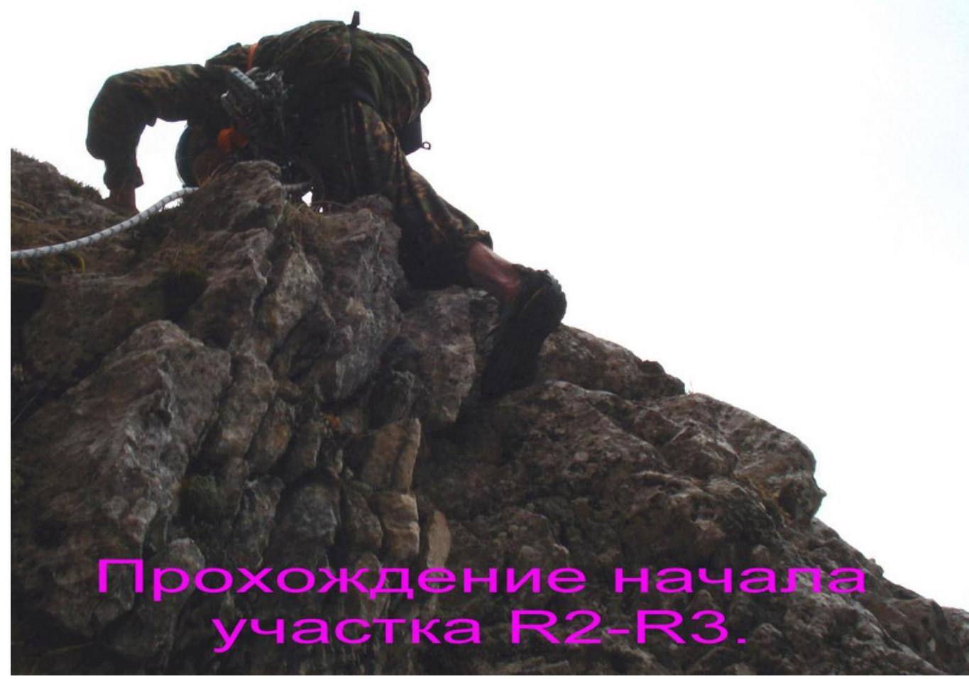
Passing the start of section R2–R3.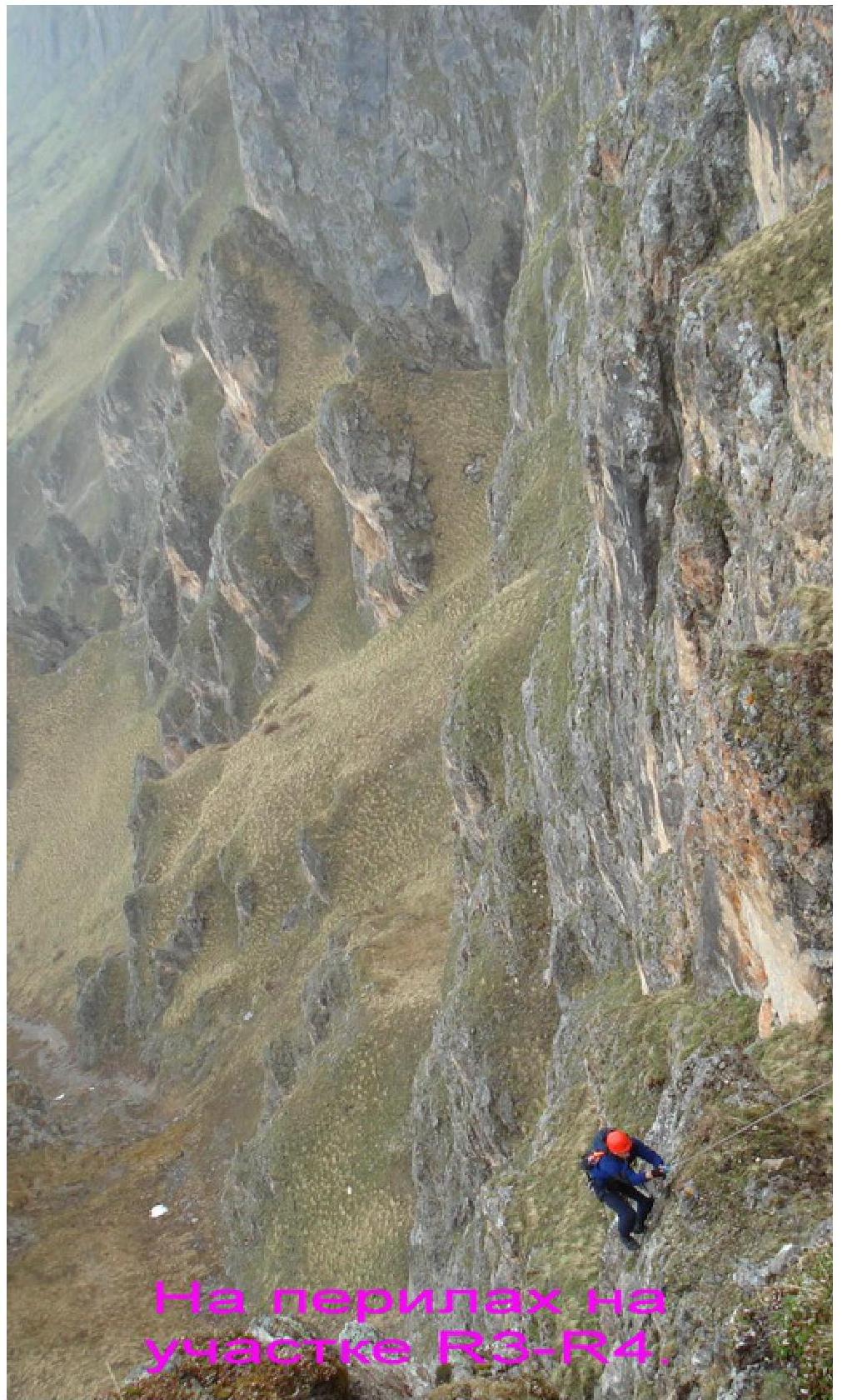
1
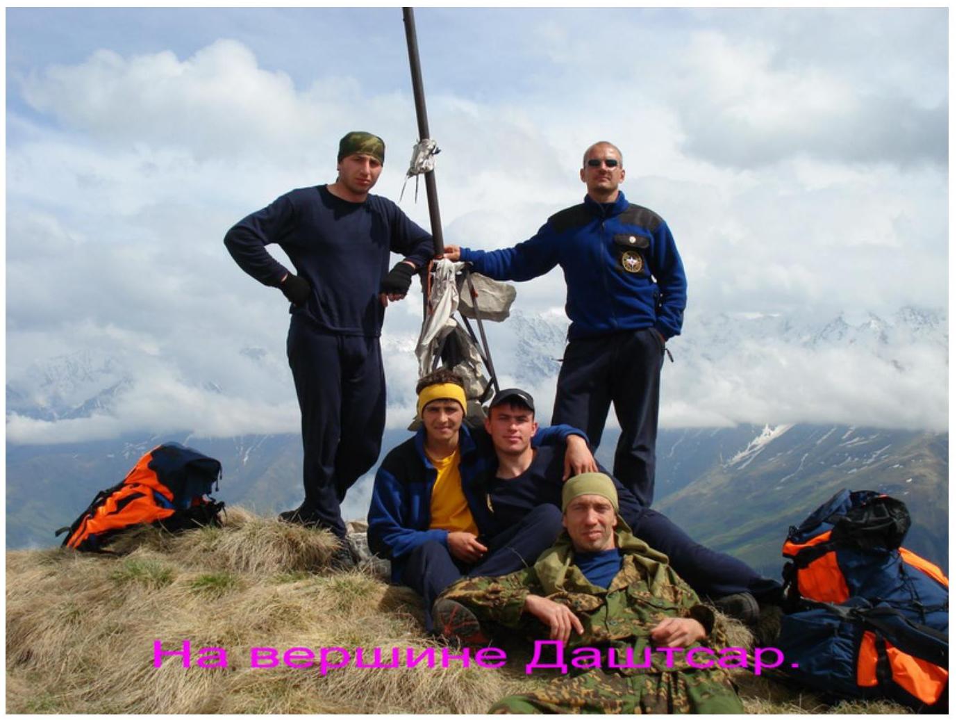
Foto: G. K. L. M. M. M.
Footnotes
-
2636.5.6. Modun B rezon ↩