Ascent Passport
- Rock climbing category.
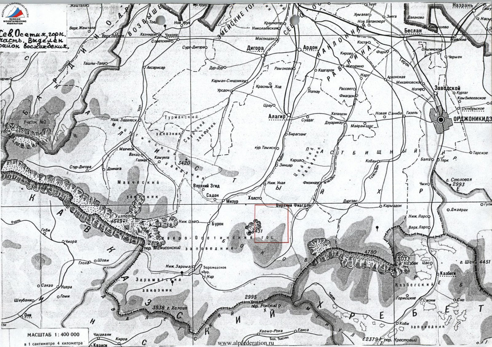
- Caucasus, Bokovoy Range, Arkhon massif.
- Arkhon Severny (3571 m); from the West via the North-East ridge.
- Proposed — 2A category of difficulty, first ascent.
- Elevation gain: 500 m.
Length about 1 km. Average slope on the route is about 30°.
- Pitons hammered: rock, chocks.
5/0 7/0
Left on the route: rock – 2 (for descent)
- Team's travel time – 8 hours; days – 1.
- Overnight stay — below the route, comfortable, lying down.
- Leader: Egorin Sergey Vladimirovich — Master of Sports
Participant: Gazdarova Olga Valeryevna — 3rd sports category
- Coach: Egorin Sergey Vladimirovich — Master of Sports
All from Vladikavkaz.
- Departure to the route: June 20, 1999. Summit: June 20, 1999. Return to base camp: June 20, 1999.
- Organization: North Ossetian Republican Search and Rescue Service of the Ministry of Emergency Situations of Russia. Address: 362035, Vladikavkaz, pr. Kosta 273, SORPSS.
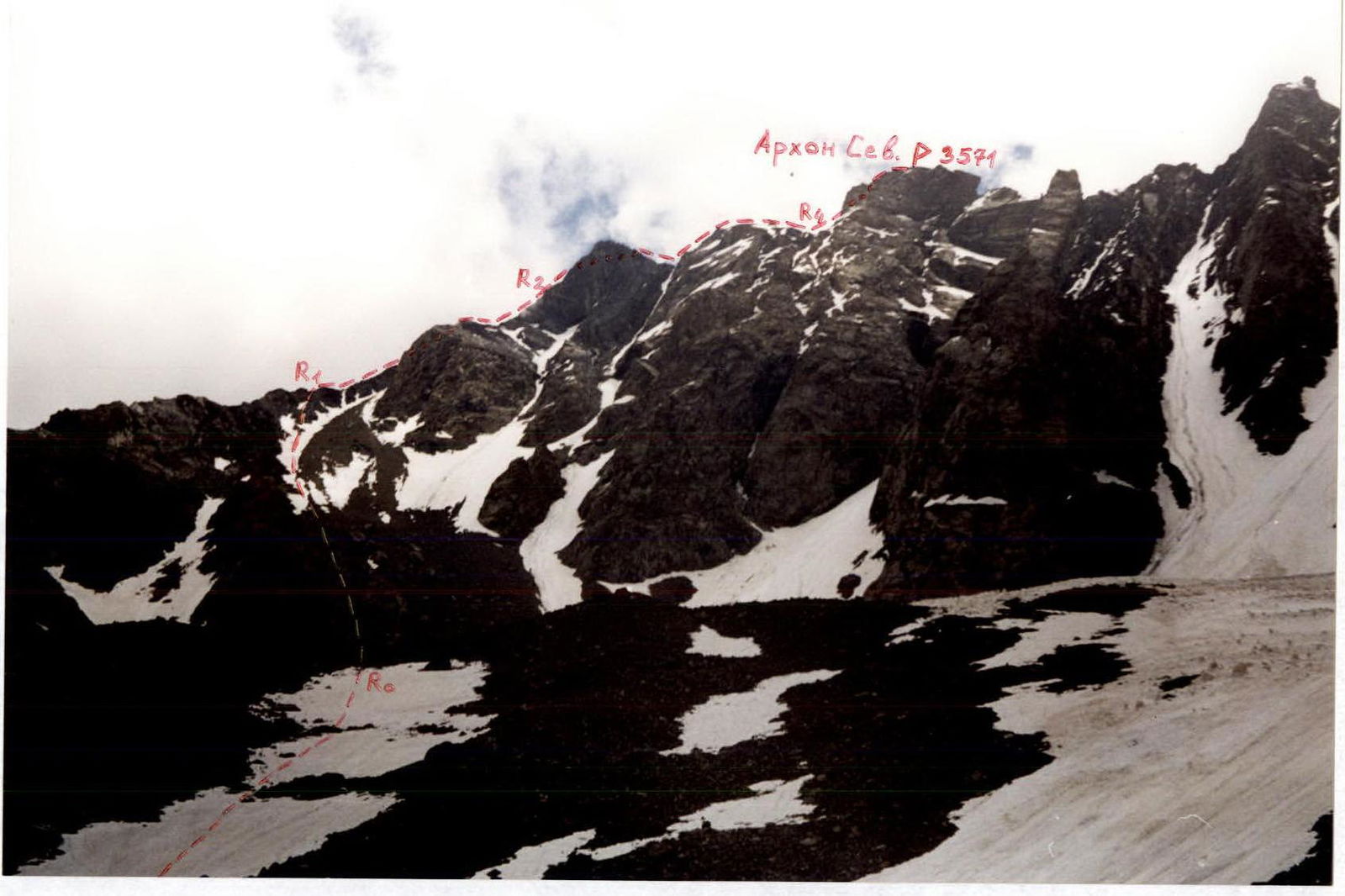
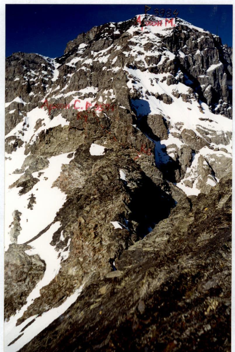
Arkhon Severny from the West, from the cirque under the start of the route. June. The first ascent route is marked.
Conclusions and Recommendations for the Route
The route is recommended for training and sports groups. With proper tactics, the ascent is safe since it mainly follows the ridges. One should be cautious of rockfalls when exiting onto the Western buttress and when ascending and descending the Black Gendarme due to its composition of clay shales. The route is purely rock climbing, but crampons may be necessary at the beginning of summer when exiting onto the Western buttress early in the morning. We consider this route to be the first ascent to the 3571 m summit and logically propose to name it Arkhon Severny, as it is the northernmost peak of the Arkhon massif. Although in mountaineering literature, specifically in the collection "To the Peaks of Soviet Land" dedicated to the 25th anniversary of Soviet mountaineering (Moscow, 1949), there is a mention of an ascent to Arkhon Severny at the end of the book in the list of first ascents. It is written: Arkhon Sev. (3665 m) — ?, Melnikov et al.; from the Fiagdon river gorge (i.e., from the East) 2A category of difficulty approximately; 1948. However, this ascent is not mentioned again in the mountaineering classification, nor is this peak. Moreover, as seen on the map, there is no peak of such height nearby.
We thoroughly investigated the 3571 m summit, the highest point, and found no signs of human presence. As visible on the photopanorama, this section of the ridge is the most prominent peak. Therefore, it remains unknown where and which Arkhon Severny was ascended in 1948.
Brief Overview of the Ascent Area
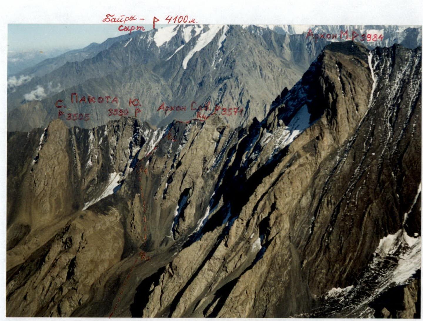
The ascent area is located within the Republic of North Ossetia–Alania, in the Tepli–Kalota mountain massif. This massif belongs to the Bokovoy Range. From two peaks in this area – Kalota and Arkhon Glavny – long ridges extend northward, bounding the Tsadjiudon river gorge. Geologically, this gorge is very interesting as it contains a contact zone between magmatic and sedimentary rocks. Some ridges and buttresses on the slopes of the peaks in this gorge are composed of strong crystalline rocks, while the couloirs between them are formed of clay shales. The Tsadjiu glacier itself is a glaciological monument – the only glacier of the Turkestan type in Ossetia. That is, it lacks a feeding area (firn field) and exists due to avalanches and ice collapses from the surrounding slopes. The Tsadjiu gorge is very promising for mountaineering. There are many unconquered peaks and unclimbed routes from 1st to 5th category of difficulty, involving rock, mixed, and ice climbing. Specifically, the Northern ridge of Kalota peak, known as the "Kalota Saw", bounds the gorge from the West. This ridge is heavily serrated, with about a dozen peaks, half of which remain unconquered. The eastern slopes of the Kalota Saw are technically interesting, with unclimbed ridges and buttresses, as well as traverses of individual peaks. To the East, the gorge is bounded by the Arkhon ridge. This includes (from south to north): Arkhon Yuzhny Zapadny – Centralny – Glavny – Maly – Severny. The western slopes of this ridge are technically complex and heavily glaciated. The elevation difference from the glacier to the peaks reaches 1 km. Previously, the gorge was rarely visited due to its remoteness from alpine camps and its location within the North Ossetian State Reserve. Only in recent years has the Tsadjiu gorge become actively explored by mountaineers from North Ossetia.
Photopanorama of the area. View from the West. September. Photo from p. Tukhachevsky. The first ascent route is marked. (Tukhachevsky Peak is located on the Kalota Saw).
Brief Description of the Approach to the Route
Travel from Vladikavkaz to Kharisdzhin village by regular bus. 1.5 hours. From the village, take a drivable dirt road up the Fiagdon river gorge — 2 km, to the mouth of the Tsadjiudon river. Follow the path on the left side of the river, past a tower, to reach an old geological road. Walk on it, staying left (in the direction of travel) of the river, until the road ends at a scree slope leading into the river. Here, cross the Tsadjiu river via logs. After crossing to the right bank (in the direction of travel), ascend up the gorge — along a path starting near the crossing. Within 1.5 hours of walking from Kharisdzhin, the gorge gradually turns left (south). Here, climb the slope to reach an old geological road visible above. Follow it, initially through forest, then over an ancient moraine step, exiting the forest into a wide, flat riverbed. This adds another 1.5 hours. Continue up the gorge, along the right bank of the river (in the direction of travel), on a path among meadows and in the riverbed, to a steep morainic ascent. Climb it directly upwards to its inflection point. Then, follow along the river to the last grassy platforms, short of the glacier. These platforms are located near the river, about 0.5 km from the glacier. The elevation here is 2900 m. The total time from Kharisdzhin village to the overnight stay is 6.5–7 hours.
Brief Description of the Route
From the overnight stay, ascend to the moraine lying to the East, which rises above the glacier. Follow the moraine ridge upwards until a small scree cirque becomes visible on the left, bounded by the western slopes of Arkhon Severny and the north-western slopes of Arkhon Maly. Turn left towards Arkhon Severny and approach the start of the route via screes and occasional snowfields. The route is clearly visible from here. The time from the overnight stay is 1.5 hours.
R0–R1: Approach the scree slopes and ascend them to reach the Western buttress of the North-East ridge of Arkhon Severny peak. The ascent path initially follows the scree, then can shift left onto broken rocks, and from there reach the ridge of the Western buttress. The section is graded 1–2.
R1–R2: Ascend the rock face of the Western buttress 1–2, bypassing difficult sections via ledges, directly upwards towards the Black Gendarme. Bypass the rust-colored tower on the ridge of the Western buttress on the right via rocks 2–3. Then, approach the base of the Black Gendarme.
R2–R3: The path to the Black Gendarme goes left of the ridge line. The rocks — steep clay shales — are heavily weathered. Ascend leftwards via ledges, bypassing difficult sections, towards the visible North-East ridge of Arkhon Severny peak against the sky. Rocks 2–3. Loose stones! Insurance is organized only using large protrusions. Time from the overnight stay to reaching the ridge is 5–6 hours.
R3–R4: Upon reaching the North-East ridge, turn right and continue southwards towards the visible summit tower ahead. Bypass the summit of the Black Gendarme on the left via its eastern slopes. The path to the Pre-summit Gendarme is graded 1–2. Ascend the Gendarme directly upwards via rocks 2–3. Descend from it along the ridge 1–2 to the col under the summit tower.
R4–R5: From the col, move left via ledges 1–2 under the base of a white quartz vein, left of a detached slab. The section is 20 m.
R5–R6: Ascend the wall directly upwards via a vein of light quartz rocks, which leads to the edge of the summit tower. At the start of the section, the wall is 5 m, 90°, graded 4. Continue via rocks 3–4 to reach the edge of the tower. The entire section is 40 m.
R6–R7: Ascend the edge directly upwards. Rocks 2–3. After 50 m, reach the summit of Arkhon Severny (3571 m). Time from the overnight stay is 7–8 hours. Descent is via the ascent route.
View from the West

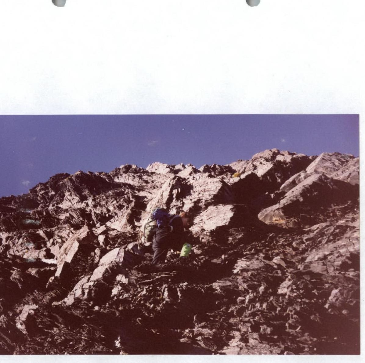
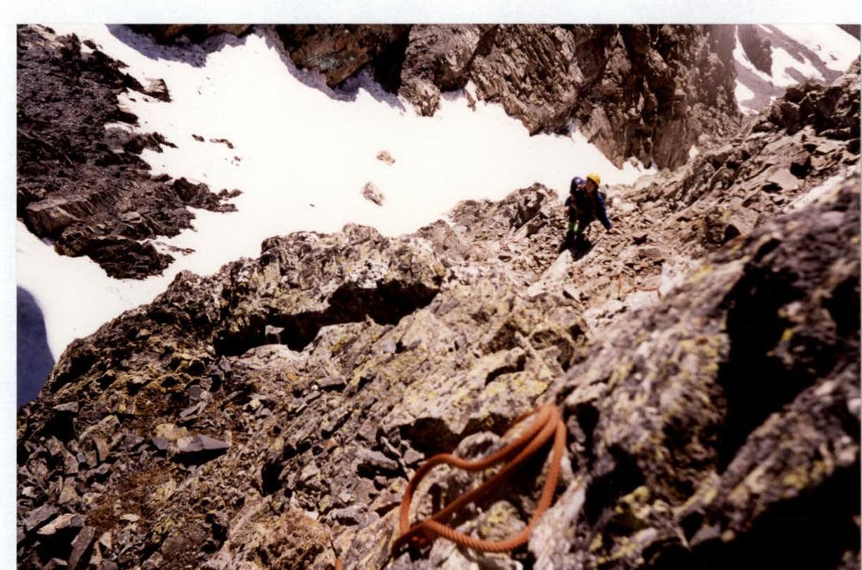
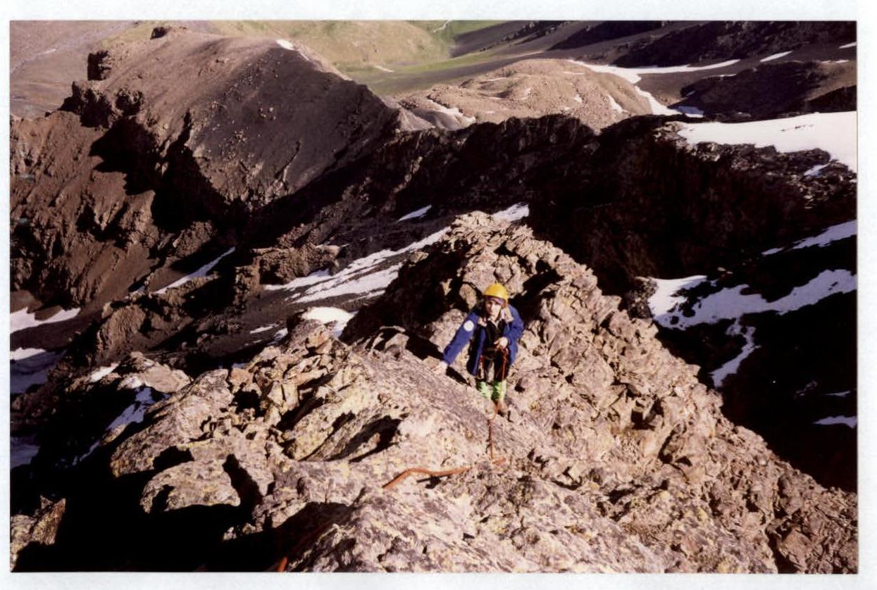
Passage of section R2–R3 — the wall of the Black Gendarme.
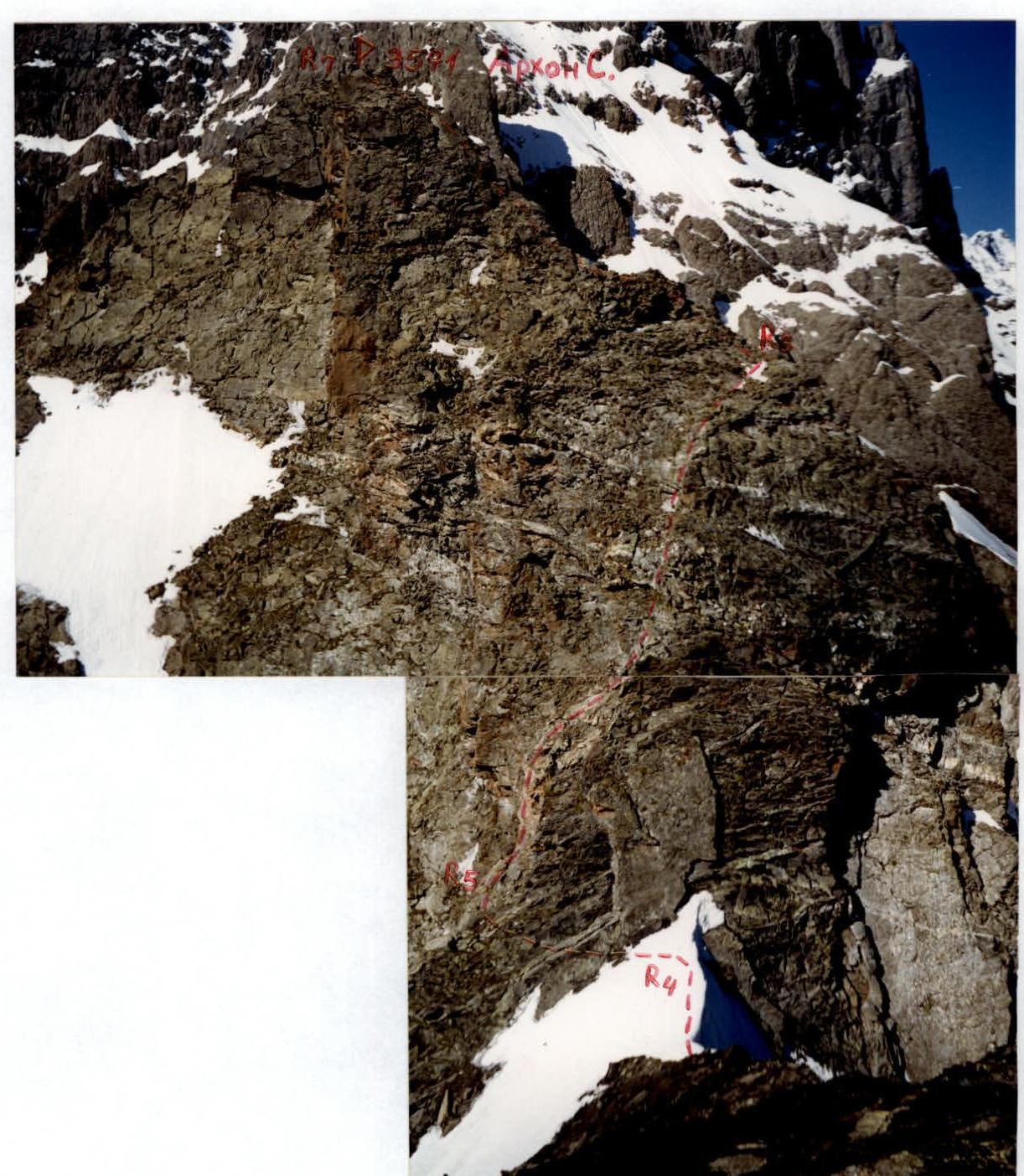
North-East ridge leading to Arkhon Severny summit. Photo from the Black Gendarme.

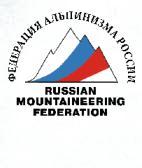
Passage of section R3–R4 — exit to the Pre-summit Gendarme.
Wall of the summit tower. The path is marked. Photo from the Pre-summit Gendarme.
Passage of the middle part of section R5–R6.
Passage of the upper part of section R5–R6.
Passage of the middle part of section R6–R7.
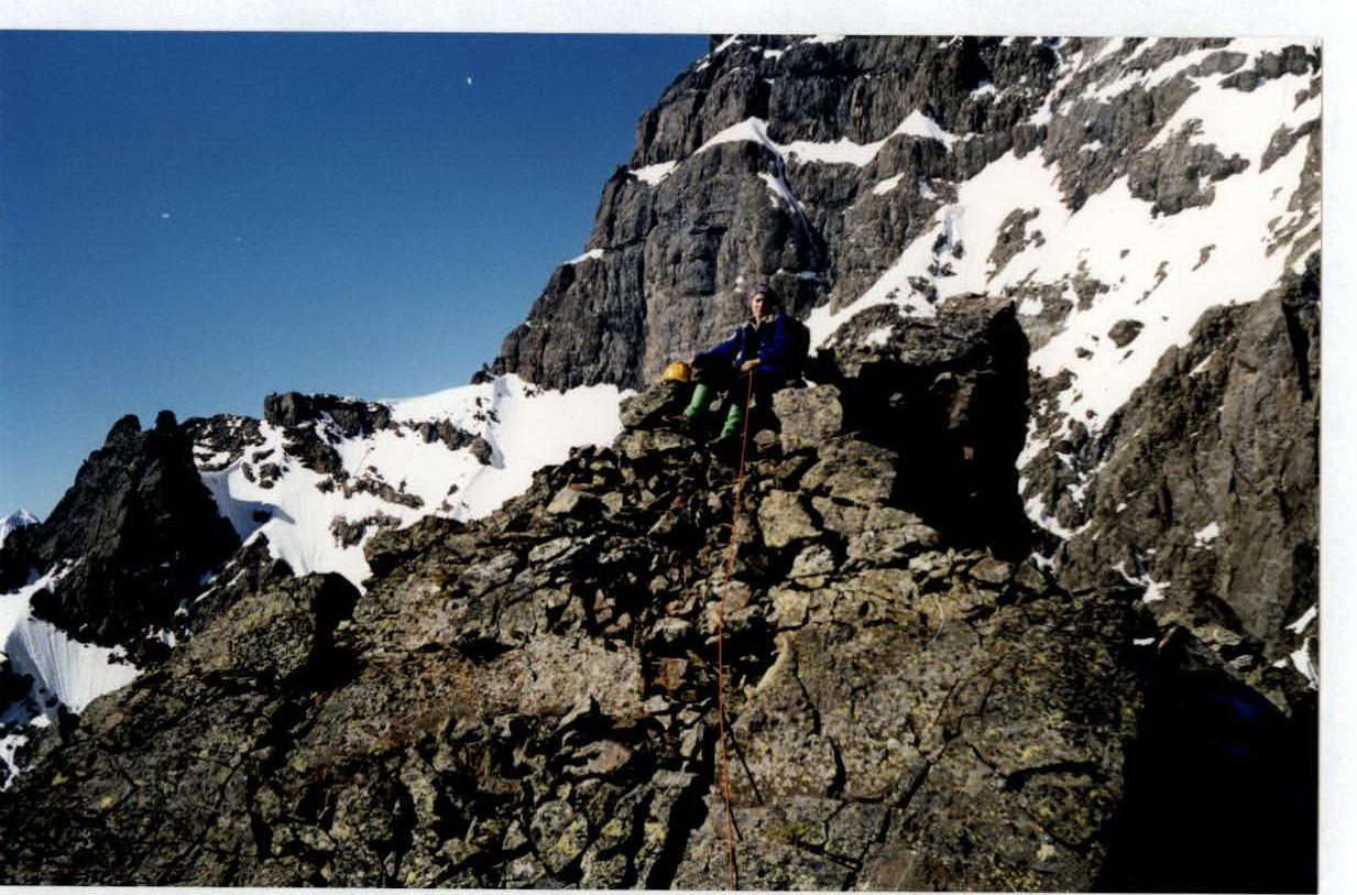
On the summit of Arkhon Severny (3571 m). In the background — North-East slopes of Arkhon Maly (3984 m).