REPORT
on the first ascent to the Sadonkhok summit, via the North ridge, Category 1B complexity, by the team of North Ossetian Search and Rescue Squad of the EMERCOM of Russia September 20, 2022
I. ASCENT PASSPORT
| № | 1. General Information | |
|---|---|---|
| 1.1 | Full name, sport rank of the leader | Egorin S.V. — Master of Sports |
| 1.2 | Full name, sport rank of participants | Kokoev D.T. — 3rd sports rank. Shmonova N.A. — 3rd sports rank. |
| 1.3 | Full name of the coach | Egorin S.V. |
| 1.4 | Organization | North Ossetian Search and Rescue Squad of the EMERCOM of Russia, UTs Tsey |
| 2. Characteristics of the ascent object | ||
| 2.1 | Region | Caucasus, Tsey Ridge |
| 2.2 | Valley | Tsey Valley |
| 2.3 | Number according to the 2020 classification table | 2.7 |
| 2.4 | Name and height of the summit | Sadonkhok, 3549 m |
| 3. Route characteristics | ||
| 3.1 | Route name | Via the North ridge |
| 3.2 | Proposed category of complexity | 1B |
| 3.3 | Degree of route exploration | First ascent |
| 3.4 | Nature of the route terrain | Rocky |
| 3.5 | Height difference of the route | 300 m |
| 3.6 | Route length | 400 m |
| 3.7 | Technical elements of the route | Category I ice/rock/combination — 200 m. Category II ice/rock/combination — 120 m. Category III ice/rock/combination — 60 m. Category IV ice/rock/combination — 20 m. Movement on closed glacier — none. Rappelling (on descent) — none. |
| 3.8 | Descent from the summit | Via the Northwest slope (easy), with exit to the Sadon Upper pass. |
| 3.9 | Additional information on the route | Water and mobile phone signal are absent on the route. |
| 4. Characteristics of the team's actions | ||
| 4.1 | Time of movement | 4 hours |
| 4.2 | Overnight stays | None |
| 4.3 | Start of the route | 8:00, September 20, 2022 |
| 4.4 | Reaching the summit | 12:00, September 20, 2022 |
| 4.5 | Descent to the pass | 14:00, September 20, 2022 |
| 5. Responsible for the report | ||
| 5.1 | Full name, e-mail | Egorin S.V., e.s.128@mail.ru |
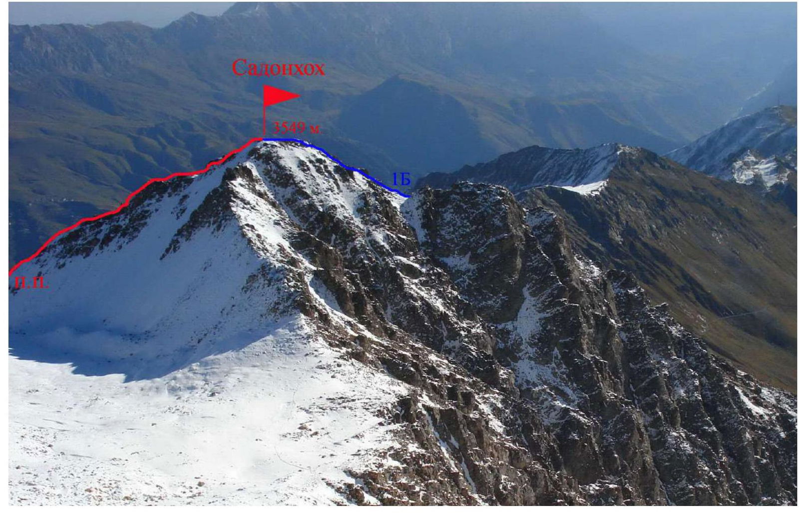
Photo 1.
1.1 General photo of the Sadonkhok summit. September 2006. Photo from the slopes of Cherevichenko peak. View from the West.
The first ascent route via the North ridge is marked in red. The 1B route via the East ridge is marked in blue.
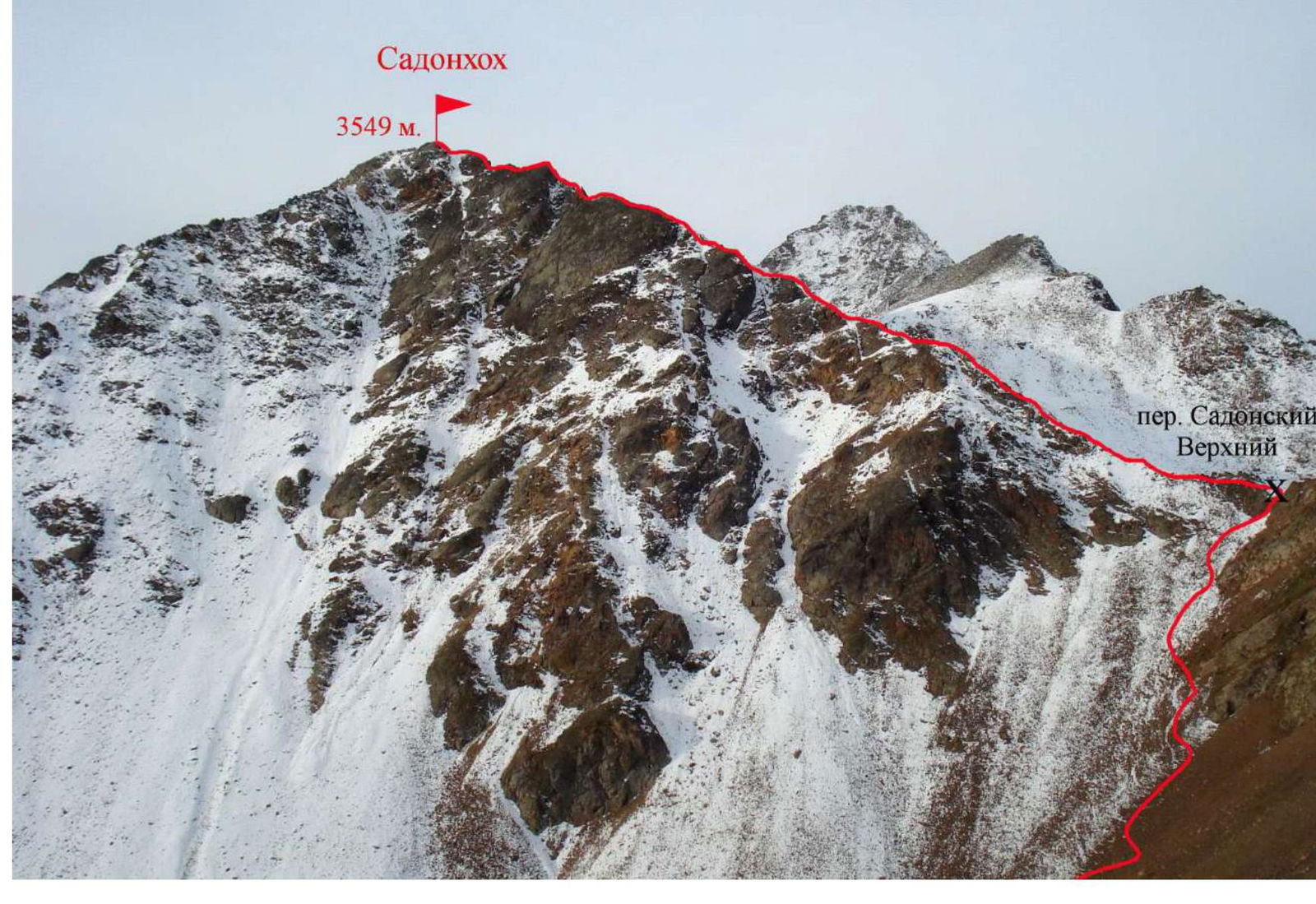
Photo 2. 1.2. Photo of the route profile. September. View from the Northeast.
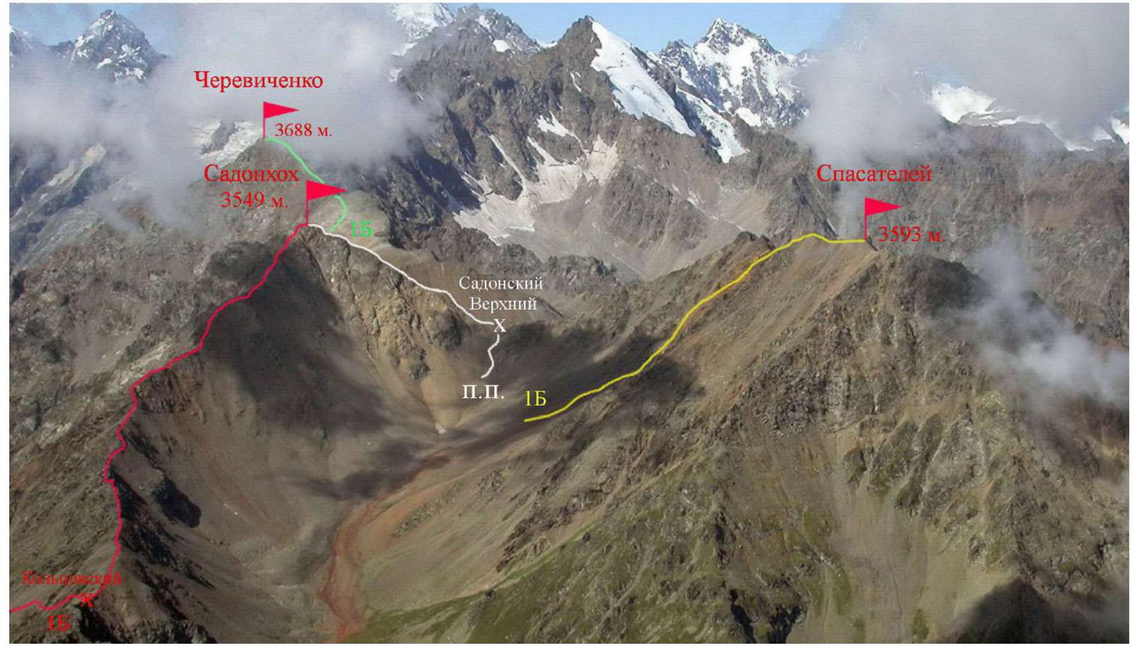
Photo 3. 1.3. Photopanorama of the ascent area. Photo taken from a helicopter, August. View from the East.
Photo 4.
The photo shows the walking part of the approach to the overnight stay near the adit. View from a helicopter, September.
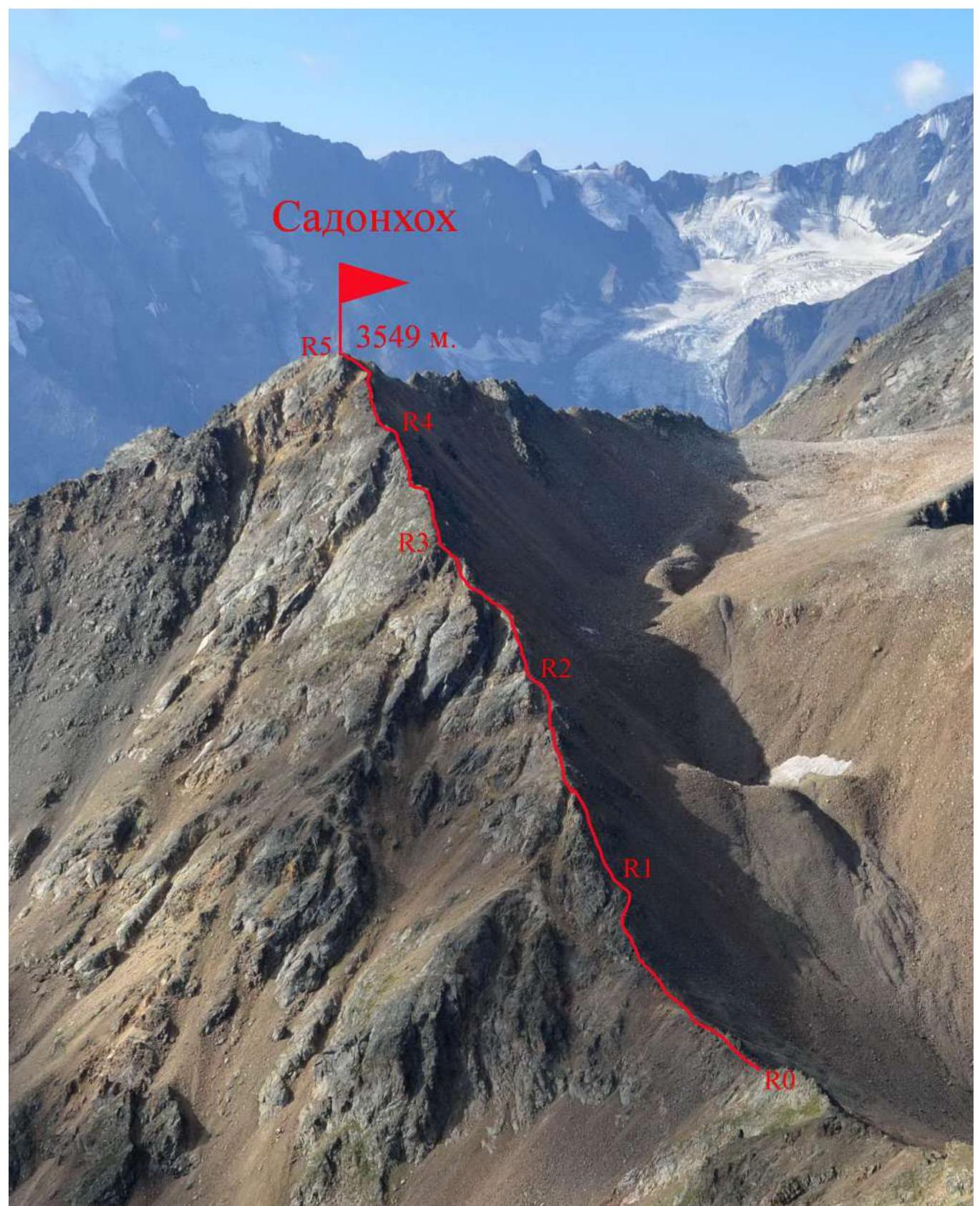
Photo 5. 2.1. Technical photo of the route. View from the North, August.
2.3. Technical characteristics of the route sections.
| Section № | Terrain characteristics | Category of complexity | Length, m | Type and number of hooks |
|---|---|---|---|---|
| R0–R1 | Rocky-scree ridge | 1–2 | 100 m | - |
| R1–R2 | Rocky-scree ridge | 1–3 | 80 m | Protection through ledges |
| R2–R3 | Rocky-scree ridge | 2–4 | 60 m | |
| R3–R4 | Rocky-scree ridge | 1–3 | 80 m | |
| R4–R5 | Rocky-scree ridge | 1–2 | 80 m |
3. Characteristics of the team's actions.
3.1.1. Description of the approach to the route:
From the EMERCOM of Tsey district, we descend down the main asphalt road to the left turn — to the settlement of Verkhny Tsey. Opposite the red stone, a new dirt road begins (for high-clearance vehicles), leading through a pine forest to the outskirts of the village. The road then turns right (to the East), past the new hotel — 1950 m — to the Tsey repeater.
Before reaching the repeater, about 12 km from the EMERCOM — there is a fork in the roads:
- To the left, to the West, an old geological road branches off, leading to the exploratory adit.
- Along this road, overgrown with bushes, you can drive another 3 km on an ATV to a large platform.
- Further, we proceed on foot along the remains of the old geological road, partially blocked by rockfalls.
After 2 hours of walking from the fork, we reach the old adit.
In 1950–1959, the Koltsovskaya exploratory geological party was stationed here, one of whose participants, Goncharenko O.A., suggested this route to the Tsey Ridge. The geologists had created a pack trail through the pass to lower equipment into the cirque in the upper reaches of Sadon. Now this is the Koltsovsky pass 1A, described and added to the caucatalog.ru database after being traversed in 2006 by Egorin S.V.
From the platform in front of the adit, we move upwards to the right (the start of the trail is 100 m to the right of the adit). The trail on the rocks is clearly visible, but on the scree, it disappears in places. After 200 m, we enter a couloir with fine reddish scree. We ascend the couloir in zigzags and exit onto the Tsey Ridge. This is the Koltsovsky pass, 3170 m.
30 minutes walk from the adit. The descent straight down is prone to rockfalls. After reaching the pass, we turn left. Along the broad scree ridge, we move to the West.
100 m from the pass, on the northern slope of the eastern ridge of Sadonkhok summit — the beginning of the descent trail into the Sadon valley is visible. These are the remains of the pack trail leading to the upper cirque of the Sadon river.
Ahead, the saddle of the Sadon Upper pass (1A) is visible — our path lies there.
We descend into the cirque along the remains of the old trail, and in the lower part — along the scree. We go straight down, towards the lower part of the red scree.
The height difference from the Koltsovsky pass is about 100 m.
Along the red scree, we proceed to the West, towards the Sadon Upper pass. Along the way, we encounter trash from the old geological party.
The pass ascent is fine scree, with "live" stones in places on the slope.
1.5–2 hours from the adit, we reach the Sadon Upper pass.
3.1 Brief description of the route passage.
| Section № | Description | Photo № |
|---|---|---|
| R0–R1 | On the pass, we turn left and begin to ascend, moving along the rocky-scree ridge towards the rocky ascent. Having passed the rocky outcrops, we approach the first rocky ascent. | |
| R1–R2 | We move along the rocky ridge with short scree connections. We mostly follow the ridge line. Protection through ledges. We approach the second rocky ascent of the ridge. | 6 |
| R2–R3 | We bypass the start of the second ascent on the left along the rocks. Then, behind a sharp rock, we exit onto a narrow connection. Further, along the right part of the ridge, along the rocky wall, we reach the top of the ascent. Along the scree of the left part of the ridge, we approach the third ascent. | 7 |
| R3–R4 | We move along the slabs of the third rocky ascent, to the left of the ridge line. At the top of the section, we exit onto the ridge, where the rocks are destroyed. | 8 |
| R4–R5 | Along the rocky-scree ridge, we ascend, mostly following the ridge line. At the end of the section, we reach the summit of Sadonkhok — 3549 m. The summit is a good panoramic point. | 9 |
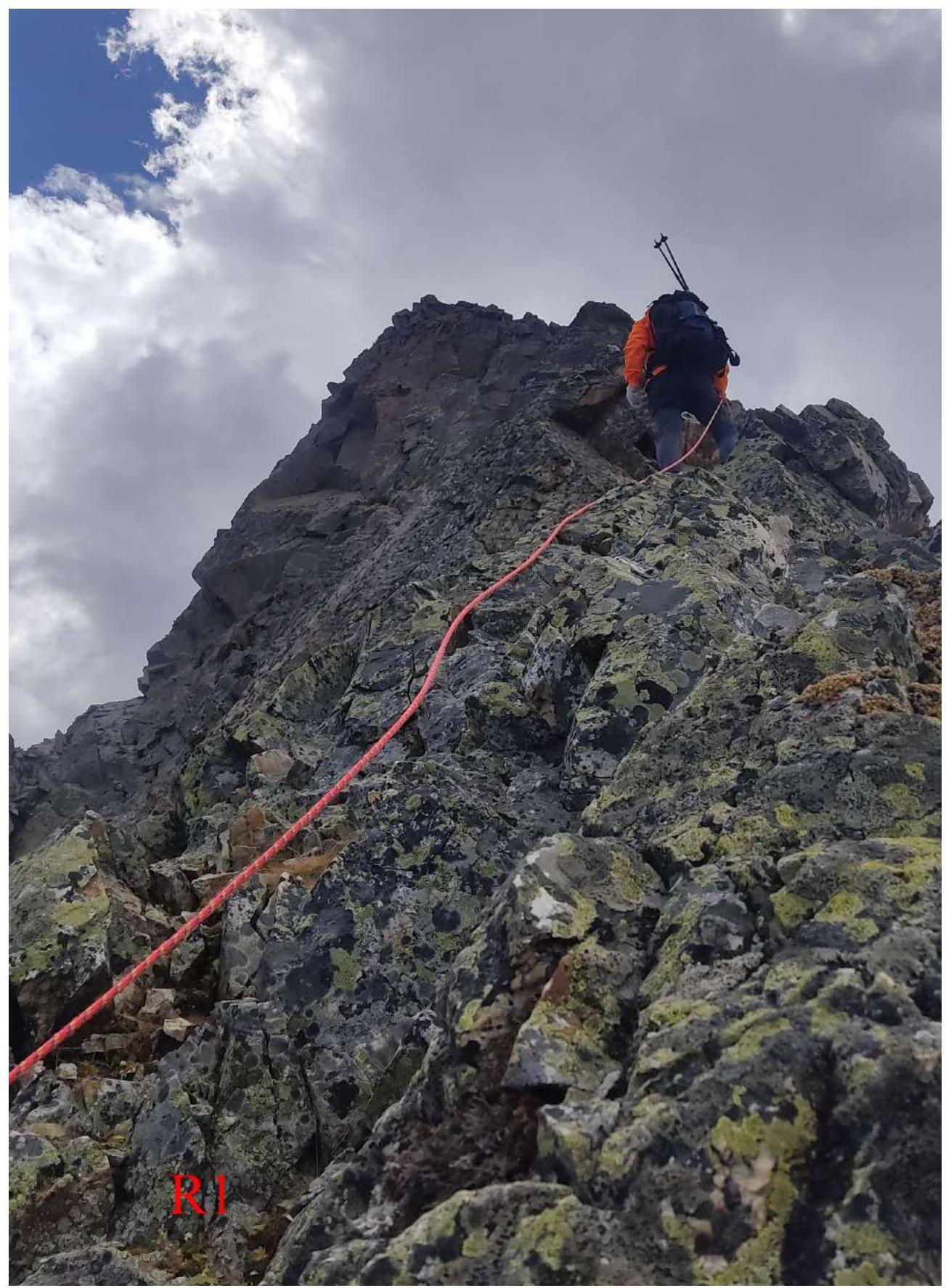
Photo 6. Start of traversing section R1–R2. Ascent to the first rocky ascent.
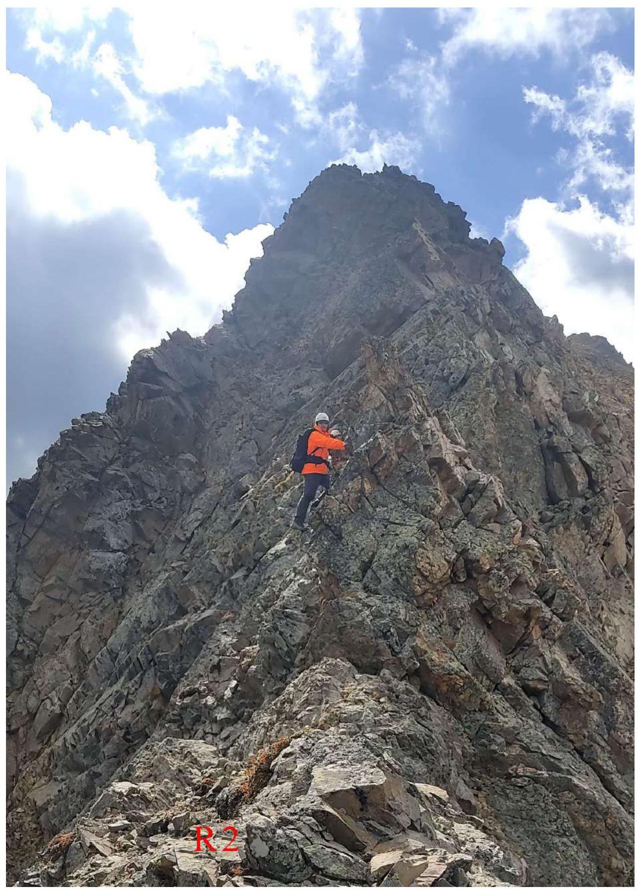
Photo 7.
Start of traversing section R2–R3. Ascent to the second rocky ascent.
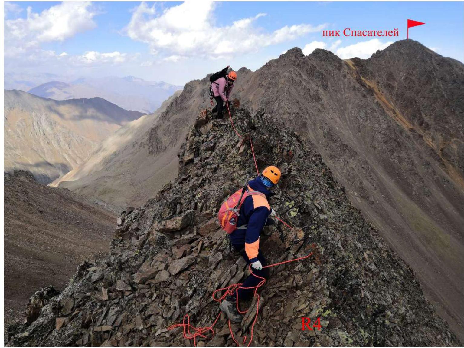
Photo 8. Traversing the end of section R3–R4.
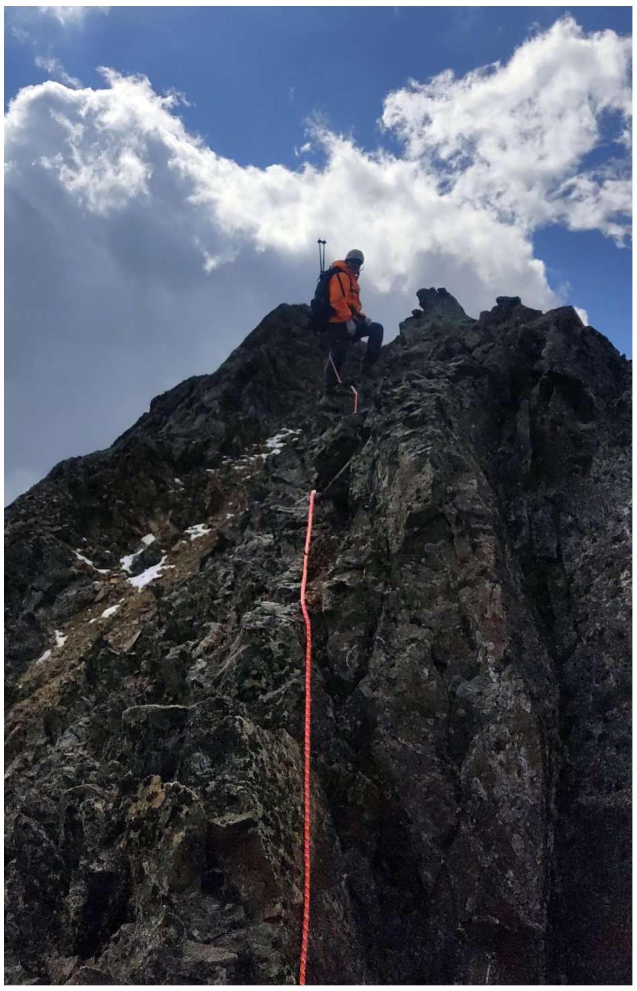
Photo 9. Traversing the middle of section R4–R5.
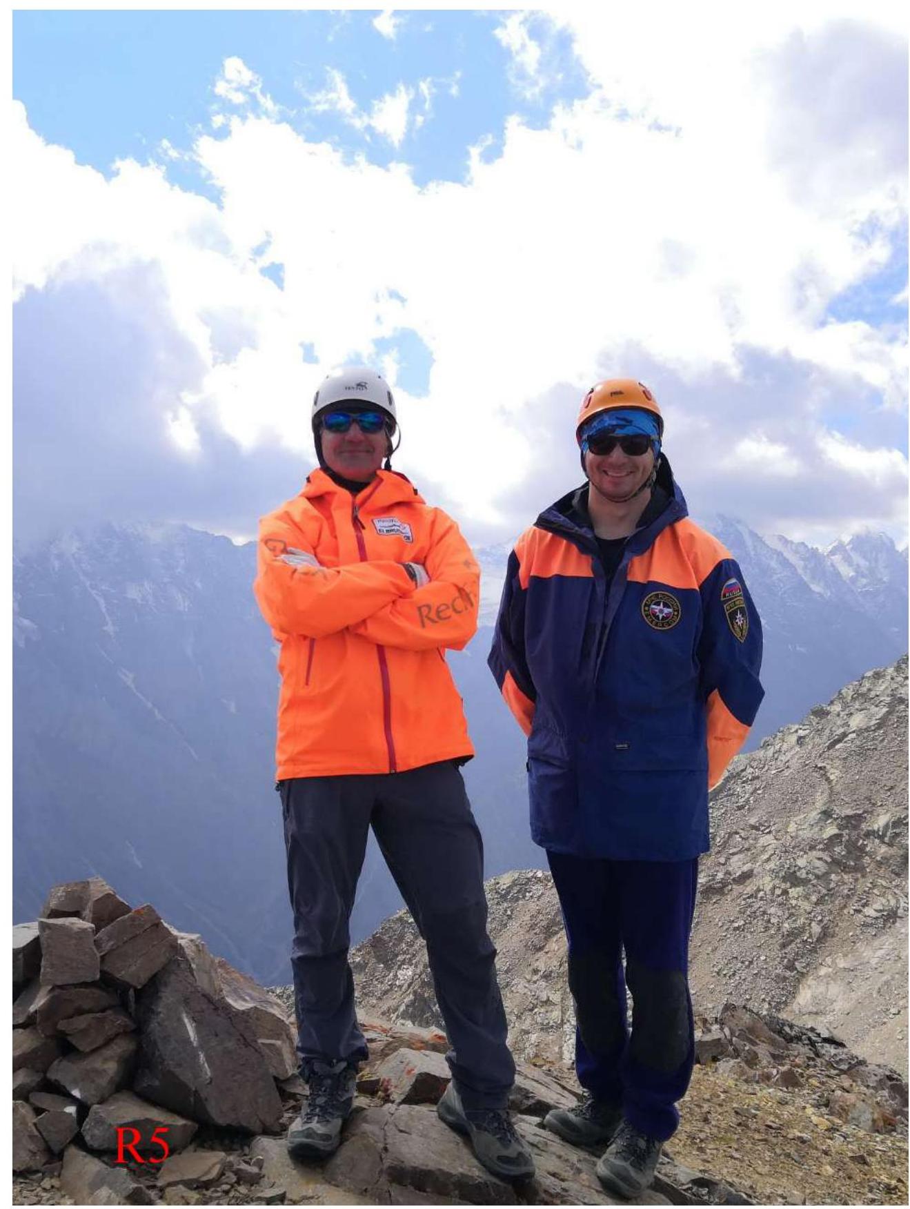
Photo 10. 3.2. Photo of the team on the summit with the control cairn.
On the summit of Sadonkhok — Egorin S.V. and Kokoev D.T.
3.3 Recommendations for the route.
Descent from the summit along the Northwest slope (easy), along snowy-scree slopes, with exit to the Sadon Upper pass from the West. Further return — via the ascent route.
The traversed route along the North ridge is logical and safe. It corresponds to Category 1B complexity when moving along the route line. It is a good training route for practicing rope team movement on the ridge, on rocks of initial categories.
Overnight stay is possible near the adit. There is a stream flowing directly from it. Mobile phone signal is available in places near the adit — "Megafon" works best.
On the ridge of Sadonkhok, on the slopes of the Rescuers peak, and in the upper cirque of the Sadon river, bear tracks have been regularly spotted in recent years.
When naming the summit, it is better to use "Sadonkhok", as there is a working settlement named Sadon below.