
In memory of Alexander Razbitnov...
Report
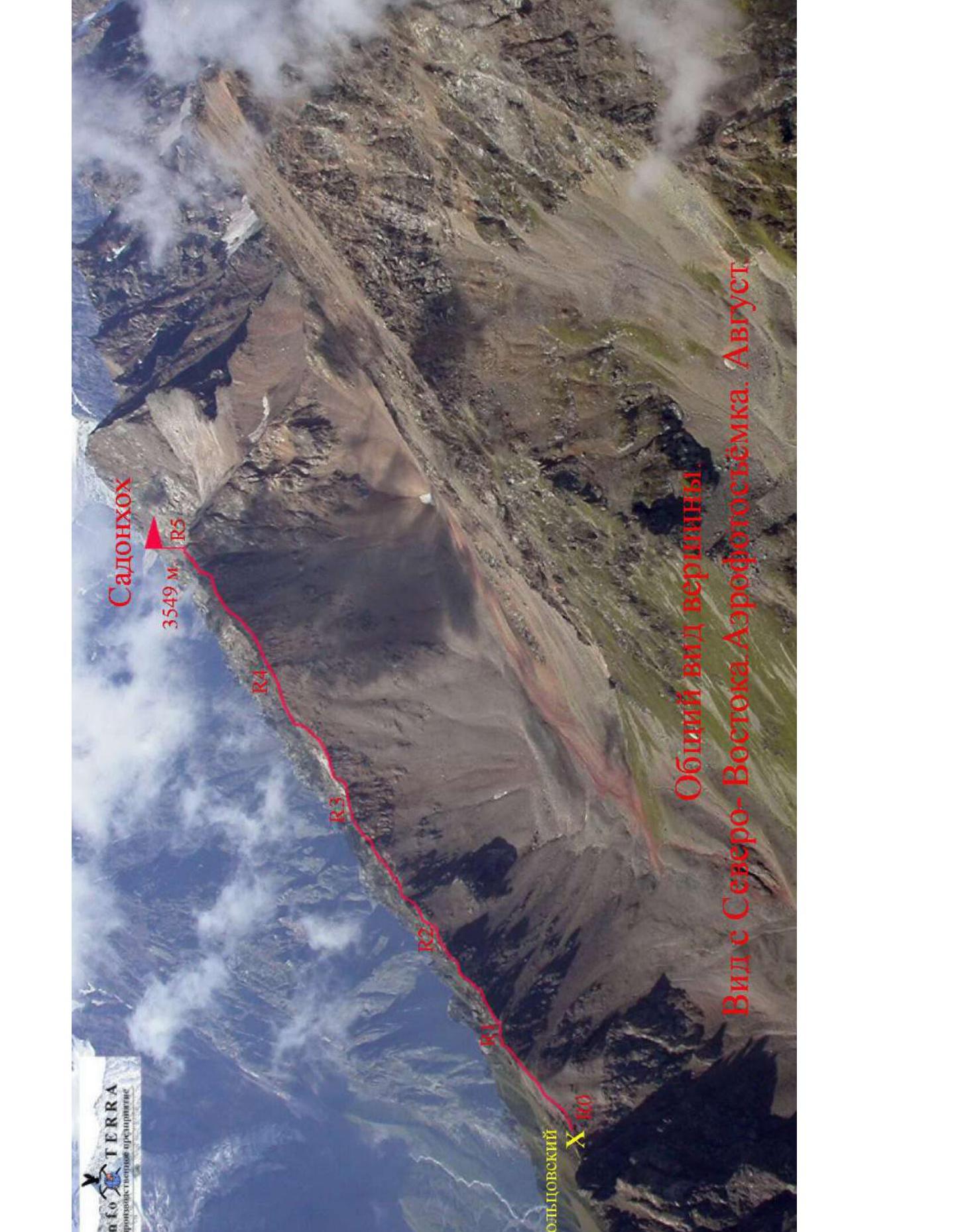
on the first ascent to the summit of Sadonkhokh via the East Ridge, category 1B, by the team of the North Ossetian Search and Rescue Squad of the EMEROS Russia May 31, 2006 2022
1. Climbing Passport
| № | 1. General Information | |
|---|---|---|
| 1.1 | Full name, sports rank of the leader | Egorin S.V. — Master of Sports |
| 1.2 | Full name, sports rank of the participants | Razbitnov A.S., Ivanov D.V., Mildzikhov R.V., Kamarzaev Z., Khachirov Z., Kokoyev D.T. All 3rd sports rank. |
| 1.3 | Full name of the coach | Egorin S.V. |
| 1.4 | Organization | North Ossetian Search and Rescue Squad of the EMEROS Russia, UTs Tsey |
| 2. Characteristics of the Climbing Object | ||
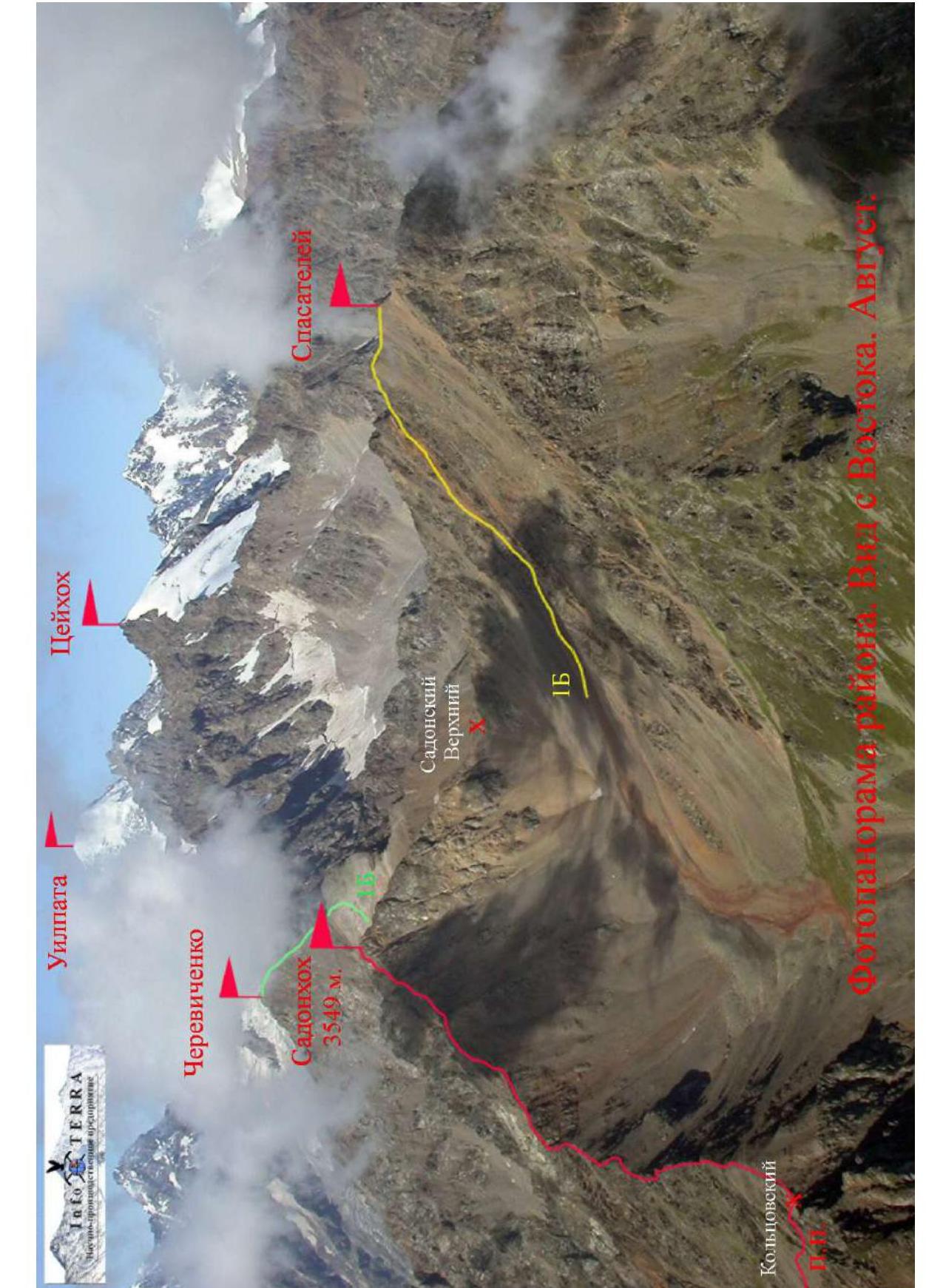
| 2.1 | Region | Caucasus, Tsey Ridge |
| 2.2 | Valley | Tsey Valley |
| 2.3 | Section number according to the 2020 classification table | 2.7 |
| 2.4 | Name and height of the summit | Sadonkhokh 3549 m |
| 2.5 | Geographical coordinates of the summit | 42°49′15.62″ N 43°54′15.09″ E |
| 3. Characteristics of the Route | ||
| 3.1 | Name of the route | Via the East Ridge |
| 3.2 | Proposed category of difficulty | 1B |
| 3.3 | Degree of route development | First ascent |
| 3.4 | Nature of the route terrain | Rocky |
| 3.5 | Height difference of the route | 380 m |
| 3.6 | Route length | Approximately 1200 m |
| 3.7 | Technical elements of the route | Category 1 ice/rock/combination — 700 m. Category 2 ice/rock/combination — 450 m. Category 3 ice/rock/combination — 40 m. Category 4 ice/rock/combination — 10 m. Movement on a closed glacier — none. Dülfer descent (on descent) — none. |
| 3.8 | Descent from the summit | Via the ascent route |
| 3.9 | Additional information on the route | The route was first climbed on May 31, 2006. Repeated for photographing technical sections on August 18, 2022. |
| 4. Characteristics of the Team's Actions | ||
| 4.1 | Time of movement | 5 hours of climbing time |
| 4.2 | Overnight stays | none |
| 4.3 | Start of the route | 7:00, May 31, 2006 |
| 4.4 | Reaching the summit | 12:00, May 31, 2006 |
| 4.5 | Descent to the pass | 17:00, May 31, 2006 |
| 5. Responsible for the Report | ||
| 5.1 | Full name, e-mail | Egorin S.V., e.s.128@mail.ru |
2. Technical Characteristics of the Route Sections
| Section | Terrain Characteristics | Category of difficulty | Length, m | Type and number of hooks |
|---|---|---|---|---|
| R0–R1 | Wide rocky and scree ridge | n.c.–1st category | 200 m | - |
| R1–R2 | Rocky and scree ridge | 1st–4th category | 300 m | Protection through ledges |
| R2–R3 | Rocky and scree ridge | 1st–4th category | 300 m | |
| R3–R4 | Rocky and scree ridge | 1st–3rd category | 200 m | |
| R4–R5 | Rocky and scree ridge | 1st–2nd category | 200 m |
3. Characteristics of the Team's Actions
3.1 Description of the Approach to the Route
From the EMEROS Tsey district, we descend down the main asphalt road to the left turn — to the village of Verkhny Tsey. Opposite the red rock, a new dirt road begins (for high-clearance vehicles), leading through a pine forest to the outskirts of the village. The road then turns right (east), past a new hotel at 1950 m — to the Tsey relay tower. About 12 km from the EMEROS, there's a fork in the roads. To the left is an old geological road leading to an exploratory adit. Along this overgrown road, we can drive another 3 km on an ATV to a large clearing. Further, we walk along the remains of the old geological road, partially covered by collapses of large-block scree. After 2 hours of walking from the fork, we reach the old adit.
In 1950–1959, the Koltsov geological exploratory party was stationed here, and one of its participants, Goncharenko O.A., suggested this route to the Tsey Ridge. The geologists had created a pack trail through a pass to lower equipment into the cirque in the upper reaches of Sadon. Now, this is the Koltsovsky Pass 1A, described and added to the caucatalog.ru database after being climbed in 2006 by Egorin S.V. Previously, the East Ridge of Sadonkhokh was only visited as a path to ascend Spartak Tsey (now known as Pik Cherevichenko).
Soviet climbers had established a good trail (described in A.F. Naumov's book on Tsey), following a grassy and scree watershed ridge — a slope between the rivers Shocherpakoydon and Komidon. This trail has now largely overgrown. It led to the East Ridge of Sadonkhokh near point R4 mentioned in this report. Thus, the main part of the East Ridge was first climbed in 2006 by our team.
From the clearing before the adit, we move up to the right (the start of the trail is 50 m to the right of the adit). The trail on the rocks is visible, but on the scree, it sometimes disappears. After 200 m, we enter a couloir with fine reddish scree. We ascend the couloir in a zigzag pattern and reach the Tsey Ridge crest. This is the Koltsovsky Pass, 3170 m. There's no direct descent.
30 minutes walk from the adit.
3.2 Brief Description of the Route Ascent
| Section | Description |
|---|---|
| R0–R1 | After reaching the pass, we turn left. Along the wide scree ridge, we move west. After 100 m, the beginning of the descent trail into the Sadon valley is visible on the northern slope. The ridge narrows, and we approach the first rocky section. |
| R1–R2 | We move along the rocky ridge with short walls of monolithic granite. We mostly follow the ridge line. Protection through ledges. |
| R2–R3 | Further up the rocky and scree ridge, we ascend, bypassing individual rock outcrops mainly on the left. At the end of the section, along a narrow rocky ridge, we reach a wide saddle with red scree. |
| R3–R4 | Through a rocky ascent composed of flat granite slabs, we continue towards the summit. Some gendarmes can be bypassed on the right (if there's no snow). |
| R4–R5 | Along the rocky and scree ridge, we ascend, bypassing individual rock outcrops. The rock is sometimes fragile. At the end of the section, along the rocky and scree ridge — slope, we reach the summit of Sadonkhokh 3549 m. The summit offers a great panoramic view. |
3.3 Recommendations
Descent from the summit is via the ascent route. It's also possible to descend along the Northwest slope and through the Upper Sadon Pass 1A category to exit into the cirque under Pik Spasatelei. From there, through the Koltsovsky Pass, return to the adit.
The route via the East Ridge is logical and safe. It's challenging due to the firm granite and corresponds to category 1B. It's a good training route for practicing movement in teams on a ridge with initial category rocks.
Overnight stay is possible near the adit. There's a stream flowing directly from it. There's mobile phone coverage in some areas of the route — "Megafon" works best.
On the Sadonkhokh ridge, on the slopes of Pik Spasatelei, and in the upper cirque of the Sadon river, bear tracks have been regularly seen in recent years.
When naming the summit, it's better to use "Sadonkhokh" since there's a working settlement named Sadon below.

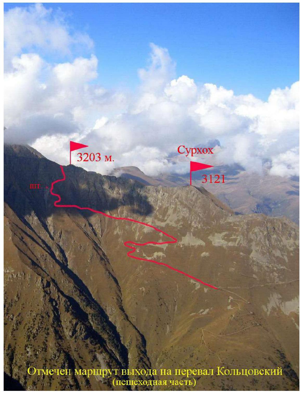 The route to the Koltsovsky Pass (pedestrian part) is marked
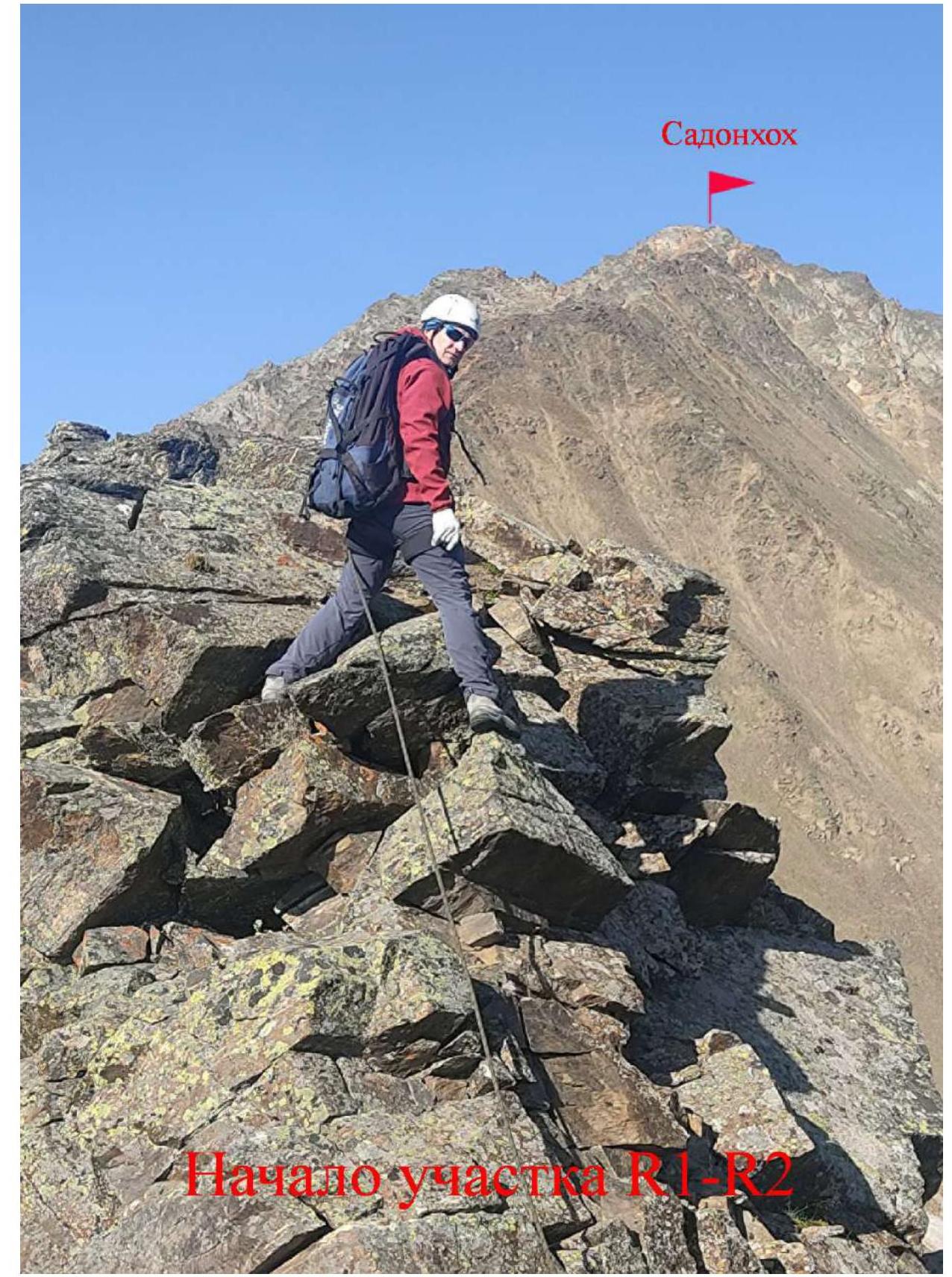 Start of section R1–R2
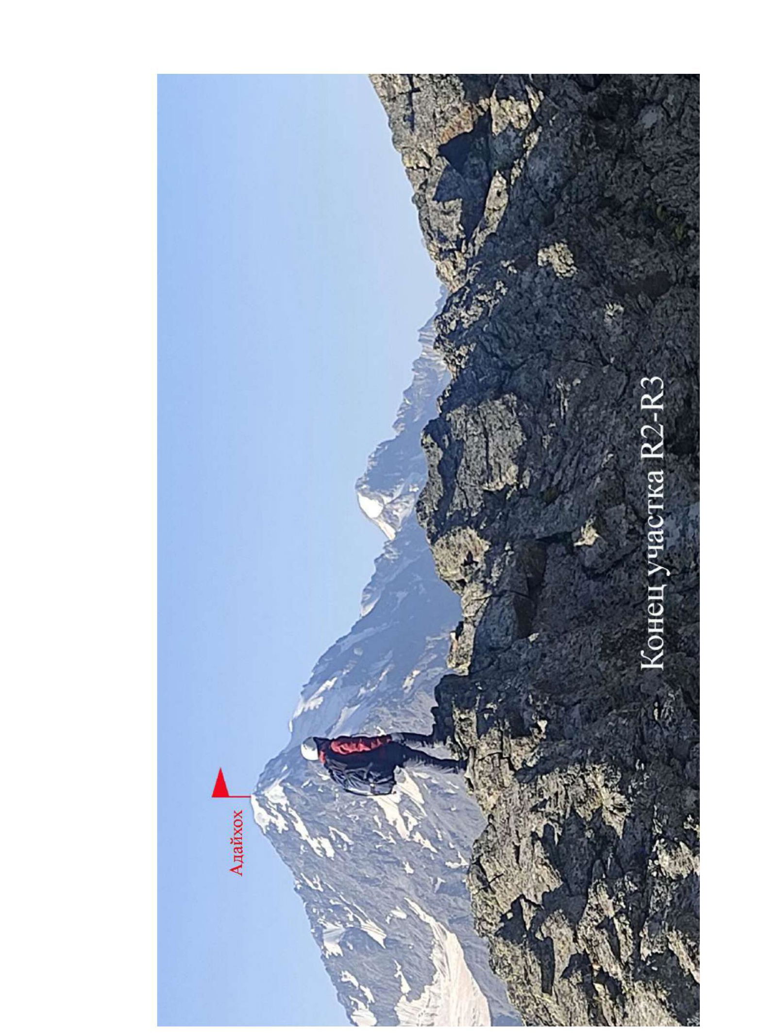 End of section R2–R3
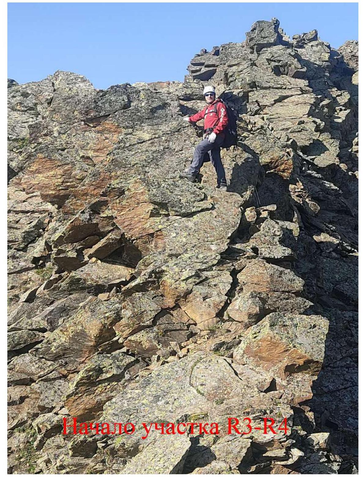 Start of section R3–R4
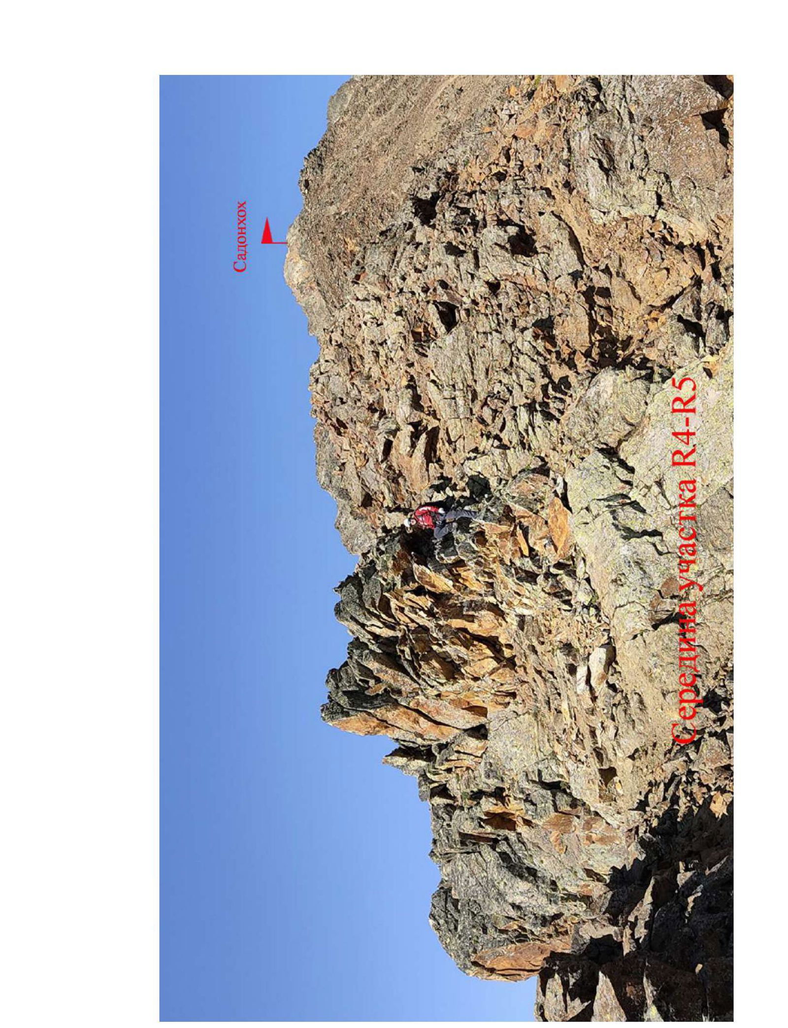 Middle of section R4–R5
 On the summit of Sadonkhokh. May 2006
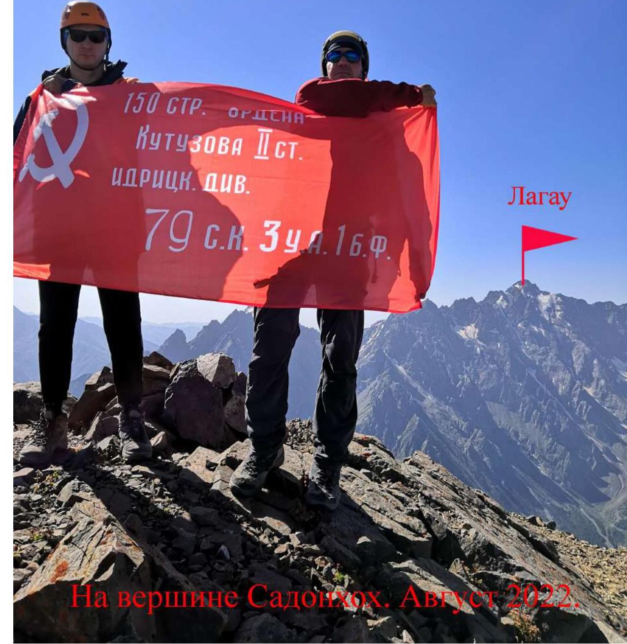 On the summit of Sadonkhokh. August 2022.
Chief of Sadonkhokh V. Dzhar.
On the summit of Sadonkhokh. August 2022.
Chief of Sadonkhokh V. Dzhar.