Report
on the first ascent to the summit of Urskhok 2nd Eastern, via the South wall, category 2A difficulty, by the team from the alpinism club "Kaskad", from July 7 to 8, 2020 2020 year
1. Ascent Passport
| №№ | 1. General Information | |
|---|---|---|
| 1.1 | Full name, sports rank of the leader | Egorin S.V. — Master of Sports |
| 1.2 | Full name, sports category of participants | Shmonova N.A. — 3rd sports category, Shmonov A.V. — 3rd sports category. |
| 1.3 | Full name of the coach | Egorin S.V. |
| 1.4 | Organization | Alpinism Club "Kaskad" |
| 2. Characteristics of the ascent object | ||
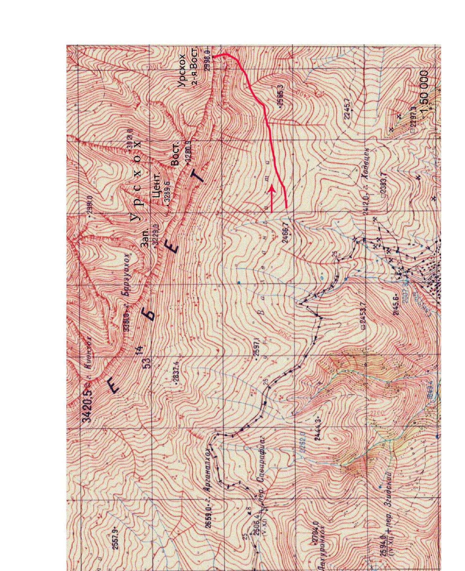
| 2.1 | Region | North Ossetia, Rocky Range, Kionsky massif. |
| 2.2 | Valley | Zgidskoye |
| 2.3 | Number according to the 2020 classification table | 2.7 |
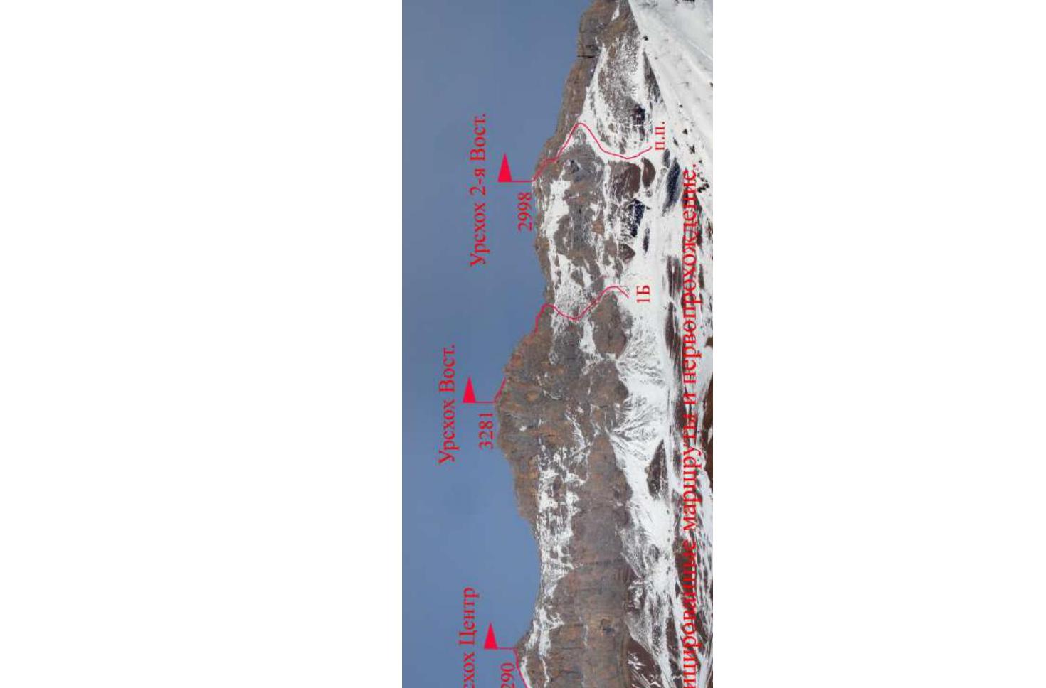
| 2.4 | Name and height of the summit | Urskhok 2nd Eastern, 2998 m |
| 2.5 | Geographical coordinates of the summit | 42° 54.062′ N 43° 59.152′ E |
| 3. Route characteristics | ||
| 3.1 | Route name | South wall |
| 3.2 | Proposed category of difficulty | 2A |
| 3.3 | Degree of route exploration | First ascent |
| 3.4 | Terrain characteristics of the route | Rocky |
| 3.5 | Elevation gain of the route | 250 m |
| 3.6 | Route length | 300 m |
| 3.7 | Technical elements of the route | I cat. diff. ice/rock/combination — 60 m. |
| II cat. diff. ice/rock/combination — 100 m. | ||
| III cat. diff. ice/rock/combination — 80 m. | ||
| IV cat. diff. ice/rock/combination — 58 m. | ||
| V cat. diff. ice/rock/combination — 2 m. | ||
| Rappelling (on descent) — no. | ||
| 3.8 | Descent from the summit | Along the Western ridge. |
| 3.9 | Additional route characteristics | Cellular connection available on the route — Megafon. |
| 4. Characteristics of the team's actions | ||
| 4.1 | Time in motion | 4 hours |
| 4.2 | Overnight stays on the route | no |
| 4.3 | Start of the route | 6:00, July 8, 2020 |
| 4.4 | Reaching the summit | 10:00, July 8, 2020 |
| 4.5 | Return to the base camp | 14:00, July 8, 2020 |
| 5. Person responsible for the report | ||
| 5.1 | Full name, e-mail | Egorin S.V., e.s.128@mail.ru |
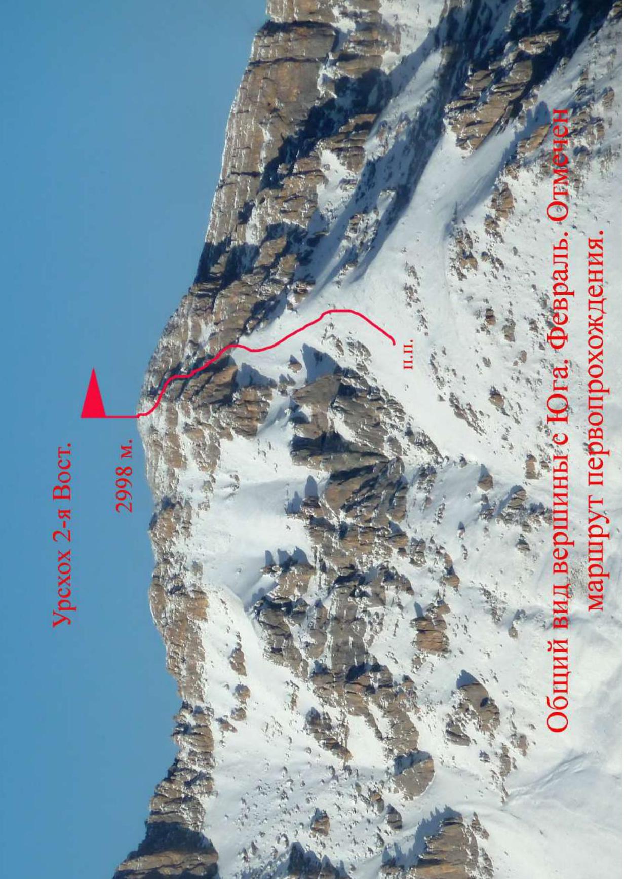 General view of the summit from the South. February. Aborted first ascent route.
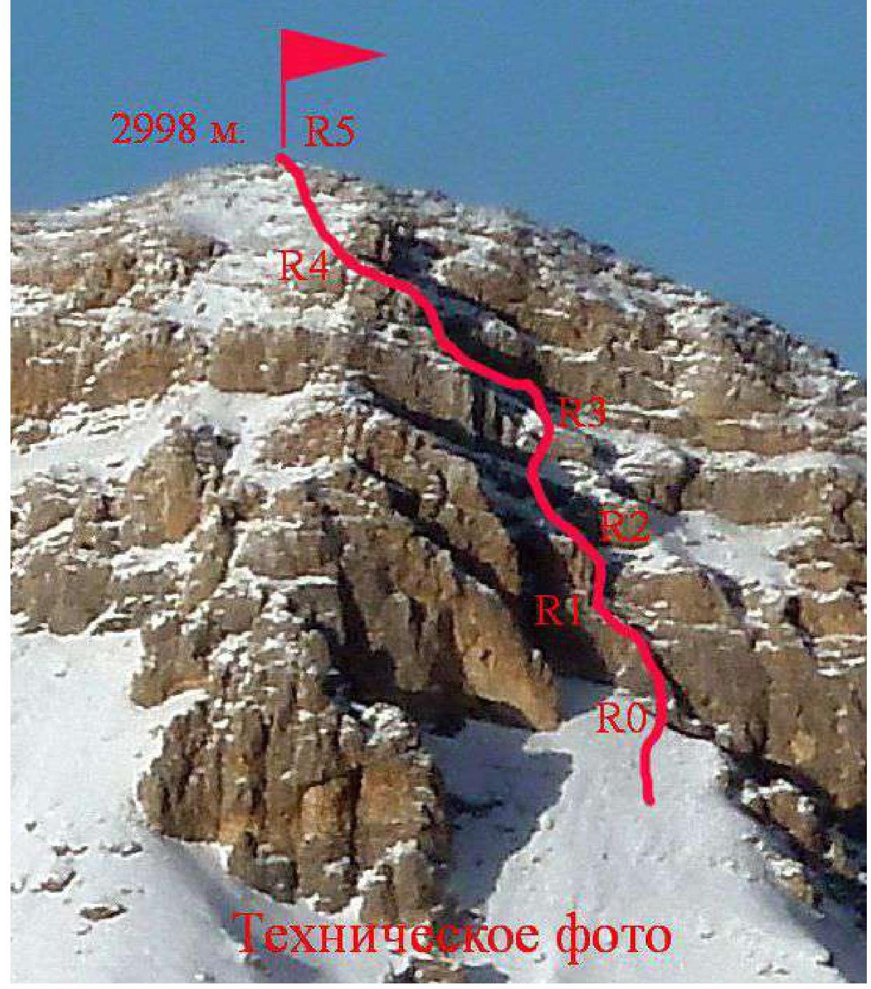
2. Technical characteristics of the route sections
| Section | Terrain characteristics | Category of difficulty | Length, m | Type and number of anchors |
|---|---|---|---|---|
| R0–R1 | Rocky ridge | 3–5 cat. diff. | 25 m | 3 anchors, 2 pitons |
| R1–R2 | Rocky wall | 2–4 cat. diff. | 25 m | 2 anchors, 3 pitons |
| R2–R3 | Slope with rocky belts | 1–3 cat. diff. | 70 m | 3 pitons |
| R3–R4 | Slope with rocky belts | 1–3 cat. diff. | 100 m | 2 pitons |
| R4–R5 | Slope | 1–2 cat. diff. | 80 m | - |
3. Characteristics of the team's actions
3.1 Description of the approach to the route
It takes 1.5–2 hours to drive from Vladikavkaz to the village of Verkhny Zgid. A regular bus runs to this village once a day, in the afternoon. You can drive further above the village, but with high-clearance vehicles. In this case, it takes about an hour to walk from the vehicle to the overnight stay under the Urskhok massif. You need to move straight up towards the triangular summit of Urskhok Central. Climbing from the road along the river, you can stay overnight at the end of the stream formed by springs that do not freeze even in winter. It takes about an hour to walk from the road to the overnight stay.
GPS coordinates in WGS-84 format:
| Elevation | N (North latitude) | E (East longitude) |
|---|---|---|
| hddd° mm′ ss.s″ | hddd° mm′ ss.s″ | |
| 2530 m | 42° 53′ 38.2″ | 43° 58′ 11.1″ |
From the overnight stay, we move up to the right, under the base of the descent couloir, between Urskhok Eastern to the left, and the summit 2998 m to the right.
The summit 2998 m is Urskhok 2nd Eastern. Without entering the couloir, we start traversing the grassy-scree slopes to the right, below the rocky walls. Having passed them, we move to the right — up, to the convex part of the scree slope. Having reached the ridge-slope line, we turn left, to the North, and go up to the South wall of the summit Urskhok 2nd Eastern.
The slope steepness gradually increases, and in the upper part, we move along the left edge of the couloir-canyon, washed out by spring streams, which is located to the East. The start of the route is at the base of the right part of the wall, along a small ridge. Behind the ridge, and under it — drops into the couloir-canyon.
From the overnight stay — about 1.5 hours.
3.2 Brief description of the route passage
| Section | Description | Photo number |
|---|---|---|
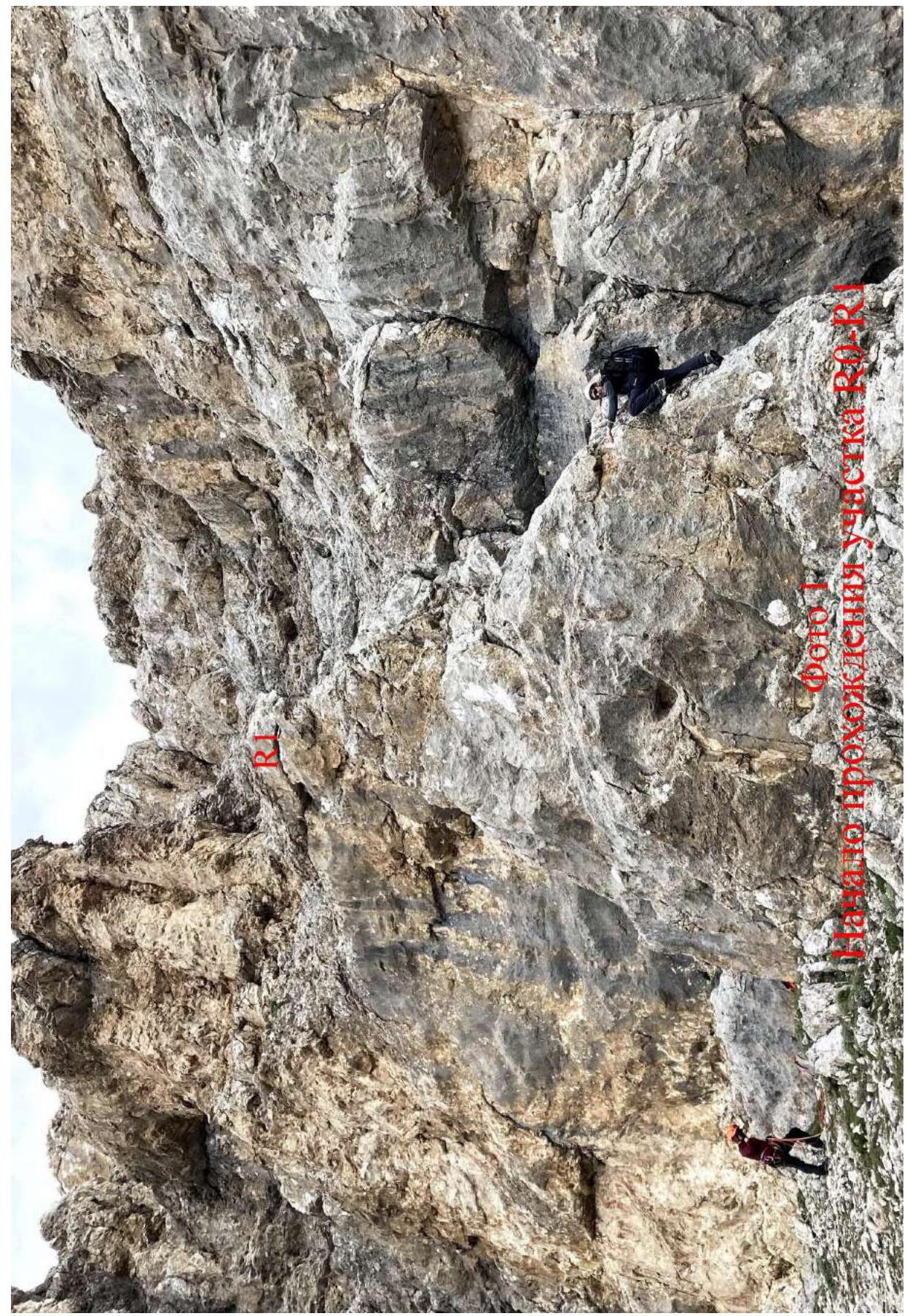
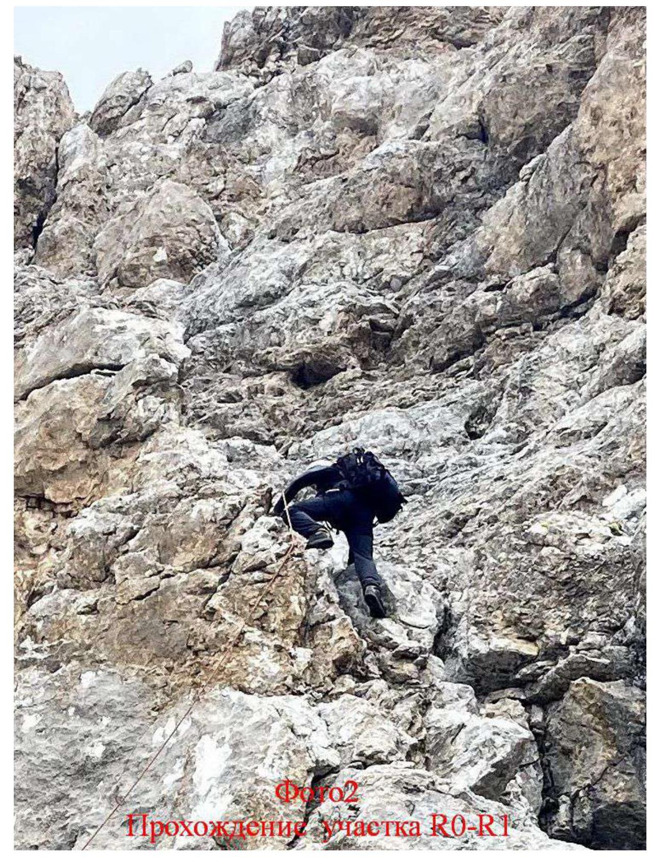
| R0–R1 | Along the ridge line, or its right part, we move up, on solid rock, 3–4 category. In the middle part — a small section 2 m, 90°, 5 cat. diff. At the top — it's problematic to organize a station. Anchor bolts are needed, or a move to R2. | Photo 1, 2 |
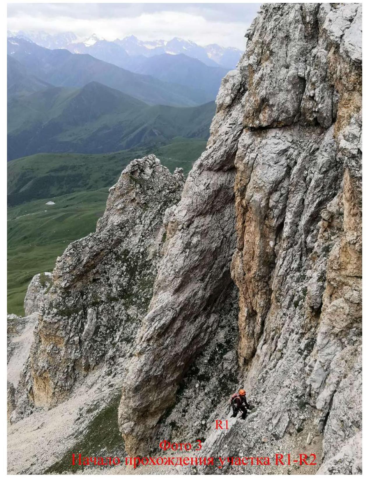
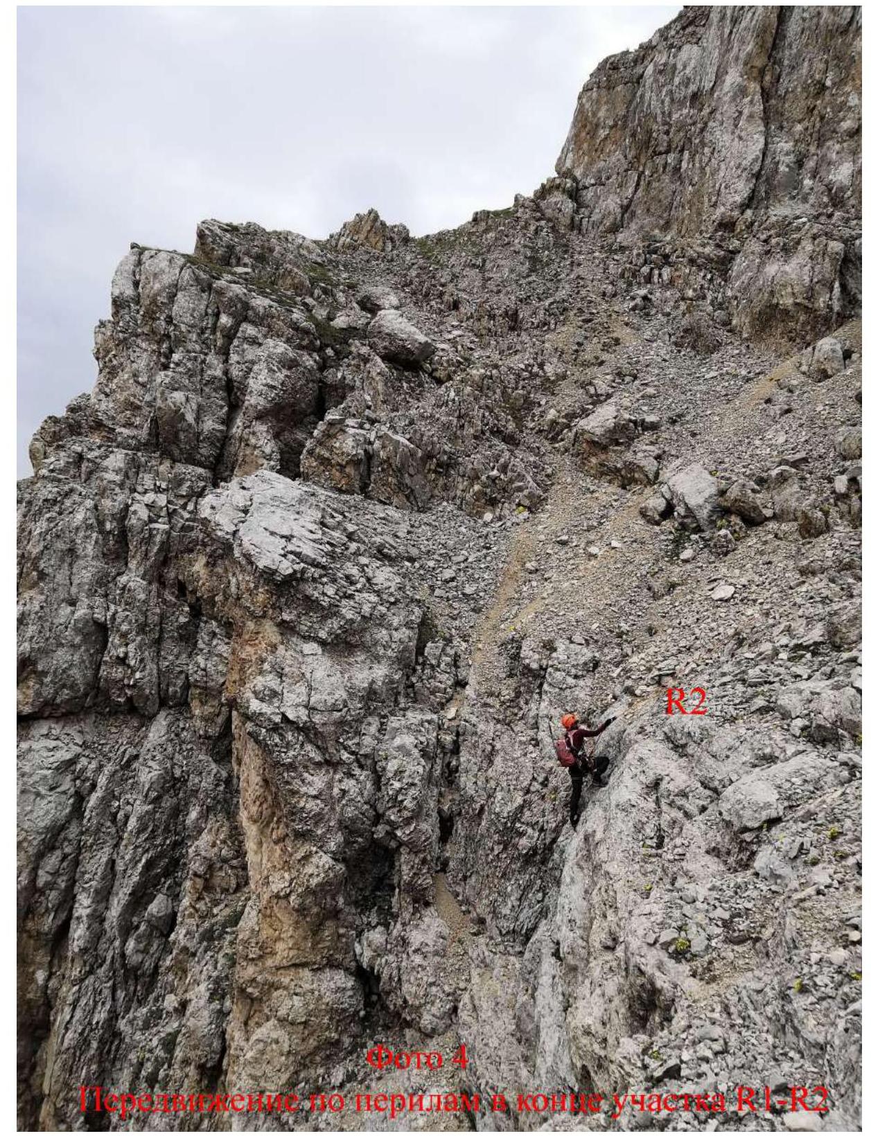
| R1–R2 | Further up, along the rocky wall with small ledges in the middle. Rock 2–4 cat. diff. After reaching a large ledge, at its upper part, you can secure the rope to a huge rocky block. | Photo 3, 4 |
| R2–R3 | From the large ledge, we bypass the next rocky belt, either to the right or to the left, on rock 2–3 category. Be careful — the rock is heavily damaged in some places! | |
| R3–R4 | Further direction of movement — to the left and up. Bypassing rocky belts, mainly along scree ledges, with small walls. | |
| R4–R5 | Along the scree slope, with small rocks in the upper part, ascent to the summit. |
3.3 Recommendations
The route via the South wall is safe, with proper ascent tactics, and can be recommended for passage by both training and sports groups. The route corresponds to category 2A difficulty and is comparable in complexity to similar routes in the area.
Descent from the summit along the Western ridge, category 1A, and further into the descent couloir under Urskhok Eastern. Rocks on the ridge are bypassed, mostly from the North.
08.07.2020 Ascent Urskhok 2nd Eastern First ascent via South wall approximately oriented Group: alpinists Egorin Sergey Shmonova Natalia Shmonov Alexey