
Climbing Passport
- Climbing type — rock climbing.
- Climbing area: Caucasus, Rocky Range.
- Peak 3280 m (Kionsky massif), via the Eastern ridge.
- Estimated complexity category, 1B — first ascent.
- Height difference: 250 m, total route length — 600 m, average slope of the route 25°.
- Pitons left on the route — no.
Use of previously driven pitons — no.
- Number of walking hours/days: 4 hours / 1 day.
- Overnights: no.
- Leader: Egorin Sergey Vladimirovich, Candidate Master of Sports.
Participants:
- Bondarenko Alexander Olegovich, 3rd sports category
- Bychkov Boris Nikolaevich, 3rd sports category
- Ivanov Vitaly Valentinovich, Candidate Master of Sports
- Sushko Alexander Pavlovich, Master of Sports
- Coach: Korablin Boris Nikolaevich, Master of Sports, Honored Coach of the RSFSR.
- Approach to the route: February 3, 1995.
Summit — February 3, 1995. Return — February 3, 1995.
- Organization: North Ossetian Republican Search and Rescue Service of the Ministry of Emergency Situations of Russia.
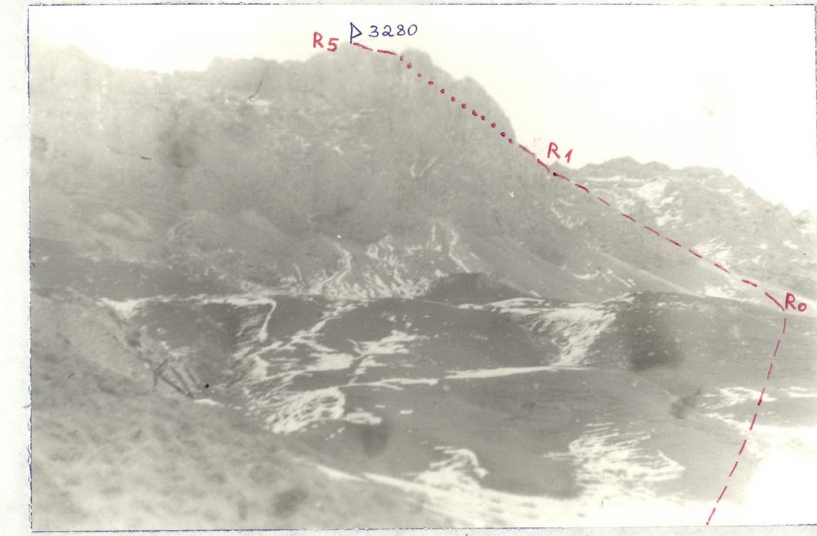
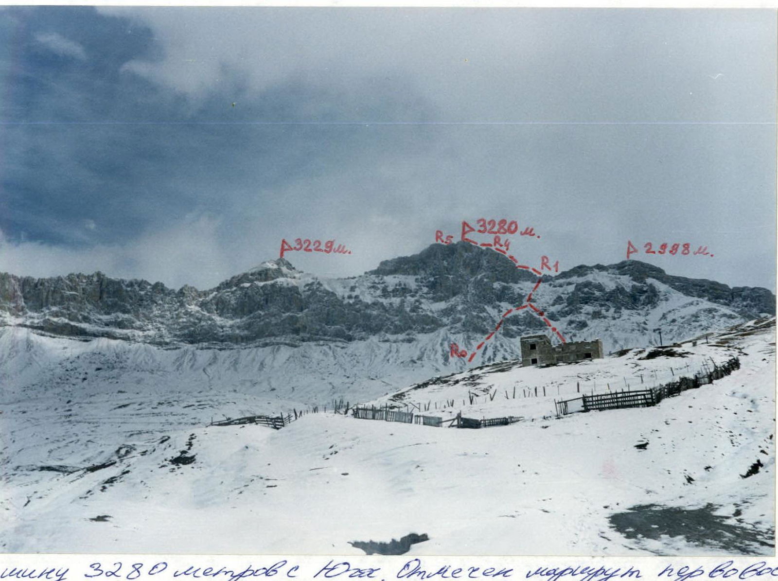 View of the 3280 m peak from the South. The first ascent route is marked.
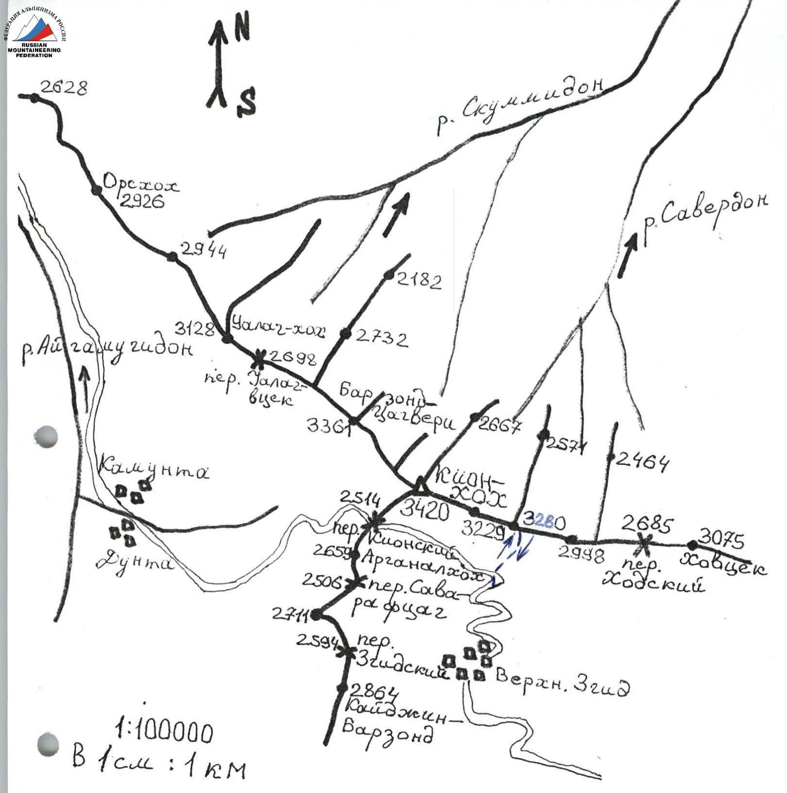 1:100000 In 1 cm: 1 km
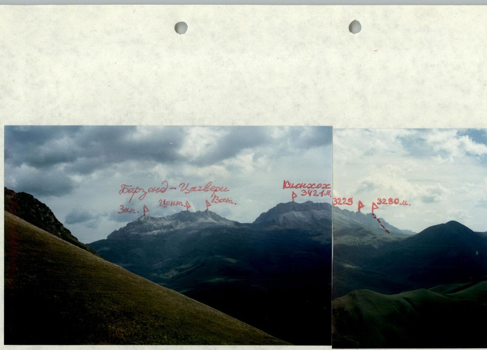
 Photopanorama of the climbing area. View from the Southeast from the village of Verkhny Zgid. April. The first ascent route is marked.
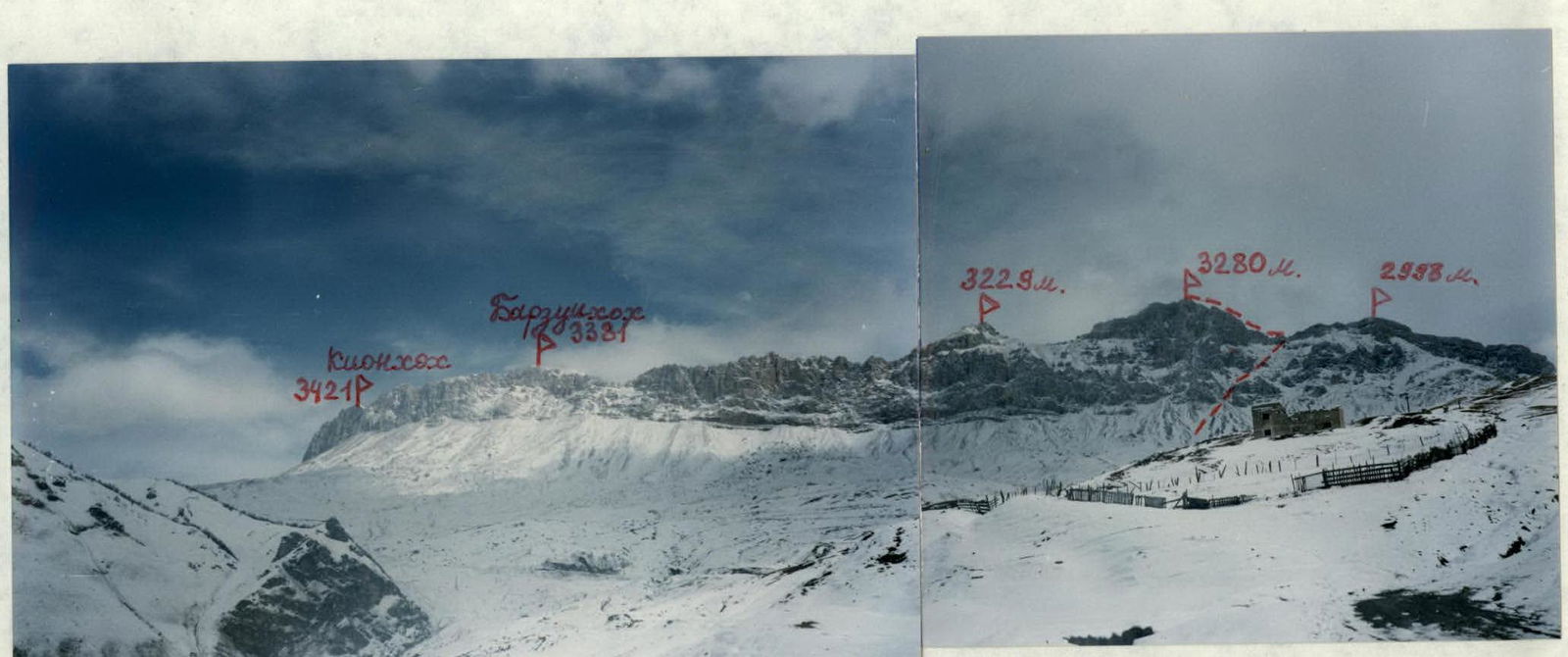 Photopanorama of the climbing area. View from the Southwest from the left bank of the Songutidon river gorge. September. The first ascent route is marked.
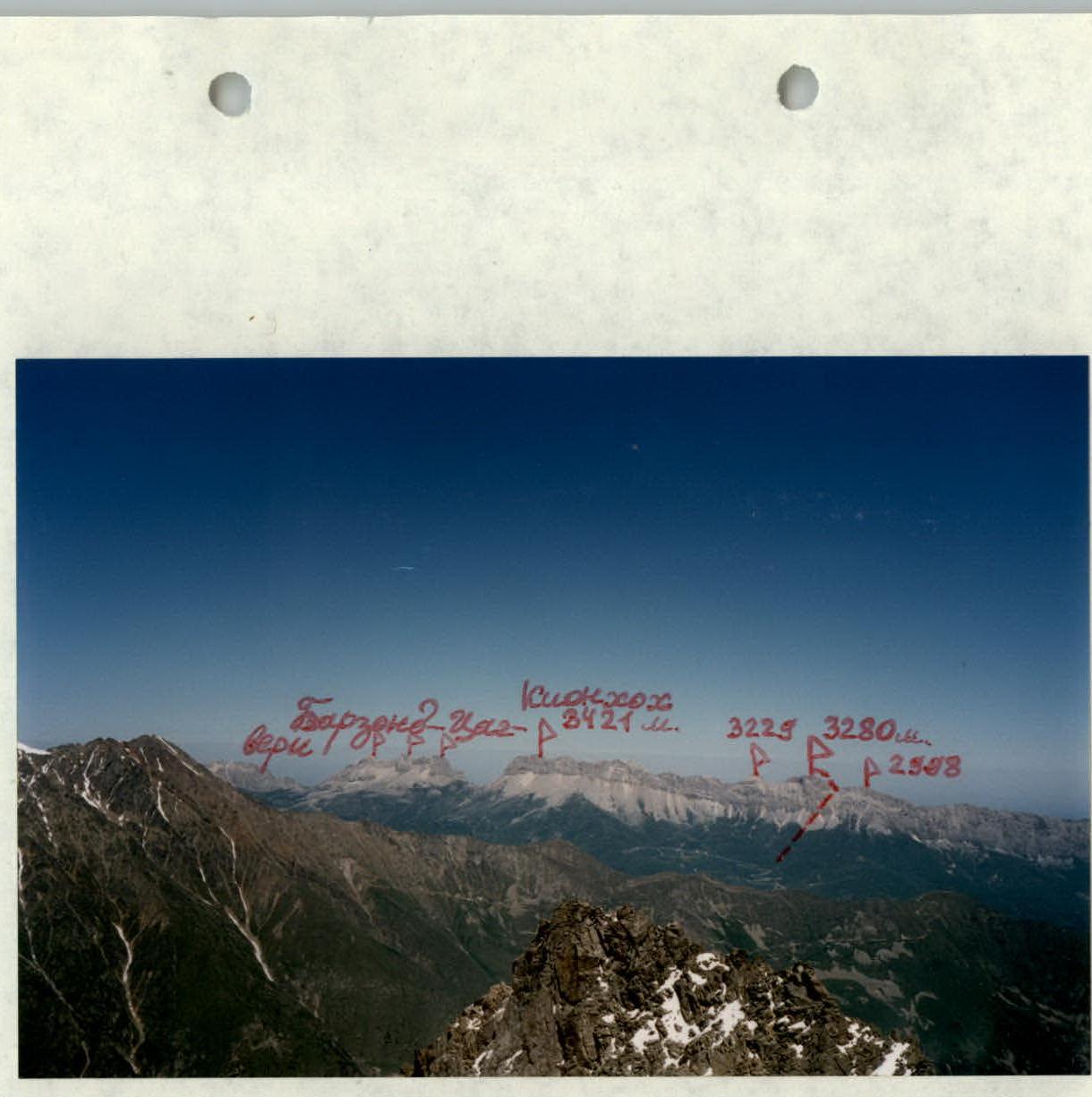
 Photopanorama of the climbing area. View from the South from the Vizbori peak. The first ascent route is marked. July.
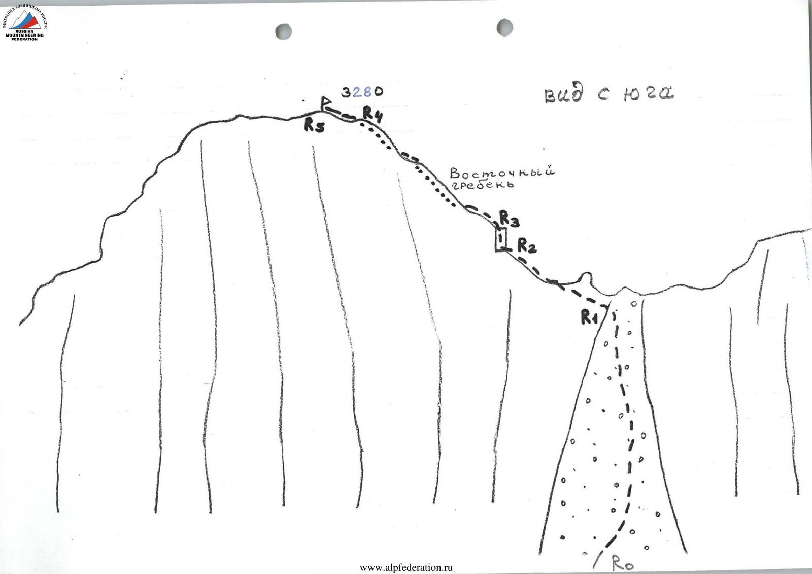
 Route profile from the left. April.
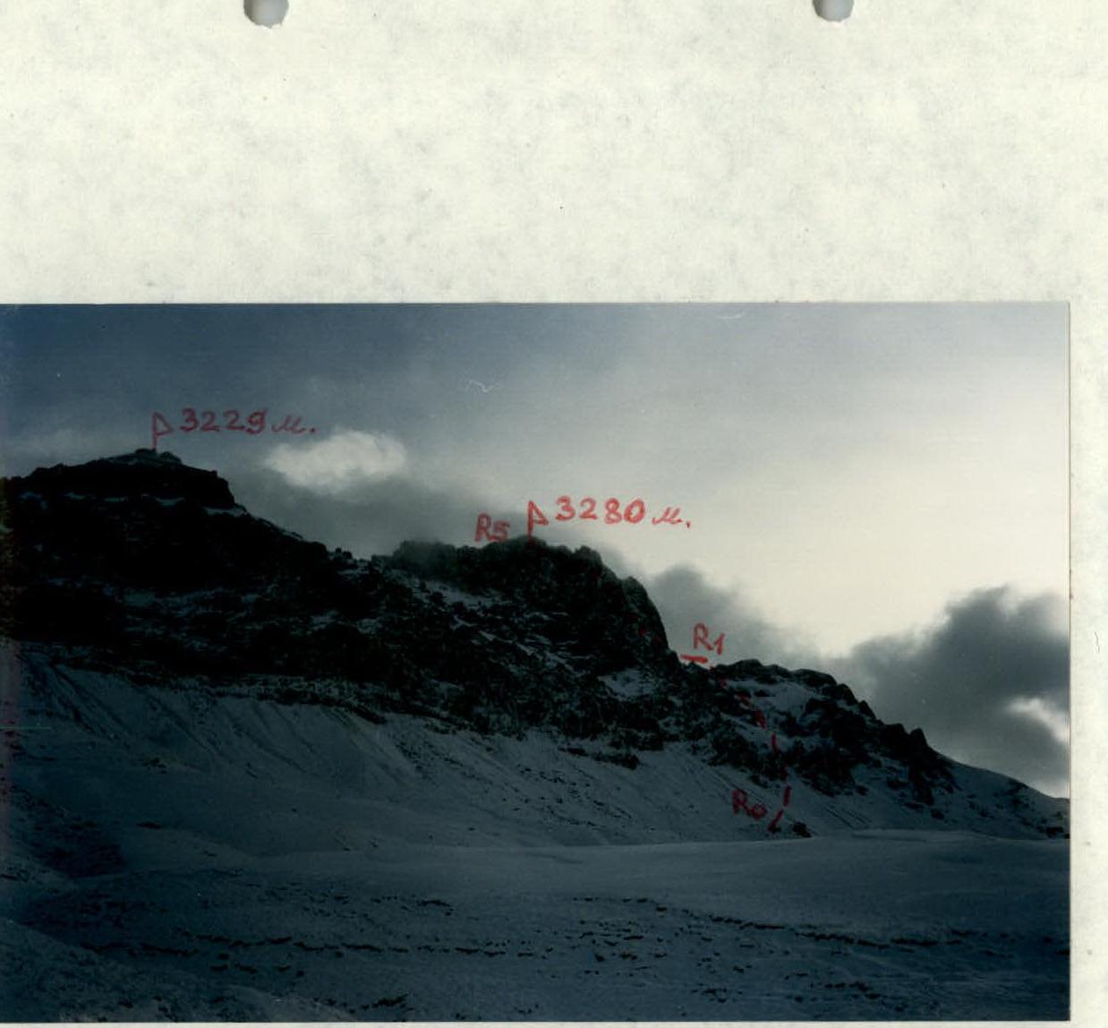 Profile of the first ascent route to the 3280 m peak from the road to Kionsky pass. February.
Description of Approaches to the Route
From the city of Vladikavkaz to the village of Verkhny Zgid, take a regular bus — about 2–2.5 hours. After passing through the village, head north towards the visible Rocky Range in the distance. The path follows a passable dirt road that leads through Kionsky pass (2514 m) to the neighboring gorge of the Aygamugidon river — to the villages of Dunta, Kamunta. After 1.5–2 hours of walking on the road, which goes through alpine meadows, about 3–4 km before Kionsky pass, start ascending northwards towards the southern walls of the Rocky Range. The road turns west towards the pass.
You need to move up to the right towards the 3280 m peak, located east of the highest point of the massif — the Kion-khokh peak (3420 m) and the still unclimbed 3229 m peak.
From the road:
- the 3280 m peak appears dome-shaped against the sky;
- the 3229 m peak — as an irregular triangle.
In the distance to the east (to the right) a wide grassy saddle is visible — this is Khodsky pass.
To the left of it (to the west):
- is the 2998 m peak;
- the next one to the west — is the 3280 m peak.
Climb the steep grassy slopes to reach the southern walls of the 3280 m peak; below the walls lie numerous small scree.
From here, as well as from the summit, a great panorama to the south opens up. Visible are:
- Kalper Shau,
- Jimarai,
- Arkhon massif,
- Tepli,
- Tsmiakom-khokh;
and to the west are visible:
- Laboda,
- Sugansky Range.
It takes 1.5 hours from the road to this point.
Route Description
Section R0–R1: Approaching the southern walls of the 3280 peak, you need to head towards the base of the wide scree couloir between the 3280 peak on the left and the 2998 m peak on the right. The main landmark when approaching: this couloir is the only one that "cuts through" the southern walls of the Kionsky massif from top to bottom, from Kion-khokh to Khodsky pass. Ascend through this couloir to the saddle of the ridge (scree, category 1 difficulty, 1.5–2 hours).
Section R1–R2: Moving left and upwards, bypassing the gendarmes from the south, reach the ridge (path category 2 difficulty) and along the ridge approach the wall (0.5 hours).
Section R2–R3: Through the wall (category 3–3+ difficulty, 5 m) continue further on the ridge. Insurance is alternate.
Section R3–R4: Continuing along the Eastern ridge towards the 3280 m peak (path category 2–3 difficulty), bypassing complex areas mainly on the right — along the northern slopes (slabs category 2 difficulty), reach the shoulder along the sometimes narrow ridge.
Section R4–R5: From the shoulder, along the ridge (category 2 difficulty), ascend to the summit of the 3280 m peak. It takes another 1–1.5 hours to reach the summit.
Descent is via the ascent route. It takes 3–3.5 hours (to the road). No human presence was detected on the summit.
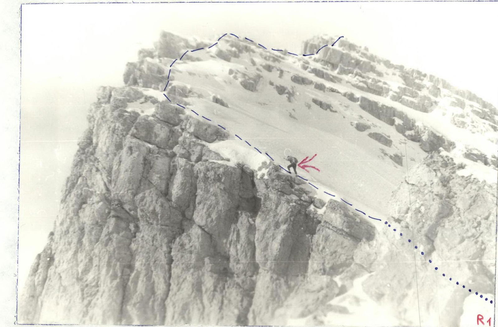 Movement along the Eastern ridge (middle part of section R1–R2)!
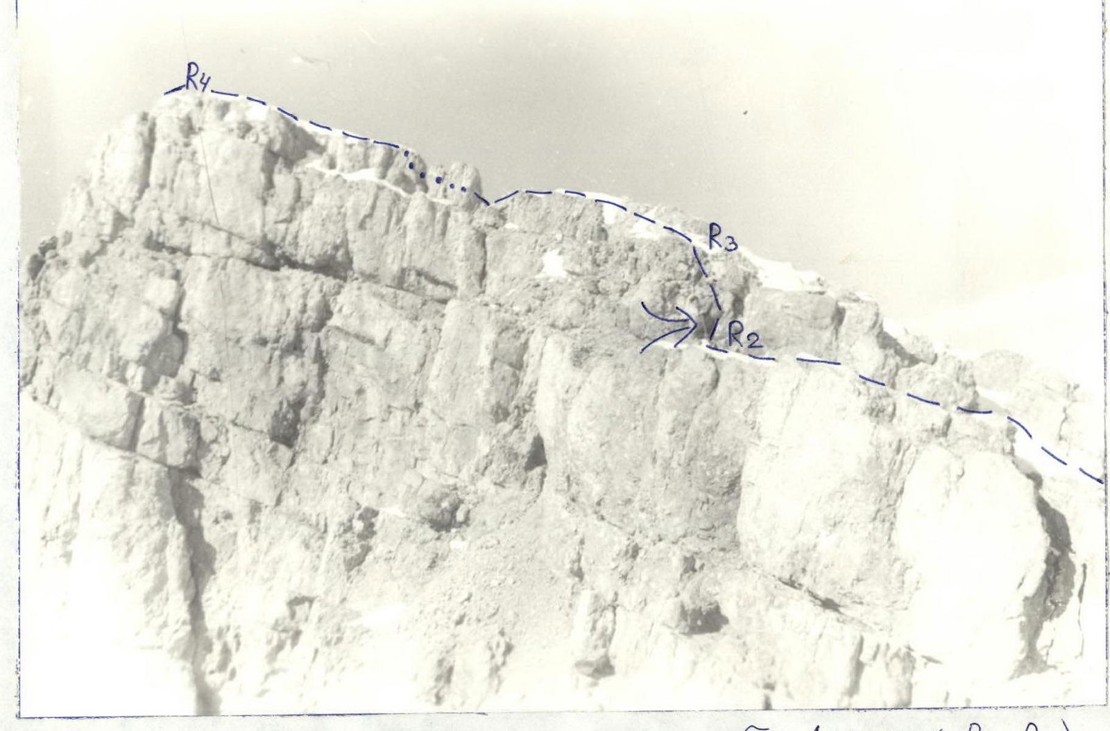 Passing the wall on the Eastern ridge (section R2–R3).